RockFLEET Assured
RockFLEET Assured is a marine-grade A-PNT system that helps vessel operators compare GNSS position data with an independent position source based on Iridium PNT. It gives bridge crews and shore teams clearer visibility of vessel position, integrity events and GNSS disruption.
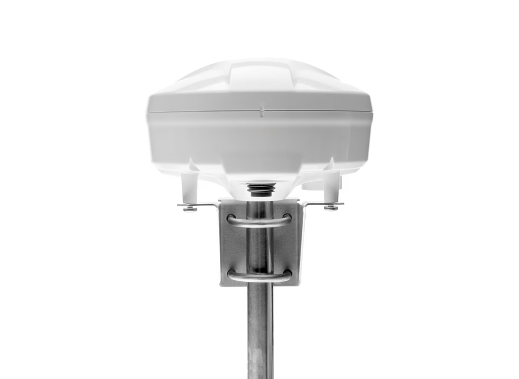
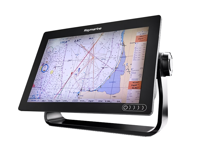
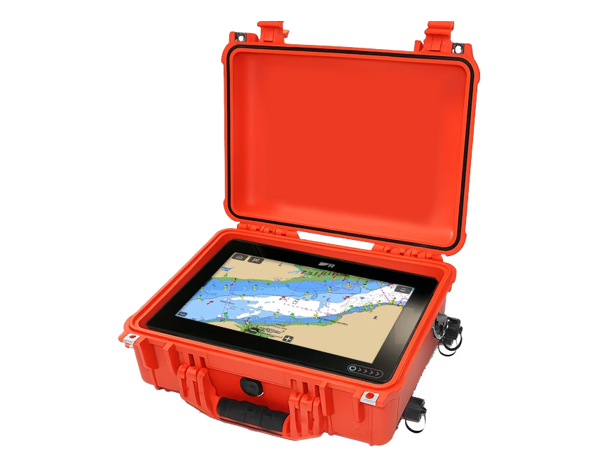
Key Features
RockFLEET Assured helps crews and shore teams recognise position anomalies earlier, retain visibility during GNSS disruption, and maintain a clearer record of integrity events.

Position Integrity Monitoring
Continuously evaluates GNSS and A-PNT data to identify unexpected drift, suspected spoofing, signal degradation and GNSS outages.

Bridge Situational Awareness
Shows assured position alongside GNSS position and track, with integrity status, alerts and event logging to help crews assess divergence.

Shore-Side Visibility and Alerts
Sends position, integrity and event data to Cloudloop Tracking or customer systems for monitoring, alerts, voyage review and escalation.

Flexible Vessel Deployment
Combines positioning, satellite communications and onboard processing in a marine-grade terminal, with remote configuration and optional bridge integration.
How It Works
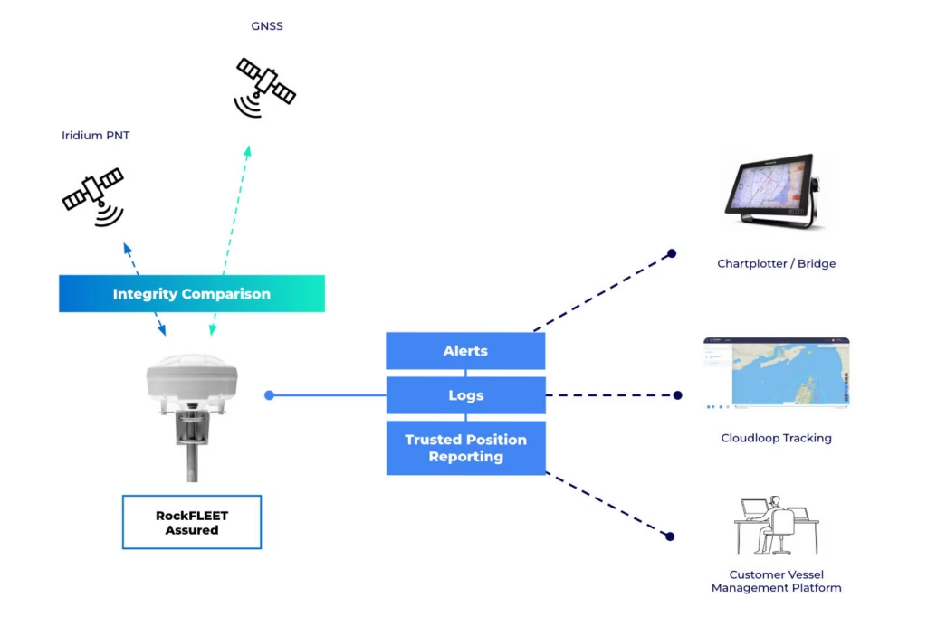
RockFLEET Assured continuously compares the vessel’s GNSS-derived position with an independent A-PNT position.
When both positions match, the system confirms that the GNSS position can still be trusted. If they begin to move apart, RockFLEET Assured flags the difference and sends alerts to bridge and shore-side teams. This can reveal suspected spoofing even when GNSS is still showing a believable position.
If GNSS becomes unavailable because of jamming, the A-PNT position remains available as an alternative reference. Position, integrity and event data can still be sent over the Iridium network to Cloudloop Tracking or customer systems.
The system also keeps a record of integrity events, helping operators review when the disruption started, how the two positions differed and how the incident developed.
Why Iridium PNT?
RockFLEET Assured uses Iridium PNT as its independent position source. Unlike systems that attempt to correct, filter or protect GNSS, Iridium PNT uses a separate satellite constellation, signal and frequency band to provide an alternative reference when GNSS is degraded, denied or no longer trustworthy.
Stronger Signals
Iridium PNT uses high-powered burst signals that are up to 1,000 times stronger than conventional GNSS signals, making them significantly harder to overwhelm.

Low Earth Orbit Architecture
The Iridium constellation operates in Low Earth Orbit, with satellites approximately 25 times closer to Earth than GNSS satellites.

Independent of GNSS
Iridium PNT operates in a different part of the spectrum and doesn’t rely on GNSS correction or filtering, reducing shared vulnerabilities.

Authenticated Position Source
Signal authentication and the geometry of the Iridium constellation support a more trusted, independently derived position reference.

Worldwide Coverage
The Iridium constellation provides global coverage, allowing assured position monitoring across international routes and remote operating areas.
Visibility On Board and Ashore
RockFLEET Assured gives bridge crews and shore-side teams different views of the same position and integrity information, supporting both immediate onboard awareness and wider fleet oversight.
Chartplotter View for Bridge Crews
Onboard, RockFLEET Assured can show assured position alongside GNSS position and track, giving bridge teams a clear way to identify divergence during suspected jamming or spoofing.
Integrity status, alerts and event information can be displayed locally, helping crew understand when GNSS data can no longer be treated as reliable.
Cloudloop for Fleet Managers
Ashore, Cloudloop Tracking gives fleet teams a centralized view of vessel position, route history and integrity events across one vessel or a wider fleet.
Live tracking, geofence alerts and historical track review help teams monitor disruption as it happens, investigate incidents afterwards and support operational reporting.
Why Choose RockFLEET Assured?
Independent of GNSS
Uses Iridium PNT to provide a separate position reference rather than relying on GNSS correction, filtering or additional GNSS constellations.

Detects Plausible but Incorrect Positions
Continuous comparison helps identify suspected spoofing and position drift even when GNSS continues to output credible-looking coordinates.
Awareness On Board and Ashore
Integrity status, alerts and position information can be presented to bridge crews and reported to shore-side teams through the same system.
Global Satellite Reporting
Iridium Messaging Transport carries position, integrity and event data beyond terrestrial coverage, supporting vessels across international routes.
Flexible Bridge Integration
Supports standalone shore-side monitoring or integration with bridge displays and existing marine systems through NMEA interfaces.

Built for Maritime Deployment
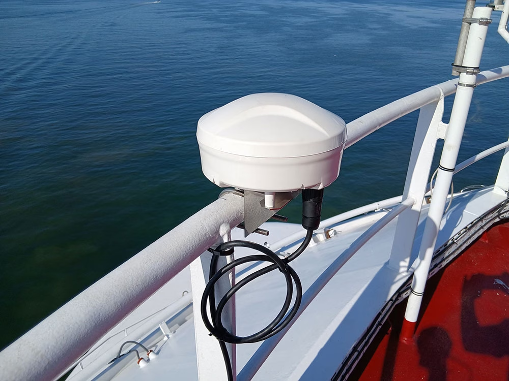
The IP67 above-deck terminal combines positioning, satellite communications and onboard processing in a marine-grade installation.

Continued Operation During Power Loss
An internal backup battery allows tracking, reporting and A-PNT operation to continue during interruptions to vessel power.

Event Records for Later Review
Integrity events and position history provide a clearer record for operational review, incident investigation and reporting.




Product Showcase
Most of the time, GPS just works. Until it doesn’t.
In this video, we introduce RockFLEET Assured, built for fleets operating in GNSS-contested waters. It delivers an assured position and clear integrity visibility when GNSS is disrupted, helping bridge teams and shore operators make confident decisions.
Highlights include:
• Assured position alongside GNSS on an optional Chart/Bridge View
• Integrity status, event logging, and alarms when integrity is at risk
• Cloud-based fleet monitoring through Cloudloop Tracking
• API first integration into existing systems and workflows.
Product Specifications
Position and Tracking
- Position Sources
- Integrated GNSS receiver and Iridium PNT module
- Position Integrity Monitoring
- Continuous comparison of GNSS-derived and independently derived A-PNT positions
- Integrity Alerts
- Configurable alerts for position divergence, suspected spoofing, GNSS degradation and GNSS outages
- Reporting Intervals
- Configurable from once per minute to once per hour
- Reporting Modes
- Scheduled, event-driven or exception-based reporting
- Geofencing
- Configurable entry and exit alerts
- A-PNT Accuracy
- Varies by latitude and operating conditions; field testing has demonstrated median accuracy of 25 m at 69° N and 42 m at 19° N
Communications and Integration
- Satellite Communications
- Iridium Messaging Transport for global two-way data delivery
- Satellite Coverage
- Global Iridium coverage
- IMT Message Size
- 25 to 100,000 bytes
- Marine Interfaces
- NMEA 2000 or NMEA 0183 / RS-422, depending on the selected system configuration
- Chartplotter Integration
- Supports the supplied Raymarine Axiom+ 9 display or compatible third-party bridge systems
- Tracking Platform
- Compatible with Cloudloop Tracking
- Custom Integrations
- Position, integrity and event data can be delivered into customer and partner platforms
Physical and Environmental
- Dimensions
- 201 mm diameter x 125 mm high (7.9 x 4.9 in)
- Weight
- 1,460 g, including antenna and mounting bracket (3.2 lb)
- Enclosure
- UV-stable plastic radome
- Ingress Rating
- IP67
- Mounting
- Low-profile above-deck unit for deck or pole mounting
- Operating Temperature
- =40°C to +70°C (-40°F to +158°F)
- Relative Humidity
- Less than 95% RH
- Cable
- 25 m marine-grade cable supplied, with lengths up to 100 m available
Electrical
- Direct Terminal Input
- 15-24 V DC
- Power Hub Input
- 10-30 V DC
- Power Consumption
- 20 W for the above-deck unit
- Complete System Power Consumption
- 30 W with the chartplotter and below-deck equipment
- AC Operation
- Available through an external 24 V DC power adapter, with regional plug options depending on the selected bundle
- Backup Battery
- Optional 12 Ah LiFePO₄ battery
- Backup Operation
- Up to four days of standalone operation, depending on configuration and reporting behavior
Configuration and Compliance
- Local Configuration
- Bluetooth LE mobile app for commissioning, diagnostics and status checks
- Remote Configuration
- Reporting profiles, alarm thresholds and device settings can be updated over the air
- Remote Device Management
- Supported through Cloudloop Device Manager
- System Configuration
- Available as a standalone shore-side monitoring system or with bridge display and marine interface integration
- Marine Compliance
- Tested to IEC 60945 environmental and EMC requirements
- Regional Compliance
- CE and UKCA compliant
Resources
Here are a few useful resources to help you assess RockFLEET Assured, including airtime rates, technical specifications and coverage information.
Frequently Asked Questions
Yes. RockFLEET Assured can be configured as an input to an ECDIS or other onboard system, with the interface type chosen before shipping. Units supplied with the optional Raymarine Axiom 9 chartplotter use NMEA 2000, while units intended for integration into a customer’s own system use NMEA 0183 over RS422.
RockFLEET Assured is not an IMO-approved primary navigation source, so it is intended for use as a backup, comparison, alerting, or other non-primary input.
RockFLEET Assured offers an optional Raymarine Axiom 9 chartplotter in two formats: a rugged case version for a complete out-of-the-box setup, or a lower-cost version without the case using a wiring harness.
If no chartplotter is purchased, the system can still integrate into existing onboard equipment via the supplied serial RS422 cable, transmitting A-PNT and GNSS position as NMEA 0183 sentences. Configuration is handled through the Bluetooth app, which also provides a visual map of both GNSS and A-PNT positions.
Accuracy is typically 25-100 meters relative to GNSS. Performance improves at higher latitudes due to the Iridium constellation geometry.
Yes. RockFLEET Assured creates a verifiable record of vessel positions, integrity events, and system alerts that can support post-incident investigations and operational reporting. For shipowners operating in regions where GNSS interference is a known risk, having an independent source of position data can strengthen evidence trails and demonstrate proactive risk management practices to stakeholders, insurers, and charterers.
Talk To Us
Whether you need assured positioning for operations in GNSS-challenged regions, a bridge ready chart view for crews, or a simple way to stream trusted location and events into your own platform, RockFLEET Assured is designed to fit.
Get in touch to arrange a demo and share your requirements either by completing the form, or emailing hello@groundcontrol.com. We’ll respond to your inquiry within one working day.