Aviation
Ground Control delivers advanced, satellite-enabled tracking and communication solutions designed to keep aircraft connected, secure, and visible anywhere in the world. With reliable global coverage, our technology supports seamless operations, real time monitoring, and enhanced safety for aviation professionals across commercial, private, and unmanned sectors.
Track Aircraft Anywhere In The Sky with Satellite Connectivity

Global, Real Time Tracking
Track and manage your aircraft anywhere on Earth with precision and reliability. Our satellite-enabled, aviation-compliant tracking devices ensure your fleet is visible and secure, no matter how remote the location.

Streamlined Fleet Management
Cloudloop provides complete fleet visibility, message history, and group communication. Pilots can use the companion app for two way messaging, while operators can monitor and manage correspondence in real time.

Safety and Compliance First
Built to meet aviation standards, our tracking devices prioritize reliability and safety. With features like emergency alerts, geofencing, and detailed trip recording, you can maintain compliance and protect your pilots and aircraft.

Uninterrupted Connectivity
Stay connected with your team wherever they are flying. Our devices offer reliable communication through satellite and cellular networks, enabling critical updates, coordination, and safety assurance in the most challenging environments.
Recommended Devices
Carry on / off tracking device
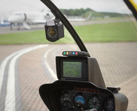
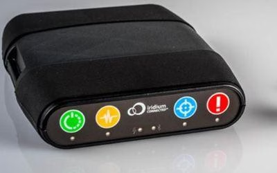
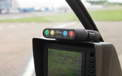
RockAIR is designed for use on the dashboard of light aircraft or rotorcraft. Using a combination of LTE Narrowband and Iridium ensures you are getting the best value for money for truly global tracking and communication.
RockAIR also features complex geofencing capabilities working on many vertices; the device will monitor its location relative to these geofences, and can have different behaviour attributed to each fence for optium positional safety.
Two way communication and SOS
Reliable asset tracking enables base operations to know where aircraft are at any given time, anywhere in the world.
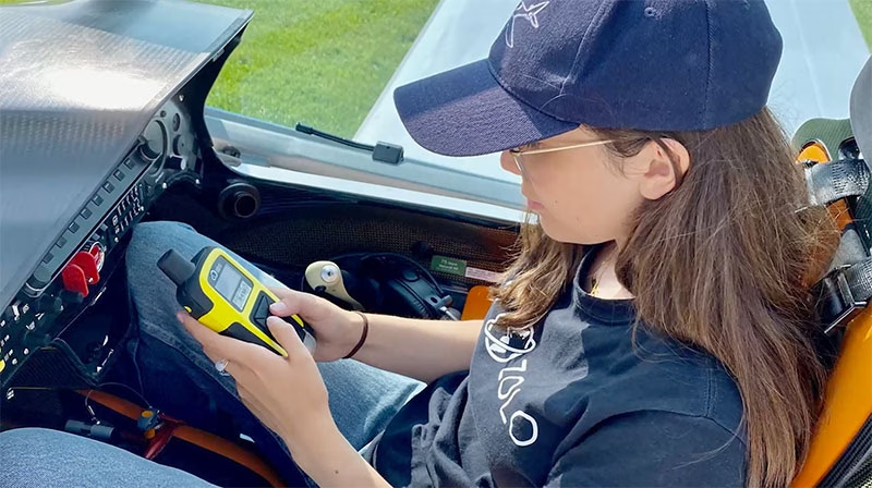
RockSTAR is a vital handheld safety device with an astonishingly long battery life, giving peace of mind to pilots and aviators wherever you fly. With the ability to send and receive texts and emails, pilot safety is improved, and collaborative decisions can be made in critical flight mission situations.
Ground Control’s Aviation Partners
While Ground Control’s devices come with a simple, effective tracking platform, we work with several partners who have built application-specific software platforms that leverage the tracking and communications data provided by Ground Control. These companies include V2Track, TracPlus, SKYTRAC, and IndigoSat. They’re definitely worth reviewing if you have a particular use case in mind.
If you have a fleet management software solution and would like to integrate Ground Control’s devices into your platform, please get in touch. We have fully featured APIs, and provide partners with cost and time-saving tools such as data pooling via our Cloudloop platform.
Who Uses Ground Control’s Aviation Tracking Solutions?
Private Aircraft Owners
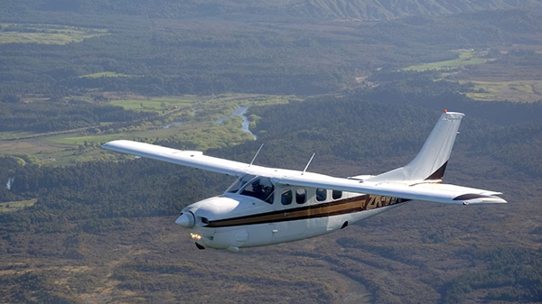
Family, friends, and colleagues get peace of mind with a satellite-enabled tracking and communication device for personal and private flights. Our tracking devices offers global coverage, real-time and historical tracking, easy carry-on/carry-off use, two-way messaging, and an emergency alert feature to notify chosen contacts.

Agricultural Aircraft
When crop dusting or topdressing, accurately tracking distance is crucial for billing. A satellite-enabled tracker is essential in areas without cellular coverage, offering hyper-accurate GPS readings, global coverage, and live and historical tracking data on an intuitive dashboard. Includes emergency alerts and two-way communication.
Search and Rescue
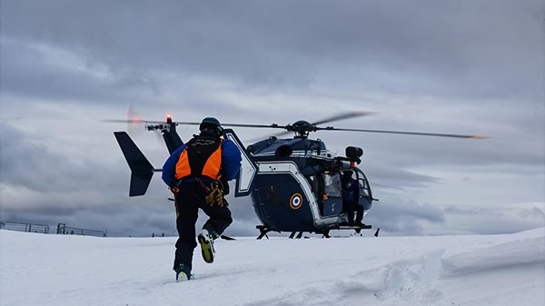
Staying connected is crucial for safety and coordination. Ground Control’s satellite-enabled tracker provides an SOS alert feature along with real-time tracking and monitoring. It offers global coverage and features a map-based interface with current and historical locations, for optimum positional awareness.

Flying Schools
A satellite-enabled tracking and communication device onboard trainer aircraft greatly enhances pilot safety. It provides real-time global tracking, historical positional data, speed, and altitude, an emergency button for faster tracking and alerts, two-way messaging via Bluetooth, and cost-efficient hybrid cellular/satellite connectivity.

Charter Flights
Whether servicing private jets, group charters, cargo, or helicopters, knowing the location of your aircraft, pilots, and passengers enhances safety and communication. Our carry-on/carry-off device, typically mounted on the glareshield, provides 100% global tracking using the Iridium satellite constellation.

Airplane and Helicopter Tours
Enhance pilot and passenger safety with a global tracking and monitoring solution. It offers real-time location tracking, historical data for improved flights, an emergency button for faster tracking and alerts, take-off and landing notifications, geofencing with alerts, and cost-saving cellular connectivity where possible.


FAQs About Satellite IoT in Aviation
Satellite IoT provides global, real time tracking with no blind spots, so it’s ideal for flights over oceans, remote regions, or unmonitored airspace. Unlike traditional ADS‑B, Ground Control’s satellite-enabled devices ensure you never lose visibility, even in areas without terrestrial radar or cellular coverage.
Yes! With two- ay, text-based messaging via satellite, pilots can receive critical updates like weather alerts, flight plan changes, or emergency advisories, even when out of cell coverage. Devices like RockAIR and RockSTAR also support SOS alerts for enhanced safety.
For routine position tracking, both RockSTAR and RockAIR are extremely data efficient. A standard GPS position report consisting of latitude, longitude, altitude, speed, and heading, requires only a small number of bytes (typically under 100 bytes per report). This makes basic tracking cost-effective and ideal for general aviation flights, search and rescue operations and personnel or asset tracking in remote regions. Transmission intervals are also configurable (e.g. every 2, 5, or 10 minutes) to balance between update frequency and airtime costs.
If your application involves real-time sensor data, such as aircraft system monitoring, environmental telemetry, or mission-specific payload feedback, data usage naturally increases. RockAIR, with its hybrid cellular and Iridium connectivity, is well-suited to handle these use cases. It can prioritize cellular transmission (when available) for high-bandwidth data like configuration updates or bulk telemetry, while using satellite as a backup or for essential messaging during cellular outages or remote flight segments.
Here to help
Ground Control devices manage entire fleets: on land, air or sea; portable, handheld, vehicle-mounted or fixed.
We work with the best satellite and cellular networks in the world, and in addition to in-house, best-in-class hardware for aviation, also work with multiple partners and OEMs to offer truly objective recommendations.
Whatever your aviation communication or connectivity needs, we can help.