Satellite Vessel Tracking
We specialize in tracking, messaging and monitoring services for small fleets. Low power, low cost, and highly reliable Maritime solutions.
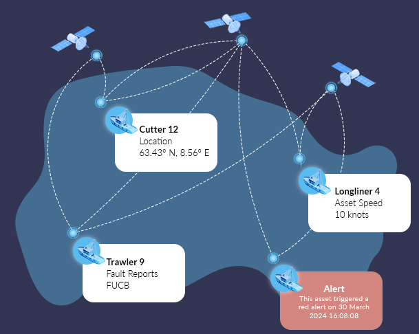
Real-Time Vessel Visibility
Global, Real-Time Vessel Tracking
Stay connected to your fleet, whether nearshore or deep at sea. Our satellite-enabled tracking delivers real-time position updates, historical route data, and event tracking for complete maritime oversight.
Enhanced Crew Safety & Alerts
Ensure crew safety with emergency alerting and two-way communication. Operators can send and receive messages, trigger distress signals, and receive instant notifications if a vessel is in trouble.
Optimize Operations & Compliance
Improve efficiency while staying compliant with maritime regulations. Monitor speed, fuel usage, and geofenced areas, while automated reporting simplifies audits and operational reviews.
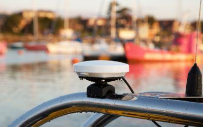
Rugged, Marine-Ready Hardware
Built for the harshest marine conditions, our devices withstand saltwater, extreme weather, and constant motion. With long battery life and easy installation, they’re designed for reliable performance.
Key Features of Cloudloop Tracking for Maritime
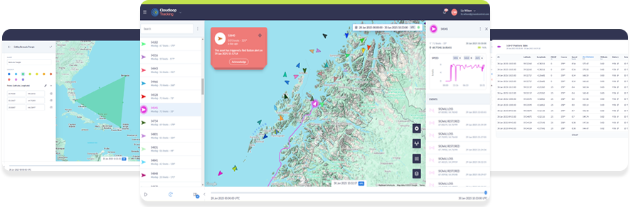
Real-Time Vessel Tracking
Monitor your fleet with live position updates, no matter how remote the operation. Cloudloop Tracking ensures vessels remain visible on an intuitive map-based platform.
- Live GPS tracking with global satellite coverage
- Historical route data for performance analysis
- Geofencing alerts for restricted or high-risk areas
- Fleet-wide visibility from a single dashboard.
Emergency Alerts & Crew Safety
Enhance crew safety with instant SOS alerts and emergency response features. If a vessel is in distress, immediate notifications ensure rapid assistance.
- Panic button for distress signals
- Instant alerts for lost connectivity or unexpected movement
- Two-way messaging for emergency coordination
- 24/7 monitoring for continuous crew protection.
Two-Way Messaging & Fleet Coordination
Stay connected with vessels and crew members through reliable satellite messaging. Ensure smooth operations with direct communication between ships and shore.
- Send and receive messages even beyond cellular coverage
- Group messaging for fleet-wide coordination
- Message history for each vessel, accessible in the platform
- Pilot-friendly app for direct communication with operations or family.
Automated Event Tracking & Reporting
Simplify fleet management with automatic tracking of key events such as departure and arrival, and geofence entry/exit.
- Automated event logging for operational transparency
- Instant notifications for specific vessel activities
- Customizable event triggers to match operational needs
- Exportable reports for compliance and record-keeping.
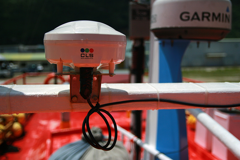
Rugged, Reliable Hardware Integration
Cloudloop seamlessly connects with maritime-grade tracking devices, ensuring reliable performance in harsh conditions.
- Waterproof and corrosion-resistant devices
- Long battery life for continuous operation
- Compact, easy installation for any vessel type
- Compatible with industry-leading marine hardware, including RockFLEET.
Intuitive, Map-Based Interface
Track and manage your fleet with a user-friendly, map-based platform designed for simple navigation.
- Clear visual display of vessel positions
- Customizable map layers for different operational needs
- Filter and search options for quick fleet insights
- Mobile-friendly access for monitoring on the go.
Our Vessel Tracking Partners
If you need more maritime-specific features from your platform, we recommend these partners.
Pivotel delivers VMS systems for marine vessels. Their solution is used to monitor quota in near real-time; monitor compliance with area and seasonal closures; supply evidence for investigations where needed; validate logbook entries on when/where fishing took place, and estimate fish stock levels.
Fangstr is a complete solution for professional fishing fleets who need to provide catch logs and tracking information. Utilizing Ground Control’s RockFLEET hardware, the team at Fangstr have created a powerful software and reporting app that captures and transmits departure points, catch reports and port calls.
GoFish delivers digital catch reporting for tourist fisheries. GoFish Start is their ‘beginner’ solution, offering catch registration, automatic reporting, digital guest registration, customs documentation, boat booking, ‘no-go’ zones and emergency alerts. GoFish Pro adds real-time tracking of boats, and support for affiliated systems.
v2track’s additional features include the ‘Windy’ weather integration, which allows you to overlay wind, rain, storms, temperature, waves etc. on to their Viewer platform. Their scheduling module lets you manage your assets more easily, and the Status Board is a fully customizable single view of all of your assets’ key information.
Who Uses Ground Control's Vessel Tracking Solutions?
Border Force
Monitor and secure maritime borders with precise tracking and instant alerts for suspicious activity. With geofencing, historical route data, and seamless communication, teams can enforce regulations and respond swiftly to unauthorized movements.
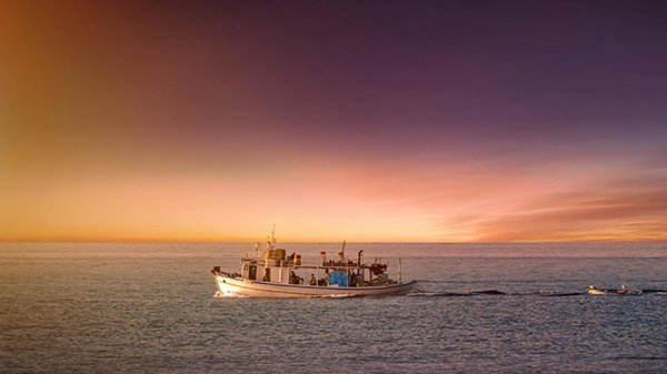
Commercial and Sport Fishing
Track and manage small fishing fleets with real-time positioning, catch-zone monitoring, and compliance reporting. Ensure crew safety with emergency alerting, while optimizing routes and fuel usage for cost efficiency.
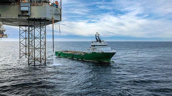
Offshore Support Vessels
Maintain visibility over offshore logistics with real-time tracking and automated event monitoring. Improve coordination between vessels and shore-based operations while ensuring crew safety in remote and high-risk environments.
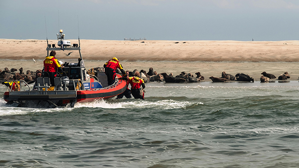
Coast Guard
Ensure round-the-clock situational awareness with real-time vessel tracking and two-way communication. Our solution enhances operational efficiency, enabling rapid response to emergencies, unauthorized incursions, and evolving maritime threats.
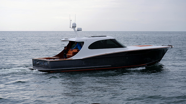
Yacht Charter
Provide guests and fleet managers with a seamless tracking solution for vessel security and trip monitoring. Real-time updates, geofence alerts, and emergency communication features ensure safe and stress-free journeys for charter operators and their customers.
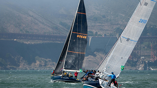
Yacht Racing
This service is provided by our specialist sister company, YB Tracking, who offer a full concierge service of rental devices, live tracking and in-person support. You can also purchase the hardware for personal use.
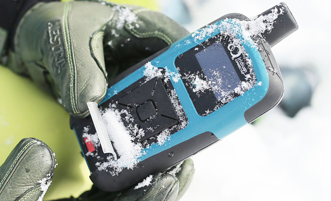
Recommended Tracking Devices
RockSTAR is a carry-on/carry-off tracking and messaging device used extensively by sailors for safety and communication. It can operate completely independently of a power source or smart phone, and has an astonishing 12 month battery life.
Packages Tailored to Suit Your Needs
Platform Only
If you have already purchased a tracking device, and would like to integrate it with Cloudloop Tracking, come and talk to us. We offer support for many Iridium and Globalstar-enabled trackers.
Our Data, Your Platform
Our well documented, robust APIs allow you to integrate the data transmitted via our devices to the platform of your choice. We have many existing integrations, and make it easy to feed your application.
Device, Data and Platform
Our integrated solution delivers everything you need to monitor your fleet. Our best-in-class hardware delivers your tracking and messaging data in close to real-time to our intuitive and feature-rich platform.
Device Only
You are welcome to purchase just the maritime tracking devices you need from us, organizing your own airtime contracts, and integrating the data with your preferred platform.

Contact Our Team
If you’d like to know more about our satellite vessel tracking solutions, please get in touch. We are a group of sailing enthusiasts as well as satellite and tracking experts, and we can offer you expert, impartial advice on tracking, monitoring and messaging services for your small fleet.
Please complete the form, or email hello@groundcontrol.com, and we will be in touch within one working day.