RockFLEET
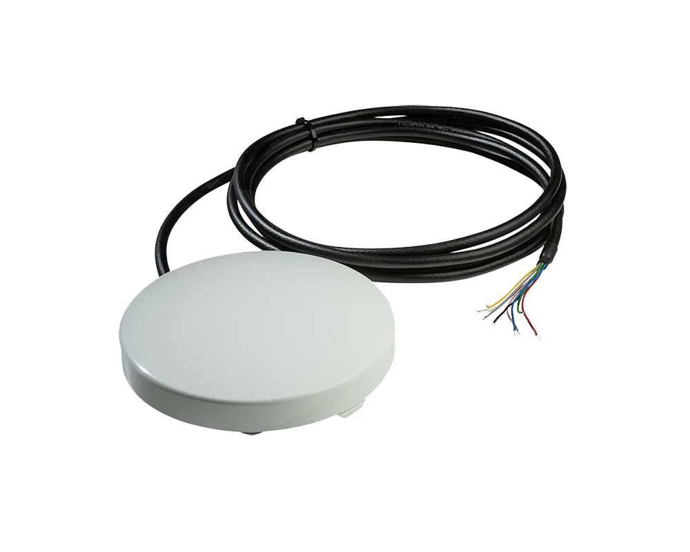
RockFLEET is a truly global tracking device designed for permanent use aboard marine vessels and land vehicles. Its optional LTE Narrowband unit allows it to use cellular networks when possible, automatically switching to the global Iridium satellite network when necessary (lowest-cost routing).
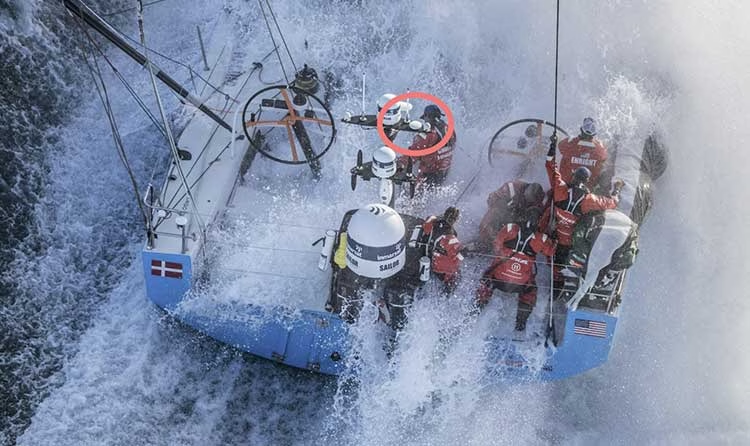
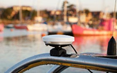
It’s waterproof, ruggedized, and has a variety of mounting options to suit your needs.
Key Features
RockFLEET combines resilient satellite communications, intelligent connectivity and cloud-based fleet management to help organizations monitor, communicate with, and protect maritime assets anywhere in the world.

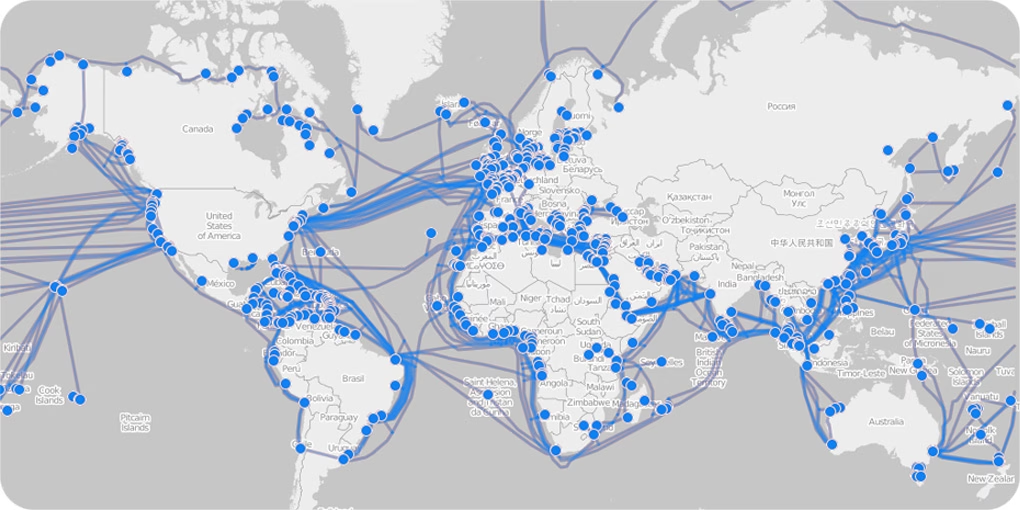
Global tracking over the Iridium satellite network

Automatic switching between LTE and satellite connectivity

Two way messaging from a Bluetooth-connected device

Flexible installation, configuration and API integration
Rugged IP67 hardware for permanent marine deployment
How It Works
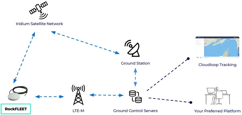
RockFLEET automatically records vessel, land vehicle or remote asset position using GNSS before transmitting data over LTE Narrowband where available or seamlessly switching to the Iridium satellite network beyond terrestrial coverage.
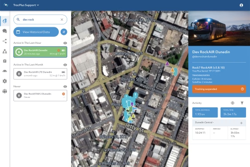
Fleet operators receive live positions, alerts, messaging and operational data through Cloudloop Tracking or directly into their own software using API integration.
RockFLEET also allows short messages (like SMS, social media updates, and short emails) to be sent using a paired Bluetooth device, such as a smartphone, and the Messenger app. This allows for full two way communication, even when out of cellular network range.
Use The Platform That Works For You
Use Your Preferred Platform
RockFLEET data can be shared through our APIs, making it easy to connect the device with your existing software and operational systems.
- Keep using the platform your team already knows
- Feed RockFLEET tracking data into your existing workflows
- Work with us to support a new platform integration.
Use Cloudloop Tracking
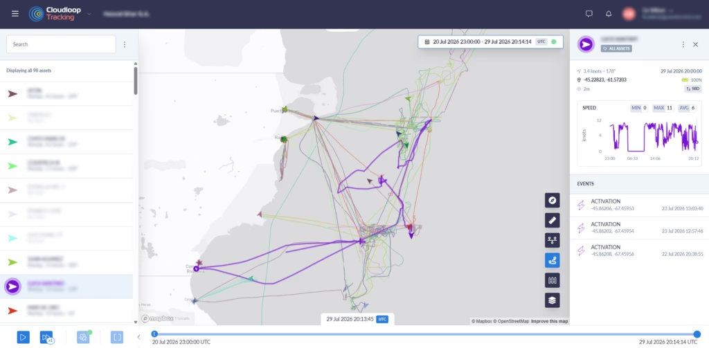
Cloudloop Tracking provides live vessel visibility, alerts and messaging through a simple subscription model designed for smaller fleets.
- Track vessels live and review journey history
- Set alerts, geofences and tracking intervals
- Message between crews and shore-based operators
- Access securely from desktop or mobile.
Why Choose RockFLEET?
Continuous Global Fleet Visibility
Track vessels and vehicles anywhere in the world, utilizing the Iridium satellite network for uninterrupted visibility of remote assets beyond terrestrial communications.

Reliable Communications Beyond Cellular Coverage
Automatic switching between LTE Narrowband and Iridium satellite connectivity to deliver dependable tracking and two way messaging wherever assets operate.
Designed for Demanding Maritime Operations
Designed for permanent installation on commercial vessels, vehicles and remote assets, RockFLEET delivers dependable performance in harsh environments across remote routes.

Faster Response During Operational Incidents
Integrated alerting, messaging and configurable reporting enable operating teams to share critical information quickly, supporting faster operational and emergency response.
Improved Fleet Visibility for Managers
Through Cloudloop Tracking, fleet managers gain live vessel or vehicle positions, historical tracking, alerts and reporting from a single, easy-to-use platform.
Flexible Installation Across Vessel and Vehicle Types
A marine-grade cable up to 100 meters delivers flexible routing and installation on commercial vessels without the need for complex below-deck equipment.

Smarter Fleet Management
Configurable reporting intervals, advanced geofencing and remote device management help operators improve efficiency, reduce manual intervention and optimize fleet operations.
Reliable Operation with Remote Management
Over-the-air configuration and firmware updates enable devices to be managed remotely, reducing maintenance visits and keeping fleets operational with minimal disruption.



Product Specifications
Tracking and Fleet Management
- Position Tracking
- Automatic GNSS position reporting
- Tracking Frequency
- Configurable from every 15 seconds to once every 24 hours
- Geofencing
- Different tracking profiles can be assigned to defined geographic areas
- Dynamic Tracking
- Reporting behavior can change based on movement, external power or connection type
- Alerts
- Supports power-loss, impact, movement and route-switching alerts
- Tracking Platform
- Compatible with Cloudloop Tracking and supported third-party platforms
- Data Delivery
- Positions and device data can be sent to your own web service via HTTP POST
- Remote Configuration
- Tracking and operating parameters can be updated over the air
- Messaging
- Two way texts and short emails through the RockCONNECT app
- Asset Insights
- View current and historical positions, speed, heading and journey events
Connectivity and Interfaces
- Satellite Connectivity
- Iridium Short Burst Data (SBD)
- Cellular Connectivity
- Optional cellular connectivity with automatic satellite fallback
- Bluetooth
- Bluetooth Low Energy for setup, messaging and integration
- Serial Interface
- Optional RS-232 connection for external equipment
- Integrated Sensors
- GNSS, accelerometer, temperature, power-loss and impact sensors
- External Data
- Serial and Bluetooth LE APIs support custom data and messaging
Physical and Environmental
- Dimensions
- 137 mm diameter x 40 mm high / 5.39 x 1.57 in
- Antenna
- Maxtena 1621 Patch Antenna
- Cabling
- 3m, 5m, 10m and 15m cable lengths available
- Operating Temperature
- -30 to 60°C / -22 to 140°F
- Storage Temperature
- -40 to 85°C / -40 to 185°F
- Operating Humidity
- Below 75% relative humidity
- Ingress Rating
- IP67 rated – sealed against dust and water ingress
- Installation
- Permanent outdoor installation with multiple mounting options
- Certifications
- CE and FCC compliant
Power
- Input Voltage
- 10-24 V DC, with ±30% voltage variation tolerance
- Maximum Consumption
- Approximately 700 mA at 12 V
- Sleep Consumption
- Less than 30 mA
- Backup Battery
- Internal rechargeable battery
- Backup Operation
- Up to five months, depending on tracking frequency and configuration
Resources
Here are a few useful resources to help you assess RockFLEET including airtime rates, technical specifications and coverage information.
Can we help you?
If you are looking for a reliable, secure, and easy-to-use vessel tracking device, then the RockFLEET is a great option. It uses LTE networks where available, and the Iridium satellite network when your device is out of cellular coverage. Perfect for a variety of maritime applications and backed by a team of experts who are dedicated to providing you with the best possible support.
Start a chat with our team today and discover how RockFLEET can enhance your marine operations. Complete our online form, or if you prefer to speak to someone directly, call us on +44 (0) 1452 751940 (Europe, Asia, Africa) or +1.805.783.4600 (North and South America). We’re standing by to help.