Airtime: BGAN M2M / IoT Pro
BGAN M2M’s Role in Soil Moisture Monitoring to Help Combat Climate Change
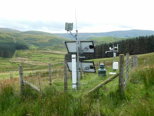
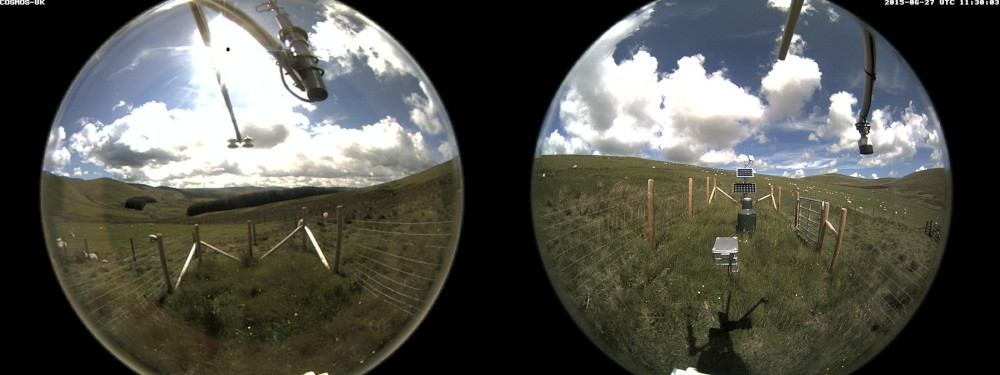
The Sourhope site on the Scottish border is one of 47 COSMOS-UK’s soil moisture monitoring stations that deliver near-real-time soil moisture data for use in farming, water resources, flood forecasting and land-surface modelling. Sites are also equipped with IP cameras for image transmission. COSMOS-UK was established by the UK Centre for Ecology & Hydrology in 2013 and is now the UK’s long-term national soil moisture monitoring programme. The COSMOS-UK data informs scientists about soil-water changes and supports environmental modelling research and related applications.


The Project
Ongoing climate change and increasing air pollution are likely to cause substantial changes in our ecosystem. To predict, manage and minimize adverse impacts on biodiversity, it’s critical that these changes are accurately, efficiently and reliably monitored so policy and management techniques can be developed.
The greater our understanding of soil moisture, the better we are able to recognize plants that are suited to particular conditions, the availability of water to maintain surface waters, and the impact soil moisture can have on our weather. This becomes more interesting and useful when we want to recognise the impacts of modifying and exploiting our environment.
Why Soil Moisture Matters
As well as optimum vegetation and crop management, measuring soil moisture also helps to inform our understanding of how the natural environment responds to climate change.
The impact of climate change could affect the water availability for agriculture, domestic consumption and the overall environment. Thus, measuring soil moisture and developing knowledge of how it varies between places and through time is fundamental to gaining insight into likely future conditions.
The Satellite Solution
The COSMOS-UK Sourhope site is located in a remote area of rough Scottish grassland, about 1 km from the border with England. This station, along with others in the COSMOS-UK network, is out of reach of cellular and fiber networks.
The Hughes 9502 is a IoT Pro (previously known as BGAN M2M) terminal, a satellite-based solution for transmitting remote environmental monitoring data. Powered by solar energy and designed to operate on both Viasat IoT Pro and cellular 2G/3G/LTE networks, it delivers always-available connectivity for critical monitoring and control applications in remote locations, perfect for the grassland site at Sourhope.
Instrumentation at the COSMOS-UK Sourhope site captures soil moisture sensor data from over almost 40 hectares (about 100 acres) at any one time and delivers the data to data centres in near real-time, 24/7, 365 days a year. This contrasts favourably with other sensor solutions, such as a soil probe, which are considered more intrusive, and provide only single point-measurements, or require an on-site operative to conduct ‘point in time’ measurements.
Viasat’s IoT Pro service provides a reliable, global, two way IP data service. It is the ideal solution as it connects monitoring and control applications in remote, unmanned locations, providing visibility and management of those assets – including high quality camera images.
“The Hughes 9502 and IoT Pro (BGAN M2M) service have been incredibly reliable; we’ve had no outages or delays since beginning use, and costs have remained predictable.”
UKCEH COSMOS-UK Project Manager
2023 and Beyond
The soil moisture data intelligence delivered by the Hughes 9502 to agricultural and environmental scientists has the potential to transform the way we understand and model the natural environment.
All data collected by the Hughes IoT Pro terminal from Sourhope, and other COSMOS-UK sites, are available free to the scientific community and the general public.
Would you like to know more?
With over 20 years of satellite experience, the Ground Control team is well placed to help keep you connected when it matters the most.
Whatever your communication or connectivity needs, we can help. Talk to one of our team to discover our products and services and how they can benefit, improve and streamline your applications.
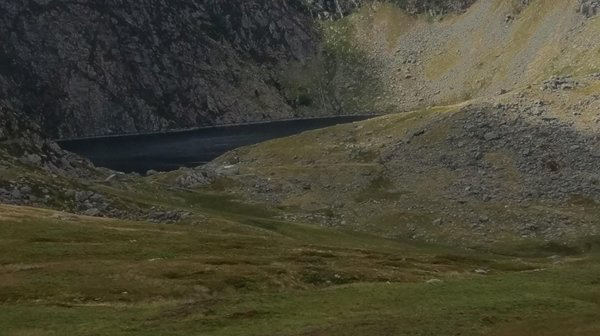
RWE is one of the world’s leading renewable energy companies, and operates five hydroelectric power stations in Snowdonia, North Wales – an area with significant rainfall that’s perfect for harnessing water to produce electricity. To maximize its renewable energy output from the reservoirs, RWE needs to manage the water levels in its catchment areas to perfection.

Turning Excess Rainfall Into Energy
Climate change is increasing the risk of flooding in this remote, mountainous region. As well as the potential damage floods can cause to the countryside and infrastructure, there’s a missed opportunity to use the excess rainfall to generate more renewable energy.
If RWE can closely monitor conditions at its hydroelectric power stations, it can better manage water levels and flow rates; until 2016, however, RWE had to rely upon sending people into the mountains to take measurements. This was time-consuming, costly, and produced limited and inaccurate results.
It was also potentially unsafe, because RWE Hydro’s operations centre is in Dolgarrog, about 10 metres above sea level; the fieldwork could be up to 600 metres above sea level, with radically different weather conditions possible.
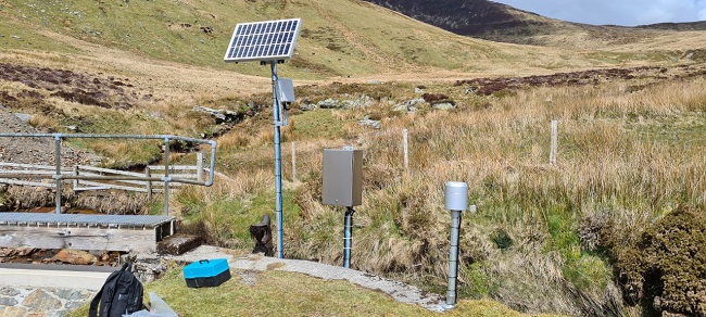
The Challenge
In 2016, RWE decided to install automated hydrology stations, with the goal of getting valuable, precise, up-to-date information on conditions without needing to send people into the field. These installations would constantly monitor water levels, precipitation, air and water temperatures, and relative humidity, enabling the company to prevent water wastage, and maximize the amount of renewable energy it supplies to the grid.
RWE faced multiple challenges in this endeavour: firstly, the solution needed to be unobtrusive, and not impair the beauty of this landscape. Secondly, there’s no terrestrial power to these areas. Finally, there’s no land- or mobile-based communication network; to successfully gather and send the necessary data, RWE needed a solution that resolved all of these issues.
The Solution
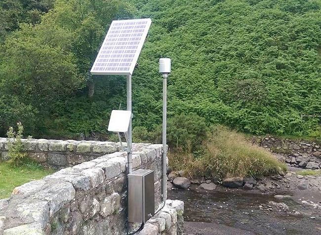
Ground Control worked with our satellite connectivity partner Viasat, sensor provider OTT Hydromet, and ASTECH Engineering Services to design, develop and deploy four energy efficient, solar powered, IoT-enabled hydrological stations.
We used Hughes 9502 terminals to transmit data every three hours, but data is collected every 15 minutes. Edge computing allows the frequency of transmission to be increased if data falls outside of normal parameters, which in turn alerts the RWE engineers, and allows them to respond.
Once water levels drop within normal parameters, the transmissions slow down again. As a result of this efficient process, monthly data usage at each site does not exceed 2MB.
It’s a very flexible, modular system which allows the configuration to be changed, or new features added, as needed.
The Result
With real time alerts of heavy rainfall, RWE can direct as much water as possible into leats and waterways, which then flow into the lakes and reservoirs. From there, RWE uses the water to generate power.
RWE are also able to reduce water wastage. When maintenance work needs to be completed, or improvements made to the waterway system, these should be done when the weather is dry and likely to remain so, as otherwise, water has to be diverted away from the area, and is wasted. With the hydrology data RWE receive, they know when the conditions are right, and can both reduce wastage and better ensure the safety of their field operatives.
RWE now plan to add a further eight hydrology stations to their network to build a full picture across their Snowdonia catchment.
“In such a changeable and challenging environment like Snowdonia, the real-time data from the BGAN-enabled hydrology stations lets us respond quickly and effectively to any changes in the water levels. We can maximize electricity production, reduce water waste and minimize the threat of damage through overspill to the landscape and our own infrastructure, while keeping our staff safe and secure.”
John McNab – Operations Engineer
Could your renewables project benefit from better connectivity?
The Ground Control team, as we hope this case study illustrates, is here to help solve your IoT connectivity challenges. If your project is in remote areas with limited cellular coverage, our partnerships with leading satellite service providers ensures that we can always bring your data home.
Complete the form or call us – we have offices in the UK and USA, and we’d love to hear from you.