Industry: Government
JCSys are an internationally trusted personnel tracking solutions provider, with global clients as diverse as the military, remote field workers, adventurers and ultra endurance athletes. Based in the UK, they’re fully accredited to work for the UK MoD and NATO.
By working collaboratively on hardware and firmware modifications to provide an end-to-end solution, JCS has successfully deployed our RockSTAR handheld devices to meet the specific situational awareness needs of their clients. This includes functionality such as the encryption of location data, pairing with BLE heart rate monitors, event geo-fencing and automated incident alerts.
JCSys is responsible for the safety of participants in some of the world’s toughest endurance events, and they take that responsibility extremely seriously. RockSTAR leverages the Iridium Short Burst Data satellite airtime service, which is ideal for JCSys as coverage is global, unaffected by weather conditions, and transmits data in close to real-time.
Locate is as an advanced and intuitive emergency incident management platform, developed in 2016 to address a spectrum of critical needs and help organizations across the globe keep their people safe. Their platform excels in swiftly identifying critical events, locating users, facilitating global mass communication, and orchestrating a prompt response.
One of Locate Global’s pivotal strengths lies in its global communication capabilities. By combining their incident management platform with Ground Control’s advanced satellite hardware, they can deliver a powerful, integrated solution, connecting stakeholders worldwide, bridging geographical gaps, and fostering a collaborative environment crucial for effective crisis management.
- Seamless Connectivity: Ground Control’s satellite technology ensures reliable communication and data transmission, even in the most remote locations
- Real-time Incident Management: Locate Global’s platform provides real-time tracking, reporting, and resolution of incidents, enhancing safety and operational efficiency
- Enhanced Coverage: Clients benefit from expanded geographical coverage, enabling them to operate confidently across the globe.
This global reach ensures that information flows seamlessly, empowering decision-makers with real-time data for an informed and strategic response. In times where every second count, Locate Global’a platform instils confidence – delivering a dependable framework that organizations can rely on during their most challenging times.
Scaling Ocean Data Collection Through Satellite-Enabled Buoy Technology
The ocean covers over 70% of the Earth’s surface, yet remains one of the least observed and understood environments due to the logistical and technological challenges involved in data collection.
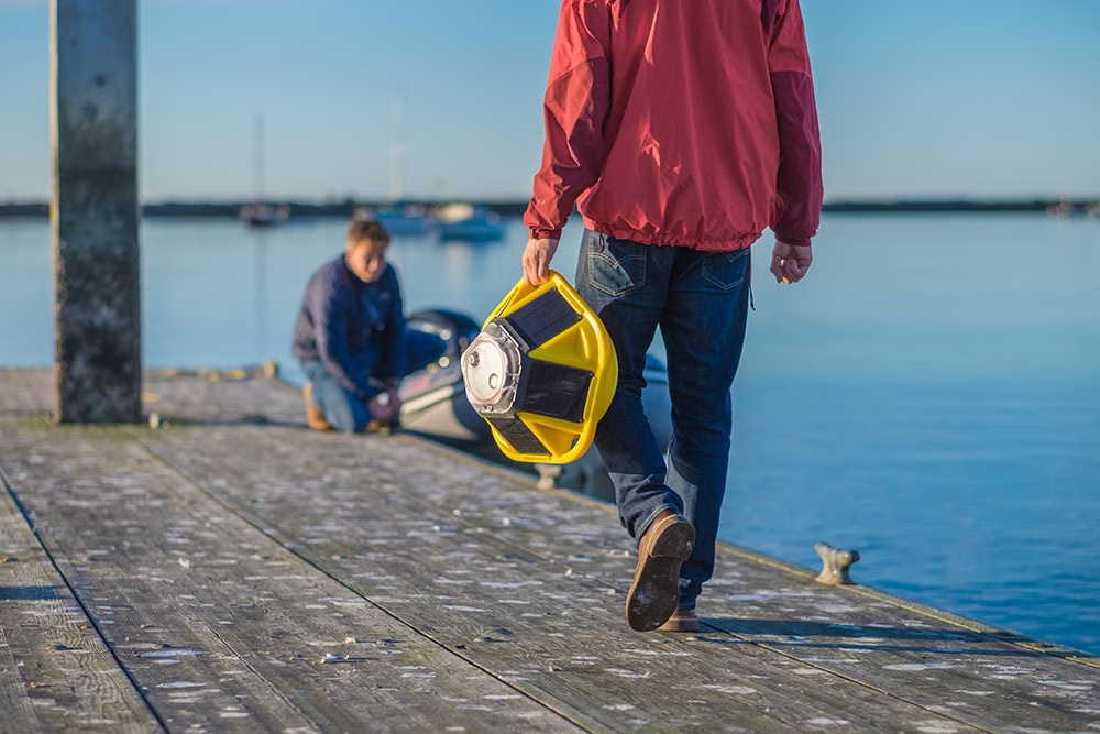
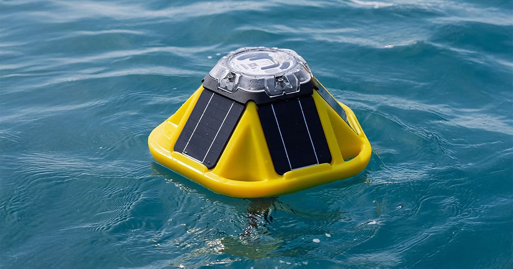
Sofar Ocean is on a mission to close this global ocean data gap. The maritime tech company builds compact, cost-effective, and extremely durable metocean buoys called Spotters, which marine professionals deploy to collect ocean data at scale. Spotter buoys measure waves, wind, sea surface temperature, barometric pressure, and other variables — providing real-time insights that power advancements in research, coastal resilience, climate science, and other critical fields.
Sofar also operates its own global network of free-drifting Spotters, which collects ocean data at a planetary scale. This unprecedented dataset powers Sofar’s proprietary marine weather forecasts, which are up to 50% more accurate than traditional forecasts.

The Challenge
Dan Breyre, Product Lead at Sofar, and his team needed a satellite communications solution that could deliver real-time data from Spotters located in remote ocean locations far beyond the reach of traditional networks.
The solution needed to provide consistent, reliable transmission and give Sofar’s customers up-to-the-minute data access from even the most isolated ocean regions.
The Solution
Sofar selected the RockBLOCK 9602 satellite modem from Ground Control, which offers reliability, ease of use, and adaptability. RockBLOCK 9602 is compact and rugged, ideal for Sofar’s distributed sensor arrays that must endure the ocean’s harsh conditions.
The modem supports consistent, two-way communication via the reliable and globally-available Iridium satellite constellation, which enables Sofar and its customers to access critical data and send firmware commands back to Spotters when needed. This functionality has proven indispensable for sustaining Sofar’s distributed sensing technology and advancing its mission to democratize ocean data access.
“Ground Control provides reliability, consistency, and ease of use, all of which are vital for our disruptive distributed sensing technology.”
Dan Breyre, Product Lead, Sofar Ocean
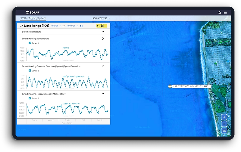
Utilizing RockBLOCK 9602, Sofar has been able to achieve extensive spatial coverage with its Spotters across vast oceanic regions, transmitting valuable insights that inform better decision-making by marine professionals.
The immediate and accurate data that Spotters deliver improves operational efficiency for ocean industry and empowers researchers, governments, and coastal communities to better understand and respond to changing marine and climate conditions.
Sofar continues to push the boundaries of ocean data collection. Its vision includes expanding the types of data Spotter collects, further reducing the size and latency constraints of the platform, and enhancing the spatial coverage of the Spotter network. Sofar strives to continuously expand access to actionable data that helps its customers address the most pressing ocean challenges.
Can we help you with remote data collection?
Ground Control has over 20 years’ experience in delivering reliable satellite IoT and tracking solutions.
If you have an asset or sensor(s) in a remote location, we can help you extract your data cost-effectively and in close to real-time.
Email hello@groundcontrol.com for more information, or complete the form, and we’ll be in touch within one working day.