Product: RockBLOCK Plus
Automated Landslide Monitoring
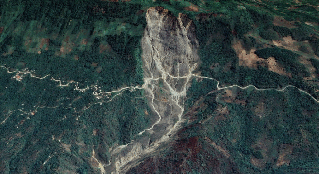
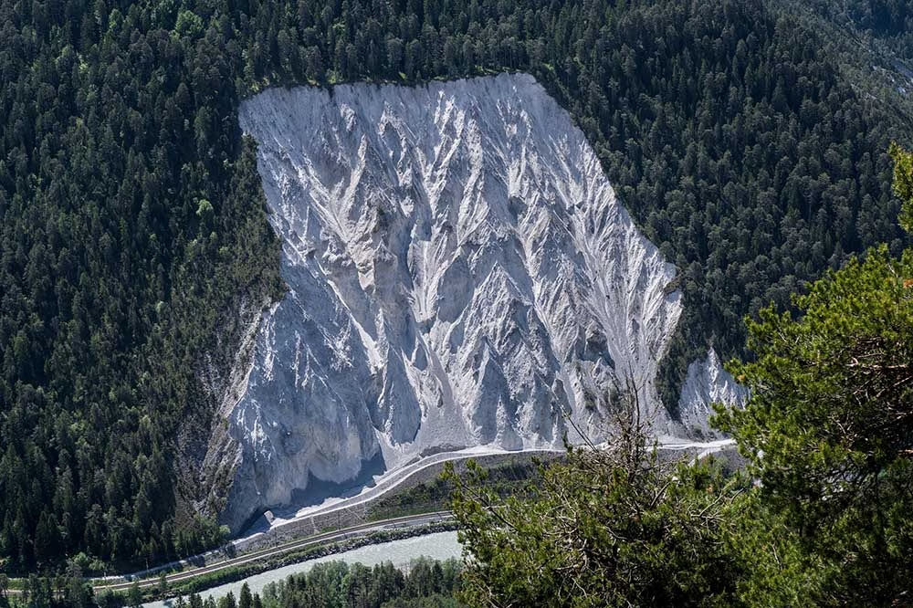
Slide Sentinel is a fully automated landslide monitoring system using Real Time Kinematics (RTK). Measuring this way aids in early warning information and limits the use of invasive and expensive drilling, the more traditional landslide monitoring technique.
The Ground Control RockBLOCK Plus is seeing continued use in the Slide Sentinel project from Oregon State University. The project is currently under rapid development as the team prepare for a deployment very soon on an active landslide in the Pacific Northwest. Current development is focussed on programming the rover and base station units.

What is Slide Sentinel?
Slide Sentinel is a fully automated landslide monitoring system using RTK. It regularly monitors landslide activity with high spatiotemporal resolution and centimetre-level accuracy for long-term deployments. Measuring this way aids in early warning information and limits the use of invasive and expensive drilling, the more traditional landslide monitoring technique.
Slide Sentinel is made up of a base station and a network of rover units which are positioned over the active landslide terrain. The rovers will record and send data regarding their position back to base via the Iridium satellite network which is then automatically recorded in the Cloud for analysis of real-time movement. Positional readings are provided every two to three hours.
Facilitated by the RockBLOCK Plus
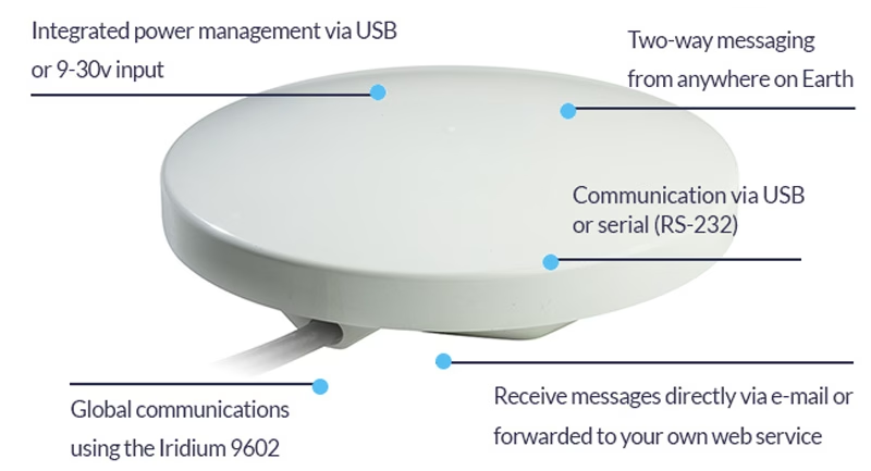
The RockBLOCK Plus device is used as the entry point into the Slide Sentinel system when it’s deployed in remote locations. All positions collected by rovers on the network are sent to the central base station, then uploaded to a cloud infrastructure for real time rover monitoring using the RockBLOCK Plus.
Rock Seven (now trading as Ground Control) director, Nick Farrell, said: “This is yet another amazing use of our IoT devices, and shows the flexibility of the product and the Iridium network as a whole. Every day we see remote projects being enabled with our equipment, allowing scientists to go further and do more than ever before.”
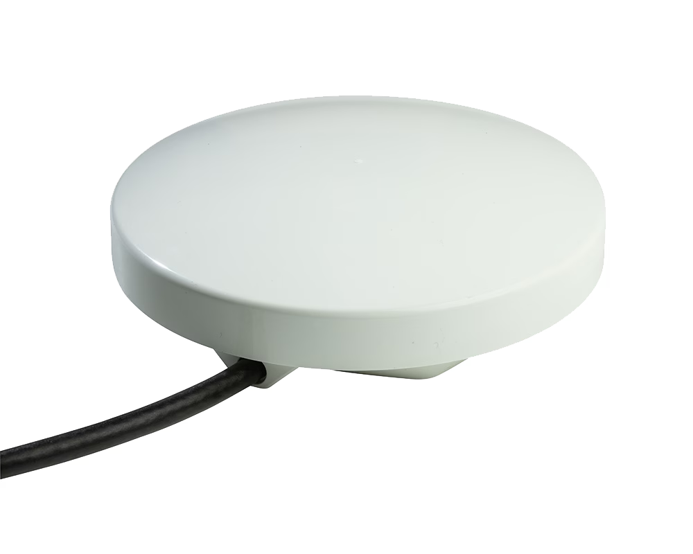
“The RockBLOCK Plus has proved useful for sending data to the rovers on our system. Users can uniquely address and send rover configuration data via the RockBLOCK Plus. This data is eventually dispatched to the proper rover and can dynamically change the behaviour of the device – i.e. we can tell the rover to wake more or less frequently or make the rover unit’s accelerometer more sensitive to movement events.”
Kamron Kent Ebrahimi, Slide Sentinel developer and project lead
Project Developments
Due to the ongoing success of the project, Slide Sentinel has seen further development to support additional receivers and communication links. Work continues and all involved are dedicated to its continued success.
Regarding why he got involved with the project, Ebrahimi said: “I got involved about a year and a half ago. I think being a lead developer on a highly technical project, as well as maintaining close contact with a client to engineer the proper system, has been one of the most formative experiences of my undergraduate career. I’m also attracted to the breadth of this project. Designing something of this scale requires learning best engineering practices for embedded systems, networking protocols, and configuring cloud infrastructure for handling data.”
What’s in store for the future? The team are hoping for a larger number of rovers to be serviced by one base as well as the use of a client web app instead of a Google spreadsheet.
Built with Ground Control
The work we support genuinely inspires us, and we’re proud to create solutions and solve customer problems like no one else can.
If you’d like to get in touch with the team either to discuss a challenge similar to that of the one above, or something completely different our team of experts will be happy to provide objective advice.
American Signal Corporation (ASC) designs, manufactures, installs and maintains state-of-the-art mass notification systems and emergency alert systems. Recognized and implemented worldwide, ASC’s solutions are relied upon daily by governments, communities, numerous industries, universities and military facilities. ASC has been an industry leader since it was founded in 1942.

Importance of ASC’s Work in Thailand
No one can forget the appalling loss of life and devastation caused by the 2004 Indian Ocean earthquake and tsunami (the “Boxing Day Tsunami”). An estimated 227,898 people died in 14 countries, in one of the deadliest natural disasters in recorded history.
There were no tsunami detection systems, nor means of warning the general population, in the Indian Ocean, so despite there being several hours between the earthquake and the ensuing tsunami, only a few communities recognized the warning signs and made for safety.
After the tsunami, this very quickly changed, and that’s where ASC stepped in. Working with the Thai Government, ASC and their dealer installed a nationwide network of devices, including high powered speaker arrays and other alerting devices together with bespoke management software to alert people to threats posed by tsunamis, floods and other disasters, both natural and manmade.


The Challenge
As a critical communications network, there was never any question that the early warning system would need to utilize satellite connectivity, both for the coverage requirements and network reliability. Commercial terrestrial power and communications networks tend to perform poorly in a disaster – either through overuse or damage to their infrastructure.
ASC’s previous solution utilized geostationary satellites. Given the importance of the early warning signal, they had priority routing to ensure that their messages weren’t queued behind less time-critical data. When this service was discontinued, it was clear to the ASC team that they needed another solution to ensure that their data was passed reliably, securely and in as close to real-time as possible to the authorities.
The Solution
American Signal Corporation chose Ground Control’s RockBLOCK Plus as their satellite transceiver. This delivers plug and play connectivity to the Iridium satellite constellation, which is a network of 66 satellites in low earth orbit (LEO). This has several benefits for the ASC team:
- The Short Burst Data (SBD) service from Iridium enables real time data through low-latency connections – essential for mission-critical applications like ASC’s tsunami warning system
- The omni-directional antennas are extremely easy to install as they do not require alignment with the geostationary satellite
- Iridium SBD uses the L-Band frequency range which has a longer wavelength, and so is not affected by rain fade; it’s both highly resilient and stable.
There are in excess of 1500 alerting devices across Thailand, of which over half are equipped with the RockBLOCK Plus transceivers. Radio is used for last mile connectivity of the remaining alerting devices from control points equipped with RockBLOCK Plus transceivers. The system is tested on a regular basis with a live activation by the Thai government together with daily polls to ensure that every device is operational, and data upload / download is as quick as required.
Do you need reliable, global coverage?
Ground Control can help. We’ve been providing satellite connectivity for communications, tracking, and IoT data backhaul since 2002.
We have customers in 107 countries and are trusted partners of airtime providers including Iridium and Inmarsat. Call us or complete the form to get a conversation started about your requirements.
Going Wireless in Greenland: Downloading Data from Deep Beneath the Ice
Glaciers are constantly on the move. They’re flowing rivers of ice, constantly flowing and fracturing and bulldozing everything in their path. But under the ice there’s a hidden network of “plumbing” – water flowing in channels within and beneath the ice. This liquid water can lubricate the flow of ice over the bedrock, changing the speed at which the ice is moving. For glaciologists, understanding this hidden plumbing is essential for improving forecasts of ice flow and, ultimately, sea level rise.
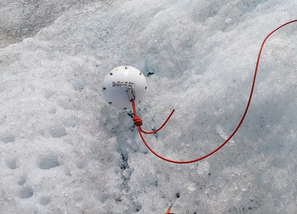
Cardiff University’s Cryoegg project set out to make those concealed environments measurable in a new way: by placing a compact wireless probe (the “Cryoegg” itself) directly into subglacial water systems, collecting pressure, temperature, and electrical conductivity data, and transmitting readings back up to the surface. The ambition was straightforward; the environment was not.

The Challenge
Subglacial research is defined by constraints. Access often comes through narrow boreholes drilled or melted through ice that is hundreds of meters thick, in places where weather is harsh, logistics are limited, and communications infrastructure is non-existent. Once instruments are down-hole, the borehole can refreeze, and moving ice can deform or destroy anything relying on fixed cables. In many cases, retrieval simply isn’t part of the plan; you have to assume what you deploy may never come back up.
That creates a second, less visible challenge: even if you can get sensor data to the surface, how do you move it off the ice reliably, with minimal power, and without needing someone to stand next to the equipment?
The Work
Cryoegg was developed specifically to reduce reliance on vulnerable wired systems. In peer-reviewed field trials, the team demonstrated wireless transmission through cold ice at substantial depths, with the published work reporting communication through up to 1.3 km of ice under test conditions.
Cryoegg’s design also targets long deployment life by spending most of its time asleep, waking briefly to take readings and transmit them, then returning to low power operation. Some Cryoeggs have now been operating for more than 18 months underneath the ice.
To make that science usable day-to-day, the field system still needs a dependable ‘last mile’ from the glacier surface back to the researchers, so data doesn’t stay stranded in a remote camp until the next field visit.
Getting the Data Home
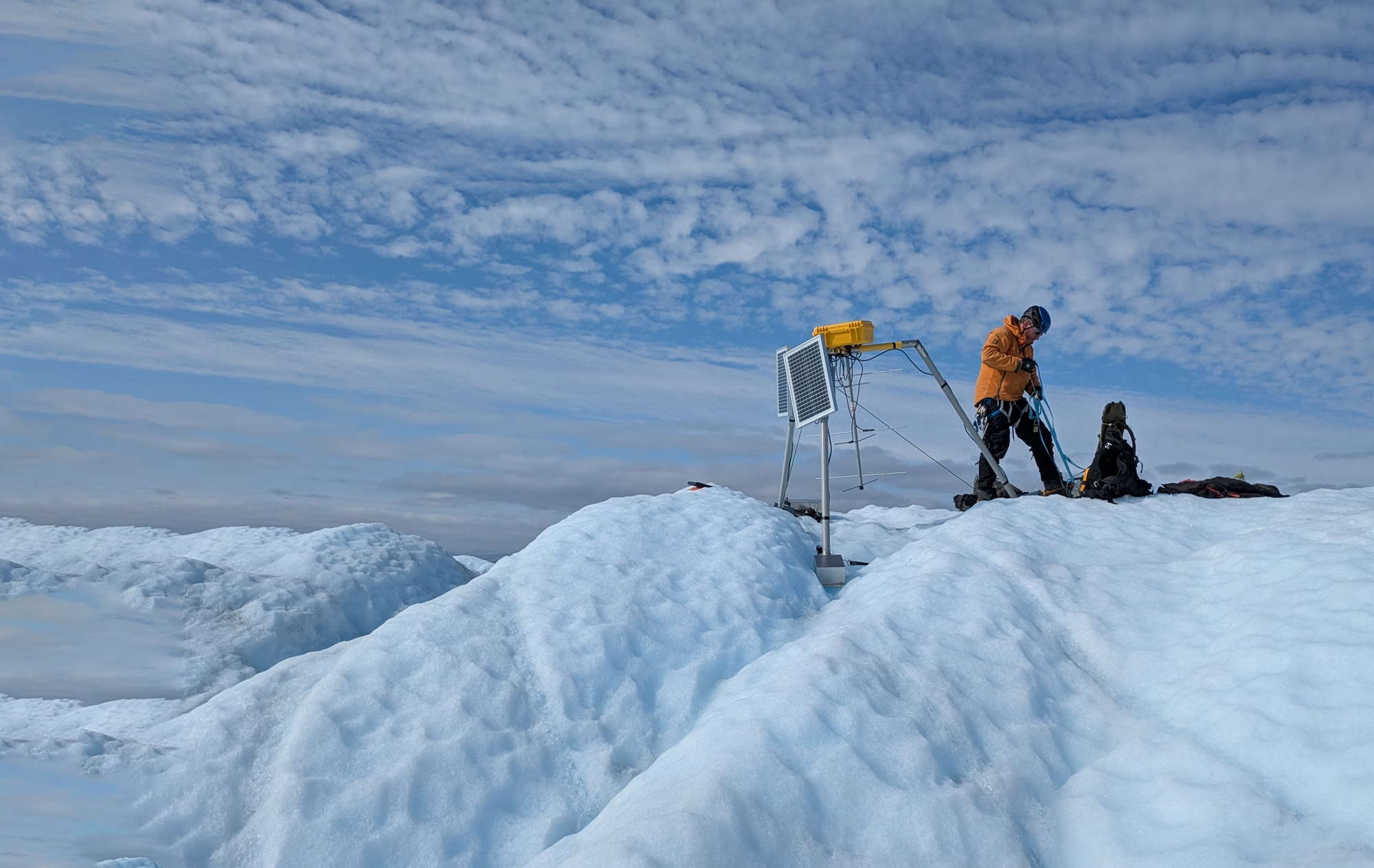
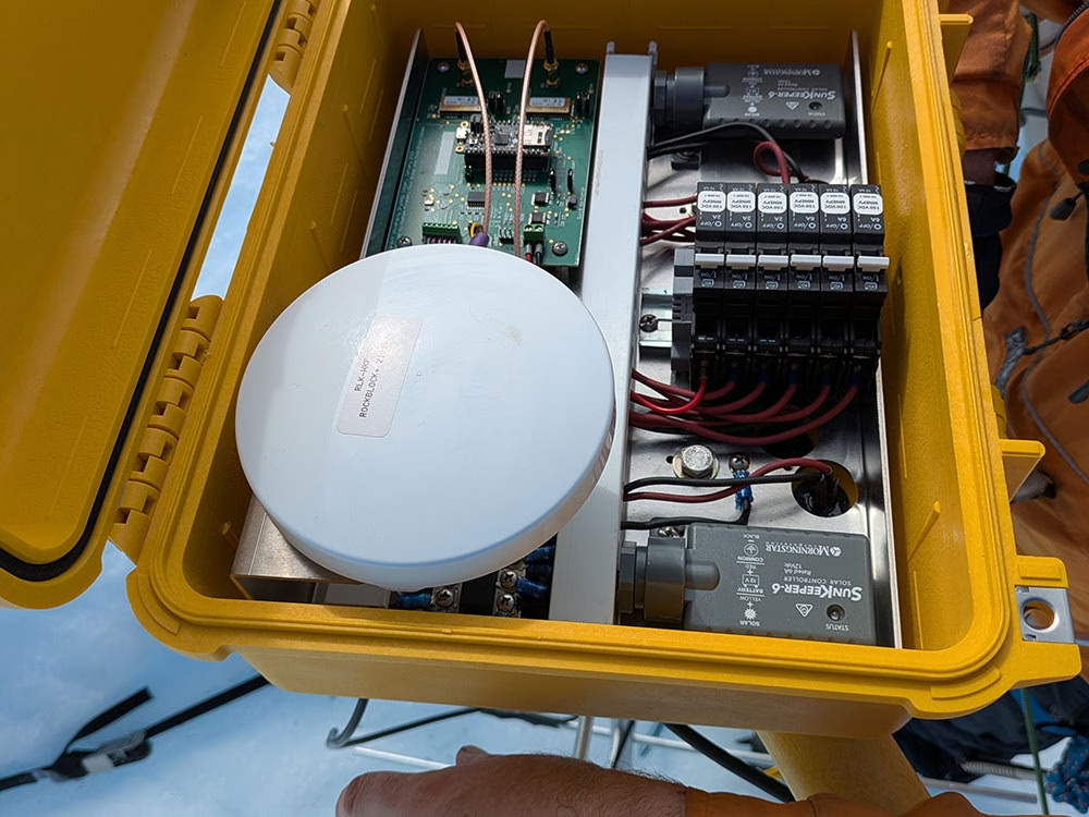
During a recent field trip to West Greenland, the team deployed a surface datalogger to receive transmissions from equipment buried hundreds of meters below the ice, then forward those messages back to the UK over satellite.
Once you’re operating in environments that are cold, wet, windy, and hard to revisit, reliability and power discipline become operational requirements. The device used by the team to move messages from the datalogger to base was RockBLOCK Plus, a waterproof satellite IoT device designed for short burst messaging via the Iridium network.
For this kind of deployment, the relevant details are simple: it’s built to stay outside, keep working, and do so without demanding much power. RockBLOCK Plus is IP67 rated, and operates in temperatures as low as -40°C to as high as +85°C, with a rugged design intended for remote, unattended installations.
The Result
By pairing a wireless subglacial probe with a robust surface-to-satellite backhaul, the Cryoegg team can focus more of their effort on what matters: collecting measurements that illuminate how water moves beneath ice, and using those observations to improve our understanding of glacier dynamics.
The overall impact is practical as well as scientific. When data can make its way off a glacier without frequent visits or complex infrastructure, projects become more resilient, field seasons become more efficient, and research teams can spend less time babysitting comms and more time interpreting results.
Read the ongoing findings of the research here.
“We’re doing exciting science in a very challenging environment. We needed something that would keep sending data reliably in harsh conditions, and RockBLOCK Plus has done exactly that. The Ground Control team were easy to work with, and I’m looking forward to trying the latest iterations of the hardware in future deployments.”
Dr Mike Prior-Jones, Electronic Engineer and Glaciologist (read more about Dr Prior-Jones)
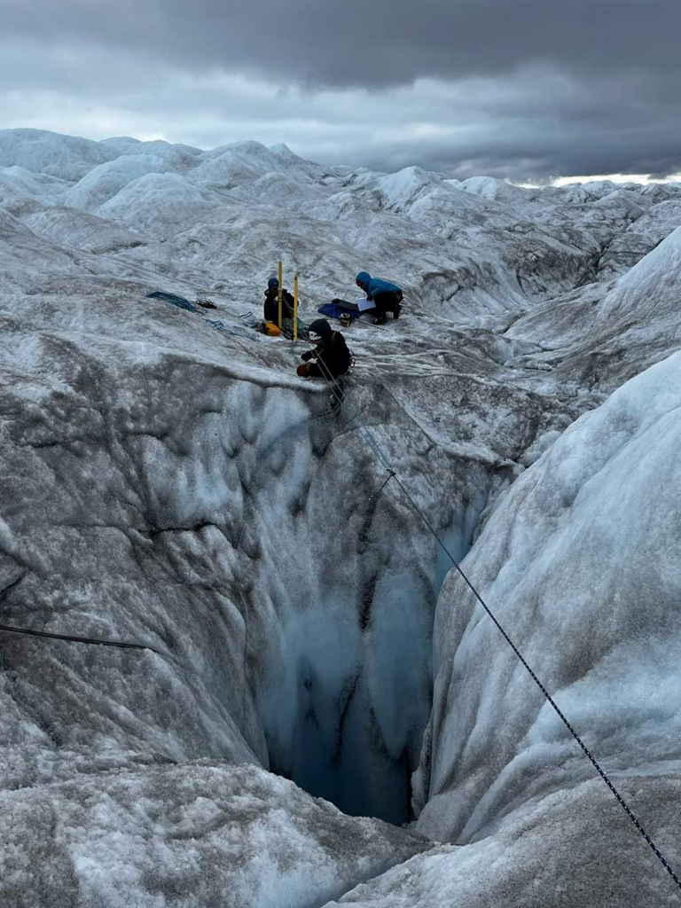
[About the picture on the right]
“The team preparing for a Cryoegg deployment in a moulin (a naturally-occurring hole in the glacier made by meltwater) on Isunnguata Sermia. Jonathan is roped up with a harness in case he falls. The ice here is about 400m thick, and the initial drop into the moulin is probably around 50m, so not something you want to fall into.”
Have data in hard-to-reach places?
Ground Control has over 20 years experience in extracting data from the most remote and inhospitable places on Earth. Our satellite IoT solutions draw very little power, work reliably anywhere with a clear view of the sky (even within a plastic container!), and come in multiple form factors, from developer PCBs to rugged and enclosed devices.
Let us know about your project by emailing hello@groundcontrol.com, or complete the form, and we’ll reply within one working day to offer our expert advice.
Preventing Illegal Deforestation
Safeguarding the World’s Largest Rainforests
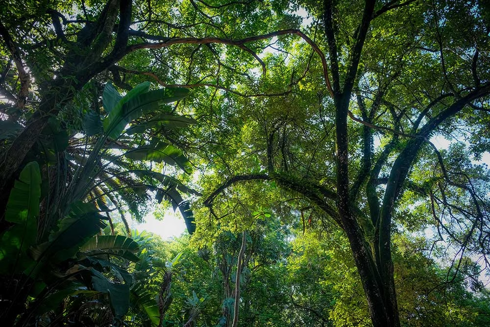
The world’s two largest rainforests, the Congo Basin and the Amazon, are under threat from illegal extraction activities. Unfortunately, both national and local authorities have long lacked the means and mechanisms to deal with these illegalities which destroy ecosystems and undermine both forest and indigenous people’s livelihoods.
Enter the Rainforest Foundation UK, now actively working with both national and local authorities with its ForestLink real-time monitoring system. Rather than relying on external or third-party observers, ForestLink relies on monitors living in the rainforest to act as watchdogs, alerting the Rainforest Foundation of suspected illegal activities via a bespoke smartphone app.
The Role of Satellite Connectivity
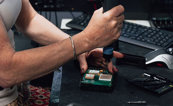
When GPRS isn’t available, the ForestLink system uses RockBLOCK and weatherproofed RockBLOCK Plus devices to exchange data via the Iridium network. After alerts are sent to a secure database, they’re analysed by NGOs and governments. Pending further details from community observers that help verify alerts, the Rainforest Foundation notifies the appropriate authorities.
The ForestLink system is currently used to address a wide range of threats that include illegal logging and mining activities, as well as oil spills. Working with local partner organizations, the Rainforest Foundation has trained over 30 communities in the DRC, Ghana, Cameroon, and Peru to use the system.
12 Million Hectares Protected
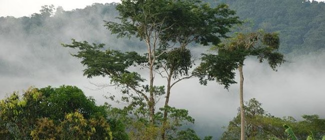
So far, thousands of alerts have been sent by community monitors, resulting in legal action against extractive industries. Since its inception, the Rainforest Foundation has helped indigenous and local communities protect more than 12 million hectares of rainforest.
The Rainforest Foundation has successfully empowered local populations by giving them the ability to secure and take control of their natural resources, as well as their individual and collective rights. Ground Control is extremely proud that satcomms can play a vital role to this end.
Facing similar connectivity challenges?
If you’re seeking a solution to a critical communications challenge, we can help.
Just complete the form and we’ll be in touch. We have offices in the USA and UK, and over 20 years’ experience in satcomms and IoT, plus access to the best airtime, devices and services available.
Keeping Flood Monitoring Data Flowing When It Matters Most
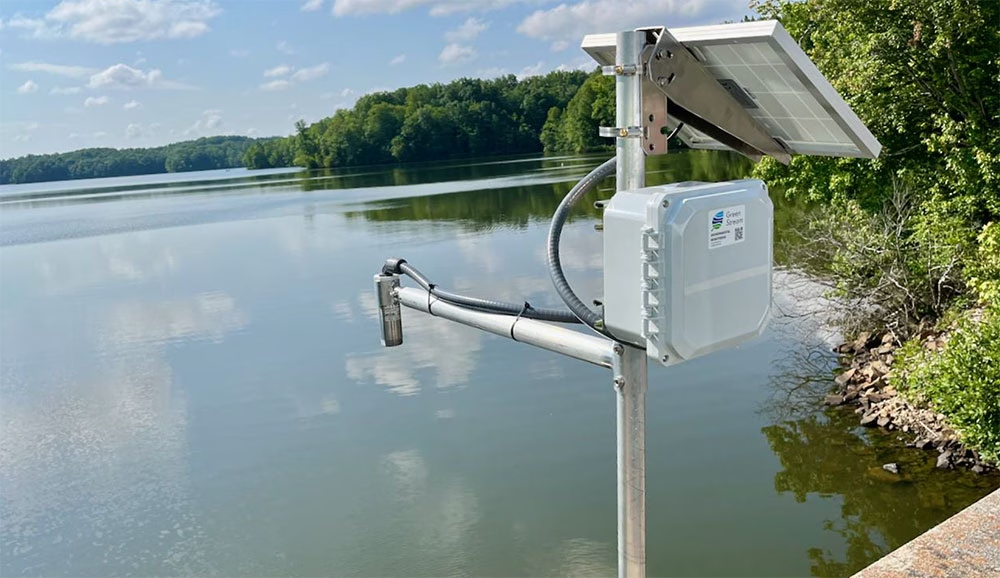
Green Stream Technologies provides real time flood monitoring systems that help communities, agencies, and infrastructure operators detect rising water, monitor rainfall and weather conditions, and respond quickly to flood risk. Its solution brings together rugged sensor kits, autonomous solar power, secure cloud services, dashboards, alerts, APIs, integrations, field services, training, and ongoing support.

The Challenge
For flood monitoring to be useful, data has to get through. A water level reading, rainfall measurement, or field image can support decisions during a fast moving event, but only if it reaches the right people in time.
Many of the locations that need monitoring are rural, coastal, or riverside sites where cellular coverage can be limited. Even where LTE is normally available, severe weather can disrupt terrestrial networks during the events these systems are designed to track. Green Stream needed a communications approach that could work across different environments, while balancing cost, reliability, latency, and operational risk.
The Solution
Green Stream uses a site-by-site telemetry strategy. Where LTE coverage is strong, cellular is often the most cost effective option. In remote areas with little or no cellular coverage, Iridium can act as the primary communications path. For mission critical sites, especially in flood-prone areas where storms may affect cellular networks, Green Stream can pair LTE with Iridium failover.
That flexibility helps Green Stream match the connectivity method to the site. It also reflects a deliberate choice. Flood monitoring depends on high resolution, real time data that customers can act on. Some emerging LEO satellite options can be lower cost, but may require waiting for a satellite pass. For flash flooding, a two- or three-hour reporting gap is not good enough. Iridium gives Green Stream global coverage and the ability to report every five minutes, with no missed reporting windows.
Using Ground Control’s RockBLOCK devices, Green Stream can add Iridium connectivity to monitoring stations beyond the reach of terrestrial networks, from rural riverbanks to coastal plains and other high impact locations.
The Service Evolution
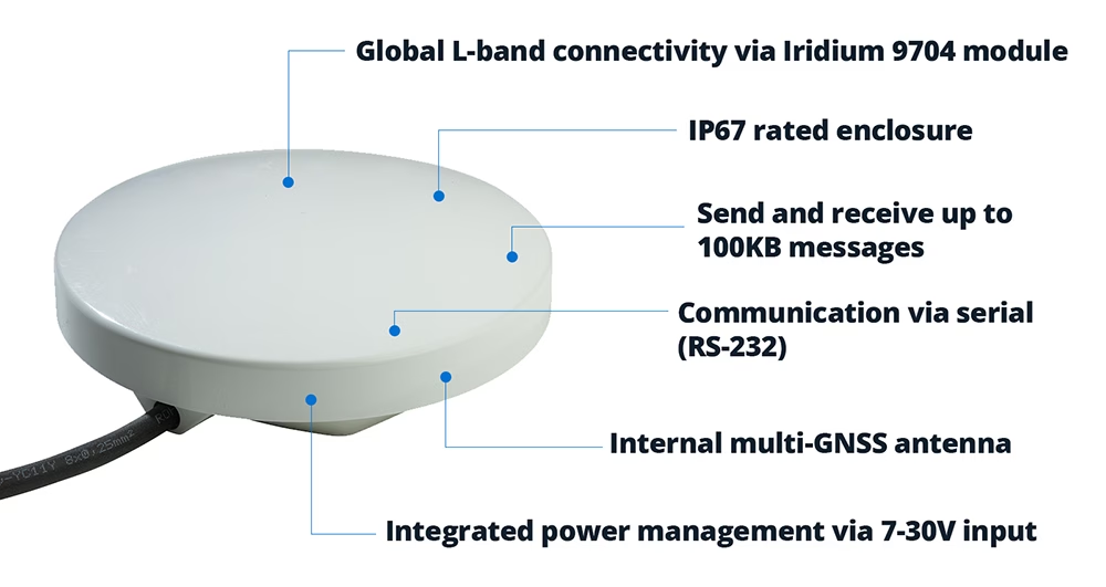
Green Stream first used RockBLOCK 9603, based on Iridium Short Burst Data (SBD), to send compact reports from remote monitoring sites. For many applications, that was enough: small packets of data covering water levels, rainfall, device status, and network health.
As its deployments evolved, Green Stream began moving to RockBLOCK 9704 and RockBLOCK Plus 9704, which use Iridium Messaging Transport (IMT). The difference is significant. RockBLOCK 9603 messages are measured in hundreds of bytes; RockBLOCK 9704 supports messages up to 100KB.
That larger message size creates room for richer reporting. Water level data remains central to flood monitoring, but Green Stream can now look at adding more context, including images from the field. During a flood event, imagery can help emergency managers see what conditions look like on the ground, not just read what a sensor is reporting.
The Result
Satellite connectivity helps Green Stream reduce operational risk, especially in remote or high impact locations where site visits can be difficult, slow, or unsafe.
During severe weather, continuity of data becomes especially important. By using Iridium through Ground Control’s RockBLOCK devices, Green Stream can offer an added layer of resilience for sites where communications failure would have the greatest impact.
This matters as Green Stream expands into more rural and underserved areas. These communities may face serious flood risk, but lack dependable cellular coverage. Satellite connectivity helps make early warning systems practical in places that would otherwise be harder to monitor.
“We chose Ground Control because it provided a fast and straightforward path to integrating Iridium into our systems, which was important for getting a satellite solution to market quickly. The platform is intuitive and well documented, and our Account Manager, Elonda, has been knowledgeable and responsive, which has made the partnership easy to work with.”
Karen Lindquist, Green Stream
Looking Ahead
Green Stream is continuing to scale as more communities look for better ways to manage flood risk. Its approach – start with a pilot, then expand to a wider network – gives customers a practical path from initial deployment to broader flood intelligence systems.
As those networks grow, satellite connectivity will help Green Stream reach more sites, support more resilient deployments, and feed local data into regional or state-level systems for emergency management.
Let’s connect your next deployment
Green Stream’s flood monitoring network is one example of how satellite IoT can help critical data keep moving when cellular coverage is limited, unreliable, or at risk of disruption.
If you’re developing an IoT solution for remote, mobile, or mission critical environments, Ground Control can help you assess your options and build a connectivity approach that fits your application, budget, and growth plans.
Complete the form or email hello@groundcontrol.com and we’ll reply within one working day.
In 2017, Founder Brandon Wright’s sailboat, SV Inconceivable, broke mooring in a winter storm, and floated to shore. Researching monitoring solutions to prevent this happening without warning again, Brandon struggled to find something that ticked all the boxes, including position relative to geo-fences, battery voltages, and bilge activity. With a background in IoT and electrical engineering, Brandon was perfectly equipped to plug the gap in the market, and Barnacle Systems was born.

The Project
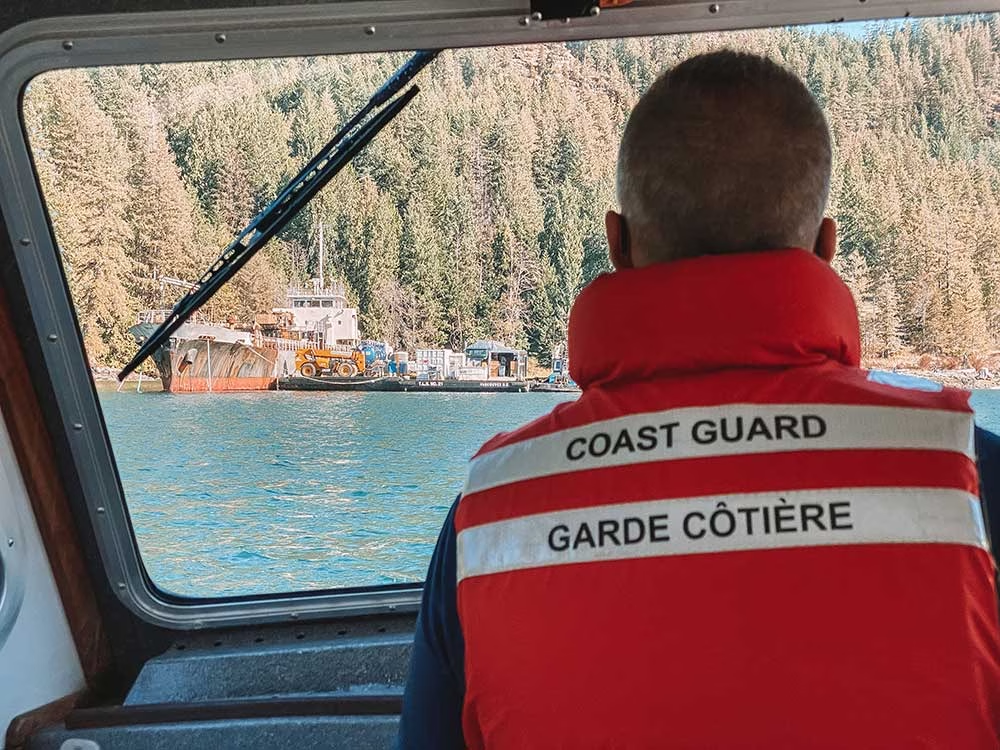
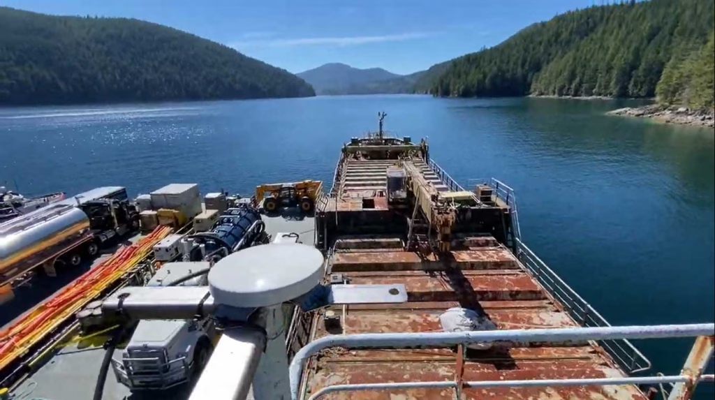
There are over 2,700 wrecked, abandoned and/or hazardous vessels in Canadian waterways, which present a navigational hazard for other boats, and as they degrade, can release contaminants into the water, poisoning marine life. These contaminants range from diesel, gas and system fluids to bottom paint and batteries. Since 2019, it’s been illegal for owners to abandon their boats, but there’s a vast legacy problem that’s tricky to solve.
With the longest coastline in the world (243,042 km), the Canadian Coast Guard has to be selective about which boats it can salvage, and in order to do so effectively, they need to know which vessels present the greatest risk.
The Solution
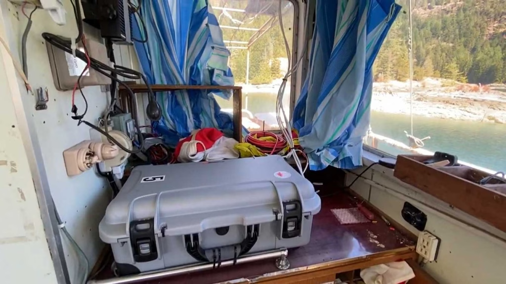
The Canadian Coast Guard has invested in 45 BRNKL Rapid Deploy units from Barnacle Systems. These are purpose-designed for the remote, long-term monitoring of stricken vessels, with capabilities ranging from position tracking, monitoring the list (heel), pitch, and sudden impacts; detecting if water is present in a specific area; and detecting and capturing photos of intruders.
The solar-powered devices are placed on board problematic vessels and enable the Coast Guard to remotely monitor them, with alerts if they begin to sink, or change position, or if intruders are detected. Real time notifications allow them to quickly deploy hazard response teams when needed; if no changes are detected, the Coast Guard can continue to remove and recycle other vessels which present a more immediate risk.
The Satellite Connection
The BRNKL Rapid Deploy units are equipped with both cellular and satellite modems for data transmission, and Brandon chose Ground Control’s RockBLOCK Plus for the satellite connectivity. RockBLOCK Plus is a fully waterproof, plug-and-play satellite transceiver that utilizes the Iridium Short Burst Data® (SBD®) airtime service, designed for IoT applications. With 66 satellites in Low Earth Orbit, Iridium offers global coverage, including the polar regions; important for Canada, as 40% of its land mass is considered Arctic.
Further, RockBLOCK Plus does not need to be ‘pointed’ to transmit to the satellites; the omni-directional antenna just needs a clear view of the sky. This means should the boat move, there’s no risk of the transmission being interrupted because of line-of-sight issues.
Having used other satellite services in the recent past, Brandon knew Iridium was the right airtime choice, due to its reliability and coverage.
“When I spoke to the Ground Control team about the BRNKL Rapid Deploy units, they recommended the RockBLOCK Plus. Its ruggedness, low power requirements and affordable transmission costs are ideally suited for this application, and they’re working exactly as intended.”
Brandon Wright | P.Eng. | CEO
What’s Next?
Barnacle Systems plans to expand the BRNKL Rapid Deploy into the global vessel salvage market, as the solution will work just as effectively for marine salvage operations anywhere on the globe. By receiving alerts about intruders or further damage to a boat scheduled for salvage, operators reduce risks and can better prioritize which vessels to extract.
Would you like to know more?
If you need to collect IoT data from remote and inhospitable locations, you can’t go wrong with the RockBLOCK Plus. That said, there are an increasing number of choices available to you – good news, because competition drives innovation and lowers costs, but it can be difficult to identify which device and satellite airtime service will best meet your needs.
The Ground Control team are here to help! We have 20 years experience in satellite services, and design and build our own satellite IoT devices. We’ll offer you objective, expert advice; just call or email us, or complete the online form.