Last updated
When Storms Hit, Data Buoys Respond: Satellite IoT for Metocean Early Warning
Data buoys are often among the first instruments to detect an approaching tsunami or severe ocean conditions. For the integrators and data scientists who design these systems, the challenge is getting rich, accurate data, ashore quickly, reliably and affordably, especially when conditions are at their worst.
The Instruments That See It First
On January 15, 2022, the Hunga Tonga-Hunga Haʻapai volcano erupted. Just 30 minutes later, a deep-ocean tsunami buoy near Tonga detected the resulting wave. Within hours, New Zealand’s emergency management agency had issued a national tsunami advisory, later crediting the buoy network with enabling faster, more accurate warnings.
On July 29, 2025, a magnitude 8.8 earthquake struck off Russia’s Kamchatka Peninsula. Around 35 minutes later, a North Pacific tsunami buoy recorded a 0.85 m wave, one of the largest readings in the network’s history. Using data from eight buoys across the Pacific, the Pacific Tsunami Warning Center refined its forecasts, helping inform warnings for coastal communities from Japan to Hawaii.
And in January 2025, Storm Éowyn brought extreme conditions to Ireland and the UK. Off the Cork coast, an Irish weather buoy recorded a 20.15 m wave, while the wider network continued transmitting data throughout the storm. Very different events, yes, but a common thread: far from shore, ocean buoys were capturing critical data as conditions unfolded, giving forecasters and emergency responders the information they needed to assess risks and to act.
The demand for reliable ocean observations is growing. The World Meteorological Organization described 2024 as a year of “record-breaking rainfall and flooding events”, highlighting the increasing urgency of effective early warning systems. From tsunami detection and severe weather forecasting to offshore operations, accurate, timely ocean data has never been more important.
Designing the next generation of ocean observation platforms raises several practical considerations: How do you get the right data ashore, reliably and quickly, even when conditions are at their worst?
Where Meteorological Data Gets Lost
Modern ocean buoys can carry an impressive range of sensors, measuring wind, atmospheric pressure, air and sea temperature, directional wave spectra, currents and water quality. But transmitting that data presents some difficult trade offs between message size, reporting frequency, power consumption, and cost.
Data capacity is often the first constraint. Traditional Iridium Short Burst Data (SBD) messages are limited to 340 bytes per transmission. This is not necessarily bad, but for high resolution wave spectra or time series measurements, this can mean reducing datasets to summary statistics or splitting them into multiple messages. In some deployments, the full dataset can remain on an onboard SD card until it can be physically retrieved. For data scientists developing forecasting models, that’s valuable information left at sea.
Transmission delays and data gaps create further challenges. When sensors generate data faster than the communications system can transmit it, queues can fill and messages may be dropped. During severe weather, when measurements are changing rapidly, these gaps can be particularly consequential. Airtime costs influence what gets sent too. Transmitting larger datasets over satellite can be expensive, leading operators to limit reporting frequency or reduce the amount of data transmitted. The compromises may be necessary to manage operating costs, but they can also restrict the information available for analysis and early warning.
Connectivity resilience matters too. Cellular networks may be the practical option for buoys operating near shore, but terrestrial infrastructure is vulnerable to severe storm weather. During Hurricane Helene in 2024, more than a fifth of mobile sites in US affected areas were reported out of service, rising to over 48% in North Carolina. Damaged infrastructure, severed fiber connections and power failures contributed to the disruption.
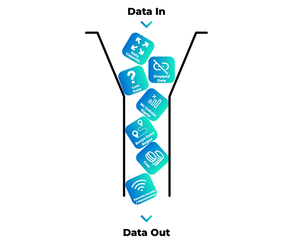
And maintaining offshore equipment is rarely straightforward. Ocean observatories report high failure rates among deployed instruments, cables and connectors. NOAA has also estimated that vandalism reduces buoy data availability by 15-20%, with damaged or severed moorings sometimes leaving buoys adrift. When equipment fails, repairs can depend on vessel availability and suitable weather windows. In 2022, two long standing Gulf of Mexico buoys went offline, requiring uncrewed surface vehicles to provide temporary observations until maintenance crews could reach them. Together, these challenges put pressure on buoy designers to deliver more data, maintain reliable communications and minimize the need for costly offshore intervention.
For buoy designers, how much data to collect, what to transmit, how often to report and how to stay operational as conditions deteriorate are all parts of the same set of decisions.
Satellite IoT Built For Early Warning Response
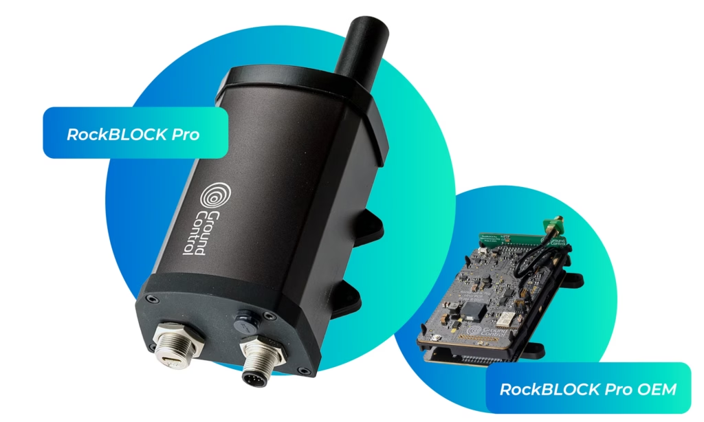
Iridium’s constellation of 66 Low Earth Orbit (LEO) satellites provides global coverage, from pole to pole, making it a proven choice for critical ocean monitoring. Its Iridium Messaging Transport (IMT) service, supported by the Iridium 9704 module, offers greater data capacity than Short Burst Data (SBD), while maintaining flexible two way communications. RockBLOCK Pro brings these capabilities together in a ready to integrate solution, helping buoy manufacturers and system integrators transmit critical ocean data reliably, wherever they’re deployed.
More Data, When it Matters Most
IMT supports messages from 25 to 100,000 bytes, around 300 times the maximum payload of the traditional SBD service. For buoy operators, this means transmitting richer datasets, from directional wave spectra to high frequency pressure readings, without extensive data reduction or fragmentation. Data scientists receive more complete inputs for forecasting and analysis, while integrators benefit from compatibility with SBD AT commands.
RockBLOCK Pro’s onboard processor manages message queuing, retries, and network optimization, reducing the workload on a host datalogger and helping maintain reliable delivery. Two way communications also give operators greater control over data usage. Buoys can transmit compact routine updates in normal conditions, increase reporting frequency to send more detailed measurements when thresholds are exceeded, returning to lower data volumes as conditions settle. This flexibility allows operators to balance data requirements with airtime costs and power consumption, without being locked into a fixed reporting strategy.
From Ocean to Application in Seconds
RockBLOCK Pro typically delivers device to cloud messages in under 10 seconds. Through Cloudloop Data, information can be routed to AWS, Microsoft Azure, Google Cloud, HTTP webhooks, MQTT or email, ready for integration with existing forecasting models, monitoring platforms and alerting systems. Four configurable I/O channels on the device also support direct connections to sensors and switches, extending monitoring and control capabilities.
Designed For Demanding Deployments
RockBLOCK Pro combines rugged construction with low power consumption for remote, solar and battery powered installations.
- IP66 rated aluminum enclosure, operating from -40°C to +65°C (-40°F to +149°F)
- 5-30 V DC input, with under 75 mW sleep and under 200 mW idle power consumption
- 2.5 W peak power draw
- Integrated four constellation GNSS for location monitoring and recovery if a buoy breaks its mooring
- Four configurable I/O for monitoring external sensors, hatch switches or tamper alerts
- Remote firmware and configuration updates through Cloudloop Device Manager, reducing the need for maintenance visits
With RS232/RS485, USB-C and Bluetooth connectivity, RockBLOCK Pro works with existing dataloggers and controllers. Choose a rugged, enclosed device with integrated or external antenna options, or the RockBLOCK Pro OEM board for integration directly into buoy electronics.
Better data. Better decisions.
Ocean observation systems need to deliver dependable data through years of exposure to demanding conditions, especially when an emerging event calls for more frequent, detailed reporting. The choices made during system design determine how much of that data reaches shore, how quickly it arrives and how reliably the buoy can continue reporting when conditions deteriorate.
RockBLOCK Pro brings together global satellite coverage, larger message capacity, intelligent data handling and flexible integration to help build more capable, responsive monitoring systems.
Building Your Next Ocean Observation Platform?
Talk to our team about your connectivity requirements, explore the RockBLOCK Pro technical documentation or order a device to start testing.
For your questions answered by our technical experts, complete the form, or email hello@groundcontrol.com and we’ll reply within one working day.