Airtime: IMT
Preventing Poaching in Gabon with RockREMOTE IMT
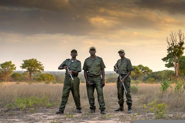
Illegal Poaching in Gabon
Africa is home to some of the world’s best-known and most iconic wildlife. However, the African Wildlife Foundation (AWF) reports that due to illegal poaching, as many as 35,000 elephants are killed each year, 43% of the lion population has been lost in the last 20 years and, staggeringly, since 1960, the population of the Black Rhino is down 97.6%.
With approximately 24 million hectares of forest, Gabon is home to a number of endangered African species, which makes for an attractive landscape to poachers. However, using the latest satellite technology, AI-powered camera traps can provide Gabon wildlife rangers with an advanced new tool in the fight against illegal poaching.

Preventing Poaching
Digital Forest aims to make wildlife and wild places accessible to everyone through immersive, interactive technology driven by real-time data streams. It’s via this real-time connection and technology that wildlife and rainforests, including Gabon, can be better maintained and protected.
Traditional monitoring systems use cameras to monitor poaching activity, but often, results are collected and analyzed months later, so rangers only know where the animals – and any poaching threats – were, not where they currently are. The lack of real-time location data means that intercepting to prevent illegal poaching is often too late.
Second Generation AI-Powered Camera Traps
The first generation of AI-powered camera traps utilized RockBLOCK 9602 to transmit sighting counts and meta data via the Iridium Short Burst Data (SBD) service which provides robust telemetry from anywhere on the planet. Digital Forest’s second generation device would build on this with the ability to also transmit images to accurately and reliably detect the presence of illegal poachers, and send real time alerts.
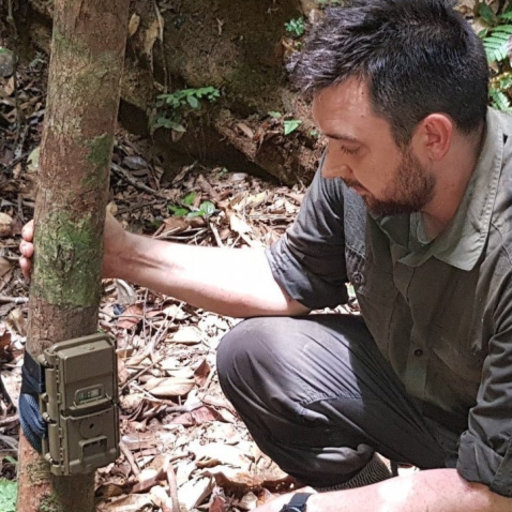
Harnessing the latest satellite technology, Digital Forest developed a smart AI-powered camera trap. The remotely deployed device continuously monitors for the presence of animal and human activity, even in forested areas. At any time of day or night, when activity is detected via the remote sensors, sophisticated image recognition technology not only detects but also classifies different animal species. These images are available immediately, 24/7, so rangers are informed of an animal’s location in real time.
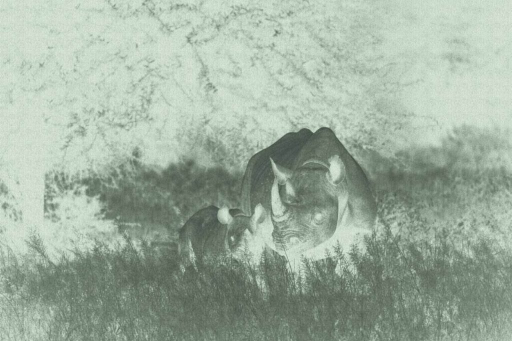
The bandwidth of Iridium’s Short Burst Data (SBD) service is limited to 320 bytes per message and it’s not feasible to send imagery from the camera traps via SBD. To effectively protect wildlife, the Gabon rangers require a cost-effective solution that can not only transfer animal and human sightings and meta-data, but also real-time imagery from remote rainforest locations.
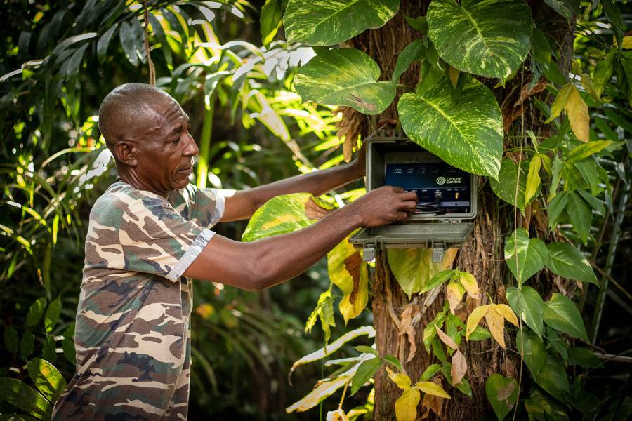
RockREMOTE is a highly capable Iridium Certus device with the ability to support both IP and message-based connectivity. The device provides a simple and easy to initiate, plug-and-play satellite connection from anywhere in the world.
The message-based connectivity is enabled by Iridium Messaging Transport (IMT) service which provides a more straightforward and cost-effective messaging capability but with a much larger message size of 100Kb – enough to include wildlife imagery.
How It Works
Leveraging Iridium Messaging Transport (IMT), RockREMOTE exposes integrators to an industry-standard MQTT interface. Ground Control’s development of a new Satellite IoT Gateway enables Digital Forest to quickly and easily integrate two-way messaging into their application using standard MQTT libraries for their platforms.
Behind the scenes, RockREMOTE takes care of all the connection management, message queuing and retrying to enable Digital Forest to simply plug-and-play, reducing integration work to just a few lines of code.
RockREMOTE automatically packages and compresses messages prior to transmission to minimise the amount of data sent. The device also selects the most appropriate compression algorithm based on the content being transmitted.
Messages are received and published to Cloudloop, enabling immediate and real-time transmission to Digital Forest’s cloud-based platform. This is effective in reverse, enabling messages to be sent to the remote field device. Digital Forest also benefits from the automatic upload of images to the AWS S3 for long-term storage.
The power of RockREMOTE with IMT enablement equips the rangers in Gabon with the latest in AI-powered camera trap technology to effectively monitor and prevent illegal poaching in the forest. With this advanced technology, endangered African species and iconic African wildlife have greater protection from poachers for this generation and the next.
What Digital Forest Says
“We’ve worked with Ground Control for many years and their products and supporting services have never failed to deliver. It’s very reassuring working with a company that designs, builds and supports every aspect of its products.
Developing our second-generation smart camera with RockREMOTE has been a breeze; we’re really excited about possible applications this technology will unlock. We’re already thinking about using RockREMOTE for transmitting audio, which will enable us to acoustically as well as visually monitor biodiversity in these truly unique locations.”
Robin Whytock, Director,
Digital Forest UK (SPV) Ltd.
Would you like to know more?
With over 20 years of satellite experience, the Ground Control team is well placed to help keep you connected when it matters the most.
Whatever your communication or connectivity needs, we can help. Talk to one of our team to discover our products and services and how they can benefit, improve and streamline your applications.
Smart Bird Boxes for Remote Wildlife Monitoring
Okala’s conservation scientists and software engineers use a combination of methodologies, including camera traps, bioacoustics, and remote sensing, to assess biodiversity and monitor environmental impact. They effectively leverage AI and machine learning for data analysis, offering expert-verified insights and a dashboard for visualizing and understanding nature data.
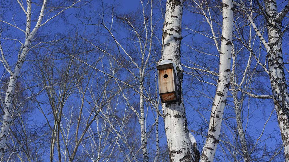
Known for delivering scalable, science-driven nature monitoring and compliance solutions, Okala partnered with Ground Control to create a new kind of remote sensing device – a smart birdbox equipped with a camera, digital scales and satellite connectivity that can be deployed in any environment, to track and monitor birdlife.

This marked the beginning of Project Pyedwagtail. The mission? Build a rugged, low-power system capable of collecting and transmitting wildlife data from anywhere in the world, even the most remote and inaccessible regions.
The challenge set by Robin, CEO of Okala, was deceptively simple: “We need a smart bird box with a camera that we can deploy anywhere.”
However, delivering on that vision required a blend of hardware innovation, software efficiency, and robust, reliable connectivity. The system needed to detect when a bird was present, or absent, inside the birdbox; capture images automatically, record temperature readings both inside and outside the box, and transmit all of the data to Okala’s conservation management platform. It had to be low power, compact and resilient, function entirely off-grid, and communicate via satellite from any location on Earth.
The Challenge Takes Flight
The Okala smart birdbox solution is built around four key stages: sensing, imaging, satellite transmission, and cloud integration. At the core of the sensing solution is a simple but effective digital scale mounted inside the birdbox, which communicates with a Raspberry Pi via the I²C interface. This setup enables the system to detect when a bird enters the box, monitors changes in weight over time, identifies how many birds are present, tracks egg-laying events, and even determines when chicks fledge. These weight changes also trigger automatic photo captures. While the Ground Control team could have implemented a more complex machine learning model, we opted for a simple, reliable mechanism for minimum power consumption and complexity.
To capture images, we utilized a Raspberry Pi Camera Module 3 and the libcamera library. Each triggers a photograph, saved as a JPEG file. However, since the size of JPEG files can vary dramatically based on image complexity, such as a blue sky versus the intricate details of a bird’s feathers, Ground Control developed a smart resize function. This function compresses images intelligently, optimizing file size for efficient satellite transmission without compromising essential visual detail. The next challenge is transmitting the data back to Okala.
See This Explained Live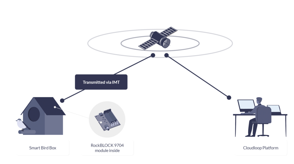
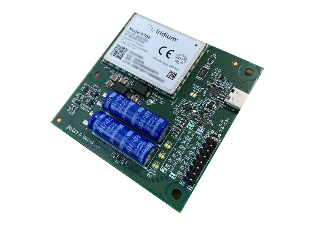
RockBLOCK 9704
For this project, reliable, global satellite connectivity is achieved via RockBLOCK 9704, a compact satellite modem that utilizes the Iridium global satellite network, and Iridium’s IMT (Iridium Messaging Transport) service. IMT enables the system to send and receive messages of up to 100Kb, with very low latency, from anywhere in the world.
RockBLOCK 9704 operates with very low power requirements, consuming less than 5 mW in sleep mode and peaking at 1.4 W during transmission. RockBLOCK’s Python and C libraries made integration incredibly simple, with only a few lines of code required to send data.
Of course, the satellite module is only one piece of the puzzle. Once the data is returned from the satellite, it needs to be routed securely and reliably to Okala’s system. This is where Ground Control’s Cloudloop Data platform plays a critical role.
Cloudloop Data
Rather than requiring custom code to decode device messages, Cloudloop Data takes care of the translation and seamlessly delivers the data to Okala, whether via MQTT, HTTPS, AWS, Azure, or other services. It’s built to ensure data reaches its destination in the correct format, no matter the protocol – SBD or IMT. By handling the complexity of proprietary device communication, Cloudloop accelerates integration and significantly reduces development time. Even if Okala’s servers are temporarily offline, Cloudloop securely stores all incoming data to guarantee nothing is lost. The platform also supports devices from other manufacturers, making it highly adaptable for diverse IoT applications.
And the cost of the project? The total system was surprisingly cost-effective. The RockBLOCK 9704 module costs $279 and operates on either prepaid plans starting from $0.29 per KB, or post-pay contract plans which are even lower cost. Given the power of the technology and the low cost of deployment, it represents an accessible, scalable solution for conservation projects of any size.
Beyond The Birdbox
By combining Okala’s expertise in AI-powered conservation platforms with Ground Control’s proven track record in global satellite IoT, Project Pyedwagtail has demonstrated what’s possible in smart, remote wildlife monitoring.
The result is a simple but robust system that can send photographs, environmental data, and near-real time alerts from any location on Earth, with nothing more than a Raspberry Pi, a few sensors, a RockBLOCK 9704 module, and some participating wildlife.
While the project started with the concept of a smart birdbox, the implications are further reaching. The combination of camera traps, intelligent sensing, and global satellite connectivity has applications across wildlife monitoring, ecological research, remote surveillance, and even anti-poaching operations.
This ability to gather visual and environmental data in near real time from remote locations opens new possibilities for field researchers, conservationists, and environmental organizations worldwide.
We’re Here to Help
If you need to transmit sensor data from remote environments, whether it’s wildlife activity, environmental metrics, or atmospheric readings, we’re here to help. At Ground Control, we specialize in connecting devices and assets in the most inaccessible locations, far beyond the reach of traditional cellular networks.
By leveraging multiple satellite networks and communication protocols, we deliver cost-effective, reliable solutions tailored to your needs. Get in touch with us at hello@groundcontrol.com or fill out the form. We’ll get back to you within one working day.
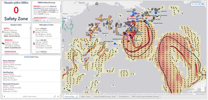
40Geo captures geographical information from hard-to-reach areas and analyses it to deliver situational awareness, competitive intelligence, and advanced visualization for supply chain optimization. One of the means 40Geo has of collecting data is utilizing drifting data buoys, which are deployed into areas being used for, or potentially used for, oil and gas exploration and extraction.
These data buoys capture wave height, temperature, wind speed, and over time, forecast patterns in ocean currents. They can even detect volume and frequency of other passing vessels by tapping into the radio signals sent out from boats. With 40Geo’s analysis, this becomes powerful data to aid decisions about when and where to situate off-shore oil and gas operations.

The Challenge
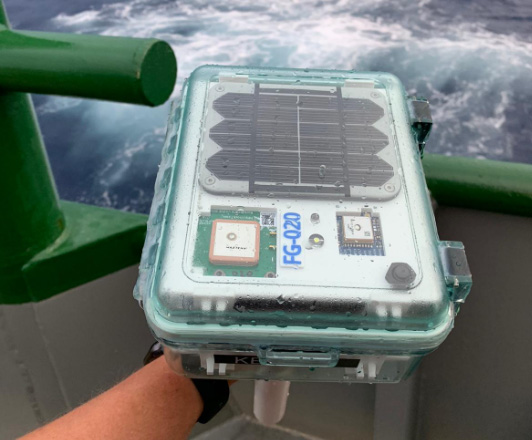
Many areas suitable for oil and gas extraction are also very remote, so backhauling that data from the data buoys to 40Geo’s servers requires a satellite connection. To date, 40Geo’s drifting data buoys have leveraged Ground Control’s RockBLOCK 9602 for this application, placing the transceiver into a waterproof box on top of the buoy.
This gives the team close to real time data under any circumstances, as the L-Band frequency that the RockBLOCK 9602 leverages is not affected by weather conditions. It’s also completely global coverage because it uses the Iridium satellite constellation; no matter where the buoy drifts to, 40Geo will be able to pinpoint its location.
The Evolution
In the Gulf of Mexico, an area rich in oil and gas reserves, there are two considerations that make 40Geo’s current data buoys less optimal. Firstly, there is cellular network coverage for a reasonable amount of the gulf, which, because it’s often lower cost compared to satellite transmission, will be the preferred means of sending and receiving data.
Secondly, there are powerful currents that can send the unpowered data buoys well away from the areas that are of most interest to 40Geo’s oil and gas customers.
The Solution
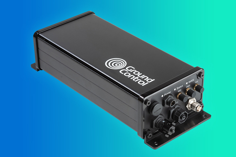
40Geo is in the final stages of launching a new USV (unmanned surface vessel) which has the ability to be remotely operated, meaning that if it should travel out of the area under inspection, the operator can put it back on course. In addition to this, the new autonomous vehicle will utilize RockREMOTE Rugged rather than the RockBLOCK 9602 for its data transmission.
This is because RockREMOTE Rugged is a hybrid LTE-M / Certus 100 / Iridium Messaging Transport (IMT)-capable device, allowing the 40Geo to use a single ‘box’ for all of their connectivity requirements. RockREMOTE Rugged can be configured to leverage the cellular network whenever available, and seamlessly switch to satellite when cellular data is unavailable, giving the 40Geo team the perfect balance of optimized costs and 100% connectivity.
“We chose the RockBLOCK because it delivered exactly what we needed: plug-and-play satellite connectivity that delivers close to real-time data. The developer documentation is thorough and the API interface works well. The RockREMOTE is an exciting evolution allowing us to provide more data while controlling costs; this is the sort of innovation that will propel satellite IoT applications forward.”
Miles Roden, COO, 40Geo
The USV will be able to undertake other tasks in addition to its main purpose of measuring wave height, wind speed etc. For example, a weather balloon can be launched from the platform to capture data from hurricanes. It simply wouldn’t be possible to launch this from an oil rig because of the fire risk from the sensing equipment and the helium (although the risk is small, helium is listed as hazardous by some operators), and the potential for the balloon to impact drilling equipment.
40Geo’s multitasking USVs can be used for many different applications, including air quality monitoring after oil spills, surveys of ocean currents for renewable infrastructure planning, video inspection of unmanned assets, marine mammal detection, and any other tasks that clients can envision.
Would you like to know more?
If you’re interested in 40Geo’s data buoys, or you have your own tracking software and want to explore integration options with Ground Control’s satellite tracking devices, we’d love to hear from you.
Call or email us, or complete the form, and one of our experienced team will be happy to help.
Keeping Flood Monitoring Data Flowing When It Matters Most
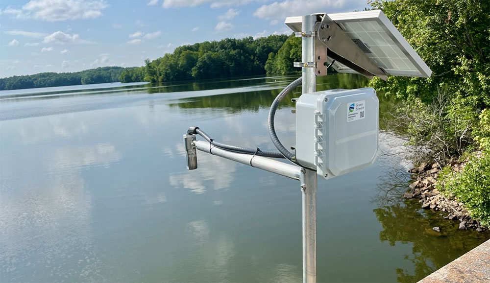
Green Stream Technologies provides real time flood monitoring systems that help communities, agencies, and infrastructure operators detect rising water, monitor rainfall and weather conditions, and respond quickly to flood risk. Its solution brings together rugged sensor kits, autonomous solar power, secure cloud services, dashboards, alerts, APIs, integrations, field services, training, and ongoing support.
The Challenge
For flood monitoring to be useful, data has to get through. A water level reading, rainfall measurement, or field image can support decisions during a fast moving event, but only if it reaches the right people in time.
Many of the locations that need monitoring are rural, coastal, or riverside sites where cellular coverage can be limited. Even where LTE is normally available, severe weather can disrupt terrestrial networks during the events these systems are designed to track. Green Stream needed a communications approach that could work across different environments, while balancing cost, reliability, latency, and operational risk.
The Solution
Green Stream uses a site-by-site telemetry strategy. Where LTE coverage is strong, cellular is often the most cost effective option. In remote areas with little or no cellular coverage, Iridium can act as the primary communications path. For mission critical sites, especially in flood-prone areas where storms may affect cellular networks, Green Stream can pair LTE with Iridium failover.
That flexibility helps Green Stream match the connectivity method to the site. It also reflects a deliberate choice. Flood monitoring depends on high resolution, real time data that customers can act on. Some emerging LEO satellite options can be lower cost, but may require waiting for a satellite pass. For flash flooding, a two- or three-hour reporting gap is not good enough. Iridium gives Green Stream global coverage and the ability to report every five minutes, with no missed reporting windows.
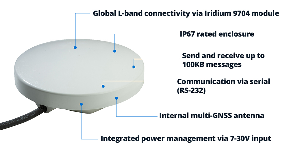
Using Ground Control’s RockBLOCK devices, Green Stream can add Iridium connectivity to monitoring stations beyond the reach of terrestrial networks, from rural riverbanks to coastal plains and other high impact locations.
The Service Evolution
Green Stream first used RockBLOCK 9603, based on Iridium Short Burst Data (SBD), to send compact reports from remote monitoring sites. For many applications, that was enough: small packets of data covering water levels, rainfall, device status, and network health.
As its deployments evolved, Green Stream began moving to RockBLOCK 9704 and RockBLOCK Plus 9704, which use Iridium Messaging Transport (IMT). The difference is significant. RockBLOCK 9603 messages are measured in hundreds of bytes; RockBLOCK 9704 supports messages up to 100KB.
That larger message size creates room for richer reporting. Water level data remains central to flood monitoring, but Green Stream can now look at adding more context, including images from the field. During a flood event, imagery can help emergency managers see what conditions look like on the ground, not just read what a sensor is reporting.
The Result
Satellite connectivity helps Green Stream reduce operational risk, especially in remote or high impact locations where site visits can be difficult, slow, or unsafe.
During severe weather, continuity of data becomes especially important. By using Iridium through Ground Control’s RockBLOCK devices, Green Stream can offer an added layer of resilience for sites where communications failure would have the greatest impact.
This matters as Green Stream expands into more rural and underserved areas. These communities may face serious flood risk, but lack dependable cellular coverage. Satellite connectivity helps make early warning systems practical in places that would otherwise be harder to monitor.
“We chose Ground Control because it provided a fast and straightforward path to integrating Iridium into our systems, which was important for getting a satellite solution to market quickly. The platform is intuitive and well documented, and our Account Manager, Elonda, has been knowledgeable and responsive, which has made the partnership easy to work with.”
Karen Lindquist, Green Stream
Looking Ahead
Green Stream is continuing to scale as more communities look for better ways to manage flood risk. Its approach – start with a pilot, then expand to a wider network – gives customers a practical path from initial deployment to broader flood intelligence systems.
As those networks grow, satellite connectivity will help Green Stream reach more sites, support more resilient deployments, and feed local data into regional or state-level systems for emergency management.
Let’s connect your next deployment
Green Stream’s flood monitoring network is one example of how satellite IoT can help critical data keep moving when cellular coverage is limited, unreliable, or at risk of disruption.
If you’re developing an IoT solution for remote, mobile, or mission critical environments, Ground Control can help you assess your options and build a connectivity approach that fits your application, budget, and growth plans.
Complete the form or email hello@groundcontrol.com and we’ll reply within one working day.
Ambrey is a global leader in maritime security, intelligence and risk management, supporting more than 24,000 vessels operating across over 34 of the world’s most complex and high risk maritime regions.
As GNSS jamming and spoofing become an increasingly common feature of commercial shipping, maintaining confidence in vessel position has become an important part of safe and efficient operations. Trusted situational awareness supports navigation, operational decision-making, regulatory compliance and the protection of crews and assets.
To enhance the services available to customers operating in these challenging environments, Ambrey has partnered with Ground Control to incorporate RockFLEET Assured into its wider maritime security offering.
The Challenge
Across key shipping routes including the Baltic, Black Sea, Red Sea and Strait of Hormuz, deliberate GNSS interference is becoming an increasingly common operational challenge.
When GNSS signals are disrupted or manipulated, the effects can extend well beyond navigation. Bridge teams may receive conflicting information from connected systems, making it more difficult to assess vessel position and maintain confidence in the information available to them. This can increase operational workload and complicate decision-making in already demanding environments.
Ambrey was hearing these concerns from customers operating in higher risk regions and recognized the value of an independent positioning reference that could help validate vessel position whenever GNSS integrity is uncertain.
“Our customers consistently highlight the challenges of operating in GPS-denied environments as a major safety concern. We are delighted to be working with Ground Control as a world leader in this space, bringing assured tracking and navigation to our clients.”
Ben Westcott, Director of Digital Services at Ambrey
The Solution
RockFLEET Assured is Ground Control’s maritime Assured Positioning, Navigation and Timing (A-PNT) solution, developed to help vessel operators maintain confidence in position data when conventional GNSS is affected by jamming or spoofing.
Built around Iridium’s secure, independent PNT service, RockFLEET Assured provides an assured positioning reference alongside existing navigation systems. By continuously comparing GNSS-derived position with Iridium PNT, bridge teams and shore operators can identify discrepancies, recognize potential interference and make more informed operational decisions.
Ambrey has chosen to incorporate RockFLEET Assured into its maritime security, intelligence and risk management services, combining assured positioning with the operational support provided by its 24/7 Global Operations Centre.
How It Works
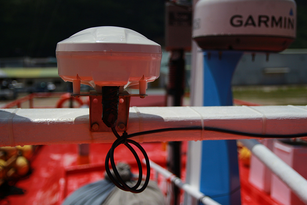
RockFLEET Assured continuously compares conventional GNSS with Iridium PNT, providing bridge teams and shore operators with an independent reference for validating vessel position. This allows discrepancies to be identified quickly, supports the detection of potential jamming or spoofing events, and helps crews maintain operational confidence in GNSS-compromised environments.
Positioning events can also be recorded and shared ashore, supporting incident investigation, operational reporting and discussions with insurers where appropriate.
Designed specifically for commercial maritime deployment, RockFLEET Assured is supplied as a compact above-deck terminal with flexible mounting options suitable for a wide range of vessel classes and superstructure configurations. Its rugged IP66-rated enclosure is engineered for harsh marine environments, while the standard installation requires no below-deck equipment, helping minimize installation time and operational disruption.
Combined with Ambrey’s Global Operations Centre, customers benefit from assured positioning alongside the intelligence and operational expertise needed to interpret navigation anomalies within the wider context of maritime risk.
“GNSS disruption is no longer a niche concern. It’s becoming an operational reality for commercial fleets operating in many parts of the world. We’re excited to be working with Ambrey to make RockFLEET Assured available as part of its wider maritime services, combining their operational expertise with our assured positioning capability. Together we’re helping ship and shore teams validate vessel position, identify anomalies and maintain confidence when GNSS integrity is in doubt.”
Alastair MacLeod, CEO of Ground Control
The Outcome
By bringing together Ground Control’s assured positioning technology and Ambrey’s maritime operational expertise, commercial operators gain greater resilience when operating in regions affected by GNSS disruption.
RockFLEET Assured provides an independent positioning reference alongside conventional GNSS, enabling operators to validate vessel position, recognize anomalies more quickly and maintain confidence in the information available to bridge and shore teams.
The result is improved situational awareness, better-informed operational decision-making and greater resilience for vessels operating in increasingly contested navigation environments.
Strengthen Your Navigation Resilience
Learn how RockFLEET Assured can help your organization maintain confidence in vessel position when GNSS signals are disrupted.
Complete the form or email hello@groundcontrol.com to speak with one of our specialists or arrange a demonstration.