Industry: Conservation
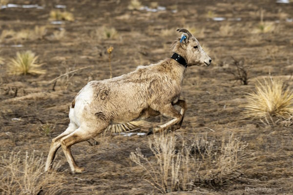
Vectronic design and build customized GPS tracking collars and connected devices for wildlife monitoring and nature conservation research projects around the world. They design the collars to impact the animal as little as possible, combining the need for longevity with lightweight, minimal construction.
To closely monitor wildlife in extremely remote locations, in difficult terrains and over large ranges with limited mobile connectivity options, Vectronic have partnered with Ground Control to implement satellite communication capabilities into their tracking collars.
By utilizing Ground Control’s IoT platform, Cloudloop, coupled with Iridium 9603 modems, Vectronic can offer their customers rich location tracking data with minimal draw on the battery life of the GPS collars.
Blue Ocean Gear’s mission is to bridge the gap between commercial ocean fishers and marine conservationists. Their satellite-connected Smart Buoy enables commercial ocean fishermen to efficiently track the location of their equipment and reduce the number of damaged nets and lines lost to the open ocean where they pose a threat to marine animals.
Blue Ocean Gear partnered with Ground Control to install Iridium 9603 modems to their Smart Buoys to transmit telemetry and location data via satellite, which is then integrated into the Blue Ocean Gear app and Timezero, a software commonly used by commercial fishing vessels.
This enables fishers to know when they have a catch ready for collection, to locate their catches quickly and reduce the amount of fuel required to reach them. They can also track valuable lost equipment, which in turn prevents the risk of entanglement to ocean animals from damaged fishing equipment floating free.
Akrocean delivers ocean data as a service through their fleet of self-powered data buoys. The buoys are modular, and equipped to capture all types of metocean and environmental data. Designed to be self-sufficient, the deployed buoys can operate for multiple years without needing any human intervention.
Windsea is a floating LiDAR service for wind resource assessment and metocean measurements. Fly’rsea is a floating RADAR solution for bird detection and environmental assessment. Seaobs is the combination of the two, and can host a large range of sensors able to monitor any parameter at your project site.
Akrocean utilize the RockREMOTE to backhaul their data; RockREMOTE is designed for larger volumes of IoT data, and leverages the truly global Iridium Certus 100 airtime service, ensuring that Akrocean’s customers get their data reliably, and close to real-time.
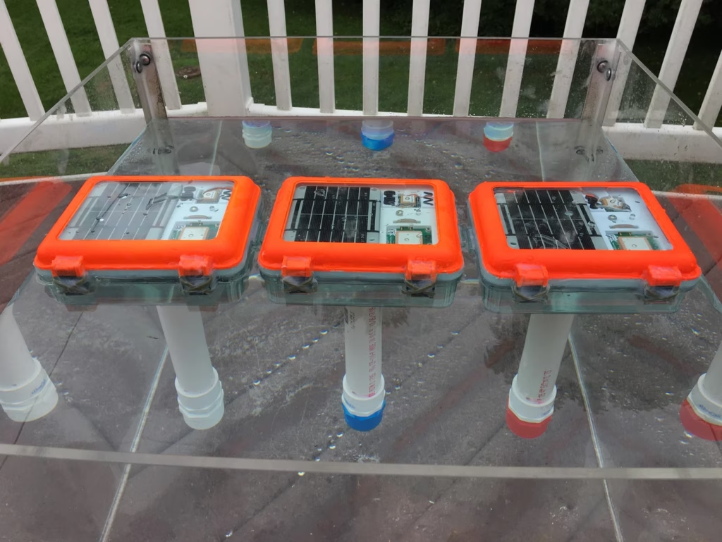
Maker Buoy is an Arduino-based drifting buoy equipped with GPS and a RockBLOCK 9603 Iridium transceiver. Fully solar powered, the buoys can be built to your specification, or you can purchase the ‘Build-a-Drifter’ kit, and assemble your own. This is ideal for educational purposes and scientists / oceanographers wishing to customize the the sensor array themselves.
As standard, the buoys feature temperature and light sensors and an accelerometer in addition to GPS; they’re most frequently used for ocean current monitoring. They’ve been used for diverse applications including helping The Ocean Cleanup foundation monitor the effectiveness of their system by simulating the movement of ocean plastics.
Sofar Ocean developed a data buoy – the ‘Spotter’ – and have deployed hundreds of these marine sensing platforms, creating the largest privately owned network of ocean sensors. Maritime shipping customers subscribe to Sofar’s extremely accurate marine weather forecasts, facilitated by the Spotter network, to help them optimize voyages to save fuel, time and emissions.
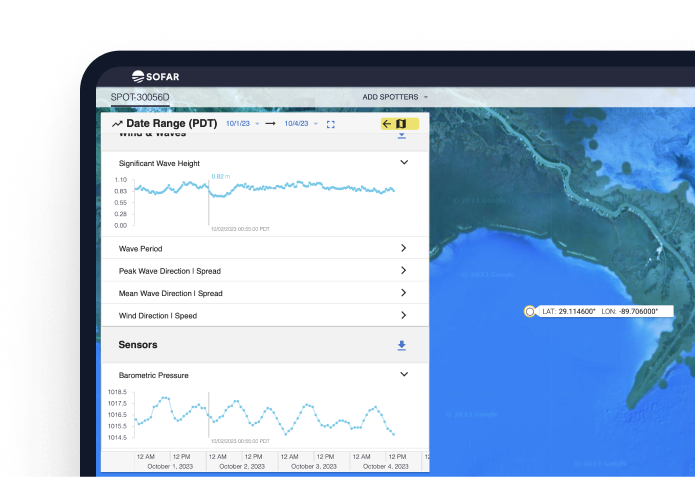
Customers can also purchase Spotter buoys themselves to capture ocean data in places not covered by Sofar’s network, and combine their data with the Spotter network to power marine research and solutions. The data captured and transmitted includes wave spectra, wind, surface and subsurface temperature, atmospheric pressure, water levels and currents, with further options available on demand.
The Spotter buoys use a combination of cellular and satellite connectivity, depending on their location, and Sofar Ocean utilizes Ground Control’s Cloudloop platform to manage their satellite airtime.
ATS delivers wildlife radio telemetry, with tracking options for birds, mammals, fish, reptiles and insects. They were founded over 35 years ago by a group of biologists and engineers, all of whom had worked on the first successful automated animal tracking system, so they have a rich pedigree in supplying telemetry to researchers and environmentalists.
For birds, mammals and reptiles moving beyond cellular coverage, ATS uses the Iridium satellite network to maintain global tracking. Compact Iridium transceivers such as the 9603N, and now the new 9604, help reduce the size and weight of tracking collars and tags without compromising coverage.

CATS – Customized Animal Tracking Solutions – supplies three key products to support conservationists, scientists, filmmakers and engineers monitor primarily marine animals. CATS Diary is their multi-sensor solution – a ‘fitbit’ for animals in effect. The CATS Cam is a high-resolution, multi-sensor recorder, controlled by a CATS Diary, and available as a 2K or 4K version. CATS Iridium is used either as a solar powered long-term tracking device with GPS, or as a recovery beacon to relocate CATS Diaries or Cams after they release from the animals.
CATS Iridium utilizes the Iridium 9603N modem to deliver global, real-time, reliable coverage. Users can remotely reprogram settings if needed; a valuable feature as these animals are often very far away from human settlements. Sensor data captured and transmitted via the Iridium satellite constellation include dive and activity data, and GPS locations.
CATS designs and builds its own hardware in-house, and has extensive customization options. Founded by avid animal conservationists, they have been a trusted animal tracking equipment provider since 2012.
Scaling Ocean Data Collection Through Satellite-Enabled Buoy Technology
The ocean covers over 70% of the Earth’s surface, yet remains one of the least observed and understood environments due to the logistical and technological challenges involved in data collection.
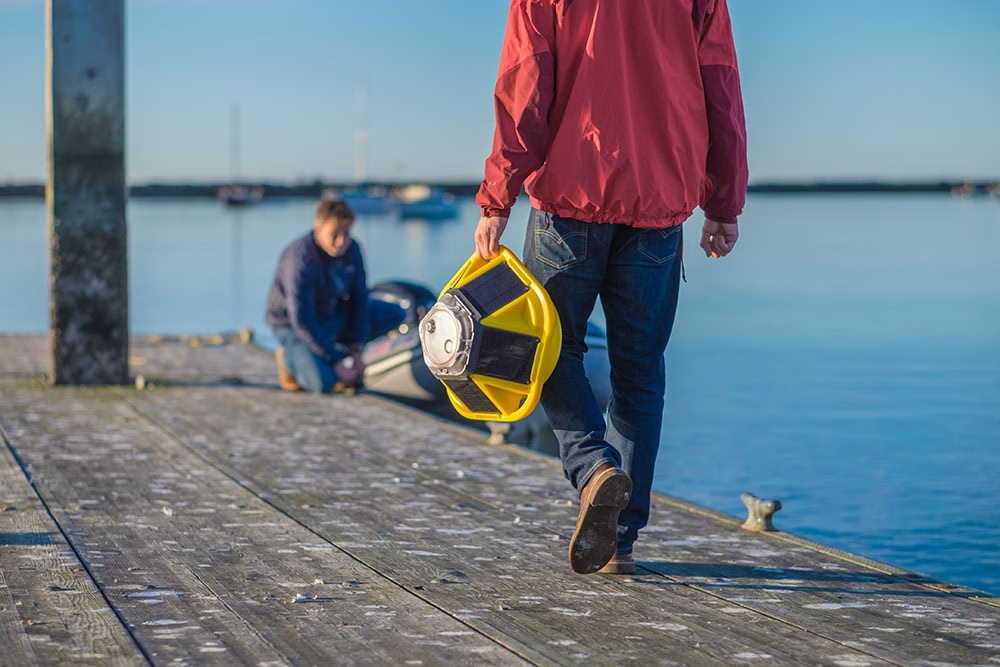
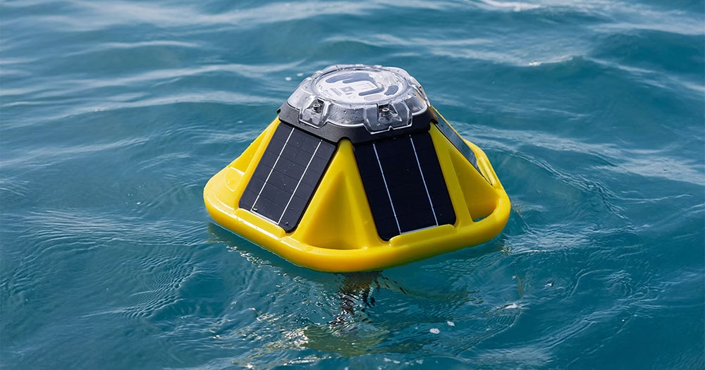
Sofar Ocean is on a mission to close this global ocean data gap. The maritime tech company builds compact, cost-effective, and extremely durable metocean buoys called Spotters, which marine professionals deploy to collect ocean data at scale. Spotter buoys measure waves, wind, sea surface temperature, barometric pressure, and other variables — providing real-time insights that power advancements in research, coastal resilience, climate science, and other critical fields.
Sofar also operates its own global network of free-drifting Spotters, which collects ocean data at a planetary scale. This unprecedented dataset powers Sofar’s proprietary marine weather forecasts, which are up to 50% more accurate than traditional forecasts.

The Challenge
Dan Breyre, Product Lead at Sofar, and his team needed a satellite communications solution that could deliver real-time data from Spotters located in remote ocean locations far beyond the reach of traditional networks.
The solution needed to provide consistent, reliable transmission and give Sofar’s customers up-to-the-minute data access from even the most isolated ocean regions.
The Solution
Sofar selected the RockBLOCK 9602 satellite modem from Ground Control, which offers reliability, ease of use, and adaptability. RockBLOCK 9602 is compact and rugged, ideal for Sofar’s distributed sensor arrays that must endure the ocean’s harsh conditions.
The modem supports consistent, two-way communication via the reliable and globally-available Iridium satellite constellation, which enables Sofar and its customers to access critical data and send firmware commands back to Spotters when needed. This functionality has proven indispensable for sustaining Sofar’s distributed sensing technology and advancing its mission to democratize ocean data access.
“Ground Control provides reliability, consistency, and ease of use, all of which are vital for our disruptive distributed sensing technology.”
Dan Breyre, Product Lead, Sofar Ocean
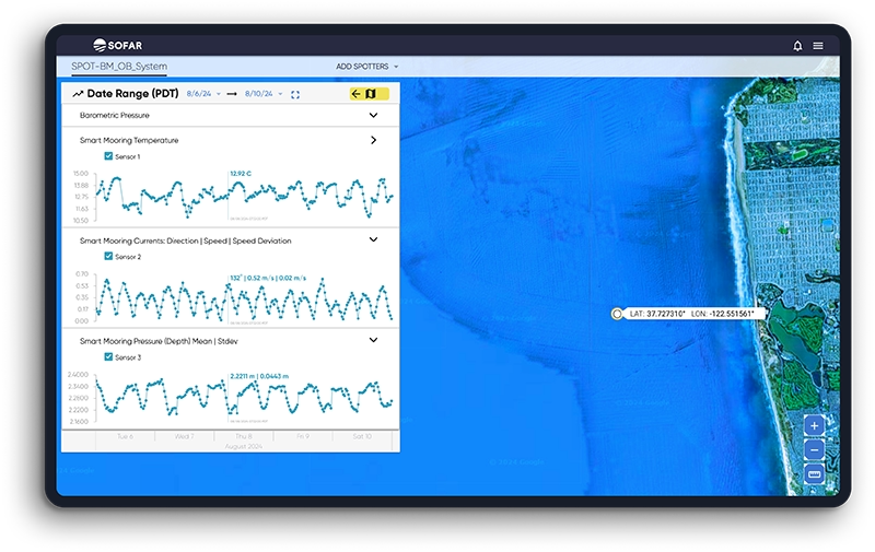
Utilizing RockBLOCK 9602, Sofar has been able to achieve extensive spatial coverage with its Spotters across vast oceanic regions, transmitting valuable insights that inform better decision-making by marine professionals.
The immediate and accurate data that Spotters deliver improves operational efficiency for ocean industry and empowers researchers, governments, and coastal communities to better understand and respond to changing marine and climate conditions.
Sofar continues to push the boundaries of ocean data collection. Its vision includes expanding the types of data Spotter collects, further reducing the size and latency constraints of the platform, and enhancing the spatial coverage of the Spotter network. Sofar strives to continuously expand access to actionable data that helps its customers address the most pressing ocean challenges.
Can we help you with remote data collection?
Ground Control has over 20 years’ experience in delivering reliable satellite IoT and tracking solutions.
If you have an asset or sensor(s) in a remote location, we can help you extract your data cost-effectively and in close to real-time.
Email hello@groundcontrol.com for more information, or complete the form, and we’ll be in touch within one working day.