Industry: Oil & Gas
InSpatial provides operators an efficient and cost-effective way to remotely monitor oil well and pump systems. Operators can reduce man hours, travel, lower the risk of a spill, and know right away when a well goes down.
From the Middle East, South America and throughout North America, InSpatial is designing and implementing the most advanced satellite/wireless oil well and pump monitoring systems, covering thousands of well sites around the world.
For locations out of cellular network range, InSpatial’s satellite based solution utilizes the Iridium 9602N modem, and the cost-effective Iridium SBD service, to ensure customers have full access to well conditions and production information across the globe.
InSpatial’s products have been adopted by some of the world’s largest oil and gas producers, OEMs, service providers and National Oil Companies (NOCs) to accurately monitor multi-site well and pump operations globally.
Comtel provides pipeline monitoring solutions to the oil and gas industry by manufacturing high quality, reliable and robust pipeline inspection gauges (pig), above ground markers and remote tracking equipment.
With the majority of pipelines sited in remote locations and out of cellular range, Comtel incorporated the RockBLOCK 9603 device into their unmanned and automated Above Ground Marker (AGM) Sentinel product to facilitate data transmission via satellite.
The AGM Sentinel is designed to be left unattended for several weeks and the low power consumption of the RockBLOCK 9603 ensures the device can keep automatically detecting the passage of overhead pigs for extended periods.
Locate is as an advanced and intuitive emergency incident management platform, developed in 2016 to address a spectrum of critical needs and help organizations across the globe keep their people safe. Their platform excels in swiftly identifying critical events, locating users, facilitating global mass communication, and orchestrating a prompt response.
One of Locate Global’s pivotal strengths lies in its global communication capabilities. By combining their incident management platform with Ground Control’s advanced satellite hardware, they can deliver a powerful, integrated solution, connecting stakeholders worldwide, bridging geographical gaps, and fostering a collaborative environment crucial for effective crisis management.
- Seamless Connectivity: Ground Control’s satellite technology ensures reliable communication and data transmission, even in the most remote locations
- Real-time Incident Management: Locate Global’s platform provides real-time tracking, reporting, and resolution of incidents, enhancing safety and operational efficiency
- Enhanced Coverage: Clients benefit from expanded geographical coverage, enabling them to operate confidently across the globe.
This global reach ensures that information flows seamlessly, empowering decision-makers with real-time data for an informed and strategic response. In times where every second count, Locate Global’a platform instils confidence – delivering a dependable framework that organizations can rely on during their most challenging times.
Anova provides global remote monitoring solutions for industrial assets: among them, gases, chemicals, fuels and water. Their monitoring devices capture data from remote tanks, wherever they travel: on land and at sea. With an Anova solution, you gain the ability to monitor multiple parameters, including level, pressure, location and vibration. You can set up custom alerts for parameters such as pressure build-up or route deviation.
Among the many benefits are loss prevention and audit protection; real-time data lets you respond rapidly to minimise any impact from unanticipated events such as equipment failure, and Anova systems create a paper trail.
Ground Control’s satellite IoT connectivity services are deployed when the asset moves out of cellular coverage. We help maintain continuous data transfer on a global basis, passing detailed location and asset status data to Anova’s customers.
Aggreko designs, builds and supplies generators, Battery Energy Storage Systems, dehumidifiers, and temperature control systems. These temporary turnkey solutions help customers transitioning between energy sources, and industries where there are seasonal requirements, such as maintaining environmental conditions to preserve fruit and vegetables.
They also supply long term equipment for Mining and Oil & Gas operations, for example; working as an engineering partner to enable greater efficiencies and lower fuel costs.
Aggreko’s equipment is usually rented, and is a valuable asset to both Aggreko and their customers. They utilize an Iridium satellite transceiver, supplied by Ground Control, to monitor their generators, which transmits the location of the assets in real-time, from anywhere on the globe. This helps to prevent theft. The same transceiver can transmit machine telemetry and fuel levels, helping with predictive maintenance.
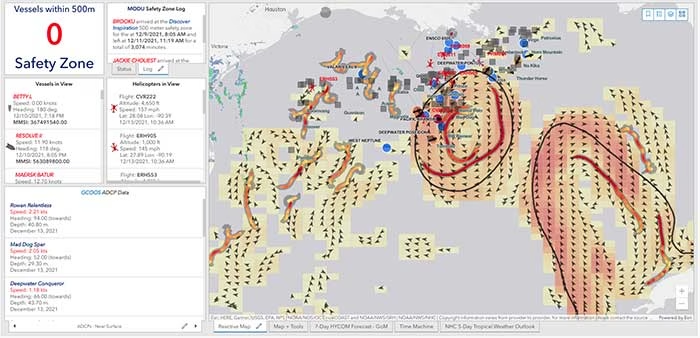
40Geo captures geographical information from hard-to-reach areas and analyses it to deliver situational awareness, competitive intelligence, and advanced visualization for supply chain optimization. One of the means 40Geo has of collecting data is utilizing drifting data buoys, which are deployed into areas being used for, or potentially used for, oil and gas exploration and extraction.
These data buoys capture wave height, temperature, wind speed, and over time, forecast patterns in ocean currents. They can even detect volume and frequency of other passing vessels by tapping into the radio signals sent out from boats. With 40Geo’s analysis, this becomes powerful data to aid decisions about when and where to situate off-shore oil and gas operations.

The Challenge
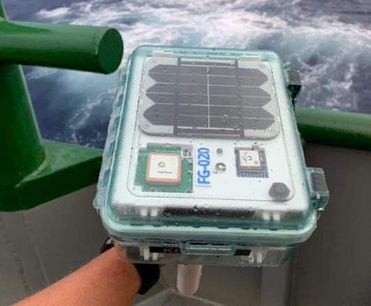
Many areas suitable for oil and gas extraction are also very remote, so backhauling that data from the data buoys to 40Geo’s servers requires a satellite connection. To date, 40Geo’s drifting data buoys have leveraged Ground Control’s RockBLOCK 9602 for this application, placing the transceiver into a waterproof box on top of the buoy.
This gives the team close to real time data under any circumstances, as the L-Band frequency that the RockBLOCK 9602 leverages is not affected by weather conditions. It’s also completely global coverage because it uses the Iridium satellite constellation; no matter where the buoy drifts to, 40Geo will be able to pinpoint its location.
The Evolution
In the Gulf of Mexico, an area rich in oil and gas reserves, there are two considerations that make 40Geo’s current data buoys less optimal. Firstly, there is cellular network coverage for a reasonable amount of the gulf, which, because it’s often lower cost compared to satellite transmission, will be the preferred means of sending and receiving data.
Secondly, there are powerful currents that can send the unpowered data buoys well away from the areas that are of most interest to 40Geo’s oil and gas customers.
The Solution
40Geo is in the final stages of launching a new USV (unmanned surface vessel) which has the ability to be remotely operated, meaning that if it should travel out of the area under inspection, the operator can put it back on course. In addition to this, the new autonomous vehicle will utilize RockREMOTE Rugged rather than the RockBLOCK 9602 for its data transmission.
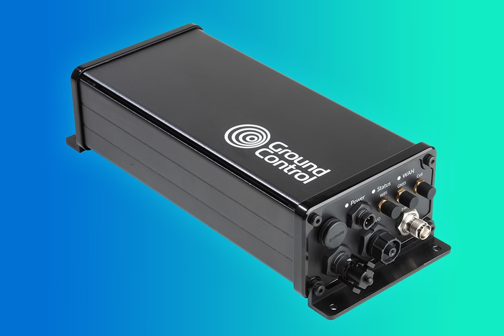
This is because RockREMOTE Rugged is a hybrid LTE-M / Certus 100 / Iridium Messaging Transport (IMT)-capable device, allowing the 40Geo to use a single ‘box’ for all of their connectivity requirements. RockREMOTE Rugged can be configured to leverage the cellular network whenever available, and seamlessly switch to satellite when cellular data is unavailable, giving the 40Geo team the perfect balance of optimized costs and 100% connectivity.
“We chose the RockBLOCK because it delivered exactly what we needed: plug-and-play satellite connectivity that delivers close to real-time data. The developer documentation is thorough and the API interface works well. The RockREMOTE is an exciting evolution allowing us to provide more data while controlling costs; this is the sort of innovation that will propel satellite IoT applications forward.”
Miles Roden, COO, 40Geo
The USV will be able to undertake other tasks in addition to its main purpose of measuring wave height, wind speed etc. For example, a weather balloon can be launched from the platform to capture data from hurricanes. It simply wouldn’t be possible to launch this from an oil rig because of the fire risk from the sensing equipment and the helium (although the risk is small, helium is listed as hazardous by some operators), and the potential for the balloon to impact drilling equipment.
40Geo’s multitasking USVs can be used for many different applications, including air quality monitoring after oil spills, surveys of ocean currents for renewable infrastructure planning, video inspection of unmanned assets, marine mammal detection, and any other tasks that clients can envision.
Would you like to know more?
If you’re interested in 40Geo’s data buoys, or you have your own tracking software and want to explore integration options with Ground Control’s satellite tracking devices, we’d love to hear from you.
Call or email us, or complete the form, and one of our experienced team will be happy to help.
Reliable Streaming, No Matter the Bandwidth
Videosoft delivers bandwidth-managed video streaming that performs even in the most unpredictable network conditions. While traditional systems struggle in low-bandwidth or variable throughput, Videosoft’s technology enables practical, real time video over connections as low as 1 Kbps, easily compatible with the 22 Kbps uplink available on the Certus® 100 network service from Iridium.
Ideal for remote monitoring and surveillance, Videosoft makes live video not just possible, but dependable – wherever it’s needed.
We’ve partnered with Videosoft to bring their unique video encoding and streaming solution to our RockREMOTE Rugged terminal. Available as a native application on the device, the integration allows customers to deploy robust live video surveillance using the Iridium Certus® 100 service, without the need for external encoders or bulky infrastructure.
From unmanned facilities in the energy sector to border security, remote utilities, and environmental monitoring, Videosoft’s ultra efficient compression technology means you can see what’s happening on site in real time, regardless of where that site happens to be. Combined with the global coverage and reliability of satellite, this capability enables faster incident response, improved operational oversight, and smarter decision making at the edge.
Kraken Project and the RockBLOCK
‘Kraken’ is a project by Sutton Grammar School, and this case study is written by them. The main concept behind the buoy is its primary use as an oil response system. The system is based around an oil response unit that aims to make it easier for oil companies to clean up spills quickly and effectively.
It consists of a series of buoys that cooperate to give an image of the spread of oil by using sophisticated GPS and radio technology. Using this, companies can get a picture of where oil has and will spread and then clean up spills as fast as possible.
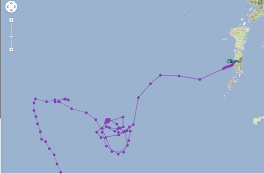
RockBLOCK 9602 is used to transmit the GPS position and other collected data back to a central management system to allow monitoring of the situation in near real-time.
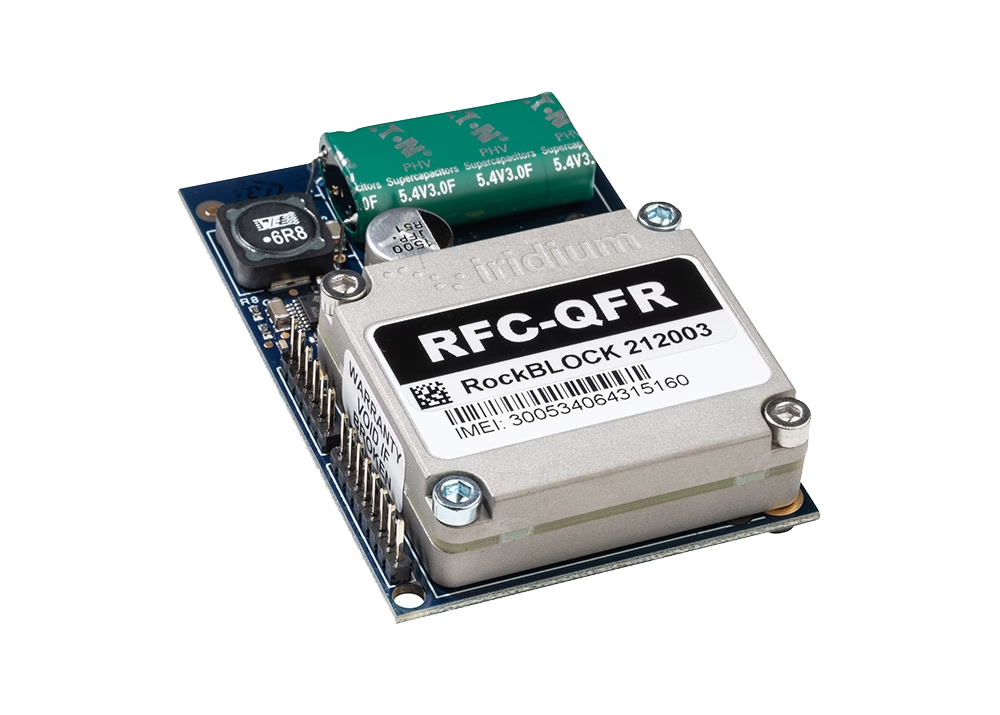
Components of the Kraken Buoy:
- Arduino Atmega328 controller
- uBlock Max 6Q
- Inertial and Temp Sensors
- RockBLOCK 9602 naked unit.
GPS – U-blox Max 6Q
These determine the location of each buoy as a latitude and longitude, and provide accurate synchronised timekeeping (GPS time) for all buoys. GPS modules communicate with the Arduino via the UBX binary protocol over a serial RS232 interface and use Sarantel SL1202 (now discontinued) antennae. The modules have been optimized for 2-D ocean use in power-saving mode (positional fix every five minutes). The team used these receivers partly because they’re very small (so will fit into the ‘nymphs’) can be put into low power mode to extend the battery life of the buoys while at sea.
Hope Microelectronics RFM22B Transceiver
[Short Range Radios]
These are low-power boards used for short range communications (sending GPS data) between buoys in the Poseidon network. The team used this open source Arduino library for easy communication between the Arduino and radio modules. Packets of data are automatically encoded and decoded, further simplifying the Arduino programming.
Arduino Atmega328
This microprocessor chip is used by the Arduino Uno board (but is in surface mount form on our buoys). They are programmed in C with the Arduino IDE version 1.0.1 and coordinate the behaviour of each buoy, decoding and relaying data from various components, e.g. the GPS receivers or the IMU out to the RockBLOCK radio.
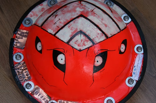
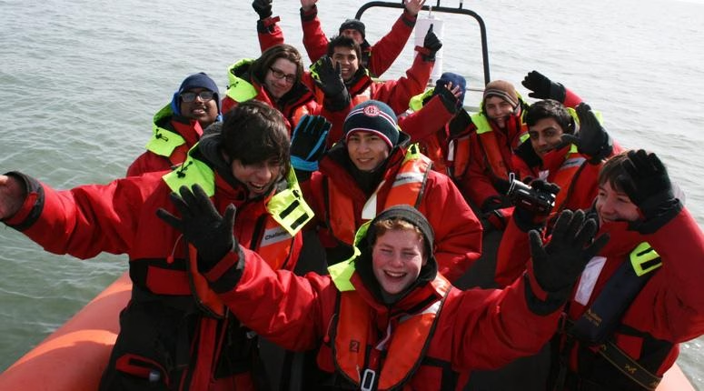
Buoy Network Concept
The students aimed to fully utilize the benefits of an entire network of buoys by allowing the ‘nymphs’ to relay each other’s transmissions to the ‘Kraken’, in case some drift out of range of the RFM22B radios. Each nymph broadcasts the GPS data it has stored in its memory to all other buoys, which receive and store this data in their own memories. This means that each time a buoy transmits its memory contents, it is transmitting GPS data on behalf of all the other buoys (not just its own location).
So if a buoy moves out of range of the ‘Kraken’, its data will still reach the Kraken providing that other nymphs are still in range to act as relays. The Kraken collects all these data transmissions to send back to the team via the Iridium constellation, enabling them to track the location of each buoy in the network whilst using only one RockBLOCK radio.
Kraken Buoy Features
- Iridium Satellite Constellation: The team use this satellite network to relay data from the buoys (wherever they are in the world) back to project HQ. The RockBLOCK radio sends data to a passing satellite. The satellite relays this data to a ground station that then emails it to the team. This includes GPS readings to update their live map.
- Inertial Measurement Unit (IMU): The IMU is sampled at 10Hz and data is transmitted back to the team to analyse.
- Additional Sensors: The buoy also contains an onboard battery voltage monitor, so they know how much longer the batteries will last. Internal temperature sensor (located near the edge of the buoy to be as close as possible to the outside water temperature). Connected to the Arduino via a one wire interface.
Supporting Educators
The work we support genuinely inspires us, and we’re proud to support educators bringing learning to life.
If you’d like to get in touch with the team either to discuss an opportunity or project similar to that of the one above, or something completely different our team of experts will be happy to provide objective advice.