Industry: Unmanned / Drones
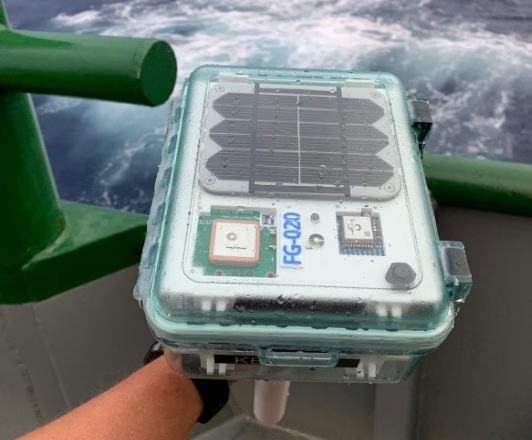
40Geo captures geographical information from hard-to-reach areas and analyses it to deliver situational awareness, competitive intelligence, and advanced visualization for supply chain optimization. One of the means 40Geo has of collecting data is utilizing drifting data buoys, which are deployed into areas being used for, or potentially used for, oil and gas exploration and extraction.
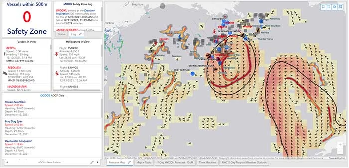
These data buoys capture wave height, temperature, wind speed, and over time, forecast patterns in ocean currents. They can even detect volume and frequency of other passing vessels by tapping into the radio signals sent out from boats. With 40Geo’s analysis, this becomes powerful data to aid decisions about when and where to situate off-shore oil and gas operations.

The Challenge
Many areas suitable for oil and gas extraction are also very remote, so backhauling that data from the data buoys to 40Geo’s servers requires a satellite connection. To date, 40Geo’s drifting data buoys have leveraged Ground Control’s RockBLOCK 9602 for this application, placing the transceiver into a waterproof box on top of the buoy.
This gives the team close to real time data under any circumstances, as the L-Band frequency that the RockBLOCK 9602 leverages is not affected by weather conditions. It’s also completely global coverage because it uses the Iridium satellite constellation; no matter where the buoy drifts to, 40Geo will be able to pinpoint its location.
The Evolution
In the Gulf of Mexico, an area rich in oil and gas reserves, there are two considerations that make 40Geo’s current data buoys less optimal. Firstly, there is cellular network coverage for a reasonable amount of the gulf, which, because it’s often lower cost compared to satellite transmission, will be the preferred means of sending and receiving data.
Secondly, there are powerful currents that can send the unpowered data buoys well away from the areas that are of most interest to 40Geo’s oil and gas customers.
The Solution
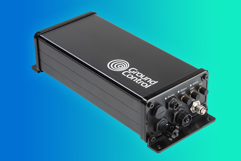
40Geo is in the final stages of launching a new USV (unmanned surface vessel) which has the ability to be remotely operated, meaning that if it should travel out of the area under inspection, the operator can put it back on course. In addition to this, the new autonomous vehicle will utilize RockREMOTE Rugged rather than the RockBLOCK 9602 for its data transmission.
This is because RockREMOTE Rugged is a hybrid LTE-M / Certus 100 / Iridium Messaging Transport (IMT)-capable device, allowing the 40Geo to use a single ‘box’ for all of their connectivity requirements. RockREMOTE Rugged can be configured to leverage the cellular network whenever available, and seamlessly switch to satellite when cellular data is unavailable, giving the 40Geo team the perfect balance of optimized costs and 100% connectivity.
“We chose the RockBLOCK because it delivered exactly what we needed: plug-and-play satellite connectivity that delivers close to real-time data. The developer documentation is thorough and the API interface works well. The RockREMOTE is an exciting evolution allowing us to provide more data while controlling costs; this is the sort of innovation that will propel satellite IoT applications forward.”
Miles Roden, COO, 40Geo
The USV will be able to undertake other tasks in addition to its main purpose of measuring wave height, wind speed etc. For example, a weather balloon can be launched from the platform to capture data from hurricanes. It simply wouldn’t be possible to launch this from an oil rig because of the fire risk from the sensing equipment and the helium (although the risk is small, helium is listed as hazardous by some operators), and the potential for the balloon to impact drilling equipment.
40Geo’s multitasking USVs can be used for many different applications, including air quality monitoring after oil spills, surveys of ocean currents for renewable infrastructure planning, video inspection of unmanned assets, marine mammal detection, and any other tasks that clients can envision.
Would you like to know more?
If you’re interested in 40Geo’s data buoys, or you have your own tracking software and want to explore integration options with Ground Control’s satellite tracking devices, we’d love to hear from you.
Call or email us, or complete the form, and one of our experienced team will be happy to help.
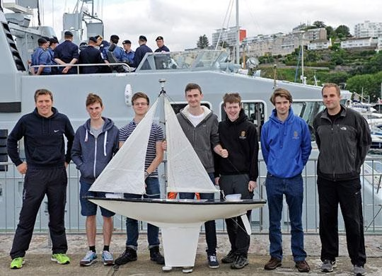
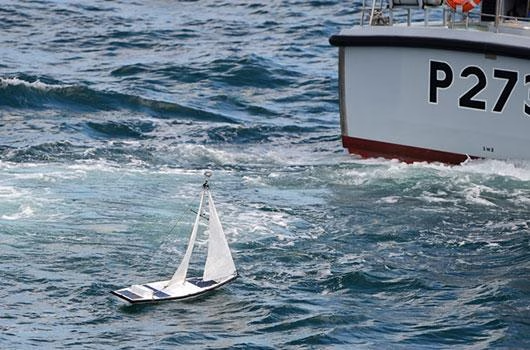
Epsom College are competing in The Microtransat challenge and are trying to build a robot boat that can sail from England to America autonomously.
It has been attempted approximately 25 times by Universities, Businesses and Individuals; however, it has never been completed.
Ground Control’s RockBLOCK 9602 is being used to send back telemetry data from anywhere in the Atlantic Ocean. Every hour it provides Latitude, Longitude, Battery Voltages, Temperatures inside the electronics bays and sends a ‘Mayday’ if water is detected in the hull. Each update is forwarded to a PHP script that easily stores the information in a SQL database, updates Twitter, and places a marker on a rolling map on their website.
The Challenge Ahead
The Microtransat Challenge was launched in 2005 to stimulate the development of fully autonomous model sailing boats capable of crossing the Atlantic in an east-west or west-east direction. To date, none of the 12 Microtransat attempts has been successful. In July 2016 the Epsom College team aimed be the first to succeed where many have failed.
The boat is a GRP hull based on a J-Class racer. We own the mould and so can try again if this boat fails. It is 1.8M long, and weighs 10-15kg depending on its ballast. The ship uses a student programmed navigation system that uses GPS and a magnetic digital compass. The boat updates its location using the Iridium Satellite Network and a Ground Control RockBLOCK 9602 board. In the first week it will update every hour, then drop back to every six hours.
Our server runs scripts that save key data in a database, uploads to Twitter and Emails the competition organizers.
The History
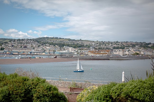
Accompanied by Head of Chemistry, Jamie Styles, and Head of Physics, Chris Telfer, 6th formers Tim Lazarus, Tom Egan, Charlie Steward, Jamie Gleave and Aiden Findlay left Torquay Marina at 10.00am aboard the Royal Navy vessels HMS Exploit and HMS Pursuer and were ferried to the selected launch point 30km off the south-west coast of England.En route to the launch, the College team witnessed a real life rescue as a Navy destroyer, HMS Dragon, and a coastguard helicopter provided assistance to a medical emergency aboard a pleasure yacht.
With a flat sea and the temperature hitting 26˚C, The Microtransat Challenge officially started on 5th July 2016 10.53am. Nerves were jangling as the boat headed the wrong way but it quickly pointed its bow in the right direction towards the Atlantic.
Initially, the tracking system appeared not to be working as it placed the boat somewhere near Paris but a small tweak to some of the land-based software quickly fixed the error.
As a final test before being left to the journey, the boat had to endure the swell of HMS Dragon as the destroyer made multiple passes to allow its crew to watch the launch.
After seeing the boat off, the team made the return trip to Torquay during which they were delighted to be flanked by a pod of breaching dolphins.
The Goal
The College team is aiming to be the first to successfully complete The Microtransat Challenge, which was launched in 2005 to stimulate the development of fully autonomous model sailing boats capable of crossing the Atlantic in an east-west or west-east direction.
Bringing together students and staff from the Mathematics, Geography, Chemistry, Physics and Computing Departments, the team have been working on the design of their boat since September 2015 as part of a student-led STEM (Science, Technology, Engineering and Mathematics) project.
Proud to Support Educators
Learning doesn’t happen just in a classroom and at Ground Control we work very closely with Educators and Researchers alike to ensure there is no limit to their projects.
If you’d like to learn more or have a project coming up that you need satellite connectivity for, simply get in touch and one of our expert team will help.
How RockBLOCK Helps Deliver Critical Medical Care via Drone
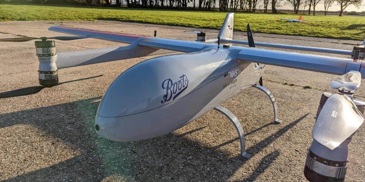
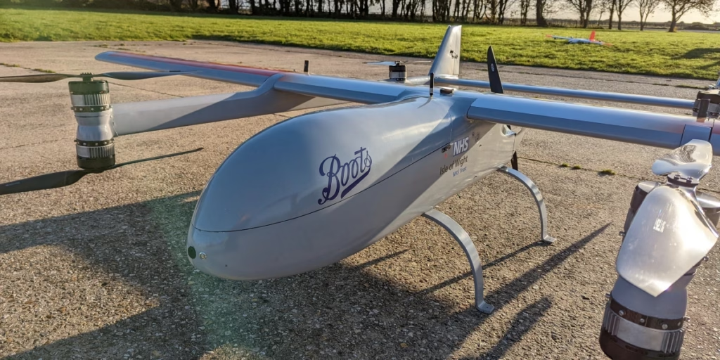
Skylift UAV designs, manufactures and operates specialist commercial drones for applications as diverse as surveillance, search and rescue, surveying, and fertilization of crops. The highly experienced Skylift team were engaged by Apian, a medical drone startup founded by a team of NHS doctors, to work with them on two projects: a prescription delivery pilot for Boots Pharmacy, and delivery of chemotherapy doses to cancer patients.

Challenge No. 1: Reducing Chemotherapy Drug Waste
Cancer patients on the Isle of Wight, located just off the south coast of the UK, sometimes experience issues in receiving their chemotherapy treatment. The chemotherapy drug is manufactured at Portsmouth Hospital University NHS Trust, couriered to Portsmouth Harbour, ferried over to the Isle of Wight, then transferred by taxi to St Mary’s Hospital, a process taking up to four hours. As chemotherapy drugs have a limited shelf life, it’s important they’re administered within a short time-frame of being created.
The chemotherapy is manufactured and dispatched before the patient is clinically assessed and approved for treatment, which can mean that on arrival, the drug can’t be used, and will be wasted. Further, there are many opportunities for this process to be subject to delays and cancellations, which creates an overhead of admin for the hospital staff, and again, can lead to drugs being wasted.
Transporting the chemotherapy via drone reduces the transport time to 30 minutes; this means it can be dispatched after the patient has been cleared for treatment, and unlike public transport, there are very few circumstances in which the drone may be held up. This means less wastage, reduced admin, and fewer delayed treatments.
Challenge No. 2: Finding Efficiencies in Prescription Delivery
In addition to the NHS, Boots Pharmacy also wanted to expedite the delivery of prescriptions to customers in remote areas; in this case, to create economic efficiencies. The Isle of Wight, because of the difficulties of transportation over the Solent (a strait between the Isle of Wight and Great Britain), was a sensible place to trial incorporating drones into its medical supply chain.
How Drones are Delivering Medicines
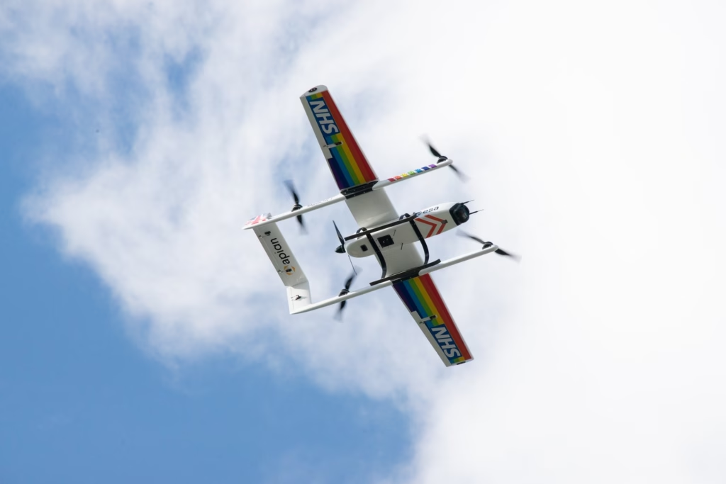
Skylift UAV built an autonomous eVTOL (electric, vertical take-off and landing) aircraft which can fly for 1.5 hours on a single charge, with a maximum speed of 100 Mph. In BVLOS (Beyond Visual Line of Sight) configuration, it can travel up to 100 Km, depending on the payload; in this instance, the distance travelled is 40 Km. This gives the drone plenty of juice to compensate for adverse wind conditions, or waiting for permission to land.
The drones are autonomous, but monitored by Skylift’s safety pilots who can take control of the drone at any time. As the drone travels BVLOS, and across a body of water (the Solent), it’s essential that the pilots have two reliable means of communication with the drone at all times. The Skylift UAV team chose RockBLOCK 9603 in addition to aviation-grade L-Band radio to ensure that irrespective of the drone’s location, connectivity is guaranteed.
The commands are simple: stop, start, return etc. What’s important is that the means of sending and receiving these commands is completely reliable, which is why the Skylift UAV team chose RockBLOCK 9603, and Iridium satellite constellation.
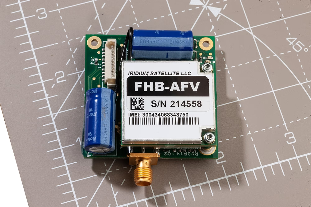
RockBLOCK 9603 is a robust, compact piece of equipment that can send and receive short messages from anywhere on Earth with a view of the sky. It’s a plug-and-play device with its own power supply and antenna, which allows it to communicate with the Iridium satellite network for pole to pole coverage.
“For us, the key benefit of the RockBLOCK 9603 is reliability. We don’t need to worry about what’s over the horizon – we know we’ll be able to communicate with our drones. It’s an essential part of our dual-redundancy system, and has never let us down.”
Toby Moores, CEO, Skylift
What’s Next?
There are many additional medical applications for drones that are being explored in addition to expediting deliveries over bodies of water / extremely remote areas. For example:
- Delivering emergency / essential medical supplies to vulnerable people who are at high risk if they travel
- Reducing the risk of medicines expiring because the ease and speed of distribution is greater, and far less subject to disruption
- Mitigating risk of transmission of infectious diseases with M2M deliveries.
Would you like to know more?
With over 40 years of combined knowledge of satellite experience, the Ground Control team is well placed to help keep you connected when it matters the most.
Whatever your communication or connectivity needs, we can help. Talk to one of our team to discover our products and services and how they can benefit, improve and streamline your applications.
Madcap Project – LOHAN
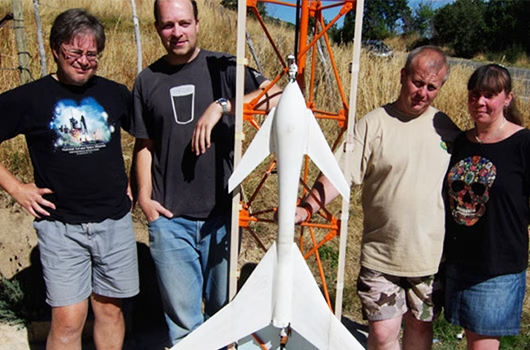
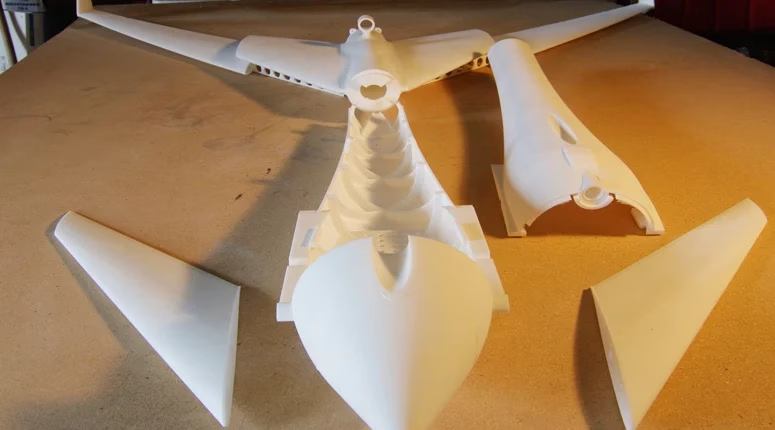
LOHAN is a madcap project involving using a high altitude balloon to launch a glider to the edge of space then have it released from the balloon and navigate itself down to a designated landing spot.
The team needed a way to communicate if/when the LOHAN travelled out of GPRS coverage. Additionally the authorities required an emergency balloon cut-down in the event that LOHAN wandered off course.
Enter RockBLOCK 9602. As well as transmitting GPS data when the unit was out of range of standard mobile networks, the RockBLOCK was also used to receive commands from the ground. If they wished to abort the mission, a message sent to the RockBLOCK using our API, would be received on-board the spacecraft and activate the self-destruct mechanism.
LOHAN Components
- RockBLOCK 9602 naked unit
- Arduino Mini Pro 3.3V 8MHz
- 5V regulator
- AAA battery holder
- Four Energizer lithium AAAs
- MOSFET to fire the release
- Cable with JST connector to connect to cut-down
- The LOHAN Spacecraft
The Challenge
The team plan to launch a rocket-powered Vulture 2 spaceplane from under a helium balloon and ask it to guide itself back to terra firma using an onboard autopilot system. This is commonly known as a ‘rockoon’ concept, or ‘ballocket’, and it presents a few serious technical challenges – not least how to launch the aircraft. As meteorological balloons can get really, really big at altitude, any launch plan needs to balance offering the vehicle the chance to get to maximum altitude while avoiding an enormous latex sphere.
Several had the idea of using multiple balloons, but the team ruled against this, the logic being, it multiplies the diameter problem and doesn’t really offer an advantage in terms of maximum attainable altitude. Afterall, all balloons would burst at around the same height, and it’s likely the first explosion would trigger multiple bangs.
Instead the team’s research brought them back to the 1980s – John Guest was involved in a rockoon project aiming to put a 1-gram payload into orbit. Unfortunately, as a result of the estimated $50K cost, this project came to nothing, evidently though some real thought was given to the matter. Guest wrote: “Launch before balloon burst. Much better platform stability. Once burst occurs, you don’t know what your craft attitude is going to be. You won’t make orbit (and I don’t think you want to, really). However, a launch attitude of 45 degrees would both maximize downrange distance and altitude.”
This echoed the team’s experiences with rockoons launched vertically which have sacrificed the balloon; disregarded due to the potential damage to the aircraft. Instead the team plan on trying the suggested spaceplane launch angle of 45 degrees.
The Initial Spec
Based on the Paper Aircraft Released Into Space (PARIS) concept of having the aircraft attached to a main payload box:
- Single helium balloon, lift capability 1,000 feet per minute
- Main payload box with onboard video and stills cameras
- Main payload to contain both a) launch trigger electronics and b) Vulture 2 onboard systems enabling electronics
- Launch of Vulture 2 programmed for before balloon burst
- Main payload to descend by rocket recovery parachute
- Main payload recovery systems to include GPS radio beacon.
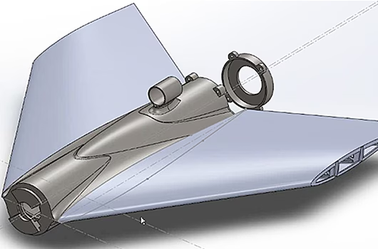
In summary, the main payload electronics will enable the Vulture 2 onboard cameras and autopilot, and then fire the rocket motor at a predetermined altitude. The aircraft will fly at an angle of 45° from some form of launch platform, the design of which should run in tandem with the Vulture 2 development.
We wish the team all the best with launch and future projects!
Built with Ground Control
The work we support genuinely inspires us, and we’re proud to be a part of the innovative solutions created by our partners and customers.
If you’d like to get in touch with the team either to discuss a challenge similar to that of the one above, or something completely different our team of experts will be happy to provide objective advice.