Product: RockSTAR
Hyper-Accurate Tracking and Messaging for Snowmobile Clubs
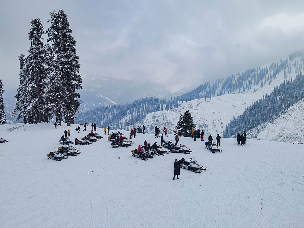
There are 121,297km of organized snowmobile trails in Canada, and 1.5 million Canadians enjoy the pastime of snowmobiling. Snowmobilers typically pay a fee – estimated to total $58 million CAD – to access the trails, which in turn pays for their upkeep. And the upkeep is managed by the paid volunteers of 729 snowmobile clubs.
The Challenge
The volunteers who groom Canada’s snowmobile trails get paid per kilometer groomed. Most clubs manage this process through a written logbook, which can lead to honest (and occasionally dishonest!) mistakes regarding mileage.
In the absence of cellular coverage, a handful of clubs implemented a satellite tracking system to dispense with the paper-based option, but it had serious flaws. The hardware and firmware wasn’t updated for over a decade, making the devices less reliable and harder to use than more modern equivalents.
Further, the old devices don’t support Bluetooth LE – which means you have to use a small, hard to operate, keypad to send messages – which is particularly laborious if you’re wearing gloves.

The Requirements
An effective satellite tracking system needs to measure the distance travelled very accurately, to prevent mistakes and volunteers being paid too little or too much. It also needs to be able to measure speed; it’s imperative for the safety of the volunteers, and the quality of the grooming, that they do not speed.
The organization responsible for the payments needs to be able to aggregate the data by snowmobile club; by date range; or by individual. Each club needs to be able to view only its own data / devices.
The Solution
The RockSTAR and the Cloudloop Tracking platform solves this challenge. RockSTAR’s odometer, once activated, takes a reading every 0.1 seconds; at the end of the session, the volunteer stops the device, which then provides a hyper-accurate GPS reading of the distance travelled, and the speed.
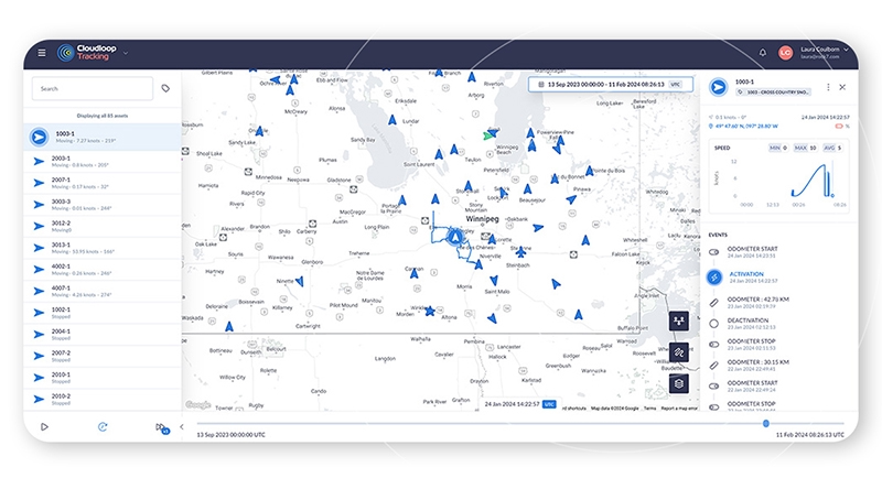
The report is sent via SMS, email, and to the Cloudloop Tracking platform, which allows the organization to see live and historical tracking data; by individual or by club, using an intuitive, easy to use dashboard. Comprehensive reporting tools show distance travelled by all, or selected devices, and what days the groomers were active.
The individual clubs – who usually have between 2-4 volunteers grooming the trails – have their own logins, and can see their own devices only.
The RockSTAR Device
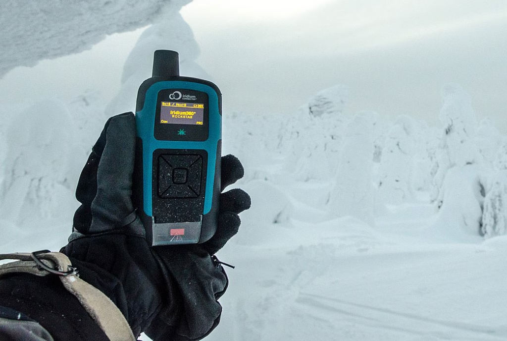
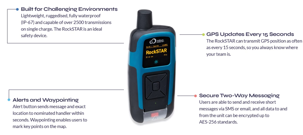
RockSTAR is an ideal device for this purpose. It’s highly ruggedized, with an IP rating of IP67 (can be submerged for up to 30 minutes in 1m of water), and is vibration tested and certified. It has a phenomenal battery life of up to 12 months (although this declines with the frequency of transmissions), and can be operated with gloves on.
RockSTAR also allows users to send and receive messages on their smartphone using Bluetooth LE.
It has a red button alert option that sends an emergency message to nominated recipients, and speeds up the tracking frequency so that the person in distress can be located quickly and accurately.
It accesses the Iridium satellite constellation, which is truly global; as long as you have a view of the sky, you can connect to send and receive messages and location data.
Would you like to know more?
RockSTAR is an extremely versatile device, being used by security forces, journalists, sailors, ultra-runners, remote field workers and now snowmobilers! If you need to communicate with, and track, your personnel when they travel out of cellular coverage, it’s a tried and trusted solution.
Cloudloop Tracking is provided with RockSTAR, but we also have open APIs so that you can integrate the tracking and any other sensor data you choose to transmit into your own platform. Get in touch with our team to discuss your requirements today.
RockSTAR Provides Vital Tracking Telemetry for Soldiers and Ultra Runners
JCSys operate robust live tracking solutions, effective in any weather and terrain. They’re internationally trusted to provide situational awareness to clients as diverse as the military to adventure racing; schools, cadets, scouts and remote field workers. Their tracking and data management services reduce risk and provide reassurance, utilizing biometric and location data, essential for peace of mind and timely, mission-critical response.

Challenge 1: Biometrics and Monitoring for the MOD
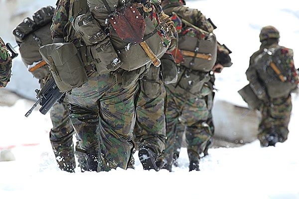
Working to a specification from the UK’s Ministry of Defence (MOD), JCSys placed their clients’ needs and reliability at the heart of the proposition. Military tracking requires a solution that goes beyond mobile network coverage; one that can provide global, real-time location data on military operatives in the toughest of climates and conditions. Equipment must be extremely reliable, ruggedized, and self-powered to handle off-grid operations.
Soldiers need a handset that’s portable and durable, compact and waterproof. It needs to provide tracking in all weather and military attire, especially in conditions too cold to free fingers from gloves. Other firmware modifications were specific to the MOD: securely encrypting location data, disabling switch off without a PIN code, delivering the ability to pair to a BLE heart rate monitor, and integration to JCSys’ software.
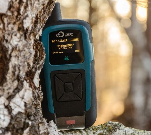
Solution: The RockSTAR – Flexible Firmware and Software Integration
JCSys were looking for a satellite technology partner willing to tailor their hardware and firmware to meet the specifics, providing developer-friendly APIs so JCSys could add context to the telemetry data provided via the device. Ground Control (then Rock Seven) was more than willing to innovate in order to support JCSys with their end-to-end solution.
“Out of the box the RockSTAR handheld device was 90% there. With some tweaks to the Ground Control firmware and integration with JCSys’ software interface, we were able to provide the bespoke tracking solution the MOD were looking for. Ground Control ticked the box for adaptability, innovation and reliability.”
Nigel Kenyon, Head of Tracking Services, JCSys
Challenge 2: Race Safety in Extreme Conditions
Another area of JCSys’ expertise is supporting professional ultra-marathon experiences. Adventure sports test human endurance across terrain and environments in a way that puts risk firmly on the map, but only if you can track it. This is real time civilian monitoring, on a minute-by-minute basis, and without it there have been some very public incidents of races going wrong.
JCSys collaborates on a variety of Beyond The Ultimate (BTU) team events. These are individual endurance races which take place over jungle, desert and ice caps, some of the most remote and hostile environments on Earth, with minimal mobile coverage.
Providing race tracking systems that enable the BTU team to deliver safe race conditions requires a tracking solution built on life-critical metrics; knowing runners’ location, flagging real time alerts, providing situational awareness, reliability, battery life, text function and simplicity of use.
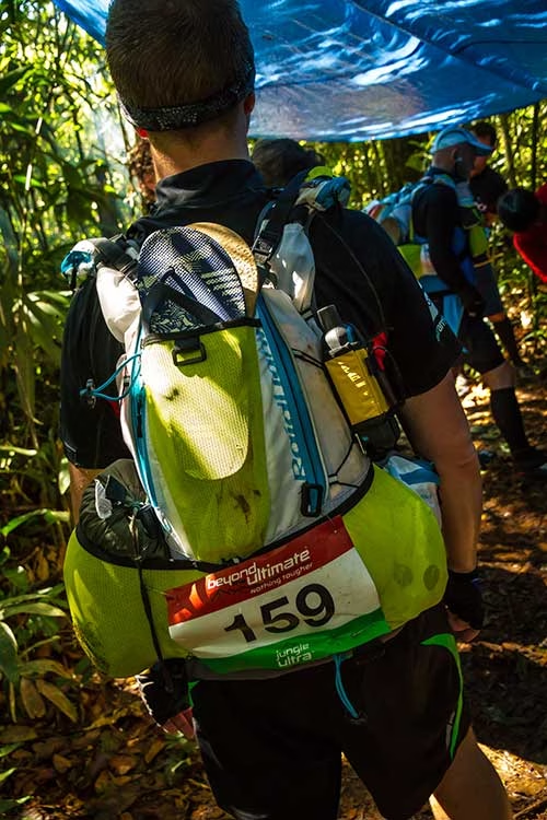
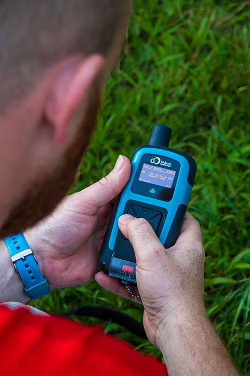
Solution: RockSTAR Tracking and Alerts
The RockSTAR gathers key telemetry and GPS data in a handheld device; waterproof, ruggedized and built to withstand the most challenging of environments. It’s robust, and yet still light, easy to set up and very user friendly. Once connected every runner out in the field is tracked and traceable.
With the RockSTAR, BTU are able to follow all race participants from their base location, tracking progress via geo-fences that provide early warning if a device has gone inside or outside a certain race area.
The device, coupled with JCSys’ software, sends real time alerts when data is received, indicating any incidents out in the field. This kind of solution has provided them with a strong reputation for safety.
“Our systems have proven their life-saving faculty on multiple occasions. We have built our reputation on the reliability of the RockSTAR and the data it provides. It’s how we are able to host some of the most high-risk events for both our UK military and civilian clients alike.”
Nigel Kenyon, Head of Tracking Services, JCSys
Future Development
JCSys continues to explore ways in which the gathering of biometrics can improve the safety and performance of remote operatives. Data gathered in military contexts is being utilized by a NATO project headed up by the Institute of Naval Medicine (INM) for the UK, to monitor operatives’ physical effort, and estimation of core body temperature (ECTemp) while out in the field. This is bringing new medical insight into the experience of operative performance under extreme duress, highlighting the potential of real time data and satellite tech in the future of innovative medical research.
Would you like to know more?
If you’re interested in handheld tracking devices, straight out of the box, or you have your own tracking software and want to explore partner integration options with Ground Control’s RockSTAR, we’d love to hear from you.
Call or email us, or complete the form, and one of our experienced team will be happy to help.
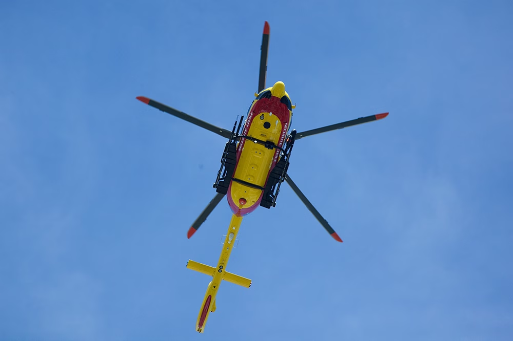
Effortless Cloud-Based Fleet Tracking with v2track
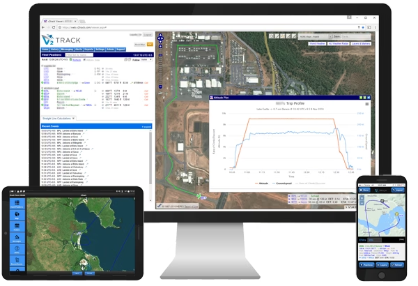
For over 15 years, v2track has delivered affordable, global, high detail flight and fleet tracking, via their powerful cloud-based asset viewing and interaction platform. v2track manufactures its own tracking device, and have also integrated their ‘Viewer’ software with Ground Control’s RockAIR, RockSTAR and RockFLEET tracking devices.
A complete solution for fleet tracking
Ground Control’s RockAIR and RockFLEET devices are very similar devices; both offer dual-mode cellular and satellite tracking capabilities, leveraging the global Iridium network, so that no matter where your asset goes, you will be able to see their location in real time.
Both provide text-based communication, so pilots and drivers can keep in touch with their base of operations. The RockAIR is designed to be carry on / carry off, with a battery that will last up to two weeks, whereas the RockFLEET is designed to be installed; either can be used on air, on land, or at sea.
What V2Track brings to the party is their advanced software platform, which has been designed by aviators, for aviators, and works extremely well for land-based fleet operations too.
Introducing V2Track’s Viewer platform
As the Viewer is cloud-based, there’s no need to download any programmes or install updates; when you log in via your desktop, tablet or mobile, you’ll be using the most up to date version of the software. Using the View you can monitor all of your aircraft, vehicles and assets in real-time. It retains the history of every trip / session for future retrieval.
- Customizable, automatic SMS, email and website alerts, e.g. speeding alerts, out of hours use, movement in and out of predefined areas
- Flight following alerts: proximity and non-reporting
- EFB functions
- Flight manifests
- Electronic checklists
- Daily history, playback and reports
When you combine the tracking and communication capabilities of the RockAIR, RockSTAR and RockFLEET devices with V2Track’s innovative and constantly improved software solution, you have an end-to-end solution for fleet tracking, anywhere in the world.
“We wanted to offer our customers a choice of hardware for their tracking and communication needs, and chose to integrate with Ground Control because of their justified reputation for reliability, and the ease of integration with our software. They make it very easy for us to work with them, and in turn, our customers get a very competitively priced and powerful fleet tracking and communication solution.”
Kylan Diprose, Director, v2track
Like to know more?
If you’re interested in V2Track’s fleet tracking and communications solution, or you have your own tracking software and want to explore integration options with Ground Control’s satellite tracking devices, we’d love to hear from you.
Call or email us, or complete the form, and one of our experienced team will be happy to help.
The Challenge for Journalists
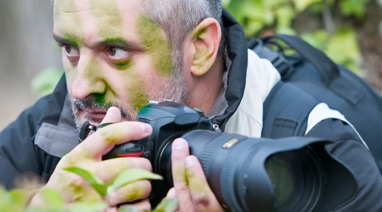
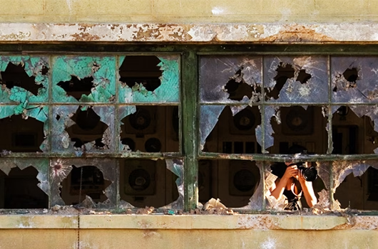
Journalists can easily find themselves in remote and hostile environments, out of reach of cellular network coverage. Travelling from place to place, it might be a warzone one week, a natural disaster area the next. They need to be able to communicate with sources, studios and access relevant files, while maintaining diligent security practices.
They can only rely on the equipment they take with them. There’s no guarantee that there will be any communications equipment onsite when they get there – most of the time they don’t even know if they’ll get a pillow to sleep on.
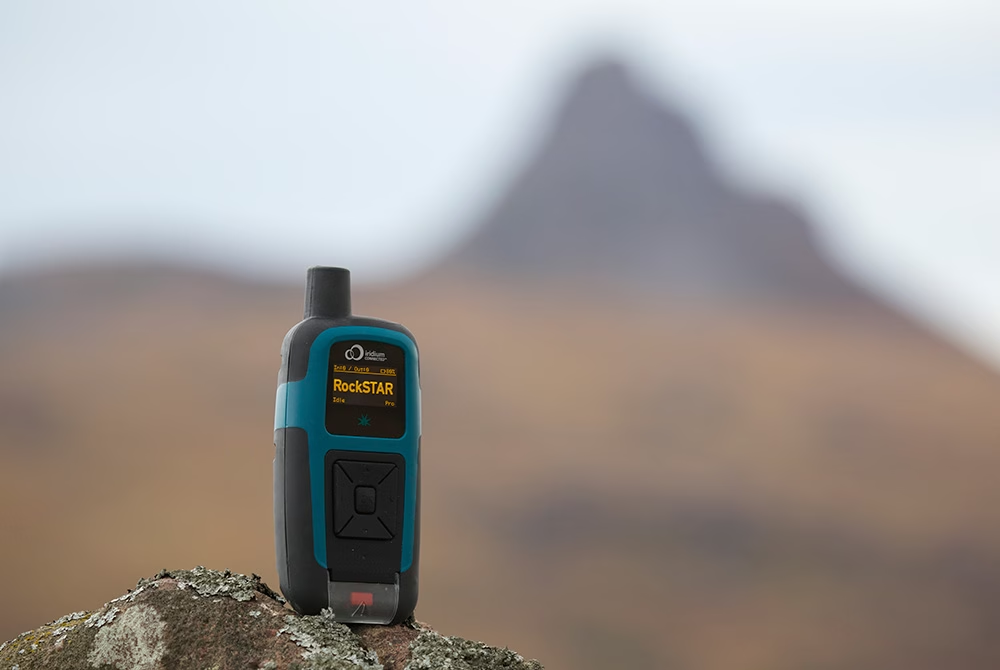
The Solution – RockSTAR Unit
That’s where RockSTAR is useful. It provides a vital way for the journalist to keep in touch with both HQ and home. Position information is sent automatically from the unit, as regularly as every 15 seconds, or as infrequently as once per day. If HQ feel that they’re in trouble, they can remotely increase the transmission rate to get more regular fixes.
RockSTAR can also be used to communicate, sending short messages via email and SMS to the office and to loved ones. Some even use our Bluetooth link (via iPad, iPhone, Android) to write short articles and send them back for print.
Our units don’t rely on any terrestrial service – if the mobile phone network is down, that’s not a problem. As long as our devices can see the sky, they can transmit their position and message data back home. That means certainty – and when you’re stuck in a warzone reporting the news, that’s worth its weight in gold.
It’s cost-effective, too. Normally news organizations might have a stock of RockSTARs, but that doesn’t mean they’re always in use. Slow news days do happen. With our service, you just pay for what you use.
Getting Started With The RockSTAR
Before the start of the trip, HQ activate the line rental for the unit for a month or more, the journalist turns the unit on, and the RockSTAR will start transmitting a position fix once per hour (or whatever the customer chooses). When the units are sat on the shelf in the store-room, you don’t pay anything. Any credits left over from one deployment will still be there when the unit is activated next time, on its next trip.
Back at HQ, the customer uses Cloudloop Tracking to monitor the positions of all their workers.
In the case of an emergency, the RockSTAR unit can be used to alert HQ, using either the dedicated red button or, even better, using the messaging facilities to indicate the type of alert and any other relevant details. It can also be sent a command to go into ‘stealth mode’, which means the screen and LED are turned off. The unit continues to operate as normal, but it looks as though the battery has run out – useful if compromised.
Key Benefits For Media Teams
- GPS tracking
- Pay only when the units are being used in the field, no annual contracts
- Two way messaging between teams and the studio/HQ
- Various alert options including red button, timer alert, dead man’s switch, etc.
- Up to 3 month battery life, transmitting every hour
- Independently powered – rechargeable in the field using standard USB options
- Portable and can be covertly placed
- Access to Cloudloop for management across all deployed teams
In summary, RockSTAR is a private and reliable means of communication and tracking between journalists on the ground and the studio. Because of the erratic nature of news events, our pay-as-you-go service is cost effective, requiring no annual contracts.
Supporting Media teams worldwide
We have experience helping Media companies and journalists stay connected, wherever the story may take them. For expert, objective advice on your next project, simply get in touch.
Horticulturalists – The Challenge
The trouble with plants is that they grow absolutely everywhere. A great many scientific discoveries have been made by studying plants and there’s an awful lot of the world’s surface to cover. Most of it doesn’t have any kind of ‘conventional’ communication infrastructure.
That’s where our products kick in. Iridium is a global satellite network that offers guaranteed of coverage anywhere you can see the sky.
From the Amazon basin to the top of Everest, our products can provide tracking information and two-way communications – vital to keep in touch with your teams in the field.
The RockSTAR can be used to mark ‘interesting finds’ using the waypoint options, meaning the remote workers can ‘tag’ locations and come back to them later. Back at HQ, using the Cloudloop IoT platform, you can monitor their progress and see those remotely marked ‘tags’.


The Solution – RockSTAR
This might seem like an odd fit for a tracking product, but it shows the flexibility of the RockSTAR device and the service we offer.
Various horticultural organizations have approached us over the last few years to provide remote worker tracking for their lone workers. A great many research projects take place outside of normal mobile phone (GSM) range and our devices provide an ideal way to keep in touch with these groups.
Global Tracking and Communications
Our devices can last for months between recharges, and if they do need to be recharged in the field then a standard USB cable is all it takes.
KEY BENEFITS FOR HORTICULTURALISTS
- Up to 3 month battery life, transmitting every hour
- Portable, easy to place in a rucksack
- ‘Interesting find’ marking
- Two way messaging between teams and HQ – Email and SMS
- GPS tracking, with access to Cloudloop Tracking for management across all deployed teams
- Various alert options including red button, timer alert, dead man’s switch, etc.
- Pay only when the units are being used in the field, no annual contracts
In summary, RockSTAR is a private means of communication and tracking between you and your remote workers. It’s robust and reliable, has a huge battery life, and is easily charged in the field.
Truly global communications
If you’d like to get in touch with the team either to discuss a challenge related to lone or remote workers, we’d be happy to help.
Working closely with cellular and satellite networks, we’re able to provide expert, objective advice, whatever your budget.
The Challenge for Aviators
Aircraft are often fitted with a number of features which have safety and rescue in mind. These can range from, but aren’t limited to, phones, GPS, trackers, emergency controls, and even tools as simple as a flare gun.
While an aircraft may be kitted out with phones and other communication devices, flight routes are often out of GSM range so cannot guarantee signal. Reliable transmission of location on a regular basis is essential though, should the worst happen.
What’s more, in an emergency situation, pilots need a quick and simple system to fire out an SOS – from messaging to accurate position information – in order to get the life-saving help they need as soon as possible.
The Sam Rutherford Rescue
In May 2019, Sam Rutherford and co-pilot Alan Simpson were ferrying a Piper Malibu propeller aircraft from West Virginia in the USA to Britain.
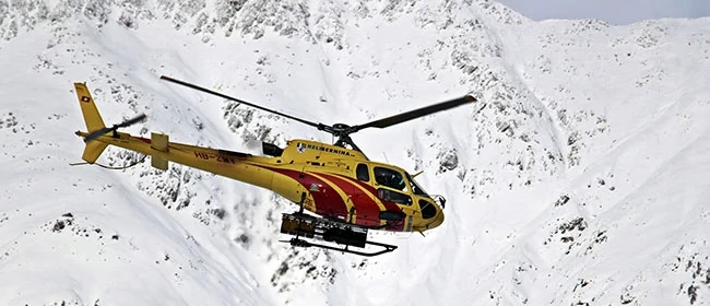
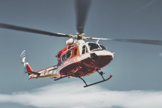
Unfortunately, they were caught in blizzard-like conditions near Makkovik, Canada, and the plane came down leaving the pilots hurt and stranded on a mountainside. While Simpson was unconscious and later sadly died of his injuries, Rutherford was able to use his tracker to send an SOS back to his wife in Belgium to send for help, which also tracked their position for the rescue team.
It took a nine-man team and a few weather-related setbacks to take on the Herculean task of rescuing the men. Rutherford acknowledges the RockSTAR – satellite tracking device, was a big contributor in saving his life that day.
“Within an hour, an hour and a half, I was getting messages [across]. From a morale point of view that was a total game-changer.”
Sam Rutherford, Pilot
Built with Ground Control
Our devices help deliver peace of mind to aviators, pilots and passengers everywhere and anywhere.
If you’re interested in learning more about the RockSTAR, RockAIR, or any satellite tracking device, or similarly have a communication challenge in the sky you’d like some advice on, simply fill in the form and one of our expert team will contact you.
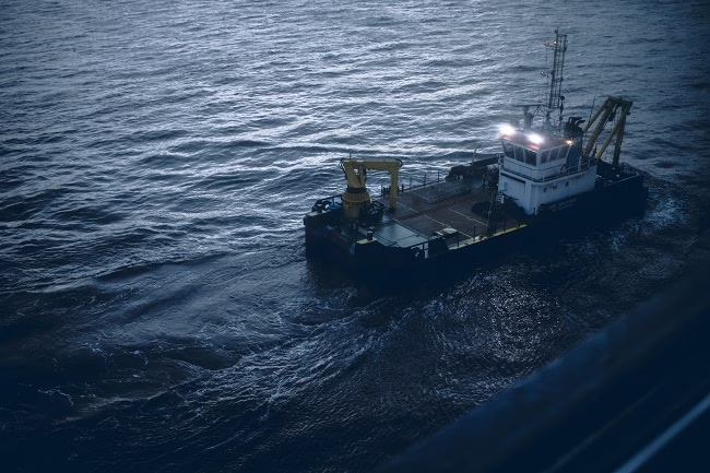
Challenges in Maritime Security
In the anti-piracy and maritime security world, it’s vital to know the situation of your remote teams.
You can’t rely on the communication facilities aboard the vessels you’re protecting, both for privacy reasons and in case of possible compromise.
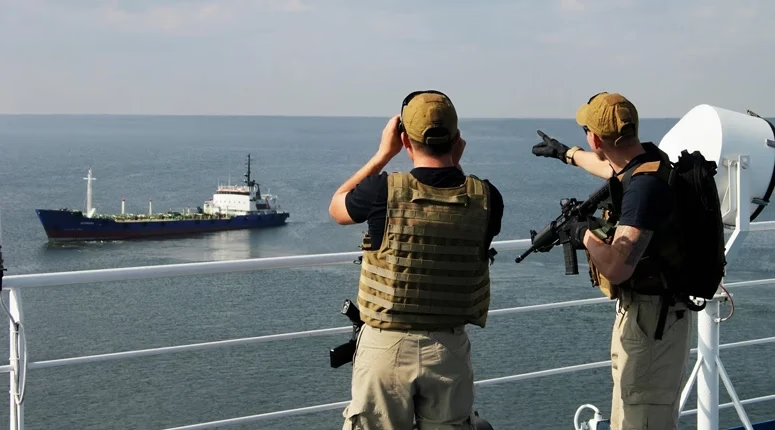
We provide RockSTAR units to a large number of marine security and anti-piracy firms worldwide. They provide accurate tracking, allowing the position of your teams/vessels to be monitored while in transit. They also give a secure and private means of communication for onboard team leaders.
The Solution – RockSTAR device
Typically, when marine security teams deploy onboard a vessel, they take a RockSTAR device with them. Before the start of the transit the unit is turned on and will start transmitting a position fix once per hour (or whatever the customer chooses). Back at HQ, the customer uses the Cloudloop management system to monitor the positions of all their teams/vessels.
The RockSTAR’s means of communication is completely separate from the vessel, so even if power is turned off aboard, the RockSTAR will continue to operate. A command can be sent to go into ‘stealth mode’, which means that the screen and LED are turned off and the unit continues to operate as normal, but it looks as though the battery has run out – useful if compromised.
In the case of an emergency, the RockSTAR unit can alert HQ, using either the dedicated red button or, even better, the messaging facilities to indicate the type of alert and any other relevant details.
Safeguarding personnel and assets with the RockSTAR
KEY FEATURES FOR MARITIME SECURITY TEAMS
- GPS Tracking – Frequency of transmissions between 15 seconds – once per day
- Up to 3-month battery life (when transmitting every hour)
- Portable and can be covertly carried/mounted
- Two-way messaging between teams and HQ
- Access to Cloudloop for management across all deployed teams
- Various alert options including red button, timer alert and dead man’s switch
- Pay only when the units are being used at sea, no annual contracts
In summary, the RockSTAR is a private means of communication and tracking between the marine security company and the teams on the vessel. It’s robust, reliable, and popular in the industry.
Want to know more?
If you’re interested in the RockSTAR device as a possible solution to Marine security or any other communication challenges, we’d love to hear from you. Call or email us, or complete the form, and one of our experienced team will be happy to help.