Topic: IoT & M2M
RockBLOCK selected for KTH Sweden Underwater Sensing Buoy
Professor Jakob Kuttenkeuler and Jari Krützfeldt of the KTH Maritime Robotics Laboratory at the Royal Institute of Technology of Sweden developed the LoTUS (long-term underwater sensing) buoy, a system for collecting oceanographic data from perhaps the most remote place on the planet – the polar region seafloor. Long-term data about the conditions there are vital for understanding complex processes such as ocean currents, melting and refreezing of ice, circulations etc.
In the past, the primary tool for investigating these entities were large ship-based expeditions that were both costly and logistically difficult to conduct. The idea behind the LoTUS system is to offer a small, affordable, lightweight and simple-to-use tool for monitoring conditions on the seafloor.
The LoTUS consists of a spherical polystyrene shell attached to an anchor, known as a bottom lander. The shell can withstand conditions found at depths down to 2000m and contains all the necessary hardware for long-term sampling of temperature, current, conductivity and pressure.
Upon reaching an area of interest, the LoTUS is launched from a ship (with an aircraft launch in the works) and quickly sinks to the seafloor. Data samples are taken every hour or so, and are stored in the LoTUS EEPROM memory which offers a data retention capability of over 100 years. After a pre-set duration, e.g. 1-10 years, the LoTUS buoy will separate from the anchor thanks to electrolytically accelerated corrosion of a steel coil. The LoTUS buoy will then float back up to the water’s surface which will hopefully be ice-free.
At the surface, the LoTUS buoy will be thousands of kilometers away from the closest research team and will likely not be collected by an expedition any time soon. Thus, it will be necessary to send its valuable data back wirelessly. It’s here that the RockBLOCK Mk2’s satellite communications capability comes into play.
As soon as a clear view of the sky is detected by the RockBLOCK, a couple of hundred SBD-messages containing compressed LoTUS data are transmitted up to Iridium. This data is then sent to Rock Seven (now trading as Ground Control) servers which, in turn, push it to an endpoint specified by the research team.
Following the completion of the first part of its mission as a bottom lander, the LoTUS now has a new lease on life as a drifter beacon. For the next few months, it will measure and transmit both buoy GPS positions and surface water temperature, sending data back to researchers in near real-time.
With the help of the newly established Iridium link and the Ground Control API, it will then also be possible to reconfigure the LoTUS buoy’s sampling interval and duration so as to save battery and extend the surface mission further.
Get in touch
If you have a remote IoT connectivity challenge, there’s a very good chance we can help! With over 20 years’ experience in satellite communications, and long-term relationships with trusted satellite constellation operators like Iridium, we’re well placed to help you backhaul your data cost-effectively and reliably from anywhere on Earth with a clear view of the sky.
Call or email us, or complete the form, and we’ll be happy to connect you with one of our solutions architects to discuss your requirements.
Maker Buoy: Drifting buoy equipped with the RockBLOCK
The Maker Buoy is a low-cost, Arduino-based, solar-powered and open-source drifting buoy available to purchase ready-made or for the end-user to construct themselves following simple instructions.
The goal is to provide a tool so that we can gain invaluable knowledge about ocean currents, climate and to improve forecasting. Making sure it is easily accessible by hobbyists, researchers and organisations is the key to making the most of the vast amounts of information that can be gleaned from studying our oceans.
The primary purpose of these long-lasting buoys is to measure ocean currents and sea temperature. This information is usually transmitted over satellite networks to oceanographers who are back in their labs on the mainland. The current of the ocean surface and various temperature readings provide vital intel for weather and climate models. Some drifters are even thrown in the ocean in the path of typhoons and hurricanes to gain a better understanding of ocean behaviour, as well as bettering our understanding of intensity forecasting.
Created by engineer Wayne Pavalko, a mathematician by training and an engineer from John Hopkins University Applied Physics Laboratory in Maryland, these buoys are readily available and incredibly easy to build from scratch.
Comprised of a Ground Control RockBLOCK 9603, 1 W solar panel, custom board, a 2AH battery, 3D-printed internal frame, Adafruit GPS, a few cable ties, and its own waterproof case, you have an incredibly robust, low-impact buoy that will last a lifetime in the ocean and can be assembled in under 10 minutes. Early designs of the buoy deployed in 2016 lasted over two years and travelled more than 9000 miles, sending valuable data the whole time. Since 2016, the design has been made smaller, cheaper, and far easier to construct, without sacrificing its robustness.
If the idea of creating your own buoy, programming the RockBLOCK 9603 and retrieving your own oceanic data is appealing, head on over to the Maker Buoy website for a quick read up.
Get in touch
Get in touch with us and find out if the RockBLOCK 9603 is the right device for your needs. Either complete our online form, or call us to be connected directly with one of our expert team. Call +44 (0) 1452 751940 (Europe, Asia, Africa, Oceania) or +1.805.783.4600 (North and South America).
With over 20 years experience in satellite tracking we have the knowledge and experience to ensure you are equipped with everything you need to make the right choice.
Building Hot Shot Fire Prevention with the RockBLOCK
James Dziadulewicz B.S. Eng. Mech & electronics engineer has built a one of a kind home in Malibu, California. His incredible home is situated on 10 acres of land in a high fire risk zone. Knowing that his home is susceptible to bushfires, James wanted to install a system that would protect his home from any impending danger. As a result of the potential threat of fires, he created the Hot Shot system – an automated, off the grid fire prevention system.
He installed a solar system with a backup generator and, using their own water supply, trenched irrigation lines and setup 12 high-pressure sprinklers around the perimeter of the home and their powerhouse trailer. He connected it all up to a 2.0 HP irrigation pump and electronic solenoid. He also used Arduino components to take transmitted messages and use them to turn the pump and solenoid on and off at will.
Knowing that he lived in an area that could potentially be completely cut off from cell phone reception and power if the towers were disabled during a fire, James decided that he needed a 100% reliable communication system so that he could receive and send messages to enable his system. He discovered the RockBLOCK and, realising it ran off of the Iridium Satellite Network, installed one to be used as the transmitter. Paired with an external helical antenna, this guaranteed that any messages sent to or from the RockBLOCK would be transmitted reliably.
RockBLOCK 9603
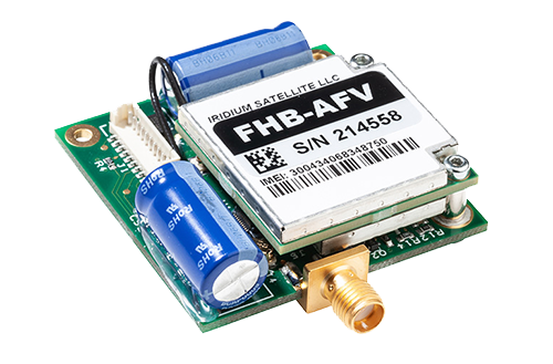
The smallest and lightest version in our RockBLOCK family, the RockBLOCK 9603 is targeted primarily at systems integrators and product developers where space inside your enclosure is at a premium. RockBLOCKs can send and receive short messages from anywhere on Earth with a view of the sky.
With an app created by his friend, Matthew Jenks B.S. Eng. software & M.S. Eng. electrical engineer, James was able to activate the system 54 miles away from his home using his phone, when he received from the sensors attached to the system that the fire was getting closer. He activated the system 35 minutes before the fires hit the area. This was more than enough time for the high-pressure sprinklers to activate and douse his home and the surrounding area, effectively making the area impervious to the fires. His home was left completely unscathed.
While the RockBLOCK is small, it’s a vital part of the system. It worked so well it is now patent pending, and we’re thrilled that we played a part in saving James’ beautiful home. We’re hoping that this system will start to roll out over areas with high fire risk, with one large home in Thousand Oaks, California, already signing up for one.
Can we help you?
Get in touch with us and find out if the RockBLOCK 9603 is the right device for your needs. Either complete our online form, or call us to be connected directly with one of our expert team. Call +44 (0) 1452 751940 (Europe, Asia, Africa, Oceania) or +1.805.783.4600 (North and South America).
With over 20 years experience in satellite tracking we have the knowledge and experience to ensure you are equipped with everything you need to make the right choice.
RockBLOCK 9603 used in MIRKA2-RX Mission
With the completion of the MIRKA2-RX mission, the student members of the Small Satellite Group of the University of Stuttgart field tested technology that will be used in a future CubeSat mission.
The MIRKA2-RX mission that launched on March 18th, 2016, consisted of a micro re-entry capsule (MRC) and the newly developed Low Orbit Technical Unit Separator (LoTUS) which were both integrated within a REXUS program rocket.
The European REXUS/BEXUS program supports scientific and technological experiments on research rockets and balloons, sending two of each into space every year.
132 seconds after lift-off, and while the REXUS rocket was at apogee, a pyro cutter onboard the separator would cut the wire securing the MRC to the separator carriage, thus ejecting it out into the upper atmosphere.
The ejection would also trigger a mechanical switch enabling battery-assisted data collection from pressure, temperature, acceleration and radiation sensors placed inside the MRC.
While the mechanical switch wasn’t successfully activated during the successful ejection, the MRC’s landing on snow-covered Swedish tundra, was. Now active, the MRC used its RockBLOCK 9603 modem and antenna to send back telemetry via Rock Seven (now trading as Ground Control)’s API and server to the MIRKA2-RX team’s own server, allowing the team to locate the device.
The separator integrated into the MIRKA2-RX mission was also designed to fit inside a forthcoming CubeSat Atmospheric Probe for Education (CAPE) mission developed by the University of Stuttgart Institute of Space Systems (IRS). The CAPE mission will test heat shield materials and a pulsed plasma thruster.
RockBLOCK 9603
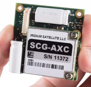
RockBLOCK 9603 is targeted primarily at systems integrators and product developers where space inside your enclosure is at a premium. RockBLOCKs can send and receive short messages from anywhere on Earth with a view of the sky.
RockBLOCK chosen for Cryologger deployments in the Canadian Arctic
Water and ice play a critical role in Canadian landscapes, ecosystems, and infrastructure. The effects of a rapidly changing climate are expected to result in profound environmental changes in the Canadian Arctic.
The Water and Ice Research Laboratory (WIRL) at Carleton University, Canada, aims to better understand the effects of climate change through research focused on aquatic and cryosphere environments. A prerequisite for successful research is the ability to gather as much data from as many sources as possible.
In the past, expensive proprietary hardware was a major constraining factor in the ability of researchers to gather field data. With the development of open-source software and inexpensive, modular, and user-friendly hardware, it’s now possible for the WIRL to better observe and monitor the cryosphere.
Adam Garbo did just that by developing the Cryologger – an Arduino-based, multi-purpose datalogger and telemeter designed to collect data such as temperature, pressure, orientation, and GPS coordinates. The Cryologger was designed to be robust and is intended for deployments in the Canadian Arctic of one year or more.
In the summer of 2018, six Cryologgers were deployed as ice-tracking beacons in the Canadian Arctic. They’ll allow the WIRL to monitor the drift patterns of icebergs and ice islands along the coasts of Ellesmere and Baffin Island. Data from these Cryologgers is being transmitted hourly via a RockBLOCK 9603 to Rock Seven (now trading as Ground Control) and then pushed to the Cryologger tracking website.
An assessment of the Cryologger’s performance will determine if low-cost, open-source hardware and software can provide a reliable and cost-effective alternative to commercially available equipment for use in the demanding polar regions. Given the success of many similar RockBLOCK enabled projects in the past, we can’t be anything but optimistic about the verdict.
Get in touch
Get in touch with us and find out if the RockBLOCK 9603 is the right device for your needs. Either complete our online form, or call us to be connected directly with one of our expert team. Call +44 (0) 1452 751940 (Europe, Asia, Africa, Oceania) or +1.805.783.4600 (North and South America).
With over 20 years experience in satellite tracking we have the knowledge and experience to ensure you are equipped with everything you need to make the right choice.
Supporting the Eldorado Space Program
In 2014, Paul McWhorter, a 17-year veteran of Sandia National Labs and founder of a Silicon Valley nanotechnology company, returned to his hometown of Eldorado, Texas, to start a new career as a high school teacher.
When not teaching math and engineering classes at Eldorado High School, Paul devotes time to lecturing on subjects ranging from how to become a successful engineer, programming with Arduino/Raspberry Pis, and learning 3D CAD. Paul uploads his lecture videos on his website and YouTube channel.
Much to everyone’s surprise, Paul also established the high school’s first space program. He oversees a four-year high school engineering program where younger students are encouraged to join the space program in their junior and senior years.
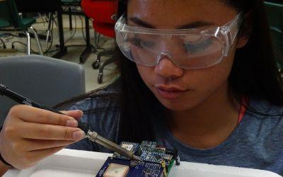
With his guidance, students design, build, and program instrumentation packages sent into the upper atmosphere via high-altitude balloons. He documents the missions in a dedicated YouTube channel.
The instrumentation packages, called Eagles, are sent to the edge of space and transmit back temperature, pressure, and GPS data, as well as live video. A 9-axis inertial measurement system also sends data on the Eagle’s orientation. In all, twenty different data channels are telemetered back to ‘Mission Control’ in the classroom. Some of the additional data channels include down range velocity, vertical ascent rate, latitude, longitude, elevation, system health, signal strength, downrange distance, heading, and trajectory.
A unique accomplishment of these student engineers is their development of an ability to stream live video from the edge of space back to the classroom. The students use standard 2.4 GHz Wi-Fi radios and reconfigure them to operate on the 2.39Ghz HAM microwave radio band. Each member of the program has a HAM radio license, so they can legally operate on this microwave band.
Since the instrument packages can reach altitudes over 115,000 feet and can travel 100 miles down range, maintaining a live video link is a formidable challenge. Technical and regulatory requirements limit the space-bound microwave radio to 1 watt transmit power. In order to communicate over these large distances at such a low power level, a high-gain antenna is required on the ground-based tracking system.
The challenge of using a high-gain antenna on the ground is that it must be pointed with precision at the space-bound instrument package. A pointing error of just a few degrees can lead to loss of signal. According to Mission Commander Jack Griffin: “The challenge becomes even more formidable since the instrument package can reach speeds of over 150mph, as the package ascends through the jet stream. Imagine trying to hit a target with one-degree precision that’s over 100 miles away, traveling at over 150mph.”
Griffin, who is a 17-year-old high school senior, continues: “We’re definitely solving real-world problems in this program. It’s more like working for a Silicon Valley start-up than being in a high school class.”
The ground-based tracking antenna is mounted on a Pelco Pan/Tilt platform. The position of this platform is controlled by relays in a closed-loop feedback system run on a Raspberry Pi microcontroller. The control system works as follows: A GPS on the space-bound instrument package measures the package’s latitude, longitude, and altitude. This data is then transmitted back to the ground- based tracking system. The system then takes these data points and applies the complex Haversine computation to calculate the necessary heading and elevation for the antenna to be precisely pointed to the instrument package. A feedback loop then moves the Pelco such that the antenna is precisely pointed at the target coordinates. In order to maintain the microwave video link, this feedback loop must constantly and quickly adjust the antenna position.
High school junior and Ground Tracking Specialist Benjamin McGee claims: “This is definitely a challenge and mission success depends on keeping the ground-based antenna pointed precisely at the package, no matter where or how fast it goes.”
The team is busy working on preparations for the launch of Eagle IX. Mission Commander Jack Griffin is confident that this will be the best launch ever. Griffin says: “We have our flight designed and expect to get our highest-quality images and most precise data to date, which we will live-stream on our YouTube channel so anyone on Earth can see it.”
The key element for this entire system to work is to have a reliable way to get the GPS data back from the space-bound instrument package to the ground-based tracking system.
Mission Specialist Christine Lindsey says: “Mission success depends on reliable transmission of GPS coordinates from the instrument package back to the ground, We’ve chosen the RockBLOCK modem and Iridium satellite network because it provides rock-solid connectivity. Initially we sent the GPS data coordinates over our microwave link, but if we lost connection, there was no way to regain it. With the RockBLOCK, we always know where the package is and how to point to it. With this system, we can maintain our microwave data link.”
This high-frequency radio beam has poor propagation, meaning it’s important to aim the antenna precisely at the Eagle. To achieve this, GPS data is transmitted via RockBLOCK to Ground Control’s servers. It’s then pushed via HTTP post to Paul’s own server which adjusts the high-gain antenna position accordingly, thus maintaining the video link.
Get in touch
Get in touch with us and find out if the RockBLOCK 9603 is the right device for your needs. Either complete our online form, or call us to be connected directly with one of our expert team. Call +44 (0) 1452 751940 (Europe, Asia, Africa, Oceania) or +1.805.783.4600 (North and South America).
With over 20 years experience in satellite tracking we have the knowledge and experience to ensure you are equipped with everything you need to make the right choice.
Remote Environmental Monitoring
Ephemeral washes located in Southeastern Arizona, USA, contribute to large rivers like the San Pedro. For this reason, ephemeral washes are used by the Arizona Department of Environmental Quality (ADEQ) to gather data on contaminants like E. coli and suspended sediment which impact larger bodies of water downstream.
When a runoff event occurs, field scientists visit local wash sites to collect in-situ sample bottles. Any bottles containing significant samples of water are returned for analysis. The problem with this method is that field scientists spent too many hours hiking through dangerous conditions to check up on collection bottles. This resulted in unnecessary wear and tear to both equipment, and the field scientists themselves.
Hans Huth, a hydrologist with ADEQ’s Watershed Protection Unit, was looking for an easier way to check up on collection bottles. Though commercial GPRS modems and autosamplers could do the job, they were prohibitively costly.
Huth began his research into affordable open source alternatives, adopting the Arduino system and its wide variety of sensors. Huth built a solar powered prototype that sensed rain and water runoff and encased it in a waterproof kayaker’s lunchbox. A basic 2G GPRS modem was used to transmit sensor data to ThingSpeak, the IoT analytics platform that allows users to store, analyze, and visualize their data.
In order to deploy these remote environmental monitors (REM) in areas with no cellular connectivity, Hans worked with Sean Keane, an ADEQ intern, on reprogramming the Arduino to work with a RockBLOCK. For the purpose of monitoring discharges from a stocktank and to facilitate sample collection, a RockBLOCK-powered REM was successfully deployed at Horseshoe Draw near the border with Mexico. Given this success, ADEQ plans to deploy nine more cellular and RockBLOCK powered REMs throughout the state prior to the close of July, 2019. ADEQ is in the process of documenting time and money savings from respective deployments.
Huth documented his first environmental monitor’s development and deployment on YouTube to include links to source code for these inventions. Huth’s YouTube channel also includes chapters on building and deploying these REMs, and he is currently working on a new chapter summarizing code and deployment of RockBLOCK-enabled REMs.
Why Choose Iridium for IoT?
IoT (internet of things) has become a massive buzzword over the past few years, as more and more devices exchange data. In a majority of cases these devices can use land-based networks, such as GSM or LoRa, but a significant number of projects need to get data back from remote areas, where satellite is the only option. There are a number of satellite communications solutions offering IoT capabilities out there – so what are the benefits of choosing an Iridium/Ground Control product?
Truly Global Coverage
Iridium’s 66 satellites orbit the Earth at a low altitude, allowing for global coverage that includes the poles. Because of their low altitude they move in the sky, going from horizon to horizon in a matter of minutes. Thanks to this satellite ‘movement’, you’ll always be able to transmit as long as your device has a view of the sky. It’s a reassuring fact when you or your device are tucked away in a deep valley or traversing the polar regions – in a deep valley, for example, you would just wait a few moments until an Iridium satellite came into view and you could then transmit your message.
In contrast, geo-stationary satellites are always ‘fixed’ at a certain point in the sky. If you wanted to place a sensor in a valley, and your sensor’s view of a geo-stationary satellite was blocked by a mountain, you’d never be able to transmit.
Global Communications Protocol
For two decades, the oil and gas, maritime, rail, aeronautical, and energy industries, as well as government and defense, have been exchanging mission-critical data with the help of Iridium’s short burst data (SBD) service. Iridium SBD will continue to be the backbone for IoT in the most remote parts of the world, where information can be sent and received in a stream of data packets of up to 340 bytes each.
Iridium’s ‘NEXT’ constellation complements SBD with high-speed broadband. It also ensures that Iridium’s satellite network and services have another 15+ years of guaranteed longevity – something that gives you confidence if you’re planning a long term deployment of remote sensors.
Off-the-Shelf Technology = Rapid Deployment
Rock Seven (now trading as Ground Control)’s products and APIs let you quickly enable satellite communications on a variety of popular hardware and software based devices. In fact, the record for someone receiving their RockBLOCK to transmitting their first message successfully stands at just seven minutes.
Many of our customers use an off-the-shelf Arduino or Raspberry Pi as the heart of their project, while others use more industrial and heavyweight PLCs. This is important for enterprise customers that want to keep costs down for hundreds or thousands of units and for small businesses, researchers, and even hobbyists who want the lowest possible development costs for just a few units.
Personal and Rapid Customer Support
Iridium partners with value-added resellers (VARs) like Ground Control who package all the required hardware and software into a solution for you, the end customer. That means your questions will be directly answered by knowledgeable, real people, rather than by a generic scripted helpdesk. We’re experts in Iridium solutions and will always be able to help you find a solution to your remote data needs.
Do you want to learn more about how our SBD-enabled devices can help you and your organization communicate, coordinate, learn, or stay safe? Contact us.
RockBLOCK chosen to support AirCore sampling
Introduced in a paper published in 2010 in the American Meteorological Society, the AirCore has proven itself a robust atmospheric sampling device used with balloons and other airborne assets. Co-developed by the University of Colorado and the NOAA, the heart of the AirCore is 100m of thin, valve-tipped, and coiled stainless-steel tubing that stores gas but prevents its diffusion.
Initially, known amounts of trace gases called fill gas are pumped into the coil. The valves keep the fill gas inside the coil, but as the AirCore ascends through the atmosphere, the exterior pressure drops and the fill gas slowly escapes out.
At around 95,000 feet, the fill gas has almost completely left the coil and, in this current application by the NOAA team, a payload cutdown controller (PCC), which includes the AirCore and all of its auxiliary communications and logging equipment, is separated from a balloon and begins its parachuted descent.
As the PCC falls to the ground, the external pressure slowly builds up, forcing ambient air through a small magnesium perchlorate-filled canister (to dry the air) and into an open valve back into the coil. At ground level, the AirCore will have collected a vertical profile of undiffuse air, almost like a solid core. Back at the lab, the air is then pushed back out of the coil and analysed, ideally in AirCore pairs to make sure that accurate results have been gathered. The small amount of fill gas left in the AirCore indicates the top of the profile.
The PCC uses a Teensy 3.6 board (similar to an Arduino) that controls the cutter. The RockBLOCK itself is programmed to send out location data every five minutes throughout the flight, from power up prior to launch until about 30 minutes after landing. Two-way communication via the RockBLOCK’s SBD Library also gives the team the ability to cut the balloon loose early in flight. Powering the entire PCC for at least four hours are two rechargeable lithium 18650 2200mAh batteries in series.
Usually, a flight will go according to plan but on two occasions the RockBLOCK has gotten more than it bargained for. As Jack Higgs from the NOAA ESRL Global Monitoring Division explains:
“On one flight in Oklahoma last week, the balloon string became tangled with the parachute after cutting so the payload was carried up until the balloon burst. The RockBLOCK reached an altitude of 112,913 feet and low pressure of 5 millibar. It still transmitted its location message at that altitude without any problems. The package was also exposed to a low temperature of -75 degrees C during the flight. The electronics are housed in a Styrofoam package but are not heated. They only benefit from heat generated by the components.”
In another instance, the team had to borrow a canoe from a nearby homeowner and paddle out into the middle of a lake to retrieve the PCC. Amazingly, all the electronics were still operating, even though they were all wet inside. The RockBlock was transmitting its location every five minutes while saturated with water and floating horizontally in the lake.
The AirCore’s success has been duplicated on this side of the Atlantic, too. Academic institutions such as the University of East Anglia, University of Groningen, and the Finnish Meteorological Institute have used it for similar research.
More information on the AirCore can be found at the NOAA’s Earth System Research Laboratory.
Get in touch
Get in touch with us and find out if the RockBLOCK 9603 is the right device for your needs. Either complete our online form, or call us to be connected directly with one of our expert team. Call +44 (0) 1452 751940 (Europe, Asia, Africa, Oceania) or +1.805.783.4600 (North and South America).
<br>
<br>
With over 20 years experience in satellite tracking we have the knowledge and experience to ensure you are equipped with everything you need to make the right choice.
Octanis Rover Mission
Operating out of the École Polytechnique Fédérale de Lausanne, Octanis is a 30-member strong not-for-profit student/alumni association focused on enabling rapid prototyping locally. Anyone interested in sciences, engineering, or making can become a member.
It was the need for a low-cost, minimal environmental impact platform for scientific experiments in extremely cold temperatures, that led the association to develop the Octanis Rover.
The rover was designed to be weatherproof, cold-resistant, and lightweight, while robust enough to complete a multi-month mission autonomously. From November 2016 to January 2017, Octanis successfully field-tested the rover in Antarctica on a research mission to create a map of the snow surface using the rover’s low-cost laser scanner.
Using differential GPS (dGPS), stereo cameras, and LIDAR, an operator in the field chose waypoints for the rover’s goal-to-goal navigation. At the same time, its internal and external sensors would regularly gather and transmit telemetry back to a nearby field base station via LoRa radio.
At the station, the mission’s waypoints and sensor telemetry were transmitted via RockBLOCK back to Switzerland, allowing the research team to see how the Octanis rover was operating and to ascertain whether its sensors were producing good data.
RockBLOCK 9603
RockBLOCK 9603 is targeted primarily at systems integrators and product developers where space inside your enclosure is at a premium.
RockBLOCKs can send and receive short messages from anywhere on Earth with a view of the sky.
All Octanis software and hardware has been specifically chosen to adhere to the principles of the open source movement, and the RockBLOCK is no exception. The publicly available Rock Seven (now trading as Ground Control) API allows users to deliver messages from RockBLOCKs directly to their own application’s web service or e-mail, and to send messages or commands back to RockBLOCKs in the field.
Mapping Ocean Fronts with Robotic Fleets and the RockBLOCK
Led by Dr. João Borges de Sousa of the Laboratório de Sistemas e Tecnologia Subaquática (LSTS) of Portugal, a multinational, multidisciplinary team of scientists have designed, built, and deployed seven autonomous underwater vehicles (AUVs) in the North Pacific Subtropical Ocean Front using the Schmidt Ocean Institute’s research vessel Falkor.
Ocean fronts are areas where drastic changes occur in the properties of waters. These changes are of interest to scientists studying Earth’s climate and marine ecosystems. The particular ocean front examined by the teams is situated about 1,000 nautical miles SW of Southern California. It’s here that less dense and cold waters coming from the Arctic meet the otherwise saline waters of the Pacific.
Three scout ASVs (autonomous surface vehicles) were sent to detect the ocean front ahead of the Schmidt Ocean Institute expedition. The area was then mapped for three weeks by a fleet of AUVs, UAVs (unmanned aerial vehicles) and the R/V Falkor.
In order to map the 3D structure of this dynamic front, the AUVs cycled in a ‘saw-tooth’ pattern between the water’s surface at a depth of 100 meters. The AUVs were controlled from either the R/V Falkor or across the world from an ocean space center in Portugal, with commands sent via RockBLOCKs and the Iridium network.
Operating 24/7, the AUVs would also periodically upload preliminary sensor data, like temperature, salinity, chlorophyll, and turbidity profiles (water properties at different measured depths).
When interesting features would appear, UAVs were deployed to measure the same features from the air using thermal and multispectral cameras. This feat wouldn’t have been possible using only traditional marine/aerial vehicles, due to the logistical and financial restrictions involved with these larger assets.
In less than three weeks, the AUVs traversed over 1,000 nautical miles, operating approximately for 500 hours and sending over 12,000 transmissions – or 2.5 megabytes of Iridium data – to researchers via Rock Seven (now trading as Ground Control)’s servers.
The mission’s success proves that lower-cost, autonomous, and connected vehicles can play a key role in collecting abundant data sets from remote locations. This allows research vessels like the R/V Falkor to shift their role from being a primary sampling unit to a command center, reducing operational costs while increasing scientific knowledge.
Iridium connectivity also allowed the replica command center based in Portugal to take over the second shift, giving scientists round the clock control of their research assets.
More information about this research can be found in the Schmidt Ocean Institute’s expedition page.
Get in touch
Get in touch with us and find out if the RockBLOCK 9603 is the right device for your needs. Either complete our online form, or call us to be connected directly with one of our expert team. Call +44 (0) 1452 751940 (Europe, Asia, Africa, Oceania) or +1.805.783.4600 (North and South America).
With over 20 years experience in satellite tracking we have the knowledge and experience to ensure you are equipped with everything you need to make the right choice.
The HAPP Project
Thanks to advancements in IT and DIY fabrication, missions reserved for national space agencies just a decade ago are becoming increasingly accessible to hobbyists. Cue the High Altitude Photography Platform (HAPP), created by Christopher Couch and James Mayes.
The two engineers designed and built the HAPP, which is comprised of a jet-stabilized aircraft resembling the iconic three-man Apollo re-entry vehicle: a balloon system designed to take the aircraft to its 30km apogee and all the peripheral equipment and electronics that made that project successful. Though not the first high-altitude photography project, the HAPP is the first to capture stabilized 360-degree video.
Even more amazing was the project’s focus on DIY: over 80% of the 22 months for development were dedicated to creating tools and methods rather than actually producing flight hardware. The result is a project that can be replicated by hobbyists using locally sourced parts.
The HAPP can drift as much as 100km during each mission, so it was important to keep track of the lander and provide flight data to air traffic control. The RockBLOCK 9603 was vital in sending telemetry and system sensor data from the Arduino-based flight control computer at an altitude of up to 22km on the maiden flight, mission HAPP-M1.
While the power supply was in a temperature-controlled enclosure, the U-Blox board and PCBs were exposed to the atmosphere for the duration of the mission, experiencing temperatures ranging from +42°C down to -45°C, and pressures from 1atm down to 0.05atm.
The project’s creators have done a great job in documenting the project build and sharing the valuable knowledge they’ve gained.