Product: RockBLOCK

Transforming Arctic Iceberg Monitoring: Low-Cost, Open-Source Tracking Solutions
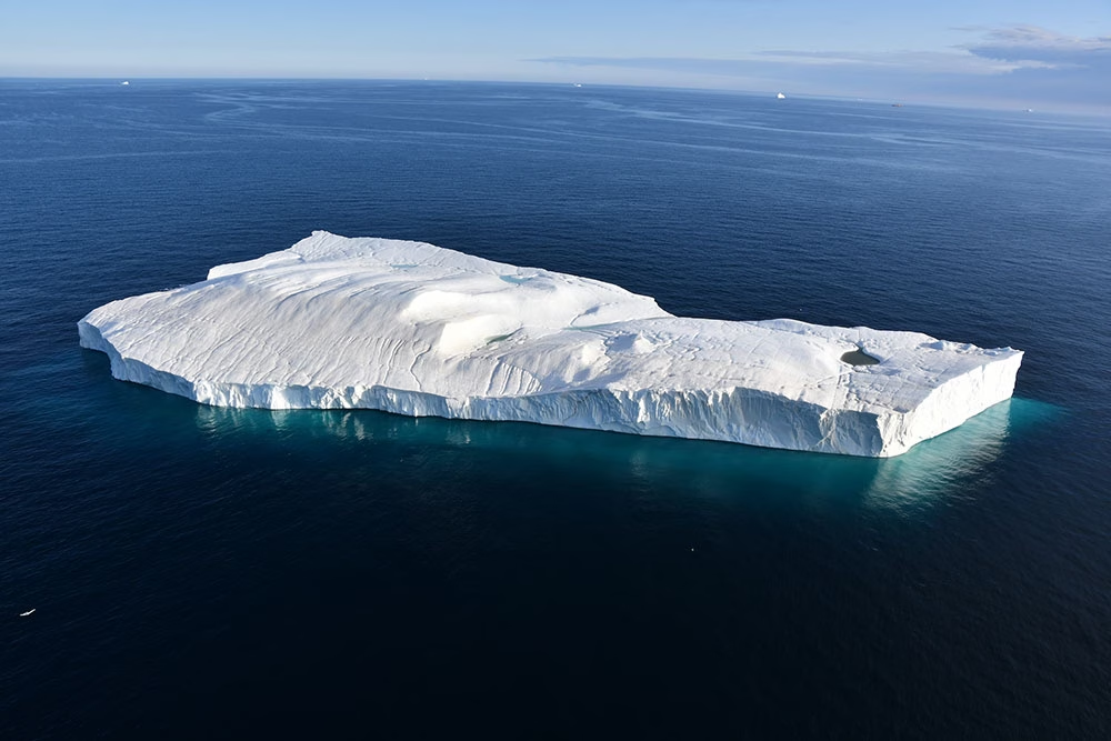
Since the early twentieth century, and most noticeably over the last 25 years, many glaciers around the world have been melting at an accelerated pace due to climate change. In the Arctic, this has led to an overall reduction in sea ice coverage, and an increase in the formation of large icebergs calved from glaciers and drifting out on the ocean currents.
A consequence of the overall reduction of sea ice in the Arctic has been an increase of 111% in shipping traffic in the region over the last 10 years, with fishing vessels also increasing significantly both in individual numbers and distance covered (41% and 37% respectively).
This increase in shipping vessels in Arctic waters means tracking the trajectories of icebergs has become even more critical to mitigate the risks they pose to shipping traffic, as well as to local communities and offshore infrastructure.
The Challenge
Arctic icebergs are smaller and more irregular than their Antarctic counterparts, making them harder to track. Traditional iceberg tracking methods, relying on ship observations, satellites, and aerial reconnaissance, are limited by weather conditions and are not sufficient for long-term risk management as Arctic shipping traffic continues to rise.
Over the last few decades, Ice Tracking Beacons (ITB) have been used to continuously monitor the movements of ice over the Arctic, providing valuable sources of information to complement radar and aircraft reconnaissance.
Short-term iceberg movement data can be utilized to create drift and deterioration models, while data on long-term movement paths can be applied to predictive modeling and enhancement of iceberg detection algorithms in satellite images. Additional data from the tracking beacons, such as tilt and heading, can also help determine how icebergs are drifting and deteriorating.
However, due to the high cost of commercially available ITBs, their use, and therefore efficacy, has been limited.
The Solution
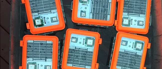
At the Water and Ice Research Laboratory in the Department of Geography and Environmental Studies at Carleton University, Adam Garbo and Dr Derek Mueller collaborated to design and construct the Cryologger, a low-cost, satellite-enabled tracking beacon that can be built at a cost of up to 10 times cheaper than the commercial alternatives.
The Cryologger is a data recording and telemetry platform that utilizes Arduino’s open-source software and hardware. It’s designed to be adaptable to meet specific remote environmental sensing requirements, using inexpensive, readily available components. With no specialized knowledge or tools needed for assembly, it is easily accessible for researchers, citizen scientists, and enthusiasts to create their own data gathering devices.
To monitor the icebergs, the Cryologger was specifically designed to be a ruggedized Ice Tracking Beacon (ITB) that could operate at Arctic temperatures.
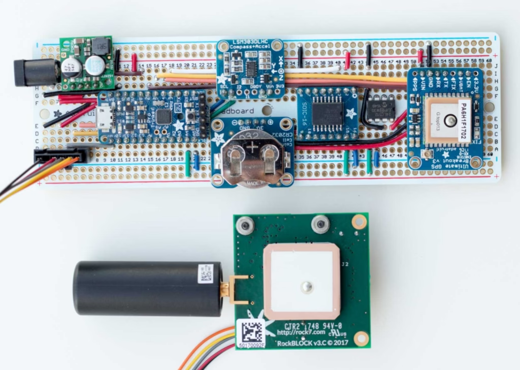
Each beacon contains the following components:
- GNSS receiver for positioning information
- Real Time Clock (RTC) for time keeping and alarm capabilities so the beacon could wake up at transmission times the power down to sleep mode
- Accelerometer and magnetometer to provide pitch, roll and tilt-compensated heading measurements
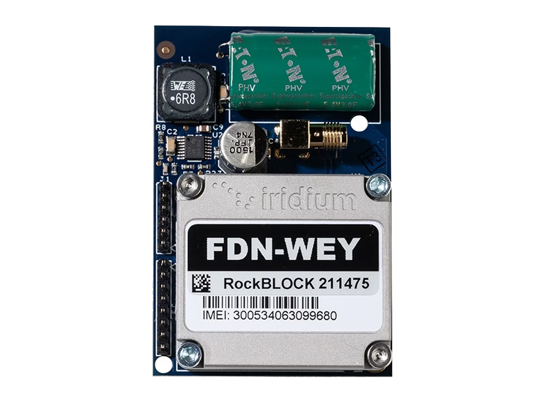
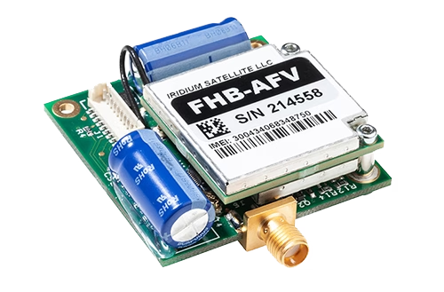
- RockBLOCK 9603 to transmit the data packets via the Iridium global satellite network, which has pole-to-pole coverage
- Lithium-based battery pack designed to absorb power spikes during satellite transmission
- Ruggedized, impact-resistant, IP67 waterproof case.
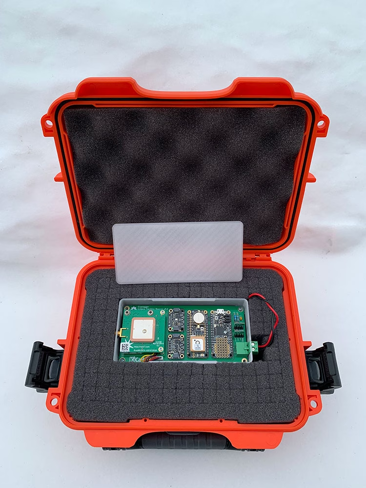
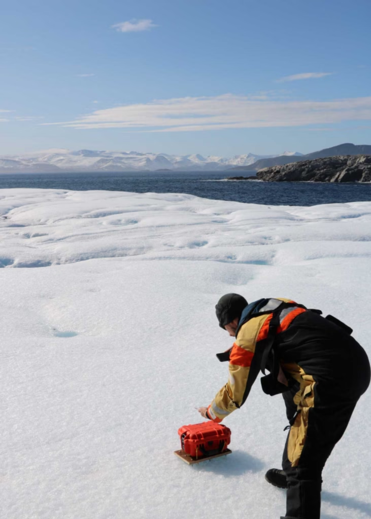
The Ice Tracking Beacon project involved each Cryologger being placed onto an iceberg or ice island to collect and transmit data for a minimum of 2 years. The ITB gathers data on location, temperature, pressure, battery voltage, and orientation every hour, and then transmits the data via satellite every 3 hours using the Iridium satellite network as a Short Burst Data (SBD) message, which can transmit up to 340 bytes.
Over the summers of 2018 and 2019, 20 Cryologger ITBs were deployed on icebergs and ice islands across the Arctic, including the coasts of Ellesmere Island, Baffin Island, and Greenland. Several beacons were also placed on the Petermann Glacier to monitor ice movement and prepare for anticipated major calving events
View Cryologgers' DataEnvironmental Monitoring with RockBLOCK
The advantage of developing low cost, open source technologies is the ability to design, deploy, test and improve continuously. The first wave of Cryologger ITBs exceeded their expected lifespans by a significant margin – one beacon was still active 5 years after deployment – and many of the issues experienced were related to relative unknowns, such as the impacts of the low temperatures the device components were exposed to, water ingress due to extreme weather conditions, or the deterioration of iceberg itself.
The data recorded by the ITBs over their lifespans and regularly transmitted by the RockBLOCK 9603s onboard has provided valuable insights into the potential of utilizing low cost, ‘real time’, in-situ environmental monitoring of icebergs and ice islands to supplement existing iceberg observation networks within the Canadian Arctic.
To find out more about the Cryologger Ice Tracking Beacon, visit https://cryologger.org/.
We’re Here to Help
If you need to transmit remote sensor data, such as location, movement, tilt and heading, we can help. We specialize in connecting devices and assets in remote locations beyond the reach of cellular connectivity.
We work with multiple satellite networks, and networking protocols, to ensure our customers’ needs are met cost-effectively and reliably. Please email hello@groundcontrol.com or fill in the form, and we’ll be in touch within one working day.
Mapping Monsoon Currents to Support Coastal Livelihoods
The UK’s National Oceanography Centre (NOC) is one of the world’s top ocean research institutions. NOC’s scientists work around the globe, uncovering links between the ocean, climate change and biodiversity loss, to help every living thing on our planet flourish.
The organisation solves challenging multidisciplinary, large scale, long-term marine science problems to underpin international and UK public policy, business and societal outcomes. NOC also operates the Royal Research Ships James Cook and Discovery and develops technology for coastal and deep ocean research.
About the Project
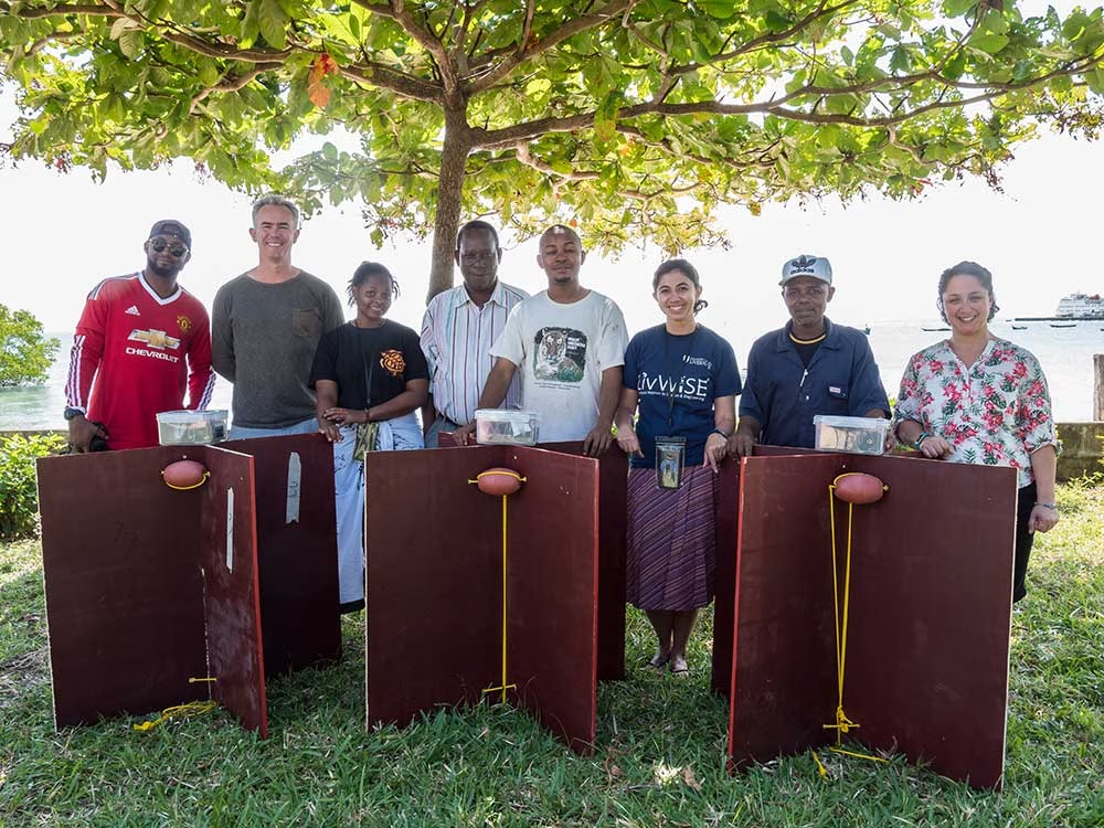
In the Western Indian Ocean’s Pemba Channel, monsoon seasons shape life above and below the surface. Understanding where currents accelerate, where eddies form, and how waters connect across borders is essential to safeguarding fisheries, supporting livelihoods, and protecting biodiversity. NOC led collaborative work within SOLSTICE-WIO to generate that evidence, while building local capacity so the benefits endure.
The Connectivity Challenge
The Pemba Channel is remote, energetic, and sparsely instrumented. Cellular coverage is unreliable; the science window is short. NOC needed a way to capture near-real time trajectories from small, battery powered drifters during the monsoon; robust enough for rough seas, simple enough to replicate, and affordable so partners could scale it into routine observing. The goal was decision-ready data to inform sustainable fisheries and coastal planning.
The Solution
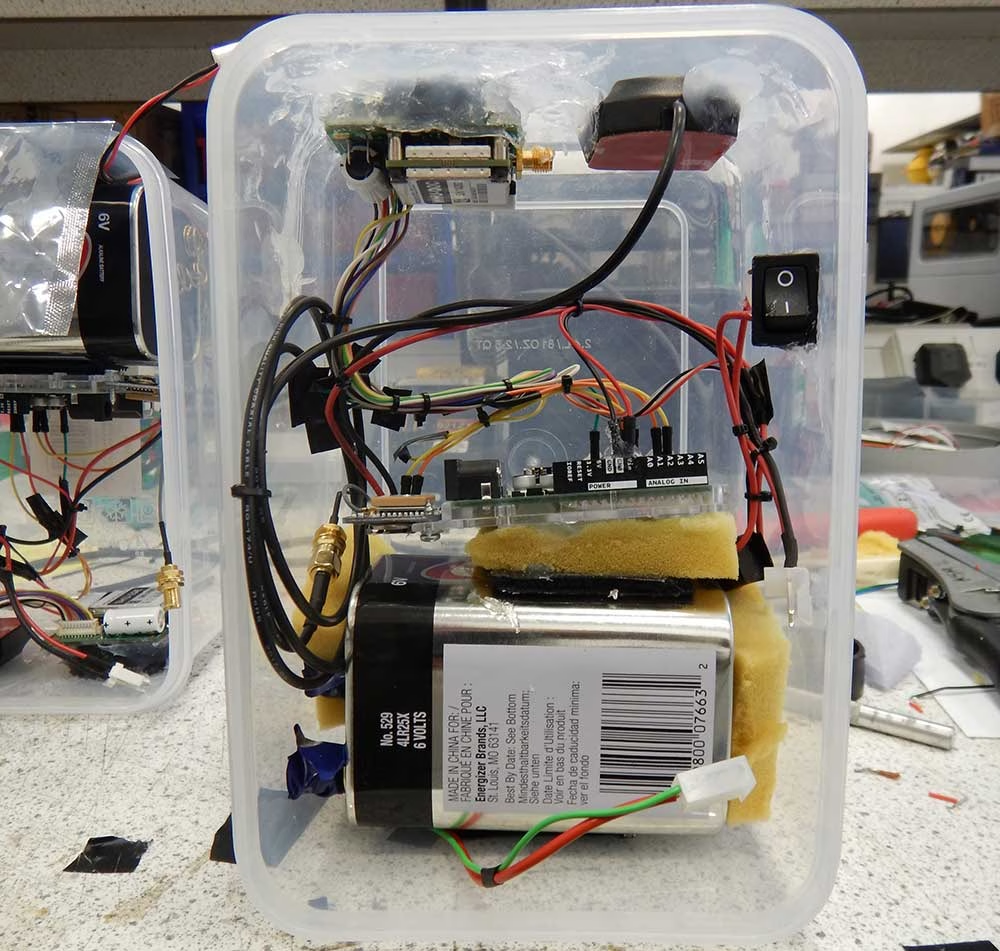
To achieve global connectivity from compact platforms, NOC integrated Ground Control’s RockBLOCK 9603 with Iridium Short Burst Data. The 9603’s small footprint, straightforward wiring, and low power draw made it a natural fit for locally built, low cost drifters assembled from off the shelf parts.
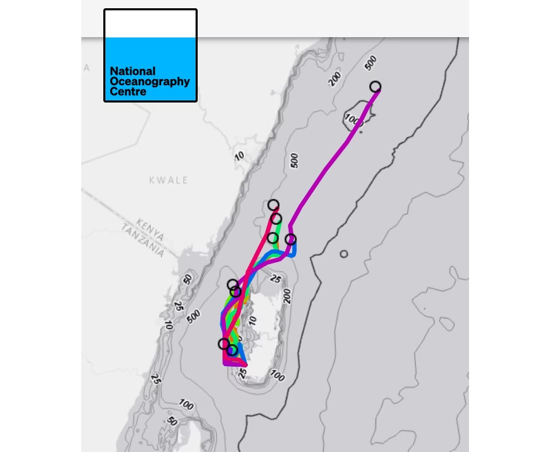
NOC and partners constructed a fleet of nine surface drifters and executed multiple deployments across tidal cycles and shifting winds. Each unit uplinked GPS positions via Iridium, feeding a simple tracking and visualisation workflow so the team, and regional stakeholders, could see the ocean move as conditions evolved.
Why RockBLOCK 9603 for Metocean Data?
RockBLOCK 9603 delivers global, two way Iridium Short Burst Data (SBD) messaging from compact, battery-powered platforms. It’s designed for harsh, remote environments where cellular networks aren’t an option, providing dependable links for position reports and sensor data whenever a clear sky view is available.
Integration is straightforward. The 9603’s small footprint (45×45×16 mm, ~39 g) and simple connector make it easy to embed alongside GPS and microcontrollers in space constrained builds. Clear developer documentation and example workflows help teams move quickly from bench testing to sea trials.
Power efficiency is a core advantage. Short wake cycles and low standby draw support long deployments on modest battery packs, which is ideal for lightweight drifters and autonomous systems. In practice, that means more time collecting decision ready data, and fewer retrievals or battery swaps.
The Results
- Actionable ocean intelligence: The drifters resolved fast central flows, persistent eddies, and strong tidal modulation. These features drive nutrient transport and productivity, shaping fish distribution and catch success. Turning them from invisible forces into mapped patterns helps align fishing effort with sustainability.
- Connectivity across borders: Tracks that exited the channel highlighted time dependent links into Kenyan waters, informing conversations about shared stocks and coordinated management.
- Capacity built in the region: Because the design is repeatable and affordable, partners can assemble, deploy, and interpret their own drifters, embedding skills locally, and creating a foundation for long term observation.
- Better models, better policy: Observations serve as ground truth alongside remote sensing, strengthening regional ocean models that underpin fisheries advice, marine planning, and climate resilience strategies.
Have a Remote Monitoring Challenge?
Ground Control has over 20 years’ experience in connecting very remote things, from data buoys to weather stations, animal tracking collars to wind farms. If you have an application that’s out of reach of cellular, we can help you bring your data home.
Tell us about your project by completing the form or emailing hello@groundcontrol.com; we’ll reply within one working day with expert, impartial advice.
Empowering Climate Resilience Through Satellite-Enabled Precision Farming
Synnefa was founded in 2013 in Kenya with a mission to create lasting solutions to challenges faced by farmers. The solution has developed over time, but the goal has remained the same: take the guesswork out of farming and improve production, through remote monitoring and trend analysis. After just two years, the team was providing services to 400 farmers; at the time of writing, in 2023, Synnefa works with over 8,726 farmers.


How It Works
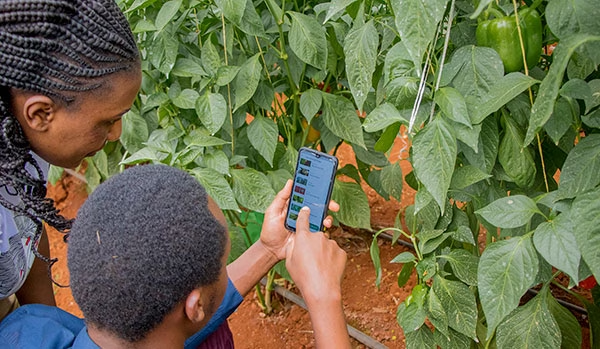
A typical Synnefa customer is a smallholder who works in the city and tends to their farm on a part-time or entirely remote basis. Using Synnefa’s FarmShield device, farmers gain access to sensor data including temperature, soil moisture, nitrogen levels in the soil and light intensity. Farmers can use this information to make educated decisions about when to irrigate or fertilize their crops; or they can use Synnefa’s smart greenhouses and drip kits which will automatically fulfil these tasks based on sensor data.
The FarmShield data is expressed in the FarmCloud software, which predicts the optimum harvest time and projected yield, and even allows farmers to sell their produce based on these projections. It’ll also provide suggestions for the most productive crops for each farm delivering precision farming through observation and measurement.
The Connectivity Challenge
Many of the farms supported by Synnefa operate outside of terrestrial infrastructure; there’s unreliable cellular or fiber coverage through which to transmit the FarmShield sensor data. In these circumstances, Synnefa utilizes the RockBLOCK 9602 satellite transceiver to backhaul their sensor data. Using Iridium’s Short Burst Data (SBD) service, this is as low-cost as satellite transmissions get, and helps to ensure that Synnefa’s subscription pricing remains within reach of the farmers that most need the support.
Synnefa chose the RockBLOCK 9602 in particular because of the robust modem that easily and quickly connects with the Iridium satellite constellation. It is reliable, and communicates well. The Cloudloop dashboard is user-friendly and gives Synnefa all information they need, such as messages sent and received, and connection details.
What’s Next?
Synnefa is committed to supporting three of the UN’s Sustainable Development Goals (SDGs): no poverty, zero hunger, and climate action. The response to their enterprise has been incredible:
- Farmers are saving water by over 50%
- Reducing fertilizer application rates by 41%
- Increasing production by 30% when compared to yields prior to the use of their devices.
The next steps are to expand the program outside of Kenya so that more farmers can benefit from greater yields and reduced wastage.
Do you have a agritech project that could benefit from satellite connectivity?
Synnefa is delivering meaningful, positive change for the farmers it works with, and Ground Control is very proud of the small part we play in making this project successful.
If you’d like to know more about how satellite technology is being used in agriculture, or you have a agritech project of your own which would benefit from improved connectivity, please get in touch; we have over 20 years’ experience and we’re here to help.
How Hack the Planet is Revolutionizing Anti-Poaching Efforts in Zambia
Hack the Planet is a non-profit organization dedicated to using advanced engineering and technology to address critical global challenges. They work on projects that have a positive social and environmental impact, collaborating with various partners like Greenpeace, WWF, and other conservation organizations. The team is a part of the digital product studio Q42, which provides them with access to a large pool of engineers to bring their ideas to life.

Combating Illegal Poaching Activities Within Zambia’s National Parks
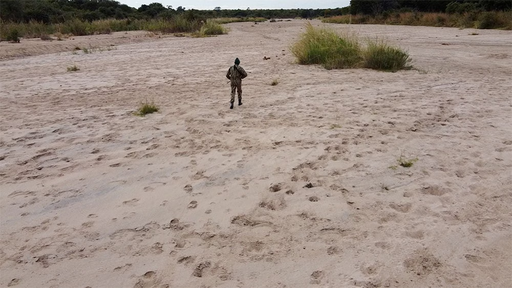
Poaching is a significant threat to wildlife, particularly in regions with endangered species. Hack the Planet’s services were engaged to find a solution for monitoring and preventing poaching in Zambia’s National Parks. Traditional methods are often resource-intensive and limited in their effectiveness, especially in vast, remote areas where quick response times are critical.
To overcome the challenge of connectivity in these remote areas, the team needed a reliable communication system to ensure that detection data could be transmitted in real-time to park rangers. This is where Ground Control’s services became crucial, providing satellite connectivity that ensured that the sensors could communicate effectively.
Tackling the Problem
To mitigate poaching, Hack the Planet needed a way to detect unauthorized human presence in national parks, specifically the presence of individuals who might be involved in poaching activities.
The solution had to be reliable, able to cover large areas, and operate in environments with limited connectivity.
A key technical hurdle was ensuring that the team’s sensors could communicate data from remote locations to park rangers in real-time.
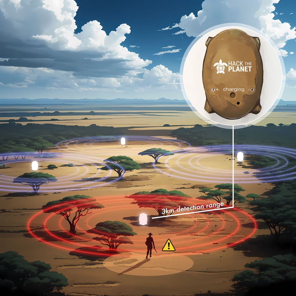
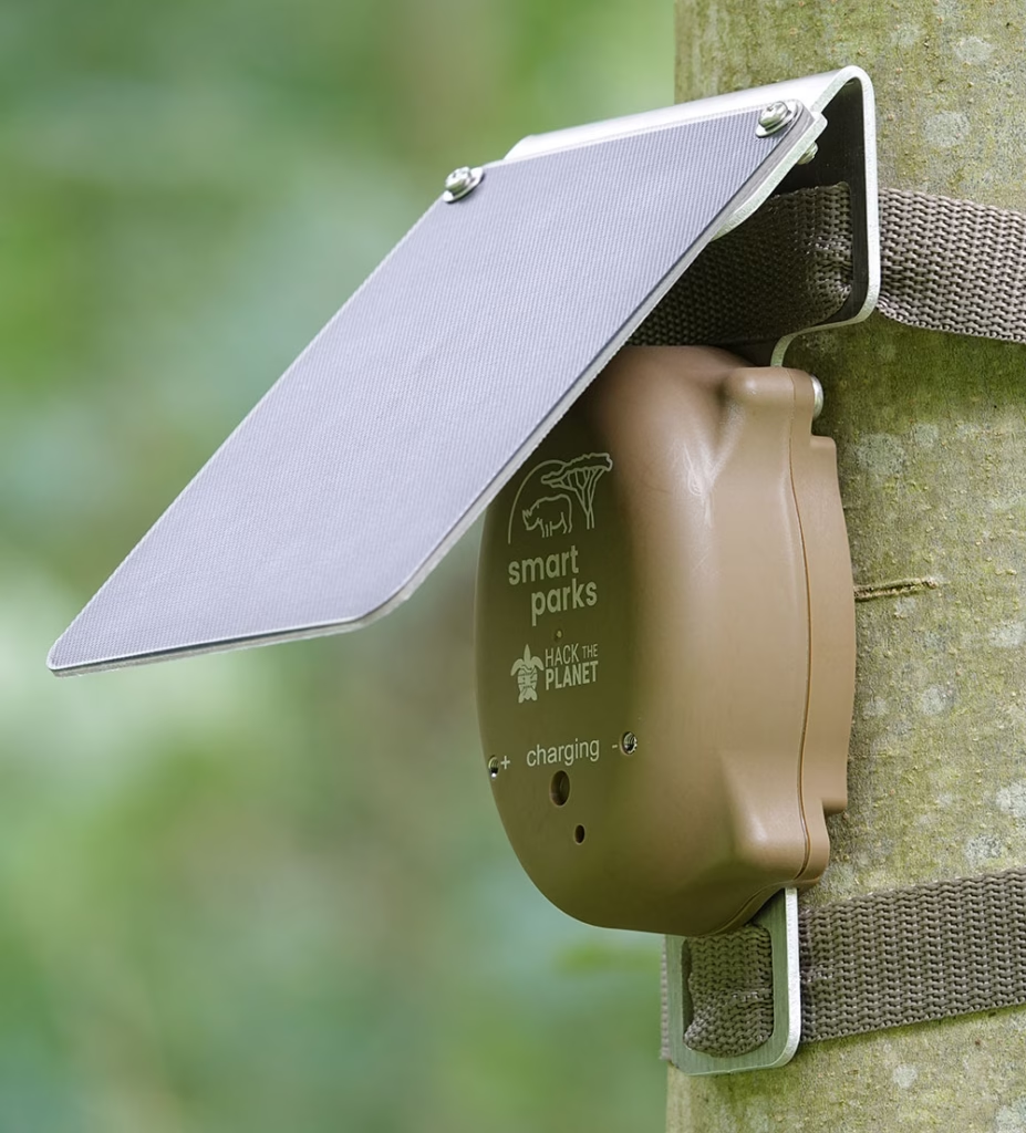
Hack the Planet developed sensor technology that detects the presence of cell phones in areas where they shouldn’t be, such as within national parks.
These sensors are strategically placed throughout the park and are capable of detecting signals from cell phones carried by individuals within a 3km radius, even in remote areas.
When a cell phone is detected, the sensor immediately relays this information to park rangers, who can then investigate and take action to prevent potential poaching incidents.
The Role of Satellite IoT
Ground Control played a crucial role in enabling the real time communication of Hack the Planet’s sensors by providing satellite connectivity through our RockBLOCK 9603 satellite modem.
This technology allows the team’s sensors to transmit data from remote areas of the park, where there is no cellular network coverage, to a central monitoring station.
This connectivity ensures that park rangers can receive alerts and respond swiftly, significantly improving the effectiveness of the anti-poaching efforts.
Looking ahead, Hack the Planet aims to expand this anti-poaching project to other national parks and regions facing similar challenges. They’re also exploring the potential of integrating additional technologies, such as AI-powered analytics, to enhance the accuracy and efficiency of their detection systems.
To contact Thijs and the Hack the Planet team, visit https://www.hack-the-planet.io/contact or email info@hack-the-planet.io.
“This ongoing collaboration with Ground Control and other partners is pivotal to our mission of using technology to protect endangered species and preserve biodiversity across the globe.”
Thijs Suijten – Hack the Planet
Can we help to solve your connectivity challenge?
If you have a project that’s limited by cellular coverage, we can help. We work with multiple satellite network operators and networking technologies to ensure our customers get the right combination of coverage, cost and reliability.
Please complete the form to tell us more about your project, or email the team at hello@groundcontrol.com. We’d love to help.
Obscape have been developing, manufacturing and supplying real time systems for environmental observations for over a decade. Their mission is to make high quality, environment observations easy. Obscape’s instruments are designed to be easily installed, compact, robust and low maintenance. The small size and integrated telemetry and solar power make Obscape’s instruments very easy to use and deploy.

Preventing the Causes of Flooding
A Government Agency responsible for coastal, storm water and catchment management assigned Obscape to assist with reporting on areas such as – monitoring and reporting on catchment management, flood risk areas, storm drains and drainage ditches with the aid of the RockBLOCK.
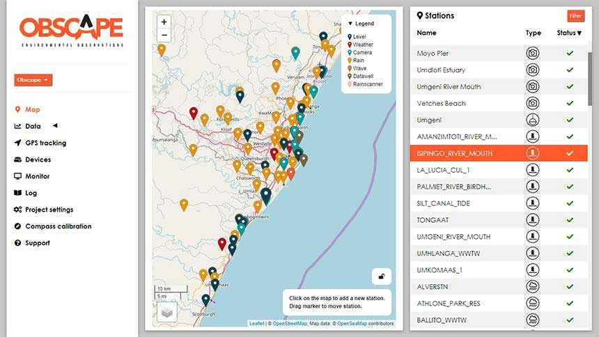
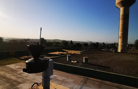
Blocked, overflowing systems can cause flooding, erosion, turbidity, storm and sanitary sewer system overflow, and infrastructure damage. Combining data received from Rock Seven (now trading as Ground Control)’s Iridium RockBLOCK 9602 modems, which can be located in Obscape’s Powered Telemetry Modules (PTM), Obscape clients are able to monitor and forecast these events visually from their powerful portal from a mixture of time lapse cameras, water level gauges, rain gauges, and weather gauges.
Reliable, Accurate Flood Mapping
With the aid of Ground Control products, Obscape confirms data by managing and monitoring developments in urban river corridors and wetlands as important natural features within the urban landscape; for the purpose of promoting multi-functional, sustainable use of river corridors and drainage systems.
By using Ground Control systems, Obscape can report on stressed areas in urban infrastructure in real-time and forecast where improvements in water infrastructure is required.
Collated data received and converted from Ground Control’s Iridium Modules enables Obscape to advise the Agency on predictive capabilities of flood mapping when looking at historical flood data paired with real-time and predicted weather and precipitation data.
PTM Modules Obscape have installed for the Government Agency
With the help of Ground Control’s location communication systems, Obscape have developed their durable monitoring systems to convey, repeatable accurate reliable information in the most efficient and cost-effective manner.
This includes collection of data using the RockBLOCK to transmit from remote areas; with the information transmitted back to the user without need to repeatedly visit a site.
Satellite communication information can be relayed through multiple RockBLOCK satcom devices with accumulated reporting to one Data Portal.
- Beach Surveys – Monthly
- Offshore Mapping
- Estuarine Surveys x 12
- Wave Buoys x 4
- ADCPs x 5
- Rain Radar x 1
- Wave Radar x 1
- Tide & Level Gauges x 50
- Rain Gauges x 60
- Weather Stations x 10
- Time Lapse Cameras x 40
- Real Time Water Quality x 17
- AIS Data Logging
- LoraWAN Gateway
- Offshore Weather Station x 1
“Ground Control improves the efficiency and quality of our environmental data gathering. By installing a RockBLOCK in our PTM we can guarantee a great investment and low running costs, reliability, resilience, operator ease of use installation and operation, data accuracy, quality assurance, quality control and data security.”
Obscape
Want to know more?
If you’re interested in Obscape’s environmental monitoring and reporting solution, or you have your own environmental software or hardware and want to explore integration options with Ground Control’s satellite tracking devices, we’d love to hear from you. Call or email us, or complete the form, and one of our experienced team will be happy to help.

Preventing Illegal Deforestation
Safeguarding the World’s Largest Rainforests
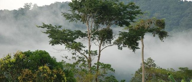
The world’s two largest rainforests, the Congo Basin and the Amazon, are under threat from illegal extraction activities. Unfortunately, both national and local authorities have long lacked the means and mechanisms to deal with these illegalities which destroy ecosystems and undermine both forest and indigenous people’s livelihoods.
Enter the Rainforest Foundation UK, now actively working with both national and local authorities with its ForestLink real-time monitoring system. Rather than relying on external or third-party observers, ForestLink relies on monitors living in the rainforest to act as watchdogs, alerting the Rainforest Foundation of suspected illegal activities via a bespoke smartphone app.

The Role of Satellite Connectivity
When GPRS isn’t available, the ForestLink system uses RockBLOCK and weatherproofed RockBLOCK Plus devices to exchange data via the Iridium network. After alerts are sent to a secure database, they’re analysed by NGOs and governments. Pending further details from community observers that help verify alerts, the Rainforest Foundation notifies the appropriate authorities.
The ForestLink system is currently used to address a wide range of threats that include illegal logging and mining activities, as well as oil spills. Working with local partner organizations, the Rainforest Foundation has trained over 30 communities in the DRC, Ghana, Cameroon, and Peru to use the system.
12 Million Hectares Protected
So far, thousands of alerts have been sent by community monitors, resulting in legal action against extractive industries. Since its inception, the Rainforest Foundation has helped indigenous and local communities protect more than 12 million hectares of rainforest.
The Rainforest Foundation has successfully empowered local populations by giving them the ability to secure and take control of their natural resources, as well as their individual and collective rights. Ground Control is extremely proud that satcomms can play a vital role to this end.
Facing similar connectivity challenges?
If you’re seeking a solution to a critical communications challenge, we can help.
Just complete the form and we’ll be in touch. We have offices in the USA and UK, and over 20 years’ experience in satcomms and IoT, plus access to the best airtime, devices and services available.
Off-Grid Fire Prevention Systems
Wildfire Risks and Challenges
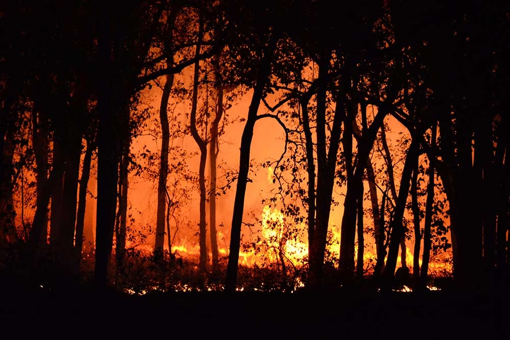
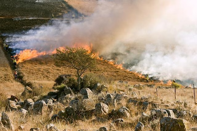
Every year, wildfires devastate tens of thousands of properties across the globe. Homes in remote locations are usually the worst affected, as they may be alerted too late; many homes in remote areas are outside GSM range and far from fire stations, or lack sufficient extinguishing capabilities.
Regular home fire safety equipment (alarms and extinguishers) rely on a fire to have already entered the premises or someone to be home to raise the alarm. Though standard fire safety equipment can assist small fires, wildfires are fierce and the devastation quick, resulting in loss of assets and even loss of life. So whether at home or away, access to a robust safety system is incredibly important.
Off-grid fire prevention systems can protect properties and communities as a whole, but reliable, continuous transmission of data is paramount to any safety systems ongoing success.
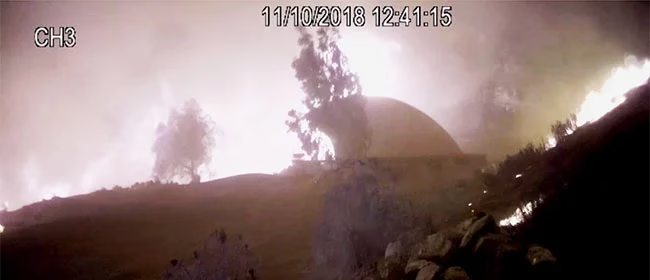
Hot Shot Automatic Personal Home Fire Department System
James Dziadulewicz, B.S. Eng. mechanical and electronics engineer, built an automated off-the-grid fire prevention system called the Hot Shot Automatic Personal Home Fire Department System. It detects wildfires in real-time and generates a virtual progression map.
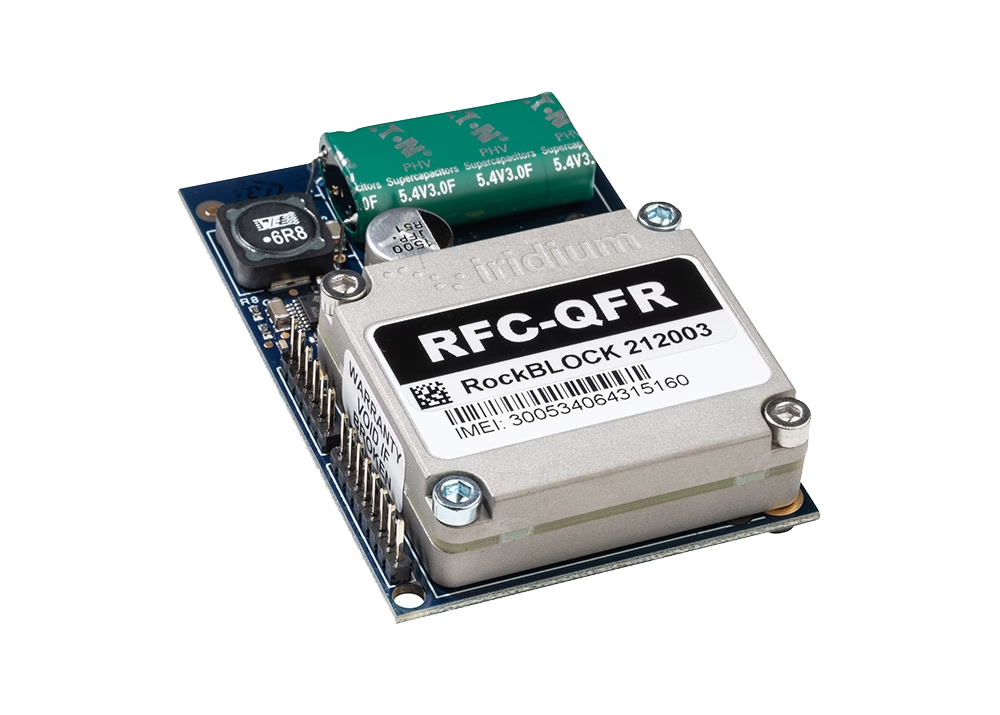
The technology uses a RockBLOCK 9602 to send the data to the app built by James’ friend Matthew Jenks, a software and electrical engineer.
Since RockBLOCK is a two way communication system, a command can then be sent back to the system to trigger the high pressure sprinkler system to drench the property and save the home. A process which was followed and succeeded in a real-life event in 2018.
“This is a satellite-based system that’s activated by our smart mesh network of sensors or a cell phone. Our [Malibu] Home survived a trip to hell, untouched as it was by the worst of the Malibu wildfire. This invention works.”
James Dziadulewicz, Creator of Hot Shot Fire Prevention System
RockBLOCK: Plug-and-Play Satellite Connectivity
RockBLOCK 9602 is a versatile, compact, low power and dependable way of sending and receiving data from remote homes. It uses the Iridium satellite network, giving truly global coverage and is a vital part of fire prevention systems.
Already being used by a number of remote homes with patents pending, we’re hoping to see systems being rolled out over more areas with high fire risks.
- Truly global two way coverage
- Low power usage, small antenna
- Plug-and-play product, simple setup
- Reliable data transmission with acknowledgements
- Lifetime phone and email support.
Built with Ground Control
The work we support genuinely inspires us, and we’re proud to be a part of the innovative solutions created by our partners and customers.
If you’d like to get in touch with the team either to discuss a challenge similar to that of the one above, or something completely different, our team of experts will be happy to provide objective advice.
Drifting Buoys are versatile kits that anyone with the know-how can use to retrieve their own oceanic data. Generally, the main purpose of drifting buoys is to measure ocean currents and sea temperatures, the data of which is then transmitted back to research labs on the mainland for analysis.
The data provides vital intelligence for weather and climate models and ultimately aids in the better understanding of ocean behaviour and intensity forecasting.
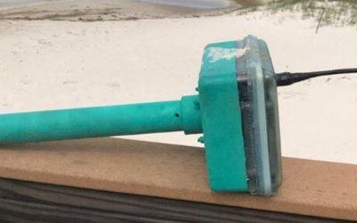
The Maker Buoy is a solar-powered, Arduino-based research buoy that measures ocean drift and sea temperature and carries a RockBLOCK 9603 to transmit position, water temperature, and other data via the Iridium satellite network.
The unit can be built by hobbyists, researchers, and meteorological organizations, and data shared is used to further our understanding of our oceans.
Maker Buoy supplies various options: a bare PCB, a populated PCB, a complete kit for the end user to construct themselves, and a complete unit. One of the most notable users of Maker Buoy is The Ocean Cleanup.
The Challenge
Drifters are sometimes thrown in the ocean in the path of typhoons and hurricanes to gain a better understanding of ocean behavior. As such, components need to be long-lasting and compact enough to ensure efficient use of space.
Projects range from small scale hobby projects through to high budget global schemes, so accessibility by hobbyists, researchers, and organizations alike is key.
The Solution
RockBLOCK 9603 is a versatile, compact, low power and dependable way of sending and receiving data from remote locations. It uses the Iridium satellite network, giving truly global coverage.
RockBLOCK is readily available to anyone with a passion for IoT who wants to send and receive data from remote locations – such as the middle of ocean.
- Truly global two way coverage
- Low power usage, small antenna
- Plug-and-play product, simple setup
- Reliable data transmission with acknowledgements
- Lifetime phone and email support.
“A nice feature of Ground Control’s RockBLOCK Iridium satellite SBD service is the ability to forward messages to another modem, allowing access to Maker Buoy data in locations without Internet access.”
Wayne Pavalko, Maker Buoy Founder
Built with Ground Control
If you’re exploring your own ocean and coastal monitoring buoys project, please call or email us, or complete the form, and we’ll be happy to help. We have offices in the UK and USA, and 20 years’ experience in satellite connectivity, so you’re in safe hands.
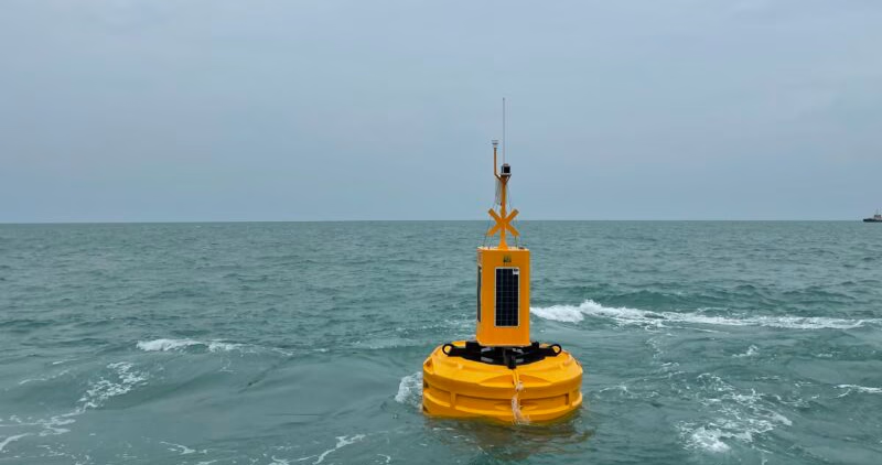
Data Buoys for Offshore Telemetry
Data Buoys purposes can include measurements of water temperatures, salinity, drift patterns, and pollutant levels, which inform a large number of personal and global projects from boat manufacture through to meteorology and climate change.
Working with Bangor University on the SEACAMS2 Project, Ocean Scientific International Ltd (OSIL) is using RockBLOCK 9602 for the satellite communications element for its telemetered data buoys. The buoys collect and measure oceanographic, meteorological, and water quality data parameters around the coast of North Wales to assess renewable energy opportunities.

The Challenge
Regardless of deployment location, buoys will often find themselves drifting to remote locations where mobile GSM just can’t reach or is intermittent.
The data collected is vital and therefore continuous, reliable transmission is paramount to its ongoing success.
What’s more, any components of the buoy need to be compact enough to ensure it doesn’t take up vital space in the equipment used to remain lightweight.
The RockBLOCK Solution
RockBLOCK 9602 is a versatile, compact, low- ower, and dependable way of sending and receiving data from remote locations. It uses the Iridium satellite network, giving truly global coverage. RockBLOCK 9602 is used when the buoy is out of range of cellular networks to allow data to be sent and received regardless of location.
- Truly global two way coverage
- Low power usage, small antenna
- Plug-and-play product, simple setup
- Reliable data transmission with acknowledgements
- Lifetime phone and email support.
“We enjoy working with Ground Control as they offer great, sensibly priced products with excellent after sales support and an easy to use online portal.”
Rob Luthwaite, OSIL Project Manager
Built with Ground Control
The work we support genuinely inspires us, and we’re proud to create solutions and solve customer problems like no one else can.
If you’d like to get in touch with the team either to discuss a challenge similar to that of the one above, or something completely different, our team of experts will be happy to provide objective advice.
Introducing the Eldorado Space Program
Instrumentation packages are often sent into the upper atmosphere via high altitude balloons to collect a wide range of data. Data transmission can be achieved using both satellite and microwave links, and the data itself can include down range velocity, vertical ascent rate, latitude, longitude, elevation, system health, signal strength, down range distance, heading and trajectory, and more.
A 17-year veteran of Sandia National Labs and founder of a Silicon Valley nanotechnology company, teacher Paul McWhorter established his high school’s first Space Program.
Edorado High School sends instrumentation packages, called Eagles, to the edge of space and transmits back temperature, pressure, and GPS data, as well as live video. In all, twenty different data channels are telemetered back to ‘Mission Control’ in the classroom.
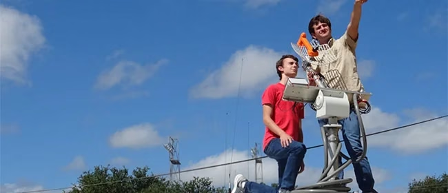
Due to technical and regulatory requirements, a high-gain microwave antenna on the ground is needed. The challenge here is that a high frequency microwave radio beam has poor propagation so it must be pointed extremely precisely at the space-bound instrument package.
Pointing errors of just a few degrees can lead to loss of signal, so a separate and reliable way of transmitting the GPS location of the remote device is needed to help keep the microwave antenna aimed in the right direction and re-establish a link if lost.
This is where RockBLOCK 9602 comes in. RockBLOCK 9602 acts as a back-up system to help the main microwave array maintain and regain connection.
“Mission Success depends on reliable transmission of GPS coordinates from the instrument package back to the ground, We have chosen the RockBLOCK modem and Iridium satellite network because it provides rock solid connectivity.”
Christine Lindsey, Mission Specialist
RockBLOCK 9602: Plug-and-Play Satellite Connectivity
RockBLOCKs are a versatile, compact, low-power, and dependable way of sending and receiving data from remote locations. Devices use the Iridium satellite network, allowing truly global coverage.
GPS data is transmitted via RockBLOCK to Ground Control’s servers. It’s then pushed via HTTP post to the client’s server which adjusts the high-gain antenna position accordingly, thus maintaining the links.
Key Features for Educators:
- Truly global two-way coverage
- Low power usage, small antenna
- Plug and play product, simple setup
- Reliable data transmission with acknowledgements
- Lifetime phone and email support.
Supporting Educators
The work we support genuinely inspires us, and we’re proud to create solutions and solve customer problems like no one else can.
If you’d like to get in touch with the team either to discuss a challenge similar to that of the one above, or something completely different our team of experts will be happy to provide objective advice.
Smart Bird Boxes for Remote Wildlife Monitoring
Okala’s conservation scientists and software engineers use a combination of methodologies, including camera traps, bioacoustics, and remote sensing, to assess biodiversity and monitor environmental impact. They effectively leverage AI and machine learning for data analysis, offering expert-verified insights and a dashboard for visualizing and understanding nature data.
Known for delivering scalable, science-driven nature monitoring and compliance solutions, Okala partnered with Ground Control to create a new kind of remote sensing device – a smart birdbox equipped with a camera, digital scales and satellite connectivity that can be deployed in any environment, to track and monitor birdlife.

This marked the beginning of Project Pyedwagtail. The mission? Build a rugged, low-power system capable of collecting and transmitting wildlife data from anywhere in the world, even the most remote and inaccessible regions.
The challenge set by Robin, CEO of Okala, was deceptively simple: “We need a smart bird box with a camera that we can deploy anywhere.”
However, delivering on that vision required a blend of hardware innovation, software efficiency, and robust, reliable connectivity. The system needed to detect when a bird was present, or absent, inside the birdbox; capture images automatically, record temperature readings both inside and outside the box, and transmit all of the data to Okala’s conservation management platform. It had to be low power, compact and resilient, function entirely off-grid, and communicate via satellite from any location on Earth.
The Challenge Takes Flight
The Okala smart birdbox solution is built around four key stages: sensing, imaging, satellite transmission, and cloud integration. At the core of the sensing solution is a simple but effective digital scale mounted inside the birdbox, which communicates with a Raspberry Pi via the I²C interface. This setup enables the system to detect when a bird enters the box, monitors changes in weight over time, identifies how many birds are present, tracks egg-laying events, and even determines when chicks fledge. These weight changes also trigger automatic photo captures. While the Ground Control team could have implemented a more complex machine learning model, we opted for a simple, reliable mechanism for minimum power consumption and complexity.
To capture images, we utilized a Raspberry Pi Camera Module 3 and the libcamera library. Each triggers a photograph, saved as a JPEG file. However, since the size of JPEG files can vary dramatically based on image complexity, such as a blue sky versus the intricate details of a bird’s feathers, Ground Control developed a smart resize function. This function compresses images intelligently, optimizing file size for efficient satellite transmission without compromising essential visual detail. The next challenge is transmitting the data back to Okala.
See This Explained Live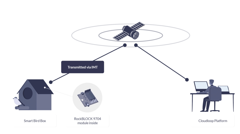
RockBLOCK 9704
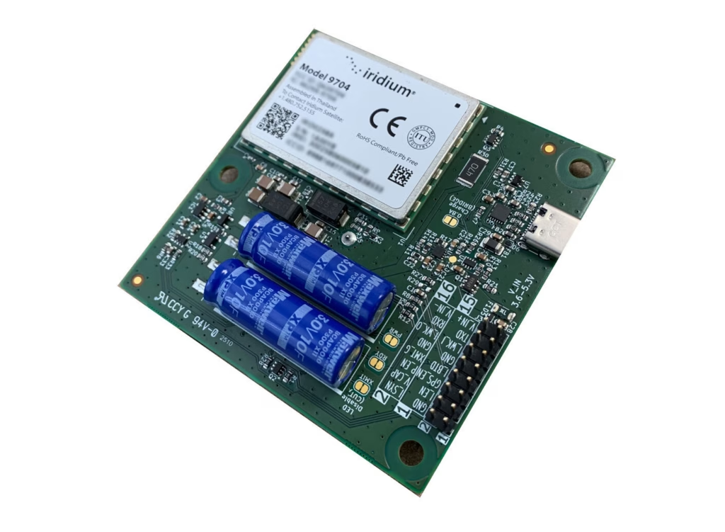
For this project, reliable, global satellite connectivity is achieved via RockBLOCK 9704, a compact satellite modem that utilizes the Iridium global satellite network, and Iridium’s IMT (Iridium Messaging Transport) service. IMT enables the system to send and receive messages of up to 100Kb, with very low latency, from anywhere in the world.
RockBLOCK 9704 operates with very low power requirements, consuming less than 5 mW in sleep mode and peaking at 1.4 W during transmission. RockBLOCK’s Python and C libraries made integration incredibly simple, with only a few lines of code required to send data.
Of course, the satellite module is only one piece of the puzzle. Once the data is returned from the satellite, it needs to be routed securely and reliably to Okala’s system. This is where Ground Control’s Cloudloop Data platform plays a critical role.
Cloudloop Data
Rather than requiring custom code to decode device messages, Cloudloop Data takes care of the translation and seamlessly delivers the data to Okala, whether via MQTT, HTTPS, AWS, Azure, or other services. It’s built to ensure data reaches its destination in the correct format, no matter the protocol – SBD or IMT. By handling the complexity of proprietary device communication, Cloudloop accelerates integration and significantly reduces development time. Even if Okala’s servers are temporarily offline, Cloudloop securely stores all incoming data to guarantee nothing is lost. The platform also supports devices from other manufacturers, making it highly adaptable for diverse IoT applications.
And the cost of the project? The total system was surprisingly cost-effective. The RockBLOCK 9704 module costs $279 and operates on either prepaid plans starting from $0.29 per KB, or post-pay contract plans which are even lower cost. Given the power of the technology and the low cost of deployment, it represents an accessible, scalable solution for conservation projects of any size.
Beyond The Birdbox
By combining Okala’s expertise in AI-powered conservation platforms with Ground Control’s proven track record in global satellite IoT, Project Pyedwagtail has demonstrated what’s possible in smart, remote wildlife monitoring.
The result is a simple but robust system that can send photographs, environmental data, and near-real time alerts from any location on Earth, with nothing more than a Raspberry Pi, a few sensors, a RockBLOCK 9704 module, and some participating wildlife.
While the project started with the concept of a smart birdbox, the implications are further reaching. The combination of camera traps, intelligent sensing, and global satellite connectivity has applications across wildlife monitoring, ecological research, remote surveillance, and even anti-poaching operations.
This ability to gather visual and environmental data in near real time from remote locations opens new possibilities for field researchers, conservationists, and environmental organizations worldwide.
We’re Here to Help
If you need to transmit sensor data from remote environments, whether it’s wildlife activity, environmental metrics, or atmospheric readings, we’re here to help. At Ground Control, we specialize in connecting devices and assets in the most inaccessible locations, far beyond the reach of traditional cellular networks.
By leveraging multiple satellite networks and communication protocols, we deliver cost-effective, reliable solutions tailored to your needs. Get in touch with us at hello@groundcontrol.com or fill out the form. We’ll get back to you within one working day.
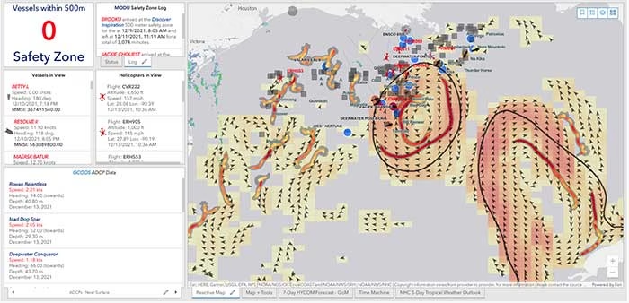
40Geo captures geographical information from hard-to-reach areas and analyses it to deliver situational awareness, competitive intelligence, and advanced visualization for supply chain optimization. One of the means 40Geo has of collecting data is utilizing drifting data buoys, which are deployed into areas being used for, or potentially used for, oil and gas exploration and extraction.
These data buoys capture wave height, temperature, wind speed, and over time, forecast patterns in ocean currents. They can even detect volume and frequency of other passing vessels by tapping into the radio signals sent out from boats. With 40Geo’s analysis, this becomes powerful data to aid decisions about when and where to situate off-shore oil and gas operations.

The Challenge
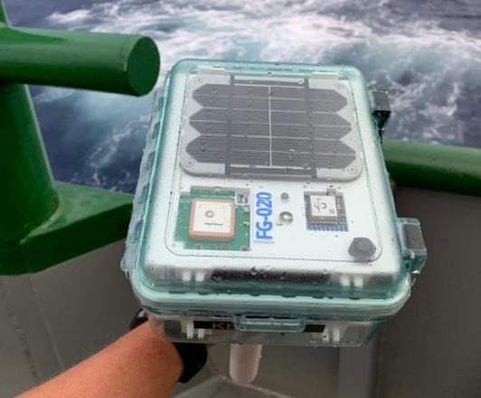
Many areas suitable for oil and gas extraction are also very remote, so backhauling that data from the data buoys to 40Geo’s servers requires a satellite connection. To date, 40Geo’s drifting data buoys have leveraged Ground Control’s RockBLOCK 9602 for this application, placing the transceiver into a waterproof box on top of the buoy.
This gives the team close to real time data under any circumstances, as the L-Band frequency that the RockBLOCK 9602 leverages is not affected by weather conditions. It’s also completely global coverage because it uses the Iridium satellite constellation; no matter where the buoy drifts to, 40Geo will be able to pinpoint its location.
The Evolution
In the Gulf of Mexico, an area rich in oil and gas reserves, there are two considerations that make 40Geo’s current data buoys less optimal. Firstly, there is cellular network coverage for a reasonable amount of the gulf, which, because it’s often lower cost compared to satellite transmission, will be the preferred means of sending and receiving data.
Secondly, there are powerful currents that can send the unpowered data buoys well away from the areas that are of most interest to 40Geo’s oil and gas customers.
The Solution
40Geo is in the final stages of launching a new USV (unmanned surface vessel) which has the ability to be remotely operated, meaning that if it should travel out of the area under inspection, the operator can put it back on course. In addition to this, the new autonomous vehicle will utilize RockREMOTE Rugged rather than the RockBLOCK 9602 for its data transmission.
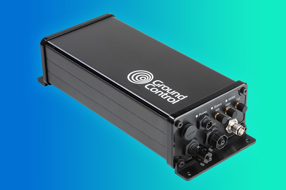
This is because RockREMOTE Rugged is a hybrid LTE-M / Certus 100 / Iridium Messaging Transport (IMT)-capable device, allowing the 40Geo to use a single ‘box’ for all of their connectivity requirements. RockREMOTE Rugged can be configured to leverage the cellular network whenever available, and seamlessly switch to satellite when cellular data is unavailable, giving the 40Geo team the perfect balance of optimized costs and 100% connectivity.
“We chose the RockBLOCK because it delivered exactly what we needed: plug-and-play satellite connectivity that delivers close to real-time data. The developer documentation is thorough and the API interface works well. The RockREMOTE is an exciting evolution allowing us to provide more data while controlling costs; this is the sort of innovation that will propel satellite IoT applications forward.”
Miles Roden, COO, 40Geo
The USV will be able to undertake other tasks in addition to its main purpose of measuring wave height, wind speed etc. For example, a weather balloon can be launched from the platform to capture data from hurricanes. It simply wouldn’t be possible to launch this from an oil rig because of the fire risk from the sensing equipment and the helium (although the risk is small, helium is listed as hazardous by some operators), and the potential for the balloon to impact drilling equipment.
40Geo’s multitasking USVs can be used for many different applications, including air quality monitoring after oil spills, surveys of ocean currents for renewable infrastructure planning, video inspection of unmanned assets, marine mammal detection, and any other tasks that clients can envision.
Would you like to know more?
If you’re interested in 40Geo’s data buoys, or you have your own tracking software and want to explore integration options with Ground Control’s satellite tracking devices, we’d love to hear from you.
Call or email us, or complete the form, and one of our experienced team will be happy to help.