Airtime: SBD
The role RockBLOCK 9603 plays in the removal of carbon from open oceans
Running Tide is on a mission to restore ocean health and productivity, rebalance the carbon cycle, decarbonise global supply chains, and revitalise coastal communities.
Running Tide’s multidisciplinary team designs and develops integrated software and hardware systems, including monitoring and measurement capabilities to deploy nature-based interventions that remove carbon, combat ocean acidification, and increase the scientific understanding of ocean ecosystems.


The Global Carbon Challenge
Globally, 100–1000 billion tons of CO2 must be removed from the atmosphere before the end of the century to reach long term climate goals of the Intergovernmental Panel on Climate Change (IPCC). One impact of this will be to lower the levels of acidity in the ocean, which by some estimates, has already absorbed 30% of the 2 trillion tonnes of CO2 emitted since the beginning of the industrial era.
The high acidity is wiping out marine species and contributing to coral bleaching; by reducing ocean acidification, we can protect marine life, and prevent greater food insecurity. Development of technologies that drive large-scale intervention to move CO2 from the fast carbon cycle to the slow cycle are essential to achieving this goal.
The deep ocean is a massive reservoir that, by current estimates, stores 37,000 gigatons of carbon. Efficiently and effectively moving measurable quantities of CO2 from the fast cycle back to slow, while not disrupting or causing damage to marine life, requires both nature-based innovation and satellite-based technology.
Ocean-Based Carbon Removal
Running Tide is developing a global carbon removal system with the capability to integrate and amplify natural carbon removal pathways. It processes sustainably sourced, carbon-rich terrestrial biomass into buoys, to be deployed in the open ocean and dispersed by ocean currents.
Buoys are coated with calcium carbonate or similar alkaline materials, and when placed in the open ocean, the carbon buoy partially dissolves, thereby sequestering CO2 through a recognised carbon removal process known as Ocean Alkalinity Enhancement (OAE).
Running Tide also incorporates macroalgae in its carbon removal system. Buoys can be seeded with macroalgae, and in the duration that the carbon buoys float, the macroalgae fixes carbon while it grows. Once the buoys absorb enough water to lose buoyancy, they rapidly sink, transporting the embodied fast carbon to the deep ocean (slow carbon cycle), where it remains for centuries or millennia.
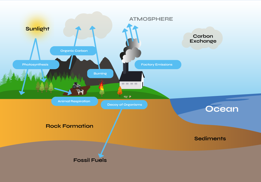
Moving To The Slow Carbon Cycle
This process effectively transports carbon, stored in both the macroalgae and terrestrial biomass within the buoy, thereby removing it from the fast cycle to the slow carbon cycle. The system amplifies existing natural processes, and utilizes low-energy inputs (gravity, photosynthesis, and ocean currents). Running Tide’s carbon removal system is highly scalable, and shows the promise of a solution that can meet the scale of the problem.
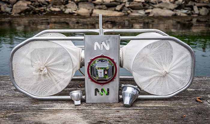
To measure the efficacy of carbon buoy deployments, Running Tide utilizes a fleet of verification buoys that are deployed alongside the carbon buoys at sea, part of the company’s detailed quantification platform.
Powered by RockBLOCK 9603
Capturing data from the carbon buoy deployments is essential to understanding their rate of progress, and satellite connectivity for the data transmission is essential. While designing their verification buoy fleet, Running Tide conducted a deep dive into the available satellite communication options, and selected RockBLOCK 9603.
This Iridium-powered, plug-and-play transceiver sends and receives messages via Short Burst Data (SBD) from anywhere on Earth with a view of the sky. This makes the device the optimum solution for reliable data transmissions from Running Tide’s verification buoys.
The data transferred is designed to quantify the carbon removed and optimize the system for future deployments: including those related to the size and composition of buoys, the lifecycle of the macroalgae, and the timing and location of deployments.
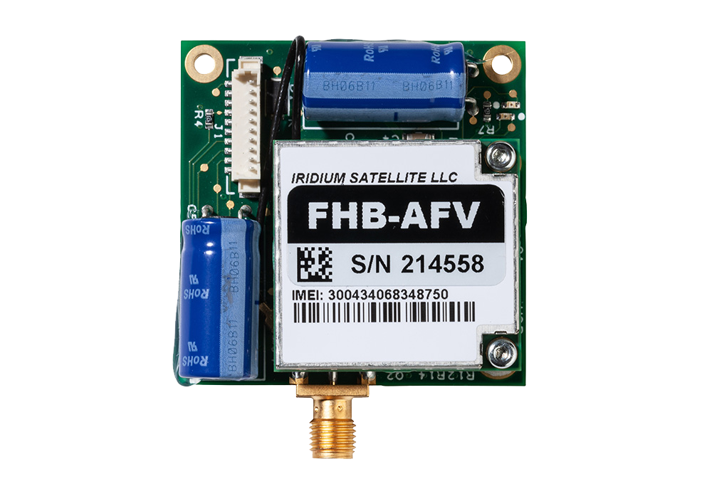
“Capturing comprehensive and accurate data in the early stages of the carbon buoy roll-out is particularly important so we can model the impacts of each iteration of our interventions and the progression of macroalgae in future deployments. We chose the RockBLOCK 9603 because it provides global coverage, has competitive and flexible data plans, and is integrator friendly to our existing carbon removal system.”
Tim Dyson | Senior Electrical Engineering Manager | Running Tide
What’s Next?
In December 2022 and January 2023, Running Tide launched two deployments of verification buoys out of its base in Iceland, which encapsulated RockBLOCK 9603 technology. Ultimately, Running Tide’s carbon removal system aims to not only restore and amplify the transfer of carbon from the fast cycle to the slow at scale, but to also create carbon-negative supply chains that drive decarbonization across a number of additional critical industries.
Would you like to know more?
With over 20 years of satellite experience, the Ground Control team is well placed to help keep you connected when it matters the most.
Whatever your communication or connectivity needs, we can help. Talk to one of our team to discover our products and services and how they can benefit, improve and streamline your applications.
Enhanced Real Time Tracking and Communications with TracPlus
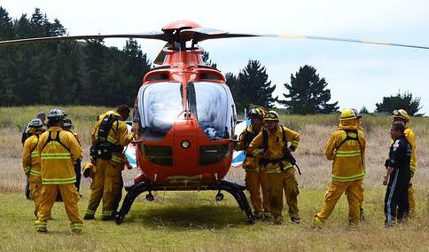
TracPlus is the trusted real time tracking and communication platform used by first responders, government agencies, militaries, and other critical operators around the world. Their platform has been developed to deliver situational awareness to first responders, irrespective of who owns the asset, what the asset is, who provides the tracking, or what the platform or signal type is – be it radio, cellular or satellite.

Delivering mission critical information to the right people
TracPlus was developed in response to an avoidable tragic event. The event highlighted the need for a solution that would allow operational data to be shared with first responders, enabling them to better plan, communicate and coordinate their activities. Through collaboration and insight from customers, the platform has continued to evolve. Providing robust, real-time tracking, voice and messaging software across aviation, maritime and land-based markets.
To power the platform, devices which reliably transmit tracking and communication data need to be fitted to all assets. Devices need to be convenient, cost effective and able to withstand increasingly challenging environments. To ensure they could help customers achieve superior outcomes without forcing them to adapt their working practices, TracPlus partnered with a number of manufacturers.
The Challenge
Motivated to find best-in-class tracking devices for their customers, TracPlus contacted Rock Seven (now trading as Ground Control), to trial the RockSTAR and RockFLEET. Following the trial’s success in 2014, TracPlus started using both devices to support their land-based and maritime customers.
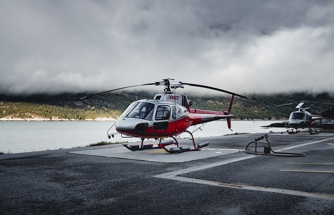
However, at that time there was nothing within the product range to reliably support aviation tracking. So TracPlus approached Ground Control to see whether anything could be created to deliver similar capabilities to their aviation customer base.
Ideally, TracPlus needed a device which was aircraft vibration certified, could easily connect into the cockpit and able to deliver reliable, global tracking.
The Solution
Ground Control worked with TracPlus to design, develop and manufacture a new device – the RockAIR. Utilizing their insight and experience working with aviation operators, TracPlus were able to advise on device design and key features, and Ground Control were able to manufacture the unit to mirror some of the previous product range features, namely dual mode.
Dual mode enables the unit to switch from mobile cell-networks to the Iridium satellite network when out of GSM range. Meaning TracPlus could guarantee their customers complete coverage, within a cost effective framework.
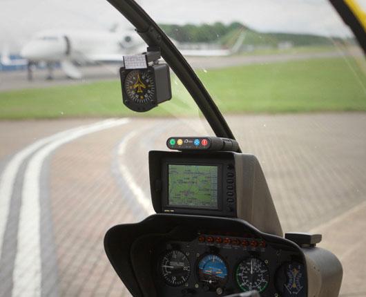
The RockAIR is designed as a carry on, carry off unit, able to quickly mount onto the dashboard or windshield of light aircraft and road vehicles. It also provides reliable tracking data every 15 seconds which can easily be interpreted by the TracPlus platform.
“Collaborating on the RockAIR, meant we could use all of our customer and industry insight, to ensure the device was capable of delivering true peace of mind to our customers. Ultimately, we pride ourselves on being able to bring people home safely through seamless tracking and communication. Anywhere. Anytime. To do this, we have strived to engage with industry players so that we are at the forefront of meeting their rapidly changing needs. The RockAIR is a great example of this, and one we’re very proud of.”
Todd O’Hara, CMO, TracPlus
The Result
RockAIR is now fitted for a number of TracPlus’s customers, providing accurate, real time tracking anywhere in the world. With quick access to alerts, messaging, and tracking features, it has everything needed to alert and update rescue teams, should an emergency arise. Enabling customers to remain informed, connected and above all, safe.
Ground Control and TracPlus have worked in partnership for six years, developing essential, cost effective solutions for organizations and their assets, all over the world.
Partner with Ground Control
The work we support genuinely inspires us, and we’re proud to facilitate incredible initiatives worldwide.
A substantial proportion of those initiatives are delivered by our vibrant, creative, partner channel. We’d love to have you join them. If you’re a business looking for a potential partnership get in touch with the team today.
Effortless Cloud-Based Fleet Tracking with v2track
For over 15 years, v2track has delivered affordable, global, high detail flight and fleet tracking, via their powerful cloud-based asset viewing and interaction platform. v2track manufactures its own tracking device, and have also integrated their ‘Viewer’ software with Ground Control’s RockAIR, RockSTAR and RockFLEET tracking devices.
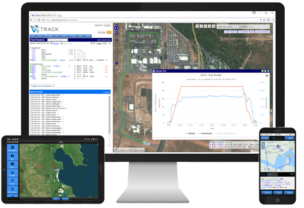
A complete solution for fleet tracking
Ground Control’s RockAIR and RockFLEET devices are very similar devices; both offer dual-mode cellular and satellite tracking capabilities, leveraging the global Iridium network, so that no matter where your asset goes, you will be able to see their location in real time.
Both provide text-based communication, so pilots and drivers can keep in touch with their base of operations. The RockAIR is designed to be carry on / carry off, with a battery that will last up to two weeks, whereas the RockFLEET is designed to be installed; either can be used on air, on land, or at sea.
What V2Track brings to the party is their advanced software platform, which has been designed by aviators, for aviators, and works extremely well for land-based fleet operations too.
Introducing V2Track’s Viewer platform
As the Viewer is cloud-based, there’s no need to download any programmes or install updates; when you log in via your desktop, tablet or mobile, you’ll be using the most up to date version of the software. Using the View you can monitor all of your aircraft, vehicles and assets in real-time. It retains the history of every trip / session for future retrieval.
- Customizable, automatic SMS, email and website alerts, e.g. speeding alerts, out of hours use, movement in and out of predefined areas
- Flight following alerts: proximity and non-reporting
- EFB functions
- Flight manifests
- Electronic checklists
- Daily history, playback and reports
When you combine the tracking and communication capabilities of the RockAIR, RockSTAR and RockFLEET devices with V2Track’s innovative and constantly improved software solution, you have an end-to-end solution for fleet tracking, anywhere in the world.
“We wanted to offer our customers a choice of hardware for their tracking and communication needs, and chose to integrate with Ground Control because of their justified reputation for reliability, and the ease of integration with our software. They make it very easy for us to work with them, and in turn, our customers get a very competitively priced and powerful fleet tracking and communication solution.”
Kylan Diprose, Director, v2track
Like to know more?
If you’re interested in V2Track’s fleet tracking and communications solution, or you have your own tracking software and want to explore integration options with Ground Control’s satellite tracking devices, we’d love to hear from you.
Call or email us, or complete the form, and one of our experienced team will be happy to help.
Madcap Project – LOHAN
LOHAN is a madcap project involving using a high altitude balloon to launch a glider to the edge of space then have it released from the balloon and navigate itself down to a designated landing spot.
The team needed a way to communicate if/when the LOHAN travelled out of GPRS coverage. Additionally the authorities required an emergency balloon cut-down in the event that LOHAN wandered off course.
Enter RockBLOCK 9602. As well as transmitting GPS data when the unit was out of range of standard mobile networks, the RockBLOCK was also used to receive commands from the ground. If they wished to abort the mission, a message sent to the RockBLOCK using our API, would be received on-board the spacecraft and activate the self-destruct mechanism.
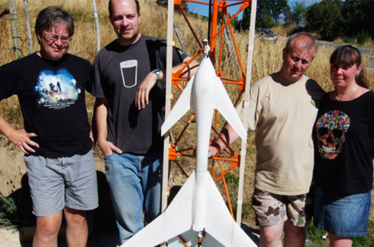
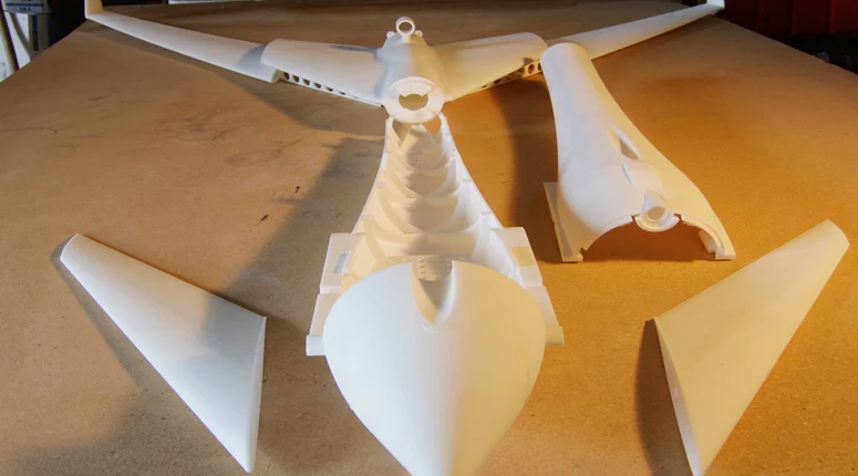
LOHAN Components
- RockBLOCK 9602 naked unit
- Arduino Mini Pro 3.3V 8MHz
- 5V regulator
- AAA battery holder
- Four Energizer lithium AAAs
- MOSFET to fire the release
- Cable with JST connector to connect to cut-down
- The LOHAN Spacecraft
The Challenge
The team plan to launch a rocket-powered Vulture 2 spaceplane from under a helium balloon and ask it to guide itself back to terra firma using an onboard autopilot system. This is commonly known as a ‘rockoon’ concept, or ‘ballocket’, and it presents a few serious technical challenges – not least how to launch the aircraft. As meteorological balloons can get really, really big at altitude, any launch plan needs to balance offering the vehicle the chance to get to maximum altitude while avoiding an enormous latex sphere.
Several had the idea of using multiple balloons, but the team ruled against this, the logic being, it multiplies the diameter problem and doesn’t really offer an advantage in terms of maximum attainable altitude. Afterall, all balloons would burst at around the same height, and it’s likely the first explosion would trigger multiple bangs.
Instead the team’s research brought them back to the 1980s – John Guest was involved in a rockoon project aiming to put a 1-gram payload into orbit. Unfortunately, as a result of the estimated $50K cost, this project came to nothing, evidently though some real thought was given to the matter. Guest wrote: “Launch before balloon burst. Much better platform stability. Once burst occurs, you don’t know what your craft attitude is going to be. You won’t make orbit (and I don’t think you want to, really). However, a launch attitude of 45 degrees would both maximize downrange distance and altitude.”
This echoed the team’s experiences with rockoons launched vertically which have sacrificed the balloon; disregarded due to the potential damage to the aircraft. Instead the team plan on trying the suggested spaceplane launch angle of 45 degrees.
The Initial Spec
Based on the Paper Aircraft Released Into Space (PARIS) concept of having the aircraft attached to a main payload box:
- Single helium balloon, lift capability 1,000 feet per minute
- Main payload box with onboard video and stills cameras
- Main payload to contain both a) launch trigger electronics and b) Vulture 2 onboard systems enabling electronics
- Launch of Vulture 2 programmed for before balloon burst
- Main payload to descend by rocket recovery parachute
- Main payload recovery systems to include GPS radio beacon.
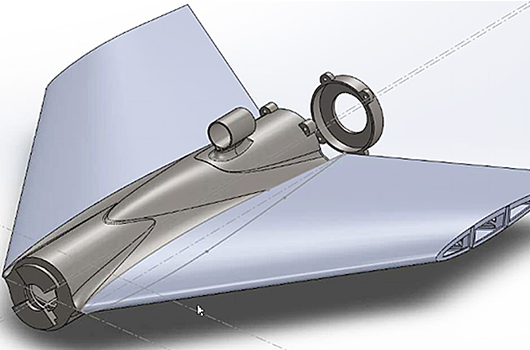
In summary, the main payload electronics will enable the Vulture 2 onboard cameras and autopilot, and then fire the rocket motor at a predetermined altitude. The aircraft will fly at an angle of 45° from some form of launch platform, the design of which should run in tandem with the Vulture 2 development.
We wish the team all the best with launch and future projects!
Built with Ground Control
The work we support genuinely inspires us, and we’re proud to be a part of the innovative solutions created by our partners and customers.
If you’d like to get in touch with the team either to discuss a challenge similar to that of the one above, or something completely different our team of experts will be happy to provide objective advice.
Kraken Project and the RockBLOCK
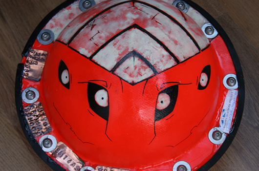
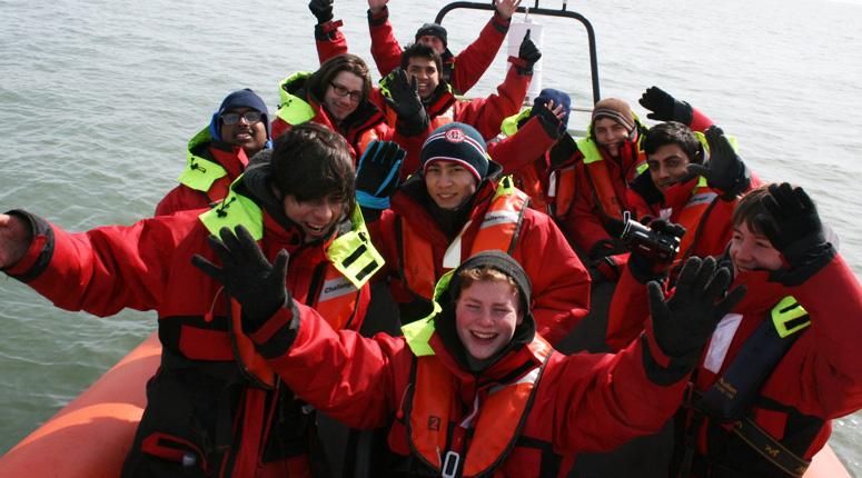
‘Kraken’ is a project by Sutton Grammar School, and this case study is written by them. The main concept behind the buoy is its primary use as an oil response system. The system is based around an oil response unit that aims to make it easier for oil companies to clean up spills quickly and effectively.
It consists of a series of buoys that cooperate to give an image of the spread of oil by using sophisticated GPS and radio technology. Using this, companies can get a picture of where oil has and will spread and then clean up spills as fast as possible.
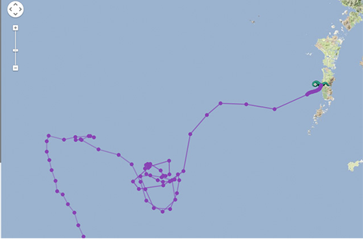
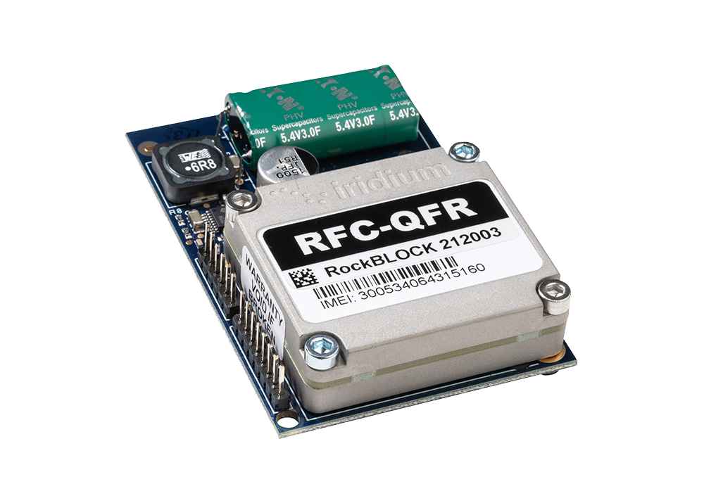
RockBLOCK 9602 is used to transmit the GPS position and other collected data back to a central management system to allow monitoring of the situation in near real-time.
Components of the Kraken Buoy:
- Arduino Atmega328 controller
- uBlock Max 6Q
- Inertial and Temp Sensors
- RockBLOCK 9602 naked unit.
GPS – U-blox Max 6Q
These determine the location of each buoy as a latitude and longitude, and provide accurate synchronised timekeeping (GPS time) for all buoys. GPS modules communicate with the Arduino via the UBX binary protocol over a serial RS232 interface and use Sarantel SL1202 (now discontinued) antennae. The modules have been optimized for 2-D ocean use in power-saving mode (positional fix every five minutes). The team used these receivers partly because they’re very small (so will fit into the ‘nymphs’) can be put into low power mode to extend the battery life of the buoys while at sea.
Hope Microelectronics RFM22B Transceiver
[Short Range Radios]
These are low-power boards used for short range communications (sending GPS data) between buoys in the Poseidon network. The team used this open source Arduino library for easy communication between the Arduino and radio modules. Packets of data are automatically encoded and decoded, further simplifying the Arduino programming.
Arduino Atmega328
This microprocessor chip is used by the Arduino Uno board (but is in surface mount form on our buoys). They are programmed in C with the Arduino IDE version 1.0.1 and coordinate the behaviour of each buoy, decoding and relaying data from various components, e.g. the GPS receivers or the IMU out to the RockBLOCK radio.
Buoy Network Concept
The students aimed to fully utilize the benefits of an entire network of buoys by allowing the ‘nymphs’ to relay each other’s transmissions to the ‘Kraken’, in case some drift out of range of the RFM22B radios. Each nymph broadcasts the GPS data it has stored in its memory to all other buoys, which receive and store this data in their own memories. This means that each time a buoy transmits its memory contents, it is transmitting GPS data on behalf of all the other buoys (not just its own location).
So if a buoy moves out of range of the ‘Kraken’, its data will still reach the Kraken providing that other nymphs are still in range to act as relays. The Kraken collects all these data transmissions to send back to the team via the Iridium constellation, enabling them to track the location of each buoy in the network whilst using only one RockBLOCK radio.
Kraken Buoy Features
- Iridium Satellite Constellation: The team use this satellite network to relay data from the buoys (wherever they are in the world) back to project HQ. The RockBLOCK radio sends data to a passing satellite. The satellite relays this data to a ground station that then emails it to the team. This includes GPS readings to update their live map.
- Inertial Measurement Unit (IMU): The IMU is sampled at 10Hz and data is transmitted back to the team to analyse.
- Additional Sensors: The buoy also contains an onboard battery voltage monitor, so they know how much longer the batteries will last. Internal temperature sensor (located near the edge of the buoy to be as close as possible to the outside water temperature). Connected to the Arduino via a one wire interface.
Supporting Educators
The work we support genuinely inspires us, and we’re proud to support educators bringing learning to life.
If you’d like to get in touch with the team either to discuss an opportunity or project similar to that of the one above, or something completely different our team of experts will be happy to provide objective advice.
The Challenge for Journalists
Journalists can easily find themselves in remote and hostile environments, out of reach of cellular network coverage. Travelling from place to place, it might be a warzone one week, a natural disaster area the next. They need to be able to communicate with sources, studios and access relevant files, while maintaining diligent security practices.
They can only rely on the equipment they take with them. There’s no guarantee that there will be any communications equipment onsite when they get there – most of the time they don’t even know if they’ll get a pillow to sleep on.


The Solution – RockSTAR Unit
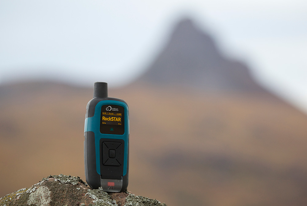
That’s where RockSTAR is useful. It provides a vital way for the journalist to keep in touch with both HQ and home. Position information is sent automatically from the unit, as regularly as every 15 seconds, or as infrequently as once per day. If HQ feel that they’re in trouble, they can remotely increase the transmission rate to get more regular fixes.
RockSTAR can also be used to communicate, sending short messages via email and SMS to the office and to loved ones. Some even use our Bluetooth link (via iPad, iPhone, Android) to write short articles and send them back for print.
Our units don’t rely on any terrestrial service – if the mobile phone network is down, that’s not a problem. As long as our devices can see the sky, they can transmit their position and message data back home. That means certainty – and when you’re stuck in a warzone reporting the news, that’s worth its weight in gold.
It’s cost-effective, too. Normally news organizations might have a stock of RockSTARs, but that doesn’t mean they’re always in use. Slow news days do happen. With our service, you just pay for what you use.
Getting Started With The RockSTAR
Before the start of the trip, HQ activate the line rental for the unit for a month or more, the journalist turns the unit on, and the RockSTAR will start transmitting a position fix once per hour (or whatever the customer chooses). When the units are sat on the shelf in the store-room, you don’t pay anything. Any credits left over from one deployment will still be there when the unit is activated next time, on its next trip.
Back at HQ, the customer uses Cloudloop Tracking to monitor the positions of all their workers.
In the case of an emergency, the RockSTAR unit can be used to alert HQ, using either the dedicated red button or, even better, using the messaging facilities to indicate the type of alert and any other relevant details. It can also be sent a command to go into ‘stealth mode’, which means the screen and LED are turned off. The unit continues to operate as normal, but it looks as though the battery has run out – useful if compromised.
Key Benefits For Media Teams
- GPS tracking
- Pay only when the units are being used in the field, no annual contracts
- Two way messaging between teams and the studio/HQ
- Various alert options including red button, timer alert, dead man’s switch, etc.
- Up to 3 month battery life, transmitting every hour
- Independently powered – rechargeable in the field using standard USB options
- Portable and can be covertly placed
- Access to Cloudloop for management across all deployed teams
In summary, RockSTAR is a private and reliable means of communication and tracking between journalists on the ground and the studio. Because of the erratic nature of news events, our pay-as-you-go service is cost effective, requiring no annual contracts.
Supporting Media teams worldwide
We have experience helping Media companies and journalists stay connected, wherever the story may take them. For expert, objective advice on your next project, simply get in touch.
Horticulturalists – The Challenge
The trouble with plants is that they grow absolutely everywhere. A great many scientific discoveries have been made by studying plants and there’s an awful lot of the world’s surface to cover. Most of it doesn’t have any kind of ‘conventional’ communication infrastructure.
That’s where our products kick in. Iridium is a global satellite network that offers guaranteed of coverage anywhere you can see the sky.
From the Amazon basin to the top of Everest, our products can provide tracking information and two-way communications – vital to keep in touch with your teams in the field.
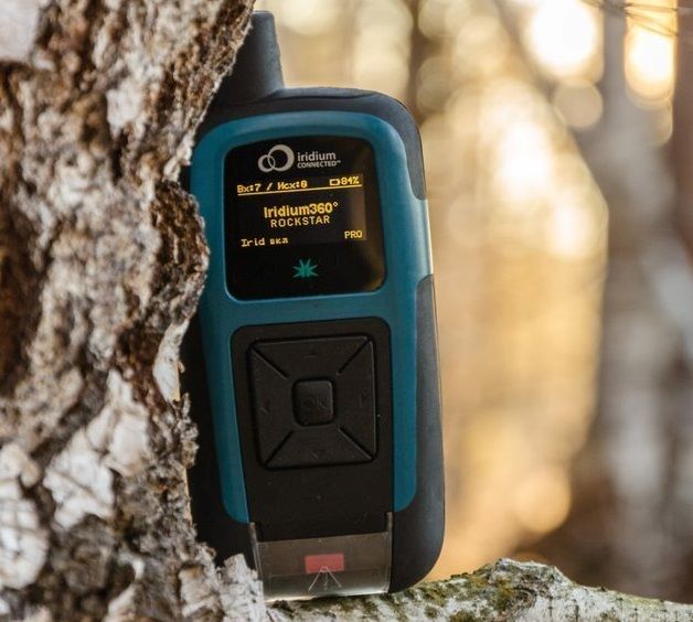
The RockSTAR can be used to mark ‘interesting finds’ using the waypoint options, meaning the remote workers can ‘tag’ locations and come back to them later. Back at HQ, using the Cloudloop IoT platform, you can monitor their progress and see those remotely marked ‘tags’.


The Solution – RockSTAR
This might seem like an odd fit for a tracking product, but it shows the flexibility of the RockSTAR device and the service we offer.
Various horticultural organizations have approached us over the last few years to provide remote worker tracking for their lone workers. A great many research projects take place outside of normal mobile phone (GSM) range and our devices provide an ideal way to keep in touch with these groups.
Global Tracking and Communications
Our devices can last for months between recharges, and if they do need to be recharged in the field then a standard USB cable is all it takes.
KEY BENEFITS FOR HORTICULTURALISTS
- Up to 3 month battery life, transmitting every hour
- Portable, easy to place in a rucksack
- ‘Interesting find’ marking
- Two way messaging between teams and HQ – Email and SMS
- GPS tracking, with access to Cloudloop Tracking for management across all deployed teams
- Various alert options including red button, timer alert, dead man’s switch, etc.
- Pay only when the units are being used in the field, no annual contracts
In summary, RockSTAR is a private means of communication and tracking between you and your remote workers. It’s robust and reliable, has a huge battery life, and is easily charged in the field.
Truly global communications
If you’d like to get in touch with the team either to discuss a challenge related to lone or remote workers, we’d be happy to help.
Working closely with cellular and satellite networks, we’re able to provide expert, objective advice, whatever your budget.
The Challenge for Aviators
Aircraft are often fitted with a number of features which have safety and rescue in mind. These can range from, but aren’t limited to, phones, GPS, trackers, emergency controls, and even tools as simple as a flare gun.
While an aircraft may be kitted out with phones and other communication devices, flight routes are often out of GSM range so cannot guarantee signal. Reliable transmission of location on a regular basis is essential though, should the worst happen.
What’s more, in an emergency situation, pilots need a quick and simple system to fire out an SOS – from messaging to accurate position information – in order to get the life-saving help they need as soon as possible.
The Sam Rutherford Rescue
In May 2019, Sam Rutherford and co-pilot Alan Simpson were ferrying a Piper Malibu propeller aircraft from West Virginia in the USA to Britain.
Unfortunately, they were caught in blizzard-like conditions near Makkovik, Canada, and the plane came down leaving the pilots hurt and stranded on a mountainside. While Simpson was unconscious and later sadly died of his injuries, Rutherford was able to use his tracker to send an SOS back to his wife in Belgium to send for help, which also tracked their position for the rescue team.
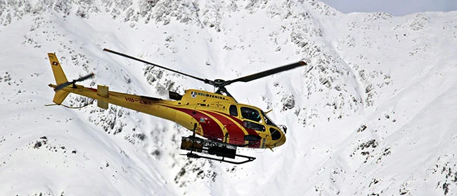
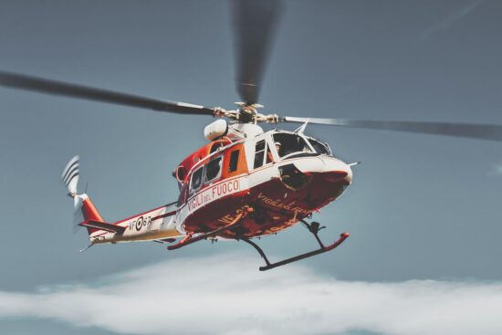
It took a nine-man team and a few weather-related setbacks to take on the Herculean task of rescuing the men. Rutherford acknowledges the RockSTAR – satellite tracking device, was a big contributor in saving his life that day.
“Within an hour, an hour and a half, I was getting messages [across]. From a morale point of view that was a total game-changer.”
Sam Rutherford, Pilot
Built with Ground Control
Our devices help deliver peace of mind to aviators, pilots and passengers everywhere and anywhere.
If you’re interested in learning more about the RockSTAR, RockAIR, or any satellite tracking device, or similarly have a communication challenge in the sky you’d like some advice on, simply fill in the form and one of our expert team will contact you.
Challenges in Maritime Security
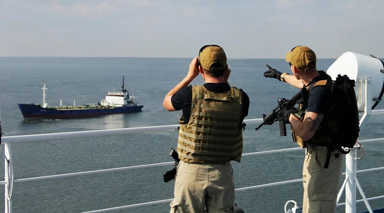
In the anti-piracy and maritime security world, it’s vital to know the situation of your remote teams.
You can’t rely on the communication facilities aboard the vessels you’re protecting, both for privacy reasons and in case of possible compromise.
We provide RockSTAR units to a large number of marine security and anti-piracy firms worldwide. They provide accurate tracking, allowing the position of your teams/vessels to be monitored while in transit. They also give a secure and private means of communication for onboard team leaders.
The Solution – RockSTAR device
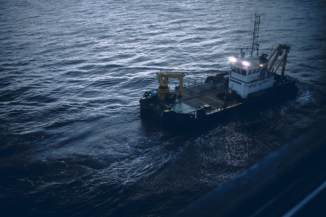
Typically, when marine security teams deploy onboard a vessel, they take a RockSTAR device with them. Before the start of the transit the unit is turned on and will start transmitting a position fix once per hour (or whatever the customer chooses). Back at HQ, the customer uses the Cloudloop management system to monitor the positions of all their teams/vessels.
The RockSTAR’s means of communication is completely separate from the vessel, so even if power is turned off aboard, the RockSTAR will continue to operate. A command can be sent to go into ‘stealth mode’, which means that the screen and LED are turned off and the unit continues to operate as normal, but it looks as though the battery has run out – useful if compromised.
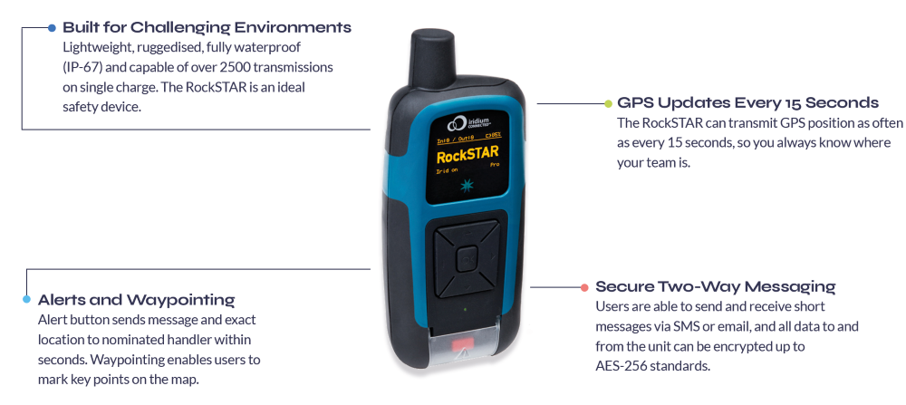
In the case of an emergency, the RockSTAR unit can alert HQ, using either the dedicated red button or, even better, the messaging facilities to indicate the type of alert and any other relevant details.
Safeguarding personnel and assets with the RockSTAR
KEY FEATURES FOR MARITIME SECURITY TEAMS
- GPS Tracking – Frequency of transmissions between 15 seconds – once per day
- Up to 3-month battery life (when transmitting every hour)
- Portable and can be covertly carried/mounted
- Two-way messaging between teams and HQ
- Access to Cloudloop for management across all deployed teams
- Various alert options including red button, timer alert and dead man’s switch
- Pay only when the units are being used at sea, no annual contracts
In summary, the RockSTAR is a private means of communication and tracking between the marine security company and the teams on the vessel. It’s robust, reliable, and popular in the industry.
Want to know more?
If you’re interested in the RockSTAR device as a possible solution to Marine security or any other communication challenges, we’d love to hear from you. Call or email us, or complete the form, and one of our experienced team will be happy to help.