Industry: Agriculture
Empowering Climate Resilience Through Satellite-Enabled Precision Farming
Synnefa was founded in 2013 in Kenya with a mission to create lasting solutions to challenges faced by farmers. The solution has developed over time, but the goal has remained the same: take the guesswork out of farming and improve production, through remote monitoring and trend analysis. After just two years, the team was providing services to 400 farmers; at the time of writing, in 2023, Synnefa works with over 8,726 farmers.

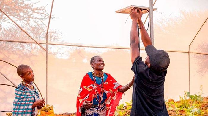
How It Works
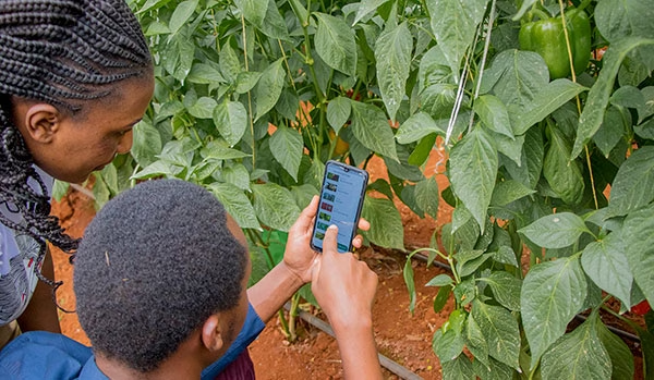
A typical Synnefa customer is a smallholder who works in the city and tends to their farm on a part-time or entirely remote basis. Using Synnefa’s FarmShield device, farmers gain access to sensor data including temperature, soil moisture, nitrogen levels in the soil and light intensity. Farmers can use this information to make educated decisions about when to irrigate or fertilize their crops; or they can use Synnefa’s smart greenhouses and drip kits which will automatically fulfil these tasks based on sensor data.
The FarmShield data is expressed in the FarmCloud software, which predicts the optimum harvest time and projected yield, and even allows farmers to sell their produce based on these projections. It’ll also provide suggestions for the most productive crops for each farm delivering precision farming through observation and measurement.
The Connectivity Challenge
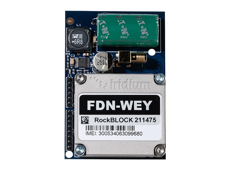
Many of the farms supported by Synnefa operate outside of terrestrial infrastructure; there’s unreliable cellular or fiber coverage through which to transmit the FarmShield sensor data. In these circumstances, Synnefa utilizes the RockBLOCK 9602 satellite transceiver to backhaul their sensor data. Using Iridium’s Short Burst Data (SBD) service, this is as low-cost as satellite transmissions get, and helps to ensure that Synnefa’s subscription pricing remains within reach of the farmers that most need the support.
Synnefa chose the RockBLOCK 9602 in particular because of the robust modem that easily and quickly connects with the Iridium satellite constellation. It is reliable, and communicates well. The Cloudloop dashboard is user-friendly and gives Synnefa all information they need, such as messages sent and received, and connection details.
What’s Next?
Synnefa is committed to supporting three of the UN’s Sustainable Development Goals (SDGs): no poverty, zero hunger, and climate action. The response to their enterprise has been incredible:
- Farmers are saving water by over 50%
- Reducing fertilizer application rates by 41%
- Increasing production by 30% when compared to yields prior to the use of their devices.
The next steps are to expand the program outside of Kenya so that more farmers can benefit from greater yields and reduced wastage.
Do you have a agritech project that could benefit from satellite connectivity?
Synnefa is delivering meaningful, positive change for the farmers it works with, and Ground Control is very proud of the small part we play in making this project successful.
If you’d like to know more about how satellite technology is being used in agriculture, or you have a agritech project of your own which would benefit from improved connectivity, please get in touch; we have over 20 years’ experience and we’re here to help.
Preventing Poaching in Gabon with RockREMOTE IMT
Illegal Poaching in Gabon
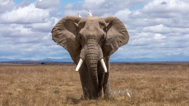
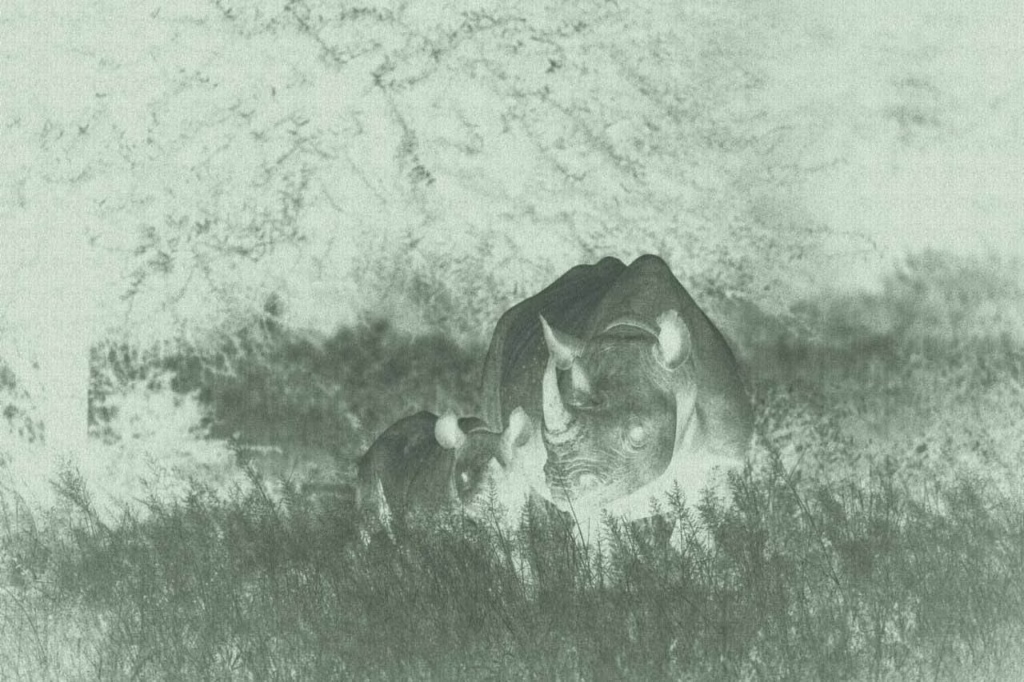
Africa is home to some of the world’s best-known and most iconic wildlife. However, the African Wildlife Foundation (AWF) reports that due to illegal poaching, as many as 35,000 elephants are killed each year, 43% of the lion population has been lost in the last 20 years and, staggeringly, since 1960, the population of the Black Rhino is down 97.6%.
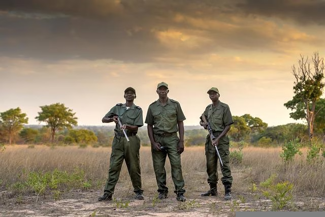
With approximately 24 million hectares of forest, Gabon is home to a number of endangered African species, which makes for an attractive landscape to poachers. However, using the latest satellite technology, AI-powered camera traps can provide Gabon wildlife rangers with an advanced new tool in the fight against illegal poaching.
Preventing Poaching
Digital Forest aims to make wildlife and wild places accessible to everyone through immersive, interactive technology driven by real-time data streams. It’s via this real-time connection and technology that wildlife and rainforests, including Gabon, can be better maintained and protected.
Traditional monitoring systems use cameras to monitor poaching activity, but often, results are collected and analyzed months later, so rangers only know where the animals – and any poaching threats – were, not where they currently are. The lack of real-time location data means that intercepting to prevent illegal poaching is often too late.
Second Generation AI-Powered Camera Traps
The first generation of AI-powered camera traps utilized RockBLOCK 9602 to transmit sighting counts and meta data via the Iridium Short Burst Data (SBD) service which provides robust telemetry from anywhere on the planet. Digital Forest’s second generation device would build on this with the ability to also transmit images to accurately and reliably detect the presence of illegal poachers, and send real time alerts.
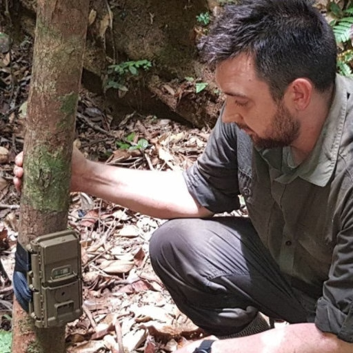
Harnessing the latest satellite technology, Digital Forest developed a smart AI-powered camera trap. The remotely deployed device continuously monitors for the presence of animal and human activity, even in forested areas. At any time of day or night, when activity is detected via the remote sensors, sophisticated image recognition technology not only detects but also classifies different animal species. These images are available immediately, 24/7, so rangers are informed of an animal’s location in real time.
The bandwidth of Iridium’s Short Burst Data (SBD) service is limited to 320 bytes per message and it’s not feasible to send imagery from the camera traps via SBD. To effectively protect wildlife, the Gabon rangers require a cost-effective solution that can not only transfer animal and human sightings and meta-data, but also real-time imagery from remote rainforest locations.
RockREMOTE is a highly capable Iridium Certus device with the ability to support both IP and message-based connectivity. The device provides a simple and easy to initiate, plug-and-play satellite connection from anywhere in the world.
The message-based connectivity is enabled by Iridium Messaging Transport (IMT) service which provides a more straightforward and cost-effective messaging capability but with a much larger message size of 100Kb – enough to include wildlife imagery.
How It Works
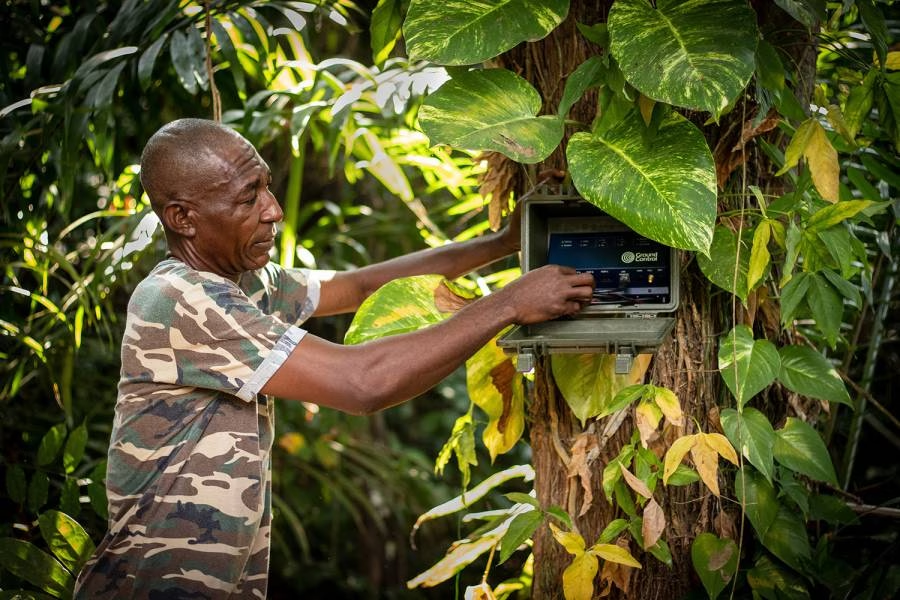
Leveraging Iridium Messaging Transport (IMT), RockREMOTE exposes integrators to an industry-standard MQTT interface. Ground Control’s development of a new Satellite IoT Gateway enables Digital Forest to quickly and easily integrate two-way messaging into their application using standard MQTT libraries for their platforms.
Behind the scenes, RockREMOTE takes care of all the connection management, message queuing and retrying to enable Digital Forest to simply plug-and-play, reducing integration work to just a few lines of code.
RockREMOTE automatically packages and compresses messages prior to transmission to minimise the amount of data sent. The device also selects the most appropriate compression algorithm based on the content being transmitted.
Messages are received and published to Cloudloop, enabling immediate and real-time transmission to Digital Forest’s cloud-based platform. This is effective in reverse, enabling messages to be sent to the remote field device. Digital Forest also benefits from the automatic upload of images to the AWS S3 for long-term storage.
The power of RockREMOTE with IMT enablement equips the rangers in Gabon with the latest in AI-powered camera trap technology to effectively monitor and prevent illegal poaching in the forest. With this advanced technology, endangered African species and iconic African wildlife have greater protection from poachers for this generation and the next.
What Digital Forest Says
“We’ve worked with Ground Control for many years and their products and supporting services have never failed to deliver. It’s very reassuring working with a company that designs, builds and supports every aspect of its products.
Developing our second-generation smart camera with RockREMOTE has been a breeze; we’re really excited about possible applications this technology will unlock. We’re already thinking about using RockREMOTE for transmitting audio, which will enable us to acoustically as well as visually monitor biodiversity in these truly unique locations.”
Robin Whytock, Director,
Digital Forest UK (SPV) Ltd.
Would you like to know more?
With over 20 years of satellite experience, the Ground Control team is well placed to help keep you connected when it matters the most.
Whatever your communication or connectivity needs, we can help. Talk to one of our team to discover our products and services and how they can benefit, improve and streamline your applications.
BGAN M2M’s Role in Soil Moisture Monitoring to Help Combat Climate Change
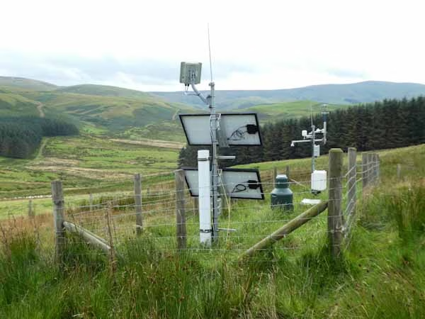
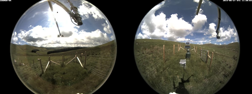
The Sourhope site on the Scottish border is one of 47 COSMOS-UK’s soil moisture monitoring stations that deliver near-real-time soil moisture data for use in farming, water resources, flood forecasting and land-surface modelling. Sites are also equipped with IP cameras for image transmission. COSMOS-UK was established by the UK Centre for Ecology & Hydrology in 2013 and is now the UK’s long-term national soil moisture monitoring programme. The COSMOS-UK data informs scientists about soil-water changes and supports environmental modelling research and related applications.


The Project
Ongoing climate change and increasing air pollution are likely to cause substantial changes in our ecosystem. To predict, manage and minimize adverse impacts on biodiversity, it’s critical that these changes are accurately, efficiently and reliably monitored so policy and management techniques can be developed.
The greater our understanding of soil moisture, the better we are able to recognize plants that are suited to particular conditions, the availability of water to maintain surface waters, and the impact soil moisture can have on our weather. This becomes more interesting and useful when we want to recognise the impacts of modifying and exploiting our environment.
Why Soil Moisture Matters
As well as optimum vegetation and crop management, measuring soil moisture also helps to inform our understanding of how the natural environment responds to climate change.
The impact of climate change could affect the water availability for agriculture, domestic consumption and the overall environment. Thus, measuring soil moisture and developing knowledge of how it varies between places and through time is fundamental to gaining insight into likely future conditions.
The Satellite Solution
The COSMOS-UK Sourhope site is located in a remote area of rough Scottish grassland, about 1 km from the border with England. This station, along with others in the COSMOS-UK network, is out of reach of cellular and fiber networks.
The Hughes 9502 is a IoT Pro (previously known as BGAN M2M) terminal, a satellite-based solution for transmitting remote environmental monitoring data. Powered by solar energy and designed to operate on both Viasat IoT Pro and cellular 2G/3G/LTE networks, it delivers always-available connectivity for critical monitoring and control applications in remote locations, perfect for the grassland site at Sourhope.
Instrumentation at the COSMOS-UK Sourhope site captures soil moisture sensor data from over almost 40 hectares (about 100 acres) at any one time and delivers the data to data centres in near real-time, 24/7, 365 days a year. This contrasts favourably with other sensor solutions, such as a soil probe, which are considered more intrusive, and provide only single point-measurements, or require an on-site operative to conduct ‘point in time’ measurements.
Viasat’s IoT Pro service provides a reliable, global, two way IP data service. It is the ideal solution as it connects monitoring and control applications in remote, unmanned locations, providing visibility and management of those assets – including high quality camera images.
“The Hughes 9502 and IoT Pro (BGAN M2M) service have been incredibly reliable; we’ve had no outages or delays since beginning use, and costs have remained predictable.”
UKCEH COSMOS-UK Project Manager
2023 and Beyond
The soil moisture data intelligence delivered by the Hughes 9502 to agricultural and environmental scientists has the potential to transform the way we understand and model the natural environment.
All data collected by the Hughes IoT Pro terminal from Sourhope, and other COSMOS-UK sites, are available free to the scientific community and the general public.
Would you like to know more?
With over 20 years of satellite experience, the Ground Control team is well placed to help keep you connected when it matters the most.
Whatever your communication or connectivity needs, we can help. Talk to one of our team to discover our products and services and how they can benefit, improve and streamline your applications.
Horticulturalists – The Challenge
The trouble with plants is that they grow absolutely everywhere. A great many scientific discoveries have been made by studying plants and there’s an awful lot of the world’s surface to cover. Most of it doesn’t have any kind of ‘conventional’ communication infrastructure.
That’s where our products kick in. Iridium is a global satellite network that offers guaranteed of coverage anywhere you can see the sky.
From the Amazon basin to the top of Everest, our products can provide tracking information and two-way communications – vital to keep in touch with your teams in the field.
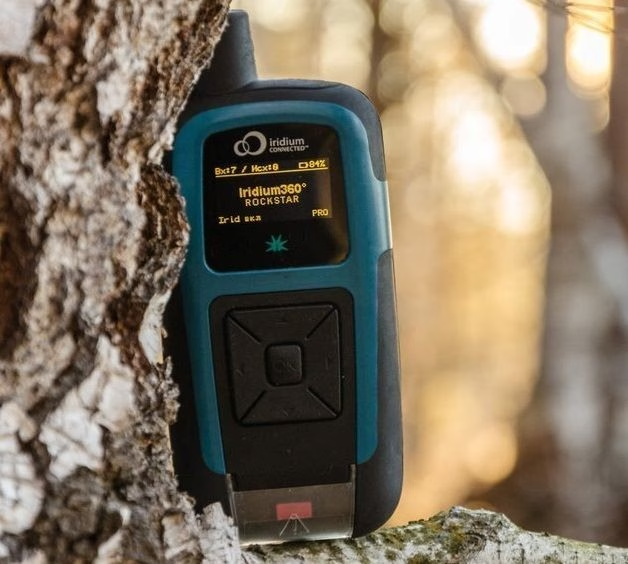
The RockSTAR can be used to mark ‘interesting finds’ using the waypoint options, meaning the remote workers can ‘tag’ locations and come back to them later. Back at HQ, using the Cloudloop IoT platform, you can monitor their progress and see those remotely marked ‘tags’.
The Solution – RockSTAR
This might seem like an odd fit for a tracking product, but it shows the flexibility of the RockSTAR device and the service we offer.
Various horticultural organizations have approached us over the last few years to provide remote worker tracking for their lone workers. A great many research projects take place outside of normal mobile phone (GSM) range and our devices provide an ideal way to keep in touch with these groups.
Global Tracking and Communications
Our devices can last for months between recharges, and if they do need to be recharged in the field then a standard USB cable is all it takes.
KEY BENEFITS FOR HORTICULTURALISTS
- Up to 3 month battery life, transmitting every hour
- Portable, easy to place in a rucksack
- ‘Interesting find’ marking
- Two way messaging between teams and HQ – Email and SMS
- GPS tracking, with access to Cloudloop Tracking for management across all deployed teams
- Various alert options including red button, timer alert, dead man’s switch, etc.
- Pay only when the units are being used in the field, no annual contracts
In summary, RockSTAR is a private means of communication and tracking between you and your remote workers. It’s robust and reliable, has a huge battery life, and is easily charged in the field.
Truly global communications
If you’d like to get in touch with the team either to discuss a challenge related to lone or remote workers, we’d be happy to help.
Working closely with cellular and satellite networks, we’re able to provide expert, objective advice, whatever your budget.