Industry: Education & Research
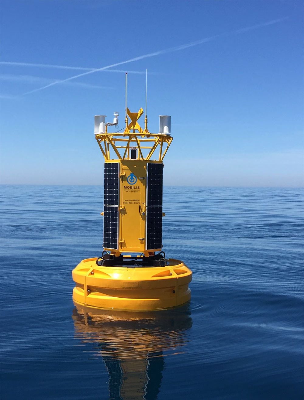
Building Resilient Connectivity for Offshore Monitoring
Founded in 1990, Mobilis is a French maritime engineering company with equipment deployed in more than 90 countries. Combining in-house R&D, manufacturing and project expertise, it develops solutions for navigation, mooring and ocean observation, helping customers operate safely and make better informed decisions in demanding marine environments.

The Challenge
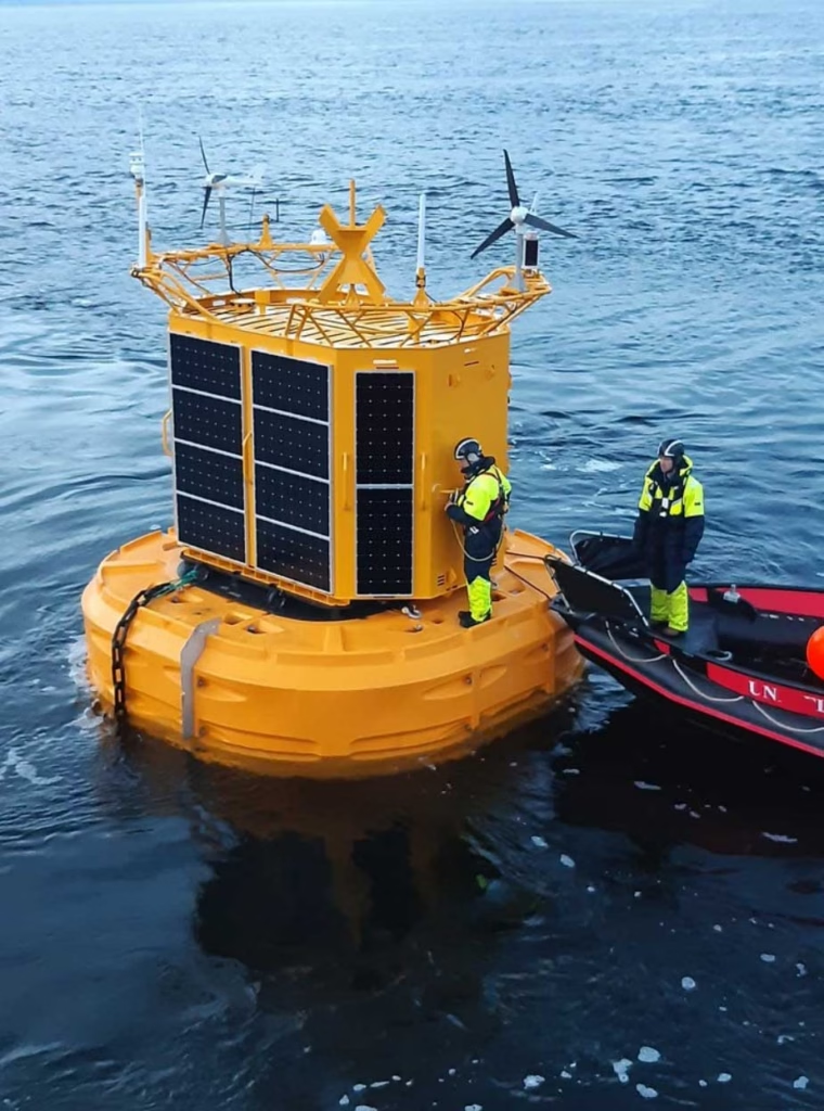
Mobilis’ environmental monitoring systems support applications including port operations, dredging, marine construction, environmental compliance, offshore projects and scientific research.
Depending on the application, they can measure meteorological conditions, waves, currents, water quality, position and system health, alongside more specialist project-specific data. For customers, continuous access to this information can reduce the need to send vessels offshore simply to understand what is happening.
But collecting the data is only part of the challenge. Mobilis also needs to get it reliably back to shore. Many deployments sit beyond dependable terrestrial coverage, while LTE/GSM and radio links can be interrupted by network outages, roaming issues, antenna problems or local conditions. For systems expected to remain offshore for months or years, losing that connection can mean losing operational visibility.
Mobilis therefore needed a communications model that could maintain connectivity when terrestrial networks were unavailable, without making satellite airtime unnecessarily expensive.
The Solution
Mobilis integrated Ground Control’s RockREMOTE Mini into its own data-acquisition architecture, alongside its datalogger, power management and sensor interfaces.
The resulting hybrid model can adapt to each deployment. Where LTE/GSM or radio is available, Mobilis can use it for bulk telemetry, with satellite providing an independent backup. At more remote sites, satellite can become the primary connection.
Mobilis also separates routine telemetry from remote engineering access. For everyday data transmission, it uses Iridium Messaging Transport (IMT). Sensor measurements are compressed into compact binary payloads before transmission, replacing verbose text with short identifiers, compact timestamps and efficient numeric formats. This can reduce data volumes by an order of magnitude or more compared with plain text, helping Mobilis transmit regularly while keeping airtime predictable.
Data passes through the Mobilis datalogger and RockREMOTE Mini to Iridium and Ground Control’s Cloudloop platform. From there, it’s routed into Mobilis’ cloud environment, decoded and delivered to web platforms, mobile applications and customer dashboards.
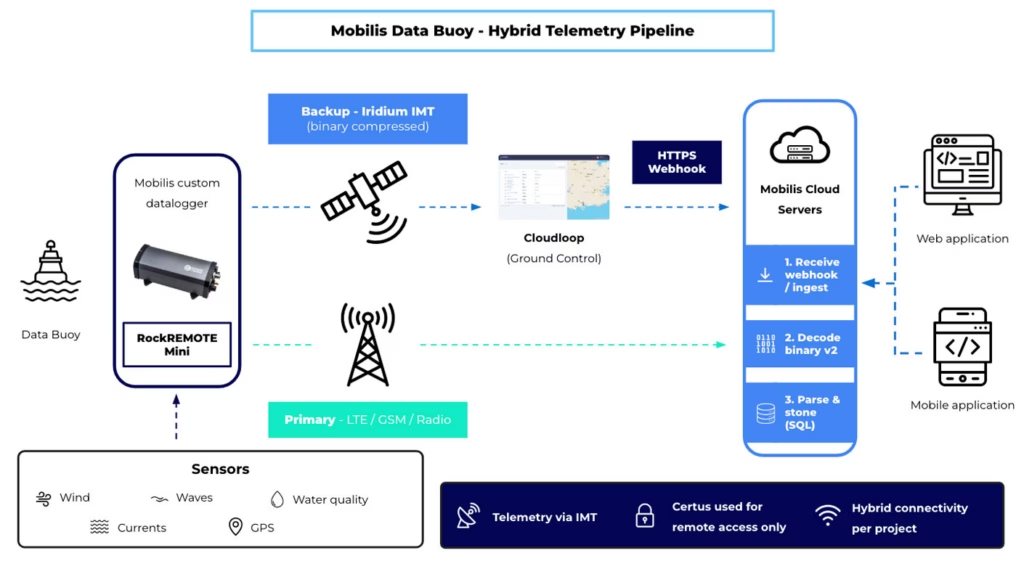
When engineers need direct access to a deployed system, Mobilis uses an Iridium Certus 100 IP connection. If LTE or radio is unavailable, this gives the team a remote route into the datalogger for diagnostics, configuration and maintenance, including SSH access.
Using IMT for efficient routine telemetry and Certus 100 for IP-based remote access allows Mobilis to use the most appropriate type of satellite connectivity for each task.
The Results
The hybrid model helps Mobilis maintain visibility across its satellite-enabled fleet, even when cellular or radio communications fail.
Remote Certus 100 access allows engineers to investigate and potentially recover systems from shore, reducing the need for costly offshore visits. At the same time, binary compression and IMT help keep routine satellite costs under control as sensor sets and projects grow.
Once ashore, measurements flow directly into Mobilis’ applications, giving ports, project teams and environmental specialists near real-time access to offshore conditions.
The architecture is also repeatable. The same combination of Mobilis datalogger, RockREMOTE Mini and Cloudloop can be used across international projects while adapting the sensor configuration and connectivity model to each deployment.
“What we appreciate is support that understands real buoy constraints power, intermittent sky view, metered messaging, and the need to separate telemetry from remote access. CLS and Ground Control feel more like a technology partner, rather than a hardware supplier.”
Alberto Dallolio, Ph.D. Eng.
Ingénieur Senior Robotique Marine | Senior Marine Robotics Engineer
Looking Ahead
Mobilis plans to extend its hybrid LTE/radio and Iridium model across more projects, while continuing to refine binary compression for new sensor types.
The team is also developing more automated fleet-health monitoring and deeper integration with the Mobilis Data Portal and customer mobile applications. As its connected fleet grows, Mobilis is exploring ways to simplify multi-device management and Cloudloop integration, with the same goal at the heart of the system: keeping critical offshore data accessible when conventional communications cannot be relied upon.
Connecting Equipment Beyond Terrestrial Coverage
From offshore monitoring systems to other remote marine assets, we can help you build a connectivity solution that keeps critical data flowing when cellular or radio networks cannot be relied upon.
To speak to our team about your project, either complete the form or email hello@groundcontrol.com, and we’ll reply within one working day.
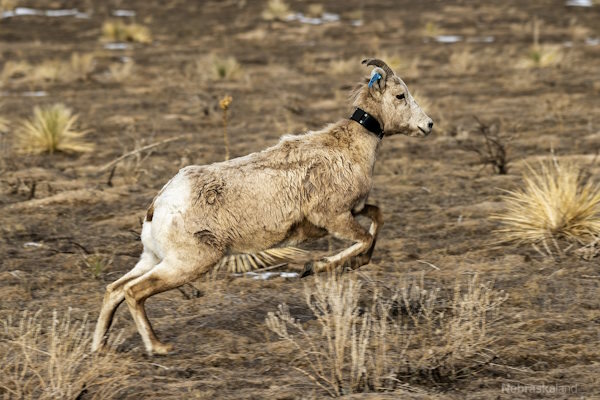
Vectronic design and build customized GPS tracking collars and connected devices for wildlife monitoring and nature conservation research projects around the world. They design the collars to impact the animal as little as possible, combining the need for longevity with lightweight, minimal construction.
To closely monitor wildlife in extremely remote locations, in difficult terrains and over large ranges with limited mobile connectivity options, Vectronic have partnered with Ground Control to implement satellite communication capabilities into their tracking collars.
By utilizing Ground Control’s IoT platform, Cloudloop, coupled with Iridium 9603 modems, Vectronic can offer their customers rich location tracking data with minimal draw on the battery life of the GPS collars.
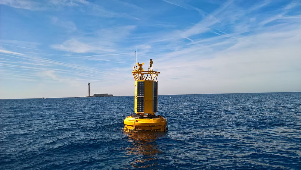
Akrocean delivers ocean data as a service through their fleet of self-powered data buoys. The buoys are modular, and equipped to capture all types of metocean and environmental data. Designed to be self-sufficient, the deployed buoys can operate for multiple years without needing any human intervention.
Windsea is a floating LiDAR service for wind resource assessment and metocean measurements. Fly’rsea is a floating RADAR solution for bird detection and environmental assessment. Seaobs is the combination of the two, and can host a large range of sensors able to monitor any parameter at your project site.
Akrocean utilize the RockREMOTE to backhaul their data; RockREMOTE is designed for larger volumes of IoT data, and leverages the truly global Iridium Certus 100 airtime service, ensuring that Akrocean’s customers get their data reliably, and close to real-time.
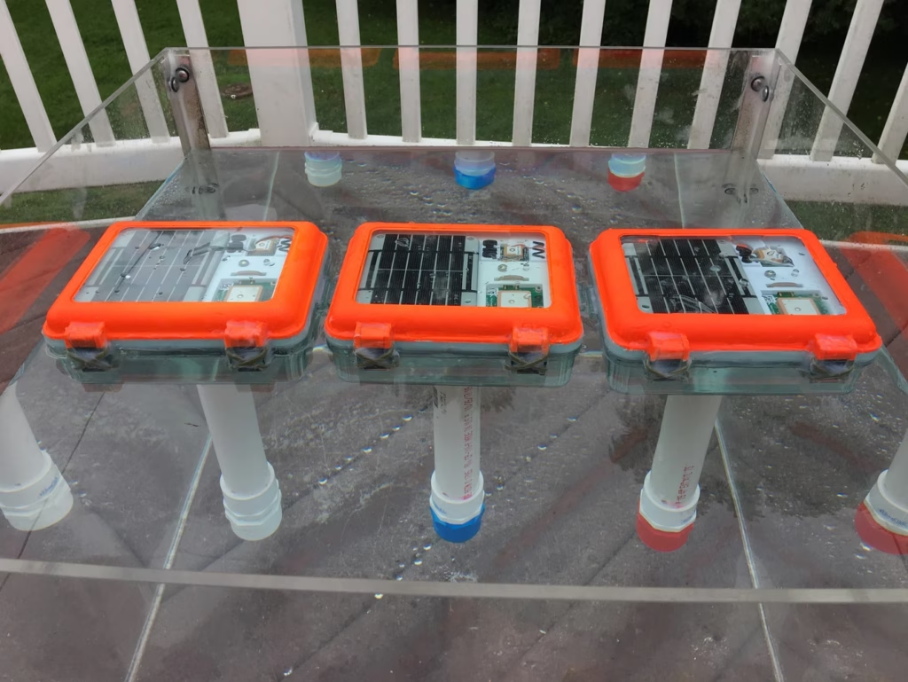
Maker Buoy is an Arduino-based drifting buoy equipped with GPS and a RockBLOCK 9603 Iridium transceiver. Fully solar powered, the buoys can be built to your specification, or you can purchase the ‘Build-a-Drifter’ kit, and assemble your own. This is ideal for educational purposes and scientists / oceanographers wishing to customize the the sensor array themselves.
As standard, the buoys feature temperature and light sensors and an accelerometer in addition to GPS; they’re most frequently used for ocean current monitoring. They’ve been used for diverse applications including helping The Ocean Cleanup foundation monitor the effectiveness of their system by simulating the movement of ocean plastics.
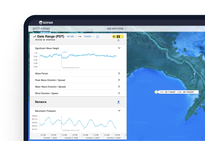
Sofar Ocean developed a data buoy – the ‘Spotter’ – and have deployed hundreds of these marine sensing platforms, creating the largest privately owned network of ocean sensors. Maritime shipping customers subscribe to Sofar’s extremely accurate marine weather forecasts, facilitated by the Spotter network, to help them optimize voyages to save fuel, time and emissions.
Customers can also purchase Spotter buoys themselves to capture ocean data in places not covered by Sofar’s network, and combine their data with the Spotter network to power marine research and solutions. The data captured and transmitted includes wave spectra, wind, surface and subsurface temperature, atmospheric pressure, water levels and currents, with further options available on demand.
The Spotter buoys use a combination of cellular and satellite connectivity, depending on their location, and Sofar Ocean utilizes Ground Control’s Cloudloop platform to manage their satellite airtime.
ATS delivers wildlife radio telemetry, with tracking options for birds, mammals, fish, reptiles and insects. They were founded over 35 years ago by a group of biologists and engineers, all of whom had worked on the first successful automated animal tracking system, so they have a rich pedigree in supplying telemetry to researchers and environmentalists.
For birds, mammals and reptiles moving beyond cellular coverage, ATS uses the Iridium satellite network to maintain global tracking. Compact Iridium transceivers such as the 9603N, and now the new 9604, help reduce the size and weight of tracking collars and tags without compromising coverage.


Transforming Arctic Iceberg Monitoring: Low-Cost, Open-Source Tracking Solutions
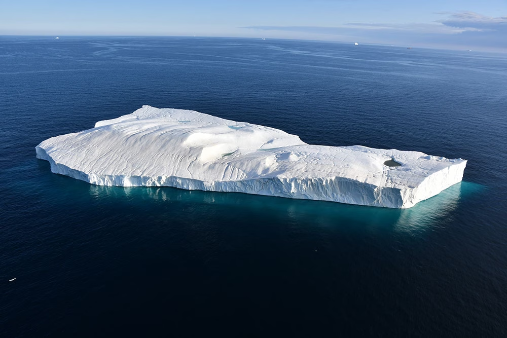
Since the early twentieth century, and most noticeably over the last 25 years, many glaciers around the world have been melting at an accelerated pace due to climate change. In the Arctic, this has led to an overall reduction in sea ice coverage, and an increase in the formation of large icebergs calved from glaciers and drifting out on the ocean currents.
A consequence of the overall reduction of sea ice in the Arctic has been an increase of 111% in shipping traffic in the region over the last 10 years, with fishing vessels also increasing significantly both in individual numbers and distance covered (41% and 37% respectively).
This increase in shipping vessels in Arctic waters means tracking the trajectories of icebergs has become even more critical to mitigate the risks they pose to shipping traffic, as well as to local communities and offshore infrastructure.
The Challenge
Arctic icebergs are smaller and more irregular than their Antarctic counterparts, making them harder to track. Traditional iceberg tracking methods, relying on ship observations, satellites, and aerial reconnaissance, are limited by weather conditions and are not sufficient for long-term risk management as Arctic shipping traffic continues to rise.
Over the last few decades, Ice Tracking Beacons (ITB) have been used to continuously monitor the movements of ice over the Arctic, providing valuable sources of information to complement radar and aircraft reconnaissance.
Short-term iceberg movement data can be utilized to create drift and deterioration models, while data on long-term movement paths can be applied to predictive modeling and enhancement of iceberg detection algorithms in satellite images. Additional data from the tracking beacons, such as tilt and heading, can also help determine how icebergs are drifting and deteriorating.
However, due to the high cost of commercially available ITBs, their use, and therefore efficacy, has been limited.
The Solution
At the Water and Ice Research Laboratory in the Department of Geography and Environmental Studies at Carleton University, Adam Garbo and Dr Derek Mueller collaborated to design and construct the Cryologger, a low-cost, satellite-enabled tracking beacon that can be built at a cost of up to 10 times cheaper than the commercial alternatives.
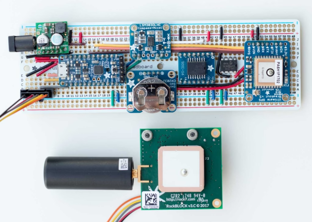
The Cryologger is a data recording and telemetry platform that utilizes Arduino’s open-source software and hardware. It’s designed to be adaptable to meet specific remote environmental sensing requirements, using inexpensive, readily available components. With no specialized knowledge or tools needed for assembly, it is easily accessible for researchers, citizen scientists, and enthusiasts to create their own data gathering devices.
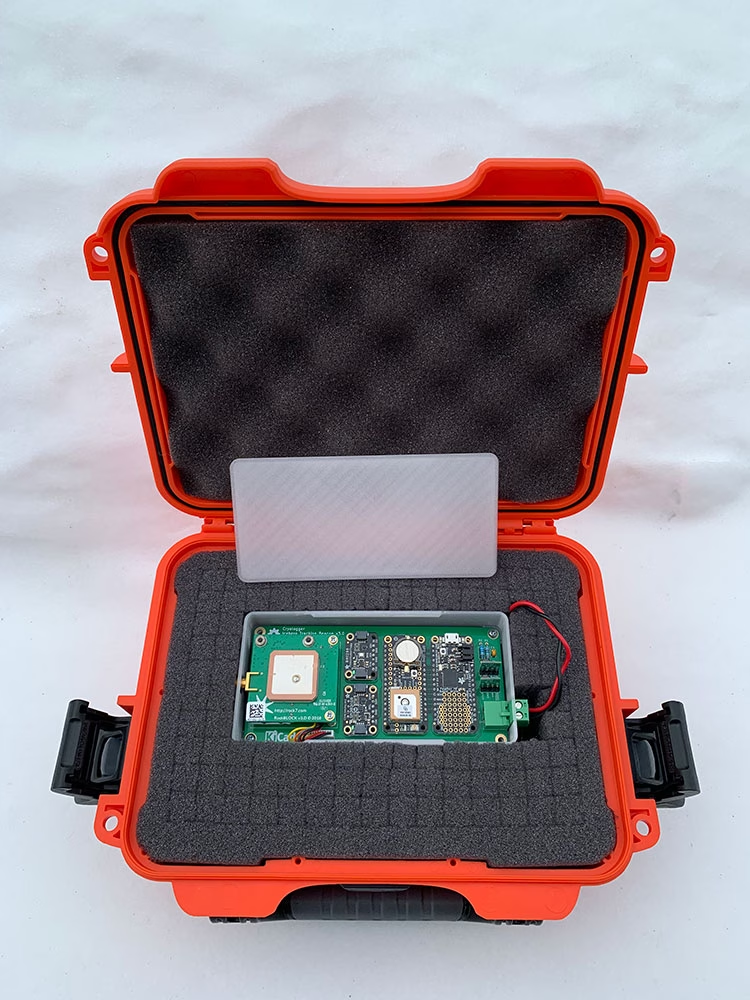
To monitor the icebergs, the Cryologger was specifically designed to be a ruggedized Ice Tracking Beacon (ITB) that could operate at Arctic temperatures.
Each beacon contains the following components:
- GNSS receiver for positioning information
- Real Time Clock (RTC) for time keeping and alarm capabilities so the beacon could wake up at transmission times the power down to sleep mode
- Accelerometer and magnetometer to provide pitch, roll and tilt-compensated heading measurements
- RockBLOCK 9603 to transmit the data packets via the Iridium global satellite network, which has pole-to-pole coverage
- Lithium-based battery pack designed to absorb power spikes during satellite transmission
- Ruggedized, impact-resistant, IP67 waterproof case.
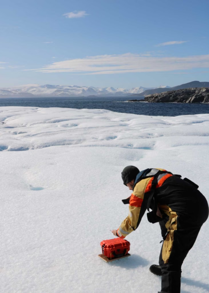
The Ice Tracking Beacon project involved each Cryologger being placed onto an iceberg or ice island to collect and transmit data for a minimum of 2 years. The ITB gathers data on location, temperature, pressure, battery voltage, and orientation every hour, and then transmits the data via satellite every 3 hours using the Iridium satellite network as a Short Burst Data (SBD) message, which can transmit up to 340 bytes.
Over the summers of 2018 and 2019, 20 Cryologger ITBs were deployed on icebergs and ice islands across the Arctic, including the coasts of Ellesmere Island, Baffin Island, and Greenland. Several beacons were also placed on the Petermann Glacier to monitor ice movement and prepare for anticipated major calving events
View Cryologgers' DataEnvironmental Monitoring with RockBLOCK
The advantage of developing low cost, open source technologies is the ability to design, deploy, test and improve continuously. The first wave of Cryologger ITBs exceeded their expected lifespans by a significant margin – one beacon was still active 5 years after deployment – and many of the issues experienced were related to relative unknowns, such as the impacts of the low temperatures the device components were exposed to, water ingress due to extreme weather conditions, or the deterioration of iceberg itself.
The data recorded by the ITBs over their lifespans and regularly transmitted by the RockBLOCK 9603s onboard has provided valuable insights into the potential of utilizing low cost, ‘real time’, in-situ environmental monitoring of icebergs and ice islands to supplement existing iceberg observation networks within the Canadian Arctic.
To find out more about the Cryologger Ice Tracking Beacon, visit https://cryologger.org/.
We’re Here to Help
If you need to transmit remote sensor data, such as location, movement, tilt and heading, we can help. We specialize in connecting devices and assets in remote locations beyond the reach of cellular connectivity.
We work with multiple satellite networks, and networking protocols, to ensure our customers’ needs are met cost-effectively and reliably. Please email hello@groundcontrol.com or fill in the form, and we’ll be in touch within one working day.
MTE Instruments have been creating custom solutions for scientific research groups since 1982. Over time, the team have come to specialize in oceanographic equipment, partially due to their location next to the Gulf of St Lawrence, on the east coast of Canada. From the earliest iterations of their data buoys and underwater recorders, it’s been imperative that they could deliver real-time telemetry, for their customers’ maintenance and monitoring purposes.
The Viking Buoy Overhaul
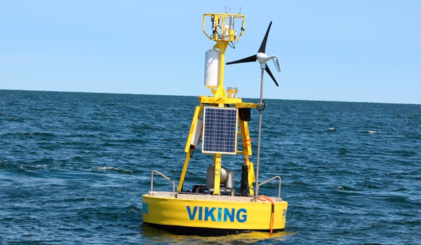
The Viking Buoy is MTE’s main platform, and has been deployed all over North America. The MTE team are in the process of overhauling the Viking Buoy to upgrade to a newer generation of solar panels, modernizing the controller for an AI capable one and upgrading the communication system.
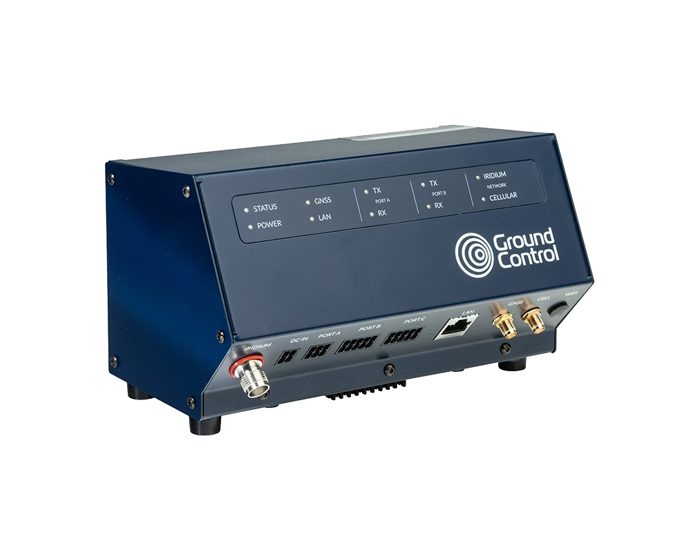
With the help of Ground Control and the RockREMOTE, MTE have been able to dramatically simplify their means of communicating with the buoy. From having to maintain and work with two means of communication, the MTE team now only have to work with one.
Why RockREMOTE And Certus 100 Works For MTE
- Bi-directional communication
- Ability to transmit about 10 MB per month for a reasonable price
- Speed is not really a factor; MTE can work with 1 KB per second
- Ability to prevent rogue transmission is a big plus (customizable data limits and alerts)
As of now, using the Iridium Certus 100 service, MTE are able to operate and debug with ease. Internet tools like SSH are made available and offer not only a possibility in fixing problems, but in the remote deployment of new AI algorithms for in-field testing.
What The Extra Data Facilitates
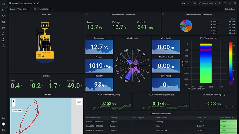
Certus 100 also allows MTE to transmit all recorded data by the buoy, instead of only summarized data. This allows data experts to process and analyze the various parameters in real time.
More and more services are made available for maritime workers to benefit from this live information. Weather information, sea currents and even whale presence are now used in day-to-day cruise planning.
OceanSIP is a service that was specifically tailored to ease the access to the live data of MTE’s various data acquisition platforms. The screenshot shows just some of data that’s now available in real-time via OceanSIP.
“With the advances in satellite communication, the hopes are rising in the scientific communities regarding the possibility of unmanned vehicles with real-time feedback, fauna monitoring cameras and audio monitoring only to name a few. It is hard not to be excited by the upcoming possibilities! From MTE, thanks for making these possibilities a reality for the various experts who thrive in improving our knowledge.”
Martin Rioux, ing. | P.Eng. | Embedded System Developer
We’re here to help
If you have a remote IoT connectivity challenge, there’s a very good chance we can help! With over 20 years’ experience in satellite communications, and long-term relationships with trusted satellite constellation operators like Iridium, we’re well placed to help you backhaul your data cost-effectively and reliably from anywhere on Earth with a clear view of the sky.
Call or email us, or complete the form, and we’ll be happy to connect you with one of our solutions architects to discuss your requirements.
Mapping Monsoon Currents to Support Coastal Livelihoods
The UK’s National Oceanography Centre (NOC) is one of the world’s top ocean research institutions. NOC’s scientists work around the globe, uncovering links between the ocean, climate change and biodiversity loss, to help every living thing on our planet flourish.
The organisation solves challenging multidisciplinary, large scale, long-term marine science problems to underpin international and UK public policy, business and societal outcomes. NOC also operates the Royal Research Ships James Cook and Discovery and develops technology for coastal and deep ocean research.
About the Project
In the Western Indian Ocean’s Pemba Channel, monsoon seasons shape life above and below the surface. Understanding where currents accelerate, where eddies form, and how waters connect across borders is essential to safeguarding fisheries, supporting livelihoods, and protecting biodiversity. NOC led collaborative work within SOLSTICE-WIO to generate that evidence, while building local capacity so the benefits endure.
The Connectivity Challenge
The Pemba Channel is remote, energetic, and sparsely instrumented. Cellular coverage is unreliable; the science window is short. NOC needed a way to capture near-real time trajectories from small, battery powered drifters during the monsoon; robust enough for rough seas, simple enough to replicate, and affordable so partners could scale it into routine observing. The goal was decision-ready data to inform sustainable fisheries and coastal planning.
The Solution
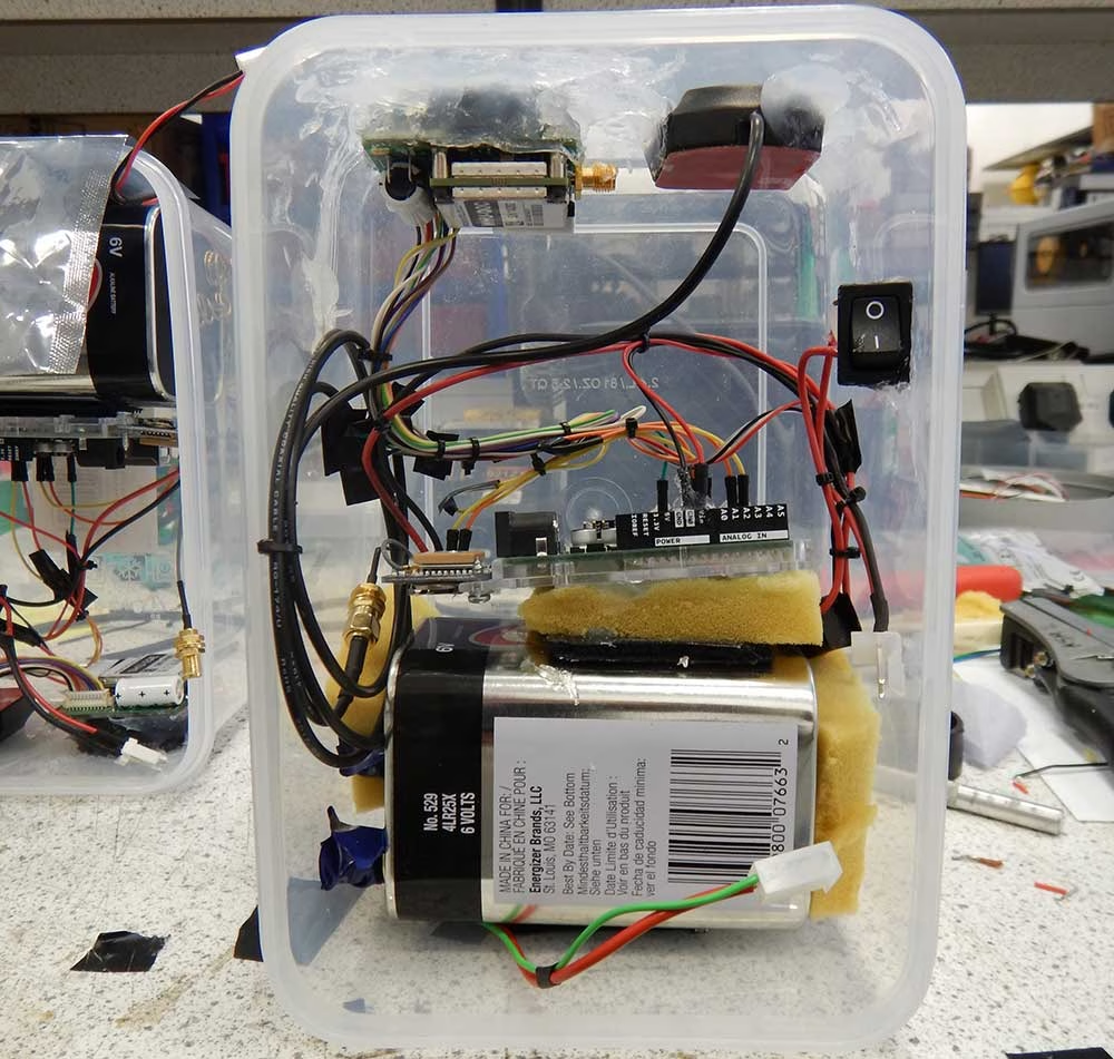
To achieve global connectivity from compact platforms, NOC integrated Ground Control’s RockBLOCK 9603 with Iridium Short Burst Data. The 9603’s small footprint, straightforward wiring, and low power draw made it a natural fit for locally built, low cost drifters assembled from off the shelf parts.
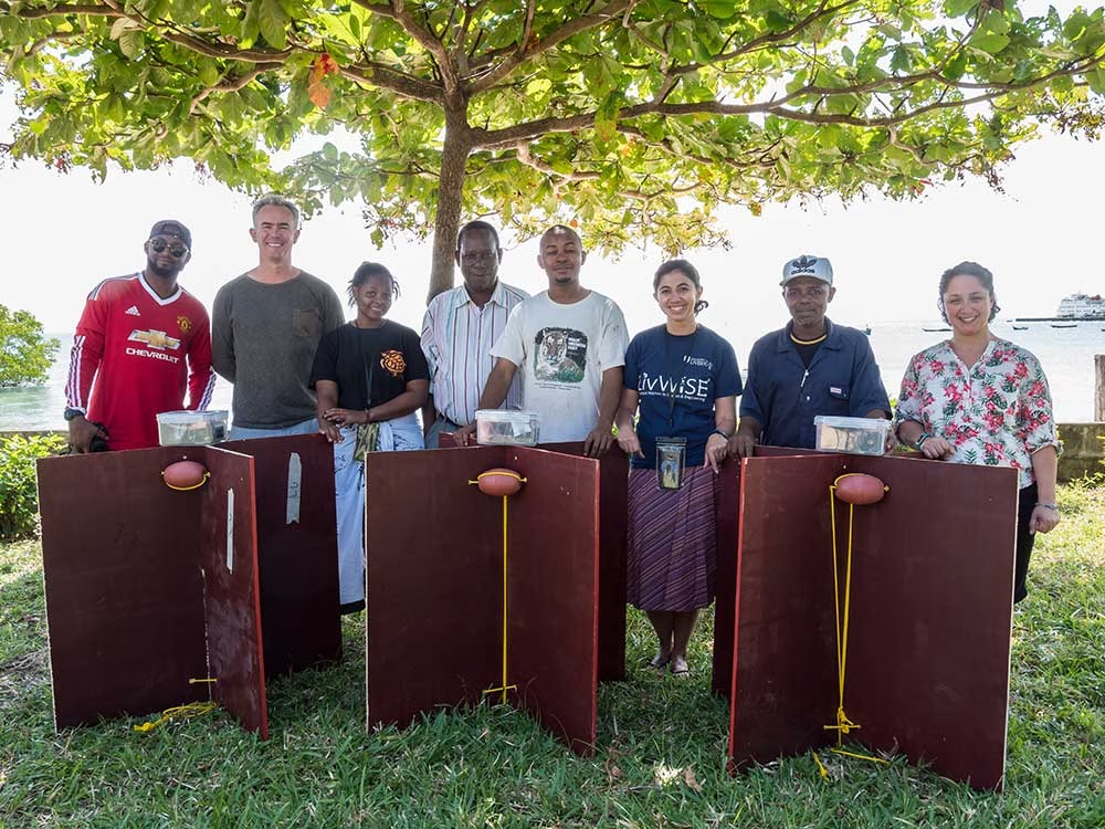
NOC and partners constructed a fleet of nine surface drifters and executed multiple deployments across tidal cycles and shifting winds. Each unit uplinked GPS positions via Iridium, feeding a simple tracking and visualisation workflow so the team, and regional stakeholders, could see the ocean move as conditions evolved.
Why RockBLOCK 9603 for Metocean Data?
RockBLOCK 9603 delivers global, two way Iridium Short Burst Data (SBD) messaging from compact, battery-powered platforms. It’s designed for harsh, remote environments where cellular networks aren’t an option, providing dependable links for position reports and sensor data whenever a clear sky view is available.
Integration is straightforward. The 9603’s small footprint (45×45×16 mm, ~39 g) and simple connector make it easy to embed alongside GPS and microcontrollers in space constrained builds. Clear developer documentation and example workflows help teams move quickly from bench testing to sea trials.
Power efficiency is a core advantage. Short wake cycles and low standby draw support long deployments on modest battery packs, which is ideal for lightweight drifters and autonomous systems. In practice, that means more time collecting decision ready data, and fewer retrievals or battery swaps.
The Results
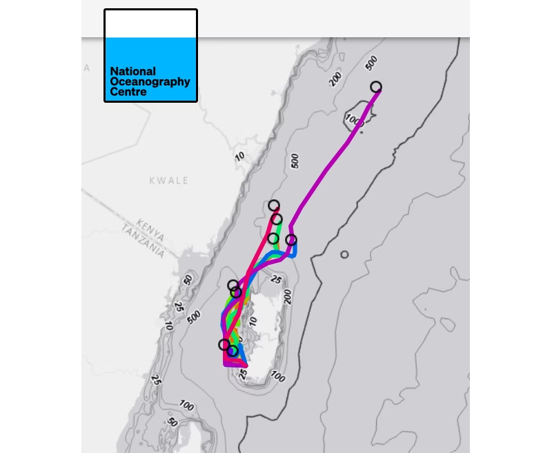
- Actionable ocean intelligence: The drifters resolved fast central flows, persistent eddies, and strong tidal modulation. These features drive nutrient transport and productivity, shaping fish distribution and catch success. Turning them from invisible forces into mapped patterns helps align fishing effort with sustainability.
- Connectivity across borders: Tracks that exited the channel highlighted time dependent links into Kenyan waters, informing conversations about shared stocks and coordinated management.
- Capacity built in the region: Because the design is repeatable and affordable, partners can assemble, deploy, and interpret their own drifters, embedding skills locally, and creating a foundation for long term observation.
- Better models, better policy: Observations serve as ground truth alongside remote sensing, strengthening regional ocean models that underpin fisheries advice, marine planning, and climate resilience strategies.
Have a Remote Monitoring Challenge?
Ground Control has over 20 years’ experience in connecting very remote things, from data buoys to weather stations, animal tracking collars to wind farms. If you have an application that’s out of reach of cellular, we can help you bring your data home.
Tell us about your project by completing the form or emailing hello@groundcontrol.com; we’ll reply within one working day with expert, impartial advice.
Going Wireless in Greenland: Downloading Data from Deep Beneath the Ice
Glaciers are constantly on the move. They’re flowing rivers of ice, constantly flowing and fracturing and bulldozing everything in their path. But under the ice there’s a hidden network of “plumbing” – water flowing in channels within and beneath the ice. This liquid water can lubricate the flow of ice over the bedrock, changing the speed at which the ice is moving. For glaciologists, understanding this hidden plumbing is essential for improving forecasts of ice flow and, ultimately, sea level rise.
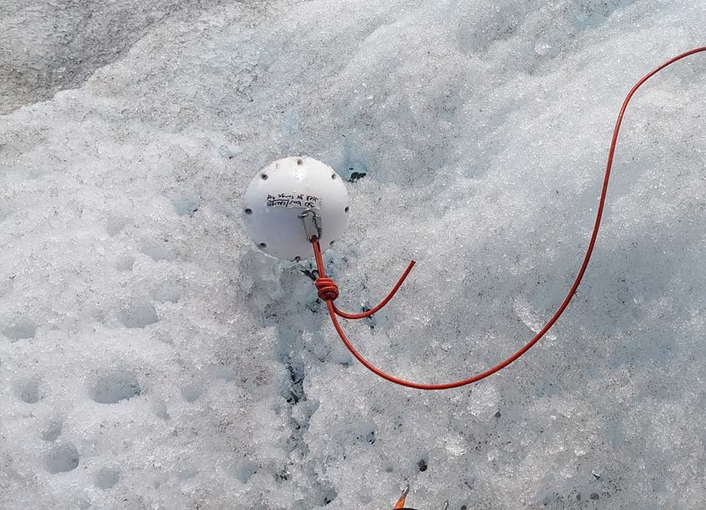
Cardiff University’s Cryoegg project set out to make those concealed environments measurable in a new way: by placing a compact wireless probe (the “Cryoegg” itself) directly into subglacial water systems, collecting pressure, temperature, and electrical conductivity data, and transmitting readings back up to the surface. The ambition was straightforward; the environment was not.

The Challenge
Subglacial research is defined by constraints. Access often comes through narrow boreholes drilled or melted through ice that is hundreds of meters thick, in places where weather is harsh, logistics are limited, and communications infrastructure is non-existent. Once instruments are down-hole, the borehole can refreeze, and moving ice can deform or destroy anything relying on fixed cables. In many cases, retrieval simply isn’t part of the plan; you have to assume what you deploy may never come back up.
That creates a second, less visible challenge: even if you can get sensor data to the surface, how do you move it off the ice reliably, with minimal power, and without needing someone to stand next to the equipment?
The Work
Cryoegg was developed specifically to reduce reliance on vulnerable wired systems. In peer-reviewed field trials, the team demonstrated wireless transmission through cold ice at substantial depths, with the published work reporting communication through up to 1.3 km of ice under test conditions.
Cryoegg’s design also targets long deployment life by spending most of its time asleep, waking briefly to take readings and transmit them, then returning to low power operation. Some Cryoeggs have now been operating for more than 18 months underneath the ice.
To make that science usable day-to-day, the field system still needs a dependable ‘last mile’ from the glacier surface back to the researchers, so data doesn’t stay stranded in a remote camp until the next field visit.
Getting the Data Home
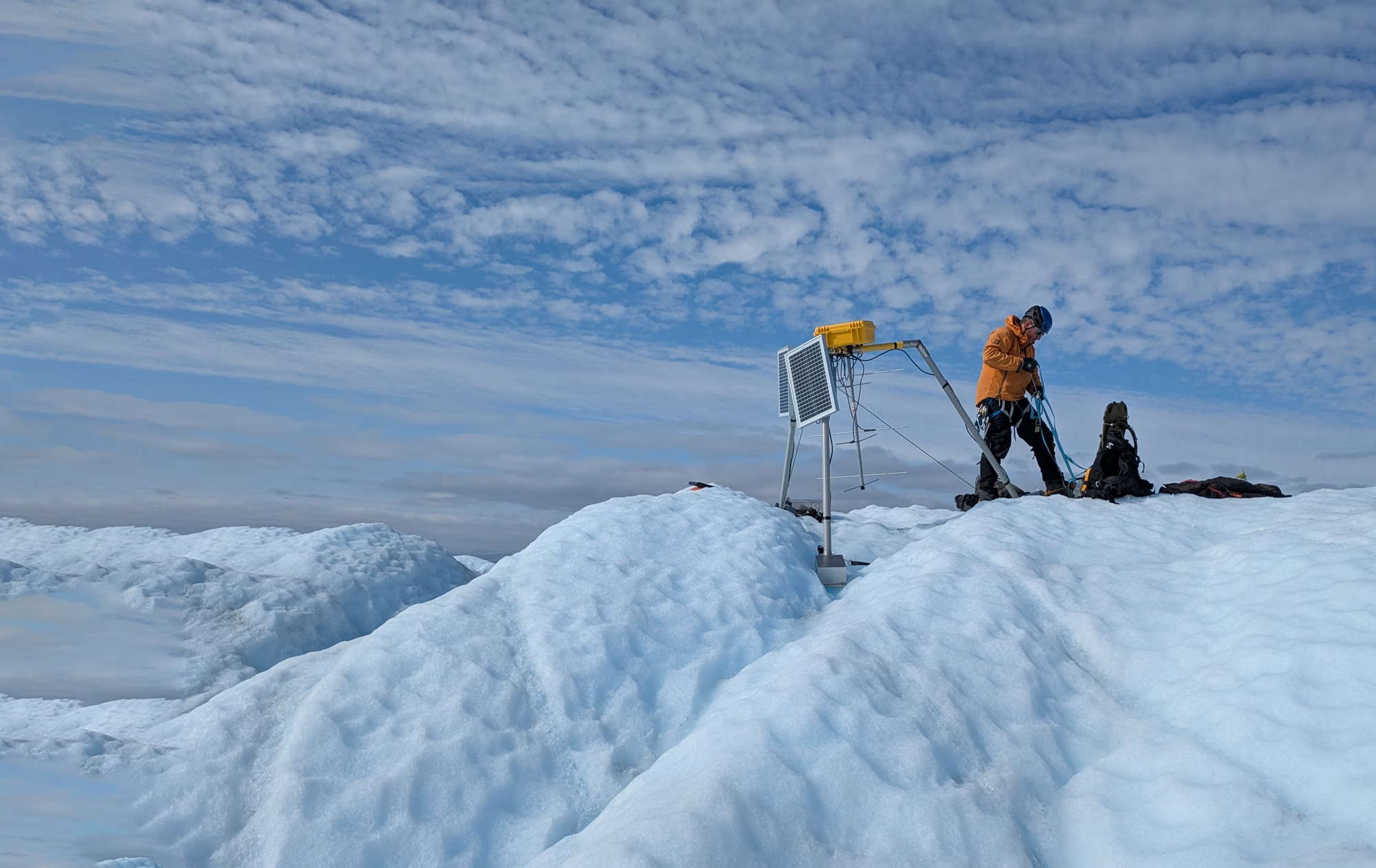
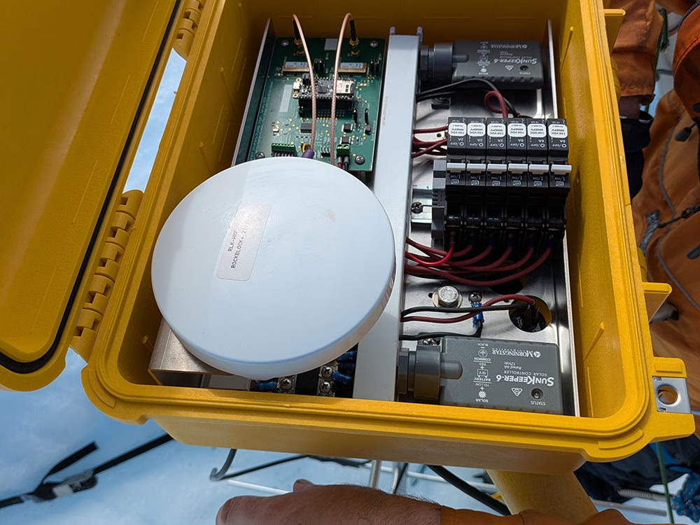
During a recent field trip to West Greenland, the team deployed a surface datalogger to receive transmissions from equipment buried hundreds of meters below the ice, then forward those messages back to the UK over satellite.
Once you’re operating in environments that are cold, wet, windy, and hard to revisit, reliability and power discipline become operational requirements. The device used by the team to move messages from the datalogger to base was RockBLOCK Plus, a waterproof satellite IoT device designed for short burst messaging via the Iridium network.
For this kind of deployment, the relevant details are simple: it’s built to stay outside, keep working, and do so without demanding much power. RockBLOCK Plus is IP67 rated, and operates in temperatures as low as -40°C to as high as +85°C, with a rugged design intended for remote, unattended installations.
The Result
By pairing a wireless subglacial probe with a robust surface-to-satellite backhaul, the Cryoegg team can focus more of their effort on what matters: collecting measurements that illuminate how water moves beneath ice, and using those observations to improve our understanding of glacier dynamics.
The overall impact is practical as well as scientific. When data can make its way off a glacier without frequent visits or complex infrastructure, projects become more resilient, field seasons become more efficient, and research teams can spend less time babysitting comms and more time interpreting results.
Read the ongoing findings of the research here.
“We’re doing exciting science in a very challenging environment. We needed something that would keep sending data reliably in harsh conditions, and RockBLOCK Plus has done exactly that. The Ground Control team were easy to work with, and I’m looking forward to trying the latest iterations of the hardware in future deployments.”
Dr Mike Prior-Jones, Electronic Engineer and Glaciologist (read more about Dr Prior-Jones)
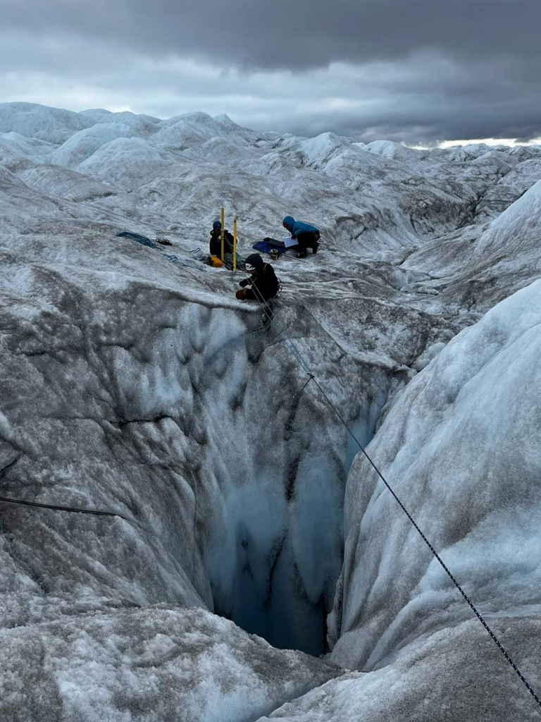
[About the picture on the right]
“The team preparing for a Cryoegg deployment in a moulin (a naturally-occurring hole in the glacier made by meltwater) on Isunnguata Sermia. Jonathan is roped up with a harness in case he falls. The ice here is about 400m thick, and the initial drop into the moulin is probably around 50m, so not something you want to fall into.”
Have data in hard-to-reach places?
Ground Control has over 20 years experience in extracting data from the most remote and inhospitable places on Earth. Our satellite IoT solutions draw very little power, work reliably anywhere with a clear view of the sky (even within a plastic container!), and come in multiple form factors, from developer PCBs to rugged and enclosed devices.
Let us know about your project by emailing hello@groundcontrol.com, or complete the form, and we’ll reply within one working day to offer our expert advice.
Drifting Buoys are versatile kits that anyone with the know-how can use to retrieve their own oceanic data. Generally, the main purpose of drifting buoys is to measure ocean currents and sea temperatures, the data of which is then transmitted back to research labs on the mainland for analysis.
The data provides vital intelligence for weather and climate models and ultimately aids in the better understanding of ocean behaviour and intensity forecasting.
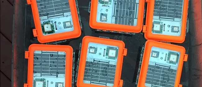
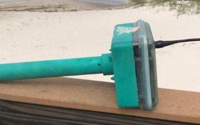
The Maker Buoy is a solar-powered, Arduino-based research buoy that measures ocean drift and sea temperature and carries a RockBLOCK 9603 to transmit position, water temperature, and other data via the Iridium satellite network.
The unit can be built by hobbyists, researchers, and meteorological organizations, and data shared is used to further our understanding of our oceans.
Maker Buoy supplies various options: a bare PCB, a populated PCB, a complete kit for the end user to construct themselves, and a complete unit. One of the most notable users of Maker Buoy is The Ocean Cleanup.
The Challenge
Drifters are sometimes thrown in the ocean in the path of typhoons and hurricanes to gain a better understanding of ocean behavior. As such, components need to be long-lasting and compact enough to ensure efficient use of space.
Projects range from small scale hobby projects through to high budget global schemes, so accessibility by hobbyists, researchers, and organizations alike is key.
The Solution
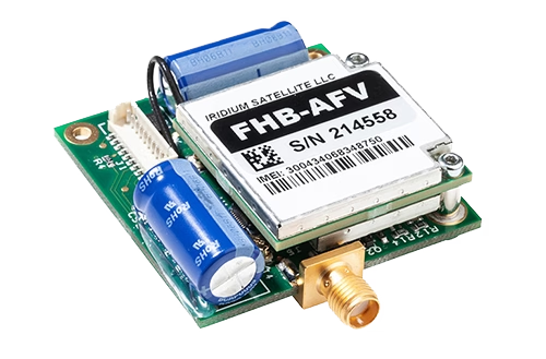
RockBLOCK 9603 is a versatile, compact, low power and dependable way of sending and receiving data from remote locations. It uses the Iridium satellite network, giving truly global coverage.
RockBLOCK is readily available to anyone with a passion for IoT who wants to send and receive data from remote locations – such as the middle of ocean.
- Truly global two way coverage
- Low power usage, small antenna
- Plug-and-play product, simple setup
- Reliable data transmission with acknowledgements
- Lifetime phone and email support.
“A nice feature of Ground Control’s RockBLOCK Iridium satellite SBD service is the ability to forward messages to another modem, allowing access to Maker Buoy data in locations without Internet access.”
Wayne Pavalko, Maker Buoy Founder
Built with Ground Control
If you’re exploring your own ocean and coastal monitoring buoys project, please call or email us, or complete the form, and we’ll be happy to help. We have offices in the UK and USA, and 20 years’ experience in satellite connectivity, so you’re in safe hands.
Data Buoys for Offshore Telemetry
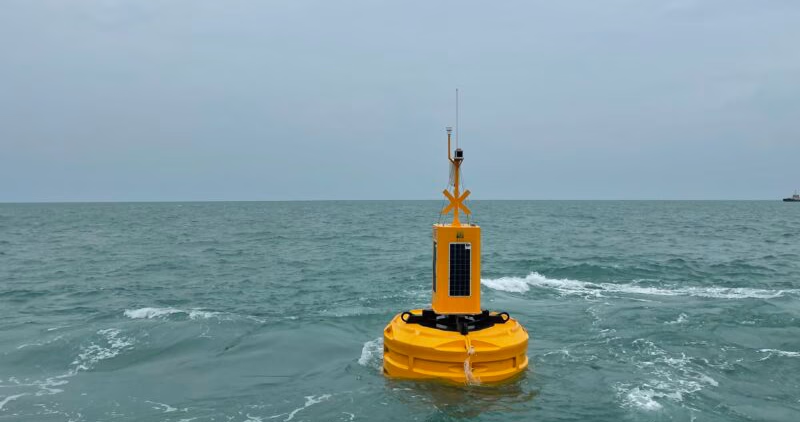
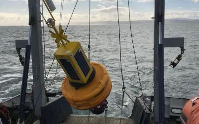
Data Buoys purposes can include measurements of water temperatures, salinity, drift patterns, and pollutant levels, which inform a large number of personal and global projects from boat manufacture through to meteorology and climate change.
Working with Bangor University on the SEACAMS2 Project, Ocean Scientific International Ltd (OSIL) is using RockBLOCK 9602 for the satellite communications element for its telemetered data buoys. The buoys collect and measure oceanographic, meteorological, and water quality data parameters around the coast of North Wales to assess renewable energy opportunities.

The Challenge
Regardless of deployment location, buoys will often find themselves drifting to remote locations where mobile GSM just can’t reach or is intermittent.
The data collected is vital and therefore continuous, reliable transmission is paramount to its ongoing success.
What’s more, any components of the buoy need to be compact enough to ensure it doesn’t take up vital space in the equipment used to remain lightweight.
The RockBLOCK Solution
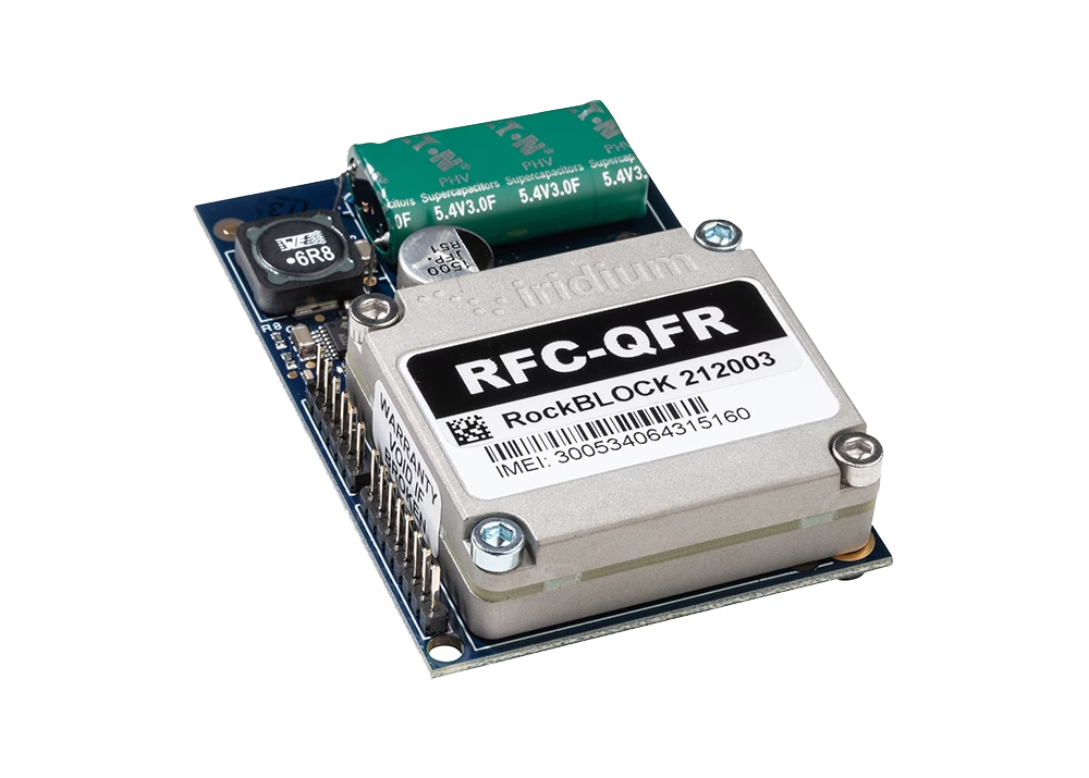
RockBLOCK 9602 is a versatile, compact, low- ower, and dependable way of sending and receiving data from remote locations. It uses the Iridium satellite network, giving truly global coverage. RockBLOCK 9602 is used when the buoy is out of range of cellular networks to allow data to be sent and received regardless of location.
- Truly global two way coverage
- Low power usage, small antenna
- Plug-and-play product, simple setup
- Reliable data transmission with acknowledgements
- Lifetime phone and email support.
“We enjoy working with Ground Control as they offer great, sensibly priced products with excellent after sales support and an easy to use online portal.”
Rob Luthwaite, OSIL Project Manager
Built with Ground Control
The work we support genuinely inspires us, and we’re proud to create solutions and solve customer problems like no one else can.
If you’d like to get in touch with the team either to discuss a challenge similar to that of the one above, or something completely different, our team of experts will be happy to provide objective advice.