Airtime: SBD
Drifting Buoys are versatile kits that anyone with the know-how can use to retrieve their own oceanic data. Generally, the main purpose of drifting buoys is to measure ocean currents and sea temperatures, the data of which is then transmitted back to research labs on the mainland for analysis.
The data provides vital intelligence for weather and climate models and ultimately aids in the better understanding of ocean behaviour and intensity forecasting.
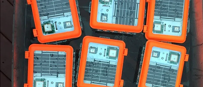
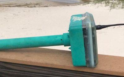
The Maker Buoy is a solar-powered, Arduino-based research buoy that measures ocean drift and sea temperature and carries a RockBLOCK 9603 to transmit position, water temperature, and other data via the Iridium satellite network.
The unit can be built by hobbyists, researchers, and meteorological organisations, and data shared is used to further our understanding of our oceans.
Maker Buoy supplies various options: a bare PCB, a populated PCB, a complete kit for the end user to construct themselves, and a complete unit. One of the most notable users of Maker Buoy is The Ocean Cleanup.
The Challenge
Drifters are sometimes thrown in the ocean in the path of typhoons and hurricanes to gain a better understanding of ocean behaviour. As such, components need to be long-lasting and compact enough to ensure efficient use of space.
Projects range from small scale hobby projects through to high budget global schemes, so accessibility by hobbyists, researchers, and organisations alike is key.
The Solution
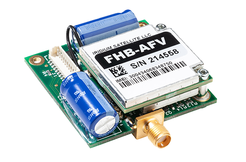
RockBLOCK 9603 is a versatile, compact, low power and dependable way of sending and receiving data from remote locations. It uses the Iridium satellite network, giving truly global coverage.
RockBLOCK is readily available to anyone with a passion for IoT who wants to send and receive data from remote locations – such as the middle of ocean.
- Truly global two way coverage
- Low power usage, small antenna
- Plug-and-play product, simple setup
- Reliable data transmission with acknowledgements
- Lifetime phone and email support.
“A nice feature of Ground Control’s RockBLOCK Iridium satellite SBD service is the ability to forward messages to another modem, allowing access to Maker Buoy data in locations without Internet access.”
Wayne Pavalko, Maker Buoy Founder
Built with Ground Control
If you’re exploring your own ocean and coastal monitoring buoys project, please call or email us, or complete the form, and we’ll be happy to help. We have offices in the UK and USA, and 20 years’ experience in satellite connectivity, so you’re in safe hands.
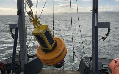
Data Buoys purposes can include measurements of water temperatures, salinity, drift patterns, and pollutant levels, which inform a large number of personal and global projects from boat manufacture through to meteorology and climate change.
Working with Bangor University on the SEACAMS2 Project, Ocean Scientific International Ltd (OSIL) is using RockBLOCK 9602 for the satellite communications element for its telemetered data buoys. The buoys collect and measure oceanographic, meteorological, and water quality data parameters around the coast of North Wales to assess renewable energy opportunities.

The Challenge
Regardless of deployment location, buoys will often find themselves drifting to remote locations where mobile GSM just can’t reach or is intermittent.
The data collected is vital and therefore continuous, reliable transmission is paramount to its ongoing success.
What’s more, any components of the buoy need to be compact enough to ensure it doesn’t take up vital space in the equipment used to remain lightweight.
The RockBLOCK Solution
RockBLOCK 9602 is a versatile, compact, low- ower, and dependable way of sending and receiving data from remote locations. It uses the Iridium satellite network, giving truly global coverage. RockBLOCK 9602 is used when the buoy is out of range of cellular networks to allow data to be sent and received regardless of location.
- Truly global two way coverage
- Low power usage, small antenna
- Plug-and-play product, simple setup
- Reliable data transmission with acknowledgements
- Lifetime phone and email support.
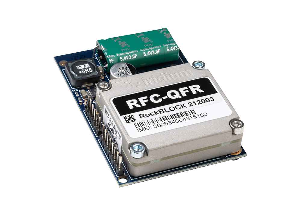
“We enjoy working with Ground Control as they offer great, sensibly priced products with excellent after sales support and an easy to use online portal.”
Rob Luthwaite, OSIL Project Manager
Built with Ground Control
The work we support genuinely inspires us, and we’re proud to create solutions and solve customer problems like no one else can.
If you’d like to get in touch with the team either to discuss a challenge similar to that of the one above, or something completely different, our team of experts will be happy to provide objective advice.
Introducing the Eldorado Space Program
Instrumentation packages are often sent into the upper atmosphere via high altitude balloons to collect a wide range of data. Data transmission can be achieved using both satellite and microwave links, and the data itself can include down range velocity, vertical ascent rate, latitude, longitude, elevation, system health, signal strength, down range distance, heading and trajectory, and more.
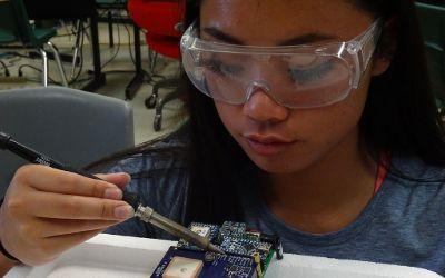
A 17-year veteran of Sandia National Labs and founder of a Silicon Valley nanotechnology company, teacher Paul McWhorter established his high school’s first Space Program.
Edorado High School sends instrumentation packages, called Eagles, to the edge of space and transmits back temperature, pressure, and GPS data, as well as live video. In all, twenty different data channels are telemetered back to ‘Mission Control’ in the classroom.
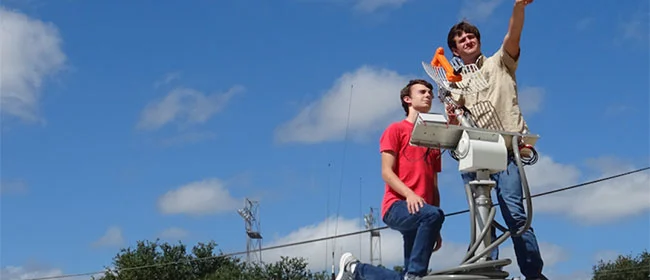
Due to technical and regulatory requirements, a high-gain microwave antenna on the ground is needed. The challenge here is that a high frequency microwave radio beam has poor propagation so it must be pointed extremely precisely at the space-bound instrument package.
Pointing errors of just a few degrees can lead to loss of signal, so a separate and reliable way of transmitting the GPS location of the remote device is needed to help keep the microwave antenna aimed in the right direction and re-establish a link if lost.
This is where RockBLOCK 9602 comes in. RockBLOCK 9602 acts as a back-up system to help the main microwave array maintain and regain connection.
“Mission Success depends on reliable transmission of GPS coordinates from the instrument package back to the ground, We have chosen the RockBLOCK modem and Iridium satellite network because it provides rock solid connectivity.”
Christine Lindsey, Mission Specialist
RockBLOCK 9602: Plug-and-Play Satellite Connectivity
RockBLOCKs are a versatile, compact, low-power, and dependable way of sending and receiving data from remote locations. Devices use the Iridium satellite network, allowing truly global coverage.
GPS data is transmitted via RockBLOCK to Ground Control’s servers. It’s then pushed via HTTP post to the client’s server which adjusts the high-gain antenna position accordingly, thus maintaining the links.
Key Features for Educators:
- Truly global two-way coverage
- Low power usage, small antenna
- Plug and play product, simple setup
- Reliable data transmission with acknowledgements
- Lifetime phone and email support.
Supporting Educators
The work we support genuinely inspires us, and we’re proud to create solutions and solve customer problems like no one else can.
If you’d like to get in touch with the team either to discuss a challenge similar to that of the one above, or something completely different our team of experts will be happy to provide objective advice.
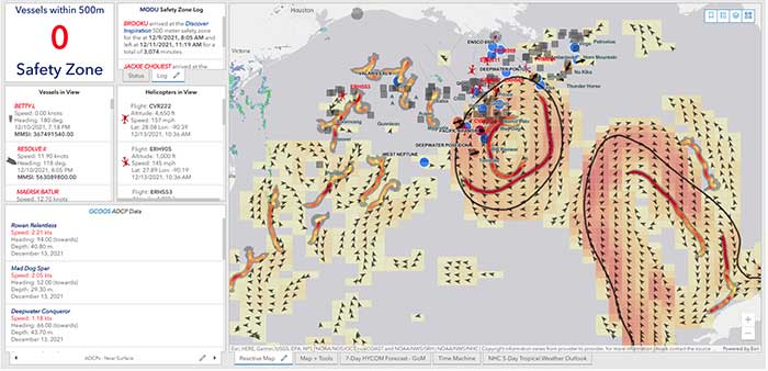
40Geo captures geographical information from hard-to-reach areas and analyses it to deliver situational awareness, competitive intelligence, and advanced visualization for supply chain optimization. One of the means 40Geo has of collecting data is utilizing drifting data buoys, which are deployed into areas being used for, or potentially used for, oil and gas exploration and extraction.
These data buoys capture wave height, temperature, wind speed, and over time, forecast patterns in ocean currents. They can even detect volume and frequency of other passing vessels by tapping into the radio signals sent out from boats. With 40Geo’s analysis, this becomes powerful data to aid decisions about when and where to situate off-shore oil and gas operations.

The Challenge
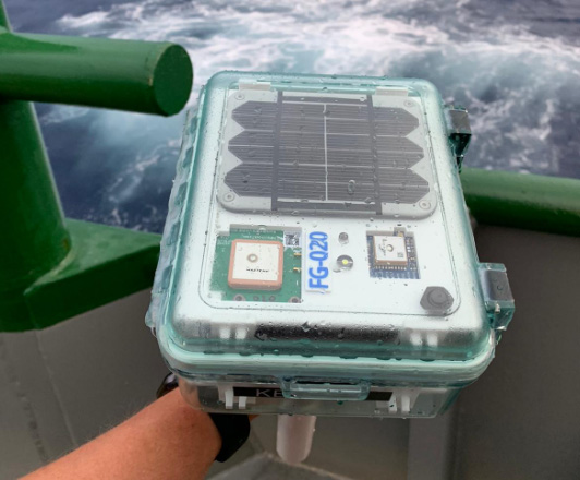
Many areas suitable for oil and gas extraction are also very remote, so backhauling that data from the data buoys to 40Geo’s servers requires a satellite connection. To date, 40Geo’s drifting data buoys have leveraged Ground Control’s RockBLOCK 9602 for this application, placing the transceiver into a waterproof box on top of the buoy.
This gives the team close to real time data under any circumstances, as the L-Band frequency that the RockBLOCK 9602 leverages is not affected by weather conditions. It’s also completely global coverage because it uses the Iridium satellite constellation; no matter where the buoy drifts to, 40Geo will be able to pinpoint its location.
The Evolution
In the Gulf of Mexico, an area rich in oil and gas reserves, there are two considerations that make 40Geo’s current data buoys less optimal. Firstly, there is cellular network coverage for a reasonable amount of the gulf, which, because it’s often lower cost compared to satellite transmission, will be the preferred means of sending and receiving data.
Secondly, there are powerful currents that can send the unpowered data buoys well away from the areas that are of most interest to 40Geo’s oil and gas customers.
The Solution
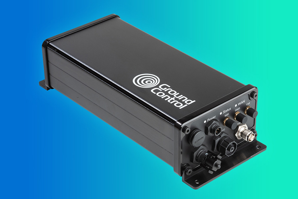
40Geo is in the final stages of launching a new USV (unmanned surface vessel) which has the ability to be remotely operated, meaning that if it should travel out of the area under inspection, the operator can put it back on course. In addition to this, the new autonomous vehicle will utilize RockREMOTE Rugged rather than the RockBLOCK 9602 for its data transmission.
This is because RockREMOTE Rugged is a hybrid LTE-M / Certus 100 / Iridium Messaging Transport (IMT)-capable device, allowing the 40Geo to use a single ‘box’ for all of their connectivity requirements. RockREMOTE Rugged can be configured to leverage the cellular network whenever available, and seamlessly switch to satellite when cellular data is unavailable, giving the 40Geo team the perfect balance of optimized costs and 100% connectivity.
“We chose the RockBLOCK because it delivered exactly what we needed: plug-and-play satellite connectivity that delivers close to real-time data. The developer documentation is thorough and the API interface works well. The RockREMOTE is an exciting evolution allowing us to provide more data while controlling costs; this is the sort of innovation that will propel satellite IoT applications forward.”
Miles Roden, COO, 40Geo
The USV will be able to undertake other tasks in addition to its main purpose of measuring wave height, wind speed etc. For example, a weather balloon can be launched from the platform to capture data from hurricanes. It simply wouldn’t be possible to launch this from an oil rig because of the fire risk from the sensing equipment and the helium (although the risk is small, helium is listed as hazardous by some operators), and the potential for the balloon to impact drilling equipment.
40Geo’s multitasking USVs can be used for many different applications, including air quality monitoring after oil spills, surveys of ocean currents for renewable infrastructure planning, video inspection of unmanned assets, marine mammal detection, and any other tasks that clients can envision.
Would you like to know more?
If you’re interested in 40Geo’s data buoys, or you have your own tracking software and want to explore integration options with Ground Control’s satellite tracking devices, we’d love to hear from you.
Call or email us, or complete the form, and one of our experienced team will be happy to help.
Keeping Flood Monitoring Data Flowing When It Matters Most
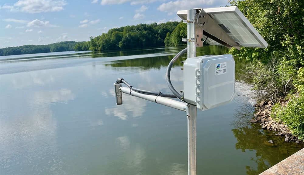
Green Stream Technologies provides real time flood monitoring systems that help communities, agencies, and infrastructure operators detect rising water, monitor rainfall and weather conditions, and respond quickly to flood risk. Its solution brings together rugged sensor kits, autonomous solar power, secure cloud services, dashboards, alerts, APIs, integrations, field services, training, and ongoing support.

The Challenge
For flood monitoring to be useful, data has to get through. A water level reading, rainfall measurement, or field image can support decisions during a fast moving event, but only if it reaches the right people in time.
Many of the locations that need monitoring are rural, coastal, or riverside sites where cellular coverage can be limited. Even where LTE is normally available, severe weather can disrupt terrestrial networks during the events these systems are designed to track. Green Stream needed a communications approach that could work across different environments, while balancing cost, reliability, latency, and operational risk.
The Solution
Green Stream uses a site-by-site telemetry strategy. Where LTE coverage is strong, cellular is often the most cost effective option. In remote areas with little or no cellular coverage, Iridium can act as the primary communications path. For mission critical sites, especially in flood-prone areas where storms may affect cellular networks, Green Stream can pair LTE with Iridium failover.
That flexibility helps Green Stream match the connectivity method to the site. It also reflects a deliberate choice. Flood monitoring depends on high resolution, real time data that customers can act on. Some emerging LEO satellite options can be lower cost, but may require waiting for a satellite pass. For flash flooding, a two- or three-hour reporting gap is not good enough. Iridium gives Green Stream global coverage and the ability to report every five minutes, with no missed reporting windows.
Using Ground Control’s RockBLOCK devices, Green Stream can add Iridium connectivity to monitoring stations beyond the reach of terrestrial networks, from rural riverbanks to coastal plains and other high impact locations.
The Service Evolution
Green Stream first used RockBLOCK 9603, based on Iridium Short Burst Data (SBD), to send compact reports from remote monitoring sites. For many applications, that was enough: small packets of data covering water levels, rainfall, device status, and network health.
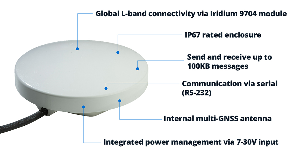
As its deployments evolved, Green Stream began moving to RockBLOCK 9704 and RockBLOCK Plus 9704, which use Iridium Messaging Transport (IMT). The difference is significant. RockBLOCK 9603 messages are measured in hundreds of bytes; RockBLOCK 9704 supports messages up to 100KB.
That larger message size creates room for richer reporting. Water level data remains central to flood monitoring, but Green Stream can now look at adding more context, including images from the field. During a flood event, imagery can help emergency managers see what conditions look like on the ground, not just read what a sensor is reporting.
The Result
Satellite connectivity helps Green Stream reduce operational risk, especially in remote or high impact locations where site visits can be difficult, slow, or unsafe.
During severe weather, continuity of data becomes especially important. By using Iridium through Ground Control’s RockBLOCK devices, Green Stream can offer an added layer of resilience for sites where communications failure would have the greatest impact.
This matters as Green Stream expands into more rural and underserved areas. These communities may face serious flood risk, but lack dependable cellular coverage. Satellite connectivity helps make early warning systems practical in places that would otherwise be harder to monitor.
“We chose Ground Control because it provided a fast and straightforward path to integrating Iridium into our systems, which was important for getting a satellite solution to market quickly. The platform is intuitive and well documented, and our Account Manager, Elonda, has been knowledgeable and responsive, which has made the partnership easy to work with.”
Karen Lindquist, Green Stream
Looking Ahead
Green Stream is continuing to scale as more communities look for better ways to manage flood risk. Its approach – start with a pilot, then expand to a wider network – gives customers a practical path from initial deployment to broader flood intelligence systems.
As those networks grow, satellite connectivity will help Green Stream reach more sites, support more resilient deployments, and feed local data into regional or state-level systems for emergency management.
Let’s connect your next deployment
Green Stream’s flood monitoring network is one example of how satellite IoT can help critical data keep moving when cellular coverage is limited, unreliable, or at risk of disruption.
If you’re developing an IoT solution for remote, mobile, or mission critical environments, Ground Control can help you assess your options and build a connectivity approach that fits your application, budget, and growth plans.
Complete the form or email hello@groundcontrol.com and we’ll reply within one working day.
Smart Satellite Buoys Reducing Ghost Gear and Protecting Oceans
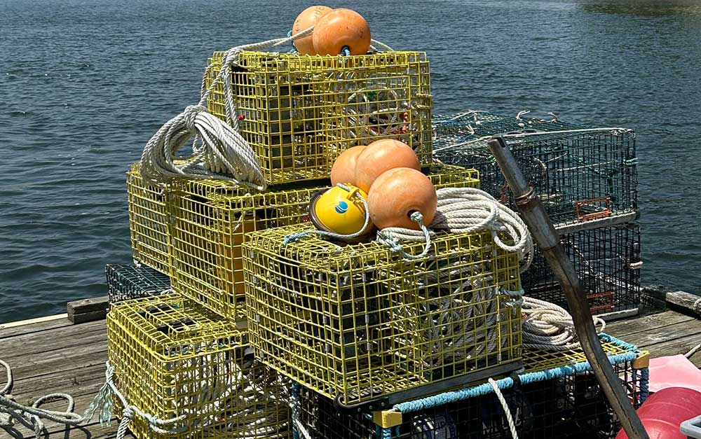
Founded in 2015, Blue Ocean Gear set out to solve a challenge for fishermen: around 10% of fishing gear is lost annually in many fisheries, estimated in 2019 to weigh about 640,000 tonnes. This has two serious impacts: the first is the economic penalty; crab traps, for example, can cost $1,000 – $2,000 each, and are often lashed together in strings of 40 or more traps; losing these traps could cost some fishermen their livelihoods.
The second is the environmental impact. The lost fishing gear continues to fish, while never harvested; it attracts females and juveniles, and off-target species, all of which die in the trap, attracting more species to become captured, and more wasteful fish deaths. There’s also the potential for gear to entangle birds, turtles, whales and dolphins; a 2020 report from the World Wildlife Fund notes that abandoned and lost fishing gear threatens around two thirds of marine animals, including all sea turtle species and half of seabirds.
Blue Ocean Gear developed a data buoy which acts like a sort of maritime air tag; fully waterproof and depth-rated, it’s easily attached to fishing gear, and its internal sensors track its location, movement and depth.
The combination of these sensors tells fishermen whether the gear is entangled or being dragged by a boat, for example; or if it’s vanished underwater due to currents, the buoys can alert the fishermen when it surfaces so they can retrieve it and harvest the catch, saving them valuable time and fuel on the water.
The buoys also help detect and prevent poaching, with a sensor sending an alert to a connected app to tell the owner of the gear when it’s in or out of the water; if it’s unexpectedly out of the water, that’s a good indication that the catch is being poached.
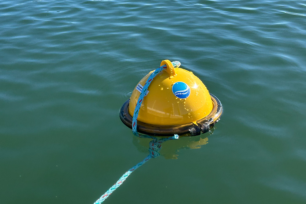
Blue Ocean Gear worked, and continues to work, very closely with fishermen to deliver a device that meets all of their needs: all of the electronics are protected internally; there’s no on/off switch; it’s extremely robust, and can withstand extreme weather conditions. On the software side of things, the fishermen can decide for themselves how frequently they need which data sets, again using the app.
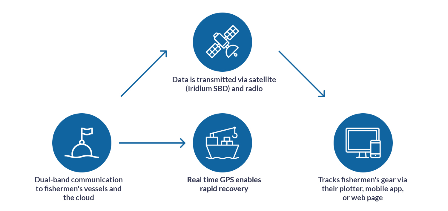
The buoys can communicate to a similar device on the vessel via radio link, but for fixed gear such as traps, most of the time the fishing vessel is not nearby, and that’s where Ground Control comes in.
Ground Control delivers satellite IoT connectivity, connecting very remote things, and has worked with Blue Ocean Gear since their pilot phase to ensure that they, and their connected customers, can retrieve their data in real time from any location on Earth.
The buoys utilize Iridium Short Burst Data, which sends data in small packets; this is an extremely efficient way to utilize satellite communication, making it cost effective and power economical, while still delivering the close-to-real time, truly global, two way communication that Blue Ocean Gear’s customers need.
Although fishermen remain central to Blue Ocean Gear’s work, their ability to collect ocean data hasn’t gone unnoticed by the scientific and research communities, and they’ve expanded their capabilities to meet the needs of scientists and offshore wind developers, for example. In addition to the temperature measurements available now, in Q1 2026, they’re adding air pressure and wave data sensors to the buoys, which substantially grows the number of applications for which they can be used.
“For our customers, having data all the time is key, whether they’re working in the Arctic, Antarctic or anywhere in between. Ground Control’s connectivity has been extremely reliable, and it was very easy to integrate with our systems. Cloudloop gives us the cost monitoring and API access we need for billing, and the support has been just wonderful throughout the many years we’ve worked together.”
Kortney Opshaug, CEO, Blue Ocean Gear
Beyond asset tracking and fishing, Blue Ocean Gear’s applications are growing rapidly, with huge potential for deployment across many different ocean industries. Collecting data from the ocean has traditionally been hard, expensive and complex; together, Blue Ocean Gear and Ground Control are helping to bridge that gap, delivering more data points in an easy, accessible and low cost way.
Let’s Connect Your Next Ocean Project
Projects like Blue Ocean Gear show what’s possible when rugged hardware, smart software and always-on connectivity come together. At Ground Control, we help organizations turn ambitious ideas into dependable, real world solutions, from tracking critical assets at sea to unlocking hard to reach environmental data.
If you’re working on an oceans, environmental monitoring or remote IoT initiative and need a connectivity partner who understands the challenges off the edge of the map, we’d love to talk. Fill in the form, or email hello@groundcontrol.com, and a member of our team will help you explore the best options for your project.
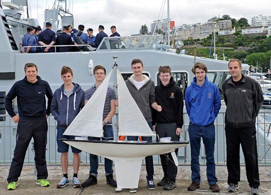
Epsom College are competing in The Microtransat challenge and are trying to build a robot boat that can sail from England to America autonomously.
It has been attempted approximately 25 times by Universities, Businesses and Individuals; however, it has never been completed.
Ground Control’s RockBLOCK 9602 is being used to send back telemetry data from anywhere in the Atlantic Ocean. Every hour it provides Latitude, Longitude, Battery Voltages, Temperatures inside the electronics bays and sends a ‘Mayday’ if water is detected in the hull. Each update is forwarded to a PHP script that easily stores the information in a SQL database, updates Twitter, and places a marker on a rolling map on their website.
The Challenge Ahead
The Microtransat Challenge was launched in 2005 to stimulate the development of fully autonomous model sailing boats capable of crossing the Atlantic in an east-west or west-east direction. To date, none of the 12 Microtransat attempts has been successful. In July 2016 the Epsom College team aimed be the first to succeed where many have failed.
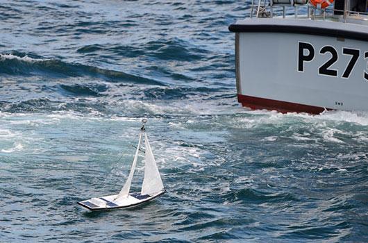
The boat is a GRP hull based on a J-Class racer. We own the mould and so can try again if this boat fails. It is 1.8M long, and weighs 10-15kg depending on its ballast. The ship uses a student programmed navigation system that uses GPS and a magnetic digital compass. The boat updates its location using the Iridium Satellite Network and a Ground Control RockBLOCK 9602 board. In the first week it will update every hour, then drop back to every six hours.
Our server runs scripts that save key data in a database, uploads to Twitter and Emails the competition organizers.
The History
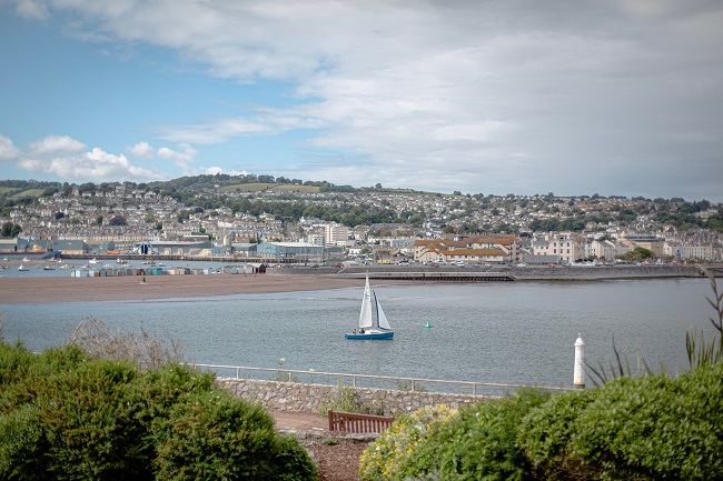
Accompanied by Head of Chemistry, Jamie Styles, and Head of Physics, Chris Telfer, 6th formers Tim Lazarus, Tom Egan, Charlie Steward, Jamie Gleave and Aiden Findlay left Torquay Marina at 10.00am aboard the Royal Navy vessels HMS Exploit and HMS Pursuer and were ferried to the selected launch point 30km off the south-west coast of England.En route to the launch, the College team witnessed a real life rescue as a Navy destroyer, HMS Dragon, and a coastguard helicopter provided assistance to a medical emergency aboard a pleasure yacht.
With a flat sea and the temperature hitting 26˚C, The Microtransat Challenge officially started on 5th July 2016 10.53am. Nerves were jangling as the boat headed the wrong way but it quickly pointed its bow in the right direction towards the Atlantic.
Initially, the tracking system appeared not to be working as it placed the boat somewhere near Paris but a small tweak to some of the land-based software quickly fixed the error.
As a final test before being left to the journey, the boat had to endure the swell of HMS Dragon as the destroyer made multiple passes to allow its crew to watch the launch.
After seeing the boat off, the team made the return trip to Torquay during which they were delighted to be flanked by a pod of breaching dolphins.
The Goal
The College team is aiming to be the first to successfully complete The Microtransat Challenge, which was launched in 2005 to stimulate the development of fully autonomous model sailing boats capable of crossing the Atlantic in an east-west or west-east direction.
Bringing together students and staff from the Mathematics, Geography, Chemistry, Physics and Computing Departments, the team have been working on the design of their boat since September 2015 as part of a student-led STEM (Science, Technology, Engineering and Mathematics) project.
Proud to Support Educators
Learning doesn’t happen just in a classroom and at Ground Control we work very closely with Educators and Researchers alike to ensure there is no limit to their projects.
If you’d like to learn more or have a project coming up that you need satellite connectivity for, simply get in touch and one of our expert team will help.
How RockBLOCK Helps Deliver Critical Medical Care via Drone
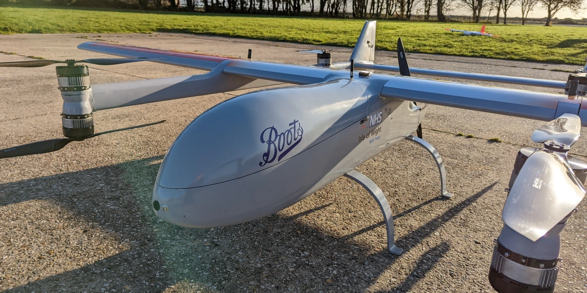
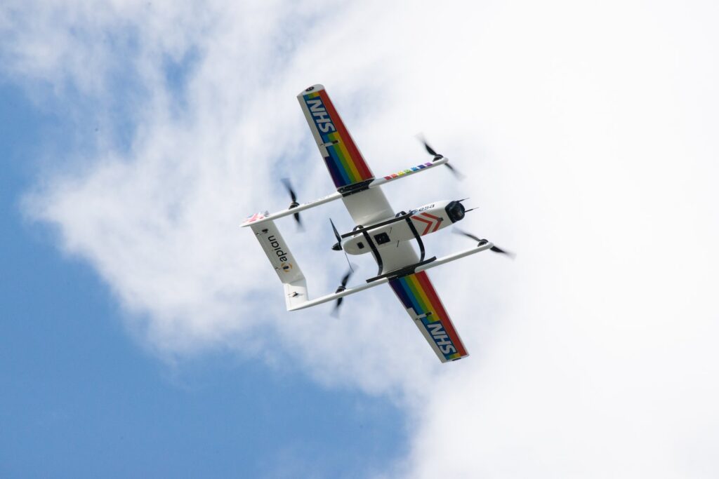
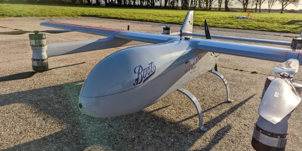
Skylift UAV designs, manufactures and operates specialist commercial drones for applications as diverse as surveillance, search and rescue, surveying, and fertilization of crops. The highly experienced Skylift team were engaged by Apian, a medical drone startup founded by a team of NHS doctors, to work with them on two projects: a prescription delivery pilot for Boots Pharmacy, and delivery of chemotherapy doses to cancer patients.

Challenge No. 1: Reducing Chemotherapy Drug Waste
Cancer patients on the Isle of Wight, located just off the south coast of the UK, sometimes experience issues in receiving their chemotherapy treatment. The chemotherapy drug is manufactured at Portsmouth Hospital University NHS Trust, couriered to Portsmouth Harbour, ferried over to the Isle of Wight, then transferred by taxi to St Mary’s Hospital, a process taking up to four hours. As chemotherapy drugs have a limited shelf life, it’s important they’re administered within a short time-frame of being created.
The chemotherapy is manufactured and dispatched before the patient is clinically assessed and approved for treatment, which can mean that on arrival, the drug can’t be used, and will be wasted. Further, there are many opportunities for this process to be subject to delays and cancellations, which creates an overhead of admin for the hospital staff, and again, can lead to drugs being wasted.
Transporting the chemotherapy via drone reduces the transport time to 30 minutes; this means it can be dispatched after the patient has been cleared for treatment, and unlike public transport, there are very few circumstances in which the drone may be held up. This means less wastage, reduced admin, and fewer delayed treatments.
Challenge No. 2: Finding Efficiencies in Prescription Delivery
In addition to the NHS, Boots Pharmacy also wanted to expedite the delivery of prescriptions to customers in remote areas; in this case, to create economic efficiencies. The Isle of Wight, because of the difficulties of transportation over the Solent (a strait between the Isle of Wight and Great Britain), was a sensible place to trial incorporating drones into its medical supply chain.
How Drones are Delivering Medicines
Skylift UAV built an autonomous eVTOL (electric, vertical take-off and landing) aircraft which can fly for 1.5 hours on a single charge, with a maximum speed of 100 Mph. In BVLOS (Beyond Visual Line of Sight) configuration, it can travel up to 100 Km, depending on the payload; in this instance, the distance travelled is 40 Km. This gives the drone plenty of juice to compensate for adverse wind conditions, or waiting for permission to land.
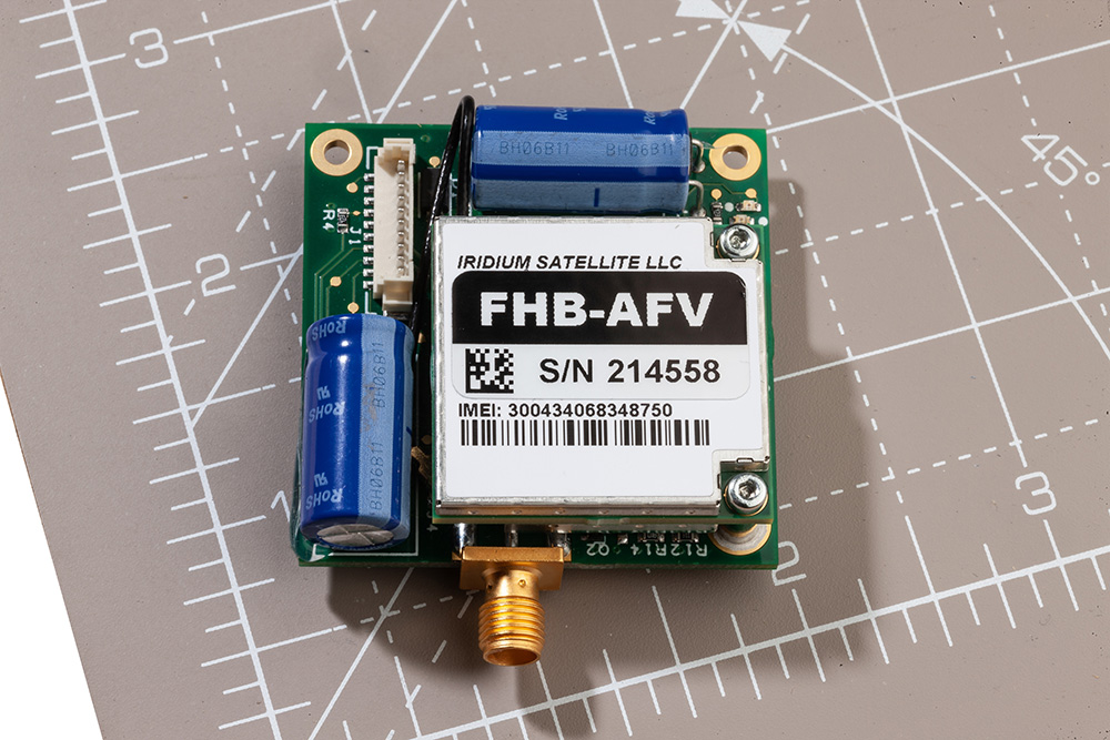
The drones are autonomous, but monitored by Skylift’s safety pilots who can take control of the drone at any time. As the drone travels BVLOS, and across a body of water (the Solent), it’s essential that the pilots have two reliable means of communication with the drone at all times. The Skylift UAV team chose RockBLOCK 9603 in addition to aviation-grade L-Band radio to ensure that irrespective of the drone’s location, connectivity is guaranteed.
The commands are simple: stop, start, return etc. What’s important is that the means of sending and receiving these commands is completely reliable, which is why the Skylift UAV team chose RockBLOCK 9603, and Iridium satellite constellation.
RockBLOCK 9603 is a robust, compact piece of equipment that can send and receive short messages from anywhere on Earth with a view of the sky. It’s a plug-and-play device with its own power supply and antenna, which allows it to communicate with the Iridium satellite network for pole to pole coverage.
“For us, the key benefit of the RockBLOCK 9603 is reliability. We don’t need to worry about what’s over the horizon – we know we’ll be able to communicate with our drones. It’s an essential part of our dual-redundancy system, and has never let us down.”
Toby Moores, CEO, Skylift
What’s Next?
There are many additional medical applications for drones that are being explored in addition to expediting deliveries over bodies of water / extremely remote areas. For example:
- Delivering emergency / essential medical supplies to vulnerable people who are at high risk if they travel
- Reducing the risk of medicines expiring because the ease and speed of distribution is greater, and far less subject to disruption
- Mitigating risk of transmission of infectious diseases with M2M deliveries.
Would you like to know more?
With over 40 years of combined knowledge of satellite experience, the Ground Control team is well placed to help keep you connected when it matters the most.
Whatever your communication or connectivity needs, we can help. Talk to one of our team to discover our products and services and how they can benefit, improve and streamline your applications.
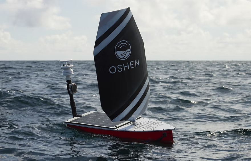
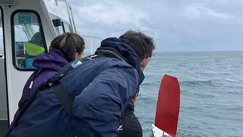
Oshen, a Plymouth, UK-based company, specializes in developing one meter long ocean robots designed for weather and environmental monitoring.
These robots, engineered to function as adaptable buoys, provide vital data from the sea over extended periods, enabling transformative advancements in oceanographic research and forecasting.

The Challenge
For Oshen’s ocean robots to operate effectively, they require robust, low power satellite communication to ensure seamless data transfer and remote control, especially in areas beyond cellular coverage.
The ability to access real time sensor readings and monitor device performance without manual intervention is critical for maintaining operational efficiency and delivering actionable insights.
The Solution
Oshen partnered with Ground Control to integrate Iridium Short Burst Data (SBD) technology into their ocean robots. Our satellite communication solutions provide reliable, low-power connectivity, enabling Oshen to collect mission-critical data and remotely monitor the robots’ performance in real time.
The RockBLOCK 9603 satellite module, tailored for low power devices, has been seamlessly incorporated into Oshen’s system, ensuring efficient operation even in challenging marine environments.
“Ground Control’s support has been invaluable in getting the data moved by the RockBLOCK 9603 modules to work with an easy-to-use dashboard.”
Marcus Thorpe, Robotics Engineer, Oshen
The Results
Oshen has achieved remarkable milestones with its satellite IoT-enabled ocean robots.
- Storm Navigation Success: One of Oshen’s ocean robots successfully navigated through a severe storm, demonstrating the reliability and resilience of its systems under extreme conditions
- Enhanced Forecasting Collaboration: Oshen is working with the Met Office to explore how its data can enhance weather forecasting, potentially revolutionizing the accuracy of marine and atmospheric predictions
- Marine Wildlife Monitoring: In partnership with a leading U.S.-based ocean research institute, Oshen is contributing to dolphin and whale monitoring projects, expanding its role in advancing marine conservation efforts.
Oshen’s innovative approach to ocean data collection, combined with Ground Control’s reliable satellite IoT solutions, is driving significant advancements in marine research and environmental monitoring. By overcoming the challenges of remote communication, Oshen continues to unlock new possibilities for oceanographic exploration and sustainability.
Can Satellite IoT Enhance Your Operations?
We design and build our satellite IoT hardware in the UK and USA, in addition to a suite of software services designed to help you get the most out of your data.
We are experts at retrieving data from remote locations reliably, cost-effectively, and quickly. Email hello@groundcontrol.com to speak with one of our technical team, or complete the form.
Ground Control in Partnership with Pivotel
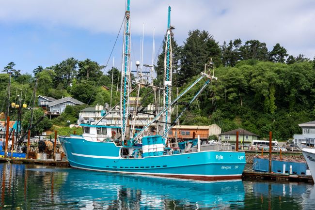
Ground Control has been working successfully in partnership with leading remote communication provider Pivotel to support the RockFLEET devices deployed with Queensland and New Zealand fishers. Over 700 RockFLEET units have been installed on Queensland and New Zealand fishing boats.
Our collaboration resulted in an expansion of the RockFLEET capabilities to support SOS alarms, scheduled check-ins, remote messaging, and catch-reporting via Bluetooth apps. RockFLEET can also slow down automatically when in port.
Currently, there’s a focus on ensuring the device maintains effective tracking for all Queensland and New Zealand vessels. Leveraging Pivotel’s online tracking portal, Tracertrak, the RockFLEET device provides real-time and historical location information to the license holder.
“The RockFLEET device is a high-quality product that’s proven easy to install and operate, but still offers the sophisticated data and coverage that the Queensland fishing industry requires.”
Peter Bolger, CEO


The Challenge
Under the terms of the scheme in Queensland, all commercial fishing and charter boats required a vessel tracking device to be fitted and operational by the end of 2020. Meanwhile, trawl, net, crab and line boats required VMS tracking to comply with regulation that came into effect in early 2019.
This is becoming a reality for many fishing industries around the world and the products used need to be reliable, robust, and connected, wherever the boat may be.
The Solution
RockFLEET’s proven reliability ensures skippers can always meet tracking requirements under their scheme.
The comparatively low initial hardware outlay and ongoing airtime costs makes RockFLEET a competitively priced VMS solution. Its compact and lightweight design makes it easy and simple to install.
The global two way communication ability, low cost of ownership, and reliability of the Iridium network gives clear advantages for VMS.
- Truly global two-way coverage
- All-in-one small unit and easy installation
- Bluetooth API with iOS/Android libraries
- Automatic transmission rate changes
- Proven maritime build quality and longevity
- Lifetime phone and email support
- Full API support for third-party mapping portals.
Built with Ground Control
The work we support genuinely inspires us, and we’re proud to create solutions and solve customer problems like no one else can.
If you’d like to get in touch with the team either to discuss a challenge similar to that of the one above, or something completely different our team of experts will be happy to provide objective advice. Either complete the form or email hello@groundcontrol.com and we’ll respond within one working day.
In 2017, Founder Brandon Wright’s sailboat, SV Inconceivable, broke mooring in a winter storm, and floated to shore. Researching monitoring solutions to prevent this happening without warning again, Brandon struggled to find something that ticked all the boxes, including position relative to geo-fences, battery voltages, and bilge activity. With a background in IoT and electrical engineering, Brandon was perfectly equipped to plug the gap in the market, and Barnacle Systems was born.

The Project
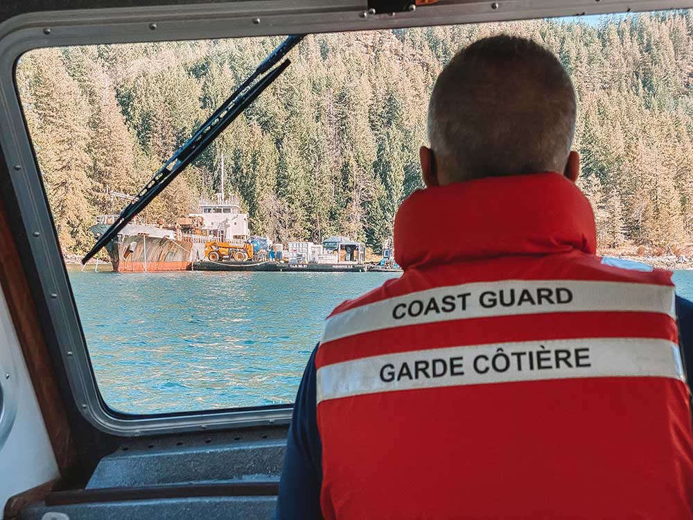
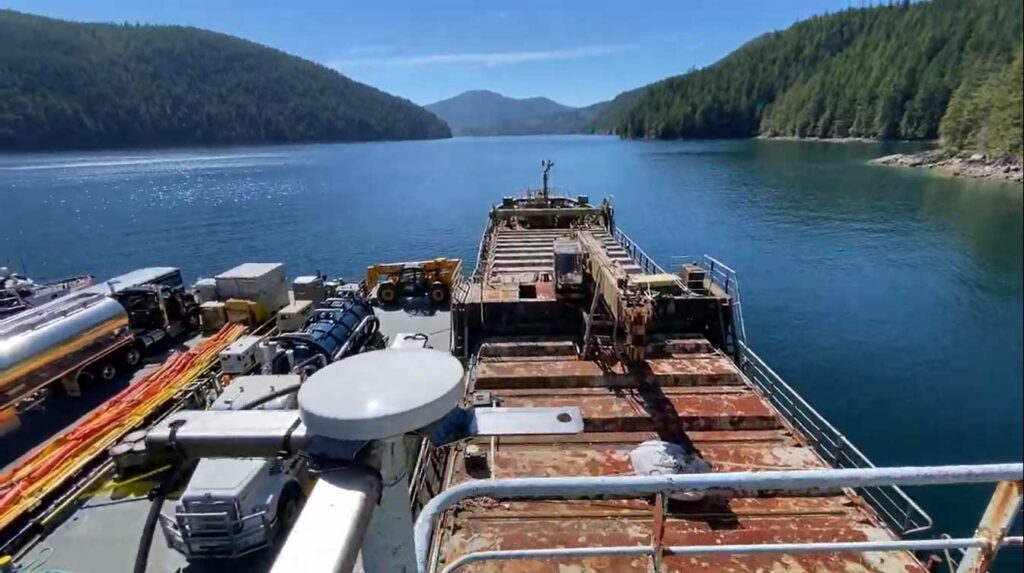
There are over 2,700 wrecked, abandoned and/or hazardous vessels in Canadian waterways, which present a navigational hazard for other boats, and as they degrade, can release contaminants into the water, poisoning marine life. These contaminants range from diesel, gas and system fluids to bottom paint and batteries. Since 2019, it’s been illegal for owners to abandon their boats, but there’s a vast legacy problem that’s tricky to solve.
With the longest coastline in the world (243,042 km), the Canadian Coast Guard has to be selective about which boats it can salvage, and in order to do so effectively, they need to know which vessels present the greatest risk.
The Solution
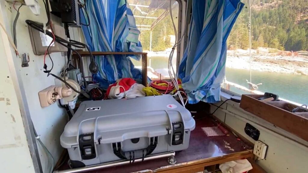
The Canadian Coast Guard has invested in 45 BRNKL Rapid Deploy units from Barnacle Systems. These are purpose-designed for the remote, long-term monitoring of stricken vessels, with capabilities ranging from position tracking, monitoring the list (heel), pitch, and sudden impacts; detecting if water is present in a specific area; and detecting and capturing photos of intruders.
The solar-powered devices are placed on board problematic vessels and enable the Coast Guard to remotely monitor them, with alerts if they begin to sink, or change position, or if intruders are detected. Real time notifications allow them to quickly deploy hazard response teams when needed; if no changes are detected, the Coast Guard can continue to remove and recycle other vessels which present a more immediate risk.
The Satellite Connection
The BRNKL Rapid Deploy units are equipped with both cellular and satellite modems for data transmission, and Brandon chose Ground Control’s RockBLOCK Plus for the satellite connectivity. RockBLOCK Plus is a fully waterproof, plug-and-play satellite transceiver that utilizes the Iridium Short Burst Data® (SBD®) airtime service, designed for IoT applications. With 66 satellites in Low Earth Orbit, Iridium offers global coverage, including the polar regions; important for Canada, as 40% of its land mass is considered Arctic.
Further, RockBLOCK Plus does not need to be ‘pointed’ to transmit to the satellites; the omni-directional antenna just needs a clear view of the sky. This means should the boat move, there’s no risk of the transmission being interrupted because of line-of-sight issues.
Having used other satellite services in the recent past, Brandon knew Iridium was the right airtime choice, due to its reliability and coverage.
“When I spoke to the Ground Control team about the BRNKL Rapid Deploy units, they recommended the RockBLOCK Plus. Its ruggedness, low power requirements and affordable transmission costs are ideally suited for this application, and they’re working exactly as intended.”
Brandon Wright | P.Eng. | CEO
What’s Next?
Barnacle Systems plans to expand the BRNKL Rapid Deploy into the global vessel salvage market, as the solution will work just as effectively for marine salvage operations anywhere on the globe. By receiving alerts about intruders or further damage to a boat scheduled for salvage, operators reduce risks and can better prioritize which vessels to extract.
Would you like to know more?
If you need to collect IoT data from remote and inhospitable locations, you can’t go wrong with the RockBLOCK Plus. That said, there are an increasing number of choices available to you – good news, because competition drives innovation and lowers costs, but it can be difficult to identify which device and satellite airtime service will best meet your needs.
The Ground Control team are here to help! We have 20 years experience in satellite services, and design and build our own satellite IoT devices. We’ll offer you objective, expert advice; just call or email us, or complete the online form.
RockSTAR Provides Vital Tracking Telemetry for Soldiers and Ultra Runners
JCSys operate robust live tracking solutions, effective in any weather and terrain. They’re internationally trusted to provide situational awareness to clients as diverse as the military to adventure racing; schools, cadets, scouts and remote field workers. Their tracking and data management services reduce risk and provide reassurance, utilizing biometric and location data, essential for peace of mind and timely, mission-critical response.

Challenge 1: Biometrics and Monitoring for the MOD
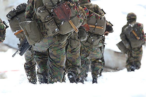
Working to a specification from the UK’s Ministry of Defence (MOD), JCSys placed their clients’ needs and reliability at the heart of the proposition. Military tracking requires a solution that goes beyond mobile network coverage; one that can provide global, real-time location data on military operatives in the toughest of climates and conditions. Equipment must be extremely reliable, ruggedized, and self-powered to handle off-grid operations.
Soldiers need a handset that’s portable and durable, compact and waterproof. It needs to provide tracking in all weather and military attire, especially in conditions too cold to free fingers from gloves. Other firmware modifications were specific to the MOD: securely encrypting location data, disabling switch off without a PIN code, delivering the ability to pair to a BLE heart rate monitor, and integration to JCSys’ software.
Solution: The RockSTAR – Flexible Firmware and Software Integration
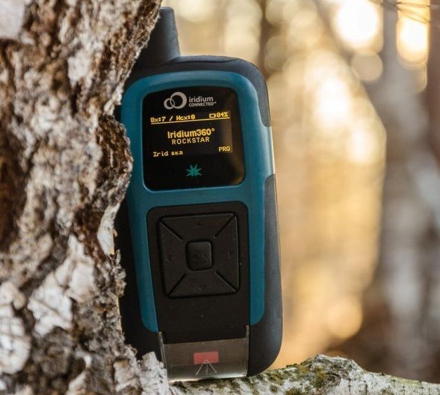
JCSys were looking for a satellite technology partner willing to tailor their hardware and firmware to meet the specifics, providing developer-friendly APIs so JCSys could add context to the telemetry data provided via the device. Ground Control (then Rock Seven) was more than willing to innovate in order to support JCSys with their end-to-end solution.
“Out of the box the RockSTAR handheld device was 90% there. With some tweaks to the Ground Control firmware and integration with JCSys’ software interface, we were able to provide the bespoke tracking solution the MOD were looking for. Ground Control ticked the box for adaptability, innovation and reliability.”
Nigel Kenyon, Head of Tracking Services, JCSys
Challenge 2: Race Safety in Extreme Conditions
Another area of JCSys’ expertise is supporting professional ultra-marathon experiences. Adventure sports test human endurance across terrain and environments in a way that puts risk firmly on the map, but only if you can track it. This is real time civilian monitoring, on a minute-by-minute basis, and without it there have been some very public incidents of races going wrong.
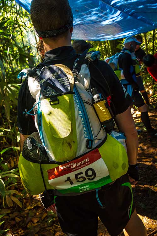
JCSys collaborates on a variety of Beyond The Ultimate (BTU) team events. These are individual endurance races which take place over jungle, desert and ice caps, some of the most remote and hostile environments on Earth, with minimal mobile coverage.
Providing race tracking systems that enable the BTU team to deliver safe race conditions requires a tracking solution built on life-critical metrics; knowing runners’ location, flagging real time alerts, providing situational awareness, reliability, battery life, text function and simplicity of use.
Solution: RockSTAR Tracking and Alerts
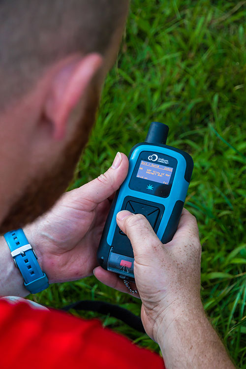
The RockSTAR gathers key telemetry and GPS data in a handheld device; waterproof, ruggedized and built to withstand the most challenging of environments. It’s robust, and yet still light, easy to set up and very user friendly. Once connected every runner out in the field is tracked and traceable.
With the RockSTAR, BTU are able to follow all race participants from their base location, tracking progress via geo-fences that provide early warning if a device has gone inside or outside a certain race area.
The device, coupled with JCSys’ software, sends real time alerts when data is received, indicating any incidents out in the field. This kind of solution has provided them with a strong reputation for safety.
“Our systems have proven their life-saving faculty on multiple occasions. We have built our reputation on the reliability of the RockSTAR and the data it provides. It’s how we are able to host some of the most high-risk events for both our UK military and civilian clients alike.”
Nigel Kenyon, Head of Tracking Services, JCSys
Future Development
JCSys continues to explore ways in which the gathering of biometrics can improve the safety and performance of remote operatives. Data gathered in military contexts is being utilized by a NATO project headed up by the Institute of Naval Medicine (INM) for the UK, to monitor operatives’ physical effort, and estimation of core body temperature (ECTemp) while out in the field. This is bringing new medical insight into the experience of operative performance under extreme duress, highlighting the potential of real time data and satellite tech in the future of innovative medical research.
Would you like to know more?
If you’re interested in handheld tracking devices, straight out of the box, or you have your own tracking software and want to explore partner integration options with Ground Control’s RockSTAR, we’d love to hear from you.
Call or email us, or complete the form, and one of our experienced team will be happy to help.