Industry: Environmental
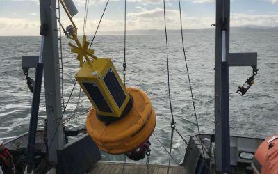
Data Buoys purposes can include measurements of water temperatures, salinity, drift patterns, and pollutant levels, which inform a large number of personal and global projects from boat manufacture through to meteorology and climate change.
Working with Bangor University on the SEACAMS2 Project, Ocean Scientific International Ltd (OSIL) is using RockBLOCK 9602 for the satellite communications element for its telemetered data buoys. The buoys collect and measure oceanographic, meteorological, and water quality data parameters around the coast of North Wales to assess renewable energy opportunities.

The Challenge
Regardless of deployment location, buoys will often find themselves drifting to remote locations where mobile GSM just can’t reach or is intermittent.
The data collected is vital and therefore continuous, reliable transmission is paramount to its ongoing success.
What’s more, any components of the buoy need to be compact enough to ensure it doesn’t take up vital space in the equipment used to remain lightweight.
The RockBLOCK Solution
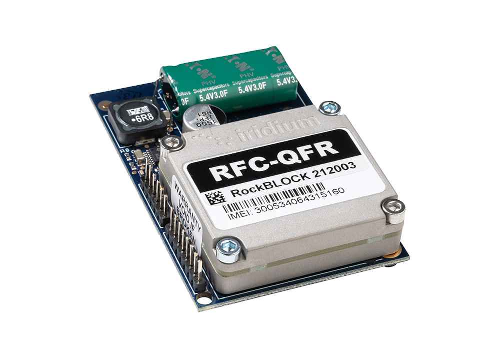
RockBLOCK 9602 is a versatile, compact, low- ower, and dependable way of sending and receiving data from remote locations. It uses the Iridium satellite network, giving truly global coverage. RockBLOCK 9602 is used when the buoy is out of range of cellular networks to allow data to be sent and received regardless of location.
- Truly global two way coverage
- Low power usage, small antenna
- Plug-and-play product, simple setup
- Reliable data transmission with acknowledgements
- Lifetime phone and email support.
“We enjoy working with Ground Control as they offer great, sensibly priced products with excellent after sales support and an easy to use online portal.”
Rob Luthwaite, OSIL Project Manager
Built with Ground Control
The work we support genuinely inspires us, and we’re proud to create solutions and solve customer problems like no one else can.
If you’d like to get in touch with the team either to discuss a challenge similar to that of the one above, or something completely different, our team of experts will be happy to provide objective advice.
Preventing Poaching in Gabon with RockREMOTE IMT
Illegal Poaching in Gabon
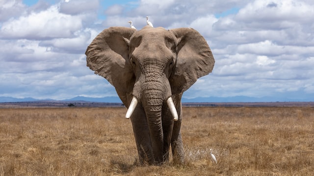
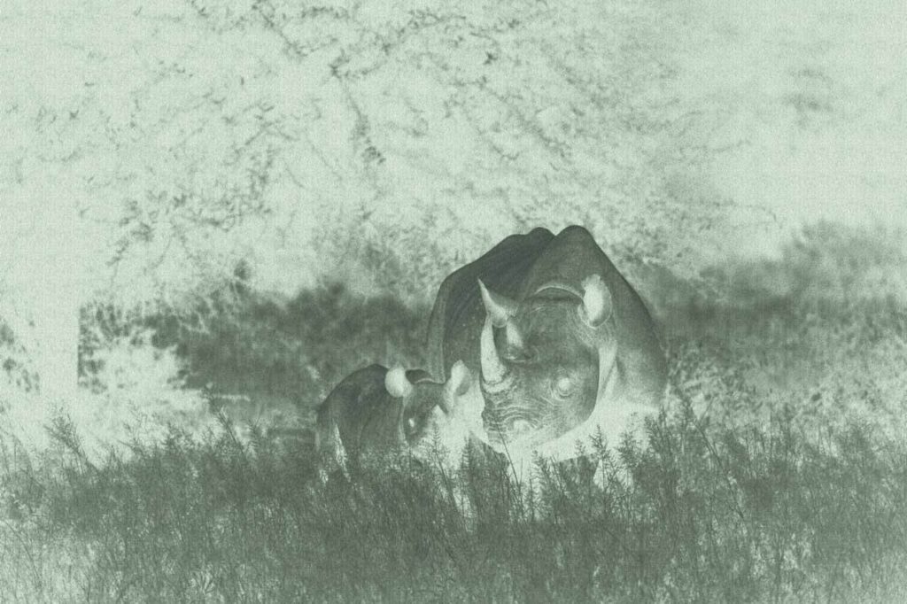
Africa is home to some of the world’s best-known and most iconic wildlife. However, the African Wildlife Foundation (AWF) reports that due to illegal poaching, as many as 35,000 elephants are killed each year, 43% of the lion population has been lost in the last 20 years and, staggeringly, since 1960, the population of the Black Rhino is down 97.6%.
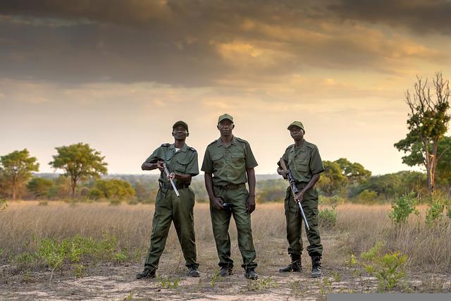
With approximately 24 million hectares of forest, Gabon is home to a number of endangered African species, which makes for an attractive landscape to poachers. However, using the latest satellite technology, AI-powered camera traps can provide Gabon wildlife rangers with an advanced new tool in the fight against illegal poaching.
Preventing Poaching
Digital Forest aims to make wildlife and wild places accessible to everyone through immersive, interactive technology driven by real-time data streams. It’s via this real-time connection and technology that wildlife and rainforests, including Gabon, can be better maintained and protected.
Traditional monitoring systems use cameras to monitor poaching activity, but often, results are collected and analyzed months later, so rangers only know where the animals – and any poaching threats – were, not where they currently are. The lack of real-time location data means that intercepting to prevent illegal poaching is often too late.
Second Generation AI-Powered Camera Traps
The first generation of AI-powered camera traps utilized RockBLOCK 9602 to transmit sighting counts and meta data via the Iridium Short Burst Data (SBD) service which provides robust telemetry from anywhere on the planet. Digital Forest’s second generation device would build on this with the ability to also transmit images to accurately and reliably detect the presence of illegal poachers, and send real time alerts.
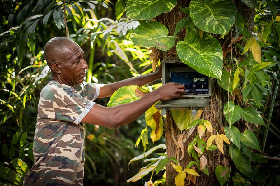
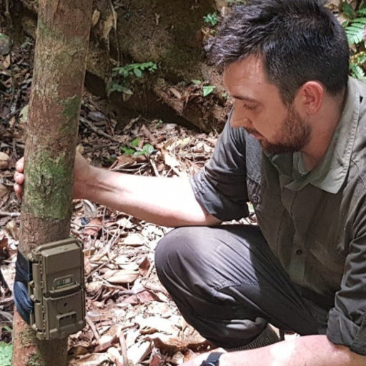
Harnessing the latest satellite technology, Digital Forest developed a smart AI-powered camera trap. The remotely deployed device continuously monitors for the presence of animal and human activity, even in forested areas. At any time of day or night, when activity is detected via the remote sensors, sophisticated image recognition technology not only detects but also classifies different animal species. These images are available immediately, 24/7, so rangers are informed of an animal’s location in real time.
The bandwidth of Iridium’s Short Burst Data (SBD) service is limited to 320 bytes per message and it’s not feasible to send imagery from the camera traps via SBD. To effectively protect wildlife, the Gabon rangers require a cost-effective solution that can not only transfer animal and human sightings and meta-data, but also real-time imagery from remote rainforest locations.
RockREMOTE is a highly capable Iridium Certus device with the ability to support both IP and message-based connectivity. The device provides a simple and easy to initiate, plug-and-play satellite connection from anywhere in the world.
The message-based connectivity is enabled by Iridium Messaging Transport (IMT) service which provides a more straightforward and cost-effective messaging capability but with a much larger message size of 100Kb – enough to include wildlife imagery.
How It Works
Leveraging Iridium Messaging Transport (IMT), RockREMOTE exposes integrators to an industry-standard MQTT interface. Ground Control’s development of a new Satellite IoT Gateway enables Digital Forest to quickly and easily integrate two-way messaging into their application using standard MQTT libraries for their platforms.
Behind the scenes, RockREMOTE takes care of all the connection management, message queuing and retrying to enable Digital Forest to simply plug-and-play, reducing integration work to just a few lines of code.
RockREMOTE automatically packages and compresses messages prior to transmission to minimise the amount of data sent. The device also selects the most appropriate compression algorithm based on the content being transmitted.
Messages are received and published to Cloudloop, enabling immediate and real-time transmission to Digital Forest’s cloud-based platform. This is effective in reverse, enabling messages to be sent to the remote field device. Digital Forest also benefits from the automatic upload of images to the AWS S3 for long-term storage.
The power of RockREMOTE with IMT enablement equips the rangers in Gabon with the latest in AI-powered camera trap technology to effectively monitor and prevent illegal poaching in the forest. With this advanced technology, endangered African species and iconic African wildlife have greater protection from poachers for this generation and the next.
What Digital Forest Says
“We’ve worked with Ground Control for many years and their products and supporting services have never failed to deliver. It’s very reassuring working with a company that designs, builds and supports every aspect of its products.
Developing our second-generation smart camera with RockREMOTE has been a breeze; we’re really excited about possible applications this technology will unlock. We’re already thinking about using RockREMOTE for transmitting audio, which will enable us to acoustically as well as visually monitor biodiversity in these truly unique locations.”
Robin Whytock, Director,
Digital Forest UK (SPV) Ltd.
Would you like to know more?
With over 20 years of satellite experience, the Ground Control team is well placed to help keep you connected when it matters the most.
Whatever your communication or connectivity needs, we can help. Talk to one of our team to discover our products and services and how they can benefit, improve and streamline your applications.
Smart Bird Boxes for Remote Wildlife Monitoring
Okala’s conservation scientists and software engineers use a combination of methodologies, including camera traps, bioacoustics, and remote sensing, to assess biodiversity and monitor environmental impact. They effectively leverage AI and machine learning for data analysis, offering expert-verified insights and a dashboard for visualizing and understanding nature data.
Known for delivering scalable, science-driven nature monitoring and compliance solutions, Okala partnered with Ground Control to create a new kind of remote sensing device – a smart birdbox equipped with a camera, digital scales and satellite connectivity that can be deployed in any environment, to track and monitor birdlife.

This marked the beginning of Project Pyedwagtail. The mission? Build a rugged, low-power system capable of collecting and transmitting wildlife data from anywhere in the world, even the most remote and inaccessible regions.
The challenge set by Robin, CEO of Okala, was deceptively simple: “We need a smart bird box with a camera that we can deploy anywhere.”
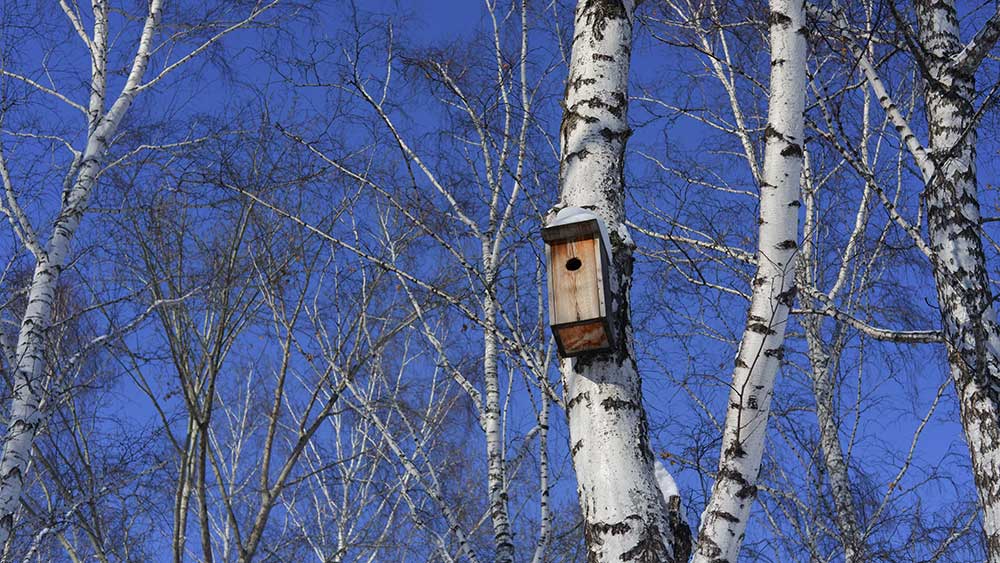
However, delivering on that vision required a blend of hardware innovation, software efficiency, and robust, reliable connectivity. The system needed to detect when a bird was present, or absent, inside the birdbox; capture images automatically, record temperature readings both inside and outside the box, and transmit all of the data to Okala’s conservation management platform. It had to be low power, compact and resilient, function entirely off-grid, and communicate via satellite from any location on Earth.
The Challenge Takes Flight
The Okala smart birdbox solution is built around four key stages: sensing, imaging, satellite transmission, and cloud integration. At the core of the sensing solution is a simple but effective digital scale mounted inside the birdbox, which communicates with a Raspberry Pi via the I²C interface. This setup enables the system to detect when a bird enters the box, monitors changes in weight over time, identifies how many birds are present, tracks egg-laying events, and even determines when chicks fledge. These weight changes also trigger automatic photo captures. While the Ground Control team could have implemented a more complex machine learning model, we opted for a simple, reliable mechanism for minimum power consumption and complexity.
To capture images, we utilized a Raspberry Pi Camera Module 3 and the libcamera library. Each triggers a photograph, saved as a JPEG file. However, since the size of JPEG files can vary dramatically based on image complexity, such as a blue sky versus the intricate details of a bird’s feathers, Ground Control developed a smart resize function. This function compresses images intelligently, optimizing file size for efficient satellite transmission without compromising essential visual detail. The next challenge is transmitting the data back to Okala.
See This Explained Live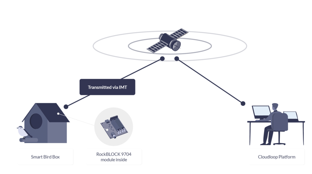
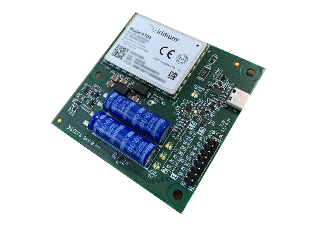
RockBLOCK 9704
For this project, reliable, global satellite connectivity is achieved via RockBLOCK 9704, a compact satellite modem that utilizes the Iridium global satellite network, and Iridium’s IMT (Iridium Messaging Transport) service. IMT enables the system to send and receive messages of up to 100Kb, with very low latency, from anywhere in the world.
RockBLOCK 9704 operates with very low power requirements, consuming less than 5 mW in sleep mode and peaking at 1.4 W during transmission. RockBLOCK’s Python and C libraries made integration incredibly simple, with only a few lines of code required to send data.
Of course, the satellite module is only one piece of the puzzle. Once the data is returned from the satellite, it needs to be routed securely and reliably to Okala’s system. This is where Ground Control’s Cloudloop Data platform plays a critical role.
Cloudloop Data
Rather than requiring custom code to decode device messages, Cloudloop Data takes care of the translation and seamlessly delivers the data to Okala, whether via MQTT, HTTPS, AWS, Azure, or other services. It’s built to ensure data reaches its destination in the correct format, no matter the protocol – SBD or IMT. By handling the complexity of proprietary device communication, Cloudloop accelerates integration and significantly reduces development time. Even if Okala’s servers are temporarily offline, Cloudloop securely stores all incoming data to guarantee nothing is lost. The platform also supports devices from other manufacturers, making it highly adaptable for diverse IoT applications.
And the cost of the project? The total system was surprisingly cost-effective. The RockBLOCK 9704 module costs $279 and operates on either prepaid plans starting from $0.29 per KB, or post-pay contract plans which are even lower cost. Given the power of the technology and the low cost of deployment, it represents an accessible, scalable solution for conservation projects of any size.
Beyond The Birdbox
By combining Okala’s expertise in AI-powered conservation platforms with Ground Control’s proven track record in global satellite IoT, Project Pyedwagtail has demonstrated what’s possible in smart, remote wildlife monitoring.
The result is a simple but robust system that can send photographs, environmental data, and near-real time alerts from any location on Earth, with nothing more than a Raspberry Pi, a few sensors, a RockBLOCK 9704 module, and some participating wildlife.
While the project started with the concept of a smart birdbox, the implications are further reaching. The combination of camera traps, intelligent sensing, and global satellite connectivity has applications across wildlife monitoring, ecological research, remote surveillance, and even anti-poaching operations.
This ability to gather visual and environmental data in near real time from remote locations opens new possibilities for field researchers, conservationists, and environmental organizations worldwide.
We’re Here to Help
If you need to transmit sensor data from remote environments, whether it’s wildlife activity, environmental metrics, or atmospheric readings, we’re here to help. At Ground Control, we specialize in connecting devices and assets in the most inaccessible locations, far beyond the reach of traditional cellular networks.
By leveraging multiple satellite networks and communication protocols, we deliver cost-effective, reliable solutions tailored to your needs. Get in touch with us at hello@groundcontrol.com or fill out the form. We’ll get back to you within one working day.
Keeping Flood Monitoring Data Flowing When It Matters Most
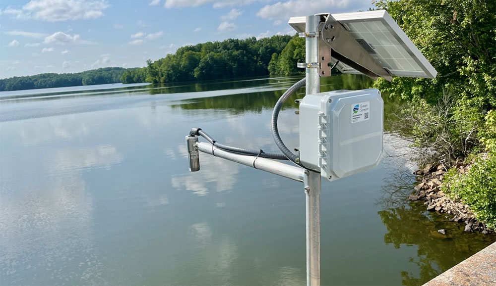
Green Stream Technologies provides real time flood monitoring systems that help communities, agencies, and infrastructure operators detect rising water, monitor rainfall and weather conditions, and respond quickly to flood risk. Its solution brings together rugged sensor kits, autonomous solar power, secure cloud services, dashboards, alerts, APIs, integrations, field services, training, and ongoing support.
The Challenge
For flood monitoring to be useful, data has to get through. A water level reading, rainfall measurement, or field image can support decisions during a fast moving event, but only if it reaches the right people in time.
Many of the locations that need monitoring are rural, coastal, or riverside sites where cellular coverage can be limited. Even where LTE is normally available, severe weather can disrupt terrestrial networks during the events these systems are designed to track. Green Stream needed a communications approach that could work across different environments, while balancing cost, reliability, latency, and operational risk.
The Solution
Green Stream uses a site-by-site telemetry strategy. Where LTE coverage is strong, cellular is often the most cost effective option. In remote areas with little or no cellular coverage, Iridium can act as the primary communications path. For mission critical sites, especially in flood-prone areas where storms may affect cellular networks, Green Stream can pair LTE with Iridium failover.
That flexibility helps Green Stream match the connectivity method to the site. It also reflects a deliberate choice. Flood monitoring depends on high resolution, real time data that customers can act on. Some emerging LEO satellite options can be lower cost, but may require waiting for a satellite pass. For flash flooding, a two- or three-hour reporting gap is not good enough. Iridium gives Green Stream global coverage and the ability to report every five minutes, with no missed reporting windows.
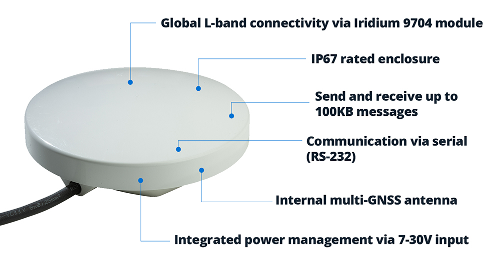
Using Ground Control’s RockBLOCK devices, Green Stream can add Iridium connectivity to monitoring stations beyond the reach of terrestrial networks, from rural riverbanks to coastal plains and other high impact locations.
The Service Evolution
Green Stream first used RockBLOCK 9603, based on Iridium Short Burst Data (SBD), to send compact reports from remote monitoring sites. For many applications, that was enough: small packets of data covering water levels, rainfall, device status, and network health.
As its deployments evolved, Green Stream began moving to RockBLOCK 9704 and RockBLOCK Plus 9704, which use Iridium Messaging Transport (IMT). The difference is significant. RockBLOCK 9603 messages are measured in hundreds of bytes; RockBLOCK 9704 supports messages up to 100KB.
That larger message size creates room for richer reporting. Water level data remains central to flood monitoring, but Green Stream can now look at adding more context, including images from the field. During a flood event, imagery can help emergency managers see what conditions look like on the ground, not just read what a sensor is reporting.
The Result
Satellite connectivity helps Green Stream reduce operational risk, especially in remote or high impact locations where site visits can be difficult, slow, or unsafe.
During severe weather, continuity of data becomes especially important. By using Iridium through Ground Control’s RockBLOCK devices, Green Stream can offer an added layer of resilience for sites where communications failure would have the greatest impact.
This matters as Green Stream expands into more rural and underserved areas. These communities may face serious flood risk, but lack dependable cellular coverage. Satellite connectivity helps make early warning systems practical in places that would otherwise be harder to monitor.
“We chose Ground Control because it provided a fast and straightforward path to integrating Iridium into our systems, which was important for getting a satellite solution to market quickly. The platform is intuitive and well documented, and our Account Manager, Elonda, has been knowledgeable and responsive, which has made the partnership easy to work with.”
Karen Lindquist, Green Stream
Looking Ahead
Green Stream is continuing to scale as more communities look for better ways to manage flood risk. Its approach – start with a pilot, then expand to a wider network – gives customers a practical path from initial deployment to broader flood intelligence systems.
As those networks grow, satellite connectivity will help Green Stream reach more sites, support more resilient deployments, and feed local data into regional or state-level systems for emergency management.
Let’s connect your next deployment
Green Stream’s flood monitoring network is one example of how satellite IoT can help critical data keep moving when cellular coverage is limited, unreliable, or at risk of disruption.
If you’re developing an IoT solution for remote, mobile, or mission critical environments, Ground Control can help you assess your options and build a connectivity approach that fits your application, budget, and growth plans.
Complete the form or email hello@groundcontrol.com and we’ll reply within one working day.
Smart Satellite Buoys Reducing Ghost Gear and Protecting Oceans
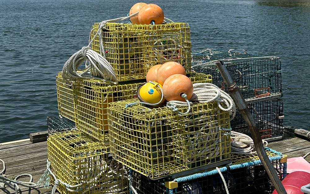
Founded in 2015, Blue Ocean Gear set out to solve a challenge for fishermen: around 10% of fishing gear is lost annually in many fisheries, estimated in 2019 to weigh about 640,000 tonnes. This has two serious impacts: the first is the economic penalty; crab traps, for example, can cost $1,000 – $2,000 each, and are often lashed together in strings of 40 or more traps; losing these traps could cost some fishermen their livelihoods.
The second is the environmental impact. The lost fishing gear continues to fish, while never harvested; it attracts females and juveniles, and off-target species, all of which die in the trap, attracting more species to become captured, and more wasteful fish deaths. There’s also the potential for gear to entangle birds, turtles, whales and dolphins; a 2020 report from the World Wildlife Fund notes that abandoned and lost fishing gear threatens around two thirds of marine animals, including all sea turtle species and half of seabirds.
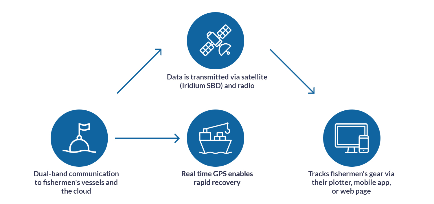
Blue Ocean Gear developed a data buoy which acts like a sort of maritime air tag; fully waterproof and depth-rated, it’s easily attached to fishing gear, and its internal sensors track its location, movement and depth.
The combination of these sensors tells fishermen whether the gear is entangled or being dragged by a boat, for example; or if it’s vanished underwater due to currents, the buoys can alert the fishermen when it surfaces so they can retrieve it and harvest the catch, saving them valuable time and fuel on the water.
The buoys also help detect and prevent poaching, with a sensor sending an alert to a connected app to tell the owner of the gear when it’s in or out of the water; if it’s unexpectedly out of the water, that’s a good indication that the catch is being poached.
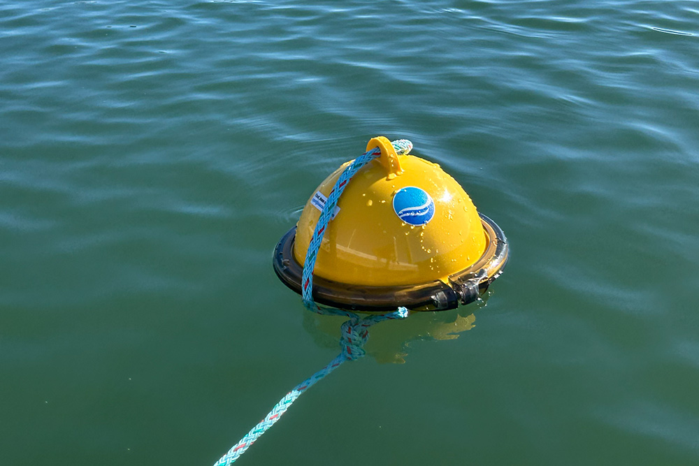
Blue Ocean Gear worked, and continues to work, very closely with fishermen to deliver a device that meets all of their needs: all of the electronics are protected internally; there’s no on/off switch; it’s extremely robust, and can withstand extreme weather conditions. On the software side of things, the fishermen can decide for themselves how frequently they need which data sets, again using the app.
The buoys can communicate to a similar device on the vessel via radio link, but for fixed gear such as traps, most of the time the fishing vessel is not nearby, and that’s where Ground Control comes in.
Ground Control delivers satellite IoT connectivity, connecting very remote things, and has worked with Blue Ocean Gear since their pilot phase to ensure that they, and their connected customers, can retrieve their data in real time from any location on Earth.
The buoys utilize Iridium Short Burst Data, which sends data in small packets; this is an extremely efficient way to utilize satellite communication, making it cost effective and power economical, while still delivering the close-to-real time, truly global, two way communication that Blue Ocean Gear’s customers need.
Although fishermen remain central to Blue Ocean Gear’s work, their ability to collect ocean data hasn’t gone unnoticed by the scientific and research communities, and they’ve expanded their capabilities to meet the needs of scientists and offshore wind developers, for example. In addition to the temperature measurements available now, in Q1 2026, they’re adding air pressure and wave data sensors to the buoys, which substantially grows the number of applications for which they can be used.
“For our customers, having data all the time is key, whether they’re working in the Arctic, Antarctic or anywhere in between. Ground Control’s connectivity has been extremely reliable, and it was very easy to integrate with our systems. Cloudloop gives us the cost monitoring and API access we need for billing, and the support has been just wonderful throughout the many years we’ve worked together.”
Kortney Opshaug, CEO, Blue Ocean Gear
Beyond asset tracking and fishing, Blue Ocean Gear’s applications are growing rapidly, with huge potential for deployment across many different ocean industries. Collecting data from the ocean has traditionally been hard, expensive and complex; together, Blue Ocean Gear and Ground Control are helping to bridge that gap, delivering more data points in an easy, accessible and low cost way.
Let’s Connect Your Next Ocean Project
Projects like Blue Ocean Gear show what’s possible when rugged hardware, smart software and always-on connectivity come together. At Ground Control, we help organizations turn ambitious ideas into dependable, real world solutions, from tracking critical assets at sea to unlocking hard to reach environmental data.
If you’re working on an oceans, environmental monitoring or remote IoT initiative and need a connectivity partner who understands the challenges off the edge of the map, we’d love to talk. Fill in the form, or email hello@groundcontrol.com, and a member of our team will help you explore the best options for your project.
BGAN M2M’s Role in Soil Moisture Monitoring to Help Combat Climate Change
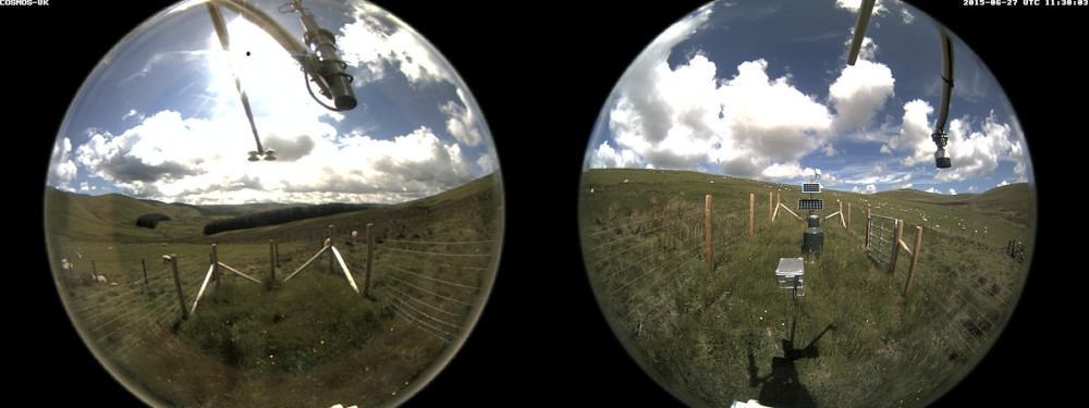
The Sourhope site on the Scottish border is one of 47 COSMOS-UK’s soil moisture monitoring stations that deliver near-real-time soil moisture data for use in farming, water resources, flood forecasting and land-surface modelling. Sites are also equipped with IP cameras for image transmission. COSMOS-UK was established by the UK Centre for Ecology & Hydrology in 2013 and is now the UK’s long-term national soil moisture monitoring programme. The COSMOS-UK data informs scientists about soil-water changes and supports environmental modelling research and related applications.


The Project
Ongoing climate change and increasing air pollution are likely to cause substantial changes in our ecosystem. To predict, manage and minimize adverse impacts on biodiversity, it’s critical that these changes are accurately, efficiently and reliably monitored so policy and management techniques can be developed.
The greater our understanding of soil moisture, the better we are able to recognize plants that are suited to particular conditions, the availability of water to maintain surface waters, and the impact soil moisture can have on our weather. This becomes more interesting and useful when we want to recognise the impacts of modifying and exploiting our environment.
Why Soil Moisture Matters
As well as optimum vegetation and crop management, measuring soil moisture also helps to inform our understanding of how the natural environment responds to climate change.
The impact of climate change could affect the water availability for agriculture, domestic consumption and the overall environment. Thus, measuring soil moisture and developing knowledge of how it varies between places and through time is fundamental to gaining insight into likely future conditions.

The Satellite Solution
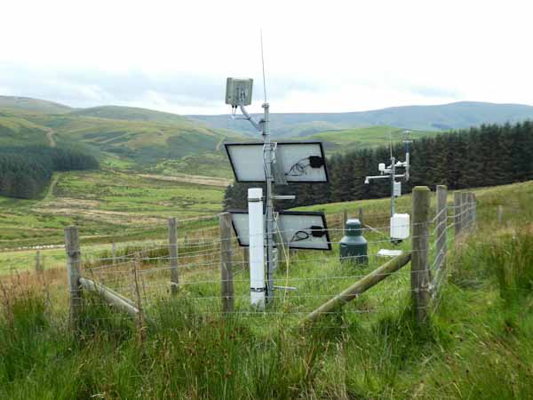
The COSMOS-UK Sourhope site is located in a remote area of rough Scottish grassland, about 1 km from the border with England. This station, along with others in the COSMOS-UK network, is out of reach of cellular and fiber networks.
The Hughes 9502 is a IoT Pro (previously known as BGAN M2M) terminal, a satellite-based solution for transmitting remote environmental monitoring data. Powered by solar energy and designed to operate on both Viasat IoT Pro and cellular 2G/3G/LTE networks, it delivers always-available connectivity for critical monitoring and control applications in remote locations, perfect for the grassland site at Sourhope.
Instrumentation at the COSMOS-UK Sourhope site captures soil moisture sensor data from over almost 40 hectares (about 100 acres) at any one time and delivers the data to data centres in near real-time, 24/7, 365 days a year. This contrasts favourably with other sensor solutions, such as a soil probe, which are considered more intrusive, and provide only single point-measurements, or require an on-site operative to conduct ‘point in time’ measurements.
Viasat’s IoT Pro service provides a reliable, global, two way IP data service. It is the ideal solution as it connects monitoring and control applications in remote, unmanned locations, providing visibility and management of those assets – including high quality camera images.
“The Hughes 9502 and IoT Pro (BGAN M2M) service have been incredibly reliable; we’ve had no outages or delays since beginning use, and costs have remained predictable.”
UKCEH COSMOS-UK Project Manager
2023 and Beyond
The soil moisture data intelligence delivered by the Hughes 9502 to agricultural and environmental scientists has the potential to transform the way we understand and model the natural environment.
All data collected by the Hughes IoT Pro terminal from Sourhope, and other COSMOS-UK sites, are available free to the scientific community and the general public.
Would you like to know more?
With over 20 years of satellite experience, the Ground Control team is well placed to help keep you connected when it matters the most.
Whatever your communication or connectivity needs, we can help. Talk to one of our team to discover our products and services and how they can benefit, improve and streamline your applications.
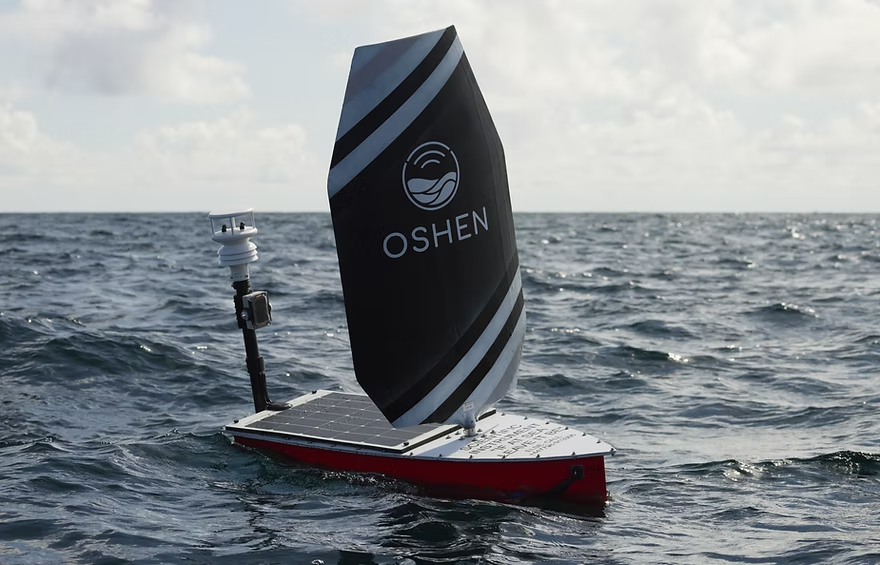
Oshen, a Plymouth, UK-based company, specializes in developing one meter long ocean robots designed for weather and environmental monitoring.
These robots, engineered to function as adaptable buoys, provide vital data from the sea over extended periods, enabling transformative advancements in oceanographic research and forecasting.

The Challenge
For Oshen’s ocean robots to operate effectively, they require robust, low power satellite communication to ensure seamless data transfer and remote control, especially in areas beyond cellular coverage.
The ability to access real time sensor readings and monitor device performance without manual intervention is critical for maintaining operational efficiency and delivering actionable insights.
The Solution
Oshen partnered with Ground Control to integrate Iridium Short Burst Data (SBD) technology into their ocean robots. Our satellite communication solutions provide reliable, low-power connectivity, enabling Oshen to collect mission-critical data and remotely monitor the robots’ performance in real time.
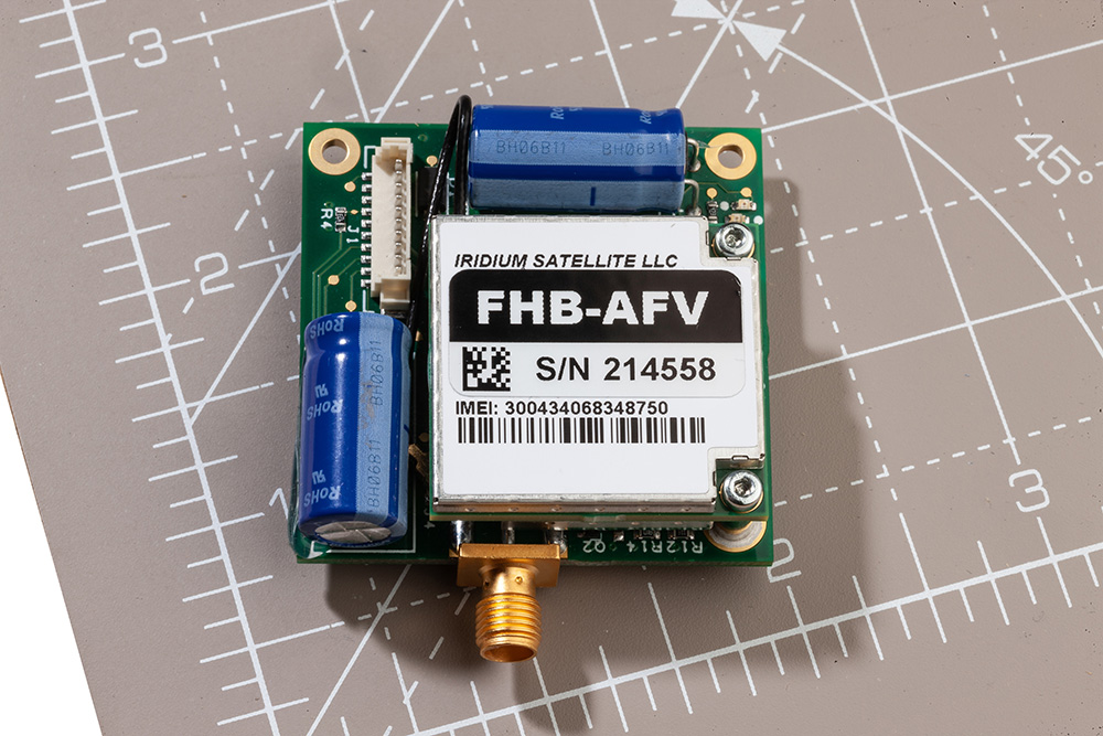
The RockBLOCK 9603 satellite module, tailored for low power devices, has been seamlessly incorporated into Oshen’s system, ensuring efficient operation even in challenging marine environments.
“Ground Control’s support has been invaluable in getting the data moved by the RockBLOCK 9603 modules to work with an easy-to-use dashboard.”
Marcus Thorpe, Robotics Engineer, Oshen
The Results
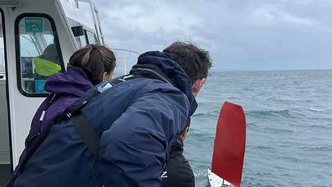
Oshen has achieved remarkable milestones with its satellite IoT-enabled ocean robots.
- Storm Navigation Success: One of Oshen’s ocean robots successfully navigated through a severe storm, demonstrating the reliability and resilience of its systems under extreme conditions
- Enhanced Forecasting Collaboration: Oshen is working with the Met Office to explore how its data can enhance weather forecasting, potentially revolutionizing the accuracy of marine and atmospheric predictions
- Marine Wildlife Monitoring: In partnership with a leading U.S.-based ocean research institute, Oshen is contributing to dolphin and whale monitoring projects, expanding its role in advancing marine conservation efforts.
Oshen’s innovative approach to ocean data collection, combined with Ground Control’s reliable satellite IoT solutions, is driving significant advancements in marine research and environmental monitoring. By overcoming the challenges of remote communication, Oshen continues to unlock new possibilities for oceanographic exploration and sustainability.
Can Satellite IoT Enhance Your Operations?
We design and build our satellite IoT hardware in the UK and USA, in addition to a suite of software services designed to help you get the most out of your data.
We are experts at retrieving data from remote locations reliably, cost-effectively, and quickly. Email hello@groundcontrol.com to speak with one of our technical team, or complete the form.
In 2017, Founder Brandon Wright’s sailboat, SV Inconceivable, broke mooring in a winter storm, and floated to shore. Researching monitoring solutions to prevent this happening without warning again, Brandon struggled to find something that ticked all the boxes, including position relative to geo-fences, battery voltages, and bilge activity. With a background in IoT and electrical engineering, Brandon was perfectly equipped to plug the gap in the market, and Barnacle Systems was born.

The Project
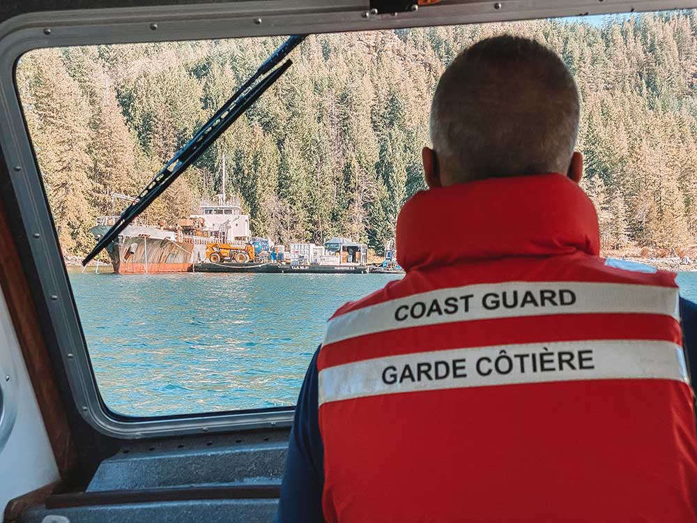
There are over 2,700 wrecked, abandoned and/or hazardous vessels in Canadian waterways, which present a navigational hazard for other boats, and as they degrade, can release contaminants into the water, poisoning marine life. These contaminants range from diesel, gas and system fluids to bottom paint and batteries. Since 2019, it’s been illegal for owners to abandon their boats, but there’s a vast legacy problem that’s tricky to solve.
With the longest coastline in the world (243,042 km), the Canadian Coast Guard has to be selective about which boats it can salvage, and in order to do so effectively, they need to know which vessels present the greatest risk.
The Solution
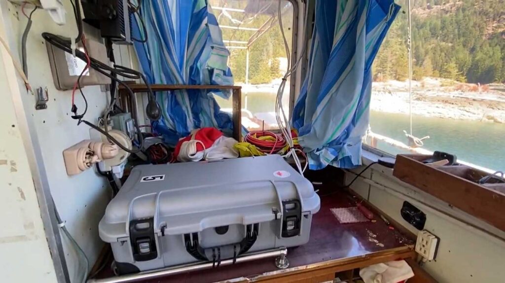
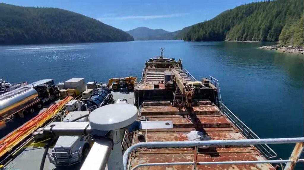
The Canadian Coast Guard has invested in 45 BRNKL Rapid Deploy units from Barnacle Systems. These are purpose-designed for the remote, long-term monitoring of stricken vessels, with capabilities ranging from position tracking, monitoring the list (heel), pitch, and sudden impacts; detecting if water is present in a specific area; and detecting and capturing photos of intruders.
The solar-powered devices are placed on board problematic vessels and enable the Coast Guard to remotely monitor them, with alerts if they begin to sink, or change position, or if intruders are detected. Real time notifications allow them to quickly deploy hazard response teams when needed; if no changes are detected, the Coast Guard can continue to remove and recycle other vessels which present a more immediate risk.
The Satellite Connection
The BRNKL Rapid Deploy units are equipped with both cellular and satellite modems for data transmission, and Brandon chose Ground Control’s RockBLOCK Plus for the satellite connectivity. RockBLOCK Plus is a fully waterproof, plug-and-play satellite transceiver that utilizes the Iridium Short Burst Data® (SBD®) airtime service, designed for IoT applications. With 66 satellites in Low Earth Orbit, Iridium offers global coverage, including the polar regions; important for Canada, as 40% of its land mass is considered Arctic.
Further, RockBLOCK Plus does not need to be ‘pointed’ to transmit to the satellites; the omni-directional antenna just needs a clear view of the sky. This means should the boat move, there’s no risk of the transmission being interrupted because of line-of-sight issues.
Having used other satellite services in the recent past, Brandon knew Iridium was the right airtime choice, due to its reliability and coverage.
“When I spoke to the Ground Control team about the BRNKL Rapid Deploy units, they recommended the RockBLOCK Plus. Its ruggedness, low power requirements and affordable transmission costs are ideally suited for this application, and they’re working exactly as intended.”
Brandon Wright | P.Eng. | CEO
What’s Next?
Barnacle Systems plans to expand the BRNKL Rapid Deploy into the global vessel salvage market, as the solution will work just as effectively for marine salvage operations anywhere on the globe. By receiving alerts about intruders or further damage to a boat scheduled for salvage, operators reduce risks and can better prioritize which vessels to extract.
Would you like to know more?
If you need to collect IoT data from remote and inhospitable locations, you can’t go wrong with the RockBLOCK Plus. That said, there are an increasing number of choices available to you – good news, because competition drives innovation and lowers costs, but it can be difficult to identify which device and satellite airtime service will best meet your needs.
The Ground Control team are here to help! We have 20 years experience in satellite services, and design and build our own satellite IoT devices. We’ll offer you objective, expert advice; just call or email us, or complete the online form.
Tracking Glacier Melt on Everest: Satellite IoT in the Western Cwm
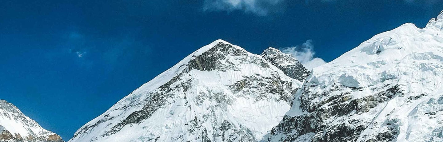
At over 6,500 meters above sea level, in the Western Cwm of Mount Everest, a team of glaciologists is gathering climate-critical data from one of the most extreme environments on Earth. Their aim is to better understand the controls of ice temperatures at high elevation, where observations are few and far between. Working on the Khumbu Glacier, their findings promise to improve forecasts of ice recession and water availability for millions of people living across the Himalayas.
Working in partnership with scientists from the University of Leeds and Aberystwyth University, Ground Control provided a satellite communications system capable of transmitting data daily from Everest’s icy slopes, without requiring a single visit back to the deployment site

The Challenge
The Khumbu Glacier has long been a focus of glaciological research, not least because of its accessibility from Everest Base Camp. But this latest project, funded by the UK’s Natural Environment Research Council, sought to go deeper. By drilling into the glacier at over 6,500 meters elevation, the research team aimed to directly measure:
- Ice temperature at different depths
- Snow depth, accumulation, and compaction
- Meteorological conditions, including temperature, humidity, and solar radiation.
Collecting this data was only half the challenge. Getting it off the glacier and into the hands of researchers in close to real time, without physically retrieving the equipment, was critical for both data continuity and team safety.
Connecting the Glacier
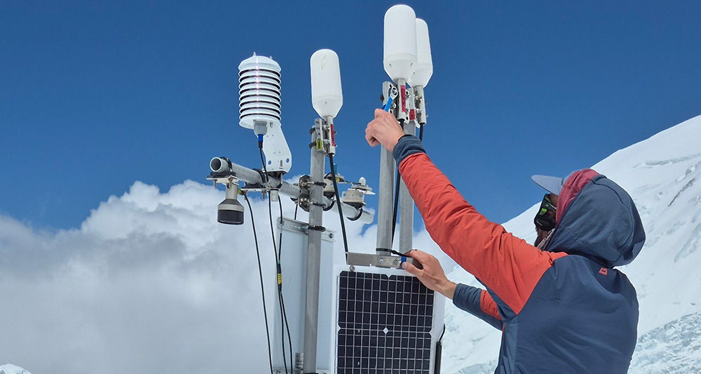
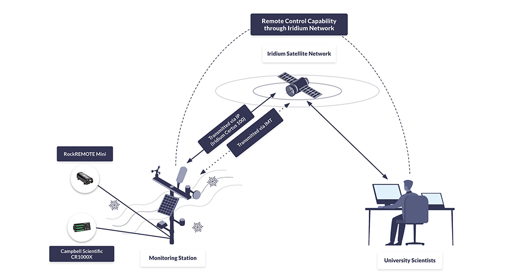
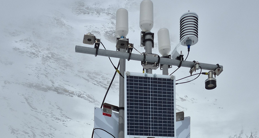
To enable this, Ground Control supported the integration of the RockREMOTE Mini satellite transceiver with Campbell Scientific CR1000X dataloggers at two drill sites and a weather station.
RockREMOTE Mini supports both IP and message-based communication over the Iridium Certus 100 network, for efficient, flexible, low power transmissions.
In addition to sending regular data packets, the system also allows researchers to remotely log in to the data logger via Satellite IP, offering full access for reconfiguration or troubleshooting without a site visit.
Early stage troubleshooting was also supported by Ground Control to ensure robust communications before the kit was taken into the field.

“We planned, tested, and validated the integration between the CR1000X and the RockREMOTE Mini. We created a sample CRBasic program that demonstrated how to control the RockREMOTE Mini from the logger, send data, and allow remote access, all of which the team could adapt for their own setup.”
Michael Mitrev, Solutions Architect, Ground Control
Outcome: Real Time Data from Everest
During operation, the satellite-enabled system transmitted data reliably from the Khumbu Glacier’s drill sites and weather station. Despite sub-zero temperatures and remote conditions, the RockREMOTE Mini operated autonomously, sending back environmental data that has helped scientists monitor how the glacier responds to changes both in short term weather and long term climate, improving forecasts of ice recession for the wider region.
The data are expected to contribute to a growing understanding of:
- The characteristics of high altitude ice masses
- Seasonal and long-term glacier melt patterns
- Future threats to communities relying on Himalayan glacial water.
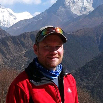
“The ability to be able to observe the glacier in near real-time, without having to visit the field site, has revolutionised the way we conduct our research. For the first time we can analyse and interpret the data as soon as we have installed the equipment, rather than waiting 12 months or more until a team can recover the loggers.”
Duncan Quincey, Professor of Glaciology, University of Leeds
Why Satellite IoT?
Traditional communication systems are unworkable on the snowfields and glaciers of the Everest region. There is no cellular coverage, and even high frequency radio is unreliable in mountainous terrain. Satellite IoT provides a uniquely resilient option for projects like this, offering:
- Global coverage, even in the highest and most remote parts of the world
- Low power operation, ideal for battery or solar-powered deployments
- Two way communication, enabling both data transmission and remote access
- Scalability, from a single sensor node to multi-site sensor networks.
For glaciologists, and for environmental science more broadly, satellite IoT is opening up new possibilities for data collection in places where previously, researchers had to choose between scientific insight and personal risk.
Bring Your Data Home From Anywhere
Want to monitor assets or environments in places where cellular and radio can’t reach?
Ground Control helps teams deploy low power satellite IoT that sends data reliably, and supports remote configuration without repeat site visits.
Tell us about your project and we’ll recommend the right connectivity and integration approach. Either complete the form, or email hello@groundcontrol.com, and we’ll be in touch within one working day.
The role RockBLOCK 9603 plays in the removal of carbon from open oceans
Running Tide is on a mission to restore ocean health and productivity, rebalance the carbon cycle, decarbonise global supply chains, and revitalise coastal communities.
Running Tide’s multidisciplinary team designs and develops integrated software and hardware systems, including monitoring and measurement capabilities to deploy nature-based interventions that remove carbon, combat ocean acidification, and increase the scientific understanding of ocean ecosystems.


The Global Carbon Challenge
Globally, 100–1000 billion tons of CO2 must be removed from the atmosphere before the end of the century to reach long term climate goals of the Intergovernmental Panel on Climate Change (IPCC). One impact of this will be to lower the levels of acidity in the ocean, which by some estimates, has already absorbed 30% of the 2 trillion tonnes of CO2 emitted since the beginning of the industrial era.
The high acidity is wiping out marine species and contributing to coral bleaching; by reducing ocean acidification, we can protect marine life, and prevent greater food insecurity. Development of technologies that drive large-scale intervention to move CO2 from the fast carbon cycle to the slow cycle are essential to achieving this goal.
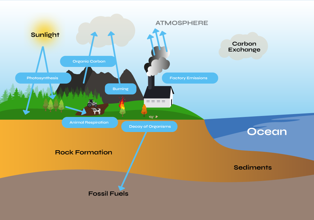
The deep ocean is a massive reservoir that, by current estimates, stores 37,000 gigatons of carbon. Efficiently and effectively moving measurable quantities of CO2 from the fast cycle back to slow, while not disrupting or causing damage to marine life, requires both nature-based innovation and satellite-based technology.
Ocean-Based Carbon Removal
Running Tide is developing a global carbon removal system with the capability to integrate and amplify natural carbon removal pathways. It processes sustainably sourced, carbon-rich terrestrial biomass into buoys, to be deployed in the open ocean and dispersed by ocean currents.
Buoys are coated with calcium carbonate or similar alkaline materials, and when placed in the open ocean, the carbon buoy partially dissolves, thereby sequestering CO2 through a recognised carbon removal process known as Ocean Alkalinity Enhancement (OAE).
Running Tide also incorporates macroalgae in its carbon removal system. Buoys can be seeded with macroalgae, and in the duration that the carbon buoys float, the macroalgae fixes carbon while it grows. Once the buoys absorb enough water to lose buoyancy, they rapidly sink, transporting the embodied fast carbon to the deep ocean (slow carbon cycle), where it remains for centuries or millennia.
Moving To The Slow Carbon Cycle
This process effectively transports carbon, stored in both the macroalgae and terrestrial biomass within the buoy, thereby removing it from the fast cycle to the slow carbon cycle. The system amplifies existing natural processes, and utilizes low-energy inputs (gravity, photosynthesis, and ocean currents). Running Tide’s carbon removal system is highly scalable, and shows the promise of a solution that can meet the scale of the problem.
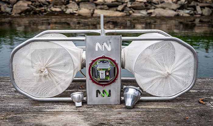
To measure the efficacy of carbon buoy deployments, Running Tide utilizes a fleet of verification buoys that are deployed alongside the carbon buoys at sea, part of the company’s detailed quantification platform.
Powered by RockBLOCK 9603
Capturing data from the carbon buoy deployments is essential to understanding their rate of progress, and satellite connectivity for the data transmission is essential. While designing their verification buoy fleet, Running Tide conducted a deep dive into the available satellite communication options, and selected RockBLOCK 9603.
This Iridium-powered, plug-and-play transceiver sends and receives messages via Short Burst Data (SBD) from anywhere on Earth with a view of the sky. This makes the device the optimum solution for reliable data transmissions from Running Tide’s verification buoys.
The data transferred is designed to quantify the carbon removed and optimize the system for future deployments: including those related to the size and composition of buoys, the lifecycle of the macroalgae, and the timing and location of deployments.
“Capturing comprehensive and accurate data in the early stages of the carbon buoy roll-out is particularly important so we can model the impacts of each iteration of our interventions and the progression of macroalgae in future deployments. We chose the RockBLOCK 9603 because it provides global coverage, has competitive and flexible data plans, and is integrator friendly to our existing carbon removal system.”
Tim Dyson | Senior Electrical Engineering Manager | Running Tide
What’s Next?
In December 2022 and January 2023, Running Tide launched two deployments of verification buoys out of its base in Iceland, which encapsulated RockBLOCK 9603 technology. Ultimately, Running Tide’s carbon removal system aims to not only restore and amplify the transfer of carbon from the fast cycle to the slow at scale, but to also create carbon-negative supply chains that drive decarbonization across a number of additional critical industries.
Would you like to know more?
With over 20 years of satellite experience, the Ground Control team is well placed to help keep you connected when it matters the most.
Whatever your communication or connectivity needs, we can help. Talk to one of our team to discover our products and services and how they can benefit, improve and streamline your applications.
Kraken Project and the RockBLOCK
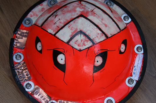
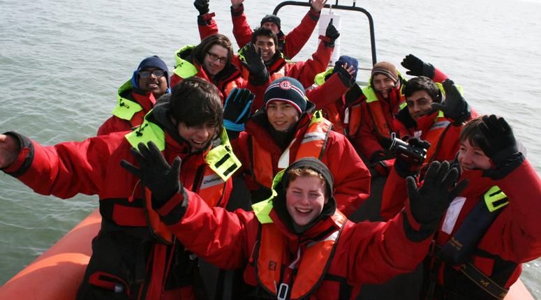
‘Kraken’ is a project by Sutton Grammar School, and this case study is written by them. The main concept behind the buoy is its primary use as an oil response system. The system is based around an oil response unit that aims to make it easier for oil companies to clean up spills quickly and effectively.
It consists of a series of buoys that cooperate to give an image of the spread of oil by using sophisticated GPS and radio technology. Using this, companies can get a picture of where oil has and will spread and then clean up spills as fast as possible.
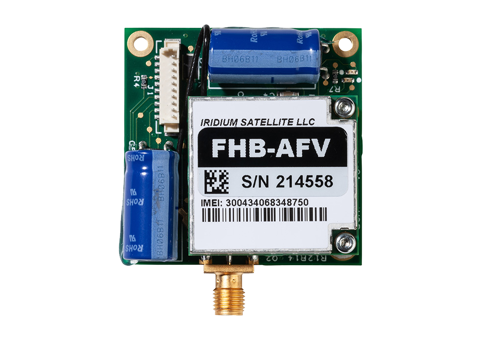
RockBLOCK 9602 is used to transmit the GPS position and other collected data back to a central management system to allow monitoring of the situation in near real-time.
Components of the Kraken Buoy:
- Arduino Atmega328 controller
- uBlock Max 6Q
- Inertial and Temp Sensors
- RockBLOCK 9602 naked unit.
GPS – U-blox Max 6Q
These determine the location of each buoy as a latitude and longitude, and provide accurate synchronised timekeeping (GPS time) for all buoys. GPS modules communicate with the Arduino via the UBX binary protocol over a serial RS232 interface and use Sarantel SL1202 (now discontinued) antennae. The modules have been optimized for 2-D ocean use in power-saving mode (positional fix every five minutes). The team used these receivers partly because they’re very small (so will fit into the ‘nymphs’) can be put into low power mode to extend the battery life of the buoys while at sea.
Hope Microelectronics RFM22B Transceiver
[Short Range Radios]
These are low-power boards used for short range communications (sending GPS data) between buoys in the Poseidon network. The team used this open source Arduino library for easy communication between the Arduino and radio modules. Packets of data are automatically encoded and decoded, further simplifying the Arduino programming.
Arduino Atmega328
This microprocessor chip is used by the Arduino Uno board (but is in surface mount form on our buoys). They are programmed in C with the Arduino IDE version 1.0.1 and coordinate the behaviour of each buoy, decoding and relaying data from various components, e.g. the GPS receivers or the IMU out to the RockBLOCK radio.
Buoy Network Concept
The students aimed to fully utilize the benefits of an entire network of buoys by allowing the ‘nymphs’ to relay each other’s transmissions to the ‘Kraken’, in case some drift out of range of the RFM22B radios. Each nymph broadcasts the GPS data it has stored in its memory to all other buoys, which receive and store this data in their own memories. This means that each time a buoy transmits its memory contents, it is transmitting GPS data on behalf of all the other buoys (not just its own location).
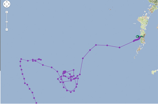
So if a buoy moves out of range of the ‘Kraken’, its data will still reach the Kraken providing that other nymphs are still in range to act as relays. The Kraken collects all these data transmissions to send back to the team via the Iridium constellation, enabling them to track the location of each buoy in the network whilst using only one RockBLOCK radio.
Kraken Buoy Features
- Iridium Satellite Constellation: The team use this satellite network to relay data from the buoys (wherever they are in the world) back to project HQ. The RockBLOCK radio sends data to a passing satellite. The satellite relays this data to a ground station that then emails it to the team. This includes GPS readings to update their live map.
- Inertial Measurement Unit (IMU): The IMU is sampled at 10Hz and data is transmitted back to the team to analyse.
- Additional Sensors: The buoy also contains an onboard battery voltage monitor, so they know how much longer the batteries will last. Internal temperature sensor (located near the edge of the buoy to be as close as possible to the outside water temperature). Connected to the Arduino via a one wire interface.
Supporting Educators
The work we support genuinely inspires us, and we’re proud to support educators bringing learning to life.
If you’d like to get in touch with the team either to discuss an opportunity or project similar to that of the one above, or something completely different our team of experts will be happy to provide objective advice.
Horticulturalists – The Challenge
The trouble with plants is that they grow absolutely everywhere. A great many scientific discoveries have been made by studying plants and there’s an awful lot of the world’s surface to cover. Most of it doesn’t have any kind of ‘conventional’ communication infrastructure.
That’s where our products kick in. Iridium is a global satellite network that offers guaranteed of coverage anywhere you can see the sky.
From the Amazon basin to the top of Everest, our products can provide tracking information and two-way communications – vital to keep in touch with your teams in the field.
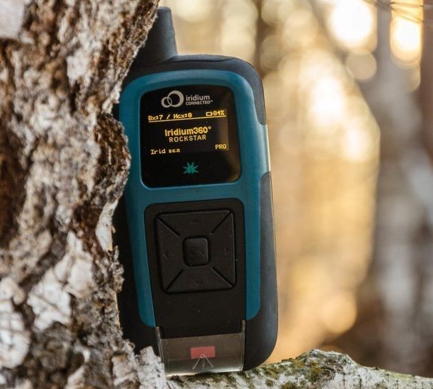
The RockSTAR can be used to mark ‘interesting finds’ using the waypoint options, meaning the remote workers can ‘tag’ locations and come back to them later. Back at HQ, using the Cloudloop IoT platform, you can monitor their progress and see those remotely marked ‘tags’.


The Solution – RockSTAR
This might seem like an odd fit for a tracking product, but it shows the flexibility of the RockSTAR device and the service we offer.
Various horticultural organizations have approached us over the last few years to provide remote worker tracking for their lone workers. A great many research projects take place outside of normal mobile phone (GSM) range and our devices provide an ideal way to keep in touch with these groups.
Global Tracking and Communications
Our devices can last for months between recharges, and if they do need to be recharged in the field then a standard USB cable is all it takes.
KEY BENEFITS FOR HORTICULTURALISTS
- Up to 3 month battery life, transmitting every hour
- Portable, easy to place in a rucksack
- ‘Interesting find’ marking
- Two way messaging between teams and HQ – Email and SMS
- GPS tracking, with access to Cloudloop Tracking for management across all deployed teams
- Various alert options including red button, timer alert, dead man’s switch, etc.
- Pay only when the units are being used in the field, no annual contracts
In summary, RockSTAR is a private means of communication and tracking between you and your remote workers. It’s robust and reliable, has a huge battery life, and is easily charged in the field.
Truly global communications
If you’d like to get in touch with the team either to discuss a challenge related to lone or remote workers, we’d be happy to help.
Working closely with cellular and satellite networks, we’re able to provide expert, objective advice, whatever your budget.