Industry: Maritime
Fangstr is a complete solution for professional fishing fleets who need to provide catch logs and tracking information – usually for regulatory purposes. Utilizing Ground Control’s RockFLEET hardware, the team at Fangstr have created a powerful software and reporting app that captures and transmits departure points (DEP), catch reports (DCA) and port calls (POR).
This information can be automatically transmitted to the regulatory authority, formatted correctly for seamless integration with their systems. The location tracking and catch reporting is also very useful for fishing fleet managers, so you can see in real-time what’s happening at sea.
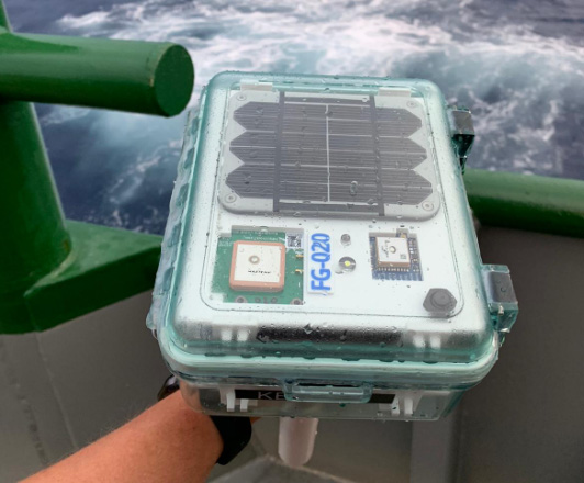
The ruggedized and waterproof RockFLEET transmits location and telemetry data via both cellular and satellite, using least-cost routing, an important consideration in this instance.
Based in Tromsø, Norway, GoFish delivers digital catch reporting for tourist fisheries. GoFish Start is their ‘beginner’ solution, offering catch registration, automatic reporting, digital guest registration, customs documentation, boat booking, ‘no-go’ zones and emergency alerts. GoFish Pro adds real-time tracking of boats, and support for affiliated systems: AIS, Guard Systems and Trackunit.
In countries where legislation requires that fishing vessels report their associated catch, zero catch or released fish – such as Norway – GoFish is an essential app to ensure compliance and protect marine resources.
The team behind GoFish – Dualog – first developed the commercial catch reporting app Fangstr, and have used that expertise to deliver GoFish. Ground Control provides them with both tracking and communication capabilities; the robust and reliable RockFLEET device transmits their data using, in this instance, cellular only, as there is good coverage in the areas where tourists are encouraged to fish.
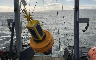
Akrocean delivers ocean data as a service through their fleet of self-powered data buoys. The buoys are modular, and equipped to capture all types of metocean and environmental data. Designed to be self-sufficient, the deployed buoys can operate for multiple years without needing any human intervention.
Windsea is a floating LiDAR service for wind resource assessment and metocean measurements. Fly’rsea is a floating RADAR solution for bird detection and environmental assessment. Seaobs is the combination of the two, and can host a large range of sensors able to monitor any parameter at your project site.
Akrocean utilize the RockREMOTE to backhaul their data; RockREMOTE is designed for larger volumes of IoT data, and leverages the truly global Iridium Certus 100 airtime service, ensuring that Akrocean’s customers get their data reliably, and close to real-time.
Pivotel supports fisheries regulators and fishermen in Australia and New Zealand with the mass deployment of mandated VMS systems and remote satellite communications for their marine vessels. Their solution is used to monitor quota in near real-time; monitor compliance with area and seasonal closures; supply evidence for investigations where needed; validate logbook entries on when/where fishing took place, and estimate fish stock levels.
Leveraging Pivotel’s online tracking portal, Tracertrak, the fixed mount RockFLEET devices provide real-time tracking and historical location information to the VMS (Vessel Monitoring System) licence holder to ensure compliance with government regulations.
The RockFLEET devices are waterproof, ruggedized and easy to install on vessels, making them perfect for remote installations and coping with tough marine conditions. Pivotel’s platform also supports data provided by the RockSTAR, our handheld, portable tracking and IoT solution which is ideal for river fishing and shellfish divers.
Maker Buoy is an Arduino-based drifting buoy equipped with GPS and a RockBLOCK 9603 Iridium transceiver. Fully solar powered, the buoys can be built to your specification, or you can purchase the ‘Build-a-Drifter’ kit, and assemble your own. This is ideal for educational purposes and scientists / oceanographers wishing to customize the the sensor array themselves.
As standard, the buoys feature temperature and light sensors and an accelerometer in addition to GPS; they’re most frequently used for ocean current monitoring. They’ve been used for diverse applications including helping The Ocean Cleanup foundation monitor the effectiveness of their system by simulating the movement of ocean plastics.
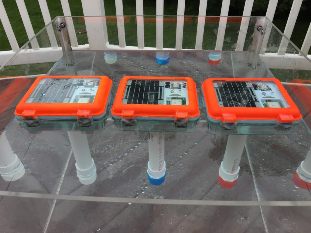
Sofar Ocean developed a data buoy – the ‘Spotter’ – and have deployed hundreds of these marine sensing platforms, creating the largest privately owned network of ocean sensors. Maritime shipping customers subscribe to Sofar’s extremely accurate marine weather forecasts, facilitated by the Spotter network, to help them optimize voyages to save fuel, time and emissions.
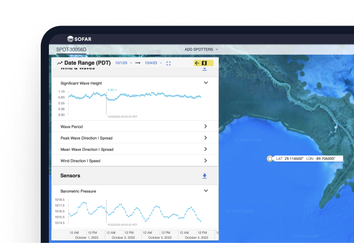
Customers can also purchase Spotter buoys themselves to capture ocean data in places not covered by Sofar’s network, and combine their data with the Spotter network to power marine research and solutions. The data captured and transmitted includes wave spectra, wind, surface and subsurface temperature, atmospheric pressure, water levels and currents, with further options available on demand.
The Spotter buoys use a combination of cellular and satellite connectivity, depending on their location, and Sofar Ocean utilizes Ground Control’s Cloudloop platform to manage their satellite airtime.
MTE Instruments have been creating custom solutions for scientific research groups since 1982. Over time, the team have come to specialize in oceanographic equipment, partially due to their location next to the Gulf of St Lawrence, on the east coast of Canada. From the earliest iterations of their data buoys and underwater recorders, it’s been imperative that they could deliver real-time telemetry, for their customers’ maintenance and monitoring purposes.
The Viking Buoy Overhaul
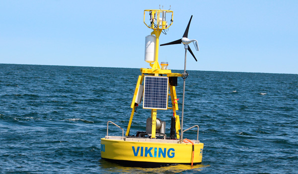
The Viking Buoy is MTE’s main platform, and has been deployed all over North America. The MTE team are in the process of overhauling the Viking Buoy to upgrade to a newer generation of solar panels, modernizing the controller for an AI capable one and upgrading the communication system.
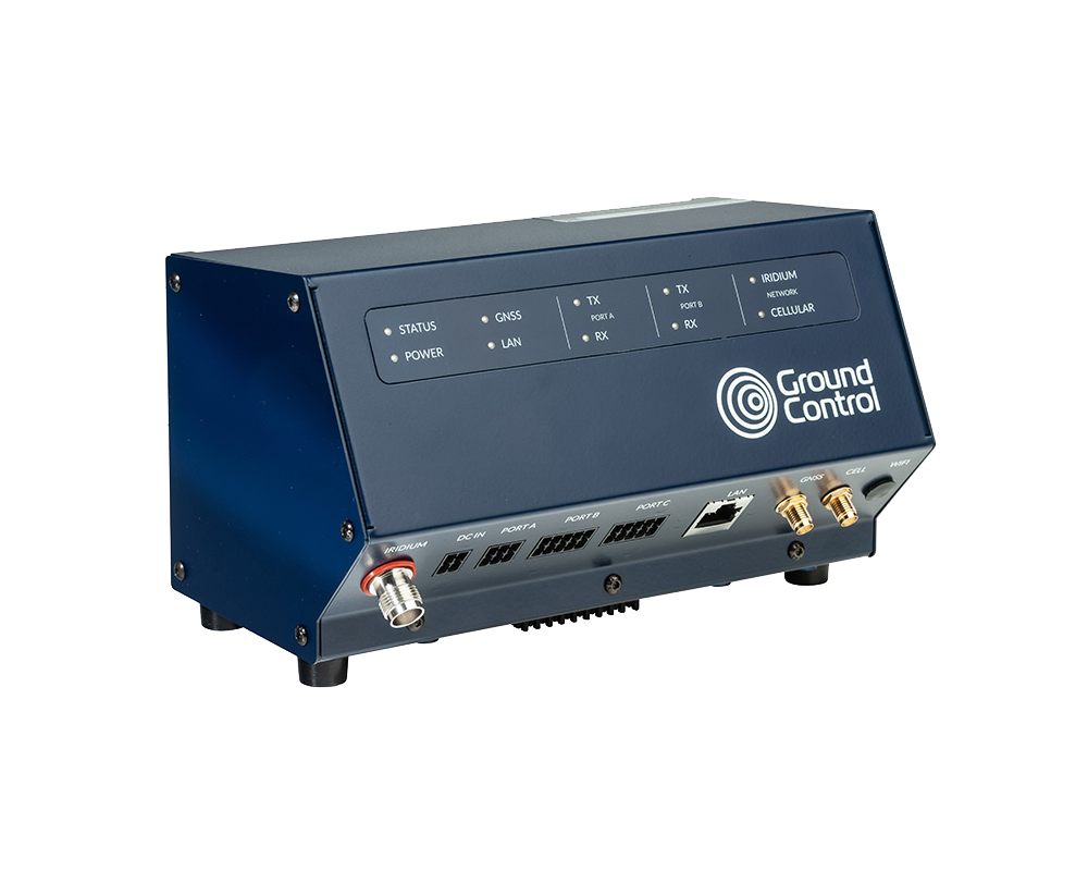
With the help of Ground Control and the RockREMOTE, MTE have been able to dramatically simplify their means of communicating with the buoy. From having to maintain and work with two means of communication, the MTE team now only have to work with one.
Why RockREMOTE And Certus 100 Works For MTE
- Bi-directional communication
- Ability to transmit about 10 MB per month for a reasonable price
- Speed is not really a factor; MTE can work with 1 KB per second
- Ability to prevent rogue transmission is a big plus (customizable data limits and alerts)
As of now, using the Iridium Certus 100 service, MTE are able to operate and debug with ease. Internet tools like SSH are made available and offer not only a possibility in fixing problems, but in the remote deployment of new AI algorithms for in-field testing.
What The Extra Data Facilitates
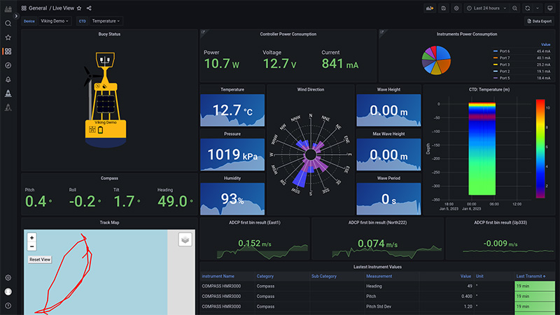
Certus 100 also allows MTE to transmit all recorded data by the buoy, instead of only summarized data. This allows data experts to process and analyze the various parameters in real time.
More and more services are made available for maritime workers to benefit from this live information. Weather information, sea currents and even whale presence are now used in day-to-day cruise planning.
OceanSIP is a service that was specifically tailored to ease the access to the live data of MTE’s various data acquisition platforms. The screenshot shows just some of data that’s now available in real-time via OceanSIP.
“With the advances in satellite communication, the hopes are rising in the scientific communities regarding the possibility of unmanned vehicles with real-time feedback, fauna monitoring cameras and audio monitoring only to name a few. It is hard not to be excited by the upcoming possibilities! From MTE, thanks for making these possibilities a reality for the various experts who thrive in improving our knowledge.”
Martin Rioux, ing. | P.Eng. | Embedded System Developer
We’re here to help
If you have a remote IoT connectivity challenge, there’s a very good chance we can help! With over 20 years’ experience in satellite communications, and long-term relationships with trusted satellite constellation operators like Iridium, we’re well placed to help you backhaul your data cost-effectively and reliably from anywhere on Earth with a clear view of the sky.
Call or email us, or complete the form, and we’ll be happy to connect you with one of our solutions architects to discuss your requirements.
Mapping Monsoon Currents to Support Coastal Livelihoods
The UK’s National Oceanography Centre (NOC) is one of the world’s top ocean research institutions. NOC’s scientists work around the globe, uncovering links between the ocean, climate change and biodiversity loss, to help every living thing on our planet flourish.
The organisation solves challenging multidisciplinary, large scale, long-term marine science problems to underpin international and UK public policy, business and societal outcomes. NOC also operates the Royal Research Ships James Cook and Discovery and develops technology for coastal and deep ocean research.
About the Project
In the Western Indian Ocean’s Pemba Channel, monsoon seasons shape life above and below the surface. Understanding where currents accelerate, where eddies form, and how waters connect across borders is essential to safeguarding fisheries, supporting livelihoods, and protecting biodiversity. NOC led collaborative work within SOLSTICE-WIO to generate that evidence, while building local capacity so the benefits endure.
The Connectivity Challenge
The Pemba Channel is remote, energetic, and sparsely instrumented. Cellular coverage is unreliable; the science window is short. NOC needed a way to capture near-real time trajectories from small, battery powered drifters during the monsoon; robust enough for rough seas, simple enough to replicate, and affordable so partners could scale it into routine observing. The goal was decision-ready data to inform sustainable fisheries and coastal planning.
The Solution
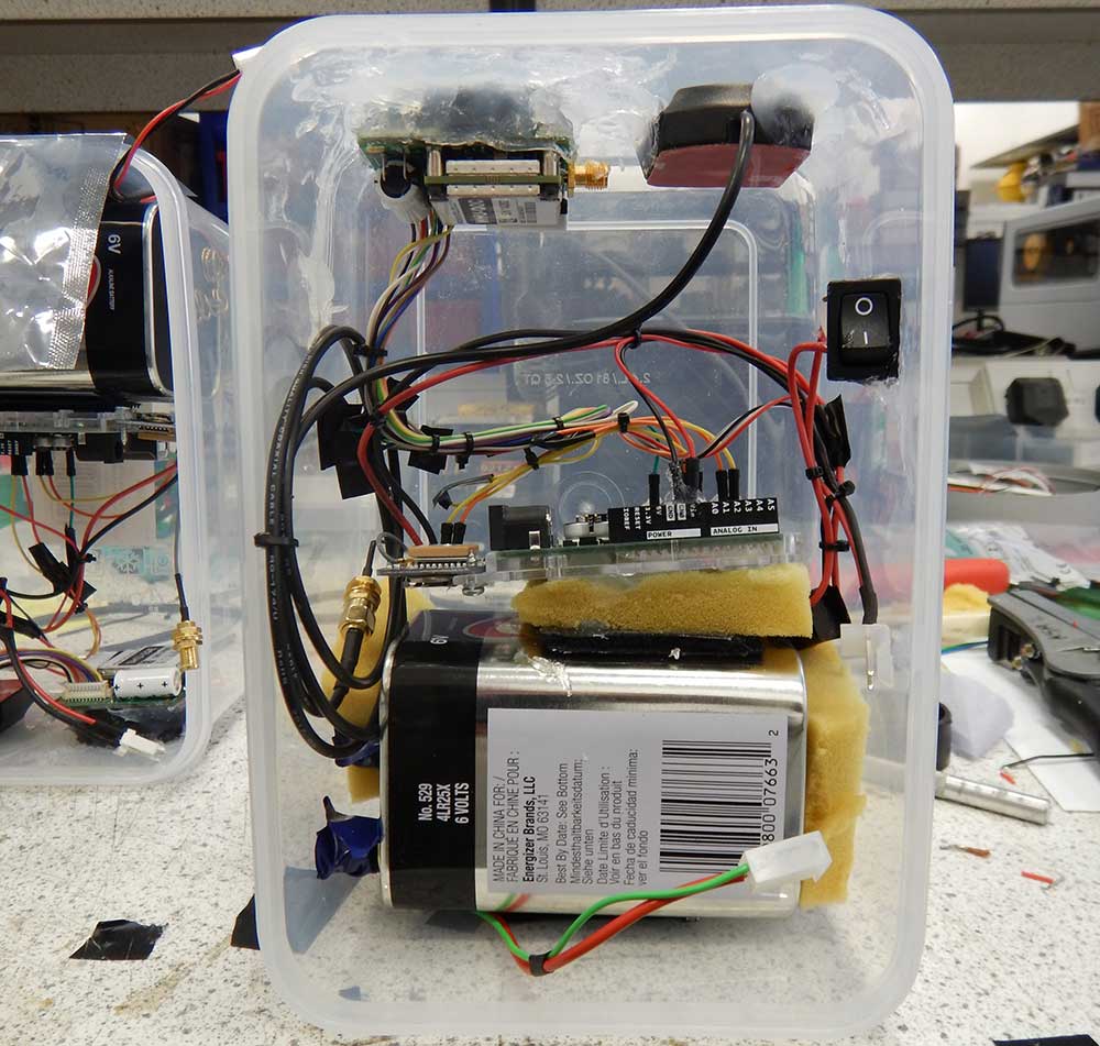
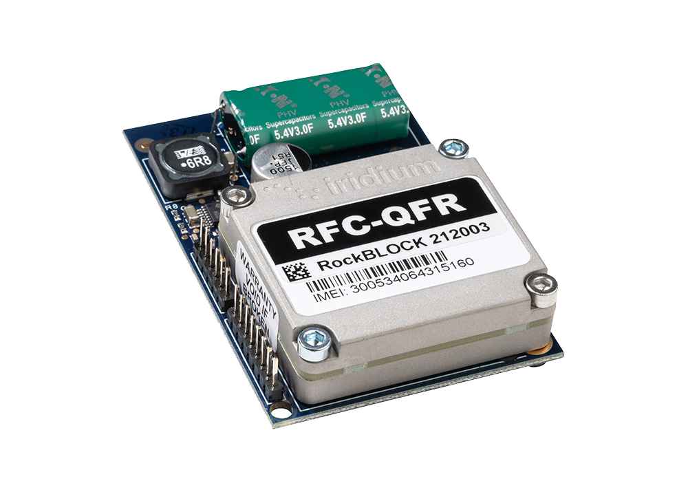
To achieve global connectivity from compact platforms, NOC integrated Ground Control’s RockBLOCK 9603 with Iridium Short Burst Data. The 9603’s small footprint, straightforward wiring, and low power draw made it a natural fit for locally built, low cost drifters assembled from off the shelf parts.
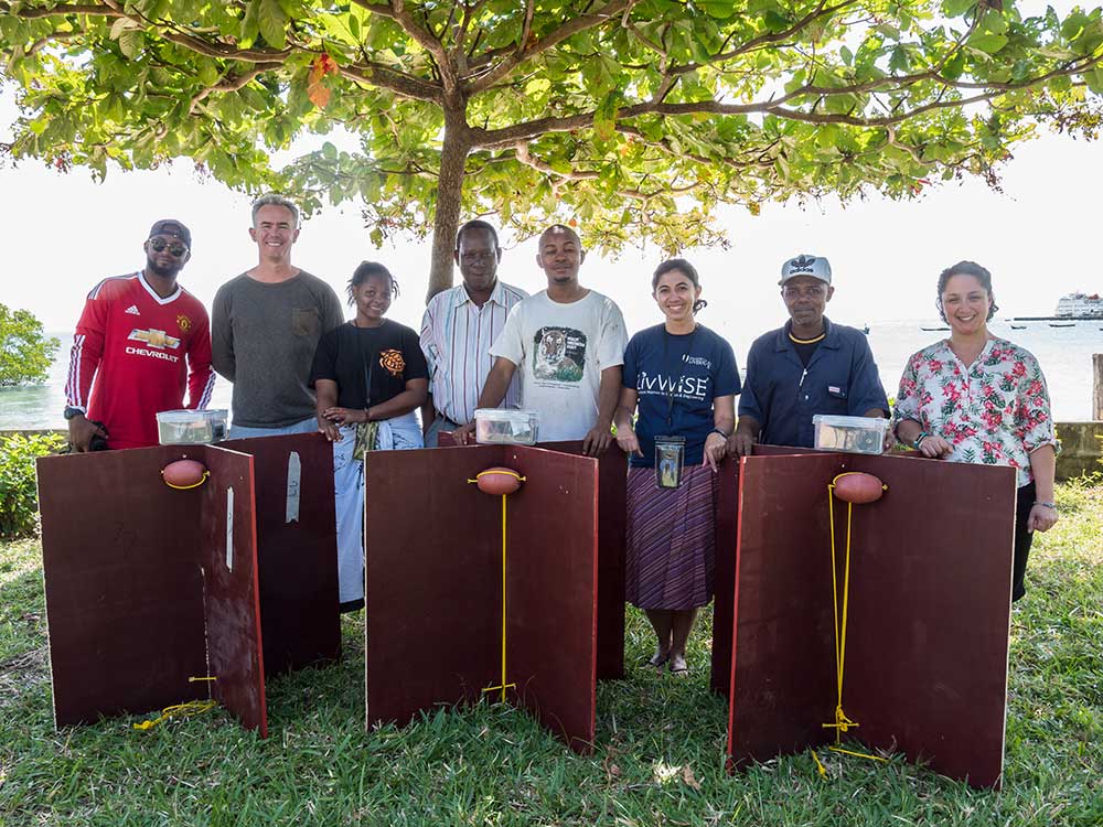
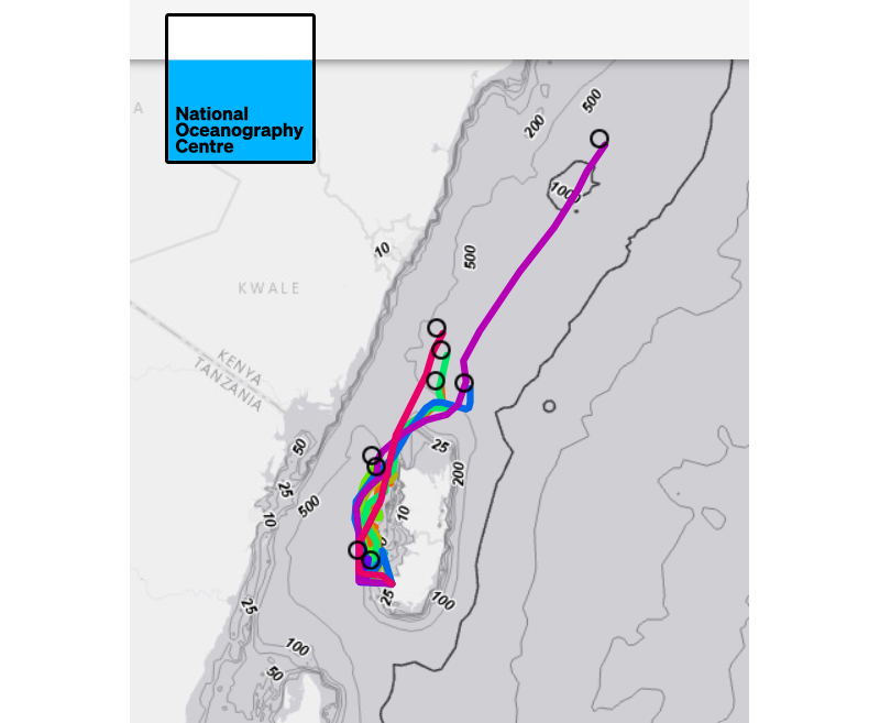
NOC and partners constructed a fleet of nine surface drifters and executed multiple deployments across tidal cycles and shifting winds. Each unit uplinked GPS positions via Iridium, feeding a simple tracking and visualisation workflow so the team, and regional stakeholders, could see the ocean move as conditions evolved.
Why RockBLOCK 9603 for Metocean Data?
RockBLOCK 9603 delivers global, two way Iridium Short Burst Data (SBD) messaging from compact, battery-powered platforms. It’s designed for harsh, remote environments where cellular networks aren’t an option, providing dependable links for position reports and sensor data whenever a clear sky view is available.
Integration is straightforward. The 9603’s small footprint (45×45×16 mm, ~39 g) and simple connector make it easy to embed alongside GPS and microcontrollers in space constrained builds. Clear developer documentation and example workflows help teams move quickly from bench testing to sea trials.
Power efficiency is a core advantage. Short wake cycles and low standby draw support long deployments on modest battery packs, which is ideal for lightweight drifters and autonomous systems. In practice, that means more time collecting decision ready data, and fewer retrievals or battery swaps.
The Results
- Actionable ocean intelligence: The drifters resolved fast central flows, persistent eddies, and strong tidal modulation. These features drive nutrient transport and productivity, shaping fish distribution and catch success. Turning them from invisible forces into mapped patterns helps align fishing effort with sustainability.
- Connectivity across borders: Tracks that exited the channel highlighted time dependent links into Kenyan waters, informing conversations about shared stocks and coordinated management.
- Capacity built in the region: Because the design is repeatable and affordable, partners can assemble, deploy, and interpret their own drifters, embedding skills locally, and creating a foundation for long term observation.
- Better models, better policy: Observations serve as ground truth alongside remote sensing, strengthening regional ocean models that underpin fisheries advice, marine planning, and climate resilience strategies.
Have a Remote Monitoring Challenge?
Ground Control has over 20 years’ experience in connecting very remote things, from data buoys to weather stations, animal tracking collars to wind farms. If you have an application that’s out of reach of cellular, we can help you bring your data home.
Tell us about your project by completing the form or emailing hello@groundcontrol.com; we’ll reply within one working day with expert, impartial advice.
Drifting Buoys are versatile kits that anyone with the know-how can use to retrieve their own oceanic data. Generally, the main purpose of drifting buoys is to measure ocean currents and sea temperatures, the data of which is then transmitted back to research labs on the mainland for analysis.
The data provides vital intelligence for weather and climate models and ultimately aids in the better understanding of ocean behaviour and intensity forecasting.
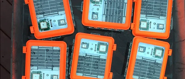
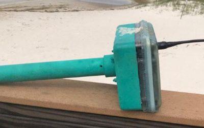
The Maker Buoy is a solar-powered, Arduino-based research buoy that measures ocean drift and sea temperature and carries a RockBLOCK 9603 to transmit position, water temperature, and other data via the Iridium satellite network.
The unit can be built by hobbyists, researchers, and meteorological organisations, and data shared is used to further our understanding of our oceans.
Maker Buoy supplies various options: a bare PCB, a populated PCB, a complete kit for the end user to construct themselves, and a complete unit. One of the most notable users of Maker Buoy is The Ocean Cleanup.
The Challenge
Drifters are sometimes thrown in the ocean in the path of typhoons and hurricanes to gain a better understanding of ocean behaviour. As such, components need to be long-lasting and compact enough to ensure efficient use of space.
Projects range from small scale hobby projects through to high budget global schemes, so accessibility by hobbyists, researchers, and organisations alike is key.
The Solution
RockBLOCK 9603 is a versatile, compact, low power and dependable way of sending and receiving data from remote locations. It uses the Iridium satellite network, giving truly global coverage.
RockBLOCK is readily available to anyone with a passion for IoT who wants to send and receive data from remote locations – such as the middle of ocean.
- Truly global two way coverage
- Low power usage, small antenna
- Plug-and-play product, simple setup
- Reliable data transmission with acknowledgements
- Lifetime phone and email support.
“A nice feature of Ground Control’s RockBLOCK Iridium satellite SBD service is the ability to forward messages to another modem, allowing access to Maker Buoy data in locations without Internet access.”
Wayne Pavalko, Maker Buoy Founder
Built with Ground Control
If you’re exploring your own ocean and coastal monitoring buoys project, please call or email us, or complete the form, and we’ll be happy to help. We have offices in the UK and USA, and 20 years’ experience in satellite connectivity, so you’re in safe hands.
Data Buoys purposes can include measurements of water temperatures, salinity, drift patterns, and pollutant levels, which inform a large number of personal and global projects from boat manufacture through to meteorology and climate change.
Working with Bangor University on the SEACAMS2 Project, Ocean Scientific International Ltd (OSIL) is using RockBLOCK 9602 for the satellite communications element for its telemetered data buoys. The buoys collect and measure oceanographic, meteorological, and water quality data parameters around the coast of North Wales to assess renewable energy opportunities.

The Challenge
Regardless of deployment location, buoys will often find themselves drifting to remote locations where mobile GSM just can’t reach or is intermittent.
The data collected is vital and therefore continuous, reliable transmission is paramount to its ongoing success.
What’s more, any components of the buoy need to be compact enough to ensure it doesn’t take up vital space in the equipment used to remain lightweight.
The RockBLOCK Solution
RockBLOCK 9602 is a versatile, compact, low- ower, and dependable way of sending and receiving data from remote locations. It uses the Iridium satellite network, giving truly global coverage. RockBLOCK 9602 is used when the buoy is out of range of cellular networks to allow data to be sent and received regardless of location.
- Truly global two way coverage
- Low power usage, small antenna
- Plug-and-play product, simple setup
- Reliable data transmission with acknowledgements
- Lifetime phone and email support.
“We enjoy working with Ground Control as they offer great, sensibly priced products with excellent after sales support and an easy to use online portal.”
Rob Luthwaite, OSIL Project Manager
Built with Ground Control
The work we support genuinely inspires us, and we’re proud to create solutions and solve customer problems like no one else can.
If you’d like to get in touch with the team either to discuss a challenge similar to that of the one above, or something completely different, our team of experts will be happy to provide objective advice.
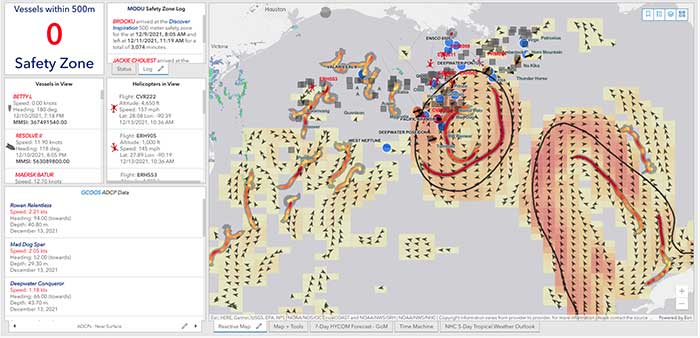
40Geo captures geographical information from hard-to-reach areas and analyses it to deliver situational awareness, competitive intelligence, and advanced visualization for supply chain optimization. One of the means 40Geo has of collecting data is utilizing drifting data buoys, which are deployed into areas being used for, or potentially used for, oil and gas exploration and extraction.
These data buoys capture wave height, temperature, wind speed, and over time, forecast patterns in ocean currents. They can even detect volume and frequency of other passing vessels by tapping into the radio signals sent out from boats. With 40Geo’s analysis, this becomes powerful data to aid decisions about when and where to situate off-shore oil and gas operations.

The Challenge
Many areas suitable for oil and gas extraction are also very remote, so backhauling that data from the data buoys to 40Geo’s servers requires a satellite connection. To date, 40Geo’s drifting data buoys have leveraged Ground Control’s RockBLOCK 9602 for this application, placing the transceiver into a waterproof box on top of the buoy.
This gives the team close to real time data under any circumstances, as the L-Band frequency that the RockBLOCK 9602 leverages is not affected by weather conditions. It’s also completely global coverage because it uses the Iridium satellite constellation; no matter where the buoy drifts to, 40Geo will be able to pinpoint its location.
The Evolution
In the Gulf of Mexico, an area rich in oil and gas reserves, there are two considerations that make 40Geo’s current data buoys less optimal. Firstly, there is cellular network coverage for a reasonable amount of the gulf, which, because it’s often lower cost compared to satellite transmission, will be the preferred means of sending and receiving data.
Secondly, there are powerful currents that can send the unpowered data buoys well away from the areas that are of most interest to 40Geo’s oil and gas customers.
The Solution
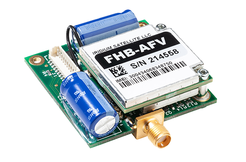
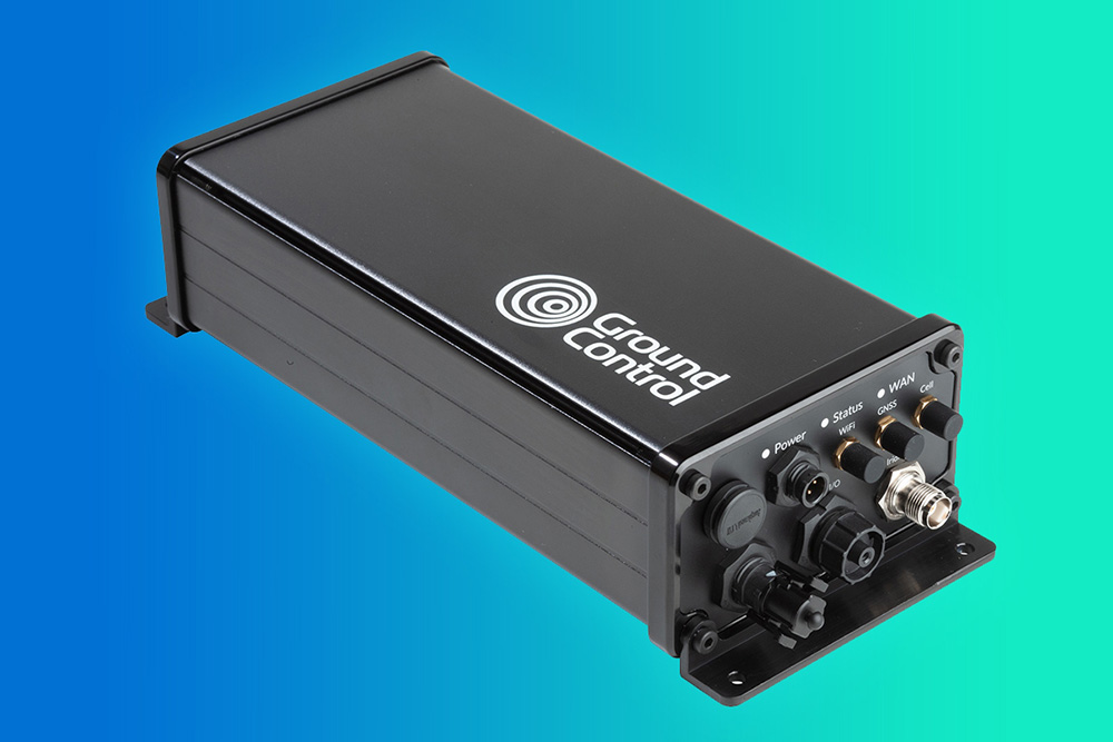
40Geo is in the final stages of launching a new USV (unmanned surface vessel) which has the ability to be remotely operated, meaning that if it should travel out of the area under inspection, the operator can put it back on course. In addition to this, the new autonomous vehicle will utilize RockREMOTE Rugged rather than the RockBLOCK 9602 for its data transmission.
This is because RockREMOTE Rugged is a hybrid LTE-M / Certus 100 / Iridium Messaging Transport (IMT)-capable device, allowing the 40Geo to use a single ‘box’ for all of their connectivity requirements. RockREMOTE Rugged can be configured to leverage the cellular network whenever available, and seamlessly switch to satellite when cellular data is unavailable, giving the 40Geo team the perfect balance of optimized costs and 100% connectivity.
“We chose the RockBLOCK because it delivered exactly what we needed: plug-and-play satellite connectivity that delivers close to real-time data. The developer documentation is thorough and the API interface works well. The RockREMOTE is an exciting evolution allowing us to provide more data while controlling costs; this is the sort of innovation that will propel satellite IoT applications forward.”
Miles Roden, COO, 40Geo
The USV will be able to undertake other tasks in addition to its main purpose of measuring wave height, wind speed etc. For example, a weather balloon can be launched from the platform to capture data from hurricanes. It simply wouldn’t be possible to launch this from an oil rig because of the fire risk from the sensing equipment and the helium (although the risk is small, helium is listed as hazardous by some operators), and the potential for the balloon to impact drilling equipment.
40Geo’s multitasking USVs can be used for many different applications, including air quality monitoring after oil spills, surveys of ocean currents for renewable infrastructure planning, video inspection of unmanned assets, marine mammal detection, and any other tasks that clients can envision.
Would you like to know more?
If you’re interested in 40Geo’s data buoys, or you have your own tracking software and want to explore integration options with Ground Control’s satellite tracking devices, we’d love to hear from you.
Call or email us, or complete the form, and one of our experienced team will be happy to help.
Smart Satellite Buoys Reducing Ghost Gear and Protecting Oceans
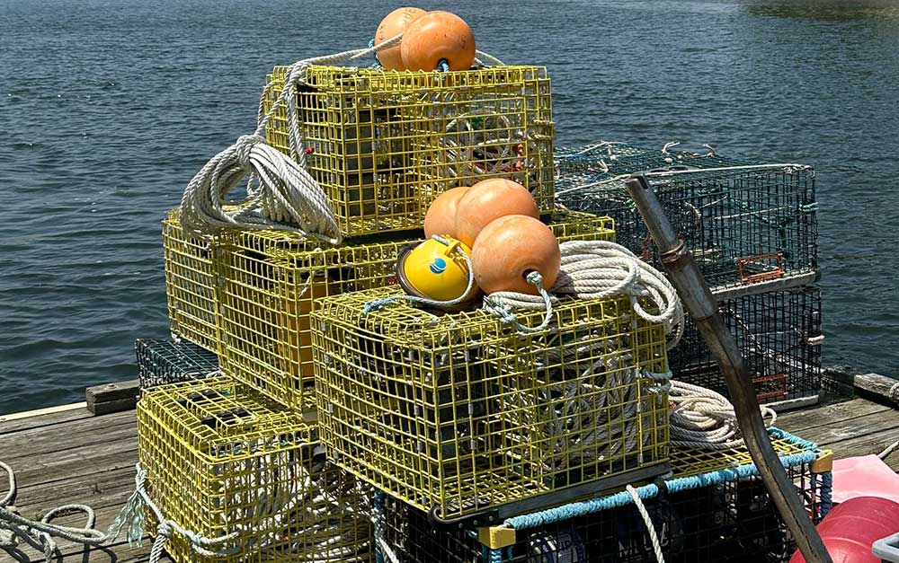
Founded in 2015, Blue Ocean Gear set out to solve a challenge for fishermen: around 10% of fishing gear is lost annually in many fisheries, estimated in 2019 to weigh about 640,000 tonnes. This has two serious impacts: the first is the economic penalty; crab traps, for example, can cost $1,000 – $2,000 each, and are often lashed together in strings of 40 or more traps; losing these traps could cost some fishermen their livelihoods.
The second is the environmental impact. The lost fishing gear continues to fish, while never harvested; it attracts females and juveniles, and off-target species, all of which die in the trap, attracting more species to become captured, and more wasteful fish deaths. There’s also the potential for gear to entangle birds, turtles, whales and dolphins; a 2020 report from the World Wildlife Fund notes that abandoned and lost fishing gear threatens around two thirds of marine animals, including all sea turtle species and half of seabirds.
Blue Ocean Gear developed a data buoy which acts like a sort of maritime air tag; fully waterproof and depth-rated, it’s easily attached to fishing gear, and its internal sensors track its location, movement and depth.
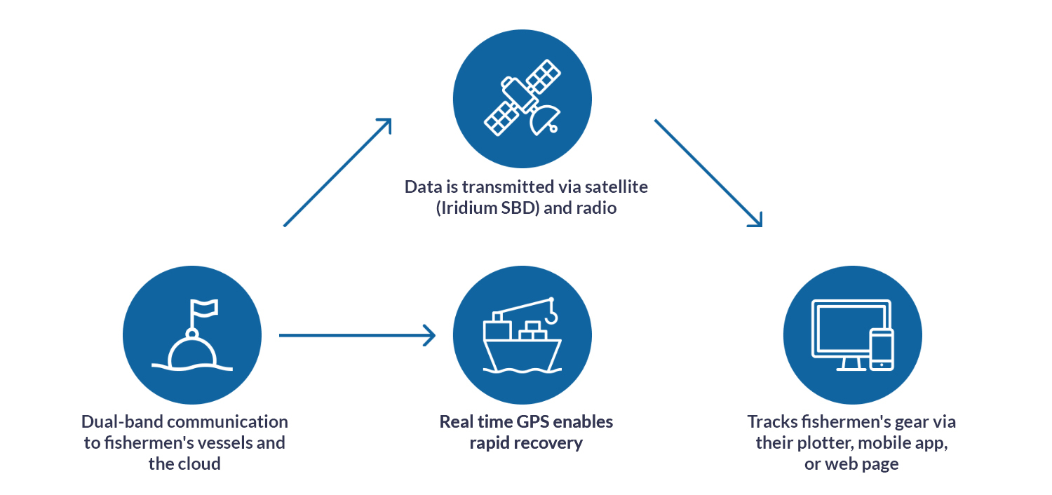
The combination of these sensors tells fishermen whether the gear is entangled or being dragged by a boat, for example; or if it’s vanished underwater due to currents, the buoys can alert the fishermen when it surfaces so they can retrieve it and harvest the catch, saving them valuable time and fuel on the water.
The buoys also help detect and prevent poaching, with a sensor sending an alert to a connected app to tell the owner of the gear when it’s in or out of the water; if it’s unexpectedly out of the water, that’s a good indication that the catch is being poached.
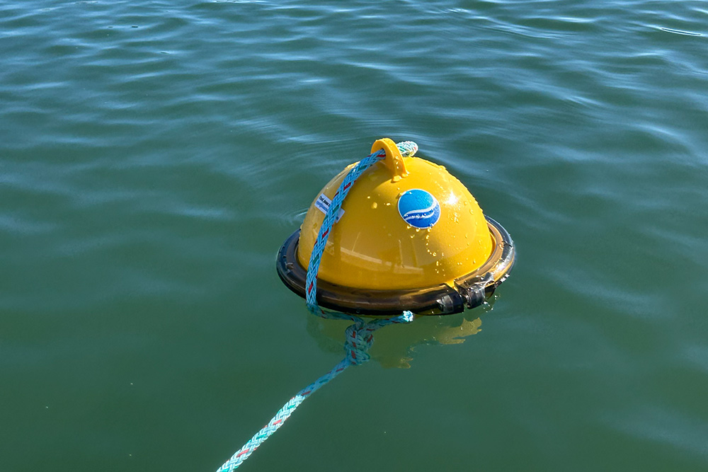
Blue Ocean Gear worked, and continues to work, very closely with fishermen to deliver a device that meets all of their needs: all of the electronics are protected internally; there’s no on/off switch; it’s extremely robust, and can withstand extreme weather conditions. On the software side of things, the fishermen can decide for themselves how frequently they need which data sets, again using the app.
The buoys can communicate to a similar device on the vessel via radio link, but for fixed gear such as traps, most of the time the fishing vessel is not nearby, and that’s where Ground Control comes in.
Ground Control delivers satellite IoT connectivity, connecting very remote things, and has worked with Blue Ocean Gear since their pilot phase to ensure that they, and their connected customers, can retrieve their data in real time from any location on Earth.
The buoys utilize Iridium Short Burst Data, which sends data in small packets; this is an extremely efficient way to utilize satellite communication, making it cost effective and power economical, while still delivering the close-to-real time, truly global, two way communication that Blue Ocean Gear’s customers need.
Although fishermen remain central to Blue Ocean Gear’s work, their ability to collect ocean data hasn’t gone unnoticed by the scientific and research communities, and they’ve expanded their capabilities to meet the needs of scientists and offshore wind developers, for example. In addition to the temperature measurements available now, in Q1 2026, they’re adding air pressure and wave data sensors to the buoys, which substantially grows the number of applications for which they can be used.
“For our customers, having data all the time is key, whether they’re working in the Arctic, Antarctic or anywhere in between. Ground Control’s connectivity has been extremely reliable, and it was very easy to integrate with our systems. Cloudloop gives us the cost monitoring and API access we need for billing, and the support has been just wonderful throughout the many years we’ve worked together.”
Kortney Opshaug, CEO, Blue Ocean Gear
Beyond asset tracking and fishing, Blue Ocean Gear’s applications are growing rapidly, with huge potential for deployment across many different ocean industries. Collecting data from the ocean has traditionally been hard, expensive and complex; together, Blue Ocean Gear and Ground Control are helping to bridge that gap, delivering more data points in an easy, accessible and low cost way.
Let’s Connect Your Next Ocean Project
Projects like Blue Ocean Gear show what’s possible when rugged hardware, smart software and always-on connectivity come together. At Ground Control, we help organizations turn ambitious ideas into dependable, real world solutions, from tracking critical assets at sea to unlocking hard to reach environmental data.
If you’re working on an oceans, environmental monitoring or remote IoT initiative and need a connectivity partner who understands the challenges off the edge of the map, we’d love to talk. Fill in the form, or email hello@groundcontrol.com, and a member of our team will help you explore the best options for your project.