Product: RockREMOTE
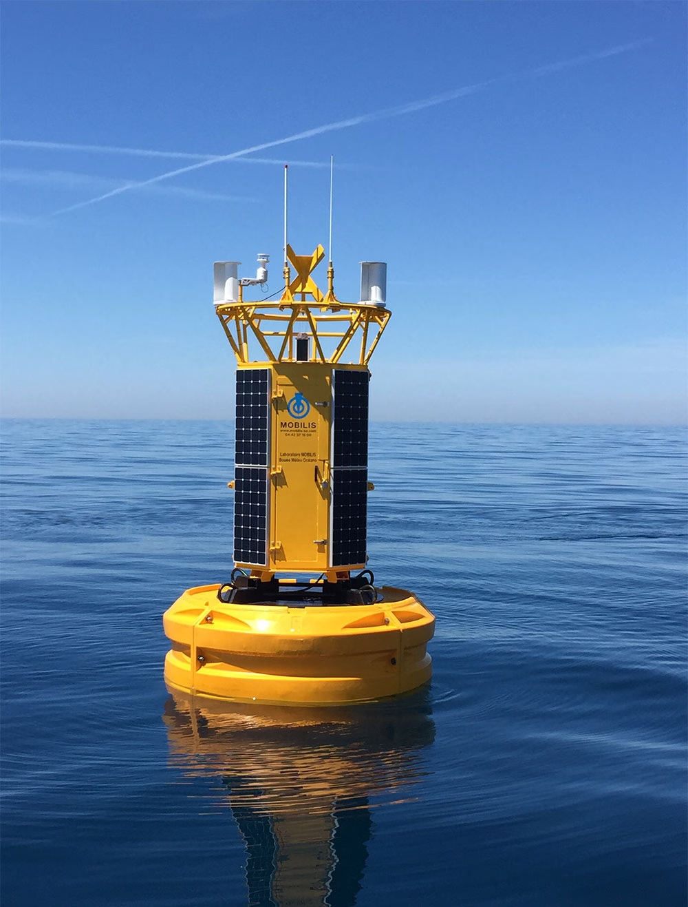
Building Resilient Connectivity for Offshore Monitoring
Founded in 1990, Mobilis is a French maritime engineering company with equipment deployed in more than 90 countries. Combining in-house R&D, manufacturing and project expertise, it develops solutions for navigation, mooring and ocean observation, helping customers operate safely and make better informed decisions in demanding marine environments.

The Challenge
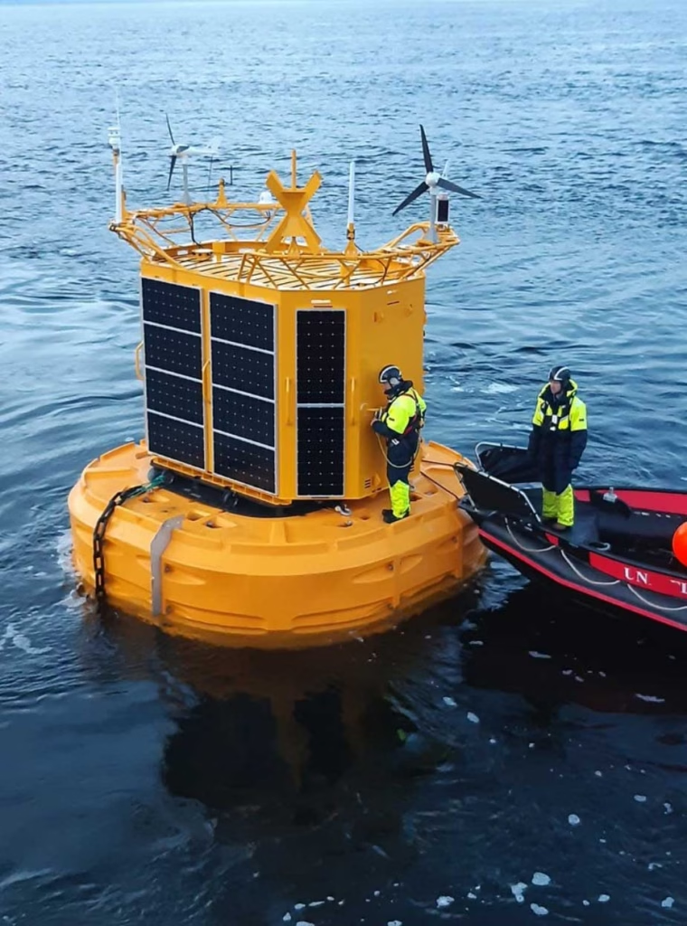
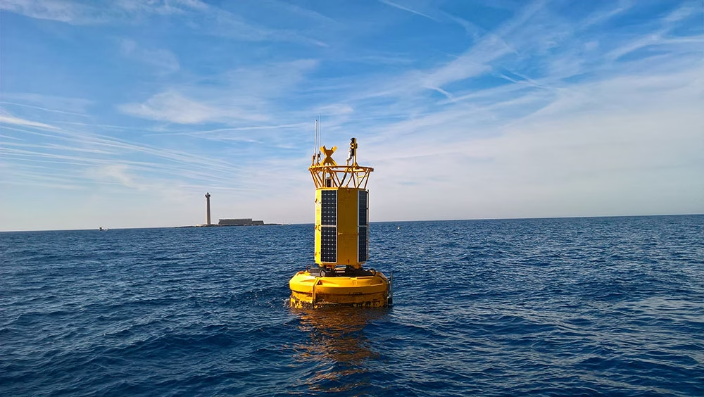
Mobilis’ environmental monitoring systems support applications including port operations, dredging, marine construction, environmental compliance, offshore projects and scientific research.
Depending on the application, they can measure meteorological conditions, waves, currents, water quality, position and system health, alongside more specialist project-specific data. For customers, continuous access to this information can reduce the need to send vessels offshore simply to understand what is happening.
But collecting the data is only part of the challenge. Mobilis also needs to get it reliably back to shore. Many deployments sit beyond dependable terrestrial coverage, while LTE/GSM and radio links can be interrupted by network outages, roaming issues, antenna problems or local conditions. For systems expected to remain offshore for months or years, losing that connection can mean losing operational visibility.
Mobilis therefore needed a communications model that could maintain connectivity when terrestrial networks were unavailable, without making satellite airtime unnecessarily expensive.
The Solution
Mobilis integrated Ground Control’s RockREMOTE Mini into its own data-acquisition architecture, alongside its datalogger, power management and sensor interfaces.
The resulting hybrid model can adapt to each deployment. Where LTE/GSM or radio is available, Mobilis can use it for bulk telemetry, with satellite providing an independent backup. At more remote sites, satellite can become the primary connection.
Mobilis also separates routine telemetry from remote engineering access. For everyday data transmission, it uses Iridium Messaging Transport (IMT). Sensor measurements are compressed into compact binary payloads before transmission, replacing verbose text with short identifiers, compact timestamps and efficient numeric formats. This can reduce data volumes by an order of magnitude or more compared with plain text, helping Mobilis transmit regularly while keeping airtime predictable.
Data passes through the Mobilis datalogger and RockREMOTE Mini to Iridium and Ground Control’s Cloudloop platform. From there, it’s routed into Mobilis’ cloud environment, decoded and delivered to web platforms, mobile applications and customer dashboards.
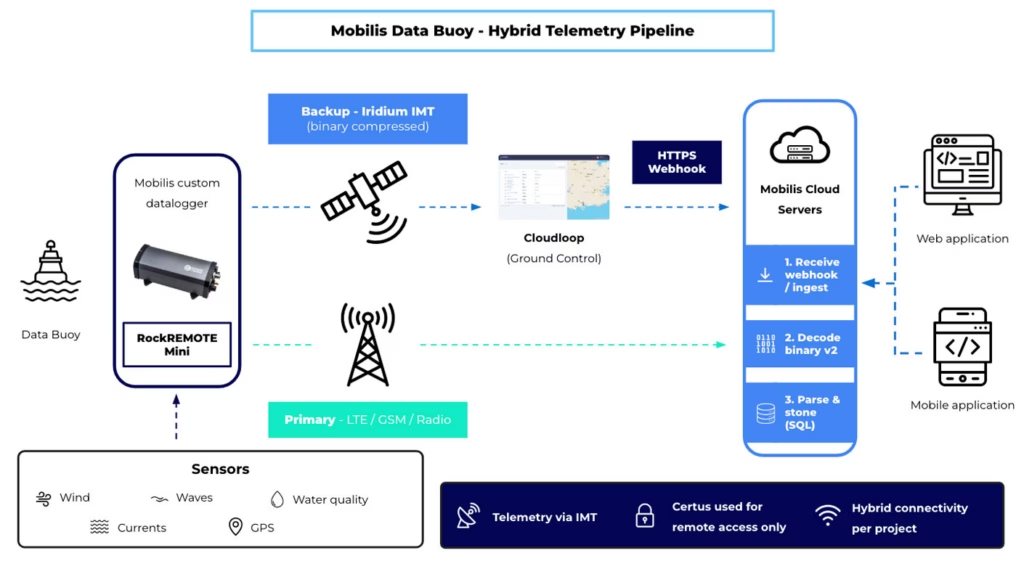
When engineers need direct access to a deployed system, Mobilis uses an Iridium Certus 100 IP connection. If LTE or radio is unavailable, this gives the team a remote route into the datalogger for diagnostics, configuration and maintenance, including SSH access.
Using IMT for efficient routine telemetry and Certus 100 for IP-based remote access allows Mobilis to use the most appropriate type of satellite connectivity for each task.
The Results
The hybrid model helps Mobilis maintain visibility across its satellite-enabled fleet, even when cellular or radio communications fail.
Remote Certus 100 access allows engineers to investigate and potentially recover systems from shore, reducing the need for costly offshore visits. At the same time, binary compression and IMT help keep routine satellite costs under control as sensor sets and projects grow.
Once ashore, measurements flow directly into Mobilis’ applications, giving ports, project teams and environmental specialists near real-time access to offshore conditions.
The architecture is also repeatable. The same combination of Mobilis datalogger, RockREMOTE Mini and Cloudloop can be used across international projects while adapting the sensor configuration and connectivity model to each deployment.
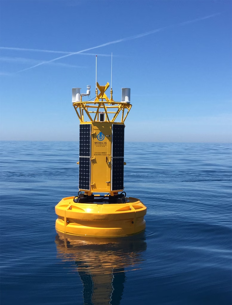
“What we appreciate is support that understands real buoy constraints power, intermittent sky view, metered messaging, and the need to separate telemetry from remote access. CLS and Ground Control feel more like a technology partner, rather than a hardware supplier.”
Alberto Dallolio, Ph.D. Eng.
Ingénieur Senior Robotique Marine | Senior Marine Robotics Engineer
Looking Ahead
Mobilis plans to extend its hybrid LTE/radio and Iridium model across more projects, while continuing to refine binary compression for new sensor types.
The team is also developing more automated fleet-health monitoring and deeper integration with the Mobilis Data Portal and customer mobile applications. As its connected fleet grows, Mobilis is exploring ways to simplify multi-device management and Cloudloop integration, with the same goal at the heart of the system: keeping critical offshore data accessible when conventional communications cannot be relied upon.
Connecting Equipment Beyond Terrestrial Coverage
From offshore monitoring systems to other remote marine assets, we can help you build a connectivity solution that keeps critical data flowing when cellular or radio networks cannot be relied upon.
To speak to our team about your project, either complete the form or email hello@groundcontrol.com, and we’ll reply within one working day.
MTE Instruments have been creating custom solutions for scientific research groups since 1982. Over time, the team have come to specialize in oceanographic equipment, partially due to their location next to the Gulf of St Lawrence, on the east coast of Canada. From the earliest iterations of their data buoys and underwater recorders, it’s been imperative that they could deliver real-time telemetry, for their customers’ maintenance and monitoring purposes.
The Viking Buoy Overhaul
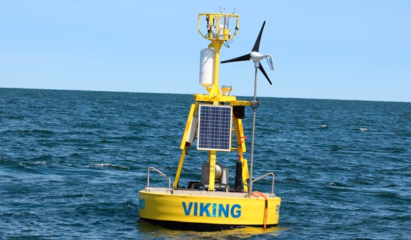
The Viking Buoy is MTE’s main platform, and has been deployed all over North America. The MTE team are in the process of overhauling the Viking Buoy to upgrade to a newer generation of solar panels, modernizing the controller for an AI capable one and upgrading the communication system.
With the help of Ground Control and the RockREMOTE, MTE have been able to dramatically simplify their means of communicating with the buoy. From having to maintain and work with two means of communication, the MTE team now only have to work with one.
Why RockREMOTE And Certus 100 Works For MTE
- Bi-directional communication
- Ability to transmit about 10 MB per month for a reasonable price
- Speed is not really a factor; MTE can work with 1 KB per second
- Ability to prevent rogue transmission is a big plus (customizable data limits and alerts)
As of now, using the Iridium Certus 100 service, MTE are able to operate and debug with ease. Internet tools like SSH are made available and offer not only a possibility in fixing problems, but in the remote deployment of new AI algorithms for in-field testing.
What The Extra Data Facilitates
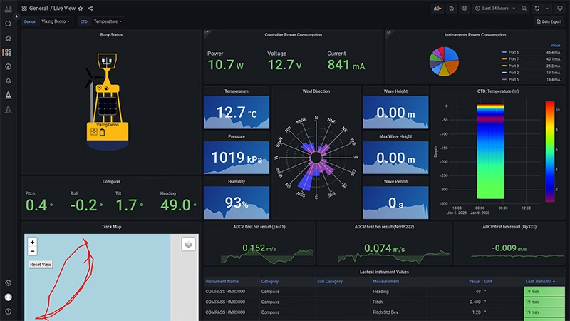
Certus 100 also allows MTE to transmit all recorded data by the buoy, instead of only summarized data. This allows data experts to process and analyze the various parameters in real time.
More and more services are made available for maritime workers to benefit from this live information. Weather information, sea currents and even whale presence are now used in day-to-day cruise planning.
OceanSIP is a service that was specifically tailored to ease the access to the live data of MTE’s various data acquisition platforms. The screenshot shows just some of data that’s now available in real-time via OceanSIP.
“With the advances in satellite communication, the hopes are rising in the scientific communities regarding the possibility of unmanned vehicles with real-time feedback, fauna monitoring cameras and audio monitoring only to name a few. It is hard not to be excited by the upcoming possibilities! From MTE, thanks for making these possibilities a reality for the various experts who thrive in improving our knowledge.”
Martin Rioux, ing. | P.Eng. | Embedded System Developer
We’re here to help
If you have a remote IoT connectivity challenge, there’s a very good chance we can help! With over 20 years’ experience in satellite communications, and long-term relationships with trusted satellite constellation operators like Iridium, we’re well placed to help you backhaul your data cost-effectively and reliably from anywhere on Earth with a clear view of the sky.
Call or email us, or complete the form, and we’ll be happy to connect you with one of our solutions architects to discuss your requirements.
Karbon-X Leads the Way in Carbon Emissions Validation with RockREMOTE Rugged
Sustainability has become a global priority, with individuals, businesses, and governments uniting to combat the escalating impacts of carbon emissions. As the world transitions to a low-carbon future, innovative solutions that balance environmental responsibility with practical implementation are important.
Karbon-X creates real world solutions for carbon reduction. Through verified carbon offset projects, they help individuals and businesses take action against climate change by investing in environmental sustainability.
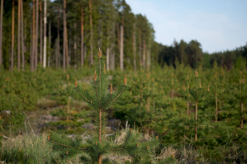
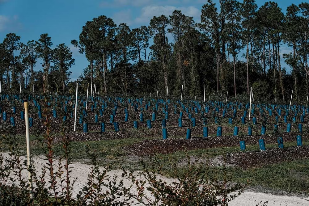
Karbon-X proactively works with global partners to find and support sustainable projects that reduce carbon emissions – including renewable energy and reforestation initiatives. Reforestation restores forested ecosystems to their original or improved state, reducing atmospheric carbon and mitigating climate change.

Challenges Validating Reforestation Projects in Remote Locations
Forests found in remote locations, out of reach of traditional terrestrial connectivity, make data monitoring to validate reforestation projects unviable, unreliable, or impossible. There are additional challenges presented by monitoring and validating carbon emissions in remote areas.
- Accessibility issues: Remote project areas often lack infrastructure, making it difficult to access sites for on-ground verification.
- High costs: Sending teams to remote areas for monitoring involves significant travel and logistical expenses.
- Time-consuming processes: Traditional data collection methods, such as manual tree measurements and soil sampling, are labor-intensive and slow, leading to delays in reporting.
- Indirect measurement systems: Satellite observational measurement and, drone LiDAR provide good but sporadic data and are prone to error, presenting uncertainty.
- Inconsistencies in data collection: Variability in on-ground methods can result in inconsistent and unreliable data, reducing stakeholder confidence.
- Environmental and weather challenges: Harsh conditions, extreme weather or difficult terrains, can further complicate on-ground verification efforts.
These key challenges hindered stakeholder trust and operational efficiency, underscoring the need for a more robust solution for carbon emission monitoring.
The Satellite Solution
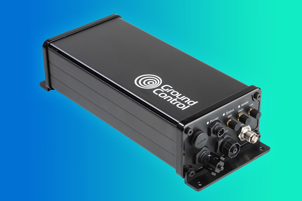
Karbon-X partnered with Ground Control to leverage the RockREMOTE Rugged satellite IoT device for remote carbon emission monitoring and project validation. They selected this path due to Ground Control’s advanced technology, global coverage capabilities via the Iridium network, and alignment with Karbon-X’s core values of data transparency and project scalability.
How It Works:
- Data collection via RockREMOTE Rugged: Remote sensors are deployed in reforestation areas to monitor key metrics like tree growth, soil health, and environmental conditions. These sensors collect data regularly, ensuring consistent insights into project health and progress
- Satellite communication: Iridium Certus 100 delivers truly global coverage in remote areas where traditional networks (like cellular or Wi-Fi) are unavailable. This also ensures real-time transmission from the RockREMOTE Rugged to the central monitoring system
- Centralized data processing: The data is sent via the Cloudloop API to the Karbon-X system, where algorithms analyze it and generate actionable insights about the project’s impact
- Remote verification: The processed data validates reforestation effectiveness by measuring metrics like tree density, growth rates, and carbon sequestration levels, reducing the need for frequent on-site visits, and drastically reducing project costs
- Visualization and reporting: Insights are visualized, using data accessed via the Cloudloop API, enabling transparent communication with stakeholders and fostering trust in the effectiveness of the initiatives.
The Benefits of Satellite IoT in Carbon Emission Validation
Through the implementation of satellite IoT technology, Karbon-X has transformed how carbon emissions are monitored and how the effectiveness of reforestation projects is validated. Some of the key benefits include:
- Global accessibility: The Iridium satellite network ensures connectivity anywhere, making it possible to monitor projects in real-time, 24/7
- Improved cost efficiency: Automated data collection and analysis significantly reduces operational expenses compared to manual data collection and monitoring methods
- Real time insights: Continuous monitoring allows quick responses to potential issues, ensuring project success
- Scalability: The satellite-enabled model supports Karbon-X’s expansion to more reforestation projects worldwide
- Enhanced credibility: Reliable, low latency Iridium Certus 100 connectivity and data-backed transparency demonstrates the precise real-time impact and thus, strengthens trust among customers and partners.
“Ground Control’s satellite IoT technology has transformed how we validate our reforestation projects. Their solution provides unmatched accuracy and scalability, allowing us to demonstrate the real impact of our initiatives with confidence.”
Guy Bolton, Karbon-X Technical Advisor
The Impact
Utilizing satellite IoT, Karbon-X can verify tree health and growth in remote project areas with accuracy. Further, the ability to verify project success remotely has strengthened its brand reputation, improved customer engagement, and opened new partnership opportunities with organizations requiring high transparency standards.
By integrating satellite IoT technology, Karbon-X is redefining carbon emission project validation. This innovative approach overcomes the limitations of traditional verification methods, enhances transparency, and establishes a scalable framework for advancing global sustainability. Karbon-X isn’t just offsetting carbon – they’re using satellite IoT to reimagine reforestation project validation, paving the way for more efficient and effective carbon emissions monitoring for years to come.
We’re Here to Help
If you need to transmit remote sensor data, such as growth, moisture and atmospheric readings, we can help. We specialize in connecting devices and assets in remote locations beyond the reach of cellular connectivity.
We work with multiple satellite networks, and networking protocols, to ensure our customers’ needs are met cost-effectively and reliably. Please email hello@groundcontrol.com or fill in the form, and we’ll be in touch within one working day.
Preventing Poaching in Gabon with RockREMOTE IMT
Illegal Poaching in Gabon
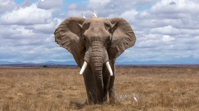
Africa is home to some of the world’s best-known and most iconic wildlife. However, the African Wildlife Foundation (AWF) reports that due to illegal poaching, as many as 35,000 elephants are killed each year, 43% of the lion population has been lost in the last 20 years and, staggeringly, since 1960, the population of the Black Rhino is down 97.6%.
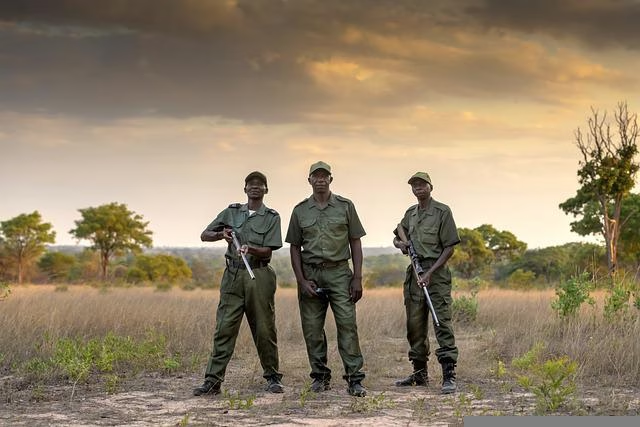
With approximately 24 million hectares of forest, Gabon is home to a number of endangered African species, which makes for an attractive landscape to poachers. However, using the latest satellite technology, AI-powered camera traps can provide Gabon wildlife rangers with an advanced new tool in the fight against illegal poaching.
Preventing Poaching
Digital Forest aims to make wildlife and wild places accessible to everyone through immersive, interactive technology driven by real-time data streams. It’s via this real-time connection and technology that wildlife and rainforests, including Gabon, can be better maintained and protected.
Traditional monitoring systems use cameras to monitor poaching activity, but often, results are collected and analyzed months later, so rangers only know where the animals – and any poaching threats – were, not where they currently are. The lack of real-time location data means that intercepting to prevent illegal poaching is often too late.
Second Generation AI-Powered Camera Traps
The first generation of AI-powered camera traps utilized RockBLOCK 9602 to transmit sighting counts and meta data via the Iridium Short Burst Data (SBD) service which provides robust telemetry from anywhere on the planet. Digital Forest’s second generation device would build on this with the ability to also transmit images to accurately and reliably detect the presence of illegal poachers, and send real time alerts.
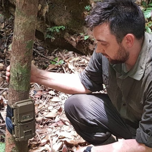
Harnessing the latest satellite technology, Digital Forest developed a smart AI-powered camera trap. The remotely deployed device continuously monitors for the presence of animal and human activity, even in forested areas. At any time of day or night, when activity is detected via the remote sensors, sophisticated image recognition technology not only detects but also classifies different animal species. These images are available immediately, 24/7, so rangers are informed of an animal’s location in real time.
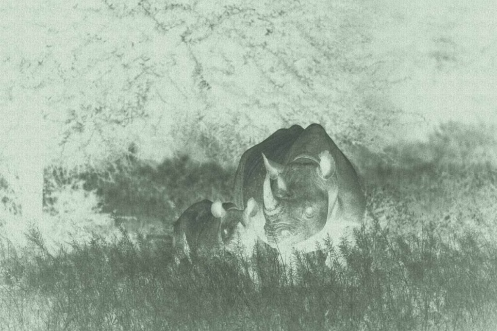
The bandwidth of Iridium’s Short Burst Data (SBD) service is limited to 320 bytes per message and it’s not feasible to send imagery from the camera traps via SBD. To effectively protect wildlife, the Gabon rangers require a cost-effective solution that can not only transfer animal and human sightings and meta-data, but also real-time imagery from remote rainforest locations.
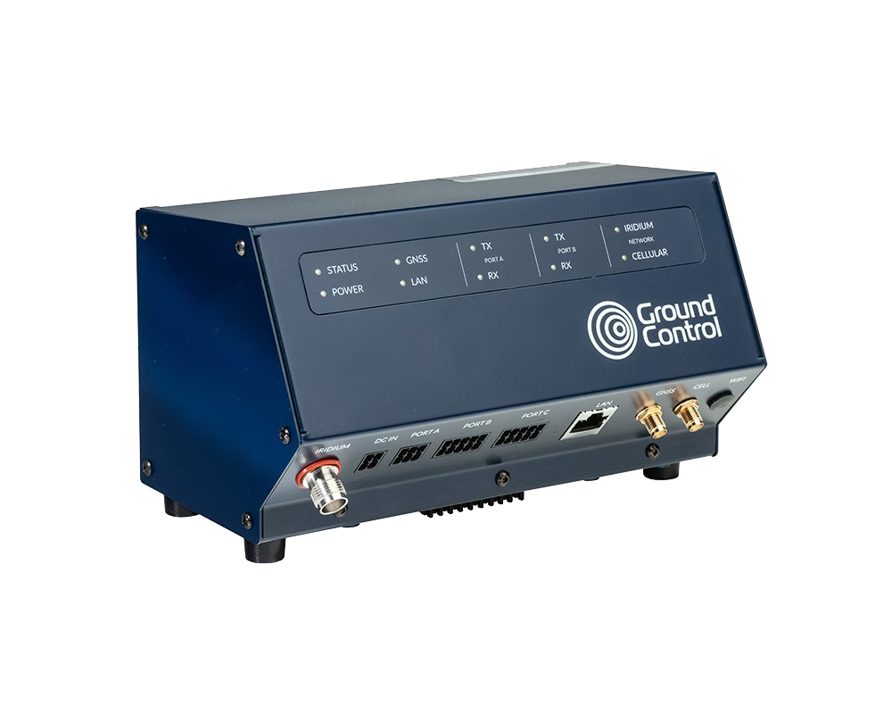
RockREMOTE is a highly capable Iridium Certus device with the ability to support both IP and message-based connectivity. The device provides a simple and easy to initiate, plug-and-play satellite connection from anywhere in the world.
The message-based connectivity is enabled by Iridium Messaging Transport (IMT) service which provides a more straightforward and cost-effective messaging capability but with a much larger message size of 100Kb – enough to include wildlife imagery.
How It Works
Leveraging Iridium Messaging Transport (IMT), RockREMOTE exposes integrators to an industry-standard MQTT interface. Ground Control’s development of a new Satellite IoT Gateway enables Digital Forest to quickly and easily integrate two-way messaging into their application using standard MQTT libraries for their platforms.
Behind the scenes, RockREMOTE takes care of all the connection management, message queuing and retrying to enable Digital Forest to simply plug-and-play, reducing integration work to just a few lines of code.
RockREMOTE automatically packages and compresses messages prior to transmission to minimise the amount of data sent. The device also selects the most appropriate compression algorithm based on the content being transmitted.
Messages are received and published to Cloudloop, enabling immediate and real-time transmission to Digital Forest’s cloud-based platform. This is effective in reverse, enabling messages to be sent to the remote field device. Digital Forest also benefits from the automatic upload of images to the AWS S3 for long-term storage.
The power of RockREMOTE with IMT enablement equips the rangers in Gabon with the latest in AI-powered camera trap technology to effectively monitor and prevent illegal poaching in the forest. With this advanced technology, endangered African species and iconic African wildlife have greater protection from poachers for this generation and the next.
What Digital Forest Says
“We’ve worked with Ground Control for many years and their products and supporting services have never failed to deliver. It’s very reassuring working with a company that designs, builds and supports every aspect of its products.
Developing our second-generation smart camera with RockREMOTE has been a breeze; we’re really excited about possible applications this technology will unlock. We’re already thinking about using RockREMOTE for transmitting audio, which will enable us to acoustically as well as visually monitor biodiversity in these truly unique locations.”
Robin Whytock, Director,
Digital Forest UK (SPV) Ltd.
Would you like to know more?
With over 20 years of satellite experience, the Ground Control team is well placed to help keep you connected when it matters the most.
Whatever your communication or connectivity needs, we can help. Talk to one of our team to discover our products and services and how they can benefit, improve and streamline your applications.
40Geo captures geographical information from hard-to-reach areas and analyses it to deliver situational awareness, competitive intelligence, and advanced visualization for supply chain optimization. One of the means 40Geo has of collecting data is utilizing drifting data buoys, which are deployed into areas being used for, or potentially used for, oil and gas exploration and extraction.
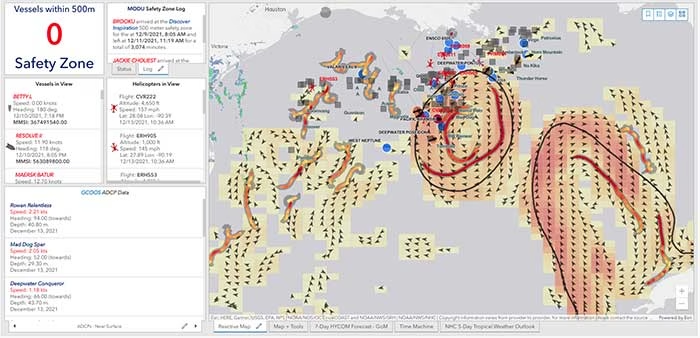
These data buoys capture wave height, temperature, wind speed, and over time, forecast patterns in ocean currents. They can even detect volume and frequency of other passing vessels by tapping into the radio signals sent out from boats. With 40Geo’s analysis, this becomes powerful data to aid decisions about when and where to situate off-shore oil and gas operations.

The Challenge
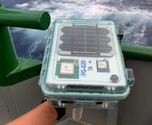
Many areas suitable for oil and gas extraction are also very remote, so backhauling that data from the data buoys to 40Geo’s servers requires a satellite connection. To date, 40Geo’s drifting data buoys have leveraged Ground Control’s RockBLOCK 9602 for this application, placing the transceiver into a waterproof box on top of the buoy.
This gives the team close to real time data under any circumstances, as the L-Band frequency that the RockBLOCK 9602 leverages is not affected by weather conditions. It’s also completely global coverage because it uses the Iridium satellite constellation; no matter where the buoy drifts to, 40Geo will be able to pinpoint its location.
The Evolution
In the Gulf of Mexico, an area rich in oil and gas reserves, there are two considerations that make 40Geo’s current data buoys less optimal. Firstly, there is cellular network coverage for a reasonable amount of the gulf, which, because it’s often lower cost compared to satellite transmission, will be the preferred means of sending and receiving data.
Secondly, there are powerful currents that can send the unpowered data buoys well away from the areas that are of most interest to 40Geo’s oil and gas customers.
The Solution
40Geo is in the final stages of launching a new USV (unmanned surface vessel) which has the ability to be remotely operated, meaning that if it should travel out of the area under inspection, the operator can put it back on course. In addition to this, the new autonomous vehicle will utilize RockREMOTE Rugged rather than the RockBLOCK 9602 for its data transmission.
This is because RockREMOTE Rugged is a hybrid LTE-M / Certus 100 / Iridium Messaging Transport (IMT)-capable device, allowing the 40Geo to use a single ‘box’ for all of their connectivity requirements. RockREMOTE Rugged can be configured to leverage the cellular network whenever available, and seamlessly switch to satellite when cellular data is unavailable, giving the 40Geo team the perfect balance of optimized costs and 100% connectivity.
“We chose the RockBLOCK because it delivered exactly what we needed: plug-and-play satellite connectivity that delivers close to real-time data. The developer documentation is thorough and the API interface works well. The RockREMOTE is an exciting evolution allowing us to provide more data while controlling costs; this is the sort of innovation that will propel satellite IoT applications forward.”
Miles Roden, COO, 40Geo
The USV will be able to undertake other tasks in addition to its main purpose of measuring wave height, wind speed etc. For example, a weather balloon can be launched from the platform to capture data from hurricanes. It simply wouldn’t be possible to launch this from an oil rig because of the fire risk from the sensing equipment and the helium (although the risk is small, helium is listed as hazardous by some operators), and the potential for the balloon to impact drilling equipment.
40Geo’s multitasking USVs can be used for many different applications, including air quality monitoring after oil spills, surveys of ocean currents for renewable infrastructure planning, video inspection of unmanned assets, marine mammal detection, and any other tasks that clients can envision.
Would you like to know more?
If you’re interested in 40Geo’s data buoys, or you have your own tracking software and want to explore integration options with Ground Control’s satellite tracking devices, we’d love to hear from you.
Call or email us, or complete the form, and one of our experienced team will be happy to help.
Expanding Feeder Automation in Remote Brazilian Networks
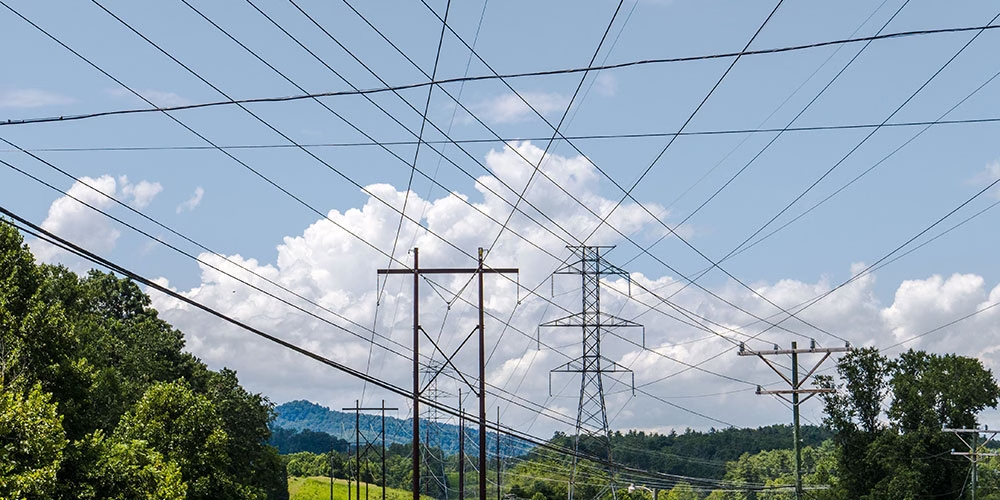
Remote recloser automation depends on continuous communication with field devices. Operators must be able to monitor equipment status, receive fault indications, and issue switching commands when required. However, communications infrastructure is often exposed to the same environmental risks as the power network itself. Distribution poles carrying electrical feeders frequently support fiber routes or cellular backhaul. When storms, falling trees, or other events damage the line, both power and communications infrastructure in the same corridor can fail simultaneously, leaving operators without visibility of key assets during an outage.
A Brazilian electricity distribution utility, expanding its remote automation programme across a growing number of feeder locations, found many of these sites were located along rural or remote distribution lines where terrestrial communications infrastructure was limited or unreliable. To support automation at these locations, they required a communications approach capable of maintaining reliable links between field devices and the control center.
The Challenge
Some remote automation sites had already deployed a satellite communications system operating over a geostationary network. While this provided coverage, the utility experienced network reliability issues with the existing provider, and directional antenna pointing added a further deployment consideration.
As the automation estate expanded, communications resilience, ease of deployment, and scalability became increasingly important. The utility therefore evaluated alternative communications solutions that could provide an independent path separate from terrestrial infrastructure, support DNP3 over IP for SCADA integration, simplify installation for pole-mounted equipment, and scale across a large number of sites.
A Resilient Data Path
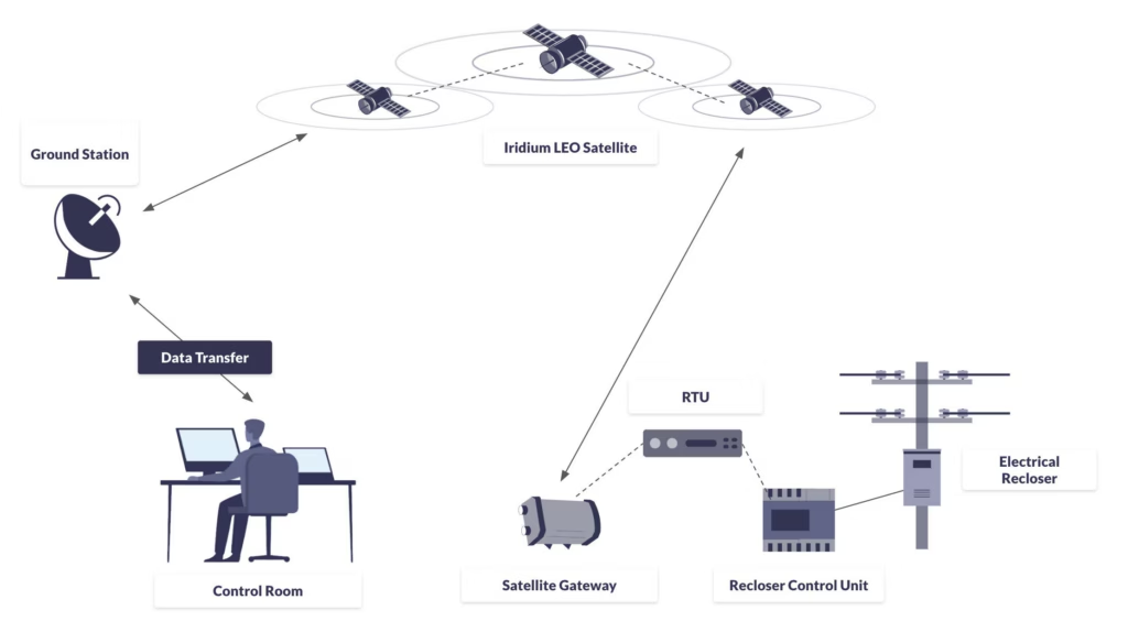
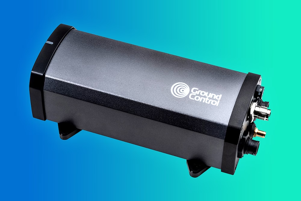
Working with Ground Control, the utility deployed RockREMOTE Mini terminals on the Iridium Certus 100 service to support communications across its remote automation sites.
At each location, the terminal was integrated with the existing RTU, enabling SCADA traffic to be transmitted over satellite, without changes to existing control systems or workflows.
The recloser continued to perform switching operations, with the controller managing protection and local control. The RTU handled telemetry and command exchange, while RockREMOTE Mini provided the backhaul link from site to network.
Outcome: Simpler Deployment and More Resilient Communications
The utility selected the RockREMOTE Mini terminal primarily to improve communications reliability for remote automation sites.
Operating over the Iridium network, the solution provided a more dependable satellite communications path than the previous service, helping the utility strengthen connectivity across its expanding automation estate.
The compact terminal also simplified field deployment by removing the need for directional antenna alignment, which reduced installation complexity at pole-mounted sites and supported rollout at scale.
Most importantly, the satellite link provided a communications path independent of local terrestrial infrastructure, improving the resilience of the utility’s critical remote automation communications architecture.
What’s Next?
As the deployment expands, the utility is reviewing how different communication types are applied across its automation estate. In locations where continuous IP connectivity is not required, Iridium Messaging Transport (IMT) is being explored for lower bandwidth, event driven data.
As the project engineer noted, “Not every site needs the same type of connectivity. In some cases, we’re just sending status or event data, so it makes sense to use a simpler approach. It helps reduce cost and complexity while keeping the network resilient where it matters.”
Maintain Visibility and Control
Reliable communications are essential for feeder automation, fault response, and network resilience, especially where terrestrial infrastructure is limited or exposed. We can help to extend SCADA connectivity to remote field equipment, using cost-effective satellite backhaul to maintain visibility and control.
If you tell us more about your network, we’ll help you assess the right approach. Either complete the form, or email hello@groundcontrol.com, and we’ll be in touch within one working day.
Tracking Glacier Melt on Everest: Satellite IoT in the Western Cwm
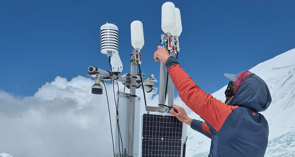
At over 6,500 meters above sea level, in the Western Cwm of Mount Everest, a team of glaciologists is gathering climate-critical data from one of the most extreme environments on Earth. Their aim is to better understand the controls of ice temperatures at high elevation, where observations are few and far between. Working on the Khumbu Glacier, their findings promise to improve forecasts of ice recession and water availability for millions of people living across the Himalayas.
Working in partnership with scientists from the University of Leeds and Aberystwyth University, Ground Control provided a satellite communications system capable of transmitting data daily from Everest’s icy slopes, without requiring a single visit back to the deployment site
The Challenge
The Khumbu Glacier has long been a focus of glaciological research, not least because of its accessibility from Everest Base Camp. But this latest project, funded by the UK’s Natural Environment Research Council, sought to go deeper. By drilling into the glacier at over 6,500 meters elevation, the research team aimed to directly measure:
- Ice temperature at different depths
- Snow depth, accumulation, and compaction
- Meteorological conditions, including temperature, humidity, and solar radiation.
Collecting this data was only half the challenge. Getting it off the glacier and into the hands of researchers in close to real time, without physically retrieving the equipment, was critical for both data continuity and team safety.
Connecting the Glacier
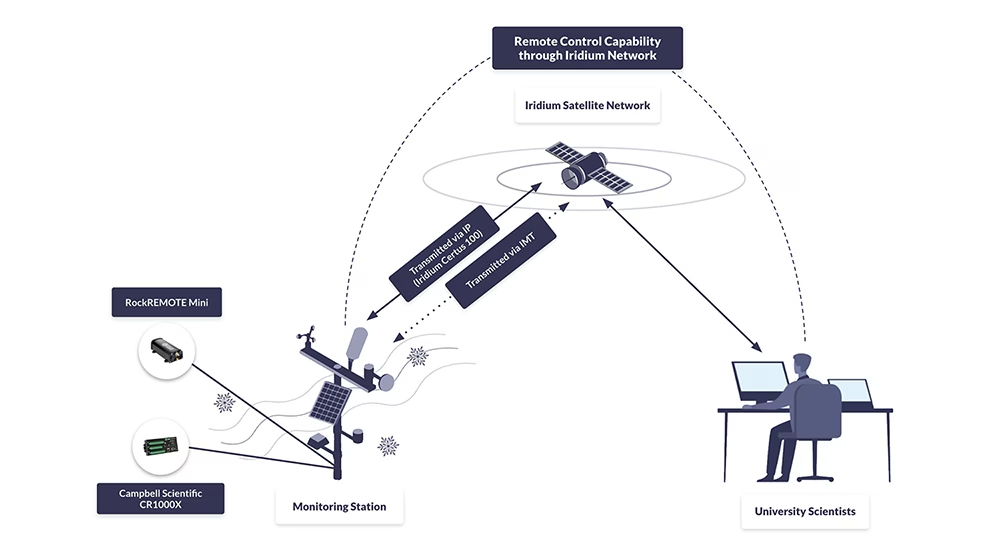
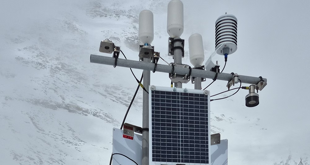
To enable this, Ground Control supported the integration of the RockREMOTE Mini satellite transceiver with Campbell Scientific CR1000X dataloggers at two drill sites and a weather station.
RockREMOTE Mini supports both IP and message-based communication over the Iridium Certus 100 network, for efficient, flexible, low power transmissions.
In addition to sending regular data packets, the system also allows researchers to remotely log in to the data logger via Satellite IP, offering full access for reconfiguration or troubleshooting without a site visit.
Early stage troubleshooting was also supported by Ground Control to ensure robust communications before the kit was taken into the field.

“We planned, tested, and validated the integration between the CR1000X and the RockREMOTE Mini. We created a sample CRBasic program that demonstrated how to control the RockREMOTE Mini from the logger, send data, and allow remote access, all of which the team could adapt for their own setup.”
Michael Mitrev, Solutions Architect, Ground Control
Outcome: Real Time Data from Everest
During operation, the satellite-enabled system transmitted data reliably from the Khumbu Glacier’s drill sites and weather station. Despite sub-zero temperatures and remote conditions, the RockREMOTE Mini operated autonomously, sending back environmental data that has helped scientists monitor how the glacier responds to changes both in short term weather and long term climate, improving forecasts of ice recession for the wider region.
The data are expected to contribute to a growing understanding of:
- The characteristics of high altitude ice masses
- Seasonal and long-term glacier melt patterns
- Future threats to communities relying on Himalayan glacial water.
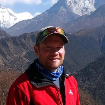
“The ability to be able to observe the glacier in near real-time, without having to visit the field site, has revolutionised the way we conduct our research. For the first time we can analyse and interpret the data as soon as we have installed the equipment, rather than waiting 12 months or more until a team can recover the loggers.”
Duncan Quincey, Professor of Glaciology, University of Leeds
Why Satellite IoT?
Traditional communication systems are unworkable on the snowfields and glaciers of the Everest region. There is no cellular coverage, and even high frequency radio is unreliable in mountainous terrain. Satellite IoT provides a uniquely resilient option for projects like this, offering:
- Global coverage, even in the highest and most remote parts of the world
- Low power operation, ideal for battery or solar-powered deployments
- Two way communication, enabling both data transmission and remote access
- Scalability, from a single sensor node to multi-site sensor networks.
For glaciologists, and for environmental science more broadly, satellite IoT is opening up new possibilities for data collection in places where previously, researchers had to choose between scientific insight and personal risk.
Bring Your Data Home From Anywhere
Want to monitor assets or environments in places where cellular and radio can’t reach?
Ground Control helps teams deploy low power satellite IoT that sends data reliably, and supports remote configuration without repeat site visits.
Tell us about your project and we’ll recommend the right connectivity and integration approach. Either complete the form, or email hello@groundcontrol.com, and we’ll be in touch within one working day.