Topic: Environmental
Smart Water Management: How Massive IoT is transforming the Water sector
The Internet of Things (IoT) describes connecting any device to other connected devices and the internet, or other communications networks. This allows all devices to collect and share data about their environment and how they are used. In short, IoT makes things smart.
Massive IoT then, is simply IoT on a massive scale; multitudes of sensors, connectivity and data processing to create new solutions. Many businesses have already adopted Massive IoT technology, citing reduced costs and wastage, and improved operational efficiency among the benefits.
Given its obvious applications to the Water industry – including smart metering and remote equipment monitoring – it’s unsurprising that sensors in the water and wastewater treatment industries are forecast to grow to $2 billion by 2030. But why is this so important?
Water is a finite, essential resource. In the UK alone, it’s estimated that by 2040 we’ll see between 50-80% less water in rivers during the summer months, and by 2050, the population will have risen from 67 million to 75 million. To put this in perspective, the Environment Agency has predicted England will run short of water within 25 years, with Sir James Bevan describing the country as facing the “jaws of death”.
Though total leakage across England and Wales has decreased over the last five years, Ofwat has estimated that currently, one fifth of all running water through pipes is lost to leakage. To even contemplate meeting increases in demand while navigating challenges such as urbanisation and climate change, suppliers must look to processes and infrastructure, across entire networks, to ensure these are as efficient as possible.
Technology advances have a history of providing the solutions we need, and thankfully, there are many ways Massive IoT is already and will continue to optimise operations for the Water and Wastewater treatment industries.
Factors driving Massive IoT adoption in the Water industry
The Water sector has already implemented a variety of sensors to monitor water quality, manage smart meters and optimise distribution. Traditionally infrastructure including pumps and reservoirs have been monitored using SCADA systems. However, the final segment of pipeline responsible for delivering water to a customer’s premises, has always remained somewhat unknown to suppliers. For information here, Water companies have relied heavily on feedback from customers; for example, calling to report a leak or fault.
As Jat Brainch, Chief Commercial and Product Officer at Inmarsat puts it – “you can’t manage what you can’t measure, and automation and digitalisation of the data capture process to collect granular, real-time results, is becoming increasingly essential”. In short, to be able to get a better handle on water management, companies need data, delivered consistently and reliably to inform decisions.
Moreover, as the risks and realities associated with climate change become better understood, so does the requirement for all organisations to reduce their overall environmental impact. This boils down to improving water optimisation and wastewater treatment so water can safely be recycled. Both of which can be better facilitated with IoT technologies.
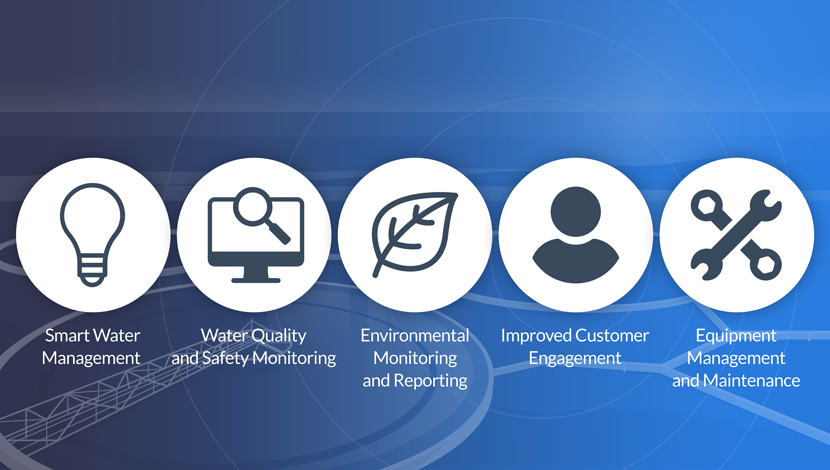
5 ways Massive IoT can benefit Water and Wastewater companies
- Smart water management
- Water quality and safety monitoring
- Improved customer engagement
- Environmental monitoring and reporting
- Equipment management and maintenance
1. Smart water management
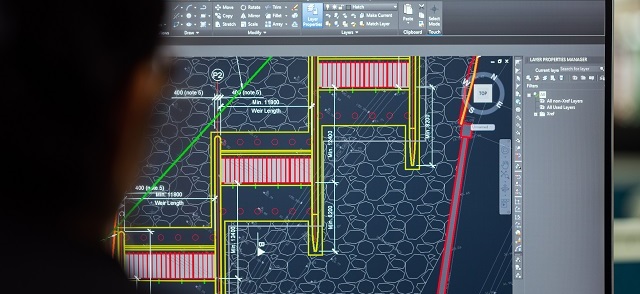
Utilising IoT technologies such as sensors, geospatial mapping, and big data analytics, companies can efficiently plan, develop, distribute, and manage water resources. Real-time monitoring and predictive analytics enable transparent pipeline management, water conservation, leak detection, and optimised service planning.
2. Water quality and safety monitoring
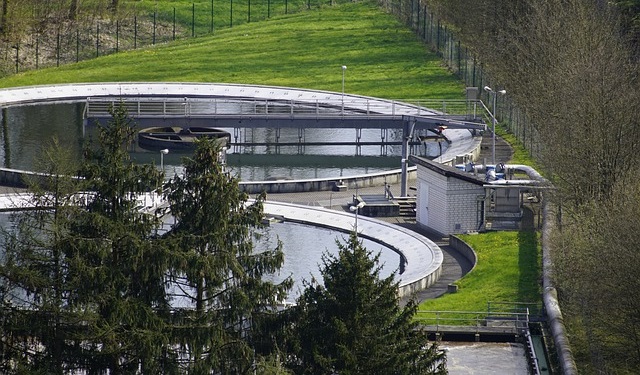
Monitoring water quality is crucial to ensure that suitable quality standards are maintained at every stage of the water cycle, from collection through treatment and distribution.
Despite laws that require water companies to treat and dispose of wastewater, raw sewage and contaminants from factories are still legally and illegally dumped in waterways in much higher concentrations than are safe for human and animal health. Estimates reveal that in 2020, there were more than 400,000 instances of discharged raw sewage into English and Welsh rivers.
Real-time monitoring systems with sensors provide data on various parameters, including pH level, dissolved oxygen level, and turbidity. This data helps identify contamination sources faster and prevent further spread, ensuring suitable water quality standards are maintained throughout the water cycle.
3. Improved customer engagement
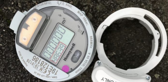
Advanced Metering Infrastructure (AMI) technology enables real-time data collection and evaluation of water consumption. Water companies can provide customers with real-time alerts about network damage, leaks, and adjust pricing based on insights. This empowers customers to make conscious decisions, leading to improved customer satisfaction, engagement, and reduced water consumption.
4. Environmental monitoring and reporting
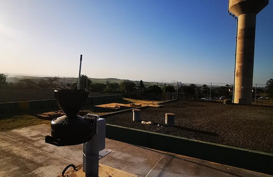
Blocked, overflowing systems can cause flooding, erosion, turbidity, storm and sanitary sewer system overflow, and infrastructure damage. While most businesses have some form of environmental monitoring system in place, there are many challenges associated with measuring and reporting on water usage. For example, remote locations can be difficult to access and monitor; pipes can become blocked or damaged; and heavy rainfall can cause flooding and damage equipment.
By combining data from sensors within Powered Telemetry Modules (PTM), companies can monitor and forecast events such as flooding, erosion, and infrastructure damage. Utilizing a variety of monitoring tools, proactive measures can be implemented to prevent and mitigate damage in areas most at risk.
5. Equipment management and maintenance
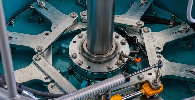
Remote monitoring and analytics help identify deviations in asset performance, allowing companies to troubleshoot and address problems before they cause damage or disruption. Predictive maintenance software alerts technicians about necessary repairs, reducing maintenance costs and preventing larger repairs or outages.
Challenges to Massive IoT deployment success: Cost, cybersecurity and connectivity
Water infrastructure is vast. Due to the volumes required, the cost of modernisation and installation of new hardware is substantial. So much so that installation is often cited as the largest cost challenge when deploying IoT solutions at scale.
In addition, legacy systems and ageing infrastructures common to businesses within the Water and Wastewater sector means that adding devices may not be quite as simple as just installing. Often some level of customisation will be required to ensure newly introduced devices work well within existing operations.
However, IoT sensors, specifically those which are battery powered, have become increasingly cost-effective and providers don’t need to light up all pipelines within a network to reap benefits. When working with smart meters for example, even relatively small numbers can be used to affect change. After all, any increase in data and operation visibility can help water companies make smarter decisions and reduce maintenance costs.
Next, cybersecurity. Though Water companies must and do ensure processes require the very minimum of customer data in each instance, with increased data and data transmission, keeping this information secure from the reach of hostile parties becomes more difficult.
In 2021, a cyberattack attempt was made to tamper with the levels of sodium hydroxide in Oldsmar, Florida’s water supply. Thankfully the plant operator observed what was going on and the attack was blocked in time, but the incident does serve as a reminder of national infrastructure vulnerabilities.
Addressing this challenge requires companies and organisations to build security through every layer of the stack, and is essential to successful IoT deployment.
Finally, connectivity. It would be remiss to not highlight that the ability to quickly adapt to surges, peaks, and troughs is dependent on reliable, consistent data. Ultimately your decisions can only be as fast and as smart, as the data at hand allows. As water company networks tend to span over large areas, it’s likely some of your network will fall outside terrestrial coverage. It’s estimated that just 15% of the Earth’s surface is supported by cellular, whereas Satellite networks like Iridium cover everywhere and anywhere – including both poles.
What’s more, a recent paper found 75% of decision makers struggled to deploy their IoT projects because of connectivity issues. So it’s important companies consider connectivity options early on in IoT planning, opting for a connectivity strategy able to consistently support all assets within a network.
In addition, it’s key companies in Water and Wastewater industries ensure connectivity strategies include alternate connectivity options for backup and backhaul. This way, should there be a problem with the terrestrial networks due to e.g. bad weather or natural disasters, your IoT application isn’t negatively affected by long delays or gaps in data.
Simply, the benefits of Massive IoT are massive. Unlocking the power of smart devices and data analytics, through Massive IoT and AI, is key to ensure a more resilient, optimised and secure water network for the environment today and into the future.
Want to discuss your connectivity options?
With our extensive experience partnering with satellite network providers like Iridium and Inmarsat, we offer competitive pricing and flexible data bundles.
If you’re looking for objective advice and support for your IoT project, fill in the form below. Our expert team is here to assist you.
Satellite IoT use cases: truly global connectivity for real world applications
Satellite IoT is growing in popularity, providing reliable connectivity to remote locations that would otherwise be challenging or even impossible to reach with terrestrial networks. As the world becomes more connected, the demand for real-time data from even the most remote locations has increased. Satellite IoT provides the solution to this need by offering truly global connectivity for real-world applications.
Satellite IoT is being used in a variety of industries, including healthcare, agriculture, workforce safety, and more. Let’s dive into just some of the most prominent use cases for satellite IoT…
1: Healthcare
IoT has revolutionised the healthcare industry by providing innovative solutions to improve patient care, reduce costs, and increase efficiency. IoT in healthcare refers to the use of connected devices, sensors, and data analytics to collect and analyse patient health data in real-time. This could include remote patient monitoring, smart medical devices and wearable technology like fitness trackers and smart watches.
Satellite IoT can also facilitate medical and healthcare accessibility to patients in remote areas who are unable to travel. For example, utilising the RockBLOCK 9603 technology, satellite IoT has enabled the transportation and delivery of emergency and essential medical supplies to vulnerable people who are at high risk if they travel.
Read Healthcare By Drone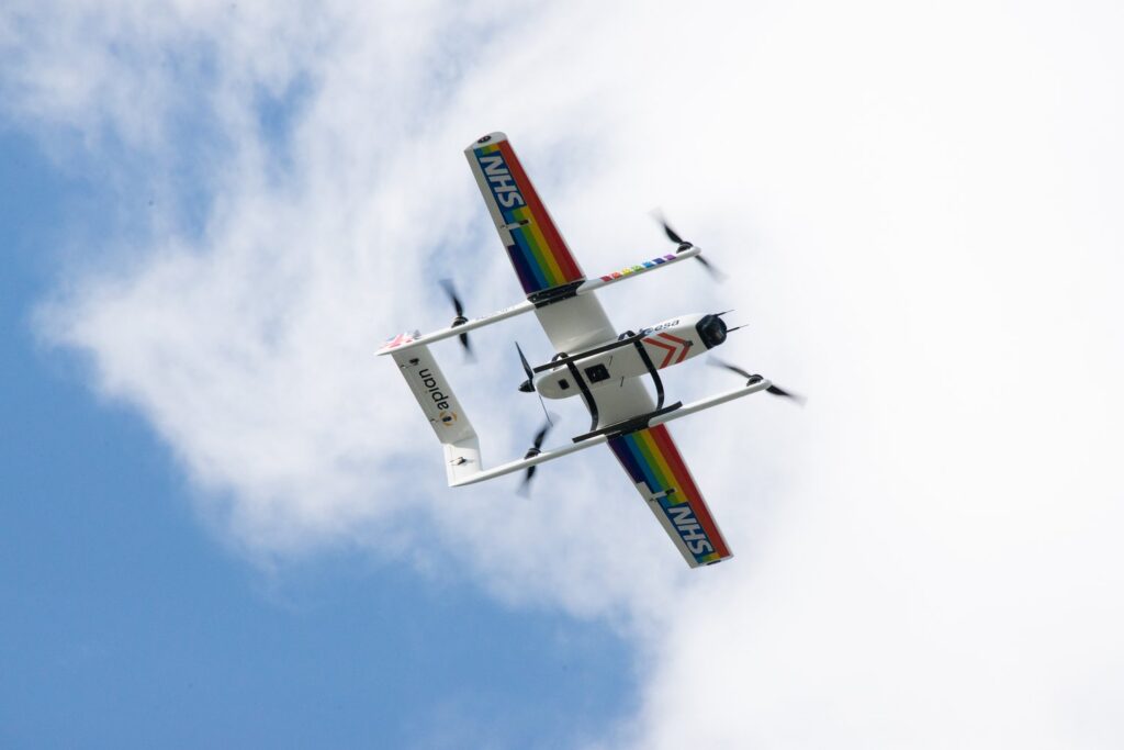
2: Agriculture
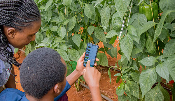
The agriculture industry is utilising satellite IoT to enhance productivity and lower expenses. By monitoring soil moisture, temperature, and other environmental factors, farmers can optimise their crop yield and reduce waste. This is sometimes referred to as Smart Farming. Satellite IoT can also be used to track livestock and monitor their health – improving overall animal welfare and reducing losses.
COSMOS-UK has installed Viasat IoT Pro terminals at remote soil moisture monitoring locations, to help combat climate change. The soil moisture data intelligence delivered by the Hughes 9502 specifically, to agricultural and environmental scientists, has the potential to transform the way we understand and model the natural environment.
Furthermore, satellite IoT has supported Synnefa in Kenya, to operate outside of terrestrial infrastructure by transmitting sensor data to enable smarter predictions for optimum harvesting times. The introduction of precision farming has been so successful, Synnefa has been able to help farmers:
- Save water by over 50%
- Reduce fertiliser application rates by 41%
- Increase production by 30% when compared to yields prior to the use of their devices.
3: Asset Tracking and Monitoring
Tracking and managing assets in real-time, providing valuable data on asset location at any given time is made possible with IoT technology. With satellite-enabled tracking devices, businesses can keep track of their assets no matter where they are in the world, even in the most remote locations. But here, it’s not just vessels, wind turbines and remote workers who can be tracked – animals can be too!
Illegal poaching is a big problem in Gabon, Africa. RockREMOTE with IMT enablement has equipped the rangers in Gabon with the latest in AI-powered camera trap technology to effectively monitor and prevent illegal poaching in the forest. With this advanced technology, endangered African species and iconic African wildlife have greater protection from poachers for this generation and the next.
Read More About Poaching in Gabon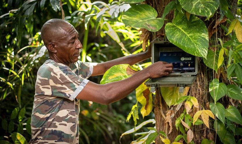
4: Workforce and Personnel Safety
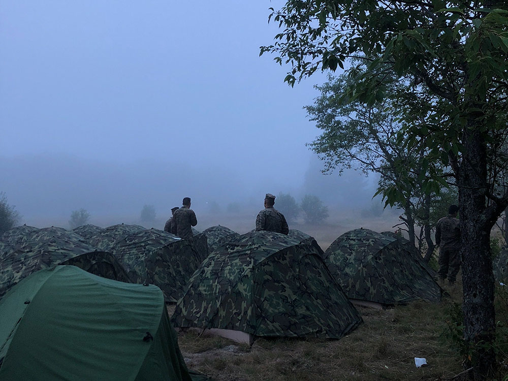
Satellite IoT can be harnessed to monitor the safety of lone or remote workers in hazardous environments. By providing real-time alerts in the event of an incident or emergency, companies can respond quickly and potentially save lives. For example, workers in mining or oil and gas operations can wear wearable devices that monitor their location and vital signs, alerting supervisors in the event of an accident or injury. In addition, monitoring remote military personnel and natural disaster response teams is critical to their safety and well-being.
For example, the RockSTAR device has been used by the Ministry of Defence in their training. The RockSTAR was paired with bluetooth heart rate monitors, meaning biometrics could be monitored throughout with the added benefit of worldwide tracking and two-way communications. As well as critical monitoring, satellite IoT can also be leveraged for more leisure-based tracking and monitoring applications – including ultra-marathon runners via the RockSTAR tracking and two-way communications device.
See Tracking in Action5: Energy and Renewables
The energy sector is also seeing the benefits of satellite IoT. The technology enables remote monitoring of renewable energy infrastructure in real-time, allowing for early identification of any faults or issues, thus preventing downtime and maximising energy output. The performance of renewable energy assets is also optimised by collecting and analysing data on weather patterns, energy production, and equipment performance. This data can be used to improve efficiency, reduce costs, and even enhance the lifespan of renewable energy assets.
With five hydroelectric power stations in Snowdonia, North Wales, RWE maximises its renewable energy output from the reservoirs with a remote IoT solution – the Hughes 9502.
Read About Facilitating Renewable Energy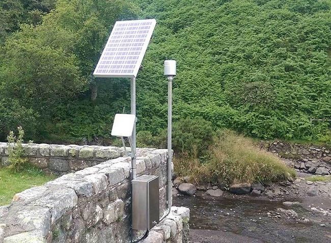
Satellite IoT vs. Traditional Cellular Networks
While traditional cellular networks are sufficient for many use cases, they have limitations when it comes to remote locations.
One of the biggest advantages of satellite IoT is that it provides truly global connectivity, even in the most remote and inaccessible locations. Unlike traditional cellular or Wi-Fi networks, satellite signals can reach anywhere on the planet, making it ideal for industries where assets are remote or located in harsh environments.
With satellite IoT, data can be transmitted from quite literally anywhere in the world, making it ideal for applications where cellular coverage is limited or even non-existent. Satellite IoT is also more reliable than cellular networks in many cases, as it is resilient to interference or disruption from extreme weather events.
However, it’s not necessary to choose either terrestrial or satellite connectivity. Satellite networks can be deployed quickly and easily, using the same messaging protocols as terrestrial networks, allowing businesses to scale their operations up or down as needed without having to worry about the limitations of traditional networks. What’s more, for businesses and industries that require global connectivity, the cost of deploying and maintaining satellite IoT devices can often be less expensive than building and maintaining traditional terrestrial networks from scratch. It can also be cheaper than deploying remote field engineers to remote sites.
In Summary…
Satellite IoT provides reliable connectivity to remote locations; bridging the connectivity gap that would otherwise be difficult or impossible to achieve with traditional cellular networks alone.
From reliable communication to real-time data collection and analysis, satellite IoT is changing the game for businesses and entire industries that need to stay connected no matter where their assets are located. Furthermore, as satellite technology continues to evolve and become more affordable, we can expect to see even more innovative use cases emerge in the coming years.
Unlock the Full Potential of Your IoT Project
Incorporating satellite IoT into your existing business operations can revolutionise what you can achieve. With satellite IoT, you can access data and insights that were previously unavailable or difficult to obtain with traditional networks and connectivity options.
Contact us to discover the added value of satellite IoT to your business today. We’re here to help and provide solutions to your connectivity challenges.
Could your Business Achieve More with Better Connectivity?
In the world of industrial IoT, cellular connectivity is the default means of transferring sensor data back to your SCADA system. But what happens if the location your sensors are in is too remote to reliably connect to cellular? Or what if your sensors are on the move, dipping in and out of cellular range? In these scenarios, satellite-enabled IoT is an obvious choice, but has long been viewed as too expensive, too complicated, too fragile, or even not secure enough.
In this webinar, recorded in September 2021, Solutions Architect Matthew Ellison and Channel Partner Manager Rory Ashley seek to dismantle these perceptions, and give real-life examples of where the extra data provided by satellite IoT connectivity has materially improved outcomes – from smart farming to disaster management, environmental monitoring to renewable energy production.
Connectivity Challenges
Terrestrial networks only cover 15% of the Earth’s surface, and focus on populated areas. This leaves a number of businesses unable to reach their assets remotely, and having instead to resort to manpower – with the time delays and additional costs presented by that solution. In these scenarios, satellite connectivity is an obvious choice.
Further, the number one challenge The IoT Magazine stated that IoT faced was cybersecurity, and the risk of hacking. Satellite has a huge advantage over cellular here, as, if needed, an entirely private satellite network can be created with no reliance on, or exposure to, public networks at all.
Satellite vs Cellular from a Cost Perspective
Satellite is not as low cost as cellular, but it is moving in the right direction. Greater competition, better technology, and diversification of offerings has seen the wholesale price of high-throughput satellite tumble in recent years, and it’s our view that prices will continue to lower, as the established players – Inmarsat and Iridium, for example – come up against well funded new entrants like Elon Musk’s Starlink, and Amazon’s Kuiper satellite offerings.
That said, it’s improbable that satellite will replace cellular, as it is likely to always remain a little more expensive; so the applications for satellite IoT are, not unexpectedly, those where cellular networks are unavailable, such as ocean data buoys or remote farms, or where the asset is moving in and out of terrestrial connectivity – such as transport and cargo ships.
Make sure to watch the webinar to see great examples of satellite connectivity in action – and if you have any questions, we’re here to help.
Get in touch
We’ve implemented satellite IoT infrastructure for decades, and there’s very rarely been an obstruction issue we couldn’t overcome with a bit of knowledge and ingenuity.
We’d be happy to talk to you about your project and offer impartial advice on the best antenna and satellite service for your particular requirements. Call or email us, or complete the form.
Far-Sighted Satellite Solutions for Constant Connectivity
We can now establish optimal communications to and from even the most inaccessible areas on land, on sea and in the skies, while contributing directly to the reduction of international carbon emissions.
Spearheading this momentous and necessary step change is Iridium, proudly designating itself as ‘the only truly global communications network’. Iridium’s Global Line of Sight programme is currently emphasising the versatility, efficiency and practicality of its satellite services with regard to unmanned aircraft systems, drones and other autonomous or remotely-piloted vehicles; and this initiative is, in turn, enthusiastically supported by Rock Seven (now trading as Ground Control), with integral products such as its RockBLOCK plug-and-play satellite communication solution.
RockBLOCK units are indispensable Internet of Things (IoT) devices, enabling all manner of autonomous assets to transmit Short Burst Data (SBD) messages between the equipment and centralised host computer systems. The range encompasses the RockBLOCK 9602 and the more compact RockBLOCK 9603, chiefly intended for use in contexts such as system integration or product development where space within an enclosure might be limited. Hosting an Iridium SBD modem, RockBLOCK effortlessly overcomes the limitations of Wi-Fi and GSM networks, and is capable of sending and receiving short messages from literally anywhere on Earth with a view of the sky.
RockBLOCK’s value to sectors such as Search & Rescue, ISR (Intelligence, Surveillance, Reconnaissance), Environmental Monitoring and Disaster Assessment, where rapid and reliable messaging is of the essence, is demonstrable. Here are some examples of the RockBLOCK in action.
Iridium Edge Solar
In addition to the RockBLOCK, Ground Control’s plug-and-play product range features a variety of other tracking and communications solutions, using the Iridium network, to enable data transfer to and from hitherto inaccessible areas. These include the RockSTAR two-way messenger, the RockFLEET global tracking device to drive efficiencies in fleet management, and the RockAIR tracking and messaging device, designed for easy mounting on the dashboard of light aircraft and vehicles.
In a meaningful new development, it was announced at the tail end of 2019 that Rock Seven (now trading as Ground Control) has been nominated as the beta partner for the new, solar-powered and competitively-priced Iridium Edge Solar tracking device, which is scheduled for launch in 2020. Offering easy wireless installation and an autonomous tracking facility, the set-and-forget Iridium Edge Solar is perfect for users requiring a simple, economical but completely reliable SBD tracking device supplying pole-to-pole connectivity.
Wingcopter
Wingcopter’s lightweight but robust VTOL drones are transforming processes and practices for customers in a broad variety of contexts – anything from the transportation of medical or aid supplies and the inspection of large-scale infrastructure, to forestry mapping and the creation of logistics chains to and from remote locations.
Wingcopter has been equipping its drones with RockBLOCK units. With their unprecedented range and speed, the VTOL drones are capable of flying into environments and territories with limited or zero GSM coverage, and the RockBLOCK’s ability to send and receive data from such locations means that users can reliably track a drone’s flight status with ease from their tablet or computer, regardless of the VTOL’s whereabouts.
RockBLOCK at High Altitudes
RockBLOCK units have also been fundamental components in esoteric, questing enterprises such as the LOHAN (Low-Orbit Helium-Assisted Navigator) spaceplane project, enacted by the Special Projects Bureau from the science and technology website The Register, aided by a team of volunteers. The project’s aim was to deploy a single meteorological balloon to raise the 3D-printed spaceplane to altitude – the rim of space – then release the craft and glide it back to a designated landing site using a combination of GPS and autopilot control.
The RockBLOCK proved indispensable as a means of transmitting GPS data and receiving ground commands when the LOHAN unit rose out of GRPS coverage range. Furthermore, a stipulation of the project was that an emergency mission abort protocol needed to be implemented in the event of the unit veering off course. Had this occurred, a message would have been communicated to the RockBLOCK via Rock Seven’s API, which enables remote systems to interact with the firm’s products, and this would have triggered the spaceplane’s self-destruct mechanism.
A similarly lofty demonstration of the RockBLOCK’s capabilities took place when a team comprising Andrew Ashe, Jerry Sandys and Peter Gibbs sent a balloon to near space, using code developed by the eminent computer scientist and senior software engineer Mikal Hart. In this instance, the RockBLOCK was used to successfully allow the team to track the balloon throughout its flight, as well as enabling them to recover its payload when the high-altitude craft returned to Earth.
The Microtransat Challenge
Proving that RockBLOCK products are just as much at home afloat as in the sky, the Microtransat Challenge is a transatlantic race for autonomous boats; but the competitive element is, in a sense, an adjunct to its real objective, which is to encourage the development, construction and refinement of such vessels. Two teams involved in the challenge, representing Epsom College and Southampton University, are finding the RockBLOCK to be an ideal IoT solution.
Teams from Epsom College have participated in the 2016, 2018 and 2019 challenges with the boats That’ll Do, That’ll Do Two and EC-Crossing, and in each case, a RockBLOCK unit has been put to work transmitting detailed telemetry data from each vessel as they have attempted to cross the Atlantic. Once an hour, the RockBLOCK has relayed each boat’s latitude and longitude position as well as providing updates on battery voltages and temperature readings inside the electronics bays. The RockBLOCK is also capable of sending a Mayday alert should any water be detected in the hull. The RockBLOCK has enabled teams to forward vessel updates to a PHP script which places a position marker on a rolling map on the college’s website as well as updating Twitter and allowing data to be stored in a Structured Query Language (SQL) database.
Ship Science students from Southampton University, meanwhile, have applied themselves to the design and construction of an autonomous, solar-powered vessel named Peruagus. A radical departure from most craft that have undertaken the Microtransat Challenge in previous years, the sturdy, self-righting Peruagus exclusively draws upon sustainable solar energy for propulsion and rudder control, and its modular composition has been devised specifically to allow all manner of different weather monitoring apparatus, power systems and superstructure configurations to be installed. As with the Epsom College vessels, a RockBLOCK unit is a prerequisite for transmitting exhaustive telemetry data from the Peruagus while also enabling the autonomous boat to receive waypoint instructions.
SEASCAMS2
RockBLOCK units are also providing sterling service at the heart of the SEACAMS2 project, a £17m, three-year undertaking jointly conceived by the universities of Bangor and Swansea to assist research and applications for low-carbon, marine-renewable energy opportunities in the convergence regions of Wales. Environmental monitoring specialists OSIL (Ocean Scientific International Ltd) are closely involved with the project and have supplied a network of three data buoys, each of which has a RockBLOCK unit installed.
The function of the buoys is to support the sustainability aims of the project by collating water quality, meteorological and oceanographic data from the waters around the North Wales coast. To this end, each buoy is equipped with a dual telemetry system; and the RockBLOCK units are a prerequisite for conveying the crucial information collected by the buoys in dependable, unbroken SBD transmissions from remote sea areas beyond the range of GSM networks.
Read more about our work with OSIL and the SEACAMS2 project.
As commerce, society and the ecology come to rely more and more upon the exchange of real-time data we can trust, Rock Seven (now trading as Ground Control) is blazing a trail for 24-carat connectivity from all corners of the globe.
Get in touch
We’ve implemented satellite IoT infrastructure for decades, and there’s very rarely been an obstruction issue we couldn’t overcome with a bit of knowledge and ingenuity.
We’d be happy to talk to you about your project and offer impartial advice on the best antenna and satellite service for your particular requirements. Call or email us, or complete the form.
OSIL use RockBLOCK to Assist Data Collection for Tidal Energy Opportunities
Working with Bangor University (Wales) on the SEACAMS2 project, Ocean Scientific International Ltd (OSIL) has provided a network of three telemetered data buoys which are each equipped with a RockBLOCK. The buoys collect and measure oceanographic, meteorological, and water quality data parameters around the coast of North Wales, using the RockBLOCK to transmit that data from remote locations.
The SEACAMS2 project is a collaboration between Bangor University and Swansea University. Funded by the European Regional Development Fund, the aim of the project is to support research and applications for renewable energy, climate change resilience, and resource efficiency.
In a continued effort to find sustainable, renewable energy opportunities, the purpose of the buoys in the SEACAMS2 project is to measure the possibility of using the ‘dramatic, tempestuous, and extremely complex environments’ the area is synonymous with for energy purposes, while ensuring it’s done safely and efficiently.
Each buoy has a dual telemetry system to relay their absorbed data from its data logger to control for analysis. If the buoy is in GSM range then the GPRS modem is used, whilst the RockBLOCK Iridium modem is triggered for short burst data (SBD) transmissions when out of GSM range.
Rock Seven (now trading as Ground Control) CEO, Nick Farrell said: “We’re pleased OSIL has chosen to use the RockBLOCK as the satellite communications element for its SEACAMS2 project buoys, ensuring continuity and reliability of its data transmission. The SEACAMS2 project is of great importance in the pursuit of clean energy and making sure the data is complete is invaluable. The RockBLOCK is a versatile and dependable way of sending and receiving data from remote locations, and can be used in conjunction with GPRS or in isolation. Because it uses the Iridium satellite network, it guarantees truly global coverage, even at the Poles.”
OSIL Project Manager, Rob Luthwaite said: “We enjoy working with Ground Control as they offer great, sensibly priced, products with excellent after-sales support and an easy-to-use online shopfront.”
View the monitoring real-time hydrodynamic changes from coastal platforms article on the OSIL website for further information on this story.
Get in touch
We have over 20 years’ experience delivering satellite-enabled asset tracking solutions to aviators worldwide.
We’re proud to design and build our own hardware, and we work with other leading manufacturers and airtime providers to ensure that all of our customers get the best solution for their needs.
Just complete the form and we’ll respond with impartial, expert advice.
Maker Buoy Utilizes RockBLOCK for Communications
Rock Seven (now trading as Ground Control) Partner Maker Buoy has developed a new populated board to get people up and running using the RockBLOCK 9602 and RockBLOCK 9603 quickly for offshore buoy telemetry applications.
The Maker Buoy is a solar-powered, Arduino-based research buoy which measures ocean drift and sea temperature, and carries a RockBLOCK 9603 for communication via the Iridium satellite network. The unit can be built by hobbyists, researchers and organisations, and the data shared to further our understanding of our oceans.
The new populated board was made in response to customers wanting a time-saving and customizable board for maritime and land uses. The board has been made to be flexible with a variety of connections for I2C, serial and 1-wire sensors, all centred around a MOSFET-controlled connection to a RockBLOCK. There’s also an optional pad on the back to allow use of the RockBLOCK sleep pin.
Maker Buoy creator Wayne Pavalko said: “This board provides an easy way to get up and running with your RockBLOCK. Install a Feather M0, and you can be sending and receiving Iridium SBD messages from land or sea in minutes.”
Rock Seven CEO Nick Farrell said: “It’s great to see the next stage of development for Maker Buoy products as a result of customer demand. It’s always fascinating to see what our customers and partners are doing with our RockBLOCK products – Maker Buoy is a superb example of where adding two-way Iridium sat-comms to remote devices creates real value.”
The populated board includes an I2C header, watchdog timer, status LED, and flashing strobe circuitry and can be bought for $45 with domestic US shipping of $7.50, or international at $15. Purchase the board by emailing makerbuoyshop@gmail.com or find out more on the Maker Buoy website.
Get in touch
Get in touch with us and find out if the RockBLOCK 9603 is the right device for your needs. Either complete our online form, or call us to be connected directly with one of our expert team. Call +44 (0) 1452 751940 (Europe, Asia, Africa, Oceania) or +1.805.783.4600 (North and South America).
With over 20 years experience in satellite tracking we have the knowledge and experience to ensure you are equipped with everything you need to make the right choice.
Building Hot Shot Fire Prevention with the RockBLOCK
James Dziadulewicz B.S. Eng. Mech & electronics engineer has built a one of a kind home in Malibu, California. His incredible home is situated on 10 acres of land in a high fire risk zone. Knowing that his home is susceptible to bushfires, James wanted to install a system that would protect his home from any impending danger. As a result of the potential threat of fires, he created the Hot Shot system – an automated, off the grid fire prevention system.
He installed a solar system with a backup generator and, using their own water supply, trenched irrigation lines and setup 12 high-pressure sprinklers around the perimeter of the home and their powerhouse trailer. He connected it all up to a 2.0 HP irrigation pump and electronic solenoid. He also used Arduino components to take transmitted messages and use them to turn the pump and solenoid on and off at will.
Knowing that he lived in an area that could potentially be completely cut off from cell phone reception and power if the towers were disabled during a fire, James decided that he needed a 100% reliable communication system so that he could receive and send messages to enable his system. He discovered the RockBLOCK and, realising it ran off of the Iridium Satellite Network, installed one to be used as the transmitter. Paired with an external helical antenna, this guaranteed that any messages sent to or from the RockBLOCK would be transmitted reliably.
RockBLOCK 9603
The smallest and lightest version in our RockBLOCK family, the RockBLOCK 9603 is targeted primarily at systems integrators and product developers where space inside your enclosure is at a premium. RockBLOCKs can send and receive short messages from anywhere on Earth with a view of the sky.
With an app created by his friend, Matthew Jenks B.S. Eng. software & M.S. Eng. electrical engineer, James was able to activate the system 54 miles away from his home using his phone, when he received from the sensors attached to the system that the fire was getting closer. He activated the system 35 minutes before the fires hit the area. This was more than enough time for the high-pressure sprinklers to activate and douse his home and the surrounding area, effectively making the area impervious to the fires. His home was left completely unscathed.
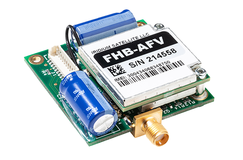
While the RockBLOCK is small, it’s a vital part of the system. It worked so well it is now patent pending, and we’re thrilled that we played a part in saving James’ beautiful home. We’re hoping that this system will start to roll out over areas with high fire risk, with one large home in Thousand Oaks, California, already signing up for one.
Can we help you?
Get in touch with us and find out if the RockBLOCK 9603 is the right device for your needs. Either complete our online form, or call us to be connected directly with one of our expert team. Call +44 (0) 1452 751940 (Europe, Asia, Africa, Oceania) or +1.805.783.4600 (North and South America).
With over 20 years experience in satellite tracking we have the knowledge and experience to ensure you are equipped with everything you need to make the right choice.
RockBLOCK chosen for Cryologger deployments in the Canadian Arctic
Water and ice play a critical role in Canadian landscapes, ecosystems, and infrastructure. The effects of a rapidly changing climate are expected to result in profound environmental changes in the Canadian Arctic.
The Water and Ice Research Laboratory (WIRL) at Carleton University, Canada, aims to better understand the effects of climate change through research focused on aquatic and cryosphere environments. A prerequisite for successful research is the ability to gather as much data from as many sources as possible.
In the past, expensive proprietary hardware was a major constraining factor in the ability of researchers to gather field data. With the development of open-source software and inexpensive, modular, and user-friendly hardware, it’s now possible for the WIRL to better observe and monitor the cryosphere.
Adam Garbo did just that by developing the Cryologger – an Arduino-based, multi-purpose datalogger and telemeter designed to collect data such as temperature, pressure, orientation, and GPS coordinates. The Cryologger was designed to be robust and is intended for deployments in the Canadian Arctic of one year or more.
In the summer of 2018, six Cryologgers were deployed as ice-tracking beacons in the Canadian Arctic. They’ll allow the WIRL to monitor the drift patterns of icebergs and ice islands along the coasts of Ellesmere and Baffin Island. Data from these Cryologgers is being transmitted hourly via a RockBLOCK 9603 to Rock Seven (now trading as Ground Control) and then pushed to the Cryologger tracking website.
An assessment of the Cryologger’s performance will determine if low-cost, open-source hardware and software can provide a reliable and cost-effective alternative to commercially available equipment for use in the demanding polar regions. Given the success of many similar RockBLOCK enabled projects in the past, we can’t be anything but optimistic about the verdict.
Get in touch
Get in touch with us and find out if the RockBLOCK 9603 is the right device for your needs. Either complete our online form, or call us to be connected directly with one of our expert team. Call +44 (0) 1452 751940 (Europe, Asia, Africa, Oceania) or +1.805.783.4600 (North and South America).
With over 20 years experience in satellite tracking we have the knowledge and experience to ensure you are equipped with everything you need to make the right choice.
Supporting the Eldorado Space Program
In 2014, Paul McWhorter, a 17-year veteran of Sandia National Labs and founder of a Silicon Valley nanotechnology company, returned to his hometown of Eldorado, Texas, to start a new career as a high school teacher.
When not teaching math and engineering classes at Eldorado High School, Paul devotes time to lecturing on subjects ranging from how to become a successful engineer, programming with Arduino/Raspberry Pis, and learning 3D CAD. Paul uploads his lecture videos on his website and YouTube channel.
Much to everyone’s surprise, Paul also established the high school’s first space program. He oversees a four-year high school engineering program where younger students are encouraged to join the space program in their junior and senior years.
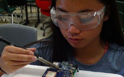
With his guidance, students design, build, and program instrumentation packages sent into the upper atmosphere via high-altitude balloons. He documents the missions in a dedicated YouTube channel.
The instrumentation packages, called Eagles, are sent to the edge of space and transmit back temperature, pressure, and GPS data, as well as live video. A 9-axis inertial measurement system also sends data on the Eagle’s orientation. In all, twenty different data channels are telemetered back to ‘Mission Control’ in the classroom. Some of the additional data channels include down range velocity, vertical ascent rate, latitude, longitude, elevation, system health, signal strength, downrange distance, heading, and trajectory.
A unique accomplishment of these student engineers is their development of an ability to stream live video from the edge of space back to the classroom. The students use standard 2.4 GHz Wi-Fi radios and reconfigure them to operate on the 2.39Ghz HAM microwave radio band. Each member of the program has a HAM radio license, so they can legally operate on this microwave band.
Since the instrument packages can reach altitudes over 115,000 feet and can travel 100 miles down range, maintaining a live video link is a formidable challenge. Technical and regulatory requirements limit the space-bound microwave radio to 1 watt transmit power. In order to communicate over these large distances at such a low power level, a high-gain antenna is required on the ground-based tracking system.
The challenge of using a high-gain antenna on the ground is that it must be pointed with precision at the space-bound instrument package. A pointing error of just a few degrees can lead to loss of signal. According to Mission Commander Jack Griffin: “The challenge becomes even more formidable since the instrument package can reach speeds of over 150mph, as the package ascends through the jet stream. Imagine trying to hit a target with one-degree precision that’s over 100 miles away, traveling at over 150mph.”
Griffin, who is a 17-year-old high school senior, continues: “We’re definitely solving real-world problems in this program. It’s more like working for a Silicon Valley start-up than being in a high school class.”
The ground-based tracking antenna is mounted on a Pelco Pan/Tilt platform. The position of this platform is controlled by relays in a closed-loop feedback system run on a Raspberry Pi microcontroller. The control system works as follows: A GPS on the space-bound instrument package measures the package’s latitude, longitude, and altitude. This data is then transmitted back to the ground- based tracking system. The system then takes these data points and applies the complex Haversine computation to calculate the necessary heading and elevation for the antenna to be precisely pointed to the instrument package. A feedback loop then moves the Pelco such that the antenna is precisely pointed at the target coordinates. In order to maintain the microwave video link, this feedback loop must constantly and quickly adjust the antenna position.
High school junior and Ground Tracking Specialist Benjamin McGee claims: “This is definitely a challenge and mission success depends on keeping the ground-based antenna pointed precisely at the package, no matter where or how fast it goes.”
The team is busy working on preparations for the launch of Eagle IX. Mission Commander Jack Griffin is confident that this will be the best launch ever. Griffin says: “We have our flight designed and expect to get our highest-quality images and most precise data to date, which we will live-stream on our YouTube channel so anyone on Earth can see it.”
The key element for this entire system to work is to have a reliable way to get the GPS data back from the space-bound instrument package to the ground-based tracking system.
Mission Specialist Christine Lindsey says: “Mission success depends on reliable transmission of GPS coordinates from the instrument package back to the ground, We’ve chosen the RockBLOCK modem and Iridium satellite network because it provides rock-solid connectivity. Initially we sent the GPS data coordinates over our microwave link, but if we lost connection, there was no way to regain it. With the RockBLOCK, we always know where the package is and how to point to it. With this system, we can maintain our microwave data link.”
This high-frequency radio beam has poor propagation, meaning it’s important to aim the antenna precisely at the Eagle. To achieve this, GPS data is transmitted via RockBLOCK to Ground Control’s servers. It’s then pushed via HTTP post to Paul’s own server which adjusts the high-gain antenna position accordingly, thus maintaining the video link.
Get in touch
Get in touch with us and find out if the RockBLOCK 9603 is the right device for your needs. Either complete our online form, or call us to be connected directly with one of our expert team. Call +44 (0) 1452 751940 (Europe, Asia, Africa, Oceania) or +1.805.783.4600 (North and South America).
With over 20 years experience in satellite tracking we have the knowledge and experience to ensure you are equipped with everything you need to make the right choice.
Remote Environmental Monitoring
Ephemeral washes located in Southeastern Arizona, USA, contribute to large rivers like the San Pedro. For this reason, ephemeral washes are used by the Arizona Department of Environmental Quality (ADEQ) to gather data on contaminants like E. coli and suspended sediment which impact larger bodies of water downstream.
When a runoff event occurs, field scientists visit local wash sites to collect in-situ sample bottles. Any bottles containing significant samples of water are returned for analysis. The problem with this method is that field scientists spent too many hours hiking through dangerous conditions to check up on collection bottles. This resulted in unnecessary wear and tear to both equipment, and the field scientists themselves.
Hans Huth, a hydrologist with ADEQ’s Watershed Protection Unit, was looking for an easier way to check up on collection bottles. Though commercial GPRS modems and autosamplers could do the job, they were prohibitively costly.
Huth began his research into affordable open source alternatives, adopting the Arduino system and its wide variety of sensors. Huth built a solar powered prototype that sensed rain and water runoff and encased it in a waterproof kayaker’s lunchbox. A basic 2G GPRS modem was used to transmit sensor data to ThingSpeak, the IoT analytics platform that allows users to store, analyze, and visualize their data.
In order to deploy these remote environmental monitors (REM) in areas with no cellular connectivity, Hans worked with Sean Keane, an ADEQ intern, on reprogramming the Arduino to work with a RockBLOCK. For the purpose of monitoring discharges from a stocktank and to facilitate sample collection, a RockBLOCK-powered REM was successfully deployed at Horseshoe Draw near the border with Mexico. Given this success, ADEQ plans to deploy nine more cellular and RockBLOCK powered REMs throughout the state prior to the close of July, 2019. ADEQ is in the process of documenting time and money savings from respective deployments.
Huth documented his first environmental monitor’s development and deployment on YouTube to include links to source code for these inventions. Huth’s YouTube channel also includes chapters on building and deploying these REMs, and he is currently working on a new chapter summarizing code and deployment of RockBLOCK-enabled REMs.
The Ocean Cleanup
Our oceans are polluted with plastic. It’s not just strangling sea life or collecting in giant swirling patches the size of countries – tiny microplastics are also abundant in the water, making their way back into the food chain and, ultimately, our plate.
Cleaning up the world’s oceans from plastic isn’t a simple affair. There are three main issues that governments traditionally balk at when faced with a large-scale cleanup – cost, cost, and cost.
Thankfully, the minds behind The Ocean Cleanup came up with an ingenious – and cheap – solution. They designed a system that uses nature to help collect the plastic garbage floating in the ocean.
The system consists of a 600-meter-long, U-shaped float that travels along the water’s surface. Underneath the floater is a 3-meter-deep skirt. The system uses perpetual wind and wave energy to carry the float along at a speed ever so slightly faster than the ocean current. The result is akin to a giant ocean-borne squeegee scouring the ocean, collecting everything from massive discarded fishing nets to millimeter-sized plastic.
The garbage will be rounded up by the curved floater, making it easier for boats to come and collect every few months.
According to The Ocean Cleanup: “A full-scale deployment of our systems is estimated to clean up to 50% of the Great Pacific garbage patch in five years.”
Rock Seven (now trading as Ground Control)’s RockBLOCKs will be used by a number of open-source drifting buoys deployed to simulate plastic movement around the systems. These ‘maker buoys’ incorporate the 9603 Rockblock, interfaced with an Arduino-based microcontroller.
The cleanup system has been engineered to be sea life-friendly and to withstand the punishing ocean environment. It’s also deployed in an area that sees hardly any marine traffic, although the position of each system will be known and subsequently avoided by vessels.
On September 8th 2018, System 001 was launched from the foundation’s assembly yard in Alameda and towed through the San Francisco Bay, toward the infamous Great Pacific garbage patch. Learn more on The Ocean Cleanup website.
RockBLOCK chosen to support AirCore sampling
Introduced in a paper published in 2010 in the American Meteorological Society, the AirCore has proven itself a robust atmospheric sampling device used with balloons and other airborne assets. Co-developed by the University of Colorado and the NOAA, the heart of the AirCore is 100m of thin, valve-tipped, and coiled stainless-steel tubing that stores gas but prevents its diffusion.
Initially, known amounts of trace gases called fill gas are pumped into the coil. The valves keep the fill gas inside the coil, but as the AirCore ascends through the atmosphere, the exterior pressure drops and the fill gas slowly escapes out.
At around 95,000 feet, the fill gas has almost completely left the coil and, in this current application by the NOAA team, a payload cutdown controller (PCC), which includes the AirCore and all of its auxiliary communications and logging equipment, is separated from a balloon and begins its parachuted descent.
As the PCC falls to the ground, the external pressure slowly builds up, forcing ambient air through a small magnesium perchlorate-filled canister (to dry the air) and into an open valve back into the coil. At ground level, the AirCore will have collected a vertical profile of undiffuse air, almost like a solid core. Back at the lab, the air is then pushed back out of the coil and analysed, ideally in AirCore pairs to make sure that accurate results have been gathered. The small amount of fill gas left in the AirCore indicates the top of the profile.
The PCC uses a Teensy 3.6 board (similar to an Arduino) that controls the cutter. The RockBLOCK itself is programmed to send out location data every five minutes throughout the flight, from power up prior to launch until about 30 minutes after landing. Two-way communication via the RockBLOCK’s SBD Library also gives the team the ability to cut the balloon loose early in flight. Powering the entire PCC for at least four hours are two rechargeable lithium 18650 2200mAh batteries in series.
Usually, a flight will go according to plan but on two occasions the RockBLOCK has gotten more than it bargained for. As Jack Higgs from the NOAA ESRL Global Monitoring Division explains:
“On one flight in Oklahoma last week, the balloon string became tangled with the parachute after cutting so the payload was carried up until the balloon burst. The RockBLOCK reached an altitude of 112,913 feet and low pressure of 5 millibar. It still transmitted its location message at that altitude without any problems. The package was also exposed to a low temperature of -75 degrees C during the flight. The electronics are housed in a Styrofoam package but are not heated. They only benefit from heat generated by the components.”
In another instance, the team had to borrow a canoe from a nearby homeowner and paddle out into the middle of a lake to retrieve the PCC. Amazingly, all the electronics were still operating, even though they were all wet inside. The RockBlock was transmitting its location every five minutes while saturated with water and floating horizontally in the lake.
The AirCore’s success has been duplicated on this side of the Atlantic, too. Academic institutions such as the University of East Anglia, University of Groningen, and the Finnish Meteorological Institute have used it for similar research.
More information on the AirCore can be found at the NOAA’s Earth System Research Laboratory.
Get in touch
Get in touch with us and find out if the RockBLOCK 9603 is the right device for your needs. Either complete our online form, or call us to be connected directly with one of our expert team. Call +44 (0) 1452 751940 (Europe, Asia, Africa, Oceania) or +1.805.783.4600 (North and South America).
<br>
<br>
With over 20 years experience in satellite tracking we have the knowledge and experience to ensure you are equipped with everything you need to make the right choice.