Topic: IoT & M2M
Reliable Grid Automation Starts With Reliable Links
In November 2021, Storm Arwen swept across the United Kingdom, causing three fatalities, felling millions of trees, and leaving almost one million homes without power. More than 100,000 homes were without electricity for several days.
In February 2023, Cyclone Gabrielle devastated New Zealand’s North Island, driving severe flooding and landslides, leaving about 225,000 homes without power, and costing 11 lives. It remains New Zealand’s most costly non‑earthquake disaster, with an estimated economic impact of ~NZ$14.5 billion (≈US$8.2 billion).
In February 2024, a windstorm in Victoria, Australia, significantly damaged transmission and distribution networks, leading to more than one million customers losing power. After three days, tens of thousands were still without supply.
As well as the devastating impact on industrial, commercial, and residential customers, sustained outages carry major penalty costs for operators. For example, on a single rural circuit, a 12 hour outage affecting 20,000 customers could trigger roughly US$2.0 million in automatic customer credits before any annual reliability penalties or reputational redress – and that’s just one feeder on one night.
The Rural Failure Loop – What Keeps Going Wrong
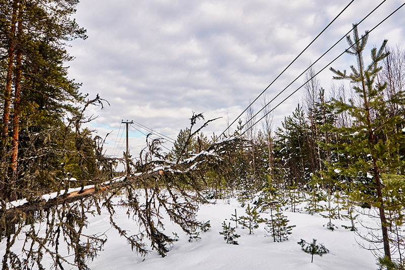
In each of the events above, power outages and physical damage in rural areas knocked out portions of the fixed and mobile telecom networks. Cell sites ran out of backup power and fiber backhaul was cut, leading to reduced or, in some districts, no telemetry or remote control from field devices. That loss of communications degraded situational awareness and coordination, lengthening restoration.
Extreme weather is increasing in frequency and severity, so we can expect more of the same. A wildfire, wind, ice, or landslip causes a fault to hit the feeder. Telecom sites at the edge flip to battery, then go dark. As terrestrial backhaul – poles, towers, ducts, and fiber – shares the same geography and hazards, the event that takes down the feeder often takes down the comms, too.
Operators then fly blind: no live status from switches or IEDs; no remote commands; FLISR (Fault Location, Isolation, and Service Restoration) slows or stalls. This in turn slows down restoration, with more truck rolls, access delays, longer isolation and switching sequences. The impact on the customer grows; minutes become hours, and penalty clocks keep ticking.
Rural environments are particularly problematic because of the sparse infrastructure; often a single tower every many kilometers, and one fiber route serving an entire valley. When weather hits, you don’t just lose a path, you lose the path. Getting back online is slower too, as closed roads and washed out bridges delay generator drops, refuelling runs and fiber repairs, stretching restoration timelines.
True Path Diversity Needs Satellite Backhaul
The main defenses against sustained outages – reclosers, switches, sectionalizers, and the RTUs and IEDs that control them – often include edge logic, but operators still need status reports and command authority. For centralized, SCADA/DMS‑directed switching, the control room needs continuous situational awareness and safe, auditable operations. Both modes depend on connectivity, which is not straightforward in rural territory.
Private VHF/UHF, Wi‑SUN FAN (an IP‑based 802.15.4g/e mesh), microwave, and private LTE all have their place, but they frequently inherit the same poles, towers, ducts, and power feeds that storms take out. Satellite connectivity provides true path diversity and coverage where nothing else exists, without requiring you to build and maintain more terrestrial infrastructure.
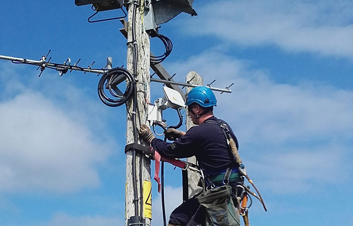
This isn’t new. In 2015, Ergon Energy used BGAN M2M (now called Viasat IoT Pro) to connect hundreds of reclosers across Queensland, Australia. This is a proprietary satellite IoT service that delivers an IP‑grade link capable of carrying DNP3 / IEC‑104 cleanly, including command and acknowledgement workflows.
However, using satellite IoT for DA/SCADA remained niche because the trade-offs used to be unappealing. The satellites through which services like Viasat IoT Pro are delivered are in geostationary orbit (GEO), some 35,786 km above Earth.
This has two implications; one is that the round trip time for data (called latency) is around ~0.6 – 1.5 seconds; acceptable for event‑driven SCADA and supervised switching, but potentially an issue if you have a system architecture that expects real time data transmission.
The second is that antennas paired with GEO networks need to have line of sight to the satellite, which requires careful positioning, and it may not be possible to get a reliable link in forested or mountainous areas. There’s also a pervasive myth that satellite means dishes, trucks and big OPEX, meaning that many teams defaulted to building more terrestrial coverage or living with rural blind spots.
Why This Is a “Now” Issue
Things have changed. Low Earth Orbit (LEO) satellite services like Iridium Certus 100 have much lower (sub-second) latency due to their proximity to Earth; their interlinked satellite network means that antennas need only a clear view of the sky, and don’t need to be pointed. Further, antennas can be smaller, and draw less power, as the data doesn’t need to travel as far – you can pole-mount a link where the device actually sits.
Across both LEO and GEO satellite networks, modern message‑based services (e.g., IMT – Iridium Messaging Transport; Viasat IoT Nano) move away from a 24/7 pipe to heartbeat‑plus‑burst with delivery acknowledgements. That’s far more economical (and power efficient) and maps well to grid operations: quiet most days, chatty during incidents.
Ruggedized terminals like RockREMOTE Rugged support both IP and message modes, work with dual‑WAN routers for automatic failover, and provide store‑and‑forward so data and commands are queued and delivered in order with proof of delivery.
Highly capable terminals, again like RockREMOTE Rugged, can also act as field gateways, aggregating low power sensors and fault indicators over LoRaWAN (or Wi‑SUN) and backhauling their data over satellite. With hosted applications at the edge, operators can separate event alarms from periodic telemetry and transmit only when needed.
The result is a pragmatic architecture: put direct satellite at a few control‑deciding points – feeder head, key tie switches, and outgoing feeders at the substation – and aggregate the many sensors / indicators to a satellite-backhauled gateway to manage cost. Combine that with event‑based transmissions, low idle costs, and near‑real time bursts when storms hit, and you have an economical, reliable coverage layer that’s independent of terrestrial networks.
Smart automation only works if it can talk. Satellite at a handful of control‑deciding points gives that automation a path that doesn’t go dark when poles, towers, or ducts do, so FLISR and operator decisions still happen in minutes, not hours.
Securing DA/SCADA Data
Security isn’t just about keeping links up; it’s about keeping DA/SCADA traffic private and accountable. Service providers that specialize in critical national infrastructure, like Ground Control, typically break out satellite traffic at a controlled meet-me point and carry it to the utility OT network over private VPN/MPLS, helping avoid best effort internet paths and keeping routing and auditing clear. At the edge, devices use certificate-based encryption with store-and-forward and acknowledgements, so data and commands are queued and delivered in order even through brief fades. Paired with dual-WAN failover, this approach reduces exposure during storms while preserving a predictable operator experience.
In short, the grid won’t get kinder and the penalties won’t get lighter. What you can change is whether your automation can still talk when the weather arrives. By giving a small number of control-deciding points a path that doesn’t share poles, towers, or ducts, and aggregating the many through a satellite-backhauled gateway, you turn hours of uncertainty into minutes of switching. Start where it matters most: your feeder heads, key ties, and outgoing feeders; measure the restoration minutes you take back, then scale.
Make Comms One Less Thing To Worry About
Ground Control has over 20 years of experience in delivering satellite connectivity for Critical National Infrastructure. We know that every network is different, and we can provide expert advice on getting the right mix of direct satcom and gateways.
Complete the form or email hello@groundcontrol.com, and we’ll be in touch within one working day.
How Standards-Based Satellite IoT Will Transform Renewable Energy Monitoring
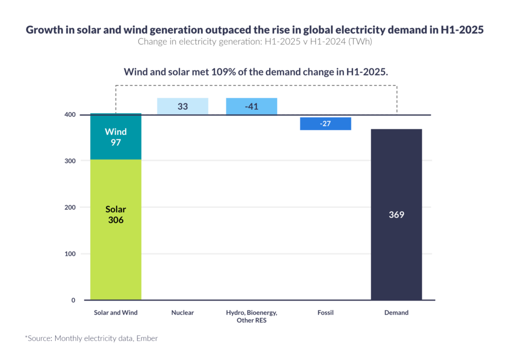
Wind and solar farms are fast becoming the backbone of our green energy future. The first half of 2025 marked a defining moment for global power generation. According to Ember’s Global Electricity Mid-Year Insights Report, global electricity demand rose by around 2.6%, yet renewables grew even faster. Solar output jumped by 31% and wind by 7.7%, helping renewables overtake coal for the first time in history, supplying 34.3% of global electricity compared with coal’s 33.1%.
That growth isn’t slowing either. Ember’s latest report forecasts that global renewable capacity additions will reach almost 793 GW in 2025 (an 11% increase on 2024) driven by 21% growth in wind and 9% in solar. At this pace, the world is within reach of tripling global renewable capacity by 2030, a central COP28 goal.
Yet as the scale of renewable infrastructure expands, new challenges arise: managing millions of connected devices, capturing continuous data, and maintaining visibility across installations that often sit far beyond the reach of terrestrial networks.
It’s not just about generating clean power anymore. It’s about keeping every asset connected, visible, and performing at its best.
The Connectivity Challenge in Renewable Energy
On remote coastlines, in vast deserts, or far offshore, wind and solar farms are typically built where natural resources are strongest. These prime energy locations often sit well beyond the reach of cellular and fiber networks, creating a growing connectivity gap that directly affects operational efficiency.
Without reliable links between assets and control centers, operators face a series of compounding challenges. Performance and fault visibility is limited, fault alerts can take minutes or even hours to arrive, and manual inspections are often required where remote diagnostics should suffice. The result is higher maintenance costs, slower response times, and an incomplete picture of system performance.
For years, proprietary satellite IoT networks, such as Iridium and Viasat, have bridged this gap. These systems provide the ultra reliable, low latency connectivity essential for mission critical operations like SCADA backhaul, emergency shutdown commands, and safety alerts. Their reliability is proven, but it comes at a price. Proprietary networks rely on specialized terminals and dedicated airtime contracts, delivering access to radio spectrum that’s dedicated to critical connections; this can, however, make these cost prohibitive for large scale sensor deployments across thousands of wind turbines or solar panels.
As renewable capacity surges and asset counts multiply, this challenge is only intensifying. Between 2023 and 2025, renewable additions have grown by an average of 29% annually. To connect every turbine, inverter, and panel without escalating operational costs, operators now need a new model for connectivity, one that blends reliability with scalability, and cost efficiency with coverage.
The Next Wave: Standards-Based NTN NB-IoT
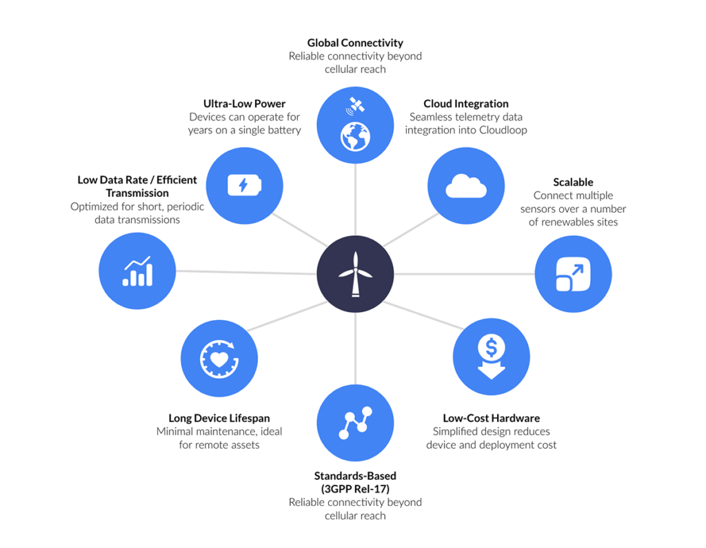
The introduction of standards-based Non-Terrestrial Networks (NTN) by 3GPP has the potential to revolutionize satellite connectivity for renewable energy. By extending Narrowband IoT (NB-IoT), a low power, low cost communication standard already widely deployed in terrestrial networks, into satellite networks, operators can achieve consistent, affordable connectivity across even the most remote wind, solar, or storage sites.
For renewable operators, this evolution opens a new era: from connecting a few critical assets to connecting everything.
Benefits of NTN NB-IoT for Renewable Energy Operators
- No proprietary modem required
Sensors use standardized NB-IoT components instead of bespoke satellite hardware, reducing integration costs. - Lower device and service costs
Shared standards and simpler connectivity models drive down both equipment and airtime expenses. - Future proof infrastructure
Global NB-IoT standards ensure long term interoperability and technology alignment across networks.
- Cost effective scalability
Thousands of low power sensors can be deployed across expansive solar or wind farms without heavy infrastructure investment. - Flexible connectivity options
As multiple satellite operators adopt the standard, service pricing and network choice become more competitive.
Applications for Standards-Based NTN NB-IoT in the Renewable Sector
For renewables, NTN NB-IoT fits best where thousands of low power sensors send small, infrequent updates from remote wind, solar, or storage sites; when reliable reach matters more than real time control.
Wind Energy: Smarter, Predictive Operations
Blade and drivetrain monitoring: Detect anomalies in vibration, strain, or temperature early to enable predictive maintenance before faults escalate.
Structural health: Monitor the integrity of towers and foundations to prevent costly structural damage.
Environmental insight: Collect temperature, humidity, and wind condition data to support condition-based maintenance in remote or offshore installations.
Solar Energy: Panel-Level Performance at Scale
Efficiency tracking: Sensors measure real time output, temperature, and irradiance across thousands of panels.
Environmental optimization: Track dust, shading, and humidity to plan cleaning schedules and maximize efficiency.
Predictive maintenance: Use AI-driven analytics on live panel data to anticipate issues before they affect yield.
Substations and Energy Storage: Always On Visibility
Operational intelligence: Monitoring of non-critical systems such as HVAC, enclosures, and backup units.
Battery and inverter performance: Sensors measure temperature, usage, and degradation to inform maintenance planning.
Local environment tracking: Monitor heat, moisture, and vibration to prevent minor issues from becoming outages.
Where it fits:
NTN NB-IoT is ideal for high volume, low data, latency tolerant applications. It gives operators affordable, long life visibility at scale across their renewable infrastructure.
Proprietary Satellite IoT: Real-Time Insight Where It Matters
While NTN NB-IoT delivers scalable connectivity for thousands of sensors, proprietary satellite IoT systems provide the other half of the equation: real time, high reliability communication for mission critical operations. These networks offer ‘always on’ control, richer data throughput, and the assured latency required for safety and command functions.
Wind Energy: Instant Awareness in Dynamic Environments
Turbine control and fault response: Enable immediate shutdown or restart commands when thresholds are exceeded, ensuring equipment protection and safety in offshore or isolated farms.
Crew safety: Maintain two way communication and emergency alerts for personnel working in remote or hazardous environments.
Data rich diagnostics: Support higher bandwidth uploads of vibration or acoustic data for detailed drivetrain and gearbox analysis.
Solar and Storage: Real Time Control and Reliability
Critical fault alerts: Provide sub-minute notifications for inverter trips, arc faults, or temperature spikes, with confirmed two way acknowledgments.
Grid dispatch and load balancing: Coordinate distributed storage and solar assets for rapid response to grid frequency or demand changes.
Remote updates and control: Push firmware and configuration changes securely to field devices.
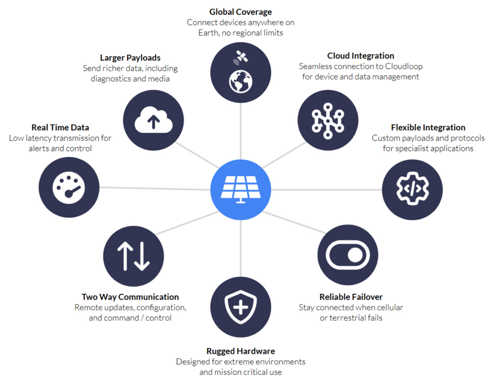
Substations and Microgrids: Control-Plane Resilience
SCADA continuity: Maintain command and telemetry when terrestrial networks fail to ensure operational visibility.
Command assurance: Provide guaranteed message delivery with acknowledgments for critical operational controls.
Local environment tracking: Monitor heat, moisture, and vibration to prevent minor issues from becoming outages.
Where it fits:
Proprietary satellite IoT excels in real time, safety critical, or data rich applications where latency, reliability, and assured control are essential.
Working Together: The Hybrid Model for Connected Renewables
Across the renewable ecosystem, both satellite technologies have distinct but complementary roles. Together, they can create a resilient hybrid connectivity framework: NTN NB-IoT for scalable insight, and proprietary satellite for mission critical control. This combination ensures every renewable asset, from panel to turbine, stays connected and performs at its best.
| Standards-Based NTN NB-IoT* | Proprietary Satellite IoT* | Hybrid Model (NTN NB-IoT + Proprietary Satellite) | |
|---|---|---|---|
| Max Practical Payload | Up to 256 bytes | Up to 100,000 bytes (100 KB) | Mix of both profiles depending on use case |
| Typical Latency | 10–60 seconds (can extend to 2–5 minutes depending on satellite pass) | 10 seconds under optimal conditions | Flexible. Real time via proprietary satellite IoT, scheduled via NTN NB-IoT |
| Best For | Low data, latency tolerant sensing across large asset fleets | Real time, safety critical, or data rich communication | Combining scale with responsiveness |
| Example Applications | Blade or panel monitoring, inverter and battery health, environmental sensing | SCADA backhaul, curtailment commands, crew safety, firmware updates, detailed diagnostics | Wide area condition monitoring plus selective real time control |
| Key Benefits | Ultra low power, long battery life, affordable scaling | Near real time, two way connectivity, proven reliability, supports richer datasets | Delivers cost efficiency and resilience. Low power coverage for mass assets and real time connectivity for critical operations |
*Example service information based on Viasat NB-NTN (Standards-based NTN NB-IoT) and Iridium IMT (Proprietary Satellite IoT)
Hybrid Connectivity Roadmap for Renewables Operators
As renewable energy networks expand, the goal isn’t to replace what works, it’s to build on proven reliability while scaling smarter, standards-based connectivity. Proprietary satellite IoT remains invaluable for mission critical operations and guaranteed uptime, but the arrival of standards-based NTN NB-IoT opens the door to a new class of affordable, low power devices that can extend data collection to every corner of a wind or solar site.
The most effective strategy is hybrid: utilize the robustness of proprietary satellite for control, command, and safety, while using NTN NB-IoT to scale data visibility across assets, sensors, and environmental systems. This staged approach allows operators to evolve without risk, modernizing their infrastructure, reducing costs, and enabling massive IoT integration at their own pace.
Stage 1: Proven Reliability (Today)
Focus on mission critical control and safety using proprietary satellite IoT for SCADA backhaul and alarms.
Stage 2: Scaling Visibility (2026–2027)
Introduce NTN NB-IoT sensors for turbine gearboxes, inverter performance, and solar panel strings. Hybrid solutions use satellite where cellular fails.
Stage 3: Massive IoT Integration (2027–2028)
Deploy thousands of NB-IoT sensors across all assets. Integrate data streams into unified cloud platforms such as Cloudloop for full fleet visibility.
Stage 4: Intelligent Operations (2028 Onwards)
Apply edge analytics and AI for predictive maintenance, automated scheduling, and output optimization. Proprietary satellite remains for safety; NB-IoT drives efficiency at scale.
Building Smarter, Greener, More Connected Energy Systems
As renewable energy capacity continues to expand, the focus is shifting from generation to ensuring every asset, from turbines and inverters to panels and storage systems, remains visible, connected, and performing efficiently. Connectivity is now the foundation that enables data driven operations, predictive maintenance, and long term resilience.
Standards-based satellite IoT is making that connected vision achievable. By combining the reliability of proprietary satellite networks for mission critical control with the scalability of NTN NB-IoT for widespread monitoring, operators can design hybrid systems that balance performance, coverage, and cost. This approach turns isolated assets into part of a cohesive, intelligent network, one capable of supporting the next phase of renewable energy growth.
The transition to hybrid connectivity isn’t just about technology; it’s about creating the operational flexibility to expand confidently. By integrating both proven and emerging IoT standards, renewable energy operators can maintain uptime where it matters most, scale visibility across every site, and continue to build an energy generation system that’s smarter, cleaner, and ready for the future.
Need help building hybrid connectivity?
With over two decades of experience connecting critical infrastructure in some of the world’s most remote environments, Ground Control helps organizations design reliable, scalable satellite and IoT networks.
From mission critical systems to large scale sensor deployments, our team can guide you in combining proprietary and standards-based solutions to keep every renewable asset online and visible.
What 2026 Really Looks Like for Standards-Based Satellite IoT
Standards-based satellite IoT is finally usable for real workloads, but only if you understand where it works today, what it costs, and how to design for its constraints.
Our new eBook, Decoding NTN: The Reality Behind Standards-Based Satellite IoT, sets out a pragmatic view of NTN for IoT teams planning 2026 – 27 deployments.
Inside, we translate standards-speak into decisions you can act on: when NB-IoT vs LTE Cat-1 over satellite makes sense, how minimum session size and protocol overhead (NIDD vs UDP/IP) shape data budgets, and what today’s coverage and SCS approvals mean for rollout planning. You’ll get a plain English decision matrix and realistic timelines so you can deploy with confidence rather than hype.
Read Free eBook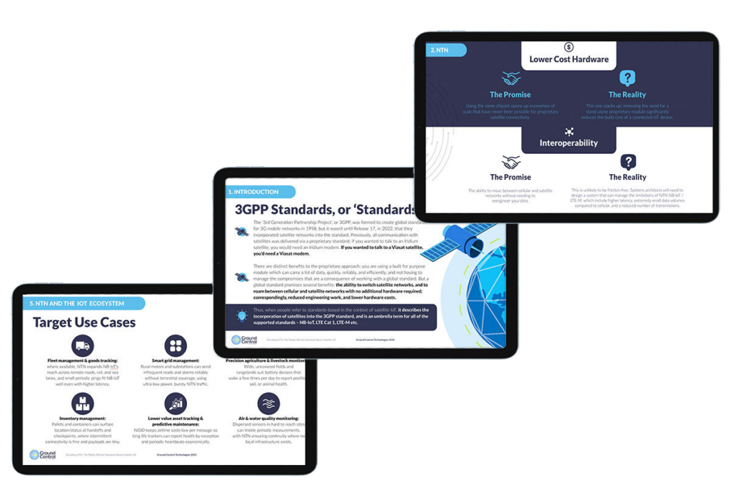
What’s Inside

Coverage, not hype
Current footprint, line of sight, and SCS approvals
Payload Economics
Minimum session size, NIDD vs UDP/IP, and payload planning

Right Tool, Right Job
NB‑IoT vs LTE Cat‑1 over satellite vs proprietary

Plan with Dates
2026 expectations and the 2027 ecosystem ramp
Why This eBook, Now
There’s been no shortage of headlines about direct to device (D2D) and “everywhere coverage”, yet many claims blend marketing terms with evolving standards. In practice, NTN means running existing cellular standards – NB-IoT or LTE – over a satellite link. That shift promises simpler hardware and a shared device ecosystem, but it also introduces satellite-specific realities: higher/variable latency, small cost-optimized data volumes, line of sight requirements and country by country enablement.
Our goal with this eBook is to separate signal from noise. We focus on what works now with NTN NB-IoT, what’s likely next with LTE Cat-1 over satellite, and when a proprietary service remains the right answer.
Coverage Today: Useful, Not Universal
The phrase “global coverage” is seductive. The reality is more localised. Current NTN availability concentrates in specific regions (with notable gaps over oceans and in many countries), and depends on national approvals often referred to as Supplemental Coverage from Space (SCS). In other words, you switch service on country by country, which means deployment plans should be validated market by market. The eBook explains how to assess coverage for your intended regions, including practical placement advice for your antenna.
Payloads and Minimum Session Size: Every Byte Counts
If you’re coming from terrestrial NB‑IoT, airtime budgeting over satellite is different. The cost optimized range for NB‑NTN is small (tens of kilobytes per device per month), and protocol choice has an outsized impact. Non‑IP Data Delivery (NIDD) keeps overheads lean for micro‑telemetry; UDP/IP is often simpler to integrate but adds bytes you’ll pay for. Some providers impose a minimum session size that can negate NIDD’s benefits for very small payloads. The eBook includes concrete examples of payload budgeting and shows when NIDD becomes attractive as commercial offers evolve.
Reliability by Design
Satellite introduces distance and scheduling. Expect higher/variable latency than cellular, and design sensible send cadences if you want predictable costs and battery life. If your use case needs near‑real time interaction or frequent updates, a proprietary IP service is usually the right tool; if you’re moving small, delay‑tolerant telemetry a few times a day, NTN services can be an excellent fit.
NB‑IoT vs LTE Cat‑1 Over Satellite
NTN is an umbrella that covers both NB‑IoT and LTE Cat‑1 waveforms. They serve different jobs. NB‑IoT over satellite fits tiny, infrequent messages on multi‑year batteries. LTE Cat‑1 over satellite suits lighter, less time critical IoT sessions where you may need occasional configuration changes or small bursts of data, typically with external power or larger batteries. The eBook includes a decision matrix to help you map each device profile to the right path.
Timelines You Can Plan Against
We outline what’s available now, what’s expected in 2026 (including anticipated support that may improve minimum session sizes), and how the broader ecosystem is likely to ramp into 2027. We also provide a sober view on “ubiquity”: harmonised experiences across orbits and architectures will take time, and national approvals will continue to shape availability.
When Proprietary Services are Still the Better Choice
If your application needs interactive, two way IP sessions, predictable low latency, or larger payloads, proprietary services remain the workhorses. The eBook compares message‑based proprietary options (efficient for small bursts) with IP‑based services (best for control loops, richer telemetry or firmware deltas), so you can decide on merit rather than ideology.
Get the Full eBook
If your devices operate beyond terrestrial coverage, this eBook gives you the practical guidance to de-risk deployments: how to validate coverage market by market, budget payloads with minimum session size in mind, and decide when NB-IoT or LTE Cat-1 over satellite (or proprietary alternatives) will best serve your requirements.
You’ll find vendor-agnostic explanations, real world constraints stated plainly (line of sight, latency, approvals), operator perspectives from recent panels, and a simple decision matrix you can adapt into your specification. It’s written for product, firmware and operations teams who want clear, testable criteria – not hype.
Download Free eBook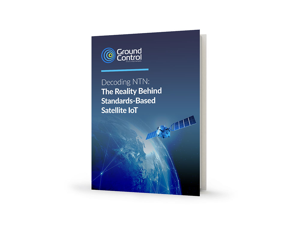
Talk to our Team
If you’d like to talk to the Ground Control team about your remote IOT application, please email hello@groundcontrol.com or complete the form. We have over 20 years of experience in delivering satellite connectivity, and work with major satellite network operators including Iridium, Viasat, OneWeb and Starlink.
Note: You don’t need to complete the form to get the eBook; just click on one of the links, it is an ungated resource.
Remote Environmental Monitoring: Matching Connectivity to the Challenge
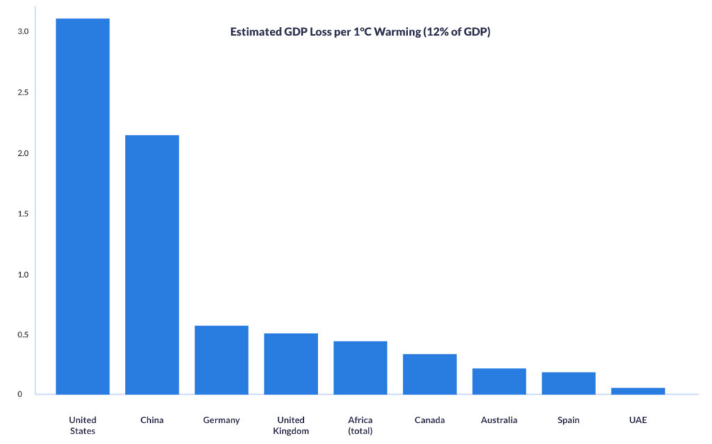
A recent macroeconomic study cited by the World Economic Forum suggests climate warming could cost the world 12% of GDP per °C of temperature rise.
Applied to national economies, this equates to annual losses of over $3.2 trillion for the United States, more than $2.1 trillion for China, and hundreds of billions for other major economies and regions such as Germany, the UK, Africa, and Australia.
These figures underline why investment in environmental monitoring and early warning systems is not just planet saving, but economically essential.
IoT opens new possibilities for environmental insight and protection, but many monitoring sites lie beyond cellular networks, making connectivity difficult.
The Challenge of Monitoring Our Planet
Why is environmental monitoring so hard in remote areas?
Often, the places we most need data from are the hardest to reach. Accessing remote rainforests, high mountain ranges, vast deserts, polar caps and oceanic regions can be difficult, costly, and dangerous. They don’t have cell towers or power lines, and sending people out to check sensors manually isn’t just impractical, it’s unsustainable. IoT for climate monitoring has opened the door, but the logistics of gathering reliable, continuous data in these places remain challenging.
One essential component of success is collaboration. Environmental monitoring is not something one agency or organization tackles alone. Governments, NGOs, researchers, universities and private tech providers all bring pieces of the puzzle, from scientific insight to provision of physical sensor networks, to the connectivity and platforms that make data flow. When these threads are woven together, they provide a picture accurate and complete enough to act on, but without them, data is disparate, narrow, and potentially unreliable.
Today, many of these agencies rely on proprietary satellite IoT to monitor the environment and keep people safe.
Environmental Monitoring via Proprietary Satellite IoT
Proprietary satellite IoT refers to connectivity solutions built on closed, vendor specific satellite networks, platforms and hardware. With a history of reliability and low latency, they’re trusted for mission critical applications, and form the backbone of systems that send wildfire alerts from remote forests, trigger flood warnings when rivers surge, or provide SOS capabilities for Rangers far from cellular coverage. These use cases work, and they save lives.
For reference, here’s a quick refresher on a couple of established proprietary satellite services, but feel free to skip ahead if you’re already familiar.
Iridium runs a Low Earth Orbit (LEO) satellite network using L-band spectrum. Coverage is truly global, including the poles, and terminals don’t require antenna pointing. For IoT, Iridium Short Burst Data (SBD) and Iridium Messaging Transport (IMT) handle low-power telemetry and tracking, while Iridium Certus 100 provides lightweight IP backhaul at up to 88 kbps down / 22 kbps up.
Viasat (through its acquisition of Inmarsat) operates primarily in Geostationary Orbit (GEO) at ~35,786 km. GEO satellites appear fixed in the sky, so you get near-global coverage (excluding the polar regions) but you do need to point the antenna and you’ll see higher latency than LEO. Viasat’s proprietary IoT options – IoT Nano and IoT Pro (previously called BGAN M2M) – are chosen for economical, stable, and reliable links where there’s a clear line of sight to the satellite.
Proprietary satellite IoT is trusted because it is proven. Networks like Iridium and Viasat offer global reach, near-real time communication, a broad range of data capacity tariffs, and connectivity that covers the most inaccessible global locations. In situations where seconds or accurate time-stamped data count, that reliability is non-negotiable.
But this approach does come with trade offs. Proprietary satellite IoT devices have added cost, limiting their widespread deployment. Agencies also face vendor lock in due to a lack of interoperability. And the data can end up siloed, with wildfire sensors on one platform, flood gauges on another, and SOS devices elsewhere. The result is a patchwork of insights that are difficult to unify. We’ve previously highlighted the problem of global data disparity and its impacts. The tension between reliability, availability and scalability, proven systems and siloed ones, defines the current status quo.
The Expanding Toolkit: LoRaWAN and NTN
Over the last decade, LoRaWAN broadened the toolkit for low power, local sensor networking, and now 3GPP’s Non-Terrestrial Networks (NTN) are emerging to extend cellular protocols such as NB-IoT and LTE into areas with no terrestrial networks.
Market Incumbents:
LoRaWAN
An open, community-driven protocol maintained by the LoRa Alliance, LoRaWAN gained momentum from ~2015 onward for low power, low cost sensing. It’s ideal for clustered local or regional deployments (e.g., watersheds, forest plots, landslide corridors). Sensors communicate to nearby gateways; those gateways then backhaul data to the cloud, often over satellite in truly remote sites. LoRaWAN is inexpensive, flexible, and easy to deploy, but coverage is only as broad as your gateway network – there’s no inherent global reach.
Proprietary Satellite IoT
Where time- or mission-critical alerts and global reach are non-negotiable, proprietary satellite services remain best in class. They offer deterministic delivery, global footprints (often including the poles), and proven reliability for safety of life or regulatory use cases. The trade off is cost, which can limit the number of sensors you can field at scale.
Market Newcomers:
Standards-Based Satellite (NTN)
3GPP Release 17 (2022) brought Non-Terrestrial Networks (NTN) to life; extensions that take familiar cellular IoT into space. In practical terms, standards like NB-IoT and LTE-M can now connect via satellite using widely available, standards-based chipsets instead of proprietary hardware.
For remote environmental IoT, that shift really matters. A unified ecosystem means terrestrial and satellite links share the same standards, improving roaming, module availability, and making it easier to switch suppliers. Devices can stay simpler too: the same class of modules can reach the network by satellite when there’s no ground coverage, reducing hardware variants across deployments. And as NTN coverage and device support expand, you can scale sensor footprints without redesigning your stack – ideal for basin-scale hydrology, fire risk perimeters, or multi-site geohazard monitoring.
It’s important to be aware that NTN coverage is still limited, so availability will be patchy for some time. Data rates are small (under 50 KB per month) and duty cycles are constrained, so plan for tiny payloads, compression, and aggressive batching. Applications must be latency-tolerant, with buffering, retry, and out-of-order handling. Unlike cellular, antenna positioning and sky view become first-order concerns, and power budgets are tighter due to longer air-time and higher TX demands.
In this expanding marketplace, there is no single winner in terms of connectivity choices. The toolkit is widening, broadening opportunities and use cases.
Within the current climate (pun intended), with high demand and fast evolving tech, the expertise lies in matching the right connectivity to the right environmental challenge, and future proofing the technologies selected.
Marine Pollution Tracking
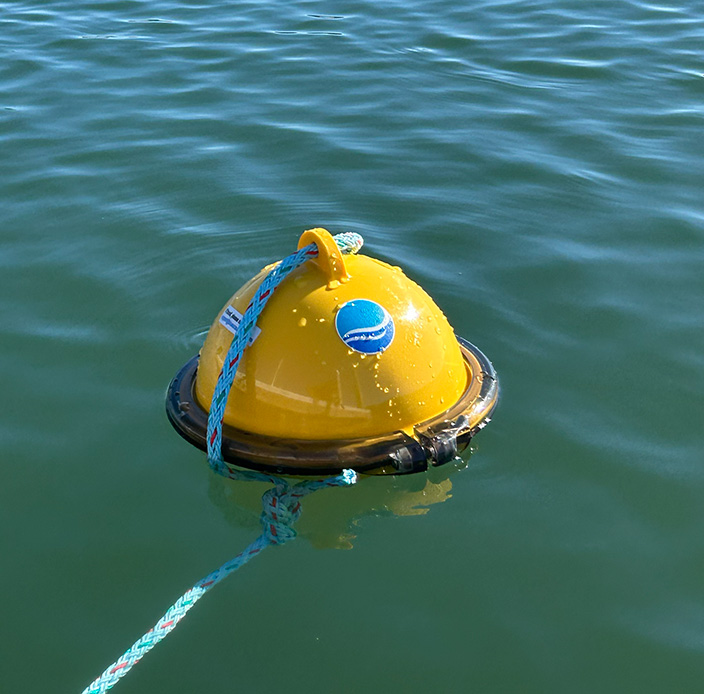
For high-priority stations (spills, hypoxia, critical metrics), proprietary satellite IoT delivers dependable, low latency, global links for continuous reporting.
For dense regional warning nets, NTN NB-IoT can enable hundreds of small, cheap nodes (open-ocean coverage still limited). Near shore, LoRaWAN meshes clusters and backhauls via cellular or satellite, avoiding coastal congestion.

Wildfire Detection
For split-second fire alerts, proprietary satellite links are best: low latency, global reach, reliability when smoke / weather / power knock out terrestrial, and reserved capacity that avoids congestion in crises.
For predictive fire risk monitoring across thousands of low cost sensors, NTN NB-IoT excels: standards-based, massively scalable, and usable as primary or failover connectivity.

Flood Monitoring
For dam breach or flash flood alarms, proprietary satellite IoT is best: real time, low latency alerts that bypass damaged ground networks and keep working when towers or power fail.
For regional flood modelling – rainfall, soil moisture, groundwater – use NB-IoT NTN or LoRaWAN clusters with satellite backhaul: dense, long term data at scale for forecasting and early mitigation.
Biodiversity Tracking
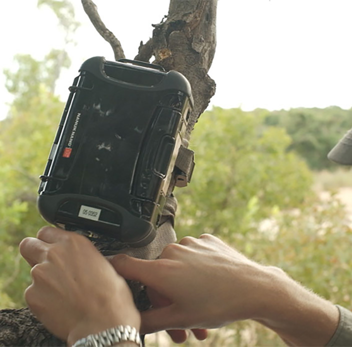
For remote conservation patrols, proprietary satellite GNSS trackers are essential, delivering reliable two way comms, SOS, and precise location in forests or mountains.
For large scale tagging (cattle, migration studies), standards-based NTN NB-IoT fits: smaller, cheaper tags sending intermittent updates, delivering months-to-years battery/solar life and scalable data for movement, breeding, and habitat models.
Soil and Water Quality Monitoring
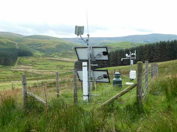
For regional farm networks and watersheds, choose by balancing coverage, power use, and data density. Proprietary satellite IoT fits isolated test sites or large estates needing guaranteed uptime and two way control.
Standards-based NTN NB-IoT enables thousands of low cost soil/moisture sensors across distributed fields, ideal for basin-wide modelling and predictive irrigation.

Glacial and Permafrost Monitoring
For polar or alpine deployments with extreme conditions and no cellular, proprietary L-band satellite IoT is the only mature option for real-time, all weather, pole to pole links.
Where coverage allows, NB-IoT NTN can send intermittent, timestamped updates – think small payloads and higher latency.
Exploring the Deployment Realities
Let’s talk coverage: How “global” are these options?
- Proprietary Satellite IoT
Iridium: Truly global, pole to pole, provided the device has a clear view of the sky. No antenna pointing required.
Viasat (Inmarsat L-band): Near-global footprint excluding the extreme polar regions; requires antenna pointing for a stable link. Best when you want economical, stable links, and have a clear line of sight to the satellite. - LoRaWAN
Coverage is inherently regional: each node talks to a nearby gateway. In open areas, practical node-to-gateway distances are roughly up to ~15–16 km (terrain and clutter can reduce this). If your monitored area is wider than that, you either give each endpoint its own satellite connection, or build a local LoRaWAN network and backhaul one or more satellite-connected gateways. - NTN (e.g. NTN NB-IoT, NTN LTE Cat-1, NTN LTE-M)
Coverage is early and patchy. Commercial availability today is concentrated in specific countries/regions with little to no ocean coverage (view current NTN coverage map from Viasat). Viasat has the most coverage, but is restricting services to areas where there is sufficient demand; thus, as more hardware / devices reach the market, and the use cases become clearer, we would anticipate coverage growing.

Reducing Silos With a Unified Data Plane
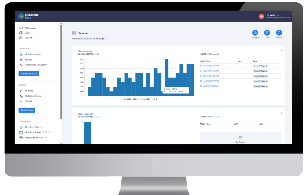
Successful deployments depend on how easily devices, platforms, and networks exchange data. The practical goal is a single pane of glass where you can see, manage, and act on data from mixed networks – proprietary satellite, NTN (as it rolls out), and, where available, cellular- without rewriting everything each time you add a site or change a bearer.
A pragmatic way to get there is an API-first platform that’s device- and network-agnostic. For example, Cloudloop is designed to ingest data from heterogeneous bearers and present it through one interface. It doesn’t make coverage universal, but it can reduce integration work and lower the risk of data silos as footprints grow.
Security: Keeping Environmental Data Trustworthy
Environmental monitoring data increasingly informs safety, regulation, and policy, so protecting its integrity matters as much as collecting it. For remote environmental monitoring, satellite IoT reduces exposure to common internet borne threats because links don’t rely on local terrestrial infrastructure or public ISPs. In practice, that means fewer attack surfaces between field sensors and your platform.
Advantages and limitations of satellite IoT security:
High Encryption Standards by Default
Professionally operated, mature satellite networks such as those operated by Iridium and Viasat encrypt data using AES-256, a symmetric block cipher algorithm recognized for its security and efficiency.
Avoids Man-in-the-Middle Attacks
Satellite networks are much harder to compromise via MitM attacks due to their direct transmission methods, reduced ISP reliance, high-altitude signal paths, and strong encryption. However, they’re not completely immune. The means by which data is routed from the ground station to the user’s application needs consideration.
There are several options here with varying degrees of security:
- VPNs / Firewalls – The most commonly deployed method for securing data being moved from a ground station is to utilize a combination of firewalls and VPNs.
- Private Wire – Private wire connections create a direct, secure link between a satellite ground station and a customer’s network, bypassing the public internet entirely. This can be achieved through dedicated leased lines or private Layer 2 circuits (such as MPLS or SD-WAN). This results in a closed, high-security data path that prevents exposure to cyber threats like DDoS attacks or data interception.
The bottom line: Satellite won’t eliminate risk, but its independence from local infrastructure, combined with private routing, encryption, segmentation, and failover, gives environmental programs a materially stronger default security posture than relying on terrestrial connectivity alone.
From Insight to Action: Key Considerations for Choosing the Right Connectivity
Understanding these findings is just the start. The next step is applying them, choosing the right technology mix to meet real world monitoring goals while staying compliant, scalable, and resilient.

“We can only afford a handful of sensors, but we need scale.”
Utilize NB-IoT/NTN NB-IoT for assured security or LoRaWAN sensor networks with satellite backhaul for affordable, dense deployments.

“We need reliable alerts for emergencies.”
Use a proven, proprietary L-band satellite IoT link e.g., Iridium SBD/IMT or Certus 100, or Viasat IoT Nano/Pro that’s stress-tested for mission critical use.

“Coverage is patchy, how do we know what will actually work in our region?”
Iridium’s proprietary services are global, LoRaWAN is regional, and NTN NB-IoT is emerging. Check coverage maps for more detailed information, or speak to a remote connectivity professional.
“Our systems don’t talk to each other.”
Utilize Cloudloop functionality with APIs for interoperability. Consume your data in a way that is right for the collaboration, including sending data securely to multiple (pre-integrated) destinations.

“We’re worried about data security and compliance.”
Choose partners that prioritize end-to-end encryption, secure APIs, and compliant cloud hosting. Ground Control’s Cloudloop platform ensures data integrity across hybrid networks while maintaining full customer control over data destinations.

“We can’t do this alone.”
With proven expertise, Ground Control is a valued technical partner, not just a provider. Helping NGOs, agencies, and companies to deploy hybrid, collaborative solutions.
Building a Smarter, More Connected Planet
The future of environmental monitoring isn’t about replacing one connectivity technology with another; it’s about building hybrid IoT networks that combine the best of each. Proprietary satellite IoT will continue to deliver life- and mission-critical reliability, providing resilient links and accurate, time stamped data from even the most remote regions. Meanwhile, standards-based NB-IoT and LoRaWAN are unlocking scalable, low-cost sensor deployments bringing environmental data collection to new levels of density and insight.
When agencies, NGOs, and research partners collaborate across these ecosystems, we can turn isolated measurements into continuous, planetary-scale intelligence.
Looking to Find Your Connectivity Partner ?
At Ground Control, we bridge today’s proven systems with tomorrow’s scalable standards, helping organizations deploy what works now while preparing for what’s next. If you’re exploring how to expand your monitoring capability, talk to our team about designing a solution that fits your goals, your environment, and your stakeholder needs.
Email hello@groundcontrol.com or complete the form, and we’ll be in touch within one working day.
New Report: The Technologies Shaping Satellite IoT in 2026
Satellite IoT is no longer a niche. According to Berg Insight’s latest Satellite IoT Communications Market report, the global subscriber base surpassed 5.8 million connections in 2024 and is forecast to reach 32.5 million by 2029 – a compound annual growth rate of more than 41%. Revenues are expected to grow in parallel, from €334 million in 2024 to nearly €1.6 billion in 2029, even as the average monthly ARPU drops to €4.05.
That growth is being driven by demand from industries operating far beyond terrestrial coverage, agriculture, maritime, energy, construction, transportation, and government among them. With only about 10% of the Earth’s surface covered by terrestrial connectivity, satellite IoT is filling the gap and unlocking new applications at scale.
Against this backdrop of rapid expansion, Ground Control set out to understand which emerging forces satellite IoT users themselves believe will most shape their industries in the next 2-3 years. We surveyed 211 professionals across Defense, Utilities, Telecommunications, Maritime, Environmental Monitoring, Engineering, and more, asking them a simple but important question:
“Which emerging trends do you think will shape your industry the most over the next 2–3 years?”
The results reveal five powerful forces – some already in motion, others still emerging – that will define the next phase of satellite IoT. You can download the full Ground Control 2026 Satellite IoT Outlook eBook for the complete analysis, but here’s a snapshot of what we found.
Read 2026 Trends Report
Key Insights from the Report
1. Security and Resilience
45% of respondents highlighted security and resilience as their top concern. With GPS jamming and spoofing incidents rising in both aviation and maritime sectors, resilience is no longer optional. It extends beyond navigation to cover networks, supply chains, and architectures that underpin critical operations.
Governments are responding too. In the UK, for example, new investments in resilient space-based services highlight how security is being treated as both an economic and national security priority.
The takeaway? Security is moving from being a specialist consideration to a mainstream business imperative for anyone using satellite IoT.
2. Next Generation Proprietary Services
45% of users anticipate next generation proprietary services like Iridium Messaging Transport (IMT) and Viasat IoT Nano (OGx) will influence their work. Unlike older SBD or IDP services, these platforms allow for larger, more cost efficient messages, enabling richer telemetry and new use cases.
And while some might assume that the rise of standards-based NTN IoT could threaten these established proprietary services, Iridium itself takes a different view. Speaking earlier this year, Iridium’s SVP of Product Management, Greg Aziz, explained that the company’s IoT business is highly diversified and that established services will continue to have a long life:
“People think it’s just IoT, but we’re going to use that protocol to operate on consumer devices as well … We’re very diversified and we don’t see these [established] businesses shrinking or going anywhere over the next several years.”
In other words, Iridium views NTN NB-IoT as an incremental growth opportunity – a slice of its broader strategy, not a disruptive threat to its existing services. For IoT users, this means confidence that current proprietary services remain stable and reliable, while also being enhanced by new capabilities.
3. New Mega Constellations
39% of respondents flagged mega constellations, including Starlink and Kuiper, as a potential influence. These networks are being built first and foremost to extend mobile and broadband coverage, not to serve ultra-low power IoT sensors.
Take Starlink’s Direct-to-Cell (D2C) initiative: the system enables text, calling, and browsing via satellite directly to standard LTE phones, effectively acting like a space-based cell tower. Early rollout focuses on texting and basic location features, with voice and data functionality being rolled out later. The target use cases are consumer – cars, smartphones, rural coverage – rather than custom IoT deployments.
That context matters. While mega constellations carry potential, their current architecture, marketing, and immediate value align more closely with consumer connectivity than the needs of industrial IoT. For IoT users, this reinforces the importance of designing around specialized satellite services built for sensor data, rather than expecting these consumer networks to fill all roles down the line.
4. Standards-Based Satellite IoT (D2D)
Just over a third of respondents (35%) see standards-based Direct to Device (D2D) as an emerging influence. By using cellular protocols such as NB-IoT and LTE in non-terrestrial networks (NTN), devices can connect to satellites with a single SIM and existing cellular standards.
Pipeline highlights how this model could simplify deployments and cut costs for large scale, latency tolerant applications. Still, this isn’t a universal fit. Data constraints, message frequency limits, and current gaps in global coverage mean NTN NB-IoT is best for price sensitive, scale driven use cases, not for critical real time monitoring.
5. AI and the Value of IoT Data
AI was the least selected force in our survey (24%), but that doesn’t undermine its relevance. As IoT Business News reported, billions in AI investment could be undermined if organizations can’t ensure reliable IoT connectivity.
AI adoption is accelerating, and Asia leads the way: 56% of respondents in the region expect it to reshape their operations, compared to just 20% in Europe and 21% in North America.
The lesson? AI will increasingly separate leaders from laggards, but success will depend on the quality, accuracy, and architecture of IoT data; not AI in isolation.
If your organization relies on satellite IoT for critical operations, the choices you make over the next 2-3 years will shape your resilience, efficiency, and competitiveness. The landscape is evolving quickly, from the rise of next generation proprietary services to the promises of standards-based NTN, alongside the growing importance of security, AI, and mega constellations.
Our comprehensive report provides the insights and strategies you need to:
- Understand the top priorities of IoT users worldwide, including why security and resilience now top the agenda.
- Evaluate emerging technologies like NTN NB-IoT and AI, and see where they fit (and where they don’t) in critical operations.
- See how adoption differs by region and industry, and benchmark your own strategy against your peers.
- Gain clarity on mega constellations; what they mean for consumers today, and why IoT users should focus on stability and reliability.
Download the full report now to discover how satellite IoT is changing, and how your organization can stay secure, resilient, and ready for the future.
Read Report
Can we help?
If you’d like tailored advice on strengthening your remote IoT infrastructure and architecture, we’re here to help.
Our team at Ground Control works with organizations across defense, utilities, maritime, and more to design secure, resilient, and future-ready connectivity strategies.
Get in touch to discuss your IoT challenges and opportunities; either complete the form or email hello@groundcontrol.com and we’ll respond within one working day.
How Satellite IoT Keeps Pipeline Infrastructure Safe in Remote Environments
Pipelines stretch thousands of miles, transporting oil, gas, water, and chemicals across diverse terrains, including mountainous areas, deserts, and offshore waters. They are essential infrastructure, but monitoring such vast and inaccessible pipeline networks presents a unique challenge and when leaks or failures go undetected, the consequences can be severe to both the pipeline operators and the environment.
Satellite-enabled IoT is an increasingly viable solution. By linking sensors directly to a global network of satellites, operators can achieve 24/7 data monitoring with zero dependance on terrestrial networks. With satellite IoT, pipeline operators can continuously monitor pipeline health, detect anomalies in real time, predict maintenance needs, and even act remotely to prevent minor issues from becoming costly disasters. Pipelines will always cross remote places, but with satellite IoT, those places no longer have to be blind spots.
Here’s why pipeline health monitoring is critical, and how selecting the right satellite IoT network and device – from low power sensors to real time control systems – can help operators protect remote infrastructure and prevent costly failures.
Why Remote Pipelines Need Satellite IoT
Traditional pipeline monitoring methods rely heavily on cellular networks or fixed wired systems. Both approaches work well where infrastructure is dense and coverage is consistent, but pipelines rarely follow such convenient paths. They cross deserts, mountain ranges, wetlands, and offshore environments where terrestrial coverage is patchy at best and, in many cases, does not exist at all. Wired systems, meanwhile, are expensive to install and maintain over long distances, particularly where terrain is unstable or hostile.
Coverage gaps create serious risks, as even a small leak in an isolated section of pipeline can go undetected for days, releasing oil, gas, or chemicals into the surrounding environment. In many cases, this not only carries the cost of remediation but also heavy regulatory penalties and reputational damage. Even when problems are eventually identified, the time lost between the first failure and the response often magnifies the scale of the incident.
Unplanned downtime is another consequence of limited pipeline monitoring. When equipment fails without warning, operators are forced to take entire sections of pipeline offline while they diagnose and repair the issue. This is disruptive and costly, especially in industries where margins depend on continuous flow. Coverage gaps also limit the effectiveness of predictive maintenance, forcing operators to rely on scheduled inspections or reactive repairs that drive up costs and increase vulnerability.
Further, there are safety implications. When a fault occurs in a remote environment, personnel are dispatched into difficult and sometimes hazardous conditions with limited information about what awaits them. This not only puts people at risk, but it also slows the time to resolution. Ultimately, terrestrial connectivity is not sufficient to monitor, manage, and ensure pipeline and personnel health in the mostremote areas.

The Cost of Connectivity Gaps in Pipeline Monitoring
In March 2006, more than 200,000 gallons of crude oil spilled onto the Alaskan tundra from BP’s Prudhoe Bay pipeline; the largest oil spill ever recorded on the North Slope at the time. Investigators traced the leak to a ¼-inch hole caused by internal corrosion in a section of pipeline that had not been inspected for years. With limited monitoring in this remote environment, the corrosion went undetected until it caused a catastrophic failure. The consequences were immediate: U.S. domestic oil production dropped by nearly eight percent, cleanup costs ran into the hundreds of millions, and regulators imposed heavy fines.
A similar pattern has played out elsewhere. In 2017, a crude oil pipeline in India ruptured along a hidden seam defect despite having undergone periodic inline inspections. Without continuous monitoring, the defect went unnoticed between inspection intervals, ultimately leading to a major spill and disruption to local communities and infrastructure.
These cases illustrate how gaps in visibility – whether caused by lack of network coverage or the limits of periodic inspections – can turn slow-building problems into headline-grabbing disasters. In remote areas where traditional cellular or wired networks simply don’t reach, operators are left to rely on sporadic checks, leaving too much room for failure.
How Satellite IoT Bridges The Connectivity Gap
Satellite IoT bridges the connectivity gap in pipeline monitoring, eliminates blind spots, and addresses pipeline vulnerabilities. Here’s how:
1. Detecting Anomalies Before They Escalate
The earliest signs of issues within a pipeline can be subtle – a slight pressure drop, a shift in temperature, or a vibration outside normal range can all indicate the beginning of a leak, corrosion, or interference. Continuous sensing makes these small deviations visible, but visibility is only useful if the data can reach operators without delay.
In regions with reliable terrestrial networks, that flow of data is relatively straightforward. In remote terrain, a sensor may detect a problem, but without connectivity, the information stays in the field. By the time operators and inspectors reach the pipeline, days may have passed and a minor leak may have spread into soil, waterways, or communities. The result is a much larger clean-up, higher costs, and often regulatory scrutiny. This is where satellite IoT changes the equation. Data from remote sensors is transmitted securely from any location on Earth with a clear view of the sky. Operators have complete visibility in near real time and can act on the first sign of irregularity.
2. Predictive Maintenance with Data Intelligence
Pipelines and their supporting equipment degrade gradually over time; bearings loosen, pumps vibrate, and valves begin to stick. If these changes go undetected, the first sign of trouble may be a breakdown, forcing operators to react after the fact by dispatching crews to remote locations at short notice and losing valuable supply time. Research shows that failures in critical components like bearings and pumps are among the leading causes of unplanned downtime in industrial systems, particularly when early warning data are scarce.
In areas without reliable connectivity, operators often rely on fixed inspection schedules, replacing components whether they need it or not, or worse, leaving them in place too long, which raises the risk of failure. This approach means maintenance decisions are based on limited information rather than real time insights into the pipeline’s actual condition, a problem well documented in studies of condition-based maintenance and industrial IoT. As a result, organizations remain stuck in a reactive cycle, facing higher costs and greater operational vulnerability.
Satellite-enabled predictive maintenance works differently. By streaming live sensor data into analytical systems, operators can recognize patterns that signal when a component is beginning to deteriorate. A pump running hotter than usual, or a valve that opens more slowly than before, triggers an automated early warning. Pipeline maintenance teams can then be dispatched to service the specific section of pipeline that needs maintenance, at the right time, rather than covering hundreds of miles in search of faults that may or may not exist.
Satellite IoT makes this approach viable even in the most remote environments. Reliable, global satellite coverage ensures that predictive platforms always receive the data they require, so operators are no longer forced to choose between over-servicing their pipelines and risking unexpected failure. They can maintain only what requires intervention, extend the lifespan of their assets, and minimise downtime. This leads to safer operations, more cost-effective maintenance, and fewer unexpected failures.

3. Monitoring and Control from Afar
Detecting issues in pipeline health is only half the battle. As most pipelines stretch across some of the most inaccessible terrain on earth and beyond cellular reach, operators are forced to rely on field teams reaching the site before remedial action can take place, and that delay can be costly. A leak may continue unchecked for hours or days and valuable time can be lost while crews travel long distances with limited information about any issues.
Satellite IoT enables remote actuation, allowing pipeline operators to send commands instantly to equipment in the field, closing valves, adjusting pumps, or isolating sections of pipe as soon as a problem is detected. A pressure sensor signalling a sudden drop can trigger an immediate response from the control room, instead of waiting for a maintenance team to drive or fly to a remote location. The technology not only directly reduces the scale of spills but also shortens downtime and improves safety for field personnel. Pipeline engineers are no longer dispatched into hazardous conditions to perform urgent manual interventions and instead, they can attend the site to carry out targeted repairs under safer, more controlled circumstances.
Without satellite-enabled actuation, pipeline operators remain vulnerable to longer response times and escalating incidents in remote regions. With it, they gain the ability to contain risks immediately, keeping both pipeline infrastructure and the surrounding environment safer.
Choosing the Right Satellite IoT Solution
Every pipeline is different. The right connectivity depends on how much data you need to transmit, how often you need to send it, and how critical it is to have immediate, two way communication. Here’s a quick guide to help you decide where to start.
For Low Data Volumes and Periodic Updates: NTN NB-IoT
If your sensors only need to send small packets of data, and the problem won’t escalate if readings are sent a few times per day (e.g., 8-12 transmissions), NTN NB-IoT is a cost-effective option.
Best for environmental monitoring, slow changing metrics like temperature, pressure, or flow trends, and non-critical maintenance data.
It’s important to remember that this is emerging technology, and coverage is still expanding, so availability varies by region. Further, because the service is currently delivered by Viasat, whose satellites are in Geostationary orbit, sensors need direct line of sight to the satellite, which can be a challenge in heavily forested or mountainous terrain.
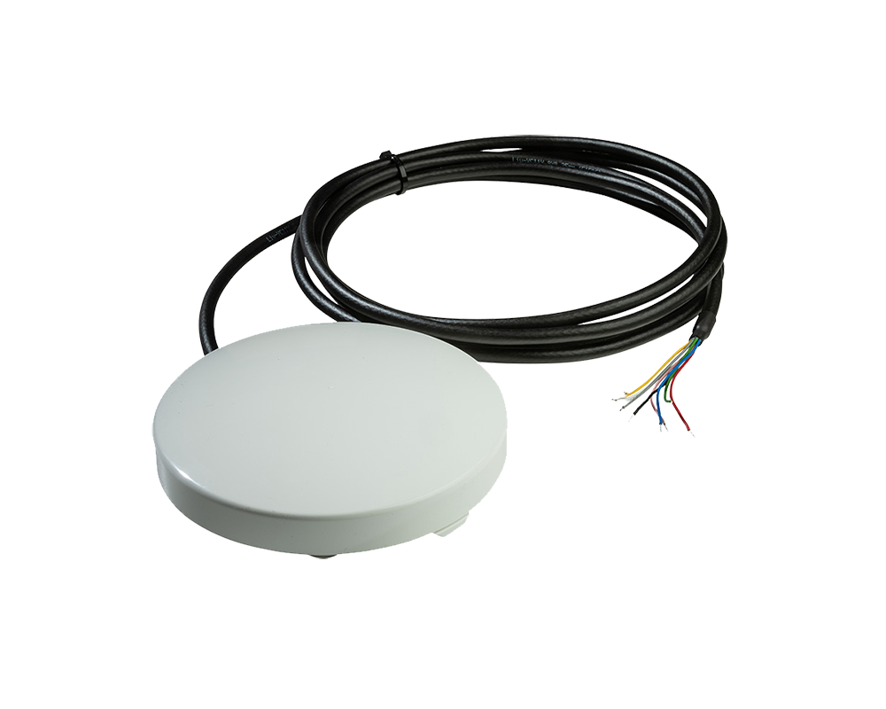
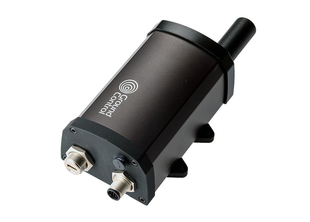
Our recommendation is RockBLOCK RTU; designed for ultra-low power consumption and long term field deployments, making it an ideal choice for pipelines using NTN NB-IoT connectivity. It’s a flexible device that can also operate on cellular where available, and can be shipped with Iridium Short Burst Data (SBD) as an alternative satellite network, if your pipeline is not within the coverage area of the NTN NB-IoT service.
For Higher Data Volumes or More Frequent Reporting: Iridium Messaging Transport (IMT)
When your pipeline monitoring requires more frequent updates or larger data volumes, Iridium Messaging Transport (IMT) is the better fit. Its truly global coverage ensures connectivity even in the most remote environments, while its sub-10-second round-trip time makes it suitable for near real-time applications.
This is ideal for continuous health monitoring of pumps, valves, and sensors, early warning systems where immediate alerts are crucial, and remote assets that are inaccessible for long periods.
IMT supports more frequent transmissions than NTN NB-IoT and can handle a higher data load, making it ideal for situations where small, periodic updates simply aren’t enough.
Our device recommendations would be RockBLOCK Pro or RockBLOCK Plus 9704 – rugged, field-ready devices built to withstand extreme conditions and provide reliable, low power operation for continuous monitoring.
For Real Time Monitoring and Remote Control: IP-Based Solutions
For mission-critical sites where you need to both monitor and act instantly, an IP-based solution is essential. These systems enable real time, two way communication, so operators can remotely command equipment, such as closing valves or isolating sections of pipe the moment a fault is detected.
Best for critical infrastructure nodes, emergency response situations, and high value assets where downtime costs are severe.
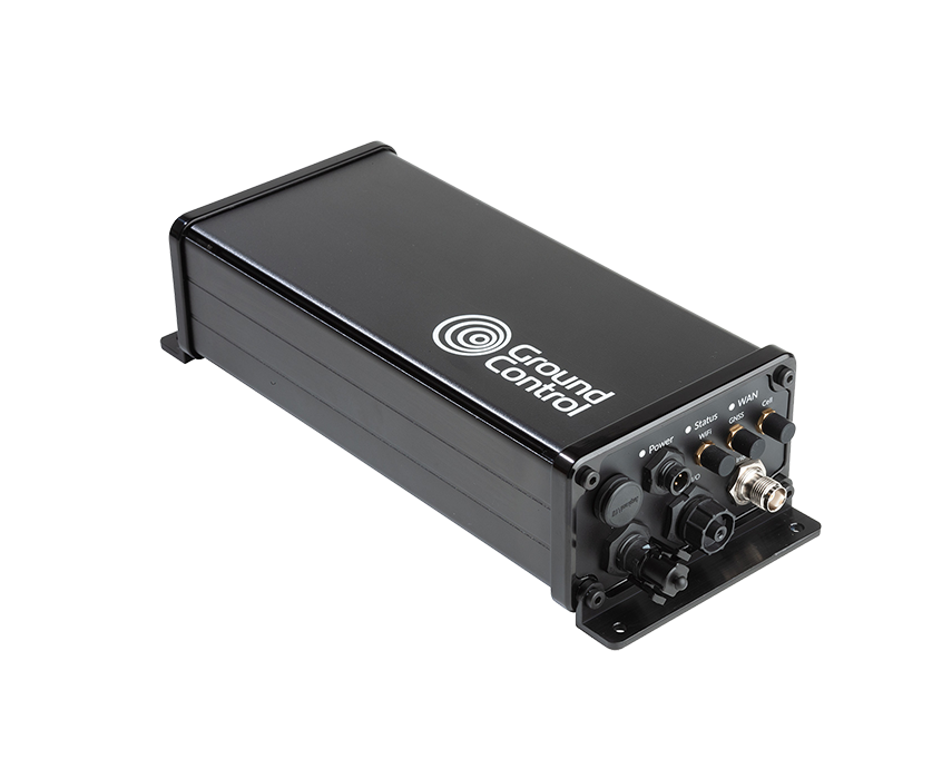
Powered by Iridium Certus 100, these solutions deliver global coverage with very low latency, enabling near-instant response. Choose RockREMOTE Mini for a rugged tough, IP-based device which is optimized for low power draw, or RockREMOTE Rugged to take advantage of its sophisticated edge processing capabilities, and MQTT / FTP facades.
Satellite IoT gives pipeline operators the tools to see, predict, and act, even in the most remote environments. By matching the right technology to each monitoring challenge, operators can prevent minor issues from becoming disasters, safeguard their teams, and protect the environment. With the right strategy, every mile of pipeline can be monitored and managed with confidence, no matter how far it stretches.
Can we help?
Partner with us to implement satellite IoT technology that safeguards your critical infrastructure and pipeline operations.
Complete the form or email us at hello@groundcontrol.com and we’ll get back to you within one working day.
No Signal, No Problem: Enabling BVLOS Drone Operations Anywhere on Earth
Drones are no longer futuristic novelties. They’re already saving lives, cutting emissions, and driving efficiency across industries as diverse as healthcare, energy, and infrastructure.
The ability to fly Beyond Visual Line of Sight (BVLOS) is critical to unlocking these benefits at scale. Without BVLOS, most missions are limited to the operator’s direct line of sight, constraining both range and impact. With BVLOS, drones can cross oceans, inspect thousands of miles of pipeline, and deliver life saving supplies to remote communities.
But for BVLOS to be safe and effective, drones must maintain reliable, unbroken connectivity. And that’s where the challenge begins.
The Comms Reality Check
However, relying solely on terrestrial networks for drone connectivity can be a risky proposition, especially for BVLOS missions.
1. Vulnerability to inference and jamming
In contested or hostile environments, terrestrial links are vulnerable to deliberate interference or jamming. For example, during the conflict in Ukraine, both commercial LTE and unlicensed radio links have been targeted and disrupted, grounding entire fleets of drones and illustrating how fragile these systems can be when faced with intentional electronic warfare. Even in peacetime, terrestrial systems are not immune to accidental interference; for instance, at large sporting events or urban centers where multiple devices compete for spectrum, drones can lose connection at critical moments.
2. Coverage gaps in rural and offshore areas
Coverage is another major challenge. LTE and 5G networks work well in cities, but in rural or offshore areas, coverage gaps are common. This creates real problems for industries like pipeline inspection or offshore wind maintenance, where drones must operate hundreds of kilometers from the nearest tower.
3. Network failures during disasters
Even where coverage exists, networks can fail under stress: in natural disasters such as hurricanes or wildfires, cellular towers are often damaged or overloaded. For instance, during Hurricane Ian (2022), parts of Florida experienced complete cellular blackouts, leaving first responders unable to rely on mobile networks.
4. Technical limitations
Long missions also introduce technical issues like handover failures when a drone crosses between towers – a known problem for high speed UAVs flying over mixed terrain. Finally, legacy aviation bands like VHF are limited to strict Line of Sight, making them unsuitable for missions that span mountains, forests, or the open ocean.
The bottom line is that the only truly global, always-on network is in space. For many BVLOS missions, satellite connectivity is the primary link for safe command and control (C2). In other cases, it’s a failover that ensures uninterrupted operations if the primary terrestrial link drops or fails.
Choosing the Right Connectivity
The table below outlines the strengths and weaknesses of the most common BVLOS connectivity options.
| Direct RF (LoS) | Cellular (4G/5G) | LEO Satellite (e.g., Iridium) | Mesh / Relay Networks | Hybrid (e.g., LTE + Satcom) | |
|---|---|---|---|---|---|
| Range | Low-Mid (20–30 km) | High – wherever towers exist | Global (with constellation coverage) | Variable – range extends hop by hop | Global with redundancy |
| Coverage | Limited – range depends on altitude and obstructions | Urban/suburban areas, gaps in rural/remote regions | Requires clear view of the sky – partial blockage from terrain, buildings, or canopy can cause dropouts | Customizable – requires supporting nodes or relay drones | Global – seamless failover between links |
| Cost | Low | Moderate | High | Medium-High | High |
| Ideal Use Case | Close range inspections, small scale BVLOS in open terrain | Urban delivery, public safety, mapping | Remote BVLOS missions needing high bandwidth: offshore energy, maritime inspections, remote mining | Disaster response, temporary missions in areas with no infrastructure | Safety-critical commercial BVLOS, mixed terrain missions |
LEO vs GEO: Understanding the Differences
Satellites are positioned in either Low Earth Orbit (LEO), Medium Earth Orbit (MEO), or Geostationary orbit (GEO). Our blog post on Satellite Orbit Heights provides a more detailed explanation, but to summarise, the closer the satellite network is to Earth, the lower the latency – the time it takes for data to travel from the drone, to the orbiting satellite, and down to the ground station (from where it’s routed to the drone operator’s system). Latency is a key attribute for UAV operators looking for as close to real-time command and control as possible, so it’s worth reviewing LEO satellite networks such as Iridium, Starlink or OneWeb.
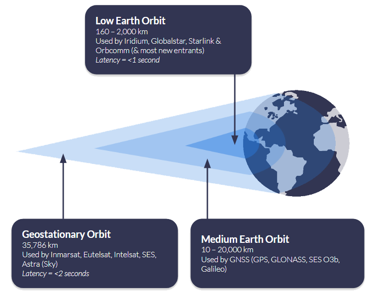
Another consideration is where your drone will be operating. If you are connecting to a satellite in Geostationary orbit, such as Viasat, the satellite remains in the same location overhead, and you need “line of sight” to that satellite. This works very well in wide open spaces, but if the signal could be blocked by infrastructure or mountains, for example, it’s not the best choice. Satellites in Low Earth Orbit need a “clear view of the sky”, but because the satellites are in motion overhead, rather than in a fixed point, it’s less rigid than GEO services. Read more about what’s meant by a clear view of the sky.
Also, consider the practicalities of hardware and power consumption when choosing between LEO and GEO networks. Terminals designed for LEO services are often smaller and lighter, making them well suited to drones where every gram matters and battery life is at a premium. Because these satellites are closer to Earth, they can typically operate at lower power levels, which helps maximize flight endurance. GEO terminals, while still compact, may draw more power and require slightly larger antennas to maintain a continuous connection with a single, fixed satellite.
Ultimately, the decision isn’t just about latency or coverage. It’s about balancing responsiveness, operating environment, and hardware constraints to select the right orbit for the mission. Whether it’s low-latency LEO for real-time control or the stable, wide-area coverage of GEO for long-range operations, matching the satellite architecture to the needs of the drone is key to safe and reliable BVLOS flight anywhere on Earth.
Hybrid Strategies: Best of Both Worlds
Whether you choose LEO for responsiveness or GEO for stability, no single connectivity method can cover every scenario perfectly. The most resilient BVLOS operations don’t rely on a single link at all; instead, they use a hybrid strategy, combining multiple communications paths to ensure that control of the aircraft is never lost, no matter what happens in the sky or on the ground.
A hybrid approach integrates multiple communication technologies, each serving a different role. This isn’t simply about adding a backup link; it’s about creating a system where the aircraft actively prioritizes and switches between links in real time, based on performance and availability.
At present, most commercial operators treat satellite as a failover link. Cellular and RF systems are used as the primary connection because they are cost effective and can handle large data streams such as live HD video or high-resolution sensor data. Satellite is kept in reserve as the safety net – the “final line of defense,” as Skylift UAV describes their use of the RockBLOCK 9603.
In their words, the satellite module provides the confidence to continue operating safely in the unlikely event of a complete communications blackout. This model works well for urban and suburban missions where cellular coverage is strong, or for flights where Line of Sight RF can be maintained most of the time.
However, as BVLOS missions grow in range and complexity, this dynamic is beginning to shift. In rural or offshore environments, cellular coverage is unreliable or entirely absent, and Line of Sight radios quickly become impractical. In these contexts, satellite is increasingly moving from failover to primary link, especially for critical command and control traffic. For example, during recent flight tests, pilots reported that LTE video streams were prone to frequent dropouts at altitude, but satellite remained reliably stable throughout.

A hybrid approach requires intelligent link management. The drone must be able to segment traffic by type and seamlessly prioritize the best available link without pilot intervention. For example, during an offshore mission, a drone may begin by streaming video over LTE while using satellite for command and control in the background. As it moves further out to sea and loses cellular coverage, the satellite connection continues uninterrupted, ensuring no loss of control. Later, if the drone comes back into range, LTE automatically resumes for payload data, but satellite remains quietly handling the critical link in the background. From the operator’s perspective, these transitions should be invisible, with the system maintaining continuous awareness and control throughout.
Many regulatory frameworks now encourage or require operators to demonstrate redundancy, often by using two independent communications paths so that a single failure cannot compromise control of the aircraft. This level of resilience is essential for operations such as pipeline patrols, offshore deliveries, or disaster response, where losing connectivity could have serious safety, regulatory, or financial consequences.
With a hybrid strategy in place, the next step is to match the satellite service to the mission profile.
Matching Satellite Services to Missions
Before you pick a hardware or service, think about your data rates, power and weight constraints, and how critical your command and position links are. The table below shows two tiers of mission profiles, one for simple commands such as go to the nearest rally point, go home, or terminate the flight, and another for full BVLOS operations, with the attributes you should aim for in each.
Simple Commands (Light Missions)
- Lightweight telemetry and commands only
- Ultra low power draw, so maximal flight time
- Small hardware footprint, minimal antenna gain
- Reliable even in remote environments, rough terrain, trees, or sparse coverage
Full BVLOS Operations
- Continuous, reliable command and control link
- Command response delays kept under ~700 ms
- Position updates as frequent as 1 second
- Enables safe separation from other aircraft and scalable BVLOS flights across mixed terrain and range
Ground Control’s RockBLOCK devices are optimized for simple commands, where size, power, and reliability under constrained conditions are the top priorities. Meanwhile, our Iridium Certus 100-based offerings (e.g. RockREMOTE UAV OEM) are built for BVLOS missions that need higher throughput, frequent updates, and strong command responsiveness. Adjusting your satellite choice to the mission kind avoids over-engineering, keeps costs manageable, and ensures safety without carrying unnecessary weight or power burden.
The following devices all leverage the Iridium satellite network, chosen because it is in Low Earth Orbit, so has very low latency, and truly global coverage. It has been tried and tested over years of operation, and is extremely reliable and resilient.
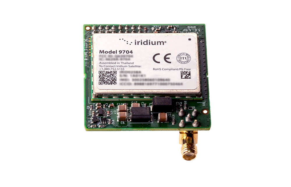
RockBLOCK 9704
RockBLOCK 9704 supports larger message payloads, giving operators more flexibility for richer telemetry and mission data.
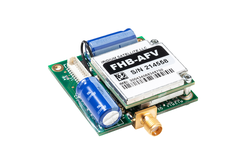
RockBLOCK 9603
RockBLOCK 9603 provides lightweight, low power satellite messaging for essential UAV tracking, telemetry and alerts.
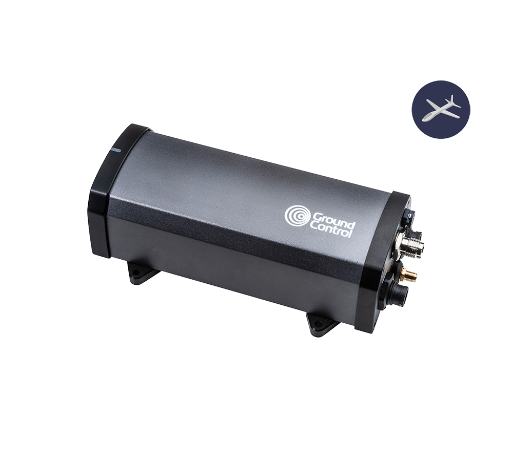
RockREMOTE UAV
RockREMOTE UAV delivers low power IP connectivity for UAV applications that need an always available satellite data link.

RockREMOTE UAV OEM
RockREMOTE UAV OEM brings the same IP connectivity into a compact embedded form for integration within the aircraft or payload system.
BVLOS drones are already proving their value across industries. In the UK, drones are delivering chemotherapy drugs to the Isle of Wight eight times faster than traditional transport, while in the offshore energy sector, companies like Skyports are replacing helicopter supply runs with drones, cutting emissions and reducing downtime. In the USA, long range drone patrols are helping to monitor thousands of miles of remote pipelines, and in the North Sea, offshore wind farms are being inspected in real time without costly, carbon intensive vessel missions.
Key Takeaways
When planning BVLOS operations, the priority should always be maintaining a reliable command and control link. Satellite connectivity is uniquely suited to this role because it offers consistent, global coverage that isn’t dependent on local infrastructure. Terrestrial networks such as LTE or RF can still play an important role, but they are best used for non-critical data like video streaming or payload telemetry rather than the core C2 function.
A hybrid approach delivers the best of both worlds. By combining satellite and terrestrial links intelligently, operators can use satellite for stable, predictable command and control while taking advantage of LTE or other networks for higher bandwidth data when coverage is available. This balance provides flexibility while keeping safety at the forefront.
Operational resilience comes from planning for failure. BVLOS systems should be designed with multiple communications paths and the ability to switch between them instantly, ensuring that connectivity is never lost if one link goes down. Continuous monitoring and rapid failover processes are essential to meeting safety and regulatory expectations as drone fleets grow in scale.
Finally, data management must not be overlooked. Tracking airtime, managing costs, and ensuring telemetry data is actionable are all key to running efficient, scalable operations. By keeping a close eye on data use and system performance, operators can make informed decisions that improve reliability and maximize return on investment.
Take Your BVLOS Operations Further
BVLOS connectivity doesn’t have to be a limiting factor. With the right mix of satellite and terrestrial links, your drones can stay connected and operational anywhere on Earth; from dense urban environments to the most remote locations.
Whether you need lightweight hardware for simple commands or a fully scalable solution for complex BVLOS missions, our team can help you design a system that’s safe, reliable, and ready to grow with your operations.
Email hello@groundcontrol.com or complete the form, and we’ll be in touch within one working day.
Your Top Questions About NTN NB-IoT, Answered
On September 4, 2025, we co-hosted a webinar on NTN NB-IoT Uncovered: What It Is, What It Isn’t, and Where It Wins with Viasat. This is emerging technology with a great deal of promise, and we had a large audience, with an accordingly large number of questions! We’ve collated these questions into several topics in this blog post, which we will keep updated as the roadmap progresses.
Quick Links:
- What is the expected cost of hardware (e.g., modem, antenna)?
- What will ongoing connectivity cost, for example at 50 KB per month or one transmission per hour?
- How does NTN NB-IoT communication cost compare to terrestrial NB-IoT and proprietary satellite solutions?
- Does the device include a subscription, and are any licenses required to use the service?
- What are the expected power requirements for receiving and sending messages?
- Will latency in satellite NB-IoT significantly impact battery performance?
- What counts as “small data volumes,” and how is data usage calculated (uplink vs downlink)?
- Is TCP/IP supported, or is NB-IoT limited to other protocols like UDP or NIDD?
- Are message acknowledgements supported, and do they consume billable data?
- What countries and regions are currently covered, and what are the rollout plans?
- Will the service work at sea or in harsh environmental conditions (e.g., offshore, deserts, extreme temperatures)?
- What are the main technical differences between NTN NB-IoT and cellular NB-IoT?
- How does NTN NB-IoT compare to proprietary satellite services like Iridium SBD?
- What frequencies are used, and how do they integrate with mobile networks?
- How does network selection work when both terrestrial and satellite networks are available?
- Is NIDD part of the 3GPP standard and supported by the network?
- Can we manage NTN NB-IoT devices and integrate using existing patterns in Cloudloop?
- What applications are best suited to NTN NB-IoT?
- How suitable is NTN NB-IoT for UAVs, HAPs, or other mobile applications?
- How does NTN NB-IoT compare to Starlink Direct to Cell?
- Could it replace or compete with services like Iridium or Starlink in the future?
- How well does it perform in environments with heavy metal or interference, such as steel plants?
- Does the service require direct line-of-sight, and how does it perform under partial obstruction (e.g., forest canopy)?
- Are the satellites GEO, LEO, or a mix?
Pricing and Licensing
What is the expected cost of hardware (e.g., modem, antenna)?
Hardware pricing varies widely depending on the capabilities your project requires. Some modules are designed purely as basic modems to connect to NTN NB-IoT networks and are relatively inexpensive, but they only provide connectivity.
Products like RockBLOCK RTU are far more than just a connection point. In addition to NTN NB-IoT access, they include:
- Edge processing to handle data locally and reduce transmission frequency (saving airtime and battery life).
- Configurable sensor reading and alerting, so you can trigger transmissions only when thresholds are met.
- A plug-and-play design, enabling faster deployment and simpler integration with cloud platforms like Cloudloop.
Because of this added functionality, RockBLOCK RTU and similar devices sit at a different price point than a simple dongle, but they often reduce overall project costs by lowering airtime usage, extending battery life, and minimizing field maintenance.
In short, the “right” hardware investment depends on whether you need just connectivity or a complete field-ready solution that simplifies operations and scales with your project.
What will ongoing connectivity cost, for example at 50 KB per month or one transmission per hour?
Viasat has not yet published official NTN NB-IoT pricing, but early indications suggest it will be competitive for the specific niche of very small, infrequent data transmissions. Final rates are expected to be announced in Q1 2026.
Because of the complexity and scale of satellite infrastructure, NTN NB-IoT data will not follow the same pricing model as terrestrial NB-IoT. In practical terms, this means far less data for a higher cost, making it best suited to scenarios where devices send tiny payloads, such as tens of bytes per hour, rather than continuous data streams.
When compared to proprietary satellite services, NTN NB-IoT can be more cost effective for ultra-low data volumes (typically below 30-50 KB per month per device). This makes it a strong choice for applications like remote sensors, infrequent tracking, and metering.
Around 50 KB per month, message-based services like Iridium Messaging Transport (IMT) and NTN NB-IoT become roughly equivalent in cost.
Above 50 KB per month, proprietary services like IMT quickly become far more economical, especially for higher data throughput or near-real time applications.
In summary, NTN NB-IoT fills a valuable gap for low data, low power use cases, but it is not simply a continuation of cellular NB-IoT pricing in space. For higher data needs, traditional satellite services remain the better fit.
How does NTN NB-IoT communication cost compare to terrestrial NB-IoT and proprietary satellite solutions?
Satellite NB-IoT is designed for very small, infrequent data transmissions, such as a few tens of bytes per hour or day. Because of the complexity of delivering data over satellites, the cost per kilobyte is much higher than for terrestrial NB-IoT, which benefits from existing cellular infrastructure and is inexpensive for high volume, high frequency data.
For ultra-low data applications, Satellite NB-IoT promises to be more affordable than traditional proprietary satellite services, which are built for higher throughput, always-on connections. However, as data usage rises beyond roughly a few dozen kilobytes per month per device, the cost of satellite NB-IoT can quickly become more expensive, making other satellite solutions like Iridium Messaging Transport, or Viasat IoT Nano, more economical.
In short:
- Terrestrial NB-IoT is the lowest cost option, but only works where there is cellular coverage.
- Satellite NB-IoT fills the gap where coverage is missing, offering lower costs than legacy satellite services for small, infrequent messages.
- Proprietary satellite solutions remain the best fit for higher data volumes, real time control, or truly global coverage.
Does the device include a subscription, and are any licenses required to use the service?
NTN NB-IoT works much like cellular IoT. Devices use a SIM card to authenticate on the network, and subscriptions are managed separately. These can be as short as one active month or discounted for 12 months or longer, depending on your needs.
No additional licenses are required as long as you are using a certified device. If you’re building your own hardware, it must first go through Viasat’s certification process before it can connect to the network.
Power Consumption
What are the expected power requirements for receiving and sending messages?
Final power profiles are still being confirmed, but early testing of devices shows very low power consumption, similar to cellular NB-IoT at the edge of coverage. Typical behavior is short, high-power bursts during transmission, with the device in deep sleep the rest of the time.
- Transmit (TX): Brief bursts at a few hundred milliamps for fractions of a second per message.
- Receive (RX): Much lower current for very short listening periods.
- Deep Sleep: Extremely low standby current between events.
For ultra-low data use cases – such as one small (50-byte) message per day – battery life can be measured in years. Even at one message per hour, multi-year operation is still realistic with careful design, especially when payloads remain small, retries are minimized, and devices have a clear view of the sky.
Tip: Use short, infrequent messages and Non-IP Data Delivery (NIDD) where possible to maximize battery life.
Will latency in satellite NB-IoT significantly impact battery performance?
Not directly. Latency in satellite NB-IoT (typically tens of seconds) affects how long a device stays “awake” waiting for confirmation or downlink data, but it doesn’t require the radio to transmit continuously. Most of the time, the device is idle and consuming minimal power.
Where battery performance can be affected is in retry scenarios. If poor antenna placement or obstructions cause repeated failed attempts, the radio will need to re-send messages, increasing total energy used. This is why clear line of sight and well planned message scheduling are key.
For applications sending small, infrequent messages, latency has little impact on battery life, and multi-year operation remains realistic, even when end-to-end message delivery takes longer.
Data & Protocols
What counts as “small data volumes,” and how is data usage calculated (uplink vs downlink)?
For NTN NB-IoT, small data volumes generally mean 30-50 KB per month per device. This roughly equates to one small message (around 50 bytes) every hour, making it ideal for applications like periodic sensor readings or exception-based reporting.
Data usage is calculated as the total of both uplink and downlink traffic, combined.
- Uplink: Data sent from the device, such as sensor readings or alerts.
- Downlink: Data sent to the device, such as configuration updates or acknowledgements.
In most deployments, uplink traffic dominates, with only small amounts of downlink data needed. However, frequent acknowledgements or commands sent to the device will eat into the monthly budget, so it’s best to minimize downlink usage wherever possible.
Rule of thumb: If your device sends a 50-byte message hourly, you’ll be close to the 30-50 KB/month sweet spot, but adding regular downlink messages or retries can quickly push usage higher.
Is TCP/IP supported, or is NB-IoT limited to other protocols like UDP or NIDD?
TCP/IP is not supported for NTN NB-IoT. By avoiding the heavy overhead of TCP/IP, devices can send and receive data far more efficiently, using fewer bytes per message and significantly reducing power consumption.
Instead, NTN NB-IoT uses lightweight protocols such as UDP and NIDD (Non-IP Data Delivery), which are purpose-built for small, infrequent IoT messages. This means:
- Lower airtime costs: No wasted data on headers or session management.
- Lower power draw: The radio stays on for less time per message.
- Simpler design: Devices can focus on sending just the essential payload.
Result: Your data goes further, your batteries last longer, and you stay well within the ideal 30-50 KB/month sweet spot for NTN NB-IoT.
Are message acknowledgements supported, and do they consume billable data?
In principle, acknowledgements are supported, but whether they’re available depends on the hardware and how it’s configured. Some devices, such as RockBLOCK RTU, can be programmed to generate acknowledgements, while others may not include this functionality out of the box.
Because an acknowledgement is just another downlink message, it does consume data and counts toward the device’s total monthly allowance (both uplink and downlink combined).
Frequent use of acknowledgements can quickly increase data consumption, so it’s best to:
- Use them sparingly, such as for critical alerts where confirmation is essential.
- Keep acknowledgement messages very small to stay within the <30 KB/month sweet spot.
- Design systems so that most reporting is uplink-only, with acknowledgements reserved for exceptions or configuration updates.
Tip: If battery life and cost are key priorities, minimize acknowledgements and focus on efficient, uplink-driven workflows.
Coverage & Availability
What countries and regions are currently covered, and what are the rollout plans?
Currently, NTN NB-IoT service is available in the United States, Canada, New Zealand, Australia and Europe (partially). It is globally capable, but not yet globally available; effectively, there have to be enough end points / applications in a particular region for the service to be unlocked. We anticipate that coverage will expand rapidly over the next 1-3 years.
Will the service work at sea or in harsh environmental conditions (e.g., offshore, deserts, extreme temperatures)?
The service is certainly capable of this, but today it isn’t available for maritime applications (see above). Instead, explore message-based solutions like Viasat IoT Nano or Iridium Messaging Transport (IMT) for an economical alternative that has truly global coverage.
Technical
What are the main technical differences between NTN NB-IoT and cellular NB-IoT?
These are summarised in the below table, and discussed at length in the webinar (watch the recording on Youtube).
| Standards-Based NTN NB-IoT* | Cellular NB-IoT | Proprietary Satellite IoT** | |
|---|---|---|---|
| Max Practical Payload | 1,000 bytes | 1,400 – 1,600 bytes | 16,000 bytes |
| Min. Practical Payload | 10-30 bytes | 30-50 bytes | 10 bytes |
| Typical Latency | Medium (10 – 60s); MVNO scheduling could increase this to 2 – 5 mins) | Low (1 – 10s) | 10 seconds under optimal conditions |
| Coverage | United States, Canada, Brazil, Australia, New Zealand and select European markets | Where supported by regional MNOs, and there is terrestrial infrastructure | Global, exc. Polar regions |
| Cost-Optimized Monthly Data Volume | < 50 KB | < 5 MB | < 1 MB |
*Based on Viasat NB-NTN | **Based on Viasat IoT Nano
How does NTN NB-IoT compare to proprietary satellite services like Iridium SBD?
NTN NB-IoT is designed for very small, infrequent data transmissions, such as tens of bytes per hour, making it a cost effective choice for applications like remote monitoring, tracking, and metering where usage stays below roughly 30-50 KB per month. It currently offers regional coverage rather than true global reach and has moderate latency, typically tens of seconds, which is acceptable for periodic updates but not for time-critical control.
Message-based proprietary services such as Iridium SBD share some similarities with NTN NB-IoT, as they also focus on small, discrete payloads and are well-suited for remote reporting. However, SBD offers truly global coverage, including oceans and polar regions, and has both lower latency and higher throughput, making it more robust for mobile or mission-critical assets.
In contrast, IP-based satellite services like Viasat IoT Pro or Iridium Certus 100 provide a continuous, always-on connection. This enables real time command and control, streaming data, and more complex integrations, something neither NTN NB-IoT nor SBD can deliver. These services are typically more expensive and consume more power, but they are essential for applications such as autonomous systems, live video feeds, or continuous telemetry.
In summary:
- NTN NB-IoT is ideal for ultra-low power, ultra-low data needs.
- Message-based services like SBD are better for mobile or global small data applications.
- IP-based services are the only option for real-time control and high throughput use cases.
What frequencies are used, and how do they integrate with mobile networks?
Viasat’s NTN NB-IoT service (and indeed all of its satellite IoT services) operates in the L-band (around 1–2 GHz), a frequency range well suited for satellite IoT because it enables reliable coverage, compact, low power antennas, and resilience to weather related interference.
Because Viasat’s service follows the 3GPP NB-IoT standard, a single SIM and chipset can, in theory, support both terrestrial (TN) and satellite (NTN) networks, allowing devices to roam or fail over between them when agreements are in place.
Although TN and NTN NB-IoT share the same core standard, they operate under very different data and power constraints. TN NB-IoT supports larger, more frequent data transfers, often over IP-based protocols. NTN NB-IoT is optimized for tiny, infrequent messages and while it can utilize UDP/IP, Non-IP Data Delivery (NIDD) is desirable to keep airtime and costs low.
As a result, systems designed for terrestrial NB-IoT often need re-architecting to perform well over satellite. Key factors such as payload size, message frequency, and downlink strategy should be carefully planned to avoid unexpected performance or cost challenges.
How does network selection work when both terrestrial and satellite networks are available?
Most devices come with lowest-cost routing built in, so will use terrestrial when available, switching to satellite when cellular drops out, and allow control over when the device will attempt a satellite connection once cellular is not available.
Is NIDD part of the 3GPP standard and supported by the network?
Yes. Non-IP Data Delivery (NIDD) is fully part of the 3GPP NB-IoT standard and is supported by Viasat’s NTN NB-IoT network. We are strong advocates of NIDD because it’s the key to unlocking the true economics and efficiency of satellite IoT.
Unlike traditional IP-based messaging, which adds significant overhead to every transmission, NIDD allows devices to send only the essential data payload, with no IP headers or session management. This brings three major benefits:
- Lower airtime costs – every byte transmitted is meaningful data.
- Lower power consumption – shorter transmissions mean devices stay in deep sleep longer, extending battery life.
- Simpler, leaner design – ideal for very small, infrequent messages typical of NTN NB-IoT use cases.
For ultra-low data applications like environmental sensors, asset tracking, or metering, NIDD is the preferred approach. While IP-based transport is still supported in the NB-IoT standard, it can quickly drive up airtime costs and power usage, especially over satellite links.
We’ve written a detailed explainer on why NIDD is so important for NTN NB-IoT; you can read it here: Unlocking NTN NB-IoT with NIDD.
Can we manage NTN NB-IoT devices and integrate using existing patterns in Cloudloop?
Yes. NTN NB-IoT devices can be fully managed and monitored within Cloudloop, alongside other satellite IoT devices, giving you a single, unified view of your entire deployment.
Through Cloudloop Data, information from NTN NB-IoT devices is automatically reformatted and standardized, so it can be delivered to a wide range of destinations, including cloud platforms, analytics tools, and third-party systems. This means you can continue using your existing integration patterns and workflows, with no need to rebuild or redesign your backend systems to handle NTN NB-IoT traffic.
Examples of integration destinations include:
- AWS IoT Core
- Azure IoT Hub
- Google Cloud IoT
- REST APIs and custom endpoints
- Webhooks for custom workflows.
Because Cloudloop is network- and protocol-agnostic, it works seamlessly with both standards-based NB-IoT devices and proprietary satellite solutions, making it ideal for organizations running mixed technologies.
Use Cases & Comparisons
What applications are best suited to NTN NB-IoT?
NTN NB-IoT, whether delivered via UDP/IP or NIDD, is ideal for low data, low power applications where devices send small, infrequent messages and where a short delay (latency) is acceptable. Because the technology is optimized for tiny payloads and long battery life, it excels in deployments where maintaining coverage in remote or hard to reach locations is the priority.
The three strongest application areas are:
- Monitoring – environmental sensors, infrastructure health checks, soil moisture, or weather stations.
- Tracking – livestock, wildlife, or remote assets where location updates are needed periodically, not in real time.
- Metering – water, gas, or energy usage reporting where daily or hourly readings are sufficient.
The service is designed to support large numbers of endpoints, each sending very small amounts of data. The sweet spot is around 30-50 KB per device per month, which equates to roughly one transmission per hour. This works well for applications like periodic sensor readings or basic status updates, but it’s not ideal for frequent updates, such as continuous tracking where you want to see location changes every few minutes.
How suitable is NTN NB-IoT for UAVs, HAPs, or other mobile applications?
NTN NB-IoT is not well suited for UAVs (Uncrewed Aerial Vehicles), HAPs (High-Altitude Platforms), or similar mobile applications. These platforms typically require an always-on, real time connection for tasks such as command and control, continuous telemetry, or video streaming.
NTN NB-IoT, by design, is optimized for tiny, infrequent data messages with latency measured in tens of seconds. This makes it perfect for periodic reporting, such as a water level sensor or asset tracker, but completely unsuited for dynamic, fast moving systems where constant situational awareness is required.
For UAVs, HAPs, and other highly mobile assets, you’ll need an IP-based satellite connection, which provides a continuous, reliable data link. Good options include:
- Iridium Certus 100 – a truly global service for mobile platforms, ideal for command and control and small data streams.
- Viasat IoT Pro – an IP-based L-band solution offering higher throughput for more complex or data-intensive applications.
- Hardware like the RockREMOTE Mini OEM, designed specifically for integrating into UAVs or other custom mobile systems.
How does NTN NB-IoT compare to Starlink Direct to Cell?
Starlink originally positioned Direct to Cell as a future option for LTE phones and IoT devices, including Cat 1 hardware. Its current roadmap, however, is focused much more heavily on extending mainstream mobile services to smartphones. The service has been rebranded as Starlink Mobile, with future development centred on higher speed data, voice, video and a terrestrial-like 5G experience for mobile subscribers. IoT is no longer prominent in Starlink’s current positioning.
That makes Starlink Mobile difficult to treat as a near-term alternative to NTN NB-IoT for industrial deployments. Availability still depends on agreements with mobile network operators, access to suitable spectrum and regulatory approval in each market. SpaceX’s agreement to acquire EchoStar’s AWS-4 and H-block spectrum supports its next-generation US service, but it does not remove the need for country-specific spectrum and commercial arrangements elsewhere.
For low power sensors and remote monitoring applications, NTN NB-IoT therefore offers the clearer and more mature development path. Starlink Mobile may eventually support a broader range of connected devices, but its present direction is toward consumer and mobile broadband rather than purpose-built, low power IoT.
The same application questions still matter when comparing satellite connectivity options: how much data must be transferred, how frequently and urgently it is needed, what power is available, whether the asset moves, and where it will operate. Ground Control can help assess those requirements and identify the most appropriate network, protocol and hardware.
Could NTN NB-IoT replace or compete with services like Iridium or Starlink in the future?
In the foreseeable future, the answer is no. NTN NB-IoT and proprietary satellite systems are designed to solve different problems and will coexist for many years to come. Viasat continues to invest in its IoT Nano and IoT Pro services, and similarly, Iridium is planning to launch its own NTN NB-IoT service in the next two years and that will exist alongside their SBD, IMT and Certus 100 IoT services.
NTN NB-IoT opens up entirely new classes of applications that were previously cost prohibitive, thanks to its lower device and connectivity costs. However, this comes with trade-offs in data volumes, latency, coverage, and potential congestion. It is, at its core, a cellular standard adapted for satellite use, whereas proprietary systems were purpose-built for satellite, optimized to send data as efficiently as possible while conserving power and bandwidth.
Looking further ahead, in the mid-2030s, we expect to see the introduction of NTN NR (New Radio), a next-generation standard that supports much higher data rates and lower latency. While this could significantly change the landscape, it’s too early to predict what the commercial proposition will look like or whether it could compete directly with purpose-built satellite services.
Ultimately, the physics of satellite communication impose unavoidable constraints: it will always be more expensive and power hungry than terrestrial cellular networks, which limits its use to specific scenarios. The deciding factor over the next decade will not just be technology, but commercial dynamics – which service delivers the best mix of coverage, performance, and cost for a given application.
How well does it perform in environments with heavy metal or interference, such as steel plants?
No satellite IoT service – including NTN NB-IoT – can transmit reliably through heavy metal structures. For successful operation, the antenna must have a clear, unobstructed view of the sky. In environments such as steel plants or shipping yards, this usually means placing the antenna outside the structure or in a location with minimal obstructions.
For more guidance on what “clear view of the sky” really means and how to plan antenna placement, see our article: What Does a Clear View of the Sky Mean?
Antenna Requirements
Does NTN NB-IoT require direct line of sight, and how does it perform under partial obstruction (e.g., forest canopy)?
Viasat’s NTN NB-IoT service requires direct line of sight between the antenna and the satellite because it operates on GEO (geostationary) satellites. If the signal is obstructed, for example, by buildings, thick forest canopy, or even certain vehicle structures, performance will degrade significantly, and the connection may fail altogether. This makes careful antenna placement essential.
By comparison, services using LEO (Low Earth Orbit) satellites, such as Iridium’s forthcoming NB-IoT service, NTN Direct, are a little more forgiving. With multiple satellites constantly moving across the sky, a general “clear view of the sky” is sufficient, and temporary obstructions are less of a problem.
For practical guidance, see our article: What Does a Clear View of the Sky Mean? This explains how to evaluate your site and position antennas for reliable connectivity, whether you’re dealing with trees, rooftops, or industrial environments.
Are the satellites supporting NTN NB-IoT GEO, LEO, or a mix?
Viasat’s IoT satellites are currently all geostationary (GEO), meaning they orbit approximately 35,786 km above the Earth’s equator and remain fixed over a point on the planet. Once a link is established with a GEO satellite, it’s highly stable (if the endpoint is static) and reliable; however the greater distance means longer latency than satellites in Low Earth Orbit (LEO).
In 2027, we anticipate Iridium will launch its NTN NB-IoT service on their LEO satellites. This will create competition and allow devices to potentially connect to both GEO and LEO satellites for the same class of service.
For anyone interested in diving deeper into how satellite orbit height affects performance, our definitive guide is here: How Satellite Orbit Heights Impact Satellite Communication.
In Summary
NTN NB-IoT opens up exciting new possibilities for connecting devices in remote or hard-to-reach locations, enabling low cost, low power communication at a scale that was previously out of reach for many industries. However, like any technology, it has its strengths and limitations. It’s best suited to small, infrequent transmissions where latency is acceptable, and less suited to real time or high data volume applications.
If you’d like to explore NTN NB-IoT further, we’ve included some recommended resources below. And if you still have questions or want to discuss how NTN NB-IoT might fit into your specific project, please get in touch using the form at the bottom of this page, or email hello@groundcontrol.com; our team will be happy to help.
Any more questions?
If you didn’t find the answer you were looking for, or if you’d like to discuss how NTN NB-IoT could fit into your project, our team is here to help.
Simply fill out the form, and one of our experts will get back to you to talk through your requirements, explore possible solutions, and help you plan your next steps.
Whether you’re just starting to explore NTN NB-IoT or are ready to move ahead with a deployment, we’ll work with you to find the right approach for your application.
Power, Payload, Performance: What Drone Manufacturers Ask Us About Satellite Connectivity
Unmanned aerial vehicles are no longer confined to the pilot’s line of sight. Today’s drone programs, from infrastructure inspection across deserts to search and rescue in the Arctic, depend on rock solid, global data links. Satellite connectivity has gone from “nice to have” to mission critical, but integrating it brings a fresh set of challenges: regulatory approvals for BVLOS, SWaP trade-offs inside a tiny airframe, keeping latency low for real time piloting, and building in fail-safe handovers when the sky gets crowded.
In this guide, we tackle the questions drone manufacturers ask most often. We’ll show you how to:
- Prove your link reliability for Beyond Visual Line Of Sight flights
- Choose and integrate a compact, power efficient satellite modem without busting your weight budget
- Optimize latency and throughput so your command links stay sharp
- Understand cost structures and usage patterns to build a viable business case.
Click on the above links to jump straight to your top concern, or read straight through for an end-to-end blueprint. Let’s get you connected.
Q: What Makes BVLOS so Challenging, and How Can Satellite Connectivity Help?
A: Flying Beyond Visual Line of Sight (BVLOS) introduces several core challenges which satellite connectivity can help mitigate using commercially available, aviation-tested technologies. The insights below draw on findings from Iridium’s excellent white paper, Monitored BVLOS Operations & Safe Separation, which we highly recommend reading in full.
1. Detect and Avoid (DAA)
Challenge: Drones must detect and steer clear of nearby aircraft, especially in non-segregated airspace.
Satellite role: By integrating Commercial Off-the-Shelf (COTS) avionics such as ADS-B In, and using satellite communications to deliver traffic data to the RPIC, operators can enhance situational awareness and support onboard or ground-based DAA strategies, even in regions with no ground infrastructure.
2. Reliable Command & Control (C2)
Challenge: Maintaining a robust, real-time command link is critical, but VHF is unavailable in remote areas and LTE coverage is patchy.
Satellite role: Iridium L-band communication links deliver consistent, uninterrupted C2 performance, even in remote and hostile environments where terrestrial networks fail. In test flights, satellite C2 links proved more reliable and continuous than LTE. Aircraft with dual independent L-band satcom systems also gain redundancy, ensuring control is maintained even if one link fails.
3. Communication with Air Traffic Control (ATC) and Other Aircraft
Challenge: Drones operating in controlled airspace still need to maintain communication with ATC and be aware of other traffic, even without VHF.
Satellite role: COTS satcom solutions can be used to maintain communication between RPICs and ATC where ground-based VHF isn’t an option. Integrating technologies such as ADS-B In and Out over satellite provides RPICs with the same traffic visibility expected of crewed IFR flights.
4. Regulatory and Certification Barriers
Challenge: Aircraft type certification processes were built for decades-long product cycles, not fast-evolving drone platforms. A 36 month certification timeline often means that core systems (e.g. batteries, avionics) are outdated by the time certification is complete.
Satellite role: While waiting for certification frameworks to catch up, drone operators can pursue BVLOS waivers for specific missions. Embedding a standardized Minimum Equipment List (MEL) of proven, COTS avionics and satcom hardware strengthens the case for safe, monitored BVLOS operations and supports a more scalable path toward regulatory approval.
Q: How Can I Integrate Satellite Connectivity Into My Drone Without Compromising on Size, Weight, or Power?
A: Thanks to ongoing improvements in satellite IoT hardware, it’s now possible to integrate satellite connectivity into a drone without breaking your SWaP budget, but there are trade-offs. Smaller, lighter, message-based modules like RockBLOCK 9603 and 9704 are ideal for sending telemetry or basic commands with minimal power draw. However, if your application demands real-time command and control, you’ll need a larger, IP-capable device like the RockREMOTE UAV OEM, which delivers more functionality, but at a higher cost in power and space.
1. Managing the SWaP Budget for Satellite Modules
Fortunately for UAV manufacturers, satellite IoT modules have been on a smaller, lighter, lower-power draw trajectory for several years, so it’s not usually difficult to find a module that will fit into your enclosure. Our most popular device is the RockBLOCK 9603, weighing just 36 g (1.27 oz) and measuring 45 x 45 x 15 mm. This incorporates a patch antenna, but because it usually sits within a metal enclosure, an external antenna is often deployed.
However, there are trade-offs between module size and capability. RockBLOCK 9603 utilizes Iridium’s Short Burst Data service (SBD), which is suitable for some drone applications, but not all.
It works well as a failover means of communication in the event that the primary means of communication (usually radio) drops; to transmit the drone’s position, altitude and speed, and to issue basic commands (go to the nearest rally point; go home; terminate flight etc.).
If you simply need to send more data – for example, compressed images or multiple sensor readings – RockBLOCK 9704, which utilizes Iridium Messaging Transport (IMT), delivers much larger data packets, and is similarly small and light (35 g / 48 x 52 x 16 mm for the SMA – external antenna – option).
Both of these solutions are message-based, however, which makes them less suited to real-time command and control of your UAV. For this purpose you need an IP-based transmission, and that means both a larger device, which draws more power.

2. Trade-Offs Between Module Size, Transmit Power, and Battery Life
An IP-based connection enables near real-time communication, making it ideal for applications like command and control, or remote diagnostics. However, this comes at a cost: IP-based modules require more processing power, memory, and a more complex operating system, which increases both size and power consumption. They also transmit higher volumes of data, which typically requires more energy per transmission.
Our recommended hardware for an IP-based connection is RockREMOTE UAV OEM, as this utilizes both the Iridium Certus 100 airtime service, running at 22/88 Kbps, and Iridium Messaging Transport, giving you the option to save power and potentially costs by transmitting some data in a packet format, and reserving the IP connection for real-time applications. It’s also one of, if not *the*, smallest and lightest options for UAV IP communication.
Q: How do I Manage Latency When Designing Satellite Connectivity for Drones?
A: LEO satellites offer low latency – typically 0.5 – 1.5 seconds for IP-based services – making them ideal for real time drone control, while message-based protocols (around 10 seconds latency) are better suited to delay-tolerant data like location or telemetry. GEO satellites add more delay due to distance, but can still be effective for non-urgent communications.
Latency – the time it takes for your data to do the trip from your drone to your application – is chiefly governed by the satellite orbit height. Simply, the further away from Earth the orbit, the longer the latency. Satellite networks in Low Earth Orbit (LEO), including Iridium and Starlink, are between 160 and 2,000 km above Earth, and the typical round-trip latency for an IP-based service like Iridium Certus 100 is between 500 – 1,500 milliseconds (0.5 – 1.5 seconds). This makes LEO services ideal for time-sensitive operations like piloting or real time alerts.
It’s worth noting that LEO round-trip latency is longer for a message-based service – around 10 seconds – because the message is queued, then forwarded to a ground station, vs. an always-on transmission model. So, for drone applications, message-based protocols are better suited to delay-tolerant applications (location, altitude, speed; basic commands; failover comms), reserving IP-based connectivity for real time command and control, or live diagnostics.
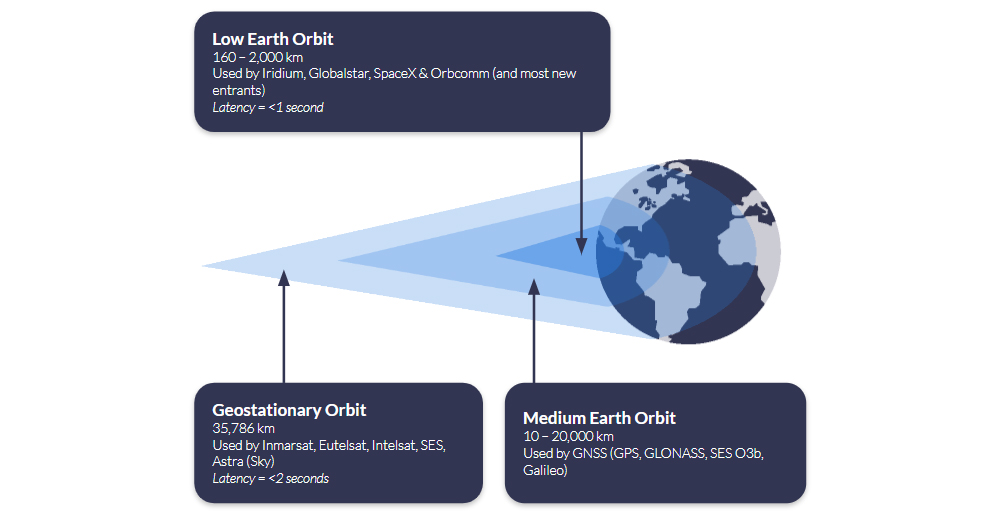
Satellites in Geostationary Orbit (GEO) are 35,786 km above Earth; because they’re so much further away, they can ‘see’ much more of the Earth’s surface, so fewer satellites are needed to provide wide coverage. The latency is longer – c. 2 seconds for an IP-based connection such as Viasat IoT Pro, and longer for a message-based solution such as Viasat IoT Nano – because the data has to travel further. However, if you can bake in some latency tolerance into your application, or simply reserve this means of communication for less time-sensitive telemetry, this offers an economical and often very stable means of communication.
Q: Is Satellite Connectivity Financially Viable for Drone Operations?
A: Satellite airtime can be tailored to match drone usage patterns and fleet scale, using flexible subscription models with clear pricing. For many drone operators, particularly those flying BVLOS or in low connectivity areas, satellite becomes cost effective with just 10 – 20 flight hours per month, especially when uptime is mission critical.
Flexible Subscription Models
Recognising that unmanned applications like drones are a key growth market, satellite network operators like Iridium offer increasingly diversified options for airtime. Ground Control, as a long-term Iridium partner, can offer UAV manufacturers and users monthly subscriptions, pay‑as‑you‑go, or annual commitments – all with transparent pricing and volume discounts for larger operations. Operators using existing Certus 100-compatible hardware can activate airtime instantly through Ground Control, simplifying deployment.
When Does Satcom Pay Off?
Although detailed cost breakdowns vary by mission profile, satellite connectivity often becomes cost effective at a relatively modest flight tempo. If your missions involve command/control, telemetry, or operations beyond cellular coverage, satellite ensures reliability that terrestrial networks can’t guarantee. With real time capabilities over Iridium Certus 100 and competitive airtime pricing, operational risk reduction often justifies the cost within 10 – 20 flight hours per month.
Connecting Drones Beyond Terrestrial Coverage
Satellite connectivity makes it possible to operate UAVs far beyond the reach of terrestrial networks, but integrating it requires thoughtful design. From managing size, weight and power to understanding latency, throughput and cost, this post outlines the key considerations for adding satcom to your drone system.
If you’re developing a satcom-enabled drone, our team can help you find the right hardware and airtime for your mission. Email hello@groundcontrol.com or complete the form, and we’ll be in touch within one working day.
Ultra Low Power at Scale: Unlocking NTN NB-IoT with NIDD
According to IoT Analytics, the global market for satellite IoT connectivity is projected to grow at a CAGR of 26%, reaching $4.7 billion by 2030. Currently, the satellite IoT market is dominated by proprietary modules – meaning that if you want to use Iridium’s SBD service, you need an Iridium SBD module. These modules and accompanying protocols have been tailor-made for satellite communication, and can move large data payloads quickly and reliably, making them perfect for critical IoT applications such as alerts, command and control, and critical infrastructure.
The growth projected by IoT Analytics is anticipated to largely come from standards-based, rather than proprietary, IoT connectivity. This means using standards built for cellular to move data over satellite, so you can use the same chipset that you would use for cellular NB-IoT to access non-terrestrial NB-IoT (in this context, satellite-based connectivity is almost always referred to as NTN – non-terrestrial network). Analysts believe that the lower cost of modules, ability to switch suppliers, and extremely low power requirements will facilitate new, massive IoT applications.
That said, the cost of manufacturing proprietary modules – which have historically commanded a higher premium – is falling, as scale manufacturers like u-blox and Quectel have started to produce these at a much lower cost. Any massive IoT application which is not latency-tolerant, and/or needs to move larger volumes of data, will have options to explore in the proprietary module space, too.
In this blog post, however, we’re exploring NTN NB-IoT in detail, with the goal of helping systems integrators and network architects evaluate whether this emerging technology will suit their remote connectivity application.
What is NTN NB-IoT?
NB-IoT, or Narrowband Internet of Things, is a cellular technology standardized by 3GPP Release 13 in 2016. It was specifically designed for the Internet of Things. NB-IoT falls into the category of Low Power Wide Area Network (LPWAN) technologies. LPWAN technologies are tailored for devices with specific requirements, distinct from smartphones or mobile broadband connections. Key characteristics include:
Small Data Amounts
Devices are designed to send relatively small amounts of data, typically a few bytes or kilobytes, infrequently. This is suitable for simple sensor data or control commands.
Long Battery Life
Due to minimal data transmission and optimized radio usage, these devices are built to operate for extended periods on battery and/or solar power, often for several years.
Low Hardware Cost
LPWAN technologies typically have low cost hardware costs, which is essential for IoT deployments involving hundreds or thousands of devices spread over large geographical areas.
Wide Area Coverage
LPWAN technologies offer long range, low power, small packet connectivity over extensive areas, enabling huge numbers of devices to run for years on a single battery.
NB-IoT achieves these goals by using a subset of features from traditional LTE cellular technology, operating within a narrow slice of the radio spectrum (80 kilohertz bandwidth). This narrow bandwidth and simpler protocols are key to power efficiency and low cost, reducing the complexity and power consumption of the device’s modem. However, terrestrial NB-IoT devices can only send data in areas with reliable cellular coverage.
Non-Terrestrial Network Narrowband IoT (NTN NB-IoT) combines NB-IoT’s low power, low cost cellular technology with satellite communication, enabling devices to connect via satellites in addition to, or instead of, terrestrial towers.
NTN NB-IoT will, when fully mature as a technology, enable global IoT deployments, for projects involving large numbers of simple, low power, low data devices spread across remote areas and across borders. It extends the benefits of NB-IoT beyond its terrestrial limitations, delivering (depending on the satellite network) up to 100% global coverage.
What are the Benefits of NTN NB-IoT?
In addition to being extremely power efficient, the key benefits of cellular NB-IoT is that it operates in licensed spectrum controlled by Mobile Network Operators (MNOs) and standardized by 3GPP, which offers dedicated capacity, more flexibility in the cellular network for switching and roaming, and multi-vendor support for devices and network infrastructure.
NTN NB-IoT similarly operates within licensed spectrum, in this case, controlled by Satellite Network Operators (SNOs) like Viasat and Iridium. It is actively being standardized within 3GPP; initial support for NTN was introduced in Release 17, and Release 18 (launched mid-2024) is significantly advancing NTN integration into the 5G system. It uses a narrow spectrum of the L-Band, S-Band and Ka-Band frequencies, allowing IoT devices to communicate with LEO, MEO and GEO satellite constellations.
Mobile IoT devices equipped with NTN NB-IoT modules can move from terrestrial networks to satellite networks without needing to use a proprietary module. This means IoT devices can be built with a single chipset that delivers NB-IoT connectivity over both cellular and satellite networks, reducing hardware costs because of production economies of scale.
As noted earlier, proprietary modules are also set to benefit from these scale economics, as large chipset manufacturers like u-blox and Quectel are adding the production of these to their portfolio. A key distinction, however, is that a proprietary module will only allow you to connect with one satellite constellation, whereas an NTN NB-IoT module could connect to any satellite network that supports NTN NB-IoT, which could reduce airtime pricing thanks to competition. It will be some years before there is adequate coverage for this to be realized, however.
The promise of NTN NB-IoT lowering the cost of satellite connectivity has the potential to unlock new massive IoT applications in fields such as environmental monitoring, agriculture, and global asset tracking.
Challenges for NTN NB-IoT
Like its cellular counterpart, NTN NB-IoT is designed for large scale, battery-powered deployments. However, communicating with a satellite using a standards-based module, rather than a proprietary satellite modem, brings a new set of technical and economic challenges to overcome.
Higher Latency
While cellular NB-IoT can achieve sub-second latency, NTN NB-IoT introduces significantly higher delays due to the long round-trip to orbiting satellites. Latency can range from several seconds to tens of seconds depending on link quality, protocol, and retry mechanisms. Applications must be tolerant of delayed responses and asynchronous communication.

Increased Battery Usage
Satellite transmissions require higher power output from the radio module to maintain a stable link, particularly in marginal conditions or at low elevation angles. Combined with longer active sessions (due to higher latency), this can drain batteries faster than in terrestrial NB-IoT deployments. Efficient power management and optimized duty cycling become critical.
Antenna Positioning
Terrestrial NB-IoT signals can penetrate walls and underground spaces, allowing flexible antenna placement. NTN NB-IoT requires a clear, unobstructed view of the sky to connect to a satellite, and in many cases, line of sight to a specific satellite at a fixed angle. This can complicate deployments, especially in mountainous or forested environments.

Coverage
NTN NB-IoT coverage is currently limited to specific regions: spot beams lit over North America, Europe, parts of South America, and Australasia. Coverage is expanding, but it’s far from global. Cellular NB-IoT, by contrast, offers much broader regional coverage wherever networks have been deployed and roaming agreements are in place.
Costs
Although standards-based NTN NB-IoT is cheaper than some proprietary satellite services, it’s many times more expensive than cellular NB-IoT. It is more expensive than proprietary options if you exceed monthly data volumes ~30 kB. Cost models are evolving, but pricing will reflect the more limited spectrum and capacity available in space.

Network Congestion
Satellite networks have far less capacity than terrestrial ones, and as NTN NB-IoT adoption grows, so will contention. Congestion may lead to failed transmissions, backoff delays, or restricted access during peak times, especially in areas with high device density or where consumer direct-to-device (D2D) services compete for bandwidth.

Lower Data Rates
NTN NB-IoT operates at significantly lower physical data rates than terrestrial NB-IoT – typically 1-2 Kbps vs. tens or hundreds of Kbps – and enforces small message sizes (e.g., 256 bytes max). This makes it well-suited for small, infrequent payloads, but unsuitable for bandwidth-heavy or real-time applications.
Data Optimization for NTN NB-IoT
For remote NTN NB-IoT applications, sending occasional small data packets becomes essential to reduce signaling duration and battery energy usage, as well as to minimize costly per-byte satellite usage.
When it comes to selecting how data is transferred, there are two options provided by the key players in the industry: IP and Message-based protocols. And to meet the data constraints of remote NTN NB-IoT applications, these protocols become a choice between UDP/IP and NIDD (Non-IP Data Delivery).
Here’s an example to highlight the differences between UDP/IP and NIDD data packet sizes.
A simple water level sensor is sending a status reading and the raw data is 18 bytes long. On top of that, the application running on the device is using CoAP (Constrained Application Protocol), which adds a 4-byte header. This creates a payload of 22 bytes of application data.
To send this message using a traditional UDP/IP stack, the IP and UDP headers add a further 28 bytes, resulting in a total packet size of 50 bytes. By contrast, using NIDD the message is transmitted without any IP or UDP headers, so the total packet size remains just 22 bytes. This efficiency makes NIDD particularly well suited to low-power, low-data IoT devices operating over NTN networks, where every byte of airtime and every milliwatt of battery power matters.
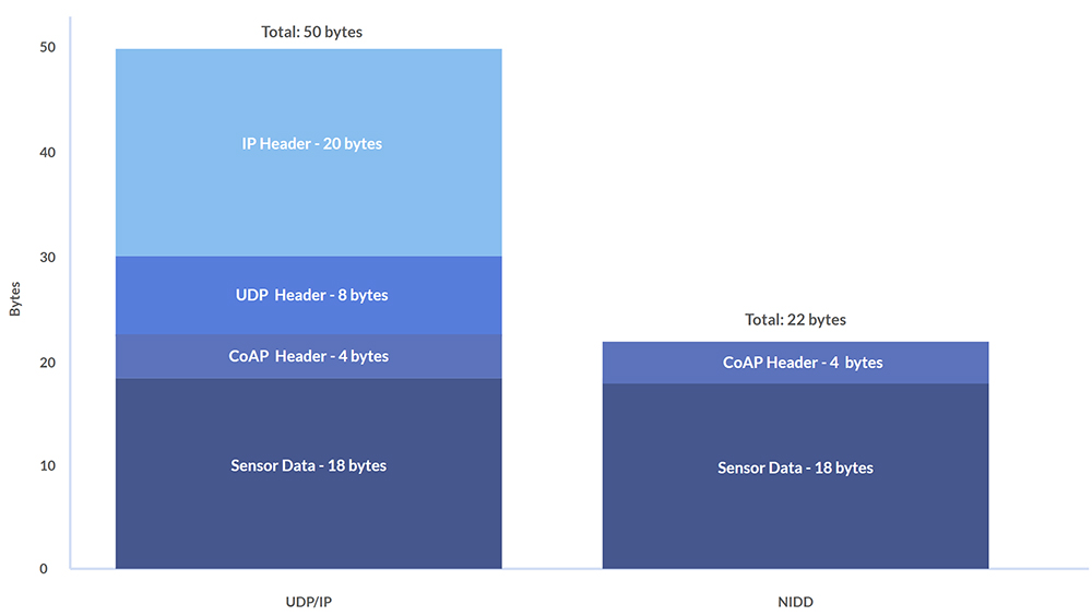
So, the case for using NIDD for NTN NB-IoT is that it reduces the size of data packets to be sent to the satellite, and therefore reduces satellite byte costs, while drawing less power. However, the key benefit of UDP/IP is that the same IP address can be used when moving between cellular and satellite, which is useful for applications which cover devices moving in and out of cellular range, such as maritime vessels or pipeline monitoring.
Comparing UDP/IP and NIDD Benefits
Depending on their agreement with the SNO, some NTN NB-IoT service providers will be offering UDP/IP and/or NIDD solutions, and there are benefits and drawbacks to both. Here is a comparison table to highlight the key differences between each method of data transfer.
| UDP/IP over NTN NB-IoT | NIDD (Non-IP) over NTN NB-IoT | |
|---|---|---|
| Protocol Overhead | IPv4+UDP adds 28 bytes header per packet. Some NTN offerings bill with a 50-byte minimum that includes this IP/UDP header. | No IP/UDP header; payload is carried on signaling (control-plane), avoiding the 28-byte IP/UDP overhead of UDP. |
| Power Consumption | Higher than NIDD for tiny, intermittent messages because you transmit extra header bytes and maintain an IP data session. | Lower for small, sporadic messages by eliminating IP overhead and using signaling paths designed for low power. |
| Integration | Easier for standard IP apps; minor firmware/backend changes may be needed. | Requires SCEF/I-API support and backend changes to map messages to your application. |
| Security | Runs over the Internet path; secure with DTLS/TLS and/or VPN. NAT/VPN commonly recommended for inbound traffic. | Data doesn’t traverse the public Internet; operator exposure functions provide an extra security boundary. |
| Roaming | Single IP address when moving terrestrial ↔ satellite. | Satellite‑only: no IP address for cellular roam; each uplink uses the NTN pathway. |
| Best For… | Applications that move in/out of cellular coverage (e.g., maritime, logistics). | Ultra‑low data, stationary sensors where minimizing airtime and power is paramount. |
Cost & Minimum Payload Considerations
The economics of NTN NB‑IoT hinge heavily on each provider’s minimum supported packet size. Today, Skylo enforces a 50 B floor (including headers) on every UDP/IP message, effectively eliminating NIDD’s payload‑size savings until true NIDD support arrives. Likewise, Sateliot offers standard 3GPP Rel‑17 NB‑IoT over satellite (UDP/IP only) and hasn’t published any reduced‑overhead or NIDD option, so ultra‑small packet users are forced into that same ~50 B envelope.
Until more satellite operators clarify their packet‑size limits or introduce truly NIDD‑capable services, many “tiny telemetry” applications will find themselves priced out of the savings NIDD could otherwise deliver.
The first full NIDD offerings won’t arrive until H1 2026, when Viasat NB-NTN launches its satellite‑only NB‑IoT SIM, complete with both UDP/IP and NIDD modes. Shortly after, Iridium NTN Direct – built on 3GPP Release 19 NTN enhancements – will also bring standardized NIDD support (devices expected in 2026).
In the meantime, proprietary satellite‑IoT networks such as Iridium SBD and Viasat IoT Nano bill in 10 B increments, making them the only current options for truly tiny, cost‑efficient uplinks – albeit at the price of custom hardware and vendor lock-in.
NTN NB‑IoT Service Timeline
Early 2024 – Summer 2025
- Skylo rolls out its Release 17-based service (UDP/IP only) via partner MNOs across the United States, Canada, Brazil, Australia, New Zealand and select European markets
- Sateliot operates a demo LEO fleet for Rel 17 NB‑IoT trials; today’s service is UDP/IP only, with no published NIDD option.
H2 2025 (Pilot & Dev Kits)
- Viasat NB-NTN appears in partner POCs and developer previews (e.g., Ground Control’s Cloudloop integration), with two way NB‑IoT over L‑band. UDP/IP today, NIDD to follow.
H1 2026 (Projected Commercial Launch)
- Viasat NB-NTN full release: satellite‑only NB‑IoT SIM supporting both UDP/IP and NIDD payloads
- Iridium NTN Direct enters commercial service built on 3GPP Release 19 NTN enhancements (including standardized NIDD support).
Will NTN NB‑IoT Open New Markets for Satellite IoT?
NTN NB‑IoT holds clear potential to bring truly global, low‑power IoT to industries unable to leverage terrestrial networks; think widespread environmental sensing, remote infrastructure monitoring and asset tracking in the world’s most isolated regions. However, two pivotal commercial variables will determine how far it can go:
- Cost per Byte & Minimum Packet Size: Until services offer sub‑30 B NIDD payloads at competitive rates (versus today’s 50 B UDP/IP floors or proprietary 10 B options), many micropacket use cases will remain marginal.
- Network Capacity & Congestion Management: Supporting massive fleets of devices over narrow satellite channels requires robust scheduling, interference mitigation and priority handling – features still under development in Rel 17/18 NTN specs and vendor implementations.
Importantly, NTN NB‑IoT does not replace today’s proven proprietary services; it adds to the IoT toolbox. Solutions like Iridium SBD/IMT and Viasat IoT Nano will continue to serve critical, higher throughput or low latency applications, where SLAs, two‑way command/control and strong QoS are non‑negotiable. And, as discussed, the advent of scale manufacturers taking over the production of proprietary modules is set to bring down the cost of these services. NTN NB‑IoT, by contrast, unlocks a new class of latency-tolerant, very small data deployments of homogenous hardware across areas with a mix of cellular and satellite coverage.
Once Viasat NB-NTN and Iridium NTN Direct deliver standardized NIDD in 2026, expect a step‑change: low power, low cost satellite IoT scaling from niche pilots into planet‑wide solutions, while incumbent proprietary networks remain the go‑to for mission‑critical workloads.
Talk to Us About NTN NB-IoT
We’re experts in satellite IoT and asset tracking, and are actively working on new NTN NB-IoT enabled hardware and service integrations with our IoT platform, Cloudloop.
If you have questions about how NTN NB-IoT could enable your IoT projects, please email hello@groundcontrol.com or complete the form to tell us about your requirements, and we’ll reply within one working day.
Using a Campbell CR1000 (CRBasic) with a RockBLOCK RTU (SBD Device)
In today’s rapidly evolving landscape of remote monitoring and data acquisition, integrating reliable communication systems is crucial. RockBLOCK RTU integration provides a robust solution for industries such as environmental monitoring, agriculture, and industrial automation, ensuring seamless data collection and transmission from remote locations.
In this post, we will discuss the integration of RockBLOCK RTU, and show how we have configured it to work with the Campbell Scientific CR1000.
What is RockBLOCK RTU, and Why Does it Matter?
RockBLOCK RTU is a low power, rugged, waterproof remote I/O device designed for permanent installation in harsh outdoor environments. Utilizing Iridium’s Short Burst Data (SBD) satellite service, RockBLOCK RTU supports two way communication anywhere on the globe, ensuring reliable connectivity even in the most remote locations.
Combined with Ground Control’s Cloudloop Services Suite (Subscription Manager and Cloudloop Data), RockBLOCK RTU allows users to land, visualize, store and forward their data in a flexible environment that is easy to integrate with. Aside from the Cloudloop suite, the RockBLOCK RTU supports physical analogue and digital inputs and outputs that can be locally programmed to trigger based on thresholds or actions.
How we integrated the CR1000 with the RockBLOCK RTU
Step 1: Understanding the Data Format
The RockBLOCK RTU system supports a structured data format that includes:
- Channels CH16 to CH31 mapped to General Purpose Sentence (GPS) data
- Each channel supports 5-digit values (00000 to 65533)
- Comma-separated values within the data string.
Example Data String:
STXGP0,…,GP15,ETXCHECKSUMCRLF

STX = 0x02 (HEX) – (Start of Sentence)

ETX = 0x03 (HEX) – (End of Sentence)

CHECKSUM = Between STX and ETX (Excluding them) formatted as 5 digits, zero padded

CR = 0x0D (Carriage Return)

LF = 0x0A (Line Feed)

STX00000,00000,00000,00000,00000,00000,00000,00000,00000,00000, 00000,00000,00000,00000,00000,00000,ETXCHECKSUMCRLF
Step 2: Configuring Cloudloop for RockBLOCK RTU
- Create Channel: Map channels 16 to 31
- Type: Analog Input
- General Purpose Data String-related Device Channel Configuration:
-
- Mode: RAW
- COV (Change of Value): 0 for no COV, 1 for COV enabled
- Group Transmission Size: Minimum 1
Note: Channels should get created automatically in Cloudloop Data once valid data is passed through, although each channel can still be re-configured or pre-configured via Cloudloop Data. It is also important to note that the RTU needs to be active, powered and have a good view of the sky for it to receive the channel configurations via the satellite link.
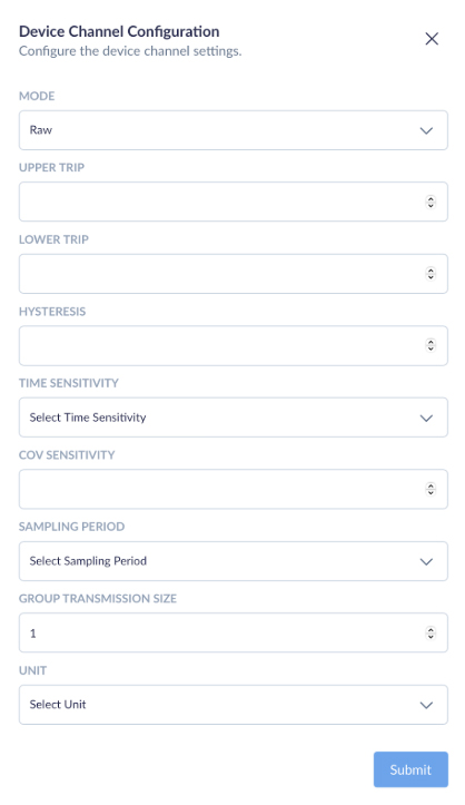
Example of Cloudloop Data Insights
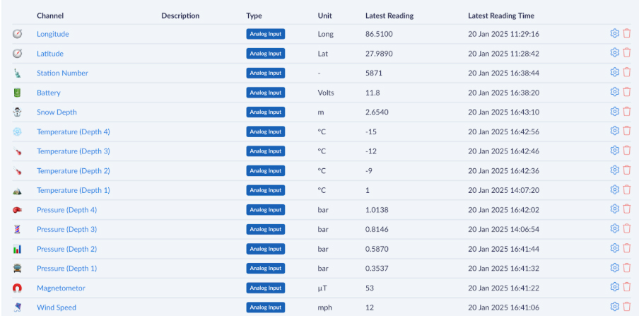
This screenshot showcases the Cloudloop platform’s data visualization capabilities when integrated with RockBLOCK RTU. Each channel represents a specific parameter being monitored, such as location (latitude and longitude), battery voltage, snow depth, temperature at various depths, pressure readings, and wind speed. All of which can be named and customized per your requirements. we have chosen the aforementioned parameters for illustration purposes.
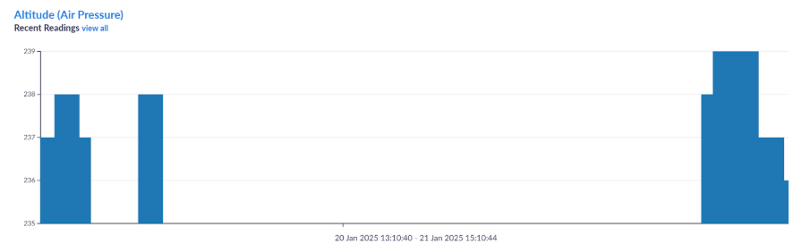
Step 3: Setting Up Communication
- Connect Serial COM2 TX to RX (PINK) on RockBLOCK RTU
- Set baud rate to 19200, which is the default for RockBLOCK RTU
Step 4: Implementing the CRBasic Code
The CRBasic code constructs data strings in stages to accommodate memory constraints. Temporary strings (TempStr variables) are concentrated to form the final 16 channel DataString.
Example CRBasic Code:
This integration will allow up to 16 sensor values to transmit from the CR1000 through the RockBLOCK via SBD to Cloudloop Data (Insights) and optionally forward to a chosen destination. By introducing Cloudloop Data in the middle of the data transfer, you allow for much more than just data display or remote configuration, but the ability to set email alerts depending on thresholds and even set actions – such as controlling a separate RockBLOCK RTU anywhere in the world autonomously.
Imagine a scenario where one RockBLOCK measures the water level at a dam, and a second RockBLOCK controls a valve on pre-set thresholds.
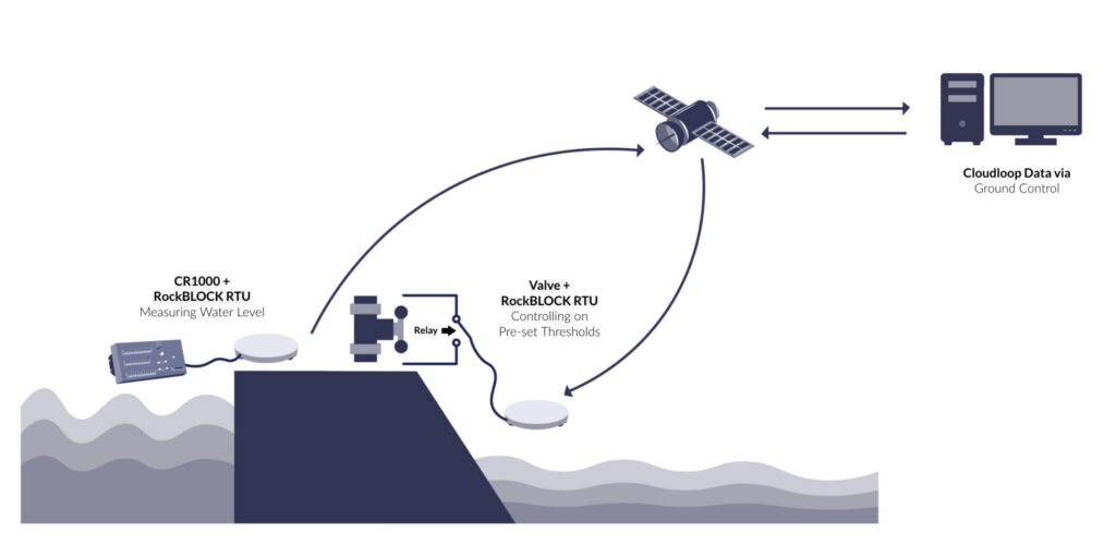
Ready to get started?
If you’re interested in learning more about how RockBLOCK RTU can transform your remote monitoring capabilities, contact us for a personalized consultation.
Also, have a look at our RockBLOCK RTU documentation website.

Michael Mitrev – Solutions Architect
Graduating with a 1st Class Degree in Computer Systems and Networks Engineering and joining the team in 2024, Michael has been closely involved in the development of the RockREMOTE Mini and is passionate about its growth and success. He’s also contributed to the RockBLOCK RTU, ensuring both devices integrate seamlessly with data loggers to create highly sought-after solutions – primarily focusing on testing with Campbell’s CR1000.
Transform your CR1000 into a powerful remote monitoring solution
Whether you’re tracking snow depth, water levels, or environmental conditions, the RockBLOCK RTU + Cloudloop integration offers reliable, global data delivery.
Complete the form, or email hello@groundcontrol.com for expert advice; we’ll respond within one working day.
How NTN NB-IoT Unlocks Smarter Water Utility Operations
Water utilities worldwide are under increasing pressure to deliver more with less. Ageing infrastructure, growing demand, environmental challenges, and regulatory compliance all demand smarter, more efficient operations. Yet many of the most critical water assets, including pipelines, reservoirs, pumping stations, and metering points, are located in remote or rural areas where conventional cellular connectivity is either unreliable or unavailable.
This connectivity gap has long been a barrier to digital transformation in the water sector. Without reliable communication between remote assets and central systems, utilities face costly manual inspections, delayed responses, and fragmented data. Satellite IoT is helping to bridge that divide, bringing off-grid infrastructure online and enabling smarter, more efficient operations. While proprietary satellite IoT has served this role for decades, a newer, standards-based alternative is now emerging: NTN NB-IoT (Non-Terrestrial Network Narrowband Internet of Things).
NTN NB-IoT, part of the 3GPP standard for satellite-enabled IoT communications, allows connected sensors to communicate with satellites using the same NB-IoT protocol, and chipset, that they would use to connect to a terrestrial network. Economies of scale means that this drives down the cost of the chipset, delivering lower hardware costs, and potentially lower airtime costs too. For water utilities, this unlocks applications that might have been cost-prohibitive prior to the advent of standards-based satellite IoT.
At Ground Control, we specialize in enabling satellite-based connectivity and telemetry solutions for critical infrastructure. As NTN NB-IoT technology matures, we’re perfectly positioned to help water utilities leverage it to extend smart monitoring and control to the very edges of their networks. Here’s how NTN NB-IoT differs from proprietary satellite IoT and where it adds value to smarter water utility operations.
Rethinking Remote Connectivity
As water utilities continue to extend monitoring and automation efforts in remote and rural environments, satellite communication has been, and remains, critical to bridge connectivity gaps where cellular networks are unreliable or unavailable. Until very recently, the only option for utilizing satellites was to use a proprietary satellite module, e.g. if you wanted to utilize the Iridium satellite constellation, you would need an Iridium module.
These proprietary solutions are are built for purpose; the designers have not had to limit their modules’ capabilities to the 3GPP standard, which of course started as a cellular standard. This means you can send more data, more quickly, through a proprietary solution.
Further, if you’re using a message-based proprietary solution, such as Iridium’s Short Burst Data service, Iridium Messaging Transport (IMT), or Viasat IoT Nano, you also get the benefit of power efficiency.
Proprietary solutions, therefore, have been a trusted option for many years, providing reliable, low bandwidth satellite communication for mission critical data such as flow rates, tank levels, pump status, and alarm notifications. They have proven particularly valuable for applications requiring near real-time data or coverage in truly isolated areas.
However, when it comes to massive IoT deployments, proprietary solutions have limitations. Relatively high device and airtime costs, and proprietary integration requirements can make services like SBD, IMT and IoT Nano challenging to deploy at scale, particularly for low-power sensor networks or distributed metering systems.
Enter NTN NB-IoT (what is NTN NB-IoT?).
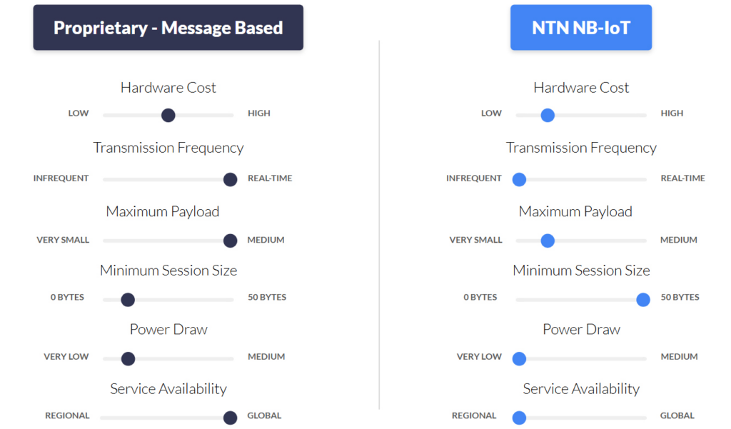
For water utilities, NTN NB-IoT could be a breakthrough. Water utility providers can deploy NTN NB-IoT-enabled sensors, meters, and monitoring equipment in places that were previously cost-prohibitive to connect via proprietary satellite IoT.
What are the Applications for NTN NB-IoT in Water Utilities?
For a water utility weighing NTN NB‑IoT against higher‑bandwidth proprietary satellite links, the sweet spot is infrequent, small payload telemetry where truly global reach (no cell towers) matters more than millisecond alerts. Typical deployments include:
Daily or multi‑hour meter reads
Remote or off‑grid customer meters (flow, volume) that only need to report once or twice a day for billing or usage analysis. A 200 byte payload can easily carry several readings, supporting rural homes, farms, or remote industrial sites.
Tank level and reservoir monitoring
Track water levels, detect overflow risks and monitor usage trends in storage facilities far from population centers. Gravity‑fed storage tanks in remote service areas report level and temperature every few hours – enough to plan refills without real‑time urgency.
Environmental baseline sensing
pH, turbidity, conductivity or chlorine residual sensors on remote intakes or treatment sites. These can trickle in (no pun intended!) once per shift or per day to track long term trends, enabling insight into water quality, and supporting regulatory compliance.
Pump run‑hours and basic status
Hourly or daily “I’m alive” heartbeats plus simple ON/OFF or run‑time counters to track remote booster stations or solar powered pumps, helping to reduce downtime and extend the life of critical infrastructure.
Pipeline integrity logs
Low frequency pressure, flow rate and structural vibration snapshots in isolated, hard to access terrain, allowing early detection of leaks, bursts or blockages to reduce water loss.
Asset inventory and location
Periodic GPS pings and motion/tamper alerts from mobile test vans, valve exercise robots or floating sensors in open canals, optimizing maintenance schedules and improving operational security.
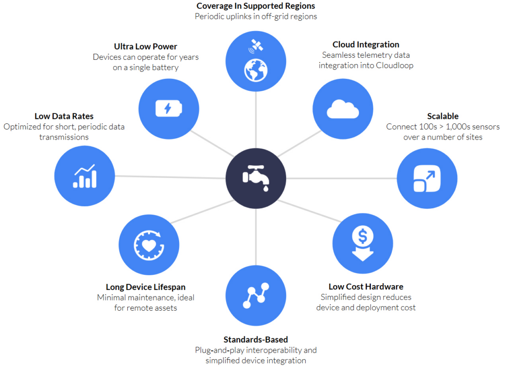
Beyond NTN NB‑IoT: Scenarios Requiring Real Time Satellite Links
Here are the water‑utility applications that really demand real time links and higher data volumes – i.e. where you’d reach for a proprietary satellite IoT service such as SBD, IMT or IoT Nano, rather than NTN NB‑IoT:
Instant leak/failure alerts
Continuous pressure or flow monitoring that must trigger sub‑minute alarms when a burst or major leak occurs.
Remote valve actuation and control
Two‑way commands (open/close, throttling) with confirmation feedback to isolate sections of pipe or adjust flow on demand.
SCADA‑style telemetry
High frequency readings (e.g. every few seconds or minutes) from multiple sensors (pressure, temperature, vibration) at booster stations and treatment plants.
Video or acoustic inspection
Transmitting snapshots, short video clips or high‑resolution acoustic signatures from remote intake structures or pipeline inspection robots.
Predictive maintenance analytics
Bulk uploads of rich sensor datasets (e.g. vibration spectra, pump performance curves) to cloud analytics for failure prediction.
Bi‑directional firmware updates and diagnostics
Pushing larger firmware or configuration payloads OTA (over the air), plus logging back detailed health / status reports in real time.
Event‑driven sampling
Millisecond‑resolution burst data (e.g. transient pressure spikes) that need to be streamed offsite immediately for analysis.
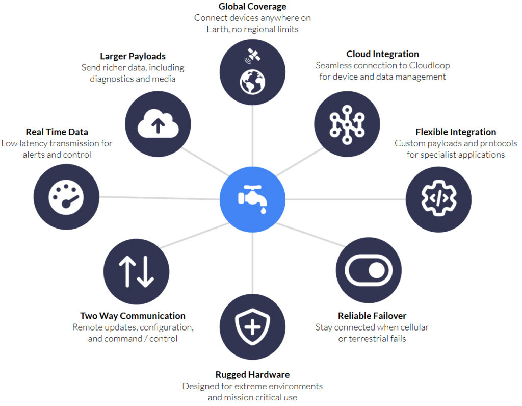
Emergency backup SCADA link
A full‑bandwidth failover channel when terrestrial SCADA lines go down, to keep control room visibility alive.
These use cases all hinge on low latency, two way communication and/or bulk data transfers; capabilities that proprietary satellite IoT is designed to deliver.
What is NTN NB-IoT?
Simply, NTN NB-IoT allows data to travel over satellite using the same standard as terrestrial NB-IoT. This means that the same chipset can be used for satellite or cellular connectivity, leading to lower hardware costs, and potentially, lower airtime costs.
It doesn’t, however, mean that it is identical to terrestrial NB-IoT, and network architects need to bear its limitations in mind. We’ve outlined some of the key differences in the following table:
| Standards-Based NTN NB-IoT* | Cellular NB-IoT | Proprietary Satellite IoT** | |
|---|---|---|---|
| Max Practical Payload | 1,000 bytes | 1,400 – 1,600 bytes | 16,000 bytes |
| Min. Practical Payload | 10-30 bytes | 30-50 bytes | 10 bytes |
| Typical Latency | Medium (10 – 60s); MVNO scheduling could increase this to 2 – 5 mins) | Low (1 – 10s) | 10 seconds under optimal conditions |
| Coverage | United States, Canada, Brazil, Australia, New Zealand and select European markets | Where supported by regional MNOs, and there is terrestrial infrastructure | Global, exc. Polar regions |
| Cost-Optimized Monthly Data Volume | < 50 KB | < 5 MB | < 1 MB |
| Typical Transmissions Per Day | Common MVNO plans: ~1 – 3 uplinks/day (entry tiers) | No strict cap: supports thousands to tens of thousands of uplinks/day (limited only by data plan allowances) | No strict cap; governed by data plan allowances |
In summary, users can anticipate smaller data volumes, and intermittent data transmission (e.g. a few times per day), allowing devices to operate for years on battery and solar power. NTN NB-IoT is, therefore, ideal for low bandwidth, low power, and long life IoT applications.
A Smarter Approach to Connectivity
NTN NB‑IoT shines when you need occasional, small payload uplinks from truly off-grid assets. Its standards based 3GPP Release 17 stack makes integration straightforward, devices run for years on battery, and you can monitor things like daily meter reads, tank levels, water‑quality snapshots or pump “heartbeats” in remote terrain without laying any infrastructure.
Proprietary satellite IoT earns its keep when you need low latency, high volume, two way links, for real time leak/failure alarms, remote valve control, SCADA‑style bursts, video or acoustic inspections, large OTA updates, and emergency failover.
With decades of experience in satellite communications, Ground Control offers more than just connectivity; we deliver complete, integrated solutions from device to cloud. So, whether you’re starting a pilot water management project or scaling a nationwide deployment, we’re here to help you harness the full potential of NTN NB-IoT and build a smarter, more resilient, and efficient water utility network.
Ready to explore your options?
Curious which satellite technology is right for your application? Whether you’re rolling out smart meters in rural areas or need real time alerts from critical infrastructure, we can help you choose the best fit solution.
Talk to our team for a side-by-side comparison of NTN NB-IoT and proprietary satellite IoT, based on your data needs, latency requirements, and power constraints.
Email hello@groundcontrol.com or complete the form, and we’ll be in touch within one working day.