Why Navigation Resilience Is Becoming a Standard Security Deliverable at Sea

Given that 90% of international trade is carried by sea, maritime safety is fundamental. For most of the modern maritime era, the formula was relatively simple: assess the route, understand the threat environment, adapt operating procedures, and, when justified by risk, place experienced personnel on board to deter, respond, and protect. That approach still matters, but it is no longer sufficient.

Today, merchant shipping is delegating a far broader range of responsibilities to private maritime security companies (PMSCs). The remit is no longer limited to protection from physical threats; increasingly, it also includes support for the operational risks created by disruption to critical onboard systems. One of the clearest and fastest growing examples is navigation resilience.

For maritime security providers supporting secure fleet operations, advising owners and operators, and delivering risk-managed transit, this change is already taking shape in practice. Clients may not use the term “A-PNT” (Assured Position, Navigation, and Timing), and they may not explicitly ask for “navigation resilience”. But the expectation is there nonetheless: in the questions they raise, the incident reporting they request, and the operational standards they increasingly assume are in place. The reason is straightforward: when positioning fails at sea, it becomes a security issue whether anyone labels it that way or not.


Security Has Expanded Beyond the Physical

The biggest misconception in maritime security right now is thinking this is a niche technical issue, something for bridge teams, electronics specialists, or a ship’s IT provider, when in practice, it has become a frontline operational risk.

GNSS disruption, jamming, and spoofing are no longer rare anomalies confined to active conflict zones. Independent analysis by C4ADS has documented widespread maritime spoofing events affecting thousands of vessels, particularly in the Black Sea and the Middle East. Subsequent advisories from the U.S. Coast Guard Navigation Center (NAVCEN) and UK Maritime Trade Operations (UKMTO) have continued to warn of GPS interference affecting commercial traffic in multiple regions.

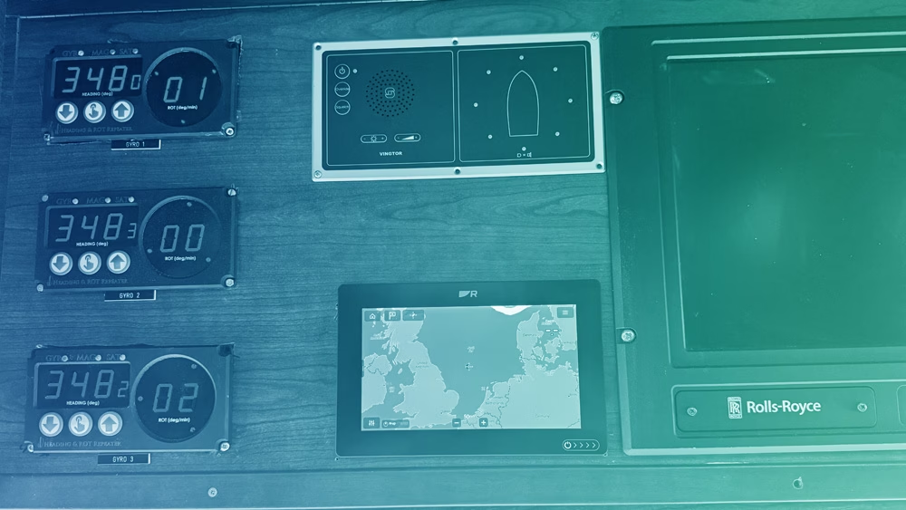
When a vessel loses trustworthy position and timing, the impact cascades fast. Routing decisions become uncertain, safety margins shrink, bridge teams hesitate, and in high consequence waters, uncertainty becomes vulnerability. That’s why navigation resilience is moving into the security deliverables category. Not because it’s a buzzword, but because the outcomes are security outcomes – the ability to maintain control, continuity, and confidence in the vessel’s movements. And, as shipping companies continue to lean on third party providers to manage risk, the responsibility is naturally shifting to the people who already own the security mission.


Merchant Shipping Is Outsourcing Resilience, Not Just Risk

The International Maritime Organization (IMO) has formally recognized navigation systems as part of a vessel’s cyber risk surface. U.S. Department of Transportation reporting on Complementary PNT strategies has likewise acknowledged the vulnerability of civil GPS and the need for resilient alternatives. At the same time, the operational picture has become harder to ignore. From spoofed coordinates linked to tanker incidents, to cargo vessels disappearing from satellite tracking under jamming conditions, interference with positioning and navigation is now a live operational issue.

That has direct implications for maritime security. It is no longer enough for PMSCs to track piracy patterns and regional instability. They now have to understand electronic disruption, degraded communications, cyber-enabled interference, and deliberate manipulation of navigation systems. The threat landscape is no longer confined to the physical domain; it now extends into the systems vessels rely on to operate safely.

GPS Jamming map

For shipping companies, the response is familiar. When risk grows faster than internal capacity, they outsource. First that meant physical protection. Then it meant intelligence and route advisory. Now it increasingly means outsourcing resilience, especially where failure has immediate operational consequences. Navigation is one of the clearest examples.


The New Scope of PMSCs

PMSCs are increasingly being drawn into questions that would once have remained strictly on the bridge:

  1. What happens if GNSS becomes unreliable mid-transit?
  2. How quickly can we detect spoofing versus simple signal loss?
  3. How do we keep the bridge team confident in the vessel’s position when the primary reference is compromised?
  4. What proof can we provide after the fact – to the owner, to insurers, to regulators, and to internal stakeholders – that the vessel maintained safe navigation?


These are no longer theoretical or hypothetical concerns and possibilities; they’re operational questions and sit directly inside the modern security mission. Marine insurers and P&I clubs such as Allianz and Gard have already published guidance highlighting navigation system vulnerabilities as emerging operational risks. The Nautical Institute’s Mariners’ Alerting and Reporting Scheme (MARS) has also captured incident reports reflecting confusion and degraded situational awareness linked to navigation system anomalies. In many cases, the crew onboard is highly competent but not equipped with the tools or the time to manage GNSS integrity issues in a repeatable way. But it’s not a training failure – it’s an equipment and process gap.


Why A-PNT Is Becoming the Navigational Standard

The real challenge in modern navigation is not only loss of signal, but loss of trust. In a disrupted environment, the greatest risk is often not that positioning disappears, but that it appears reliable when it is in fact wrong. That is what spoofing does, and it turns navigation failure into an operational and security problem.

That’s why A-PNT is becoming increasingly important. It’s often not a single product or platform, but a broader resilience approach: ensuring that positioning, navigation, and timing remain dependable and verifiable when GNSS is degraded, denied, or manipulated.

Solutions such as Iridium PNT sit within that broader picture. They offer an additional means of maintaining trusted PNT in operating environments where traditional GNSS may be vulnerable to interference.

For maritime operators, that is the real shift. A-PNT is becoming less of a specialist capability and more of an operational standard, because resilience in navigation is increasingly inseparable from resilience in the voyage itself.

GNSS diagram for RockFleet Assured

Where RockFLEET Assured Fits into Modern Maritime Security

RockFLEET Assured, powered by Iridium PNT, enters the market at a moment when PMSCs are increasingly expected to provide resilience as part of secure fleet operations, not just protection from physical threats.

Designed specifically for maritime deployment, the marine-grade smart antenna delivers cryptographically authenticated positioning and an assured navigation reference for vessels operating in environments where GNSS integrity cannot be guaranteed. In practice, that means an independent source of trusted position data when GPS or other GNSS signals are degraded, denied, or manipulated.

Its value is operational as much as technical. By comparing GNSS inputs with Iridium PNT outputs, RockFLEET Assured helps bridge teams and shore-based personnel identify anomalies more quickly, detect possible spoofing or jamming, and respond with greater confidence. Event data can be logged and transmitted ashore, creating a defensible record for incident review, compliance documentation, or insurer scrutiny.

RockFLEET Assured

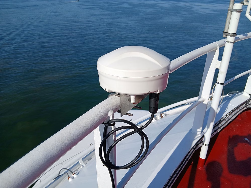
Just as importantly, it’s built for repeatable deployment at fleet level. The system is delivered as a single above-deck terminal, with mounting options to suit different vessel types and superstructure layouts, reducing the need for vessel-by-vessel customization. Its IP66-rated enclosure is designed for exposed marine conditions, and no below-deck electronics are required unless bridge view is selected.

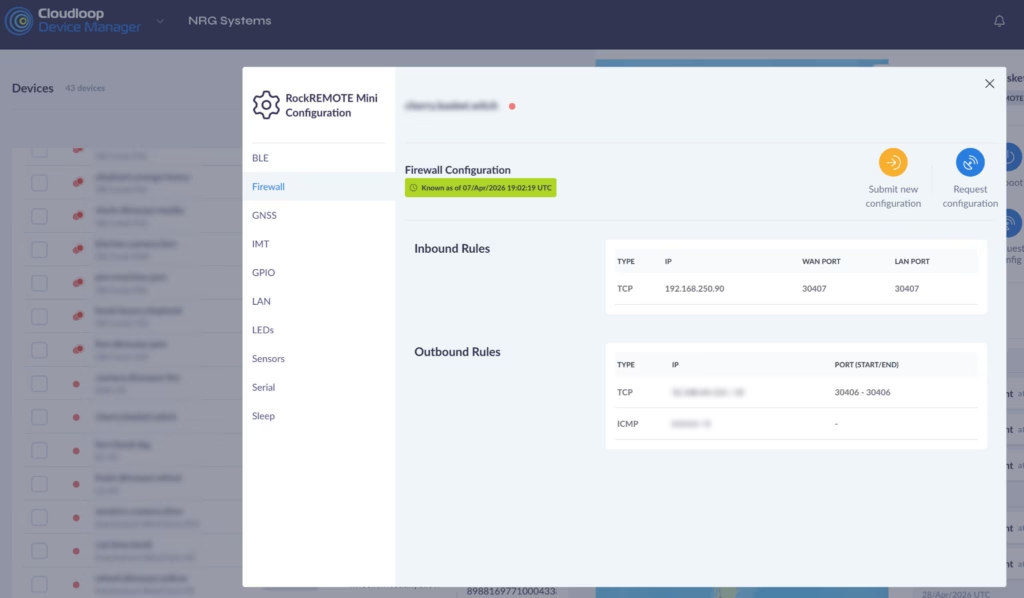
Reporting is equally flexible. Through Iridium Messaging Transport (IMT), RockFLEET Assured supports configurable position updates and secure two way messaging between ship and shore, with reporting intervals tailored to different operational requirements. Integration with Ground Control’s Cloudloop platform enables centralized fleet visibility, while API connectivity supports incorporation into existing monitoring and security systems.

Optional bridge view functionality adds another practical advantage, allowing assured positioning data to be displayed alongside standard GNSS outputs. For crews, that provides a clearer visual reference during interference events and helps reduce hesitation when rapid navigational decisions are required.

For PMSCs, that makes RockFLEET Assured a practical way to embed navigation resilience into a broader security offering. Rather than treating disruption as a vague technical failure, it helps turn it into something observable, reportable, and manageable.

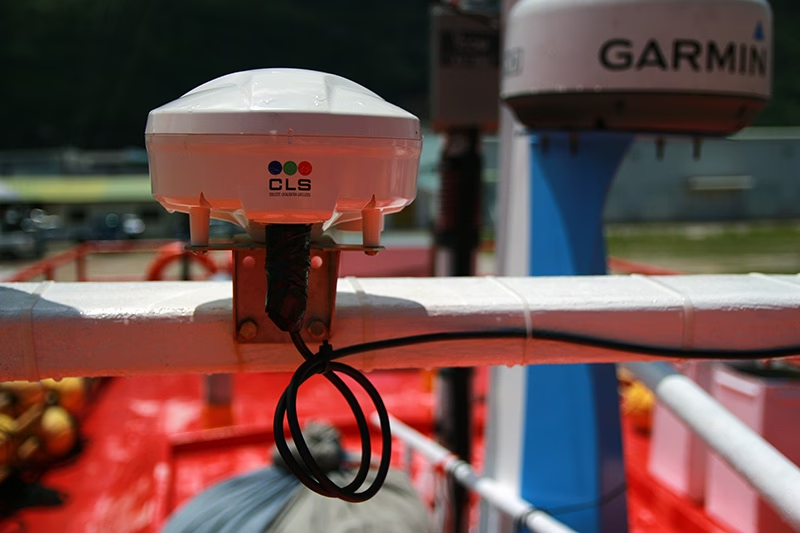
RockFLEET-Assured-CLS-Brand-in-Situ

What Changes Operationally for PMSCs

PMSCs often operate under heightened expectations for compliance, documentation, and professionalism. Clients – corporate security teams, fleet operators, insurers, charterers – expect measurable capability, not procedural reassurance. Without A-PNT, disruption remains ambiguous. With it, disruption becomes detectable, documentable, and defensible. That shift strengthens operational reporting, reduces decision latency on the bridge, and improves client confidence. It becomes a deliverable in a security modeland part of how PMSCs define secure fleet operations in 2026 and beyond.


The Future of Maritime Security

The maritime security industry is not abandoning its roots: physical threats still exist, high-risk areas still demand proven experience, and human expertise still matters. But the center of gravity is shifting as electronic disruption, contested signal environments, and hybrid risk become normalized features of global shipping lanes. International policy bodies, insurers, and national governments have all acknowledged this reality in recent years.

The most forward-looking maritime security providers are therefore evolving from personnel-based security offerings to layered security and resilience platforms. They are expanding into technical advisory, electronic threat awareness, and operational continuity support. They are positioning themselves as secure fleet partners, not just voyage contractors, and A-PNT is one of the cleanest, most valuable additions to that stack.

The next era of maritime security will be defined by who can keep ships operating safely and confidently when the environment becomes contested physically, electronically, and operationally. Navigation resilience is becoming a security standard because disruption is becoming the norm, so for PMSCs responsible for secure fleet operations, this is the moment to lead. The companies that adopt assured A-PNT now through solutions like RockFLEET Assured will be the ones positioned to define what security means at sea over the coming years or more.

Trusted A-PNT For Navigational Certainty at Sea

For over 20 years, we’ve delivered resilient satellite solutions for remote connectivity and secure communications. We’re proud to support commercial shipping, offshore operators, and maritime security providers with dependable satellite connectivity and assured positioning capabilities designed for the realities of the modern maritime domain.

If you want to offer A-PNT solutions as part of the security strategy for your maritime clients, complete the form, or email hello@groundcontrol.com and we’ll reply within one working day.

Name
Privacy Policy

Why A-PNT is the Future of Trusted Positioning for BVLOS Drone Operations

Global Navigation Satellite Systems (GNSS) such as GPS, Galileo, GLONASS, and BeiDou have driven navigation for Unmanned Aerial Vehicles (UAVs) for decades. These satellite signals provide critical positioning, navigation, and timing (PNT) data that inform core functions like waypoint navigation, path planning, dynamic obstacle avoidance, geofencing for airspace compliance, and failsafe behaviors such as Return to Home or auto landing. However, GNSS/GPS signals are inherently weak – designed to be received at the Earth’s surface from satellites tens of thousands of kilometers away – and as such, are vulnerable to interference, jamming, or deliberate PNT denial.

Particularly over conflict zones, but increasingly widespread, GNSS signals are being degraded, spoofed, or blocked, causing multipath errors and signal loss and leaving autonomous drones without reliable positioning or timing information. Reliance on GNSS alone subsequently becomes a single point of failure for safe, reliable and trusted and UAV operations.

This is why navigation resilience has become one of the most important technical and operational requirements for modern BVLOS UAV deployments, and why selecting the right navigation solution is no longer simply about accuracy, but about operational continuity, trust, and reliability when navigational conditions degrade.

In this blog, we’ll explore the satellite service that addresses GNSS/GPS overreliance, the onboard technology that delivers resilient UAV navigation in contested environments, and the key factors integrators should consider when choosing a navigation stack for BVLOS operations.

Continuity Challenges in Contested and Complex Environments

Studies on GNSS-denied navigation show that jamming can overwhelm genuine satellite frequencies, driving receivers into error or total loss of signal. Spoofing goes a step further by feeding convincing but false signals, tricking receivers into calculating an incorrect location and potentially sending autonomous systems off course. This isn’t theoretical – the mechanisms and impact of GNSS spoofing and jamming are well documented, with spoofing described as a more complex and deceptive threat than simple interference, because it actively misleads the navigator rather than just depriving it of data.

GNSS denial isn’t confined to military battlefields either. Complex civil environments present similar challenges. Urban canyons made of steel and glass can reflect, attenuate, and distort satellite signals. Industrial zones rife with electromagnetic activity can drown out weak satellite broadcasts. Remote farmlands, border regions, and mountainous terrain all produce signal shadows and multipath effects, and these are not edge cases; many operators encounter these conditions regularly.

Without trusted PNT, a drone’s ability to follow a flight plan, maintain orientation, and sense its environment becomes compromised. In military operations, this can mean the difference between mission success and failure when conducting reconnaissance, supply delivery, or coordinated swarm operations. In maritime environments far from land, relying solely on GNSS undermines situational awareness and safety. In these contested or degraded environments, drones that depend exclusively on GPS risk mission degradation, erratic navigation, or complete loss of control.

It’s worth noting, however, that when a UAV loses trusted PNT, it doesn’t necessarily lose the ability to fly. Rather, it loses confidence in where it is, and that uncertainty is enough to abort missions, degrade data quality, violate airspace restrictions, or erode operator trust. Without PNT, UAV missions fail not because the vehicle lacks propulsion or control, but because it cannot navigate with confidence. For BVLOS operations, this loss of confidence is especially critical. Unlike VLOS flights, BVLOS operations depend on automation, remote supervision, and regulatory compliance. A drone that cannot prove where it is – reliably and continuously – cannot safely remain in controlled airspace or operate near people, infrastructure, or other aircraft.

The Solution Beyond GPS

To address the vulnerabilities in GNSS/GPS, engineers and operators are turning to Assured Positioning, Navigation and Timing (A-PNT).

A-PNT represents a layered approach in which GNSS is complemented, and in some cases temporarily replaced, by alternative sources that can provide trusted PNT data in environments where GPS is unavailable or untrusted. One alternative A-PNT source is derived from Iridium, and broadcast from a constellation of Low Earth Orbit (LEO) satellites. Because these satellites orbit significantly closer to Earth than traditional GNSS satellites, the downlink signals are up to 1,000 times stronger and more resistant to jamming or obstruction.

What makes Iridium’s PNT particularly effective is also its hybrid operation. When GNSS signals are present and reliable, an A-PNT system can blend that positioning data with Iridium PNT to maximise accuracy. When GNSS fails or is compromised, the system can continue operating on the stronger, authenticated Iridium PNT signals alone, preserving continuity of service and trusted navigation. This redundancy is key for autonomous systems that cannot afford to lose their bearings due to interference or contested signals.

In addition, the Iridium PNT signal incorporates cryptographic authentication that enables receivers to verify the integrity of their navigation signals and reject spoofed or tampered data. Whether operating at sea, in urban canyons, or in warfare environments, A-PNT provides a resilient and secure source of position and timing that can help autonomous drones sustain operations when GNSS cannot be trusted.

Why Antenna Positioning Still Matters in GNSS-Denied Scenarios

Even before GNSS is intentionally denied, the physical realities of a UAV or drone’s design can degrade satellite reception. The placement and orientation of antennas determine how effectively a platform can see the sky and receive navigation signals.

Placement near high current electronics, motors, or carbon fiber structures can block signals and create multipath interference, both of which erode signal quality. In contested environments, where robust reception is already tenuous, such degradation only exacerbates the problem. Careful antenna placement – including optimal sky visibility, proper ground planes, and physical isolation from noisy subsystems – remains foundational to any navigation strategy that seeks resilience when GNSS signals are challenged or absent. Further, incorporating A-PNT sources into those antenna systems becomes essential to maintaining navigation and timing.


RockBLOCK APNT for Autonomous and UAV Platforms

One of the standout implementations of this A-PNT approach is RockBLOCK APNT – a rugged, self-contained satellite device designed to deliver Iridium PNT-based positioning data even in GNSS-denied environments. RockBLOCK APNT integrates both Iridium PNT and multi-constellation GNSS reception into a compact device suitable for integration with drones and other unmanned systems. By leveraging Iridium’s globally available, authenticated PNT signals, RockBLOCK APNT delivers a level of navigational assurance that GPS alone cannot provide.

For UAV manufacturers and integrators, A-PNT needs to be both practical and reliable. Built with an IP66-rated rugged enclosure, RockBLOCK APNT withstands harsh operational conditions across land and aerial deployments, making it suitable for military, industrial, and maritime applications where environmental stresses and contested RF conditions are common.

The design is also considerate of OEM deployment, featuring a compact form factor with low size, weight, and power (SWaP) requirements, and standard interfaces that simplify integration into existing navigation stacks. It is designed to be both resilient and flexible, supporting serial, USB-C, and Bluetooth connectivity, and easily configurable with common development tools.

Notably, the device also operates with twin antennas to optimize sky visibility and signal resilience according to the drone’s design. In addition to delivering trusted PNT data, RockBLOCK APNT also provides two way satellite messaging up to 100 KB, offering a valuable fallback communications channel when other links fail.

Drone with GC circles

For UAVs and drones operating BVLOS, the ability to compare GNSS and Iridium PNT data streams is a powerful tool for detecting anomalies indicative of interference or spoofing. By validating position and timing against independent sources and reducing dependence on a single satellite navigation source, RockBLOCK APNT enhances navigational integrity and situational awareness. Operating on stronger Iridium PNT signals also expands the envelope of reliable navigation to areas where traditional GNSS geometry is poor or disrupted, such as high latitudes or deep urban corridors.


Future-Proofing UAV Operations With A-PNT

GPS and GNSS have served the world of autonomous navigation well, but they were never designed with modern contested environments in mind. As threats evolve and operations push into regions of intentional interference or obstructed signal conditions, autonomous systems must adapt.

If GNSS is your only source of PNT, your unmanned platform has a single point of failure. In environments where GNSS signals can be jammed, manipulated, or unavailable, this reliance represents a significant operational liability.

A-PNT, powered by strong alternative signals such as Iridium PNT and delivered through devices like RockBLOCK APNT, offers a practical, resilient path forward. By blending multiple navigation sources and validating integrity through authenticated signals, autonomous drones can maintain reliable PNT and continue operating effectively, even when GPS fails.

RockBLOCK APNT delivers UAVs a trusted, independent, and resilient source of positioning, navigation and timing. This enables UAVs to maintain autonomy under interference, preserve mission continuity, protect critical timing and coordination functions, and operate globally with confidence.

Trusted A-PNT For Resilient UAV and Drone Operations

Ground Control brings more than 20 years of experience delivering resilient satellite solutions for remote connectivity and secure communications. We provide expert guidance on deploying the right mix of A-PNT capabilities and reliable satellite connectivity options to ensure trusted positioning, navigation, and for autonomous drones, aircraft and UAVs.

Complete the form, or email hello@groundcontrol.com and we’ll reply within one working day.

Name
Privacy Policy

The True Cost of GPS Denial and the Case for A-PNT Resilience

GPS is so embedded in modern defense operations, commercial shipping, and aviation that it often fades into the background. It is assumed to be constant, accurate, and available, but GPS is not always guaranteed. It can be denied, degraded, jammed, or spoofed, and when that happens, the consequences are rarely limited to navigation problems; the expense can also be paramount.

Globally, over the last few years, there has been an alarming rise in deliberate GPS jamming and spoofing incidents. In 2024, over 1,000 commercial flights a day were affected by GPS spoofing, and in the Baltic Sea and Gulf of Finland, reports of jamming and spoofing incidents in 2025 increased by 127% in a three-month period.

In August 2025, the aircraft carrying European Commission President Ursula von der Leyen experienced GPS jamming over Bulgaria and required backup navigation to land safely. Subsequently, a joint statement from the International Maritime Organization (IMO), International Civil Aviation Organization (ICAO), and the International Telecommunication Union (ITU) warned about harmful interference, including jamming and spoofing, and called for action by Member States to strengthen the resilience of navigation, positioning, and timing systems.

As GNSS and GPS jamming and spoofing become more prevalent, organizations are increasingly operating blind and exposed to cascading costs relating to service disruption, safety hazards, regulatory non-compliance and reputational damage. This has accelerated the case for Assured Positioning, Navigation and Timing (A-PNT), a resilient, layered approach to sustaining trusted timing and positioning when GPS is disrupted. A-PNT can combine multiple independent sources and techniques (satellite, terrestrial, and onboard) to preserve continuity and confidence. Without A-PNT, organizations don’t just lose a signal, they lose confidence, and when confidence disappears, operations slow, costs increase, schedules unravel, and risk rises.

This blog examines the impact of GPS denial, its associated financial implications, and why A-PNT is increasingly viewed as an essential tool for military and defense users, merchant fleets, and aviators who need to maintain safe and predictable movements even when GPS is unavailable.


Uncertainty is a Cost Center

The business case for A-PNT becomes clear when you treat GPS denial as a cost center. Every minute spent slowing down, verifying, rerouting, holding, or diverting is money. Every missed slot, aborted mission, or extended transit is money. Every safety incident, near miss, or compliance failure can be catastrophic in terms of money. If a military unit has to slow or hold position while verifying navigation integrity, it may be exposed longer than planned.

If a merchant ship loses reliable position awareness, it may reroute unnecessarily, increasing transit time and risk. If an unmanned system can’t maintain navigation confidence, it may be pulled from the mission entirely. Every one of these outcomes has a financial expression, whether that’s wasted flight hours, increased maintenance burden, higher fuel usage, or the opportunity cost of assets not being where they need to be. A-PNT reduces these losses by keeping operations predictable under pressure.


Impact of GNSS Degradation in Unmanned Operations

For unmanned operators, GNSS loss or manipulation can translate into constraints and costs within minutes, because GNSS often underpins not just navigation, but also autonomy behaviors (e.g., route keeping, loiter/hold, return to home logic), geofencing and time synchronised data capture. As interference has risen in multiple regions, aviation and maritime safety bodies have issued increasingly prominent warnings about GNSS jamming/spoofing and the need to plan for disrupted environments.

When GNSS is degraded or unavailable, unmanned systems typically shift into more conservative modes: tighter operating areas, lower speeds, increased standoff distances, more manual oversight, or mission aborts. In UAV operations, especially BVLOS and infrastructure / corridor missions, GNSS degradation can also force a reversion to non-GNSS navigation sources (inertial, vision, map matching, etc.) and raise integrity management requirements, because the problem isn’t only position error, it’s whether the system can trust its own PNT well enough to continue safely.

The cost stack for unmanned operations then shows up as lost mission time, rescheduling and re-flight costs, additional personnel oversight, payload / data re-collection, and, at the sharp end, asset loss or third party risk if interference causes navigation faults. In maritime-adjacent unmanned work (USVs and vessels supporting unmanned operations), the same GNSS interference trend is being treated as a growing safety risk, with advisories urging operators to anticipate disruption, report incidents, and implement mitigations.

In time sensitive logistics and security contexts, the margin for error tightens further. Small GNSS-driven slips can break delivery windows, compromise chain of custody or data integrity, and degrade service-level commitments, while in defence and critical infrastructure missions, GNSS degradation becomes a mission assurance and deconfliction risk in contested or degraded environments. That’s why the case for layered A-PNT resilience is strengthening across unmanned platforms: not as a single replacement signal, but as an architecture that preserves confidence through diversity, detection, and graceful degradation.


The Price of Losing Trusted Positioning at Sea

For shipping and merchant fleets, predictable timing is often as valuable as speed. But the most damaging failure mode isn’t always GPS disappears; it’s when crews can’t trust position, course, or time because GNSS is being jammed or spoofed. Industry and security advisories have highlighted corroborated reports of GPS interference affecting vessels in key waterways, including the Strait of Hormuz, and recommend mitigations for navigation planning.

When GNSS integrity is in doubt, ships don’t simply carry on as normal: operators typically respond by increasing watchkeeping, leaning harder on radar and visual fixes, slowing down, widening margins, delaying pilotage/approaches, and sometimes holding or anchoring until confidence returns.

In mid June 2025, reporting and analysis around the Strait of Hormuz described widespread GPS interference and its safety implications, including a high profile collision where erratic positioning signals were observed beforehand and experts suspected jamming/spoofing as a contributing factor (even if causality remains under investigation).

Operational disruption like this cascades quickly into cost: missed berth windows, re-booking and port side fees, delayed cargo availability, and schedule breakage across liner and charterparty commitments. At the same time, GNSS interference elevates high severity safety risk – groundings, collisions, cargo damage – where a single incident can dwarf the costs of multiple disrupted transits.

APNT position compared to GNSS position

A single collision or contact event driven by GNSS interference can expose shipowners to major third party liabilities, from damage to other vessels and port infrastructure, to cargo loss, pollution response, medical and repatriation costs, and legal defense. These liabilities are typically handled through Protection & Indemnity (P&I) insurance; the mutual liability cover marine operators carry to protect against such claims.

But in a GPS-denied incident, the challenge is not only the size of the exposure, it’s the evidentiary uncertainty. P&I outcomes and recoveries can hinge on being able to demonstrate where the vessel was, what maneuvers were made, and whether it complied with COLREGs, local routing requirements, and port directions at the time of the event. If GNSS interference corrupts, removes, or calls into question the position record, investigations can become slower and more contested, fault can be harder to rebut, and legal costs can escalate, delaying settlement and, in some cases, reducing recoveries.

Beyond P&I liability, GNSS disruption can also show up in war risk pricing, because the same contested corridors where kinetic threats rise are often the places where electronic warfare (including GNSS jamming and spoofing) is part of the operating picture. In the London market, the Joint War Committee (JWC) publishes Listed Areas of perceived enhanced risk, which can trigger additional premium requirements depending on cover and voyage. In periods of heightened Red Sea risk, reported additional war risk pricing rose sharply, moving from low fractions of hull value to figures around the 0.5%-0.7% range by late 2023, with some quotes reported as high as ~1% in peak conditions. For a high-value vessel, that translates into hundreds of thousands to over a million dollars for a single transit before knock on costs are counted.

That’s why A-PNT isn’t just a technical upgrade; it’s a mission/operations enabler. The goal is to retain a trusted position and timing solution even when GNSS is denied, jammed, or spoofed, so crews and operators can keep moving safely with managed risk, rather than defaulting to delay, disruption, or avoidable exposure when the RF environment turns hostile.


Reputation Cost

There’s also a reputational dimension that doesn’t often present itself as a cost center for the cost of GPS denial. Defense organizations are measured by readiness and reliability, commercial fleets are measured by service performance and operational professionalism, and aviation operators are measured by safety and predictability. When GPS denial causes repeated disruptions, customers, partners, and leadership can begin to ask harder questions. The organizations that can demonstrate resilience; the ones that can say “GPS went down and we continued safely and predictably”, are the ones that win trust and contracts.


Resilience Through an Alternative Satellite Network

Iridium PNT delivers a key advantage in degraded GPS environments, chiefly due to signal strength at the receiver. Because the Iridium constellation operates in Low Earth Orbit (LEO) – roughly 25× closer than GNSS satellites in Medium Earth Orbit (MEO) – its downlink can be received at ground level at around 1,000 times (≈30 dB) stronger than traditional GNSS signals.

That higher received power materially improves resilience in the real world: it raises the bar for interference, supports operation in more obstructed environments, and helps sustain trusted timing and position when GNSS is being jammed or manipulated. It complements GPS / GNSS as part of a layered A-PNT approach, restoring operational confidence by providing an independent, authenticated PNT path when GNSS integrity can’t be assumed.


GNSS diagram for RockFleet Assured

For organizations that require positioning, navigation and timing solutions that can be deployed quickly, the RockBLOCK APNT and RockFLEET Assured devices provide a path to delivering a resilient solution by encapsulating Iridium PNT, without redesigning an entire platform. The devices are built around the reality that fleets and squadrons don’t have the luxury of multi-year integration timelines when the threat – and cost – of GPS jamming, spoofing and denial is already here.

A-PNT for Vehicles & Drones

RockBLOCK APNT is a rugged, self-contained satellite device that leverages Iridium PNT signals to deliver resilient positioning, navigation, and timing. Its form factor is well suited to mounted vehicle platforms, unmanned systems, and mobile assets where trusted position and timing are mission critical.

Housed in a compact, IP66-rated aluminum enclosure, RockBLOCK APNT is engineered to withstand harsh operational conditions across land and aerial deployments. Its low power consumption (under 200 mW idle) makes it suitable for persistent, remote, or battery powered platforms, including unmanned ground and aerial vehicles.

By combining a robust physical design with Iridium’s globally available, authenticated signals, RockBLOCK APNT helps maintain navigational integrity and timing continuity even when GPS cannot be trusted.

RockBLOCK-Pro-Web-2

A-PNT for Maritime

RockFLEET Assured integrates Iridium’s PNT service into a rugged, compact maritime solution designed to perform under real world navigational stress. Instead of relying solely on open GNSS signals, RockFLEET Assured outputs A-PNT-derived position and time in standard NMEA format, with configurable integrity monitoring and time difference checks to help identify anomalous conditions, supporting operations with more trustworthy navigation data when GNSS can’t be relied upon.

Commercial ships transiting spoofing hotspots can maintain position awareness even as GNSS degrades, supporting safe and confident bridge operations. Naval platforms operating in electronic warfare environments retain the dependable timing and navigation required for mission coordination. And because integrity is monitored and anomalies are flagged, operators can respond early – before bad PNT propagates into bad decisions.

RockFLEET-Assured-Above-Deck-Unit

Protecting Time, Revenue, and Reputation

Organizations often underestimate the financial impact of GPS denial because it is rarely captured as a single line item or cost center. Instead, it appears as scattered costs that add up rapidly: additional fuel consumption, extra days at sea, schedule recovery actions, personnel overtime, unplanned port charges, and operational inefficiencies that ripple through multiple departments.

A-PNT is the difference between navigating uncertainty and being governed by it. It reduces the financial impact of delays caused by GPS denial, protects schedules from such cascading disruption, and strengthens safety margins in environments where navigation integrity cannot be assumed.

RockBLOCK APNT and RockFLEET Assured are rugged, reliable, and deployable A-PNT solutions that support continuity of operations by enabling resilient PNT in the field and at sea. For commercial shipping operators, this means more stable ETAs, reduced exposure to costly port and network disruptions and lower AWRPs. For defense operators, it means maintaining tempo, reducing mission risk, and preserving synchronization across assets and units. For drone operators, it means improved navigation integrity in degraded environments and fewer operational compromises when GPS is unreliable. RockBLOCK APNT and RockFLEET Assured exist for the moments when GPS goes dark and the mission, schedule, or flight still has to continue.

Trusted A-PNT Expertise To Reduce The Cost Of GPS Denial

Ground Control brings more than 20 years of experience delivering resilient satellite solutions for unmanned, maritime and critical communications. We understand that no two vessels, convoys, or operating environments are the same, which is why we provide expert guidance on deploying the right mix of A-PNT capabilities and reliable satellite connectivity options to ensure trusted positioning, navigation, and timing anywhere in the world.

Complete the form, or email hello@groundcontrol.com and we’ll reply within one working day.

Name
Privacy Policy

How Iridium PNT Can Transform War Risk Insurance for Merchant Shipping

Every few years, a disruptive technology emerges quietly but ultimately reshapes entire sectors. Today, Assured Positioning, Navigation, and Timing (A-PNT) is gaining momentum, and Iridium’s Low Earth Orbit (LEO) PNT signal is one prominent space-based approach.

While most discussions around A-PNT focus on navigation, defense, or autonomous systems, one industry poised to benefit the most in financial significance is vessel insurance.

Shipowners and insurers face increasing pressure from unpredictable geopolitical risks, particularly in war-prone regions. The reliability of vessel position data has become a critical factor for insurers, who need to accurately assess risk in order to price policies and manage claims.

A-PNT technologies offer a solution to this long-standing challenge by providing trusted, tamper resistant, and independent positional data, which has the potential to transform how insurers evaluate and underwrite maritime risk.

Cargo Ship Bridge View

The War Risk Insurance Market is Under Pressure

War risk insurance premiums have skyrocketed in the past two years, reflecting heightened threats in key shipping corridors and merchant vessels navigating unpredictable geopolitical environments.

These premiums, known as Additional War Risk Premiums (AWRPs), are applied on top of normal insurance cover whenever a vessel enters a high risk “Listed Area” defined by the London insurance market’s Joint War Committee (JWC). These surcharges can represent hundreds of thousands, and in some cases millions, of dollars per voyage, dramatically increasing operational costs for carriers.

One example is the Red Sea crisis caused by Houthi attacks in late 2023 and 2024. During this period, war risk premiums for a typical seven day transit of the Red Sea and Bab al-Mandab Strait surged from a nominal 0.05 percent to between 0.4 and 1.0 percent of the vessel’s hull and machinery value.

For a new high value container ship valued at approximately $150 million, this translates into an additional cost of roughly $665,000 per transit. Similarly, a Large Range 2 tanker valued at $105 million faces surcharges of around $420,000, while Very Large Crude Carriers (VLCCs) with insured values near $100 million could see premiums reach $1-2 million for a single high risk seven day transit. These extreme costs, combined with the actual risks of attack, forced major carriers such as Maersk and Hapag-Lloyd to reroute around the Cape of Good Hope, adding 10 to 14 days to their journey and significant fuel costs.

The Black Sea, affected by the Russia-Ukraine conflict, represents another hotspot where war risk insurance costs have surged. The conflict has had significant impact on the grain export corridor. After Russian strikes on foreign vessels, war risk premiums reportedly increased by approximately $125,000 per voyage for a $50 million vessel. In response, insurers collaborated with the United Nations to create specialized grain corridor insurance solutions, enabling essential exports to continue despite elevated risk.

While exact invoices remain private, publicly available market data shows that transiting a war risk area can add a substantial percentage of a vessel’s value to the cost of a short transit. Insurers desperately need reliable, tamper-proof positional data to assess risk, and ships need better protection from spoofing and GNSS interference. That’s where Iridium PNT becomes invaluable.

Where Iridium PNT Fits In

Current methods for tracking vessels include AIS (Automatic Identification System), radar, and GNSS-based location tracking. However, each of these systems has limitations. AIS data can be spoofed, turned off, or manipulated. GNSS signals are vulnerable to jamming or spoofing, especially in conflict zones, and radar coverage is generally limited to coastal regions, leaving open ocean transits less secure. These limitations create blind spots between reported and actual vessel positions, increasing both operational and financial risk.

Iridium PNT addresses these challenges directly. By leveraging the global coverage of Iridium’s Low Earth Orbit (LEO) satellite constellation, Iridium PNT’s broadcast signal is up to 1,000 times stronger than GPS and transmitted from satellites 25 times closer to Earth. This makes it far more resilient to interference and reliable even when GNSS becomes unavailable.

GNSS diagram for RockFleet Assured

Why Merchant Shipping Needs A-PNT

The modern maritime industry operates under increasing levels of risk and uncertainty. War risk premiums are fluctuating dramatically, GNSS vulnerabilities are increasing, and traditional tracking solutions leave critical blind spots. In a world where a single transit can cost $500k to $2 million in extra insurance, any technology that enhances trust and reduces risk has immediate economic value.

For shipowners, A-PNT is more than a navigation enhancement. The technology is a financial and operational safeguard, enabling vessels to demonstrate the integrity of their movements and providing insurers with verifiable data that can reduce positional uncertainty. This can translate directly into lower war risk premiums as carriers can prove their routes and positions without ambiguity. By offering immutable, timestamped movement logs that are resistant to spoofing or tampering, A-PNT enables maritime insurers to price risk with confidence and operators avoid unnecessary disputes.

Beyond insurance savings, A-PNT also enhances safety and operational resilience. In high-threat areas, accurate, verified location and timing information is essential for navigation, route optimization, and compliance with safety regulations. Fleet operations centers can maintain situational awareness, even under GNSS interference, while captains receive reliable guidance via A-PNT to avoid hazards or restricted zones. The combination of operational safety and financial prudence positions A-PNT as an essential tool for modern merchant shipping. Ultimately, if ships can prove their track, timing, and location with high integrity – independently of GNSS spoofing and jamming – insurers can price risk with confidence.


Bringing Iridium PNT to the Bridge with RockFLEET Assured

RockFLEET Assured harnesses Iridium’s PNT service into a rugged, compact maritime solution built for real-world navigational pressures. It provides an independent source of positioning and timing when GPS/GNSS is jammed, degraded, or spoofed. Rather than relying solely on open GNSS signals, RockFLEET Assured can output A-PNT-derived position/time in standard NMEA format and includes configurable integrity and time difference checks to help detect anomalous conditions, supporting operations based on more reliable information when GNSS can’t be trusted.

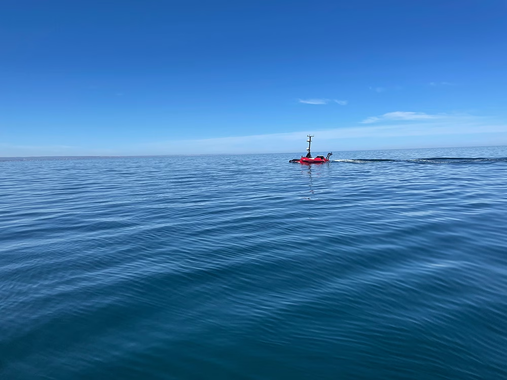
The combination of its resilient architecture and practical engineering makes RockFLEET Assured a strong choice for vessels facing GPS-denied conditions and AWRPs. Cargo ships transiting spoofing hotspots can maintain position awareness even when GNSS becomes unreliable, helping bridge teams maintain safe routing. Naval vessels operating amid electronic warfare retain dependable timing and navigation essential for mission coordination. And unmanned surface vessels benefit from uninterrupted PNT in high latitude regions where GNSS performance can be challenged.

By combining Iridium’s PNT service with RockFLEET Assured’s maritime-ready integration and onboard monitoring features, RockFLEET Assured provides a trusted positioning capability to mitigate the threats that contribute to rising war risk premiums in regions like the Red Sea and Black Sea.

Triton Case RockFLEET Assured

Reliable Navigation for Insurers and Shipowners

With millions at stake in AWRPs alone, Iridium PNT provides a new level of assurance for both insurers and vessel operators. For insurers, the technology reduces exposure to spoofing, improves positioning reliability, and enables more accurate data driven risk pricing. For shipowners and operators, APNT can lower war risk premiums, improve compliance, enhance safety, and ensure operational continuity in high-risk zones.

As the geopolitical risks continue to grow and GNSS vulnerabilities become more frequent, A-PNT is emerging not only as a navigation tool but as a business-critical tracking asset. It allows maritime stakeholders to operate with confidence, knowing that the positional data underpinning insurance decisions, operational planning, and safety compliance is reliable.

In this context, Iridium PNT and RockFLEET Assured represent a transformative solution, providing trusted, validated, and resilient positioning, navigation and timing data that benefits insurers, shipowners, and the broader shipping ecosystem. For stakeholders aiming to reduce financial exposure, enhance safety, and navigate conflict zones with confidence, RockBLOCK APNT is a reliable solution. By enabling a verifiable “source of truth” for vessel positioning, RockFLEET Assured enables more accurate, reliable and cost-effective maritime war risk insurance assessment for modern maritime operations.

Trusted A-PNT Expertise for Resilient Maritime Operations

Ground Control brings more than 20 years of experience delivering resilient satellite solutions for maritime and critical communications. We understand that no two vessels, fleets, or operating environments are the same, which is why we provide expert guidance on deploying the right mix of A-PNT capabilities and reliable satellite connectivity options to ensure trusted positioning, navigation, and timing at sea.

Complete the form, or email hello@groundcontrol.com and we’ll reply within one working day.

Name
Privacy Policy

Top GNSS/GPS-Denial Questions Answered

Modern military, aviation, and maritime operations are critically dependent on precise Positioning, Navigation, and Timing (PNT) data. For decades, the Global Positioning System (GPS) and other Global Navigation Satellite Systems (GNSS) have served as the backbone of these capabilities, enabling everything from aircraft navigation and drone guidance to vessel tracking and synchronized global communications. However, as GPS denial and deception events become more frequent and geographically widespread, the need for resilient, assured PNT (A-PNT) solutions has become urgent. Ensuring operational continuity requires a clear understanding of the causes of GNSS disruption, who is most affected, how navigation can be sustained without it, and how technologies such as A-PNT can provide protection and redundancy.

The following GPS/GNSS-denial questions outline the key dimensions of this challenge: the sources of GPS disruption, the sectors and regions most exposed, operational fallback procedures, and the A-PNT technologies and strategies designed to safeguard navigation and timing in an increasingly contested GPS environment.

Q1. What Causes GPS Disruption?

Disruption can arise from unintentional interference, deliberate hostile actions, or natural environmental factors; all of which can degrade, deny, or corrupt the signal in ways that directly impact mission assurance and operational safety.

Unintentional interference remains a common source of disruption, particularly in congested environments, like major shipping ports, airspace hubs, and coastal regions. Overpowered or poorly shielded radio frequency transmitters, such as cellular base stations, radar systems, or satellite uplinks, can unintentionally saturate or desensitize GNSS receivers. Faulty amplifiers, including “personal privacy devices” (PPDs) used illegally in vehicles to block tracking, also generate wideband noise that can overwhelm nearby receivers.

Intentional interference, including jamming and spoofing, poses a more severe and rapidly escalating threat. In the military domain, jamming may occur during electronic warfare or combat operations. Criminal organizations also exploit GPS and GNSS vulnerabilities for illicit purposes such as cargo theft, illegal fishing, or sanctions evasion using low cost jammers and spoofers to conceal location or manipulate tracking data. In aviation and maritime operations, such interference can mislead autopilot systems, distort route data, and undermine collision avoidance and surveillance systems like ADS-B and AIS, potentially leading to incidents that pose a threat to life.

Environmental and natural factors further complicate GPS reliability. Solar flares and ionospheric disturbances can alter signal transmission, particularly at high latitudes or during periods of intense space weather, resulting in signal delays or complete loss of lock.  Multipath reflections from large metallic structures, such as port cranes, vessel superstructures, or urban skyscrapers, can also distort signals and create false positional data. These effects are particularly acute in confined environments like harbors or dense airspace corridors, where reflected signals can be mistaken for valid GPS information.

Detection and characterization of GPS/GNSS disruption requires a combination of technical and procedural measures. RF power monitoring and direction finding equipment can help locate the source of interference, while incident mapping and space weather alerts support broader situational awareness. Crowdsourced interference reporting and data sharing between civil and military authorities enhance detection coverage and enable trend analysis across regions.

Q2. Who is Most Affected, and Where?

GPS and GNSS disruption has a disproportionate impact on sectors that rely on precise navigation and timing. In aviation, aircraft operating near conflict zones or at high latitudes are particularly vulnerable, with disruptions threatening precision approaches and timing synchronization. In the maritime sector, interference often concentrates along high risk regions with geopolitical tensions, including the Black Sea, Baltic, Eastern Mediterranean, and Persian Gulf – areas where dynamic positioning systems rely heavily on GPS and GNSS inputs.

In aviation, large airliners, business jets, and unmanned systems operating near conflict zones or at polar latitudes are especially exposed. In those corridors, loss or distortion of GPS during approaches or in cruise phases can degrade precision approach capabilities and force reliance on limited backup navigation systems. The aviation industry has already documented multiple spoofing and jamming events, with airlines reporting up to 1,500 daily spoofing incidents in airspace near hotspots like Israel, Lebanon, and Russia by August last year. In some cases, flights have been diverted or prevented from operating safely when GPS was degraded, and civilian aircraft have even been misled toward foreign airspace boundaries by spoofed signals in the Middle East.

In the maritime domain, the impact is acute along major shipping corridors and in regions already identified as interference hotspots. The Black Sea and Baltic Sea remain among the earliest and most persistent trouble zones, but interference has now spread to the Eastern Mediterranean, Persian Gulf, Red Sea, and other high traffic zones. In the second quarter of 2025, GPSPATRON reported that more than 10,000 vessels were affected by GNSS interference – an eightfold increase compared with the previous quarter. The report highlights both a real escalation in jamming and spoofing activity and an improvement in reporting systems across the maritime domain.

From a geographic perspective, “urban canyon” environments – major cities like London, Shanghai, Los Angeles – face a different, localized risk: multipath distortion and spoofing attempts exploiting signal reflections. In addition, there has been an uptick in inland interference reports, especially near major airports and ports, which has been attributed to illicit jammers in vehicles or on-ground emitters aiming to mask tracking.

Through enhanced incident reporting and sharing to understand which domains, vessels, aircraft, and infrastructure are most at risk, and where interference is currently the most concentrated, decision makers can prioritize surveillance assets, including radio frequency monitors, and deploy resilient PNT systems in high risk zones first, where vulnerability is highest.

Q3. How do Pilots, Mariners, and Military Personnel Navigate Without GPS?

In aviation, when GPS is unavailable, aircraft revert to more traditional navigation systems and navigation aids that must be maintained as essential backups. The backbone is the Inertial Reference System (IRS)  and Inertial Navigation System (INS), which uses accelerometers and gyroscopes to continuously estimate position, velocity, and attitude. However, inertial systems suffer from drift – small sensor errors accumulate over time. To constrain that drift, pilots use periodic corrections from ground-based radio aids such as DME (Distance Measuring Equipment), VOR (VHF Omnidirectional Range), or radar updates from Air Traffic Control. When GPS integrity is lost, pilots may revert to conventional airways and non-GNSS instrument procedures, fly under visual flight rules if weather allows, or rely on approaches guided by the Instrument Landing System (ILS), NDB (Non-Directional Beacon), or local ground-based navigation aids. The FAA explicitly retains a VOR MON (Minimum Operational Network) concept to ensure aircraft can navigate via conventional VOR paths during GPS outages.

In maritime and offshore operations, GNSS denial is a severe vulnerability, particularly for dynamic positioning vessels and precise stationkeeping tasks, so ships rely on a suite of fallback systems. A gyrocompass, Doppler log, and radar-bearing fixes provide coarse navigation and heading references in coastal waters. Electronic Chart Display and Information Systems (ECDIS) allow manual plotting of fixes, and in more extended open ocean transits, celestial navigation or celestial fixes remain usable (albeit with skill). Some operators are evaluating the revival of terrestrial radio systems like eLORAN, which transmit low frequency signals over land that are much harder to jam and can serve as a GNSS backup in restricted regions.

For military operations in contested or GPS-denied environments, reliance on GNSS is particularly fragile, so hybrid navigation is essential. The U.S. Army has actively pursued pseudolite networks (ground-based “pseudo-satellites”) to preserve position information when GPS is denied. Pseudolites broadcast local ranging signals that, when integrated with an INS, give troops a reliable local positioning layer with far higher received power than spaceborne signals and therefore much better resistance to jamming at the tactical scale.

These alternative methods, however, are not without vulnerabilities or trade-offs. Inertial systems drift and must be regularly corrected; radio aids can be jammed, degraded, or decommissioned, vision-based systems fail in low visibility or featureless terrain, and acoustic or pseudolite systems have limited coverage or require infrastructure. This is why cross-training crews in traditional navigation techniques, sensor fusion architectures, and frequent calibration of INS and navigation sensors remains essential. Maintaining up to date navigation charts, ground aids, and fallback databases all help to ensure operational continuity when GNSS is degraded or denied.

Q4. What’s A-PNT, and How Does it Compare to GPS?

RockFLEET Assured Installation Image (with Transparent Background)
GPS and GNSS signals originate from satellites orbiting over 20,000 kilometers above Earth (in Medium Earth Orbit). The signals received at ground level are weaker, more easily disrupted or imitated by stronger, locally generated transmissions. A-PNT is designed to provide resilient, assured PNT when GPS or other GNSS signals are degraded, denied, or spoofed. GPS, while globally available and highly accurate under nominal conditions, is inherently vulnerable because its space-based signals are extremely weak and susceptible to jamming, spoofing, or interference from natural and environmental factors.

Iridium’s Positioning, Navigation and Timing service, Iridium PNT, is made up of a constellation of 66 Low Earth Orbit (LEO) satellites, which provide overlapping global coverage, including the polar regions. Unlike GNSS satellites in Medium Earth Orbit (MEO), Iridium satellites transmit PNT signals that are approximately 1,000 times stronger than GPS signals, making A-PNT particularly valuable in urban canyons, indoor environments, and other challenging conditions where GNSS signals may be obstructed.

Q5. How Is Iridium PNT Improving Navigational Resilience for GPS-denied Territories?

For military and security users, this shift offers critical operational advantages. LEO-PNT services delivered via the Iridium constellation provide encrypted and regionally tailored positioning, navigation, and timing data that can penetrate indoors, under canopy, or through moderate jamming. Iridium’s PNT service leverages Iridium’s 66-satellite global mesh operating in the L-band, distinct from GPS frequencies, making it far harder to disrupt with conventional jamming equipment. Because the Iridium system is already operational and uses cross-linked satellites for global coverage, it provides real time assured timing and location integrity even in contested or denied regions such as the Arctic, the Indo-Pacific, or urban RF-dense zones.

GNSS diagram for RockFleet Assured


Satellite proximity to the Earth and signal strength alone, however, are not enough to secure PNT. Thus, the Iridium PNT service also incorporates cryptographic authentication to protect against spoofing and tampering. Every navigation and timing message is digitally signed, and receiving devices verify the integrity of those signatures before using the data. Unauthorized or falsified signals are rejected, ensuring that systems operate only on trusted information, delivering a far more robust and resilient service than GPS.

For commercial shipping and aviation, these LEO-based services introduce an accessible layer of resilience. In hybrid navigation, Iridium PNT works alongside GNSS and INS, enabling devices such as RockFLEET Assured to seamlessly shift or blend inputs as signal conditions change. In maritime environments, where GPS spoofing has been documented in the Black Sea and Eastern Mediterranean, Iridium-based A-PNT can sustain dynamic positioning operations. Similarly, aviation operators can use A-PNT to maintain flight management system synchronization and prevent false positional data from compromising navigation displays.

In practice, A-PNT serves as a critical additional layer of navigation for military, maritime, and aviation operations, allowing personnel, aircraft, ships, and unmanned systems to maintain mission continuity when GNSS is compromised. The resilient and secure design of A-PNT provides operational assurance, mitigating the single point vulnerabilities of space-based GNSS and GPS navigation, and is increasingly becoming recognized for resilient navigational planning in both defense and commercial sectors.

Q. 6 Are There Civilian-grade Alternatives to GPS?

Satellite A-PNT (Global, Operational Today)

Iridium’s PNT service is the only commercially available, satellite-delivered A-PNT service today. It rides on Iridium’s cross-linked LEO constellation to deliver robust time and location that complements GNSS and works indoors/urban canyons with much higher received power than MEO GNSS. It’s in service now across critical infrastructure timing and is being integrated with avionics and INS for navigation resilience. In a layered architecture, receivers blend or fail over between GNSS, inertial sensors and Iridium PNT to maintain continuity when GNSS is degraded or spoofed (this behavior is implemented by the receiving system; Iridium PNT is the alternative signal).


More GNSS ≠ an “Alternative,” But it Adds Diversity

Galileo now offers OSNMA (operational since 24 July 2025) to authenticate navigation messages and harden against spoofing. Helpful, but it doesn’t solve jamming or deep attenuation, because it’s still a MEO GNSS signal.

GLONASS, BeiDou, QZSS, NavIC add constellation diversity and regional coverage, improving availability and geometry. They still share core GNSS vulnerabilities (low received power, jamming/occlusion, multipath), so they’re complements, not true A-PNT alternatives. The need for non-GNSS layers is a key theme in recent policy/industry work.


Terrestrial A-PNT (Promising, But Deployment-dependent)

eLoran (LF terrestrial) delivers strong, hard to jam signals and good timing/positioning potential where networks exist. Roll-outs remain national/project-based (e.g., UK market engagement and MOD work on deployable eLoran), so coverage is not yet ubiquitous.


Emerging LEO PNT (Pre-commercial Navigation)

Several startups are flight-testing LEO PNT and demonstrating receivers, but broad commercial navigation services are still in demonstration/early rollout, not widely available to civilians today. They underscore the momentum toward frequency/orbit diversity, but Iridium PNT is the operational option right now.

For civilian users who need assured PNT today, the practical, globally available satellite alternative layer is Iridium’s PNT service, best used in a hybrid stack alongside GNSS and inertial sensors. Additional GNSS constellations and OSNMA improve resilience to spoofing, while eLoran and emerging LEO PNT add promising diversity where deployed, but they don’t replace the need for a satellite A-PNT layer like Iridium PNT in 2025/6.

Q7. What are the Early Warning Signs of GNSS Interference?

Early warning signs of GNSS interference are critical for maintaining operational safety across military, aviation, and maritime platforms. Onboard receivers may show a sudden loss of satellite lock, unexpected position or time jumps, or RAIM/integrity alerts in aircraft, all of which indicate potential jamming or spoofing. Unusually high or low signal-to-noise ratios, discrepancies between redundant receivers, or inconsistencies with INS, radar, Doppler logs, or visual bearings, or an Iridium PNT feed, are additional red flags.

In hybrid GNSS + INS + Iridium PNT architectures, the system can continuously compare GNSS against Iridium PNT’s independent time/location. Divergence beyond thresholds, for example, GNSS position drifting while STL-referenced dead reckoning and ship sensors remain coherent, provides early, positive indication of spoofing or severe degradation, enabling alarms, de-weighting of GNSS, or automatic failover/blending to maintain navigation continuity.

At the system level, automated controls may generate alerts: aircraft autopilots or ship dynamic positioning systems may show deviations from expected performance without an apparent environmental cause. Slowly drifting positions or erratic movements that do not match the platform’s true course may suggest spoofing rather than outright jamming. Environmental indicators, such as unusual RF activity in GNSS frequency bands or corroborating reports from nearby vessels or aircraft, can confirm the presence of interference.

Q8. What are the Operational Detection and Reporting Practices?

GNSS interference is usually first detected by anomalies in receiver behavior, a sudden loss of lock, abrupt jumps in reported position or time, unexplained offsets between redundant receivers and inconsistent cross-checks such as mismatches in radar or visual bearings. Passive indicators include a degraded number of satellites, rising noise floor on GNSS receivers, and unusual changes in signal-to-noise ratio. Spectrum analyzers or dedicated GNSS interference detectors will also show elevated power in GNSS bands or narrowband/discrete emitters.

For commercial ships and offshore platforms, once GPS and GNSS denial, jamming, or spoofing is detected, immediate shipboard actions should include switching to alternative position references, alerting the master and company operations center, logging precise UTC times and system messages, and retaining raw GNSS logs for later analysis. Reports must be made immediately to the national coastguard, port authorities and, where relevant, the NATO Shipping Center or regional maritime security centers. International bodies have urged states to set up reporting processes and share incident information to build enhanced situational awareness of GPS and GNSS jamming incidents.

Crews and air traffic control in civil aviation must treat suspected GNSS anomalies as safety events. Typical detection triggers are RAIM failures, unexpected position/time jumps, or receivers losing satellites simultaneously. Immediate mitigations include notifying Air Traffic Control, switching to approved non-GNSS procedures and filing a formal GPS Anomaly Report to the aviation authority. Regulators recommend issuing NOTAMs quickly once interference is corroborated and coordinating regionally to warn other operators.

Military units operate under additional communication constraints but follow similar practical steps. Military reporting prioritizes rapid attribution and countermeasures, but civil and military coordination is critical when interference affects commercial traffic or national infrastructure. NATO and national EW authorities, therefore, maintain liaison procedures to escalate cross-domain incidents. Parliamentary and defense briefings recommend documenting events and sharing forensic data while preserving operational security.

Good reporting practice in all domains requires preserving evidence and providing standardized data. Centralized incident submissions allow pattern analysis and help regulators issue area-wide warnings. Crowdsourced detection projects and academic anomaly detection tools can supplement official channels and speed community awareness.

In Summary

The vulnerabilities of GPS and GNSS represent a critical operational risk across military, aviation, and maritime domains. Their inherently weak signals are easily disrupted by intentional jamming, spoofing, or even natural phenomena such as solar flares and ionospheric disturbances. Real world incidents from the Black Sea to the Eastern Mediterranean and Arctic corridors have repeatedly demonstrated that overreliance on GNSS can jeopardize mission integrity, navigational safety, and the continuity of operations. To mitigate these threats, both defense forces and commercial operators should invest in A-PNT to further strengthen resilience by providing high-power, encrypted, and timing and positioning data.

The strategic imperative is clear: GNSS dependence must evolve toward a multi-layered ecosystem, integrating terrestrial and PNT technologies, procedural training, and robust reporting chains. For decision makers in defense, aviation, and commercial shipping, building resilience into PNT infrastructure has become an operational necessity for maintaining control, safety, and strategic advantage in an increasingly contested environment.

Any more questions?

If you didn’t find the answer you were looking for, or if you’d like to discuss how A-PNT could enhance your GPS and GNSS architecture, our team is here to help.

Simply fill out the form, and one of our experts will get back to you to talk through your requirements, explore the solutions, and help you plan your next steps.

Whether you’re just starting to explore A-PNT or are ready to move ahead with an A-PNT solution, we’ll work with you to find the right device for your application.

Name
Privacy Policy

Why GPS Isn’t Enough Anymore, And What Lies Beyond

Every time your phone pings “You have arrived”, it’s easy to forget that satellites, atomic clocks and radio beams are doing the heavy lifting. For decades, GPS has been the quiet backbone of modern life, powering navigation, synchronizing telecom networks, and enabling aviation, shipping and defense operations to function effectively. But GPS dependence is starting to look fragile.

Over the last few years, the world has seen an alarming rise in deliberate GPS jamming and spoofing. In 2024, over 1,000 commercial flights a day were affected by GPS spoofing, and this is not an isolated trend. There’s growing awareness that single-source dependence on GNSS/GPS is a strategic vulnerability. The increase of jamming and spoofing incidents has sparked growing concern that GPS manipulation could be exploited for strategic or economic gain, prompting the United Nations to call for stronger safeguards against GPS satellite interference. Aviation, shipping and defense organizations need a practical, deployable alternative now – and a plan for a layered approach in the future – because the real question isn’t if GPS will fail, but what we’ll do when it does.


The Threat of Jamming and Spoofing

Put in simple terms, “jamming” means drowning satellite signals with noise so receivers can’t hear the real thing, and “spoofing” feeds false satellite signals to trick receivers into believing they’re somewhere they’re not.

Deliberate jamming and spoofing incidents are rising in aviation, commercial shipping and defense, and the consequences are no longer hypothetical. In the Baltic Sea and Gulf of Finland, reports of jamming and spoofing incidents rose from 1,225 affected shipping vessels in Q1 of 2025, to more than 5,800 affected vessels in Q2 – a 127% increase. Six years ago, in 2019, commercial vessels operating in Chinese ports around Shanghai, reported widespread GPS anomalies. Ships experienced sudden changes in reported positions, with some appearing to move erratically or vanish from tracking systems. Investigations revealed that these anomalies were due to GPS spoofing attacks which affected hundreds of vessels and disrupted port operations.

Fast forward to this year, and the Nordic and Baltic nations, including Finland, Latvia, Lithuania and Estonia, repeatedly warned about greater electronic interference from Russia disrupting communications with planes, ships and drones. In September of this year, a plane carrying European Union chief Ursula von der Leyen was forced to land in Bulgaria using paper maps after its GPS navigation systems were jammed.

These incidents alone underscore the growing vulnerability of global navigation systems and highlight the need for stronger safeguards against electronic interference in critical transportation and defense sectors.


When GPS fails in Aviation, Maritime and Defense

The Hybrid Navigation Future

With reliance on GPS across aviation, commercial shipping, and defense sectors, concerns about vulnerability to jamming, spoofing, and system outages have driven efforts to explore more resilient navigation technologies. A range of emerging solutions is shaping the future of Assured Positioning, Navigation, and Timing (A-PNT). Each alternative offers strengths and limitations, highlighting the likelihood that the future of navigation will depend on a hybrid mix rather than a single replacement for GPS.


1. Multi-constellation GNSS

Utilizing signals from multiple satellite systems increases redundancy and complicates blanket jamming – but it doesn’t solve targeted spoofing.


2. Inertial navigation systems (INS) and sensor fusion

High-grade inertial measurement units (IMUs) combined with map-matching can bridge gaps for short to medium durations. Classical INS drifts over time however, unless tightly integrated with GNSS to bound drift, and high-performance INS can be expensive.


3. eLORAN (terrestrial low-frequency radio)

eLORAN is a modernized terrestrial radio navigation system that can provide wide area PNT and is much harder to jam at scale. The UK’s Ministry of Defence is focusing its alternative positioning, navigation and timing (Alt PNT) initiative on developing “a proposal for a resilient, terrestrial, and sovereign Enhanced Long-Range Navigation (eLORAN) system to provide backup position and navigation.” In the proposal stage only, the reintroduction and deployment of eLORAN is not currently an active system for GPS resilience.


4. Quantum and advanced sensing

Quantum sensors – notably atom interferometers, quantum magnetometers and other quantum-enabled instruments – can measure motion, gravity or magnetic anomalies with extremely high precision, potentially enabling navigation without satellite signals for hours. Last year, Boeing completed the first recorded flight using quantum navigation systems to navigate across the central United States for four hours without GPS. These technologies are not available outside of testing yet, but could be an option for navigation independent of GPS in the future.


5. Assured Positioning, Navigation and Timing (A-PNT)

Unlike GNSS satellites in Medium Earth Orbit (MEO), Iridium satellites transmit PNT signals from Low Earth Orbit (LEO) that are approximately 1,000 times stronger than GPS signals, allowing them to penetrate buildings and other hard-to-reach areas. The Iridium PNT service also incorporates cryptographic authentication to protect against spoofing and tampering. Thus, unauthorized or falsified signals are rejected, ensuring that systems operate only on trusted information. To harness Iridium PNT, organizations will need compatible receivers, firmware updates and integration with existing PNT stacks. However, that effort is still easier and faster today than building a whole eLORAN network or replacing INS suites.


GNSS diagram for RockFleet Assured

After appraising what’s available today, Iridium’s PNT service for A-PNT stands out as the most immediate, practical, and deployable mitigation to GPS jamming and spoofing. Drawing on our experience designing and building A-PNT hardware that leverages this service, we see it as a realistic option organizations can adopt now, not just a concept on the horizon.

It’s important to note, however, that A-PNT is not a full replacement for every GPS/GNSS function. While Iridium PNT excels in providing trusted timing and “truth” signals that help detect spoofing or restore receiver integrity, some high-precision positioning applications (such as sub-decimeter RTK-level GNSS for surveying) will continue to depend on multi-constellation GNSS and augmentation for the foreseeable future. For that reason, both the National Telecommunications and Information Administration (NTIA) and leading industry bodies advocate a layered approach to GPS resilience.

Iridium PNT:

  • Is already trusted by defense and commercial sectors
  • Delivers stronger LEO signals than GNSS MEO signals
  • Delivers hard-to-jam signals with cryptographic techniques
  • Is in deployment now, commercially available, and expanding.

A Layered Approach for Future GPS Resiliency

GPS reshaped modern life and will remain vital to everyday navigation and positioning, so the right answer isn’t to replace GPS, but complement it with A-PNT. Jamming and spoofing incidents are real, growing, and in some regions, weaponized. The future of resilient navigation is a hybrid one – multiple GNSS constellations, A-PNT, and in the years to come, hardened terrestrial systems like eLORAN and robust inertial/quantum sensors.

From commercial aviation to maritime shipping, military operations to critical infrastructure, reliance on a single GNNS/GPS source exposes organizations to jamming, spoofing, and unexpected interference. The examples of disrupted flights, misreported vessel locations, and spoofed navigation systems highlight its vulnerabilities.

A layered approach to PNT is essential. Among these, Iridium PNT stands out as an immediate, resilient solution. APNT provides critical timing and location integrity that organizations can rely on while building a more comprehensive layered system. Together, those layers can make sure “You have arrived” stays true, even when someone tries to move you off course.

Connecting Assets and Operations Beyond GPS

Building resilient A-PNT into our operations isn’t about replacing GPS, it’s about ensuring confidence when GPS can’t be trusted.

With over 20 years of experience, we’re a satellite-enabled solutions partner you can trust to implement technology that safeguards your aviation, maritime, and defense operations and for secure, real time data transmission wherever your journey takes you.

If you’d like to know more about our APNT solutions, our team can help you. Email hello@groundcontrol.com or complete the form, and we’ll be in touch within one working day.

Name
Privacy Policy

How Satellite IoT Keeps Pipeline Infrastructure Safe in Remote Environments

Pipelines stretch thousands of miles, transporting oil, gas, water, and chemicals across diverse terrains, including mountainous areas, deserts, and offshore waters. They are essential infrastructure, but monitoring such vast and inaccessible pipeline networks presents a unique challenge and when leaks or failures go undetected, the consequences can be severe to both the pipeline operators and the environment.

Satellite-enabled IoT is an increasingly viable solution. By linking sensors directly to a global network of satellites, operators can achieve 24/7 data monitoring with zero dependance on terrestrial networks. With satellite IoT, pipeline operators can continuously monitor pipeline health, detect anomalies in real time, predict maintenance needs, and even act remotely to prevent minor issues from becoming costly disasters. Pipelines will always cross remote places, but with satellite IoT, those places no longer have to be blind spots.

Here’s why pipeline health monitoring is critical, and how selecting the right satellite IoT network and device – from low power sensors to real time control systems – can help operators protect remote infrastructure and prevent costly failures.


Why Remote Pipelines Need Satellite IoT

Traditional pipeline monitoring methods rely heavily on cellular networks or fixed wired systems. Both approaches work well where infrastructure is dense and coverage is consistent, but pipelines rarely follow such convenient paths. They cross deserts, mountain ranges, wetlands, and offshore environments where terrestrial coverage is patchy at best and, in many cases, does not exist at all. Wired systems, meanwhile, are expensive to install and maintain over long distances, particularly where terrain is unstable or hostile.

Coverage gaps create serious risks, as even a small leak in an isolated section of pipeline can go undetected for days, releasing oil, gas, or chemicals into the surrounding environment. In many cases, this not only carries the cost of remediation but also heavy regulatory penalties and reputational damage. Even when problems are eventually identified, the time lost between the first failure and the response often magnifies the scale of the incident.

Unplanned downtime is another consequence of limited pipeline monitoring. When equipment fails without warning, operators are forced to take entire sections of pipeline offline while they diagnose and repair the issue. This is disruptive and costly, especially in industries where margins depend on continuous flow. Coverage gaps also limit the effectiveness of predictive maintenance, forcing operators to rely on scheduled inspections or reactive repairs that drive up costs and increase vulnerability.

Further, there are safety implications. When a fault occurs in a remote environment, personnel are dispatched into difficult and sometimes hazardous conditions with limited information about what awaits them. This not only puts people at risk, but it also slows the time to resolution. Ultimately, terrestrial connectivity is not sufficient to monitor, manage, and ensure pipeline and personnel health in the mostremote areas.

Remote Pipeline image

The Cost of Connectivity Gaps in Pipeline Monitoring

In March 2006, more than 200,000 gallons of crude oil spilled onto the Alaskan tundra from BP’s Prudhoe Bay pipeline; the largest oil spill ever recorded on the North Slope at the time. Investigators traced the leak to a ¼-inch hole caused by internal corrosion in a section of pipeline that had not been inspected for years. With limited monitoring in this remote environment, the corrosion went undetected until it caused a catastrophic failure. The consequences were immediate: U.S. domestic oil production dropped by nearly eight percent, cleanup costs ran into the hundreds of millions, and regulators imposed heavy fines.

A similar pattern has played out elsewhere. In 2017, a crude oil pipeline in India ruptured along a hidden seam defect despite having undergone periodic inline inspections. Without continuous monitoring, the defect went unnoticed between inspection intervals, ultimately leading to a major spill and disruption to local communities and infrastructure.

These cases illustrate how gaps in visibility – whether caused by lack of network coverage or the limits of periodic inspections – can turn slow-building problems into headline-grabbing disasters. In remote areas where traditional cellular or wired networks simply don’t reach, operators are left to rely on sporadic checks, leaving too much room for failure.

How Satellite IoT Bridges The Connectivity Gap

Satellite IoT bridges the connectivity gap in pipeline monitoring, eliminates blind spots, and addresses pipeline vulnerabilities. Here’s how:


1. Detecting Anomalies Before They Escalate

The earliest signs of issues within a pipeline can be subtle – a slight pressure drop, a shift in temperature, or a vibration outside normal range can all indicate the beginning of a leak, corrosion, or interference. Continuous sensing makes these small deviations visible, but visibility is only useful if the data can reach operators without delay.

In regions with reliable terrestrial networks, that flow of data is relatively straightforward. In remote terrain, a sensor may detect a problem, but without connectivity, the information stays in the field. By the time operators and inspectors reach the pipeline, days may have passed and a minor leak may have spread into soil, waterways, or communities. The result is a much larger clean-up, higher costs, and often regulatory scrutiny. This is where satellite IoT changes the equation. Data from remote sensors is transmitted securely from any location on Earth with a clear view of the sky. Operators have complete visibility in near real time and can act on the first sign of irregularity.

2. Predictive Maintenance with Data Intelligence

Pipelines and their supporting equipment degrade gradually over time; bearings loosen, pumps vibrate, and valves begin to stick. If these changes go undetected, the first sign of trouble may be a breakdown, forcing operators to react after the fact by dispatching crews to remote locations at short notice and losing valuable supply time. Research shows that failures in critical components like bearings and pumps are among the leading causes of unplanned downtime in industrial systems, particularly when early warning data are scarce.

In areas without reliable connectivity, operators often rely on fixed inspection schedules, replacing components whether they need it or not, or worse, leaving them in place too long, which raises the risk of failure. This approach means maintenance decisions are based on limited information rather than real time insights into the pipeline’s actual condition, a problem well documented in studies of condition-based maintenance and industrial IoT. As a result, organizations remain stuck in a reactive cycle, facing higher costs and greater operational vulnerability.

Satellite-enabled predictive maintenance works differently. By streaming live sensor data into analytical systems, operators can recognize patterns that signal when a component is beginning to deteriorate. A pump running hotter than usual, or a valve that opens more slowly than before, triggers an automated early warning. Pipeline maintenance teams can then be dispatched to service the specific section of pipeline that needs maintenance, at the right time, rather than covering hundreds of miles in search of faults that may or may not exist.

Satellite IoT makes this approach viable even in the most remote environments. Reliable, global satellite coverage ensures that predictive platforms always receive the data they require, so operators are no longer forced to choose between over-servicing their pipelines and risking unexpected failure. They can maintain only what requires intervention, extend the lifespan of their assets, and minimise downtime. This leads to safer operations, more cost-effective maintenance, and fewer unexpected failures.

Pipeline in remote landscape


3. Monitoring and Control from Afar

Detecting issues in pipeline health is only half the battle. As most pipelines stretch across some of the most inaccessible terrain on earth and beyond cellular reach, operators are forced to rely on field teams reaching the site before remedial action can take place, and that delay can be costly. A leak may continue unchecked for hours or days and valuable time can be lost while crews travel long distances with limited information about any issues.

Satellite IoT enables remote actuation, allowing pipeline operators to send commands instantly to equipment in the field, closing valves, adjusting pumps, or isolating sections of pipe as soon as a problem is detected. A pressure sensor signalling a sudden drop can trigger an immediate response from the control room, instead of waiting for a maintenance team to drive or fly to a remote location. The technology not only directly reduces the scale of spills but also shortens downtime and improves safety for field personnel. Pipeline engineers are no longer dispatched into hazardous conditions to perform urgent manual interventions and instead, they can attend the site to carry out targeted repairs under safer, more controlled circumstances.

Without satellite-enabled actuation, pipeline operators remain vulnerable to longer response times and escalating incidents in remote regions. With it, they gain the ability to contain risks immediately, keeping both pipeline infrastructure and the surrounding environment safer.

Choosing the Right Satellite IoT Solution

Every pipeline is different. The right connectivity depends on how much data you need to transmit, how often you need to send it, and how critical it is to have immediate, two way communication. Here’s a quick guide to help you decide where to start.

For Low Data Volumes and Periodic Updates: NTN NB-IoT

If your sensors only need to send small packets of data, and the problem won’t escalate if readings are sent a few times per day (e.g., 8-12 transmissions), NTN NB-IoT is a cost-effective option.

Best for environmental monitoring, slow changing metrics like temperature, pressure, or flow trends, and non-critical maintenance data.

It’s important to remember that this is emerging technology, and coverage is still expanding, so availability varies by region. Further, because the service is currently delivered by Viasat, whose satellites are in Geostationary orbit, sensors need direct line of sight to the satellite, which can be a challenge in heavily forested or mountainous terrain.

Our recommendation is RockBLOCK RTU; designed for ultra-low power consumption and long term field deployments, making it an ideal choice for pipelines using NTN NB-IoT connectivity. It’s a flexible device that can also operate on cellular where available, and can be shipped with Iridium Short Burst Data (SBD) as an alternative satellite network, if your pipeline is not within the coverage area of the NTN NB-IoT service.

RockBLOCK RTU or RockFLEET
RockBLOCK Pro

For Higher Data Volumes or More Frequent Reporting: Iridium Messaging Transport (IMT)

When your pipeline monitoring requires more frequent updates or larger data volumes, Iridium Messaging Transport (IMT) is the better fit. Its truly global coverage ensures connectivity even in the most remote environments, while its sub-10-second round-trip time makes it suitable for near real-time applications.

This is ideal for continuous health monitoring of pumps, valves, and sensors, early warning systems where immediate alerts are crucial, and remote assets that are inaccessible for long periods.

IMT supports more frequent transmissions than NTN NB-IoT and can handle a higher data load, making it ideal for situations where small, periodic updates simply aren’t enough.

Our device recommendations would be RockBLOCK Pro or RockBLOCK Plus 9704 – rugged, field-ready devices built to withstand extreme conditions and provide reliable, low power operation for continuous monitoring.

For Real Time Monitoring and Remote Control: IP-Based Solutions

For mission-critical sites where you need to both monitor and act instantly, an IP-based solution is essential. These systems enable real time, two way communication, so operators can remotely command equipment, such as closing valves or isolating sections of pipe the moment a fault is detected.

Best for critical infrastructure nodes, emergency response situations, and high value assets where downtime costs are severe.

Powered by Iridium Certus 100, these solutions deliver global coverage with very low latency, enabling near-instant response. Choose RockREMOTE Mini for a rugged tough, IP-based device which is optimized for low power draw, or RockREMOTE Rugged to take advantage of its sophisticated edge processing capabilities, and MQTT / FTP facades.

RockREMOTE Rugged

Satellite IoT gives pipeline operators the tools to see, predict, and act, even in the most remote environments. By matching the right technology to each monitoring challenge, operators can prevent minor issues from becoming disasters, safeguard their teams, and protect the environment. With the right strategy, every mile of pipeline can be monitored and managed with confidence, no matter how far it stretches.

Can we help?

Partner with us to implement satellite IoT technology that safeguards your critical infrastructure and pipeline operations.

Complete the form or email us at hello@groundcontrol.com and we’ll get back to you within one working day.

Name
Privacy Policy

How NTN NB-IoT Unlocks Smarter Water Utility Operations

Water utilities worldwide are under increasing pressure to deliver more with less. Ageing infrastructure, growing demand, environmental challenges, and regulatory compliance all demand smarter, more efficient operations. Yet many of the most critical water assets, including pipelines, reservoirs, pumping stations, and metering points, are located in remote or rural areas where conventional cellular connectivity is either unreliable or unavailable.

This connectivity gap has long been a barrier to digital transformation in the water sector. Without reliable communication between remote assets and central systems, utilities face costly manual inspections, delayed responses, and fragmented data. Satellite IoT is helping to bridge that divide, bringing off-grid infrastructure online and enabling smarter, more efficient operations. While proprietary satellite IoT has served this role for decades, a newer, standards-based alternative is now emerging: NTN NB-IoT (Non-Terrestrial Network Narrowband Internet of Things).

NTN NB-IoT, part of the 3GPP standard for satellite-enabled IoT communications, allows connected sensors to communicate with satellites using the same NB-IoT protocol, and chipset, that they would use to connect to a terrestrial network. Economies of scale means that this drives down the cost of the chipset, delivering lower hardware costs, and potentially lower airtime costs too. For water utilities, this unlocks applications that might have been cost-prohibitive prior to the advent of standards-based satellite IoT.

At Ground Control, we specialize in enabling satellite-based connectivity and telemetry solutions for critical infrastructure. As NTN NB-IoT technology matures, we’re perfectly positioned to help water utilities leverage it to extend smart monitoring and control to the very edges of their networks. Here’s how NTN NB-IoT differs from proprietary satellite IoT and where it adds value to smarter water utility operations.


Rethinking Remote Connectivity

As water utilities continue to extend monitoring and automation efforts in remote and rural environments, satellite communication has been, and remains, critical to bridge connectivity gaps where cellular networks are unreliable or unavailable. Until very recently, the only option for utilizing satellites was to use a proprietary satellite module, e.g. if you wanted to utilize the Iridium satellite constellation, you would need an Iridium module.

These proprietary solutions are are built for purpose; the designers have not had to limit their modules’ capabilities to the 3GPP standard, which of course started as a cellular standard. This means you can send more data, more quickly, through a proprietary solution.

Further, if you’re using a message-based proprietary solution, such as Iridium’s Short Burst Data service, Iridium Messaging Transport (IMT), or Viasat IoT Nano, you also get the benefit of power efficiency.

Proprietary solutions, therefore, have been a trusted option for many years, providing reliable, low bandwidth satellite communication for mission critical data such as flow rates, tank levels, pump status, and alarm notifications. They have proven particularly valuable for applications requiring near real-time data or coverage in truly isolated areas.

However, when it comes to massive IoT deployments, proprietary solutions have limitations. Relatively high device and airtime costs, and proprietary integration requirements can make services like SBD, IMT and IoT Nano challenging to deploy at scale, particularly for low-power sensor networks or distributed metering systems.

Enter NTN NB-IoT (what is NTN NB-IoT?).

Proprietary vs NTN NB-IoT Table

For water utilities, NTN NB-IoT could be a breakthrough. Water utility providers can deploy NTN NB-IoT-enabled sensors, meters, and monitoring equipment in places that were previously cost-prohibitive to connect via proprietary satellite IoT.

What are the Applications for NTN NB-IoT in Water Utilities?

For a water utility weighing NTN NB‑IoT against higher‑bandwidth proprietary satellite links, the sweet spot is infrequent, small payload telemetry where truly global reach (no cell towers) matters more than millisecond alerts. Typical deployments include:

Daily or multi‑hour meter reads
Remote or off‑grid customer meters (flow, volume) that only need to report once or twice a day for billing or usage analysis. A 200 byte payload can easily carry several readings, supporting rural homes, farms, or remote industrial sites.

Tank level and reservoir monitoring
Track water levels, detect overflow risks and monitor usage trends in storage facilities far from population centers. Gravity‑fed storage tanks in remote service areas report level and temperature every few hours – enough to plan refills without real‑time urgency.

Environmental baseline sensing
pH, turbidity, conductivity or chlorine residual sensors on remote intakes or treatment sites. These can trickle in (no pun intended!) once per shift or per day to track long term trends, enabling insight into water quality, and supporting regulatory compliance.

Pump run‑hours and basic status
Hourly or daily “I’m alive” heartbeats plus simple ON/OFF or run‑time counters to track remote booster stations or solar powered pumps, helping to reduce downtime and extend the life of critical infrastructure.

Pipeline integrity logs
Low frequency pressure, flow rate and structural vibration snapshots in isolated, hard to access terrain, allowing early detection of leaks, bursts or blockages to reduce water loss.

Asset inventory and location
Periodic GPS pings and motion/tamper alerts from mobile test vans, valve exercise robots or floating sensors in open canals, optimizing maintenance schedules and improving operational security.

Benefits of NTN NB-IoT for Water Utilities Diagram

Beyond NTN NB‑IoT: Scenarios Requiring Real Time Satellite Links

Here are the water‑utility applications that really demand real time links and higher data volumes – i.e. where you’d reach for a proprietary satellite IoT service such as SBD, IMT or IoT Nano, rather than NTN NB‑IoT:

Instant leak/failure alerts
Continuous pressure or flow monitoring that must trigger sub‑minute alarms when a burst or major leak occurs.

Remote valve actuation and control
Two‑way commands (open/close, throttling) with confirmation feedback to isolate sections of pipe or adjust flow on demand.

SCADA‑style telemetry
High frequency readings (e.g. every few seconds or minutes) from multiple sensors (pressure, temperature, vibration) at booster stations and treatment plants.

Video or acoustic inspection
Transmitting snapshots, short video clips or high‑resolution acoustic signatures from remote intake structures or pipeline inspection robots.

Predictive maintenance analytics
Bulk uploads of rich sensor datasets (e.g. vibration spectra, pump performance curves) to cloud analytics for failure prediction.

Bi‑directional firmware updates and diagnostics
Pushing larger firmware or configuration payloads OTA (over the air), plus logging back detailed health / status reports in real time.

Event‑driven sampling
Millisecond‑resolution burst data (e.g. transient pressure spikes) that need to be streamed offsite immediately for analysis.

Benefits of Proprietary Satellite IoT Diagram

Emergency backup SCADA link
A full‑bandwidth failover channel when terrestrial SCADA lines go down, to keep control room visibility alive.

These use cases all hinge on low latency, two way communication and/or bulk data transfers; capabilities that proprietary satellite IoT is designed to deliver.


What is NTN NB-IoT?

Simply, NTN NB-IoT allows data to travel over satellite using the same standard as terrestrial NB-IoT. This means that the same chipset can be used for satellite or cellular connectivity, leading to lower hardware costs, and potentially, lower airtime costs.

It doesn’t, however, mean that it is identical to terrestrial NB-IoT, and network architects need to bear its limitations in mind. We’ve outlined some of the key differences in the following table:

Product comparison
Standards-Based NTN NB-IoT* Cellular NB-IoT Proprietary Satellite IoT**
Max Practical Payload 1,000 bytes 1,400 – 1,600 bytes 16,000 bytes
Min. Practical Payload 10-30 bytes 30-50 bytes 10 bytes
Typical Latency Medium (10 – 60s); MVNO scheduling could increase this to 2 – 5 mins) Low (1 – 10s) 10 seconds under optimal conditions
Coverage United States, Canada, Brazil, Australia, New Zealand and select European markets Where supported by regional MNOs, and there is terrestrial infrastructure Global, exc. Polar regions
Cost-Optimized Monthly Data Volume < 50 KB < 5 MB < 1 MB
Typical Transmissions Per Day Common MVNO plans: ~1 – 3 uplinks/day (entry tiers) No strict cap: supports thousands to tens of thousands of uplinks/day (limited only by data plan allowances) No strict cap; governed by data plan allowances

In summary, users can anticipate smaller data volumes, and intermittent data transmission (e.g. a few times per day), allowing devices to operate for years on battery and solar power. NTN NB-IoT is, therefore, ideal for low bandwidth, low power, and long life IoT applications.


A Smarter Approach to Connectivity

NTN NB‑IoT shines when you need occasional, small payload uplinks from truly off-grid assets. Its standards based 3GPP Release 17 stack makes integration straightforward, devices run for years on battery, and you can monitor things like daily meter reads, tank levels, water‑quality snapshots or pump “heartbeats” in remote terrain without laying any infrastructure.

Proprietary satellite IoT earns its keep when you need low latency, high volume, two way links, for real time leak/failure alarms, remote valve control, SCADA‑style bursts, video or acoustic inspections, large OTA updates, and emergency failover.

With decades of experience in satellite communications, Ground Control offers more than just connectivity; we deliver complete, integrated solutions from device to cloud. So, whether you’re starting a pilot water management project or scaling a nationwide deployment, we’re here to help you harness the full potential of NTN NB-IoT and build a smarter, more resilient, and efficient water utility network.

Ready to explore your options?

Curious which satellite technology is right for your application? Whether you’re rolling out smart meters in rural areas or need real time alerts from critical infrastructure, we can help you choose the best fit solution.

Talk to our team for a side-by-side comparison of NTN NB-IoT and proprietary satellite IoT, based on your data needs, latency requirements, and power constraints.

Email hello@groundcontrol.com or complete the form, and we’ll be in touch within one working day.

Name
Privacy Policy

How RockBLOCK APNT Ensures Resilient Tracking For Military In GPS-Denied Environments

In today’s digital battlespace, Assured Positioning, Navigation, and Timing (APNT) is more than a utility; it’s the invisible infrastructure behind every mission. As adversaries grow more technologically capable, the reliability of conventional GPS-based systems is increasingly at risk. Electronic warfare tactics, such as GPS jamming and spoofing, can create blind spots and disrupt mission-critical functions. A resilient solution is needed, designed to maintain accurate, trusted location and timing data even when GPS is spoofed, faked or denied.

From satellite tracking and coordinated troop movements to secure communications and synchronized operations, reliable PNT enables modern militaries to act with speed, accuracy, and global reach.

Encapsulated within Ground Control’s RockBLOCK APNT device, reliable, global, and jamming-resilient positional awareness can be achieved by military personnel in hostile, GPS-contested environments. This blog examines the modern-day need for reliable location assurance beyond GPS for military effectiveness.


Why PNT Is Critical for Military Success

PNT systems, chiefly GPS and GNSS, are foundational to all branches of modern defense, forming the backbone of situational awareness, coordination, and operational execution. Real-time, accurate positioning provides the precise geolocation of military forces, vehicles, and critical assets, allowing commanders to make informed decisions in real time.

Navigation enables units to move accurately and more safely across land, air, or sea to ensure missions stay on course and with optimum execution. Timing is crucial for synchronizing a wide range of activities, from encrypted communications and sensor network operations to financial transactions and time-sensitive Intelligence, Surveillance, and Reconnaissance (ISR) data processing.

Numerous military functions rely on accurate and uninterrupted PNT, including Blue Force Tracking (BFT) – a system that utilizes GPS technology to track the location of friendly forces, cybersecurity command and control (C2) systems, precision time-stamping for ISR platforms, and the coordination of multi-domain operations. Without reliable PNT systems and GPS/GNSS, these operations can quickly become disjointed, inefficient, and vulnerable, jeopardizing both mission success and the safety of military personnel.

The GPS Vulnerability Problem

While GPS remains the backbone of PNT, it is vulnerable. GPS signals are low power, unencrypted and easy to jam, spoof, or fake with relatively inexpensive equipment.

In hostile environments, such as near-peer conflict zones and congested battlespaces, adversaries often target GPS to disrupt coordination, conceal positions, or disable military tracking systems.

Even in peacetime or humanitarian missions, natural obstructions like urban canyons, mountains, and indoor locations can degrade signal reception.

APNT is different. A key component of APNT is the use of one-way, secured signals transmitted from Low Earth Orbit (LEO) satellites. These signals are significantly stronger than traditional GPS – up to 1,000 times more powerful in some systems – making them far more resistant to jamming and interference. When integrated into a layered APNT architecture, these satellite-based signals help ensure trusted timing and location data even in GPS-denied environments.

Diagram of RockBLOCK APNT in Maritime Application

It’s worth noting that APNT is designed to complement, not replace, GPS and GNSS-based systems. PNT and APNT signals are compatible with some of the same hardware that supports GPS, allowing for seamless integration into existing navigation solutions. This makes APNT an ideal component of a layered satellite-tracking system strategy, enhancing resilience,
security, and continuity of positioning and timing services in critical military applications.


RockBLOCK APNT For Assured PNT Beyond GPS

For unmanned or unattended deployments, RockBLOCK APNT offers resilient satellite time and location capability in a compact, ruggedized form factor. Designed for integration into autonomous systems, remote infrastructure, and stationary platforms, it ensures critical operations remain synchronised and secure, even in heavily contested GNSS environments.

With the ability to transmit APNT data, as well as text-based messages and telemetry data (up to 100 KB per transmission), RockBLOCK APNT also serves as an effective failover
communication channel when primary systems are compromised or unavailable. Its versatility and resilience make it a valuable asset for mission-critical operations where assured connectivity is essential.

RockBLOCK Pro

A Layered PNT Strategy for Modern Defense

As militaries shift toward Multi-Domain Operations (MDO), the security and reliability of PNT and GPS are strategic priorities. Relying solely on GPS is no longer acceptable. The U.S. Department of Defense and allied nations are actively pursuing Assured PNT (APNT) initiatives, combining multiple sources to create a layered, fault-tolerant system. RockBLOCK APNT is a key enabler of this strategy in providing a complementary, GPS-independent signal that strengthens the PNT architecture.


Gain The Advantage With Mission Ready Satellite IoT

For over 20 years, we’ve partnered with defense forces, government agencies, and security contractors to develop a number of military-grade devices, harnessing APNT.

Learn how this technology can give you the tactical advantage in your mission-critical operations.

Can we help?

Our satellite-enabled RockBLOCK APNT solutions offer robust positional data connectivity when GPS fails, for defense applications and more. Partner with us to explore all our satellite solutions that safeguard your military operations anywhere in the world.

Complete the form or email hello@groundcontrol.com and we’ll get back to you within one working day.

Name
Privacy Policy

Tackling Maritime GPS Spoofing and Jamming Threats with RockFLEET Assured

One of the most disruptive threats to commercial and military maritime operators is the manipulation of Global Navigation Satellite Systems (GNSS), primarily by low-cost GPS jammers, state-sponsored GPS spoofing campaigns, and cyber-physical interference. From oil tankers seized via spoofed coordinates to cargo ships disappearing from satellite tracking due to jamming, the vulnerabilities of GNSS reliant systems are no longer theoretical, they’re operational hazards. These disruptions compromise navigation, safety, and compliance monitoring, particularly in high-risk regions such as the Baltic Sea, Eastern Mediterranean, and other areas with geopolitical tensions.

GPS Jamming Issue Grows in Eastern Mediterranean and Black Seas
Daily, October 1, 2023 – April 4, 2024

Growing Number of GPS Jamming Attempts

GNSS/GPS manipulation has far-reaching implications, from compromised navigation to operational disruptions. While there are various satellite-based techniques for detecting spoofing and jamming, RockFLEET Assured offers a truly resilient alternative. In this blog, we explore how it works and why it matters.

Key Differences Between Jamming and Spoofing

Product comparison
Jamming Spoofing
Definition Overwhelms GNSS signals with noise to block reception Sends fake GNSS signals to mislead the calculation of a false position/time
Mechanism High power RF signals on GNSS frequencies disrupt signal acquisition Fake signals mimic legitimate ones, often stronger, to deceive the vessel
Goal Denial of service (DoS) – prevents GNSS-based operation Deceives the receiving vessel into believing a false position or time
Effect on receiving vessel Loss of satellite lock; receiving vessel cannot determine position/time The receiving vessel continues to operate, but with incorrect data
Detection difficulty Often easy to detect due to complete signal loss Harder to detect, may go unnoticed as the vessel operates normally
Signal power High (to overpower weak satellite signals, typically > -100 dBm) High (to overpower weak satellite signals, typically > -100 dBm)
Legality Illegal in most countries Also illegal, often more complex to execute and trace
Hardware requirements Relatively simple – can be handheld or vehicle-mounted More complex, requires GNSS signal generation and precise timing
Use cases (malicious) Disrupt vessel navigation, leave crew and cargo vulnerable to attack Mislead ships, expose ships to hijacking, steer vessels into dangerous waters

Implications for the Shipping Industry

The interception and denial of GNSS/GPS connectivity pose significant risks to the commercial shipping industry. GPS spoofing, for example, misleads shipping vessels into believing they are on a safe course when in reality, they may be heading into dangerous waters or restricted areas. Reports indicate that vessels in the Eastern Mediterranean have been falsely located at airports, and other instances have shown ships being misled into high-risk territories. Many vessels, especially those without backup navigation systems, are vulnerable to these attacks.

In July 2019, the UK-flagged oil tanker Stena Impero, operated by Stena Bulk, was seized by Iranian forces while transiting the Strait of Hormuz. Investigations suggest that the vessel’s navigation systems were subjected to GPS spoofing, causing it to deviate into Iranian territorial waters. Analysis of AIS data indicated anomalies consistent with spoofing attacks, where counterfeit signals misled the ship’s navigation systems. This incident highlighted the vulnerabilities in maritime navigation and the potential for state actors to exploit them.

Later in 2019, vessels operating near Chinese ports, particularly around Shanghai, reported widespread GPS anomalies. Ships experienced sudden changes in reported positions, with some appearing to move erratically or vanish from tracking systems. Investigations revealed that these anomalies were due to GPS spoofing attacks, affecting hundreds of vessels and disrupting port operations. The incidents raised concerns about the potential for such attacks to be used for strategic or economic purposes, with the United Nations urging the protection of satellite navigation from interference.

Spoofing and Jamming Detection via Satellite

Satellite systems can detect GNSS/GPS spoofing and jamming by identifying inconsistencies via a number of indicators and parameters.

Positional behavior can indicate spoofing or jamming. Satellite systems can identify positional and movement abnormalities and send alerts when ships “jump” positions, show physically impossible maneuvers, such as a 90° turn at high speed, or appear in two locations simultaneously, known as ghost ships. Further, comparison with terrestrial radar and sensors is a method of spoofing detection. Satellites compare reported Automatic Identification System (AIS) data with ground radar or visual surveillance, and mismatches may indicate spoofing.

To avoid and prevent spoofing and jamming attacks, commercial shipping companies can support risk-based routing. Here, shipping companies use historical spoofing “heat maps” to reroute vessels around known interference zones, such Baltic Sea, Eastern Mediterranean, and any other region or zone with geopolitical tensions.

These detection techniques are effective, but the vulnerabilities of GNSS/GPS signals remain. A secure and resilient solution is required for complete visibility and confidence of vessel positioning at sea.

Iridium PNT For GNSS/GPS Protection at Sea

While satellite-enabled detections exist to combat traditional GNSS/GPS spoofing and jamming, Iridium offers an uncontested solution – a secure alternative for acquiring positioning, navigation, and timing (PNT) information anywhere in the world.

Iridium PNT is a one-way signal broadcast via the Iridium satellite constellation, 1,000 times stronger than GPS, making it far more resilient to jamming. Leveraging Iridium’s LEO satellite constellation and thus, a signal 25 times closer to the Earth than GNSS, Iridium PNT delivers accurate time and position data without needing traditional GNSS visibility, giving commercial ships and maritime systems trusted positioning even when GPS is denied.

Iridium PNT is not designed to replace GNSS; rather, it’s designed to complement it. Many existing GPS/GNSS receivers are capable of receiving Iridium PNT signals, making it easy to incorporate as part of a layered approach to reliable, secure and resilient tracking and positioning.

GNSS diagram for RockFleet Assured

How RockFLEET Assured Utilizes Iridium PNT for Jamming-Resilient Maritime Tracking

RockFLEET Assured is a ruggedized, compact satellite-based tracking solution that harnesses the power of Iridium PNT to deliver a secure signal independent of terrestrial or GNSS infrastructure. This PNT service offers an alternative when GPS or GNSS Global signals are absent, denied, or disrupted.

Traditional GPS signals are vulnerable and easy to overpower or imitate with spoofing equipment. Iridium PNT, by contrast, resists these threats through cryptographic techniques so spoofers cannot easily mimic the signals. Complementing traditional GPS / GNSS and delivering a reliable backup, RockFLEET Assured enables transmission of vessel location updates even when GPS / GNSS is being denied, spoofed, or jammed.

This is vital for commercial ships as well as vessels transiting piracy or cyber-prone regions, unmanned surface vehicles (USVs) operating in contested waters and NATO and allied vessels conducting patrols in high-risk areas.

Triton Case RockFLEET Assured

The technology encapsulated within RockFLEET Assured is designed for easy integration with existing maritime equipment. The device is a single above-deck terminal with no below-deck electronics required, without the optional bridge view, and setup/status are provided via a Bluetooth LE mobile app. RockFLEET Assured is compact, IP67 waterproof – ideal for harsh marine conditions – and features a marine-grade smart antenna that integrates the Iridium PNT module to support A-PNT workflows and Iridium Messaging Transport (IMT) to enable routine position reports.

Purpose-built, RockFLEET Assured is an ideal satellite-enabled, secure and rugged solution for shipping companies to tackle the ongoing threat of GPS spoofers and jammers.

Operational Scenarios with RockFLEET Assured

There are several operational scenarios where RockFLEET Assured provides an uncontested, reliable solution to GPS-denied environments, spoofing, and jamming:

Anti-Spoofing for Cargo Ships: A container vessel approaching a spoofing hotspot in the Eastern Mediterranean receives conflicting GPS signals. RockFLEET Assured continues to deliver trusted positioning, allowing the bridge crew and HQ to detect the spoof and maintain safe routing.

Naval Operations in Denied Environments: A patrol vessel operating under electronic warfare conditions near contested maritime borders loses GPS functionality. Utilizing RockFLEET Assured, onboard systems retain accurate time and position data, crucial for navigation, targeting, and tactical coordination.

Unmanned Maritime Drones: An autonomous surface vessel in the Arctic Circle cannot acquire GPS due to interference. RockFLEET Assured ensures connectivity, continuity and remote GPS monitoring via Iridium.

Secure Positioning When GPS Goes Dark

From bulk carriers drifting off-course in the Black Sea to naval vessels being targeted in the Red Sea, GNSS/GPS interference has shifted from a rare anomaly to a strategic weapon. The rise of low-cost jammers, state-sponsored spoofing campaigns, and cyber-physical interference has exposed a serious blind spot in global shipping: overdependence on vulnerable, unprotected GNSS/GPS satellite signals. RockFLEET Assured provides an essential layer of protection, ensuring a secure, resilient, and critical connection to vessels at sea.

With RockFLEET Assured, Ground Control offers a compact, secure, and rugged satellite-based solution that ensures maritime assets stay online, stay located, and stay safe, even when GPS goes dark.

Can we help?

Partner with us to implement satellite technology that safeguards your maritime operations and enhances secure, real-time data transmission wherever your journey takes you.

Complete the form or email us at hello@groundcontrol.com and we’ll get back to you within one working day.

Name
Privacy Policy

Globalstar Tracking Devices Now Integrated with Cloudloop

Ground Control’s tracking platform, Cloudloop, now supports Globalstar’s GSat Solar and SmartOne C tracking devices. The integration provides a budget friendly satellite tracking option for businesses and organizations that need occasional location updates without the expense of more advanced two-way communication systems.

This integration expands the range of options available through Cloudloop Tracking, allowing users to deploy low power, long lasting satellite tracking solutions that are ideal for monitoring assets in remote or off grid locations where cellular coverage is unreliable or unavailable.

Globalstar Logo

Globalstar operates a constellation of Low Earth Orbit (LEO) satellites, providing cost-effective tracking solutions for businesses. Devices transmit location and status updates to the satellite network at predefined intervals, and in the case of the selected hardware, only send data one way. While this has some limitations (they’re not suitable for real-time tracking of high value assets), it means the devices are significantly cheaper than two-way communication alternatives. They also draw very little power, and can run for years without maintenance, making them ideal for remote asset tracking. Their compact size and flexible mounting options also make Globalstar trackers easy to install on various assets.

Globalstar’s services are regionally available, mainly in North America, Europe, and parts of South America (see coverage map).


Why Choose Globalstar for Asset Tracking?


Lower Cost, Simple Tracking

Globalstar’s tracking solutions provide a cost-effective way to monitor assets that do not require real-time oversight. If you need to be 100% certain of an asset’s position at all times or require two-way messaging, other solutions (like Iridium-based tracking) will be more suited. However, compared to premium two-way satellite tracking solutions, Globalstar devices significantly reduce tracking expenses while still offering a reliable means of monitoring asset movements. For businesses managing large fleets of lower-value assets, the cost savings can be substantial.


Battery Powered and Compact

Both the GSat Solar and SmartOne C are designed for easy deployment without the need for a constant power source. The GSat Solar harnesses solar energy, making it an excellent choice for long-term, low-maintenance tracking. The SmartOne C, on the other hand, operates on replaceable batteries, ensuring flexibility for different use cases where solar charging may not be practical or possible. Their compact form factors also make them easy to install on a variety of asset types, such as shipping containers, vehicles and even animals.


Globalstar Tracking Devices

GSat Solar

GSat Solar is an ultra-low power, solar powered tracking device designed to provide long term asset visibility with minimal maintenance. With its solar-powered operation, GSat Solar ensures extended battery life, reducing the need for manual intervention and making it a reliable choice for long term deployments. Its compact and rugged design enhances durability, allowing it to withstand harsh environmental conditions while continuing to deliver accurate location data. The device operates on a scheduled reporting system, providing periodic updates on asset movements, ensuring that businesses can efficiently monitor and manage their assets with ease.

It is an ideal solution for tracking equipment, livestock, and other mobile assets in remote locations, offering a cost-effective option for asset managers who require periodic location updates without the need for constant oversight.


Globalstar GSatSolar Device

SmartOne C

SmartOne C is a versatile, battery powered tracking device designed for reliable asset monitoring and is an excellent solution for tracking equipment, trailers, and other valuable assets that require periodic location updates without the need for a wired power source. The device supports configurable reporting intervals, enabling businesses to balance tracking frequency with battery life, ensuring efficient and cost effective asset management.

With its user replaceable batteries, SmartOne C offers flexibility for deployments where solar charging may not be practical, ensuring long-lasting performance in the field. Its durable and rugged design also allows it to withstand tough environmental conditions, making it suitable for use in remote or harsh locations.

Globalstar SmartOne C Side view

Best Use Cases for Globalstar Tracking

Remote Transport and Infrastructure

Transport & Logistics

Logistics companies often prioritize cost efficiency, and a device that delivers scheduled location updates is sufficient to confirm that cargo is moving along its intended route. Globalstar trackers are especially valuable for monitoring shipments that traverse remote areas or international borders where terrestrial coverage may be unreliable or unavailable.

Mobile generator

Construction

Theft and unauthorized use are common concerns, making periodic tracking an effective way to ensure assets remain where they should be. Since Globalstar devices operate on long life battery power or solar energy, they provide an ideal solution for tracking assets that lack an onboard power source, reducing maintenance requirements while maintaining visibility.

Mobile Irrigation Pump

Agriculture

Farmers rely on mobile infrastructure such as irrigation pumps, fencing, and storage tanks, which are often placed in remote fields or rotational grazing areas. As this type of equipment is rarely moved but remains valuable, periodic tracking provides an affordable alternative to high end, real time tracking solutions.

Mobile lighting unit

Rental Equipment

Businesses that lease out assets such as portable lighting, sanitation units, storage containers, or temporary fencing, need a way to ensure their equipment remains in designated locations. A tracking device helps mitigate asset loss and facilitates billing verification by providing periodic location reports, ensuring that rented equipment is where it is supposed to be throughout the rental period.

Image of two ATVs in desert

Seasonal Vehicles

For snowplows, ATVs, or specialized agricultural machinery, continuous tracking is rarely required, making a low cost, long battery-life tracking solution more practical than traditional GPS systems that require frequent recharging. Globalstar devices allow asset owners to periodically check in on vehicle locations, ensuring they have not been moved or stolen during off-seasons.

GSat Solar on Rhino Ear

Animal Tracking

Ranchers can deploy these devices on cattle to verify herd locations and grazing patterns. Conservationists and researchers can gather movement data. As the devices are built for rugged environments and have extended battery life, they can remain operational for long periods, making them particularly useful for tracking animals in remote or ecologically sensitive areas.

Simplifying Globalstar Tracking & Data Management

Cloudloop Tracking offers a centralized and intuitive interface that streamlines the monitoring and analysis of Globalstar’s location data. Cloudloop Tracking consolidates tracking information from one, or multiple devices, into a single view, allowing for effortless oversight of asset locations at any time.

The platform enables users to configure customizable alerts and reports, ensuring immediate notifications for asset movements, unauthorized relocations, or scheduled status updates. Its secure, scalable cloud storage guarantees that historical records and analytics remain accessible whenever needed, providing valuable insights for long term asset management.

By combining Globalstar’s cost-effective tracking devices with Cloudloop’s robust, cloud-based ecosystem, businesses gain an advanced tool for data visualization, alerting, and reporting. Whether monitoring shipping containers, rental equipment, or livestock, Cloudloop Tracking ensures users have the right insights at their fingertips to make informed decisions.

Screenshot of Cloudloop Tracking in Action

A Smart Choice for Cost-Effective Tracking

Globalstar tracking devices offer a powerful and economical solution for businesses and organizations requiring scheduled asset monitoring without the overhead of real time tracking. While Globalstar tracking solutions are not ideal for critical, high value assets or applications that demand real time global coverage, the devices offer an excellent balance of affordability and reliability for periodic tracking needs. Whether used for logistics, construction, agriculture, rental services, seasonal asset management, or wildlife monitoring, the Globalstar GSat Solar and SmartOne C devices provide a dependable and efficient way to enhance asset visibility while keeping costs under control.


Low-Cost Asset Tracking and Monitoring

If your business needs a cost-effective way to keep tabs on shipping containers, rental equipment, agricultural assets, or even livestock, Globalstar’s GSat Solar and SmartOne C trackers could be the perfect fit.

Equip your assets with reliable, cost-effective tracking solutions powered by Globalstar and seamlessly integrated with Cloudloop. Contact us today to discover how our technology can enhance your asset visibility and security. Complete the form, or email hello@groundcontrol.com.

Name
Privacy Policy

The Role of RockFLEET in Securing Undersea Cables

Undersea internet cables are essential for global communications and economic security. The entire global network of cables is more than half a million miles long and comprised of more than 200 independent but interconnected systems. These cables span vast distances, connecting continents and enabling everything from international internet services to military communications. But with increasing geopolitical tensions and the growing importance of digital infrastructure, the threat to these cables has risen on the international agenda.

The strategic importance of undersea cables, which carry 99% of international telecommunications, makes them attractive – and vulnerable – targets.

In January 2025, the Royal Navy closely monitored the Russian vessel Yantar, officially an ocean research ship but considered a spy ship, as it entered UK waters and mapped underwater infrastructure.

Additionally, a NATO flotilla, including ships from the Netherlands, Germany, and France, assembled off Estonia to protect undersea cables in the Baltic Sea from potential sabotage, primarily by Russia.

Guard and patrol vessels play a pivotal role in deterring and responding to potential threats, ensuring the integrity of essential communication networks.

Map of Undersea Cables

Data from the TeleGeography Submarine Cable Map shows that damage to undersea cables is a common occurrence. According to a report by the International Cable Protection Committee (ICPC), around 300 cable breaks are reported every year. Most of these are accidental, caused by fishing trawlers, ships’ anchors, or natural events like earthquakes. However, the risk of deliberate attacks or sabotage by state or non-state actors is also increasing.

The potential for geopolitical tensions to spill into the maritime domain has been highlighted in various reports. For instance, the United States Department of Defense (DoD) has raised concerns about the vulnerability of critical undersea infrastructure to foreign adversaries. This type of attack can have devastating effects on global data flow, cybersecurity, and national security.

Internet traffic, military transmissions and financial transactions all depend upon submarine cables, so any disruption can cause significant economic damage, loss of access to critical services, and widespread instability in communication.

Photo of undersea / submarine cables

The Role of RockFLEET in Securing Submarine Cables

Guard boats are increasingly deployed as vital protectors of undersea cabling infrastructure. These guard boats, often repurposed fishing vessels, act as sentinels over subsea cables, ensuring their security by warning nearby vessels to keep a safe distance.

Tracking guard boats efficiently in remote and challenging maritime environments requires an advanced tracking solution. RockFLEET is a compact, robust, and highly reliable tracking device designed specifically for use in harsh maritime conditions. It operates through satellite-based communication via the global Iridium network, ensuring seamless tracking of guard boats even in areas with no cellular coverage, anywhere in the world.

This capability is essential as guard boats often patrol vast stretches of ocean far from terrestrial networks. With RockFLEET, maritime authorities and operational teams can monitor the precise location of each guard boat, ensuring the vessels are where they need to be to protect the cables effectively.

RockFLEET being held by sailor

Three Ways RockFLEET Supports Guard and Patrol Vessels

Real Time Positional Data

One of the key features of RockFLEET is its ability to provide real-time positional data, which allows maritime coordinators to track the movement of guard boats and assess their effectiveness in securing undersea cables. If a guard boat drifts away from its designated patrol zone, RockFLEET alerts the operational team, enabling quick corrective action. This constant monitoring ensures that no section of the subsea cable remains unprotected due to navigational drift or unforeseen circumstances.

Estimated Arrival Times

Another critical function of RockFLEET is providing estimated arrival times (ETA) for guard boats. When repositioning guard boats due to shifting threats, adverse weather conditions, or maintenance schedules, knowing the vessel’s precise ETA is crucial. RockFLEET transmits accurate ETA data, allowing for better planning and coordination. This information helps ensure that there are no gaps in cable coverage and that another vessel is available to take over if one needs to leave its position.

Enhanced Vessel Safety

Safety is also a significant concern for guard boat crews. Since these vessels often operate in remote and sometimes hazardous conditions, having a reliable tracking system ensures that their locations are known at all times. In case of an emergency, RockFLEET provides real-time location updates, enabling rapid response and assistance from support teams. This enhances the overall security of both the vessels and the critical cabling infrastructure they protect.

The Future of Undersea Cable Security

As the threats to undersea cables continue to evolve, governments, cable operators, and multinational organizations are increasingly prioritizing the security of this infrastructure, given its direct impact on everything from national security to economic stability. New initiatives like the UK’s ‘Nordic Warden‘, which aims to track the movement of vessels suspected of malicious damage, should enable faster response times.

Guard boats and patrol vessels in their preventative capacity will remain an essential part of this response. RockFLEET plays an essential role in ensuring the effective tracking and monitoring of guard boats tasked with the protection of undersea cables. By providing accurate location tracking, monitoring movement, estimating arrival times, and enhancing overall vessel safety, RockFLEET helps to safeguard the vital cable infrastructure that underpins global communication and commerce.

Protect Critical Infrastructure with Smarter Maritime Monitoring

As threats to undersea cables and maritime assets increase, guard and patrol vessels play a crucial role in safeguarding global communications. Our advanced satellite tracking and monitoring solutions ensure these vessels operate with maximum efficiency, real-time situational awareness, and enhanced safety – no matter how remote the mission.

Equip your fleet with the technology to stay ahead of emerging threats. Contact us today to learn how our solutions support maritime security operations. Complete the form, or email hello@groundcontrol.com.

Name
Privacy Policy