Author: Miriam Luff
Integrating RockREMOTE Mini with the CR1000 Data Logger
In this integration, we’re bringing together two proven technologies to solve a common challenge in remote monitoring: reliably transmitting environmental data from locations with no terrestrial connectivity.
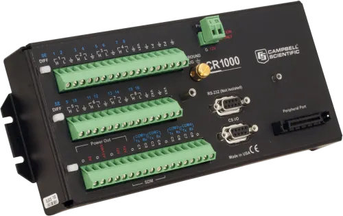
The Campbell Scientific CR1000 is a widely used data logger known for its durability and flexibility in harsh environments. By pairing it with the RockREMOTE Mini, a compact satellite device simultaneously supporting both IP and IMT communication over the Iridium Certus 100 network, we enable robust, low-power data transmission from virtually anywhere on Earth. This document outlines how the integration works, the benefits of each device, and the steps to get a system up and running.
Note: while our testing was with the CR1000, this solution will also work with the newer Campbell Scientific data logger models: CR1000x and CR1000Xe.
Why the Campbell Scientific CR1000 Series is so Prolific
The CR1000 and its successors are renowned for their versatility, reliability and robust performance in harsh environmental conditions. They support a wide range of sensors and communication protocols, making them the go-to choice for remote sensing applications. With CRBasic programming, data collection and processing can also be customized to meet specific needs, enabling bespoke, efficient, and reliable monitoring in a range of diverse scenarios.
Whether monitoring water quality or glacier temperatures at Mt. Everest, their ability to collect and process data has made them a cornerstone of environmental monitoring systems worldwide.
When paired with RockREMOTE Mini, the CR1000 becomes a truly global resource, capable of operating autonomously in even the most remote and harsh locations. By combining these two devices with a modest solar solution, users can deploy a fully self-sustaining system that ensures reliable data monitoring and access anywhere in the world, even in areas where no terrestrial networks are available.
Introducing RockREMOTE Mini
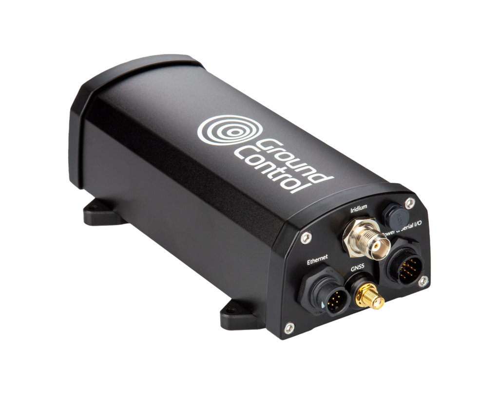
RockREMOTE Mini is an efficient and compact satellite communications device designed for connecting devices where terrestrial networks are unavailable. It utilizes the Iridium Certus 100 service and simultaneously can send data over both IMT (Iridium Message Transport) and IP (Internet Protocol). This allows you to take advantage of the easy and standards-based approach of IP for a PoC and then leverage the efficiency of IMT when scale is required.
With both Serial Communication (RS232/RS485) and Ethernet (with PoE+) available, the Mini is straightforward to integrate. The Mini’s Sleep pin allows for dynamic power management, which is particularly beneficial for solar-powered or battery-operated deployments. The Mini has a very low standby draw of only 300 mW while still being able to receive communications. It can be advantageous to put the Mini to sleep when power is at an absolute premium. An inbuilt GNSS receiver also allows the Mini to provide a time source for multiple connected devices over SNTP.
While it’s very straightforward to integrate the RockREMOTE Mini with your hardware, it is equally simple to get or view your data with our Cloudloop platform. You can use Cloudloop Data to view the data directly or have Cloudloop forward the data to your server. Crucially, Cloudloop functions as a translator between Iridium’s IMT protocol and many of the web standards that you are familiar with, for example, HTTP webhook, Azure Queue, MQTT, ThingsSpeak, AWS SQS & S3, to name a few. This means that integration is fast and efficient, allowing you to utilize the most efficient protocol for the satellite portion of the network and the most convenient one on the server side.
For IP, Cloudloop NOC provides clear packet tracing and troubleshooting, including the ability to set Inbound and Outbound firewall rules to ensure your device is protected and set up for your requirements.
Cloudloop Device Manager can also be used to manage devices by updating their firmware and configuration over the air, ensuring they remain up-to-date without requiring physical access.
Iridium Messaging Transport (IMT) vs IP
We have discussed using the most appropriate transport method for different parts of the network. This is crucial for keeping airtime costs down while also allowing for easy development. The table below gives a quick overview of the differences. Cloudloop enables you to benefit from the upsides of both.
| Iridium Messaging Transport (IMT) | IP-Based Communication | |
|---|---|---|
| Data Size | Small to medium data packets (max 100 KB per message) | Larger data transfers (unlimited size) |
| Cost | Lower cost per message (no headers, data only) | Higher cost per message (headers, TCP/UDP) |
| Use Case | Periodic sensor readings, status updates, scheduled reporting, configuration changes | Real time monitoring, program updates, large chunks of data transfers, and constant reporting |
| Integration | Requires CRBasic formatting to implement AT commands | Seamless – plug and play |
RockREMOTE Mini operates over Iridium’s Certus 100 Network, offering speeds of 22 Kbps up and 88 Kbps down to the remote terminal. IP is ideal for quick and easy integration with existing systems, leveraging standard TCP/UDP protocols, as well as Outbound, Inbound Port Filtering, and Port Forwarding.
In contrast, IMT is a message-based protocol that transmits data in Base64 format, eliminating the overhead of headers and limiting the message size to 100 KB. While IP requires no additional development work, IMT involves creating a CRBasic program to communicate with the Mini over a serial port using AT commands. This can add complexity, but it provides complete control over the transmitted data, making it a cost-efficient option for low-bandwidth applications.
For example, if an application involves transmitting temperature readings from a dozen sensors every hour, IMT would be the most cost-effective option. On the other hand, if you need to update the CR1000’s program remotely, retrieve a whole day’s worth of data, or monitor the data constantly, IP would be the better option. This highlights the flexibility of the RockREMOTE Mini since it can communicate both over IP and IMT at the same time.
How we Integrated the RockREMOTE Mini and CR1000
1. Connections:
- Connect the Mini’s brown Sleep pin to the CR1000’s C1 for power control
- Connect the Mini’s orange 0V-REF pin to the CR1000’s Ground
- Temperature sensor to 1H and 1L on the CR1000.
2. Serial Communication (for IMT):
- Mini communicates with the CR1000 via COM2 at 115200 baud
- Connect TX (CR1000) to RX (Mini) and RX (CR1000) to TX (Mini).
3. Ethernet Communication (for IP Inbound/Outbound Port Configuration):
- Connect the Mini’s Ethernet port to the CR1000 or a local switch
- Assign a static IP to the CR1000 in the Mini’s network range (e.g. 192.168.250.2).
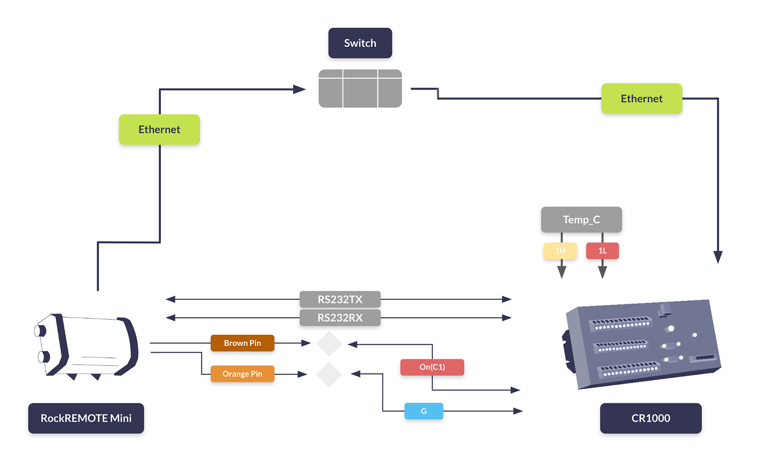
Whether you’re optimizing for cost, scalability, or accessibility, the RockREMOTE Mini and CR1000 can deliver a tailored solution that meets your needs.
This CRBasic code snippet runs on our CR1000 Logger, managing the Mini’s power state based on temperature thresholds. Initially, the Mini is in Sleep Mode. When the upper temperature threshold is exceeded, the Mini wakes up and begins transmitting data. It continues transmitting until the temperature drops below the lower threshold, at which point it returns to Sleep Mode.

Michael Mitrev – Solutions Architect
Graduating with a 1st Class Degree in Computer Systems and Networks Engineering and joining the team in 2024, Michael has been closely involved in the development of the RockREMOTE Mini and is passionate about its growth and success.
He’s also contributed to the RockBLOCK RTU, ensuring the device integrates seamlessly with data loggers to create highly sought-after solutions – primarily focusing on testing with Campbell’s CR1000.
Ready to get started?
If you’re interested in learning more about how the RockREMOTE Mini can transform your remote monitoring capabilities, contact us for a personalized consultation.
Complete the form, or email hello@groundcontrol.com, and we will reply within one working day.
Defending Utilities from Cyber Threats with TSAT
In today’s interconnected world, digital threats have reached a scale never seen before.
In 2023, rising global tensions led to a surge in cyber threats and disruptions to critical infrastructure worldwide. Escalating conflicts – such as those involving Ukraine and Russia, Israel and Hamas, and nations in the South China Sea – motivated hackers to exploit critical infrastructure for control and financial gain. Globally, ransomware incidents are increasing across every continent, as the map shows. At the same time, ransomware attacks targeted more industrial organizations, with reported incidents increasing by nearly 50 percent [Dragos report 2023].
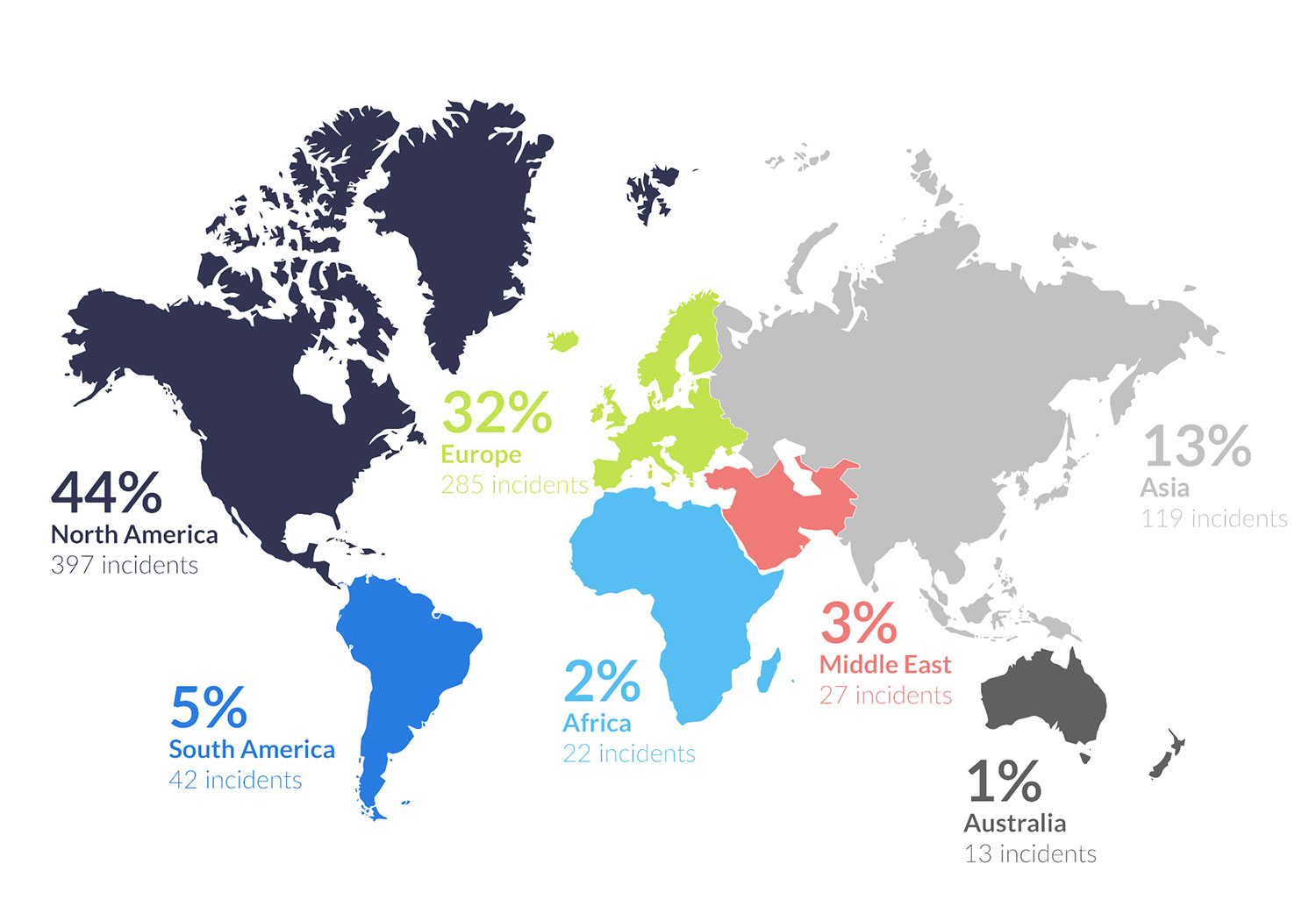 Illustration showing the number of reported ransomware attacks by continent
Cyber attacks can target everything from financial institutions to healthcare systems, transportation networks and power grids – and it’s of increasing concern to the general public. In January 2025, Ground Control conducted a survey of 500 US adults which revealed that over 65% were concerned about cyber attacks on critical national infrastructure, with 70% having limited to no confidence that essential services are protected from cyber attacks.
Utility providers are now facing an alarming new reality where cyber attacks increasingly threaten the safety of their operations. Indeed, Utilities is the second most targeted industry for ransomware attacks, experiencing a 270% increase in data violation cases between 2020 and 2023.
The 2021 Colonial Pipeline Attack
The 2021 Colonial Pipeline attack served as a wake-up call, underscoring the vulnerability of the utility sector to cyber threats. Hackers used a virtual private network (VPN) to infiltrate the pipeline’s control systems, causing widespread fuel shortages across the US East Coast. The incident led to a ransom demand of $5 million, which was ultimately paid to regain control of the pipeline.
The financial costs of data breaches are staggering. According to IBM’s 2021 report, the average cost of a data breach rose to $4.24 million. These costs go beyond the immediate exposure of data and include downtime, loss of revenue, and long-term reputational damage. Utilities must be proactive in defending against such threats to avoid crippling financial losses and operational disruptions.
The Hidden Vulnerabilities in Utility Networks
Utility companies depend heavily on SCADA (Supervisory Control and Data Acquisition) systems to monitor and control infrastructure. These systems collect and transmit data from Remote Terminal Units (RTUs), often located in remote or hard-to-reach areas. However, these RTUs present a significant security vulnerability. With 90% of utility customers reporting “limited to no visibility” into their industrial control systems, once a hacker gains access, they can easily monitor, manipulate, and potentially sabotage critical infrastructure [Dragos report, 2020].
It’s crucial for utilities to address this blind spot and implement solutions that safeguard the data extracted from RTUs and transmitted to SCADA systems.
How Remote Sites Become Prime Targets for Cyber Attack
Remote utility sites, such as offshore wind farms and oil and gas pipelines, are particularly vulnerable to cyber threats. With limited or no access to terrestrial connectivity such as cellular or fiber networks, these remote locations are often the last to receive attention when it comes to cybersecurity. Cybercriminals exploit this vulnerability, targeting sites that lack secure and reliable communications infrastructure. The risk is further compounded by the fact that many utility providers rely on lone workers or contractors to maintain and monitor these remote operations, leaving these sites exposed to cyber threats.
The Role of Satellite Connectivity in Improving Data Security in Utilities
Satellite connectivity has some inherent advantages over cellular networks when it comes to data security; with limited ground infrastructure, it’s less susceptible to physical attacks, and signals are more difficult to intercept. There’s also a reduced risk of infiltration via local Internet Service Providers (ISPs) as these are typically bypassed by satellite communications. But with satellite services diversifying, and more networks being launched, there are now many varying options for data security.
Our Recommended Solution
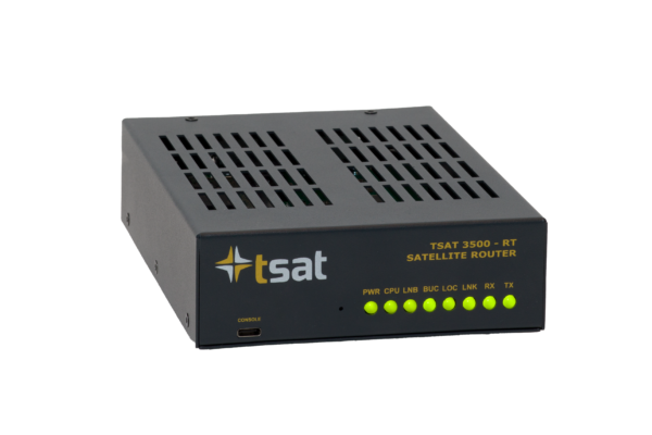
TSAT is a satellite-based communication system designed specifically for secure, resilient remote monitoring and control of SCADA systems. Unlike traditional ground-based communication networks which can be easily compromised by cyberattacks, the TSAT satellite communication solution provides a more secure and tamper-resistant infrastructure.
How TSAT Protects Critical National Infrastructure
The ability to remotely monitor and control systems via satellite communication is essential in maintaining the integrity of critical infrastructure. TSAT’s secure transmission capabilities ensure that communication between central control centers and field sites remains uninterrupted, even in the face of large scale cyber threats.
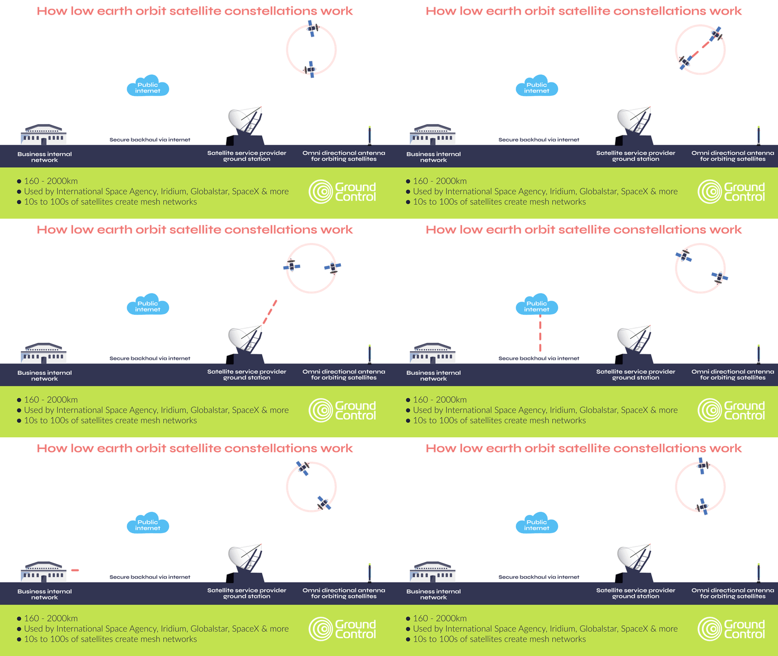
As mentioned earlier, satellite connectivity has several security advantages over terrestrial networks; a reduced attack surface, plus limited reliance on the public internet to move data being two examples. However, most satellite networks, whether in low earth orbit or geostationary orbit, leverage the internet to move data from the ground station to your application. This process is protected via VPNs and firewalls, which, in addition to AES-256 encryption of data, satisfies most organizations’ requirements.

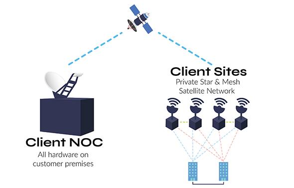
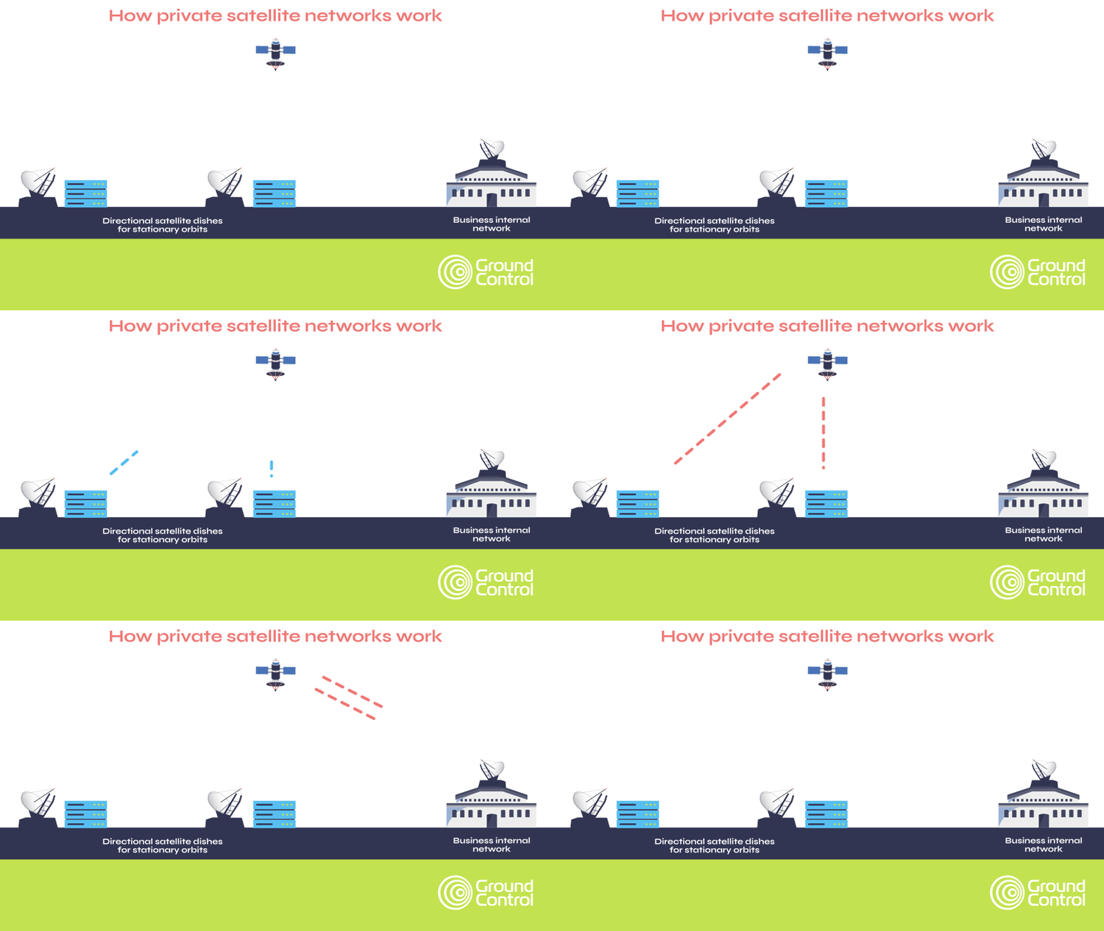
Critical National Infrastructure, however, often benefits from, and may even require, complete independence from public infrastructure, and that’s how private satellite networks like TSAT function. Here, as shown in the diagram below, data from the satellite comes to a ground station on your premises, rather than into the satellite network’s ground station. This means that your data is air gapped from external networks.
Part of the TSAT service is dedicated satellite bandwidth that prevents interference from other users, ensuring consistent and secure connectivity. TSAT also has no reliance on GPS timing, making it immune to GPS jamming. What’s more, its geo-redundant hubs and frequency diversity allow terminals to automatically switch frequencies if interference occurs, ensuring uninterrupted communication.
Real-World Applications of TSAT
A major energy infrastructure operator connects gas markets between the UK and continental Europe, managing a bi-directional gas pipeline with terminals in two key locations.
To maintain operations, a series of pressure and temperature sensors must continuously transmit data to the company’s SCADA system, which authorizes gas transmission.
If this sensor data becomes unavailable, production must halt, and gas venting procedures are required; an expensive process with significant operational and environmental impact.
To ensure real-time, reliable sensor data transmission, the company requires multiple active communication pathways at all times. They maintain a dedicated fiber connection alongside two satellite connections, all tasked with delivering critical data to the SCADA system. To further reduce reliance on public infrastructure, they have implemented TSAT ground stations at each terminal, eliminating the need for internet-based backhaul.
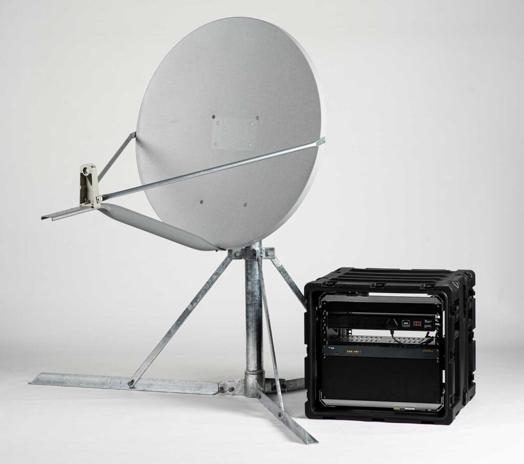
Each satellite link consists of two antennas: a hub and a remote. Typically, the remote antenna is positioned in a more isolated location near the sensors, transmitting data to the hub at the operations center. However, in this case, both satellite dishes are located in close proximity but pointed at different satellites, ensuring redundancy in case of a satellite failure.
Additionally, the company has implemented a unique failsafe: at each terminal, the hub and remote antennas are pointed at opposing satellites relative to the other terminal. This setup provides resilience against localized weather disruptions or signal degradation.
This system has been in place for over 16 years, with hardware upgrades along the way, and in that time, the satellite connectivity has never failed. Ground Control supports the company with a full turnkey service, including setup, training for routine maintenance, and periodic site visits for system health checks.
Embracing Satellite Technology for Cyber Defense
With the growing threats posed by cyber warfare, the time to act is now. TSAT offers a solution that is robust, resilient, and adaptable to the evolving threats of the digital age to utilities. It’s time for utility providers and organizations worldwide to adopt secure satellite enabled technologies, like TSAT, to protect their most vital assets and ensure uninterrupted services to customers. The question isn’t whether you can afford to adopt this technology – it’s whether you can afford not to.
Can we help?
Our satellite-enabled solutions offer robust security features designed to protect your critical data, coupled with reliable connectivity.
Partner with us to explore satellite solutions that safeguard your operations and enhance your secure data transfer capabilities.
Complete the form or email hello@groundcontrol.com and we’ll get back to you within one working day.
The Lifesaving Value of Satellite Tracking in Small Aviation
Small aviation operations – flight schools, tourist flights, and private fleets – often venture into areas where communication can be a challenge. Pilots need reliable tools to ensure safety, track their progress, and communicate effectively, even in remote regions. Yet, many still rely on cell phones or satellite phones for these critical tasks, despite their limitations.
Here’s why a dedicated satellite tracking device isn’t just a convenience; it’s a necessity that can save lives.
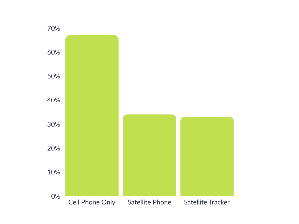
We asked 138 aviators who variously pilot helicopters (30%), gliders (18%), light aircraft (43%), cargo aircraft (25%) or military aircraft (15%) what, if anything, they were using to track their flights.
67% of respondents said they utilized the GPS on their cell phone; 34% had a satellite phone, and 33% had a dedicated satellite tracking device for this purpose (respondents were allowed to pick more than one answer).
While this didn’t come as a huge surprise, there are drawbacks of relying on cell phones. Coverage can be spotty, due to both the altitude and the remote locations visited, and also due to weather conditions. Cell phone service can be negatively affected by storms, wind, rain and even simply cloud cover (source).
Satellite phones are generally less affected by weather, and don’t suffer from coverage issues; they are, however, designed primarily for voice communication, and have none of the specialized features that pilots can benefit from with a dedicated aviation tracking solution.
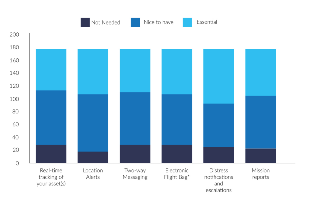
We asked the same group what they valued most in a tracking solution, and, aggregating ‘essential’ and ‘nice to have’, the results were:
- 91% – Location alerts (moving in and out of geofences, stop/start etc.)
- 88% – Mission reports (e.g. mission ID, asset details, route, crew, cargo etc.)
- 87% – Real-time tracking
- 86% – Distress notifications and escalations
- 85% – Two-way messaging
- 83% – Electronic flight bag*
So there is widespread consensus of the value of aviation tracking, but as seen above, only a third of respondents had a dedicated solution for this.
*Advanced messaging including transmission of flight manifest, weight, balance etc.
Why Dedicated Satellite Tracking Devices Excel
Dedicated satellite tracking devices, like the RockAIR, are purpose-built for aviation. Here’s what sets them apart:

Aviation-Specific Features
Altitude Recording: Provides critical data unique to aviation, unlike general-purpose devices
Emergency Response: Distress notifications and escalation processes to ensure swift action when every second counts
Location Alerts: Track movement in and out of geofenced areas or detect when a plane has stopped unexpectedly.

Reliability in Critical Moments
Real Time Tracking: Enables precise monitoring of flight paths, crucial for safety and coordination
Mission Reports: Record mission details such as route, crew, and cargo – helpful for operational efficiency
Two Way Messaging: Communicate instantly, even in areas with no cell coverage.

Designed to Last
Long Battery Life: Far exceeds that of cell phones or satellite phones, ensuring uninterrupted service
Durability: Built to withstand extreme conditions, including potential crashes, ensuring operability when it’s needed most.
A Real Life Lifesaving Story
The value of dedicated tracking devices isn’t theoretical; it’s proven. British pilot Sam Rutherford was flying in the Canadian wilderness when a crash left him stranded in freezing temperatures. Despite the dire situation, he managed to send a location-based message using his RockSTAR device. This timely communication enabled rescuers to locate and save him.
Without a dedicated satellite tracking device, Sam’s story might have ended very differently.
Key Use Cases in Small Aviation
- Flight schools: For flight schools, safety is paramount. Dedicated tracking devices allow instructors to monitor student pilots in real time, providing peace of mind and a critical safety net during training flights.
- Tourist flights: Scenic flights often traverse remote or rugged terrain. Real-time tracking and emergency features not only protect pilots but also reassure passengers of their safety.
- Small private fleets: Fleet operators benefit from improved efficiency and safety with mission reports, real-time tracking, and emergency response capabilities, ensuring that every flight runs smoothly.
Why Not Cell Phones or Satellite Phones?
While cell phones and satellite phones play a role in communication, they fall short in critical ways:
| Cell Phones | Satellite Phones | Satellite Tracking Devices | |
|---|---|---|---|
| Altitude Recording | |||
| Real Time Tracking | |||
| Distress Notifications | |||
| Battery Life | Low | Medium | High |
| Durability | Low | Medium | High |
Dedicated satellite tracking devices stand out as the only option that checks every box for aviation safety and reliability.
Flying with a dedicated satellite tracking device is more than a practical choice; it’s a lifesaving decision. From real time tracking to emergency response, these devices are purpose-built to meet the demands of small aviation.
Can we help?
Don’t leave safety up in the air. Discover the RockSTAR, RockAIR, and other Ground Control solutions to ensure your operations are as safe and efficient as possible.
Contact us by completing the form, or emailing hello@groundcontrol.com; we’ll respond to your inquiry within one working day.
Drones in Modern Warfare: Enhancing UAV Capabilities with Satellite Connectivity
Drones, or Unmanned Aerial Vehicles (UAVs), have become an integral part of modern military operations. Initially developed for reconnaissance and surveillance, drones have evolved into versatile platforms capable of executing various missions, from intelligence gathering to precision strikes. However, the full potential of UAVs is realized when enhanced with satellite connectivity, removing the limitations of traditional line of sight or terrestrial based communication, and enabling real time communication and coordination across vast distances and hostile environments.
While satellite connectivity has enhanced UAV capabilities, the utilization of UAVs in warfare is nothing especially new, and has instead, evolved significantly over the past century. Early concepts of UAVs emerged during World War I, with the development of rudimentary unmanned aircraft such as the “Kettering Bug”, – a drone prototype designed purely for bombing missions. However, these early models were not widely operational.
It wasn’t until World War II that UAV technology saw further development, particularly with the creation of the German V-1 flying bomb – essentially an early form of a cruise missile. The Cold War era spurred advancements in UAVs, primarily for reconnaissance purposes and the U.S. developed drones like the Ryan Firebee, which were used for surveillance during the Vietnam War.
The 1990s marked a turning point in UAV usage, particularly during the Gulf War, when drones like the RQ-2 Pioneer provided critical intelligence. Then in the early 2000s, UAVs like the MQ-1 Predator and MQ-9 Reaper – American remotely piloted aircrafts – gained worldwide attention for their role in counterterrorism operations. Powered by global satellite connectivity, these drones could carry out targeted strikes with high precision, far out of the reach of cellular and telecommunication networks. Step forward into 2024, and the role of UAVs in modern warfare has only continued to advance.
As the roles of UAVs broaden from strike and EW to logistics and ISR, the conversation is increasingly about how they’re used to protect people and infrastructure. Alongside the well known offensive missions, we’re seeing rapid growth in defensive and humanitarian applications enabled by resilient satellite links. Let’s explore some of these key roles in more detail.
Surveillance and Reconnaissance
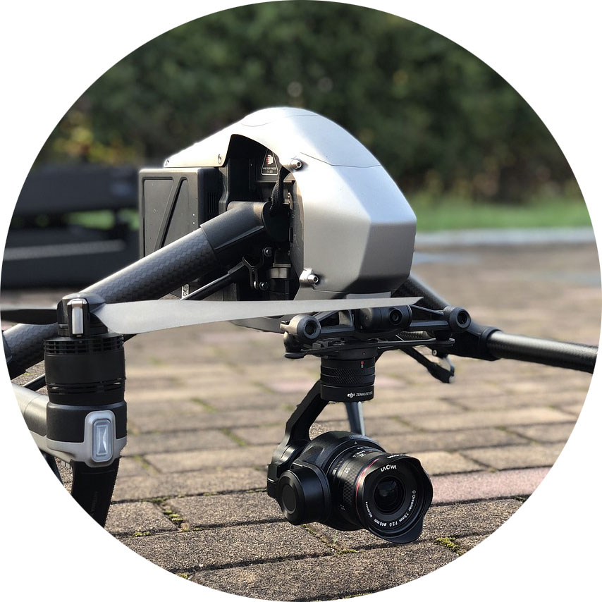
Drones are extensively used for Intelligence, Surveillance, and Reconnaissance (ISR) missions. UAVs have the ability to capture real time video and image data, which is transmitted back to command centers for analysis, without the need for soldiers to be physically present in hostile or rugged environments. The drones often operate at high altitudes, across multiple geographies.
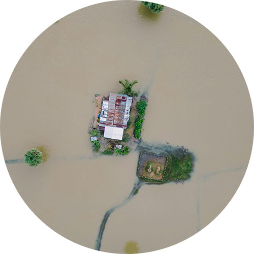
Search and Rescue
In post-conflict or disaster scenarios, UAVs can locate survivors and assess damage in areas too dangerous or inaccessible for physical teams. This can prevent further human loss and lead to the identification, location and administration of aid to ground-based defense teams. Drones have also been know to guide troops to safe areas, and away from enemy fire.
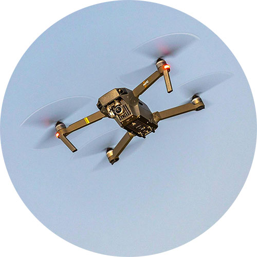
Aid and Supplies
UAVs can be adapted for resupply missions in hard to reach areas and have been deployed to help soldiers on the battlefield to receive essential supplies like food, water, and medical equipment. This capability becomes especially crucial in situations where ground convoys may face delays due to hostile terrain, enemy activity, or other logistical challenges.
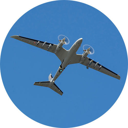
Precision Strikes
UAVs equipped with precision-guided munitions allow military forces to carry out highly targeted strikes with minimal collateral damage. Their precision has made them instrumental in counter-terrorism operations and eliminating high-value targets while protecting civilian lives. Further, the remote strike action removes the need for ground forces.
Electronic Warfare
UAVs fitted with highly sophisticated sensor systems are designed to gather signals intelligence (SIGINT) by detecting and analyzing enemy radio transmissions, as well as electronic intelligence (ELINT) by monitoring radar emissions. This data can provide comprehensive insights into the structure, capabilities, and operations of enemy networks.
Satellite Devices Best Suited for Military Drone Applications
Satellite connectivity is a reliable, secure means of communicating with UAVs far beyond the reach of terrestrial networks. These devices are our top picks for command and control, piloting BVLOS, and transmitting real time video footage from UAVs, for civil and defensive applications only.
Simple Command and Control with RockBLOCK 9603
Command and control of UAVs requires stable, low latency communication channels.
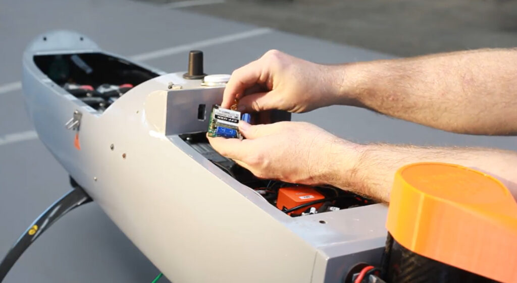
RockBLOCK 9603 enables basic two way communication over the Iridium satellite network, allowing operators to send flight commands or adjust mission parameters approximately once every 10-15 seconds, regardless of their geographical location.
For example, RockBLOCK 9603 could send positional data, informing operators of any need to make altitude adjustments or course corrections during a mission. This level of sophisticated satellite-enabled C2 is essential for UAVs operating in areas where ground communication networks are compromised or unavailable.
RockBLOCK 9603 is especially suited to applications where space is at a premium. It’s designed to make adding Iridium Short Burst Data (SBD) satellite connectivity super easy.
Piloting BVLOS with RockREMOTE Mini OEM
One of the most significant challenges in drone warfare is piloting UAVs beyond visual line of sight (BVLOS) – a necessity for long range missions or operations in hostile areas.
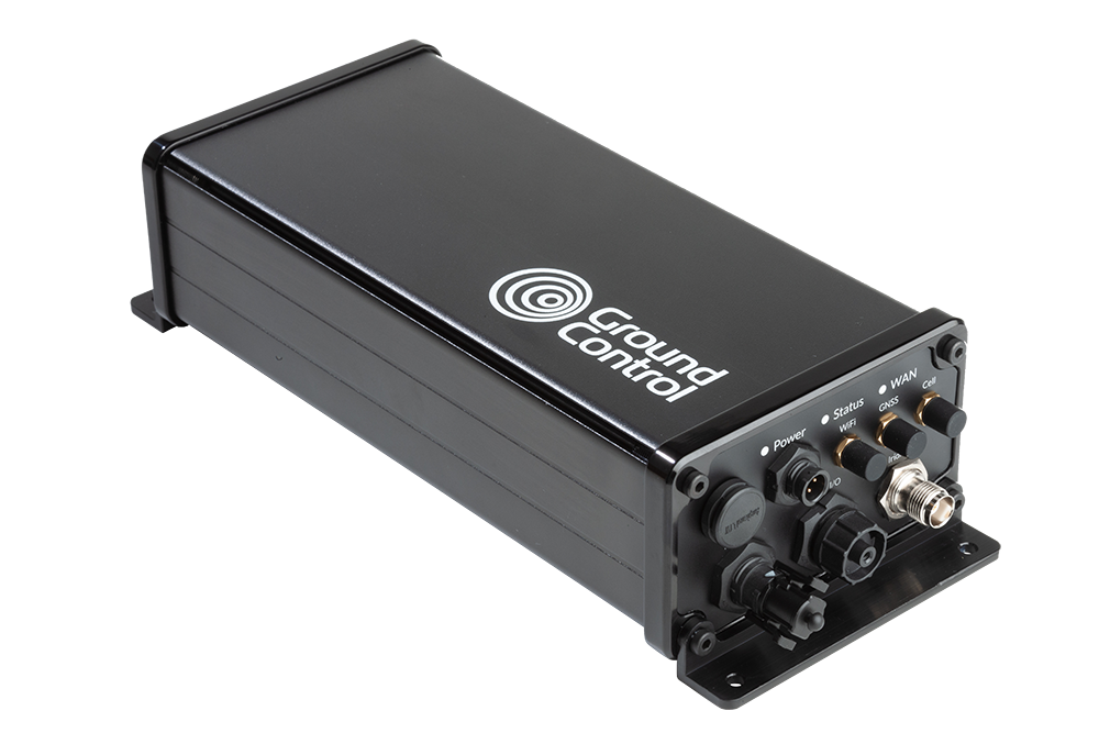
Solutions like the RockREMOTE Mini OEM provide satellite-based connectivity designed for such operations involving on the move assets.
RockREMOTE Mini OEM is lightweight, designed to draw as little power as possible, and harnesses the Iridium Certus 100 satellite network service, delivering virtually real time IP connectivity.
This technology allows for piloting and navigation adjustments, crucial for UAVs conducting missions deep into enemy territory. Furthermore, satellite-based communication ensures the operator maintains constant control over the UAV’s flight path, even when thousands of kilometers away.

Capturing Real Time Video Footage with RockREMOTE Rugged
Arguably, one of the most critical functions of UAVs in modern warfare is real time video reconnaissance.
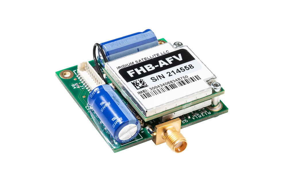
RockREMOTE Rugged coupled with Videosoft video compression technology facilitates the transmission of high definition video feeds from drones to ground stations, enabling military forces to monitor enemy activities and gather intelligence without delay. This helps military operators to respond to threats or gather information promptly, enhancing battlefield awareness and operational decision making.
RockREMOTE Rugged does not require antenna pointing, and even with a poor or changing view of the sky, RockREMOTE Rugged can reliably and securely transfer data in close to real time via the Iridium satellite network.
Selecting the Right Satellite-Enabled Solution
 RockBLOCK 9603 RockBLOCK 9603
|
RockREMOTE UAV OEM
|
RockREMOTE Rugged
|
|
|---|---|---|---|
| Size | 45 x 45 x 15 mm | 175 x 60 x 37 mm | 250 x 97 x 61 mm |
| Weight | 36 g | 287 g | 1.2 kg |
| Power | Max 450mA | <30mW (sleep), <0.25W (idle), <7.5W (average transmit) | 0W (sleep), 5W (idle), 9W (average transmit) |
| Satellite Service | Iridium Short Burst Data (340 bytes ↑ 270 bytes ↓ per message) | Iridium Certus 100 (22/88 Kbps) + IMT (100 kB per message) | Iridium Certus 100 (22/88 Kbps) + IMT (100 kB per message) |
| Interfaces | Molex PicoBlade 1.25mm pitch | Ethernet (available on pin out), Serial RS232, RS485, GPIO (2xI, 2xO) | Ethernet, Wi-Fi, Serial RS232, RS485 |
| Antenna | Built in 1621 Mhz tuned patch antenna (or use optional SMA connector for external antenna) | External – various approved options | External – various approved options |
| Hosted Applications | |||
| Ideal For | Simple Commands / Failover Comms | Piloting BVLOS; Sending Compressed Images | Transmitting Real Time Video Footage |
| View Product | View Product | View Product |
Edge AI, BVLOS, and the Next Wave of UAV ISR
UAV use is expanding across military missions, including kinetic applications; however, the fastest day to day gains we see are in defensive ISR and mission support; secure C2 beyond line of sight, wide area monitoring, and comms relay. Expect more drones running AI at the edge to spot “needles in the haystack” (changes on a perimeter, vessels of interest, wildfire flare-ups) before sending only the useful bits over constrained links, cutting bandwidth while speeding decisions. That’s already a theme in ISR tooling and video workflows.
Connectivity will remain the backbone. Iridium-powered BVLOS links, facilitated by devices like the RockREMOTE Mini OEM, are being adopted to extend C2 and push telemetry/video from places cellular can’t reach, central to safe separation concepts and multi-aircraft operations.
Swarm and multi-UAV teaming are also trending for search & rescue, disaster assessment, and wide area reconnaissance, using multiple small platforms to map faster, hand off targets, and maintain comms. Agencies are likewise exploring comms-relay roles so one asset can keep others connected in difficult terrain.
Looking ahead, one area we’re excited about is humanitarian demining. Drones can scan from above, use onboard AI to flag likely contamination, and then alert clearance teams over satcom. As those edge models improve, triage gets quicker and tasking more precise.
In short, whether it’s low rate C2, BVLOS piloting, or near-real time ISR video, pairing UAVs with reliable satellite links is unlocking new defensive capabilities, and doing it in ways that help reduce risk to people on the ground.
Can we help?
Working on UAV command and control, BVLOS piloting, or real time ISR video?
We can help you choose and integrate the right Iridium-powered solution, from RockBLOCK for simple C2 to RockREMOTE for IP video, so you get reliable, global connectivity faster. We support civil and defensive applications; tell us about your mission profile and we’ll recommend a build that fits.
Complete the form or email hello@groundcontrol.com and we’ll get back to you within one working day.
Private Satellite Network: TSAT’s Game-Changing Solution For Utilities
Remote ‘off-grid’ utilities sites play a crucial role in bringing reliable power to remote and challenging regions. But ensuring seamless communication at these remote power utility sites is no easy task. While traditional mobile and fiber connections are a great solution in cities, they fall short when it comes to the unique communication challenges of off-grid locations such national parks, mountainous regions, and permanent, poorly inhabited, grasslands.
Most power utility and water management companies have around 10% of their sites located in ‘off-grid’ areas. These sites often lack reliable access to mobile networks and terrestrial fibre infrastructure, making it impractical and costly to use conventional connectivity solutions. To make matters more challenging, these remote sites might be in environmentally sensitive areas or rough terrains, making it even harder to set up extensive communication networks.
In such situations, getting customer data back from these sites requires innovative solutions that go beyond the typical terrestrial and cellular options. It’s also crucial to distinguish between customer data backhaul and SCADA (Supervisory Control and Data Acquisition) and telemetry data backhaul. Mixing the two could lead to serious cybersecurity issues, which is why a specialized solution designed exclusively for SCADA and telemetry data is essential.
In this blog, we’ll delve into the main data connectivity and backhaul challenges faced by remote power utility providers. Additionally, we’ll discuss how TSAT offers a reliable and robust communication solution specifically tailored to meet the unique requirements of these remote power utility sites.
How TSAT overcomes the key data challenges for power utilities
1. Instant communication infrastructure
Remote areas often lack reliable communication infrastructure, such as wired internet or cellular networks. TSAT utilizes satellite communication to overcome this limitation, ensuring that data can be transmitted to and from the remote sites even in areas with no or limited terrestrial connectivity.
2. Real-time monitoring and control
Remote power utility sites might be unmanned or difficult to access regularly due to their remote site situation, but any downtime or loss of energy production can be costly. TSAT enables real-time monitoring and control of critical assets, such as generators, switchgear, and substations, from a central control center, allowing operators to respond quickly to any issues or anomalies, optimising power output and maximizing power generation.
3. Enhanced grid reliability
By continuously monitoring the remote power sites, TSAT helps identify potential problems and weaknesses in the grid, as they occur in real-time, enabling proactive maintenance and repairs. This proactive approach enhances overall grid reliability and minimises the risk of large-scale outages. Satellite is also highly reliable and unlike terrestrial and fiber, is unaffected by coverage, weather events and ground infrastructure.
4. Robustness against extreme weather events
The United Nations Office for Disaster Risk Reduction reports that over the last 20 years, there has been a “staggering rise” in the number of extreme weather events. Floods, fires, storms and earthquakes, all risk the stability, reliability and telemetry data delivery of sites reliant on cellular and fiber. As TSAT is satellite-based, connectivity is much more reliable and stable.
5. Highly secure
Cyber-attacks are on the rise around the world and utility powerhouses have been targets. TSAT ensures encrypted and authenticated data transmission between remote power sites and the central control center. The dedicated satellite network provides a private and isolated communication channel, safeguarding against cyber threats and unauthorized access; making for a trusted and effective solution for power utilities’ communication needs in remote locations.
A detailed look at TSAT
TSAT offers a narrowband private satellite network that provides an ideal solution for monitoring and controlling smart power grids in even the most remote locations. Power utilities in the UK can now benefit from this cost-effective and reliable platform, connecting distant assets to crucial utility applications like SCADA transmission, telemetry, and M2M, all within a secure network.
Designed to accommodate the needs of both small and medium-sized networks, TSAT boasts scalability with lower operating costs compared to installing and maintaining fiber connectivity. It supports both IP and legacy serial devices and operates independently from terrestrial communication systems. This not only complements existing terrestrial networks but also offers an alternative solution, ensuring continuous transmission at all times.
The hardware is purpose-built to withstand harsh environments, providing years of reliable operation, making it the most robust choice in adverse weather conditions, unlike mobile and fiber alternatives. Additionally, TSAT adheres to the IEC-61850 global standard for utility and industrial communication and automation, ensuring seamless integration with existing systems.
Through rigorous testing, Ground Control solutions have received certifications in the Worldwide Industrial Telemetry Standards (WITS) DNP3 protocol, setting the global standard for utility industry telemetry control and monitoring requirements. This ensures interoperability between equipment from different manufacturers, guaranteeing a smooth and efficient power utility system.
Save costs and be secure
The equivalent statistic for Euros regarding the average cost of laying fiber can be found in the United States Department of Transportation’s “Fiber Optic Installation Cost Survey” report. According to the report, the average cost of laying fiber is estimated to be around €23,000 per kilometer. Additionally, there’s the ongoing expense of sending experienced Field Engineers to manage installations and maintenance. Over a 10-year hardware lifespan, this this total is significant.
TSAT offers a practical solution to mitigate these costs almost entirely, as its terminal can be remotely managed. This means no more costly truck rolls, and with TSAT being always-on and relaying data in real-time, prompt and guaranteed servicing is assured.
The TSAT HUB stands out as the most cost-effective VSAT HUB available. By efficiently utilizing the satellite spectrum and tailoring satellite bandwidth to meet specific application needs, annual communication expenses are significantly reduced. This makes TSAT an ideal primary or backup option for existing terrestrial communications, providing reliable and affordable connectivity for remote utility sites.
Unlock the potential of your data
With over 40 years of combined knowledge of satellite experience, the Ground Control team is well placed to help keep you connected when it matters the most with complete satellite connectivity solutions for any situation and application.
Whatever your communication or connectivity needs, we can help.
Satellite Asset Trackers: Choosing the Right Device for Your Requirements
The importance of asset tracking
In today’s connected world, asset trackers have become an essential tool for businesses to enable effective monitoring and management of their assets across the globe. Whether you’re running a logistics company, managing a fleet of vehicles, or overseeing a construction project, having real-time visibility and control over your assets is essential.
Terrestrial asset tracking via BLE, WiFi, LPWAN and cellular has numerous benefits but is not without its drawbacks and limitations. In scenarios where assets operate in remote areas or face signal interruptions, as is often the case in mining, forestry and sea freight, for example, satellite asset tracking becomes essential to ensure uninterrupted monitoring and prevent downtime.
In contrast to terrestrial services, satellite asset tracking provides reliable coverage and continuous visibility from anywhere on the planet with a clear view of the sky; there’s no dependency on proximity to mobile phone masts. This makes it indispensable for applications where reliable asset monitoring is paramount, such as in the case of construction equipment or specialized machinery, where even slight discrepancies in location can have significant consequences. However, with a wide range of solutions available in the market, selecting the optimum satellite device for business and operational needs can be a challenge. Considerations such as coverage, data speed, battery life, accuracy, and cost will ultimately guide buyers’ decisions.
Whether you need real-time tracking or periodic updates, selecting the right device will ensure effective asset management and operational optimization. Using our guide about how to choose the right satellite enabled device will ensure you make the right asset tracker choice. Be sure to consider the key five criteria outlined here.
Choosing the right satellite device for asset tracking
1. Assess your needs
Before determining the asset tracking device required, it’s crucial to understand what needs to be achieved by the tracking solution. Considering the types of assets that need to be tracked – such as vessels at sea, a remote workforce, or aircraft – the geographical areas the assets will be located in, and the level of tracking accuracy required are just three considerations to make.
Another crucial factor to consider is the level of tracking accuracy required. Some applications demand real-time and precise location updates, such as high-value shipments or sensitive equipment. In such cases, a device that offers high accuracy and frequent data transmission will be essential. On the other hand, if periodic location updates are sufficient, a device with longer battery life and less frequent data transmission would be more suitable.

2. Evaluate coverage options
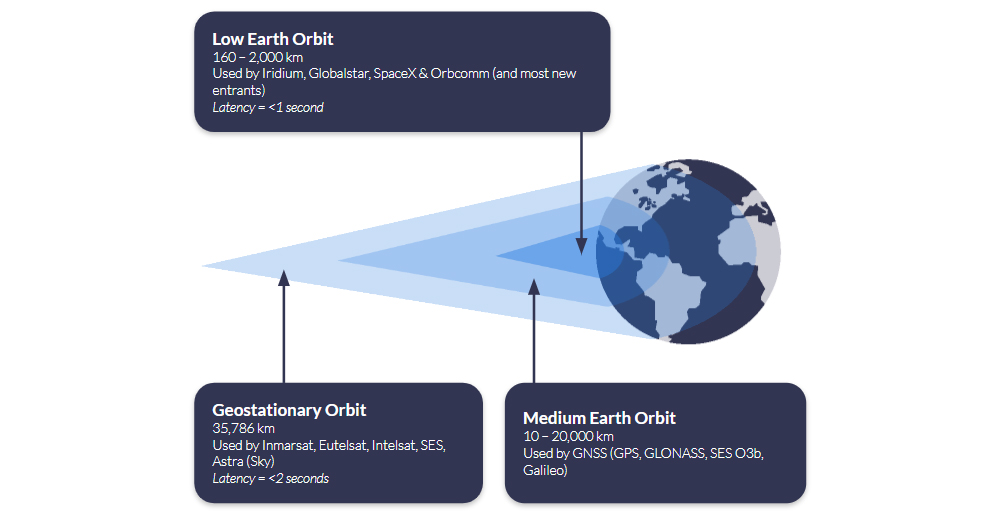
Armed with a clear view of your essential requirements, your next consideration when choosing a satellite asset tracking device is coverage. A satellite network operator’s coverage depends on the number of satellites they have in orbit, and the height of those satellites relative to the Earth.
It’s certainly not the case that all satellite operators offer 100% global coverage, and you should check carefully to ensure that the tracking device you’re looking at has good, stable coverage in every region your asset operates in.
Iridium offers complete global coverage; Viasat covers most of the globe, but service degrades towards the polar regions. Globalstar works well in the Americas, Western Europe and much of the Asia-Pacific region.
Use our coverage maps to view the different satellite networks and select a network that ensures seamless connectivity for your assets, regardless of their location.
3. Battery life and power management
Many tracking devices use your vehicle’s electrical system as their principle power source, connected via 9-30v input or USB; cars, trucks, boats, aircraft etc. If this applies to you, you’ll have a wide choice of devices and don’t need to be particularly concerned with the power draw, even if you’re transmitting a location signal very regularly.
However, for assets that have limited access to power sources, extended battery life is essential. Satellite asset trackers consume power to transmit location data, and their battery life can vary significantly depending on the device and usage frequency. If real-time tracking and monitoring are required, buyers should opt for devices with longer battery lives, solar power options or power-saving features. Alternatively, if reporting only on exception or low-frequency updates is sufficient, there are tracking devices available with extended battery life lasting weeks or even months.

4. Data accuracy, speed and management
It goes without saying that frequent and fast data transmission enables more precise asset tracking. Knowing the location and status of your assets in close to real time helps you make informed decisions, optimize logistics, and provide reliable information to customers or stakeholders. That said, data points always require context to be meaningful.
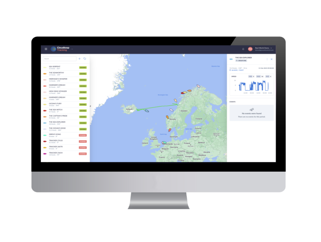
So, a robust satellite asset tracking solution should not only provide accurate, real-time location information but also deliver data management capabilities. Cloudloop is Ground Control’s cloud-based platform for subscription and device management, and, new for 2023, device tracking. There are a number of key tracking features of the platform, including:
- Real-time visibility of your assets, with multiple mapping options
- View the location, speed and heading of your assets, wherever they are on the planet
- Instant notifications of driver-issued alerts
- Historical position reporting and device events.
5. Cost and scalability
As well as the upfront costs, when selecting a tracker, it’s important to consider ongoing airtime and/or service charges. There are various pricing models available, from pay-as-you-go where you top up your device’s airtime as needed; monthly fixed payments based on your estimated usage; or post-pay invoicing based on actual usage (note: while this sounds appealing, they’re often more expensive than having a monthly fixed payment).
You can also pay per asset, or in some cases, use ‘pooled’ data so that all assets are drawing from the same data allowance (this gives you flexibility if assets’ tracking requirements change week on week, or month on month, while still having a fixed monthly payment).
Ground Control offers very flexible pricing models, and is competitive on airtime too. Our most popular tracking airtime services include Iridium Short Burst Data (SBD) and Viasat IoT Pro.
Ready to select your asset tracking device?
Having partnered with satellite network providers such as Iridium and Inmarsat for well over a decade, we have access to competitively priced tariffs, and can also be very flexible in terms of bundled data – saving you money.
So if you are working on upgrading your existing solution, or tracking your assets for the first time and would like some no pressure, objective advice, simply fill in the form and one of our expert team will get back to you.
Satellite IoT use cases: truly global connectivity for real world applications
Satellite IoT is growing in popularity, providing reliable connectivity to remote locations that would otherwise be challenging or even impossible to reach with terrestrial networks. As the world becomes more connected, the demand for real-time data from even the most remote locations has increased. Satellite IoT provides the solution to this need by offering truly global connectivity for real-world applications.
Satellite IoT is being used in a variety of industries, including healthcare, agriculture, workforce safety, and more. Let’s dive into just some of the most prominent use cases for satellite IoT…
1: Healthcare
IoT has revolutionised the healthcare industry by providing innovative solutions to improve patient care, reduce costs, and increase efficiency. IoT in healthcare refers to the use of connected devices, sensors, and data analytics to collect and analyse patient health data in real-time. This could include remote patient monitoring, smart medical devices and wearable technology like fitness trackers and smart watches.
Satellite IoT can also facilitate medical and healthcare accessibility to patients in remote areas who are unable to travel. For example, utilising the RockBLOCK 9603 technology, satellite IoT has enabled the transportation and delivery of emergency and essential medical supplies to vulnerable people who are at high risk if they travel.
Read Healthcare By Drone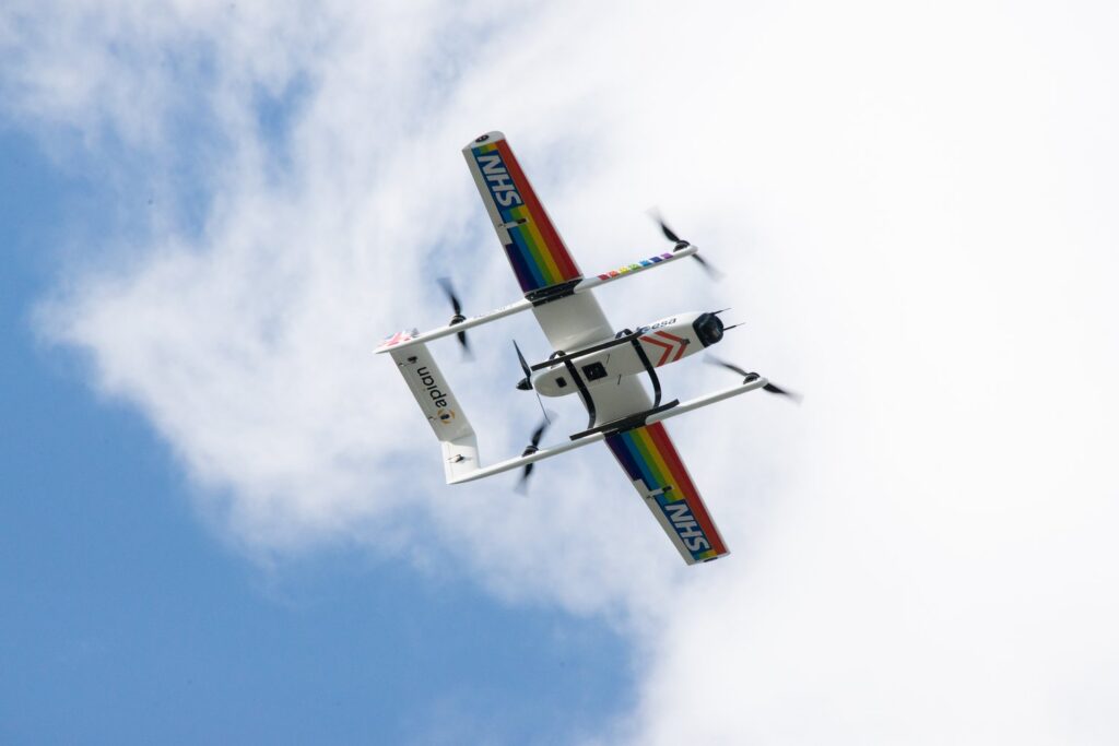
2: Agriculture
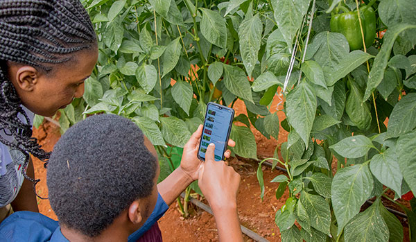
The agriculture industry is utilising satellite IoT to enhance productivity and lower expenses. By monitoring soil moisture, temperature, and other environmental factors, farmers can optimise their crop yield and reduce waste. This is sometimes referred to as Smart Farming. Satellite IoT can also be used to track livestock and monitor their health – improving overall animal welfare and reducing losses.
COSMOS-UK has installed Viasat IoT Pro terminals at remote soil moisture monitoring locations, to help combat climate change. The soil moisture data intelligence delivered by the Hughes 9502 specifically, to agricultural and environmental scientists, has the potential to transform the way we understand and model the natural environment.
Furthermore, satellite IoT has supported Synnefa in Kenya, to operate outside of terrestrial infrastructure by transmitting sensor data to enable smarter predictions for optimum harvesting times. The introduction of precision farming has been so successful, Synnefa has been able to help farmers:
- Save water by over 50%
- Reduce fertiliser application rates by 41%
- Increase production by 30% when compared to yields prior to the use of their devices.
3: Asset Tracking and Monitoring
Tracking and managing assets in real-time, providing valuable data on asset location at any given time is made possible with IoT technology. With satellite-enabled tracking devices, businesses can keep track of their assets no matter where they are in the world, even in the most remote locations. But here, it’s not just vessels, wind turbines and remote workers who can be tracked – animals can be too!
Illegal poaching is a big problem in Gabon, Africa. RockREMOTE with IMT enablement has equipped the rangers in Gabon with the latest in AI-powered camera trap technology to effectively monitor and prevent illegal poaching in the forest. With this advanced technology, endangered African species and iconic African wildlife have greater protection from poachers for this generation and the next.
Read More About Poaching in Gabon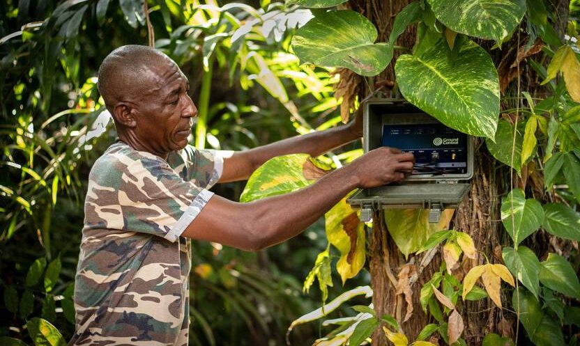
4: Workforce and Personnel Safety
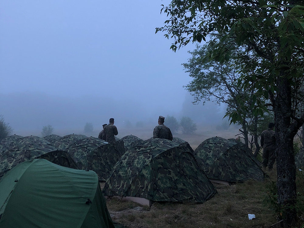
Satellite IoT can be harnessed to monitor the safety of lone or remote workers in hazardous environments. By providing real-time alerts in the event of an incident or emergency, companies can respond quickly and potentially save lives. For example, workers in mining or oil and gas operations can wear wearable devices that monitor their location and vital signs, alerting supervisors in the event of an accident or injury. In addition, monitoring remote military personnel and natural disaster response teams is critical to their safety and well-being.
For example, the RockSTAR device has been used by the Ministry of Defence in their training. The RockSTAR was paired with bluetooth heart rate monitors, meaning biometrics could be monitored throughout with the added benefit of worldwide tracking and two-way communications. As well as critical monitoring, satellite IoT can also be leveraged for more leisure-based tracking and monitoring applications – including ultra-marathon runners via the RockSTAR tracking and two-way communications device.
See Tracking in Action5: Energy and Renewables
The energy sector is also seeing the benefits of satellite IoT. The technology enables remote monitoring of renewable energy infrastructure in real-time, allowing for early identification of any faults or issues, thus preventing downtime and maximising energy output. The performance of renewable energy assets is also optimised by collecting and analysing data on weather patterns, energy production, and equipment performance. This data can be used to improve efficiency, reduce costs, and even enhance the lifespan of renewable energy assets.
With five hydroelectric power stations in Snowdonia, North Wales, RWE maximises its renewable energy output from the reservoirs with a remote IoT solution – the Hughes 9502.
Read About Facilitating Renewable Energy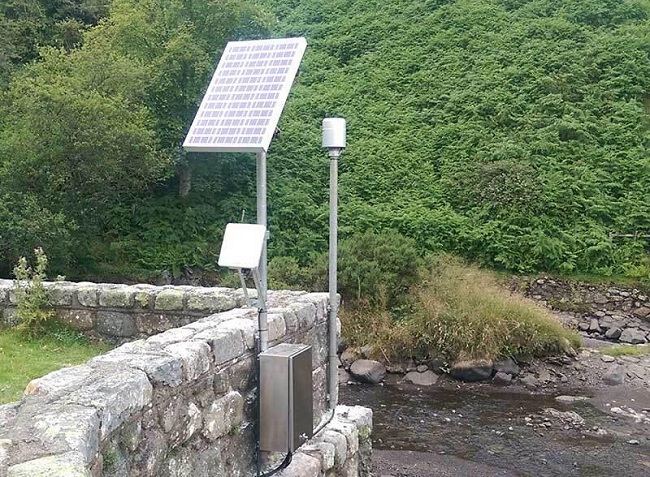
Satellite IoT vs. Traditional Cellular Networks
While traditional cellular networks are sufficient for many use cases, they have limitations when it comes to remote locations.
One of the biggest advantages of satellite IoT is that it provides truly global connectivity, even in the most remote and inaccessible locations. Unlike traditional cellular or Wi-Fi networks, satellite signals can reach anywhere on the planet, making it ideal for industries where assets are remote or located in harsh environments.
With satellite IoT, data can be transmitted from quite literally anywhere in the world, making it ideal for applications where cellular coverage is limited or even non-existent. Satellite IoT is also more reliable than cellular networks in many cases, as it is resilient to interference or disruption from extreme weather events.
However, it’s not necessary to choose either terrestrial or satellite connectivity. Satellite networks can be deployed quickly and easily, using the same messaging protocols as terrestrial networks, allowing businesses to scale their operations up or down as needed without having to worry about the limitations of traditional networks. What’s more, for businesses and industries that require global connectivity, the cost of deploying and maintaining satellite IoT devices can often be less expensive than building and maintaining traditional terrestrial networks from scratch. It can also be cheaper than deploying remote field engineers to remote sites.
In Summary…
Satellite IoT provides reliable connectivity to remote locations; bridging the connectivity gap that would otherwise be difficult or impossible to achieve with traditional cellular networks alone.
From reliable communication to real-time data collection and analysis, satellite IoT is changing the game for businesses and entire industries that need to stay connected no matter where their assets are located. Furthermore, as satellite technology continues to evolve and become more affordable, we can expect to see even more innovative use cases emerge in the coming years.
Unlock the Full Potential of Your IoT Project
Incorporating satellite IoT into your existing business operations can revolutionise what you can achieve. With satellite IoT, you can access data and insights that were previously unavailable or difficult to obtain with traditional networks and connectivity options.
Contact us to discover the added value of satellite IoT to your business today. We’re here to help and provide solutions to your connectivity challenges.
How Satellite IoT Closes The Gap in Remote Wind Turbine Data Monitoring Challenges
The renewables landscape is changing. The International Energy Agency (IEA) reports that the ‘global energy crisis has triggered unprecedented momentum behind renewables, with the world set to add as much renewable power in the next 5 years as it did in the past 20’.
The rise of renewable energy and the pitfalls of unplanned maintenance
Partially due to Russia’s invasion of Ukraine, countries are increasingly motivated to invest in renewable energy technologies to reduce reliance on imported fuels. Wind and solar energy in particular will account for over 90% of the renewable power capacity that is added globally over the next five years, according to the IEA.
So what does this mean for wind power in Europe?
Solar and wind power generated more than a fifth (22%) of its electricity in 2022, pulling ahead of fossil gas (20%) for the first time, according to the European Electricity Review 2023. However, many wind farms are located in remote areas and have limited resilience against severe weather, power outages and downtime due to unplanned maintenance.
In the case of the latter, often, renewable energy providers rely on physical onsite maintenance to restore energy production, requiring significant resources, time and cost. It presents energy providers with a big challenge. Research by Wood Mackenzie Power into renewables in 2019 found that $8.5 billion was spent on unplanned repairs and corrections caused by component failures in wind operations.
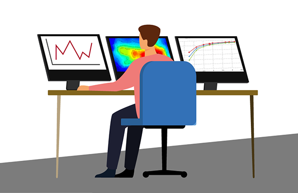
This cost could be lowered and potentially avoided if sensors for predictive maintenance were operable, and the data generated is available consistently and in close to real-time. It’s an area where satellite IoT connectivity makes economic sense.

How SCADA data helps keep the turbines turning
For each wind farm – onshore or offshore – SCADA (supervisory control and data acquisition) data is reported. This includes weather data such as wind direction, various turbine parameters, and errors encountered by the system, normally at 10-minute intervals.
It’s this historical SCADA data that provides invaluable insights to generate a robust approach to monitoring turbine performance, identifying patterns and predicting failures for better predictive maintenance planning and less downtime. Via satellite-driven data monitoring, renewable data intelligence is delivered in seconds. This enables engineers, maintenance managers and data scientists the ability to plan, predict and act to close the gap in remote wind turbine data monitoring challenges.
Why there’s a better way than cellular, fiber and onsite personnel
Unlike cellular and fiber connectivity – which in many cases is not a feasible solution due to the remote locations of wind farms – satellite IoT is truly global. Satellite connectivity ensures reliable remote data monitoring from individual turbines to entire wind farms allowing optimization and ongoing performance assurance of wind energy output.
IoT Pro terminals (previously known as BGAN M2M) are designed to connect monitoring and control applications in remote, unmanned locations like wind farms, to provide visibility and management of those assets. Remote management of the terminal can be achieved via SMS, eliminating the reliance on on-site maintenance crews, mitigating unplanned downtime and saving costs.
As an example, an experienced Field Engineer has a day rate of approx. 350 euros plus fuel, company vehicle maintenance and overtime. In contrast, the cost of operating a Viasat-enabled satellite connectivity terminal can be as little as 60 euros per month for up to 20MB; not only is this a clear saving over physically sending an engineer into the field, the data is available in close to real-time, all the time.
SCADASat by TSAT enables renewable providers to cost-effectively and reliably transmit remote SCADA, telemetry and M2M data – all in a secure network. The platform is highly scalable with low operating costs compared to the new installation and maintenance of fiber connectivity. It is compatible with both IP and legacy serial devices and operates independently from terrestrial communications systems, both complementing and offering an alternative solution to terrestrial networks, ensuring transmission at all times.


How satellite IoT closes the gap with IoT Pro
Operating on both Viasat IoT Pro and cellular 2G/3G/LTE networks, these devices keep data flowing to enable predictive maintenance.
While wind farm resilience against severe weather will continue to be tested, the challenges of power outage predictions and production downtime due to unplanned maintenance can be solved via the adoption of IoT Pro solutions.
How we can help overcome your data monitoring challenges
Ground Control can solve renewable energy monitoring challenges with satellite IoT. We help our customers achieve an accurate, real-time, 360 view of their data and operations; anywhere and everywhere. If you’d like some impartial advice on the best device and airtime for your data monitoring requirements, get in touch. With 20 years’ of experience, we’re confident we can help.
Would you like to know more?
We’re here to help. With highly experienced staff based in the UK and USA, we’re here to talk through your most challenging remote connectivity requirements.
Complete the form, or if you prefer to speak to someone directly, call us on +44 (0) 1452 751940 (Europe, Asia, Africa) or +1.805.783.4600 (North and South America).
5 Ways Satellite IoT Can Solve Renewables’ Connectivity Challenges
The renewables industry is growing. The operations required to generate power are expanding and the number of sites in remote on- and offshore areas is increasing.
In late 2022, analysts at McKinsey estimated that in less than ten years, global renewable electricity capacity will rise more than 80% from 2020 levels to more than 5,022 gigawatts (source). Further, McKinsey predicts that of this growth, two thirds will be generated by wind and solar power – an increase of 150%. By 2035, it estimates that renewables will generate 60% of the world’s electricity.
While the demand for renewable energy is growing rapidly, there are a number of challenges faced by the industry, from connectivity to security. It’s critically important that remote industrial IoT devices are connected to operations at the head office, as without this data, power outages could occur without real-time knowledge, maintenance monitoring cannot be anything but reactive, and performance could fall short of potential optimized output.
Satellite IoT communications and monitoring can solve these challenges. And it’s genuinely not as expensive as you might think…
CHALLENGE 1 – Connectivity for remote sites
The solution – RockBLOCK Plus
Renewable energy generation sites for hydro, wind and solar farms can often be in remote and even hostile locations. With terrestrial networks only covering 15% of the Earth’s surface (or 50% of the available landmass), and focused on highly populated and urban areas, renewables sites are often out of reach of cellular and fibre connectivity.
There are numerous challenges in providing data backhaul from such remote sites, whether they’re in the development or deployment stages. Unconnected sites are siloed and leave operators unable to reach their assets unless deploying a lone worker to site – with the safety, time delays and additional costs all key considerations.
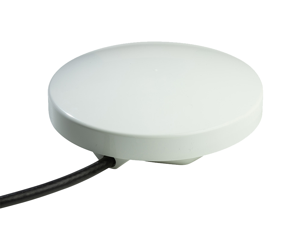
Ground Control has deployed full end-to-end solutions for renewable providers to retrieve their data from the field in over 100 countries, recommending the best solution for their operational needs. For remote site data retrieval, the RockBLOCK Plus is rugged and waterproof – ideal for remote and exposed sites – and is designed specifically to transmit sensor data from IoT applications. RockBLOCK Plus sends and receives short messages from anywhere on Earth with a view of the sky, via Iridium SBD, as frequently as every 10 seconds, making the device ideal for remote performance monitoring and pre-empting maintenance requirements.
CHALLENGE 2 – Combining distributed site data
The solution – Cloudloop
To enable renewable energy providers to balance supply and demand on the power grid, they must determine how much renewable energy is being generated at any given time. This can be challenging and even impossible to achieve without the use of satellite communication due to the size, scale and remote locations of renewable energy resources.
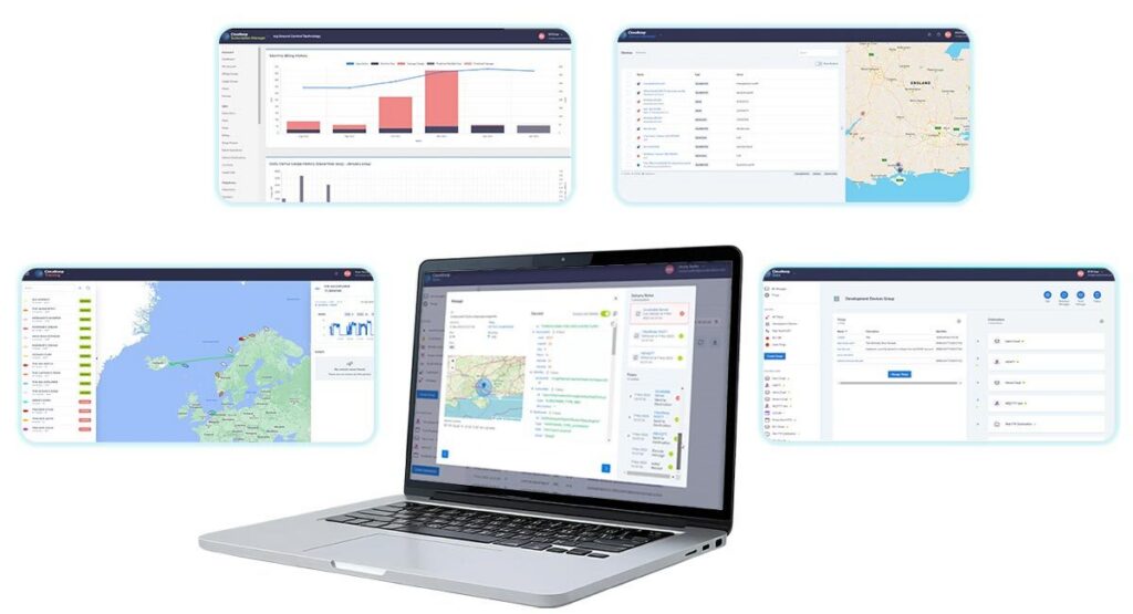
Cloudloop is Ground Control’s cloud-based software platform for subscription and device management. The software enables renewable providers to combine multiple and widely distributed sensor data into a singular entity to provide a complete visualisation of their energy-generating operations.
All satellite device activations and deactivations, airtime management and troubleshooting can be achieved remotely via the Cloudloop platform. Monitoring in real-time, historical data usage and alerts enable proactive cost management, with diagnostics reporting significantly reducing field maintenance costs, regardless of the scale or distribution of the data loggers.
CHALLENGE 3 – Security and cybercrime
The solution – SCADASat
The Colonial Pipeline hack in the USA proved beyond doubt that the renewables industry is at risk of cyber attacks, yet a key data transfer requirement exists between on-site RTUs and SCADA systems to extract mission-critical sensor data, however remote, to prevent and mitigate outages and disruption to energy supply.
Some satellite networks have the advantage of not needing any publicly available terrestrial infrastructure in order to extract data from RTUs. So if wind farms, reservoirs or solar sites don’t receive reliable cellular coverage, satellite is the best option, either as primary or failover. For maximum data security, the SCADASat by TSAT is a narrowband private satellite network that avoids utilising the internet and is the optimally secure solution for remote monitoring, controlling, and surveillance of renewable energy grids.
SCADASat enables renewable providers to cost-effectively and reliably transmit remote SCADA, telemetry and M2M data – all in a secure network. The platform is highly scalable with low operating costs compared to the new installation and maintenance of fibre connectivity. It is compatible with both IP and legacy serial devices and operates independently from terrestrial communications systems, both complementing and offering an alternative solution to terrestrial networks, ensuring transmission at all times.
CHALLENGE 4 – Energy wastage
The solution – RockREMOTE Rugged
Wind farms are a good example of where the power generated could become surplus and potentially wasted. The nature of these remote and expansive sites presents a challenge for renewable energy providers. They must be efficiently managed and monitored to ensure maximum energy utilisation and minimum energy wastage – which is otherwise costly to energy providers.
Cloud-based remote monitoring solutions are therefore essential to help operators monitor multiple wind farm locations at any one time, collecting all, or exceptional data, on wind turbine speed, torque, power, wind speed, wind direction and so on.
RockREMOTE Rugged is a reliable solution for remote IoT challenges. It securely connects remote IoT assets using IP or message-based protocols and provides diverse connectivity through Iridium Satellite or LTE networks. The device is powered by a sophisticated Linux-based operating system that offers containerised hosting for edge-computing applications.
For renewable energy sites, this means complete visibility and control – even if assets are spread over a wide area. The RockREMOTE Rugged solution extends the reach of telemetry applications and enables real-time reporting on power generation to prevent saturation and wastage.
CHALLENGE 5 – Costly data retrieval
The solution – Cobham EXPLORER 540
We know that many renewable energy sites are located in remote areas. Where cellular and fibre connectivity already exists, this will be the most cost-effective option to retrieve sensor data. However, The US Department of Transportation put the average cost of laying new fibre at $27,000 per mile. Further to the costly installation, there’s the ongoing costs to consider with an experienced Field Engineer costing, on average, $68,132 per year (hardware lifetime is typically around 10 years). Utilising remote satellite IoT communication and monitoring solutions mitigates this cost almost entirely as the terminals are remotely managed.
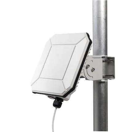
As the world’s first IoT Pro terminal designed to operate on both Viasat Satellite network and cellular 2G/3G/LTE networks, the Cobham Explorer 540 delivers always-available connectivity for critical monitoring and control applications where cellular and fiber are out of reach.
The IoT Pro Service uses Viasat to provide a reliable, global, two-way IP data service. It’s designed to connect monitoring and control applications in remote, unmanned locations, providing visibility and management of those assets. By combining IoT Pro with cellular connectivity in the same terminal, the Explorer 540 gives users the opportunity to choose the best carrier for any location, or to switch seamlessly between cellular and satellite using lowest cost routing logic.
Here, now and the future
Satellite-powered communication and monitoring solutions equip renewable energy providers with multiple ways to overcome the challenges of remote device monitoring, cyber security, power storage, and combining distributed site data.
A suite of satellite-based solutions from Ground Control enables the renewables industry to harness the efficiencies of satellite communication to advance troubleshooting and improve response times, implement predictive maintenance monitoring, automate manual tasks, and optimize energy utilization. With 60% of the world’s energy anticipated to be renewable within the next 12 years, the demand for satellite connectivity is only set to increase.
Ground Control is very well placed to support renewables connectivity, as it’s our mission to make sure data reaches its destination by the most reliable and cost-effective means possible. Whether using cellular or satellite connectivity, Ground Control can recommend the best solutions, airtime and services.
Would you like to know more?
If you’d like some impartial, expert advice on the best solution for your renewables connectivity challenge, please call or email us, or complete the form, and we’ll be happy to help.
We’re not invested in selling you a specific product or connections, just the best solution for your needs. Europe, Oceania, Asia and Africa: +44 (0) 1452 751940; North and South America: 800 773 7168.