Topic: First Responders
Remote Conservation at Wildfire Risk: Monitoring and Alerting with Satellite IoT
For teams managing remote conservation areas, wildfire risk is becoming harder to predict and harder to plan for, even in regions that have not historically been considered fire prone. Rising temperatures and longer dry periods are changing how fire behaves across forests, reserves, and protected land. One recent study found that 83.9% of wildfire-vulnerable species are now exposed to increased fire risk, with fire seasons projected to more than double in some regions. This isn’t limited to traditionally fire-prone zones. Fire seasons are lengthening, and fire behaviour is becoming less predictable and harder to contain.
You may already be seeing the signs: vegetation staying dry for longer, water sources becoming less reliable, and more ignition points across a wider area. For smaller teams covering large territories, this shifts wildfire from a seasonal concern to an ongoing operational risk.
Why remote sites are exposed
Remote conservation areas come with structural challenges that make wildfire response harder. Teams often work across large, varied terrain with limited visibility, minimal infrastructure, and inconsistent or absent cellular coverage. Ranger teams are small, but the areas they cover are not.
When a fire starts, response depends heavily on what you can detect and communicate locally. In Madagascar, one protected reserve lost around a third of its forest in a single year due to wildfire pressure linked to rising temperatures and prolonged dry conditions. Events like this highlight how quickly impact scales when detection or response is delayed.
Distance from emergency services also increases pressure on conservation teams, while budget constraints shape what can realistically be deployed. And when habitats support endangered species, even a single event can cause long-term ecological damage.
What monitoring looks like today
Wildfire monitoring is typically shaped by scale and budget. In practice, teams may rely on ranger patrols and visual observation, weather tracking such as temperature, wind, and humidity, external satellite data sources, camera systems, or WAN sensor deployments.
These tools are valuable. They provide signals, support situational awareness, and in some cases trigger real time responses. However, while the capability to monitor exists, the limitations of existing approaches are largely practical. Detection may depend on chance observation and can come too late, while reliance on cellular communication can fail under the stress of an unanticipated emergency that disrupts the very channels needed for response.
Even when sensors are deployed, reliably transmitting alerts can be difficult. Data may be captured but not delivered effectively, creating a gap between detection and awareness. Constraints like these become more visible as wildfire risk increases.
Why time is of the essence
Delays in detecting early-stage fires reduce the available window for intervention. In fast-moving conditions, even short delays can significantly increase the scale of an incident. At the same time, teams may be distributed across the landscape, and lone workers need reliable communication for both safety and coordination.
The 2024 Jasper National Park wildfire shows how quickly situations can escalate, even in well-managed environments. The event led to around 25,000 evacuations and the loss of hundreds of structures. In more remote settings, with fewer resources, the margin for delay is even smaller.
Detection works. Delivery is the problem
Deploying sensors to monitor temperature, humidity, and smoke across high risk areas can provide meaningful early signals from systems that run for long periods on minimal power.
The FireFly project in Northern Thailand is a strong example. Distributed sensor nodes monitored forest conditions and identified early fire risk, with UAVs used to confirm ignition points. The system was designed specifically for remote, low infrastructure environments with cost in mind. But field observations highlighted a recurring issue: antenna placement and enclosure design affected system reliability, while dense vegetation and uneven terrain disrupted connectivity. Environmental conditions directly influenced whether data could leave the site. In other words, detection worked, but alert delivery didn’t always follow.
The same pattern appears in field-based wildfire and peatland monitoring projects more broadly. Sensors can detect early stage fire risk, land degradation, or changing environmental conditions, but the value of those systems depends on whether data can leave the site quickly and reliably. Studies of IoT wildfire detection systems highlight communication reliability, limited cellular coverage, packet loss, latency, and energy consumption as practical deployment challenges in remote environments. The communication channel, or “last mile” connection, is therefore critical to whether early detection becomes timely awareness.
Solving the last mile with Satellite IoT
In remote conservation areas, terrain, vegetation, and distance from infrastructure all affect signal performance. Systems that depend on terrestrial networks introduce gaps and points of failure. Satellite IoT removes that dependency.
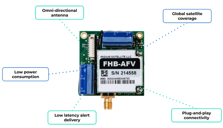
By integrating a compact modem such as RockBLOCK 9603, a sensor monitoring system can send data over the Iridium satellite network with no reliance on local infrastructure. That creates a direct path from your sensor to you, without relying on local coverage.
In practice, the workflow is simple:
- Sensors monitor defined environmental thresholds
- Local logic determines when conditions require attention
- A short alert message is generated
- That message is transmitted via satellite to your team.
Messages remain small, and transmission can be event driven, supporting low power operation and long deployment lifetimes. For conservation teams, this enables a focused deployment model: a limited number of sensors placed in high risk areas, with a communication path that remains consistently available.
When a fire is detected, the system alert is delivered, reliably, and in time to act.
When you need more field capability
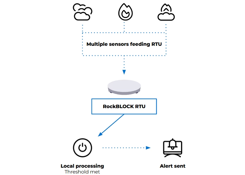
For some deployments, a compact satellite modem may be enough to connect an existing sensor system. For others, the monitoring setup needs to handle multiple sensor inputs, apply logic locally, and decide when an alert should be sent.
That’s where a device such as RockBLOCK RTU can be useful. It aggregates sensor inputs from a range of sources and applies threshold logic in the field. When defined conditions are met, it generates alerts and transmits telemetry via its satellite connection.
This approach reduces dependency on continuous connectivity and avoids the need to send raw data elsewhere for processing. Decisions are made where the data is generated, according to the conditions being monitored. Reducing unnecessary data transmission also helps keep satellite costs to a minimum.
In practice, that gives you:
- One unit integrating multiple sensors
- Configurable thresholds based on your environment
- Event-based alerting instead of continuous transmission
- Context included with each alert.
The right approach depends on the scale of the site, the number of sensors required, and how much processing needs to happen in the field.
Designing for increased wildfire risk
Effective wildfire monitoring systems prioritize early detection and dependable alert delivery. They need to operate with limited power, minimal infrastructure, and changing environmental conditions, while remaining simple enough to deploy and maintain and reliable enough to trust when something happens.
Recent events reinforce the need for this approach. Reliability, simplicity, and clear information delivered to the right people at the right time can protect lives and support more effective response.
Facing a remote monitoring or alerting challenge?
If your team needs to detect environmental risk, transmit alerts from areas without reliable cellular coverage, or keep remote systems connected, we can help you explore the right satellite IoT approach.
Complete the form, or email hello@groundcontrol.com to discuss your use case with our team – we’ll reply within one working day.
Emergency Response Has Outgrown “Good Coverage”
In 2024, a nationwide AT&T outage disrupted emergency communications, and affected access to 911 services in the US. More than 25,000 attempts to reach 911 were blocked, and service was disrupted for more than 125 million devices. At the same time, multi-state 911 outages continue to occur. Increasingly, for emergency response, the issue is not just whether networks are available, but how they perform when conditions change.
For the teams responding to calls or disaster events, working with real time video, data, and mobile command environments as part of day to day operations brings a different kind of pressure. Coverage alone is no longer enough; what matters is whether the connectivity remains usable under pressure, across networks, locations, and conditions.
Operating across multiple networks such as FirstNet or commercial LTE, traditional satellite, and increasingly LEO services such as Starlink introduces new complexity and inefficiency. Those issues now need to be addressed if emergency teams are to stay reliably connected.
Why Performance Matters as Much as Coverage
You can have a strong signal and still struggle to get the performance you need. During major incidents, networks rarely fail completely; congestion builds, latency increases, packets drop, and throughput becomes inconsistent. Even with signal present, performance becomes unpredictable. The FCC has highlighted how disasters expose these types of resilience gaps.
At the same time, operational demands are increasing. With the transition to Next Generation 911 (NG911), video, images, and real time data are becoming part of standard workflows. If communication links drop, the result is video feeds that struggle to stay stable; slower or unreliable access to CAD and GIS systems; and inconsistent performance between vehicles, command posts, and field teams.
Multiple networks: LTE, 5G, LEO satellite, and legacy GEO systems, are often all in play, whether by design or through gradual adoption. And this reflects a broader shift. Managing multiple technologies and networks is now part of the operational reality. So the challenge isn’t whether there is enough connectivity. It’s how well those networks work together when it matters.
Why Failover Based Connectivity Can Fall Short
Many setups still rely on failover. One network is primary, and others act as backup. It works when a network drops completely. It doesn’t work as well when performance degrades. In most incidents, what you actually see is:
- Increasing latency
- Packet loss
- Reduced throughput
- Unstable performance.
But failover only responds once a threshold is crossed, and by then, performance has already dropped below what applications need. There’s a delay between degradation and recovery, and during that time, services like video, VoIP, and real time data are disrupted.
It also means you’re not making full use of the networks available to you. Failover reacts to failure. It doesn’t actively optimize performance, which is the key.
Adding Starlink or Multiple Networks Doesn’t Solve the Problem Alone
You may already have addressed coverage gaps by adding services like Starlink. That improves reach and bandwidth, especially in remote or hard to cover areas. But adding more networks introduces its own complexity: multiple providers and contracts, different data plans and cost models, networks with very different performance characteristics.
Without coordination, those networks sit alongside each other, rather than working together. This often leads to manual switching between connections; static rules that don’t reflect real time conditions; uneven data usage across devices, and limited visibility into what’s actually happening across the whole response setup. So while you have more connectivity available, it’s not always being used in the most effective way.
What Multi-Network Connectivity Should Look Like in Practice
The shift here is not about adding more. It’s about changing how you use existing services, managing continuous, multi-network connectivity. In practice, that means multiple connections active at the same time and traffic routed dynamically based on real time conditions.
Instead of waiting for a connection to fail, the system adapts continuously, using the most appropriate network path at any given moment, based on latency, packet loss, and bandwidth. This is the principle behind Dejero Smart Blending technology, which routes traffic across multiple connections in real time rather than switching between them.
The outcome is more consistent performance, with fewer connectivity interruptions and less need for manual intervention. Making reliability less about network uptime, and more about service usability. It supports the wider move toward IP-based emergency communications, where video, data, and voice increasingly need to work across different networks and locations. And supports what matters most: not the status of one link, which is still important, but whether the overall service remains usable and effective at all times, providing true resiliency.
How Ground Control Multipath Optimizes Connectivity
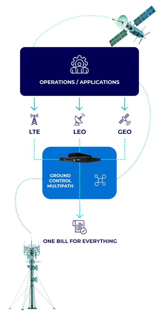
Ground Control Multipath is designed to help you bring all of your networks together into something that works as a whole. It builds on what you already have: your existing LTE and 5G connectivity, your current satellite services, including LEO and GEO, and additional capacity where it makes sense.
Those connections are then managed through a routing layer that continuously selects the most appropriate path based on real time conditions. From your perspective, that means less time managing networks individually, more consistent performance across devices and locations, shared data usage instead of isolated plans, and reduced reliance on manual failover. The goal is not to replace your existing setup; it’s to make it work more effectively as a system.
The Multipath and Dejero TITAN fit
Ground Control Multipath provides the overall solution. It’s designed around your operation, and brings your available networks together so they work more effectively as one. Dejero TITAN is the device that brings your connectivity together, helping to manage multiple live connections, ensuring a seamless switch between networks, or combining them where needed, making bandwidth usage efficient and reducing your costs. In other words, Multipath is the overall service approach; TITAN is the enabling technology that can deliver it.
What This Means for Your Operations
When your networks work together properly, you see more consistent performance across video and data services, even when individual networks degrade. You make better use of the connectivity you’re already paying for, with data shared and optimized across the deployment. And you gain confidence in how your systems will behave during an incident, not because networks don’t fail, but because your setup adapts when they do.
Most agencies now operate across multiple networks, whether intentionally or not. The next step is making those networks work together. So this is not about adding more connectivity, it is about improving how it’s used. Good coverage is no longer enough. What matters is consistent, usable performance when it matters most.
Review Your Current Connectivity Setup
If you want to make better use of the connectivity you already have, we can help. Our team offers a no cost review of your current setup to identify where performance can be improved and costs reduced. It’s a practical conversation based on how you operate today.
Complete the form or email us at hello@groundcontrol.com and we’ll get back to you within one working day.
Is Direct to Device (D2D) Technology the Answer to Lone Worker Safety?
What is D2D?
D2D refers to the ability for an unmodified device – such as a cellphone – to access satellite connectivity. This was pioneered by Apple and Globalstar as they partnered to provide an emergency satellite communication service for iPhone users in 2022.
How Does D2D Work?
There are two ways D2D can be delivered. The first is by building a chipset into the device that allows it to access a specific satellite network. This is the option chosen by Apple, and its satellite network partner Globalstar. The benefit of this approach is that Globalstar has licensed radio spectrum that allows it to provide a service anywhere where it has a satellite overhead. The downside is that the device can only communicate with a single satellite network.
The second way to deliver D2D is to adapt the satellites themselves so that they are compatible with the communication protocols already in use by cellphones and other devices – i.e. 4G, 5G etc. This is the approach chosen by Starlink, AST SpaceMobile and Lynk, all of whom are in the process of launching satellites compatible with terrestrial network communication standards.
The benefit of this approach is that, in theory, all compatible satellite networks are available to the cellphone user as simply another network on which to roam, and they can do so depending on what their commercial agreement is with their usual network service provider (e.g. Vodafone, AT&T etc.).
The downside is that because these are new satellite networks, they do not have licensed radio spectrum through which to deliver their service; this is already distributed among older, more established satellite constellations. So to deliver service, the new satellite network operators need to partner with a terrestrial network operator to ‘borrow’ some of their licensed radio spectrum. Services are only available where these partnerships exist, so they are not global. Starlink, for example, has partnerships in 10 countries; outside of these countries, it cannot provide service.
How Could D2D Benefit Lone Workers?
In 2021, we asked lone workers across multiple industries if, as part of their job, they sometimes or often travelled out of cellular coverage. 51% responded yes. We then asked about the implications of this; did they ever feel unsafe, for example, or been unable to send or receive a message when they needed to.
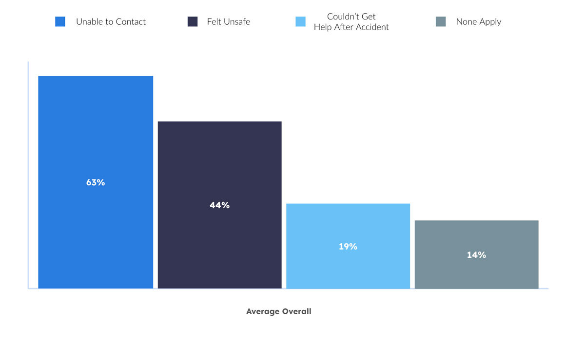
As the graph illustrates, lone workers operating in areas without voice, text or internet services feel – and are – more vulnerable. 15% of the overall workforce are considered lone workers, and NSC data indicates that working alone increases both the likelihood of incidents, and the severity of adverse outcomes.
Although we can’t draw a parallel, it’s striking that industries with a high number of lone workers – Utilities & Renewables, Oil & Gas, Forestry, Emergency Response, Community Healthcare – are also struggling with staff retention.
- 80% of Oil & Gas workers are considering leaving the industry
- The US Forest Service has lost nearly half of its permanent employees in the last three years
- In the UK, 32% of social care workers leave their roles every year – an increase of 9.1% over the last decade.
While it’s not a silver bullet, the benefits of lone worker monitoring technologies are well documented: improved safety outcomes and staff morale, leading to greater staff retention, and saved costs in recruitment and insurance premiums.
An estimated 2.3 million lone workers in Europe, North America, and Australia & New Zealand now have access to a lone worker safety solution, with the market estimated to grow at a rate of 7.1% between 2024 and 2029 – further indication of the value of these platforms.
But if they can’t be accessed because the worker is outside cellular coverage, they fail. D2D with its ability to confer internet access to any compatible cellphone with a relevant commercial agreement, unlocks the ability to access these platforms from very remote locations where cellular coverage is nonexistent.
Overheating and Thermal Shutdowns
Satellite connections require the phone to transmit at higher power levels, which generates more heat than cellular communication. Many phones will automatically shut down when internal temperatures exceed safe limits, leaving users without a means of communication.

Drop and Impact Vulnerability
A cracked screen or internal damage from a fall can render a phone unusable, preventing emergency communication. Even flagship smartphones can shatter from waist-high drops, whereas ruggedized satellite communicators are built to withstand extreme impacts.

Battery Drain and Cold Weather Failure
Phones in satellite mode will often use higher transmission power and spend more time searching for signals, draining the battery faster. Further, cold weather severely affects lithium-ion battery performance.

Lack of Physical Controls for Emergency Use
In emergency situations, speed matters. Unlike dedicated satellite devices, which often feature an SOS button that can be activated instantly, smartphones rely on touchscreen controls that may be difficult to use with wet, cold, or gloved hands.

Weak Antenna and Poor Signal Reception
Smartphones’ internal antennas are optimized for terrestrial networks, meaning signal reception in satellite mode will often be weaker and less reliable. Dedicated satellite communicators feature larger antennas that ensure consistent connectivity even in difficult environments.
The Safer Alternative: Dedicated Satellite Communicators
In life-critical situations, reliable communication is essential. The RockSTAR rugged satellite communicator outperforms standard devices with extended battery life, superior durability, and truly global coverage. Designed for extreme environments, it ensures emergency responders, remote workers, and adventurers stay connected when it matters most. With near-instant messaging and a one-button SOS feature, help is always within reach.
The RockSTAR offers a ≈12-month battery life on a single charge, operates in extreme heat and cold, and withstands rough conditions. With ≈10-second latency, it provides real-time tracking and updates. Its easy-to-reach SOS button ensures immediate distress signals, making it the ultimate safety tool for remote and high-risk environments.
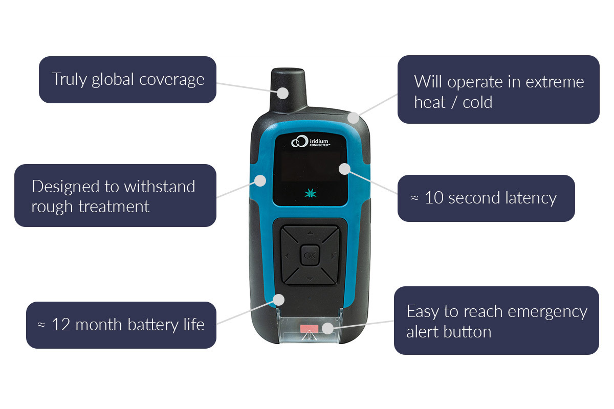
RockSTAR is more than just a rugged satellite tracker; it’s a powerful solution for real-time visibility, safety, and communication in the world’s most remote environments. When paired with Cloudloop Tracking, it offers an intuitive platform for monitoring, messaging, and emergency response, ensuring that lone workers, field teams, and mission-critical personnel remain connected no matter where they operate.
For organizations with specialized requirements, we work with trusted partners like Locate Global and JCSys, who provide advanced functionality for healthcare, emergency response, and military applications.
Additionally, our well-documented API allows operators to seamlessly integrate location, messaging, and event data into their own preferred platforms, giving them complete control over their tracking and communications ecosystem. Whether using Cloudloop Tracking or integrating with an existing system, RockSTAR ensures reliable, global connectivity for those who need it most.
Get In Touch
If we can support your efforts to improve lone worker safety and communication, please get in touch. We have delivered satellite-enabled tracking and messaging services since 2005, and provide support to a diverse set of users – from soldiers to remote site inspectors.
Email hello@groundcontrol.com to tell us about your requirements, or complete the form, and we’ll be in touch within one working day.
Ground Control Partners with Locate Global to Boost Workforce Safety and Incident Management
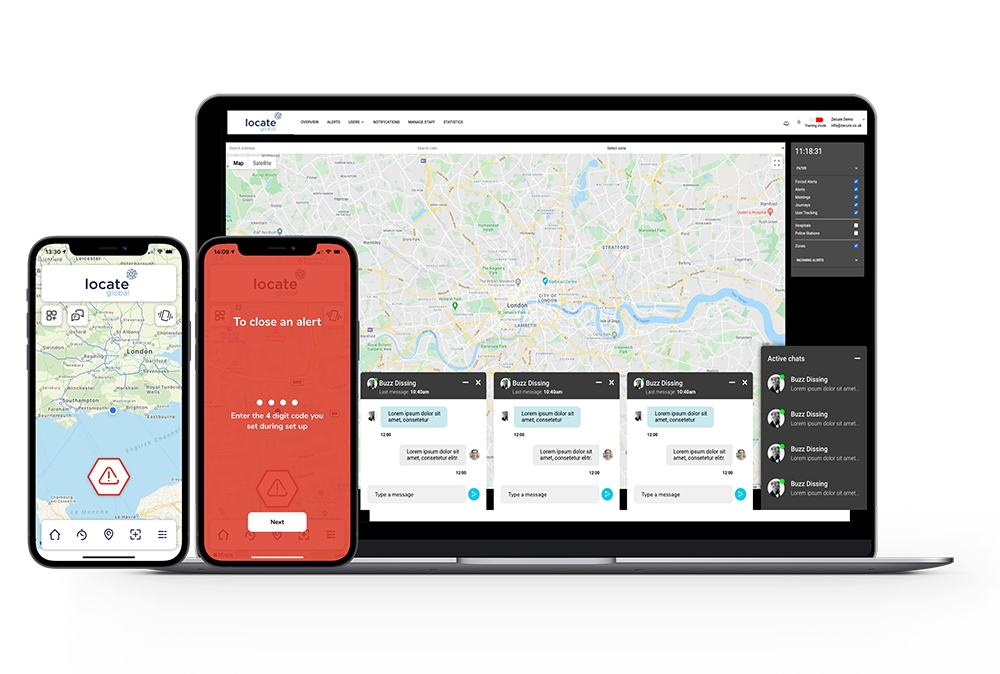
We’re excited to announce our strategic partnership with Locate Global, a prominent provider of incident management and workforce safety technology. This collaboration enhances workforce safety and incident response capabilities by integrating Ground Control’s high-speed satellite communication into Locate Global’s platform.
Locate Global’s platform enhances workforce safety and incident management through real-time location tracking, geofencing, and multi-channel communication tools.
It offers shake-triggered alerts, peer reporting, and immediate location data with video and audio to streamline emergency responses.
The system’s centralized dashboard also provides insights via heat maps and supports audit analysis, promoting a proactive safety culture.
The platform is designed for diverse applications, from protecting lone and remote workers to supporting global teams, with flexible integrations for any industry.
By incorporating Ground Control’s reliable satellite connectivity, Locate Global can provide consistent, secure communication even in remote or challenging environments where standard networks fall short.
“We are excited to partner with Ground Control, whose expertise in satellite communications complements our mission of ensuring safety and efficiency in the workplace. This partnership will allow us to provide our users with unparalleled connectivity, enabling them to communicate seamlessly and respond swiftly during emergencies.”
Raphael Polt, Head of Global Partnerships
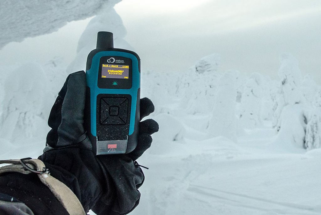
RockSTAR is a handheld satellite device that provides global messaging and tracking in real time, designed for professionals working in remote or extreme locations.
It utilizes the Iridium satellite network, which is global and extremely reliable; as long as your team members have a view of the sky, they will be able to communicate with your base of operations.
RockSTAR features two-way messaging, an emergency alert button, hyper-accurate GPS tracking, and geofencing capabilities. It can be used instead of a cell phone, or linked via Bluetooth to allow usage of the Locate Global app.
The device is ruggedized for durability, waterproof, and has an extremely long battery life, making it viable for extended outdoor use.
Partnering with Locate Global aligns with our commitment to delivering robust communication solutions for industries where connectivity is paramount. Together, we are enhancing the ability for organizations to manage incidents effectively, ensuring that teams can maintain communication and safety in any environment.
Can we help you?
Our partnership with Locate Global empowers teams to communicate and respond effectively, even in the most remote environments.
If you’d like to know more, please complete the form, or email hello@groundcontrol.com.
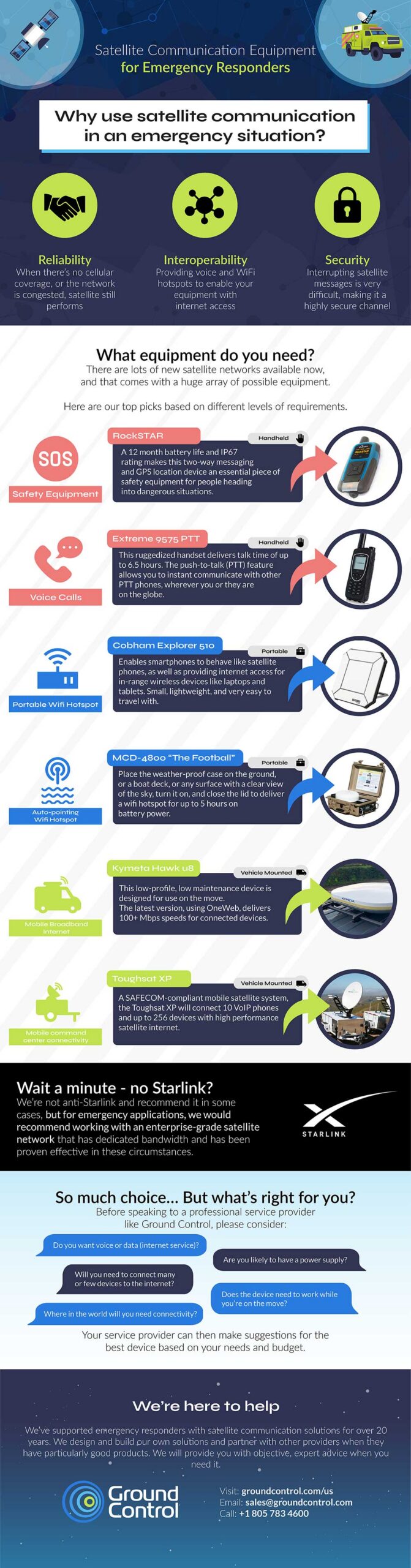
Infographic: Satellite Communication Equipment for First Responders
When you’re dealing with an emergency – threat to life from extreme weather, a terrorist incident or infrastructure damage from an earthquake – you have to be able to communicate with your fellow first responders. But what happens if your normal communication channels are compromised through network congestion or infrastructure damage? It’s not something you can just do without.
That’s why so many first responders have satellite communications equipment as a primary or backup means of providing location data, making calls, sending messages, accessing Material Safety Data Sheets (MSDS), viewing drone footage, and monitoring local TV news coverage. With no dependency on terrestrial infrastructure, high reliability and high security, satellite is the ideal communications channel in an emergency situation.
First responders have a good problem to solve, now, in that there are many more options for satellite communication equipment now than five years ago. This additional competition has brought costs down for both hardware and airtime, which is great news for Emergency Management Agencies. The only drawback is knowing what hardware to choose for each potential scenario.
That’s why we’ve put together this simple infographic; to help you navigate the plethora of choices and make the right decision for your needs. We’re here to help, too; we have 20 years of experience in delivering reliable, robust, affordable and secure communications equipment. We design and build our own hardware, but also partner with trusted manufacturers so we can match you with the right device and airtime service. Just call or email us for objective, expert help at any time.
Get some expert advice
We don’t have a vested interest in selling you a particular product or airtime service. We will provide you with objective, expert advise on the best product and airtime for your Emergency Management Agency needs.
If you’d like to talk through your requirements and get our feedback, just call or email us, or complete the form, and we’ll connect you with one of our team right away.
Elevating emergency operations: SATCOM’s role in transforming public safety
First responders – firefighters, paramedics, police, all public safety agencies – must have communication certainty. Why?
- Timely instructions reaching field teams can mean the difference between a life saved and a life lost.
- In distress situations, personnel staying connected is essential.
But 81% of emergency managers have experienced communication failures. During an emergency, traditional infrastructure may be unavailable, destroyed or overloaded. This is why satellites play such an important role in public safety operations. In just one example, the FBI and other emergency response teams relied on satellite phones throughout the Boston Marathon Bombing aftermath because cellular service was unreliable due to congestion.
SATCOM products and services provide reliable and resilient connectivity, enabling critical communication links when LTE and radios are down. With the ability to provide connectivity in remote, disaster-stricken, or otherwise challenging environments, SATCOM has already revolutionized how first response agencies operate.
How SATCOM has transformed public safety operations
Situational Awareness
Leveraging satellites, incident commanders have a reliable means of communicating with personnel in the field. This ensures real-time dissemination of information, so commanders’ can maintain situational awareness – vital for shaping a timely, appropriate response.
Emergency Response Planning
Ground personnel rely on vital information regarding population density, infrastructure, and environmental conditions. Satellite connectivity enables efficient data collection, analysis, and modeling, aiding effective response strategies and resource allocation.
Asset tracking and Management
Real time satellite-based asset tracking systems provide constant updates on the location and status of vehicles, equipment, and personnel. This optimizes resource management, boosts operational efficiency, and improves the safety of field team members.
Video and Data Transmission
Satellites facilitate seamless transmission of HD video and vital data from Unmanned Aerial Vehicles (UAVs) and sensors, plus access to extensive reports, images and maps. Allowing real-time collaboration, swift decision-making, and remote guidance for on-site personnel.
Today, SATCOM aids tactical operators with natural disaster response both as a primary and failover means of communication. It empowers wildfire response teams operating in remote forests with real-time communication, data analysis, and information retrieval. It enables field hospitals to access medical histories, transmit imagery, and provide telemedicine services on-site.
However, in a competitive market with a growing number of players, choosing the right SATCOM service and equipment can be difficult. Using our 20+ years experience supporting first responders, we’ve outlined key considerations to help guide public safety agencies define their SATCOM requirements.
Navigating the world of SATCOM: Important factors to consider
Coverage & Availability
As SATCOM systems leverage specific satellite constellations and services, it’s crucial to assess your agency’s operational zone to determine coverage and availability needs.
Coverage will depend on factors like satellite orbit position, antenna pointing accuracy, frequency used, and potential signal obstacles such as tall buildings or valleys. Key players like Iridium, Starlink, and Viasat offer global coverage (the latter excluding polar regions).
However, Starlink can suffer congestion-related slowdowns, while newer constellation OneWeb consistently covers the 35th parallel north, encompassing Canada, southern Europe, and northern USA, without speed fluctuations.
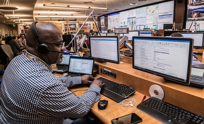
Bandwidth & Latency
Effective communication for first responders often extends beyond voice calls. Thus, teams must assess whether their SATCOM devices require capabilities like live video transmission. In such cases, prioritizing sufficient potential bandwidth and, where needed, low latency becomes essential.
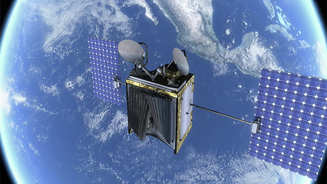
Both Iridium and OneWeb constellations operate within Low Earth Orbit (LEO), resulting in reduced ping times due to closer satellite proximity to Earth’s surface. With latency as low as 70ms, emergency responders experience near real-time collaboration.
Viasat, SES and Intelsat support high bandwidth applications like video calling, but with constellations situated in geostationary orbit, there is a slight impact on latency.
Ruggedness & Mobility
First responders often navigate challenging and unpredictable environments. Fortunately, SATCOM equipment can be ruggedized to endure demanding and rapidly changing conditions. Look for robust IP (ingress protection) ratings, and operating temperatures to ensure steadfast performance during critical moments.
If you need extremely swift deployment and setup, consider a case-based device like the MCD-4800, which allows responders to establish communications within seconds during emergencies.
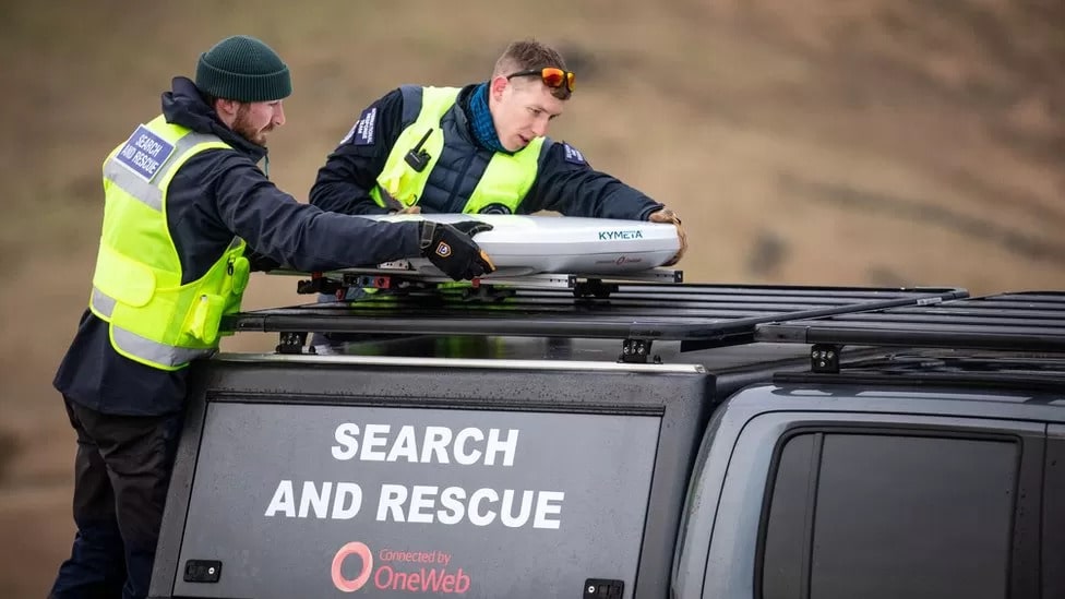
The Kymeta Hawk u8 LEO, which attaches to vehicles, offers Satcom-on-the-move capabilities—an essential feature given that a recent survey showed 37% of first responders consider connected vehicles a top priority within the next five years.
Interoperability
Seamless communication between different agencies remains a top concern for our public safety officials, with 47% of surveyed first responders recognizing the significance of interoperability. Coordinated communication among federal, state, and local agencies is essential to prevent duplication and delays in rescue efforts.
With SATCOM systems, agencies can achieve interoperability in two main ways: 1. Employing an “interoperability gateway” or crossband repeater. 2. Utilizing Mission-Critical Push-to-Talk (MCPTT) devices. Planning the “how” is essential from the outset.
Security
The transmission of sensitive data is a crucial aspect of first responder operations. To safeguard this information, the chosen SATCOM service should prioritize network security and provide robust encryption features, to ensure the confidentiality, integrity, and availability of the transmitted information.
Look for systems and services that offer end-to-end encryption, secure communication channels, and authentication mechanisms to protect data from unauthorized access. For instance, OneWeb’s service boasts military-grade network security, and some ground stations are even located within military installations.

Survey referenced above: Frontline Public Safety Communications
SATCOM equipment is a tool; selecting the right tool can make a substantial difference. And with first response teams expecting their job to require even more connected devices in the next five years, the better agencies understand their needs, the better companies like Ground Control can match agencies with the best possible tool (SATCOM equipment).
For more detailed comparisons of our popular portable and mobile satellite communication equipment, discuss your requirements with one of our experienced team by emailing us at hello@groundcontrol.com.
Ready to take the next step?
With Ground Control, our customers have access to individuals who have not only been working in SATCOMS for over 20 years, but those who have been working alongside first responders for over 20 years. Some of us were even first responders in a previous life.
So if you are reviewing satellite communication equipment and would like some objective advice, simply fill in the form and one of our expert team will get back to you.
Communicating effectively during major incidents: 3 challenges facing first responders
Did you know that 81% of emergency managers have experienced communication failures during emergencies?
Whether a major incident is caused by a natural disaster, accident or malicious intent, first responders have to contend with a constantly evolving situation where priorities can change from minute to minute. Adding to the complexity is communication, which is made particularly challenging when multiple agencies need to communicate in order to respond effectively; when an incident takes place in a remote area, or if bandwidth gets constrained.
None of these issues are easy to resolve, but we’ve written this blog post to outline some potentially overlooked, affordable and easy-to-deploy solutions which can help tackle the three core issues of interoperability, network congestion, and coverage in remote areas.
1. Interoperability
“During incidents like 9/11 and Hurricane Katrina, cell phone towers were destroyed and overloaded, and first responders’ radios were incompatible, making life-saving communications almost nonexistent when they were needed most.” – United States Army
“The inability of responders from different departments and jurisdictions to communicate over their various radio systems during the event… was determined to have been a factor in the inability to evacuate 343 firefighters from the World Trade Center buildings, who all perished as a result.” – Dereck Orr, NIST
Why were the radios incompatible? Because public safety departments across the US are free to choose their own radio systems from different manufacturers, which sometimes operate on different radio bands. But forced standardization of radio systems isn’t the answer, as allowing agencies to select their providers encourages competition, driving innovation and lowering costs.
Two options present themselves: firstly, using an “interoperability gateway” otherwise known as a crossband repeater – technology designed to transmit and receive on different parts of the radio spectrum. These devices can be quickly deployed to allow agencies using different radio systems to talk to each other, in addition to other frequently used devices like satellite phones and VoIP desk phones.
Secondly, using Mission-Critical Push-to-Talk (MCPTT) enabled devices. This is a newly developed protocol that several telecommunication companies are building into their applications, including Ericsson, Qualcomm, ESChat and Motorola. If you’re using software built to the MCPTT specification, irrespective of the network or handset being used, you can communicate with other agencies using MCPTT. Currently this technology isn’t interoperable with LMR, but this is a known requirement that’s being worked on (source).
2. Network congestion
For people caught up in an emergency, it’s a natural reaction to try and reach friends and family, but this can, and frequently does, lead to network congestion. And that can have catastrophic consequences for emergency responders and the people they’re trying to save.
Cognizant of this, two communications companies took the initiative to create networks exclusively for the use of first responders: AT&T’s FirstNet, and Verizon’s Frontline. Both provide a choice of different phones, tablets, laptops and routers compatible with the service, and cover up to 2.71 million square miles. This helpful article provides a more detailed comparison and pricing.
It’s not a perfect solution: users of FirstNet have reported poor signal coverage, while users of Frontline report frustration with saturated networks. One workaround is to use an app like ESChat, which supports multiple terrestrial networks, but also offers a satellite option, Iridium Certus, which provides 100% global coverage. That’s a highly valuable failsafe if cell phone towers are damaged or congested, or terrestrial infrastructure is wilfully targeted, as was seen at the Nashville bombing in 2020.
ESChat partnered with Thales to make this satellite solution available. If you’re a first responder with a MissionLINK 200, MissionLINK 700 or MCD-MissionLINK device, or its maritime equivalent, the VesseLINK 200 or VesseLINK 700 (the differences are the data speeds available), you’ll be able to subscribe to the ESChat service and benefit from low-latency PTT from your smartphone or tablet.
Satellite systems in general are a great failsafe should terrestrial networks be damaged, destroyed or overloaded; and the proliferation of new satellite constellations over the last few years has created more choice and lower prices for users.
Do satellite networks suffer from network congestion too?
As satellite grows in popularity thanks to companies like Starlink, congestion on satellite networks needs to be considered. Like terrestrial networks, some satellite network operators provide dedicated bandwidth for emergency response traffic, whereas with others, you’re sharing the network with commercial users. Starlink for example has grown its user base so quickly that the demand is outpacing the capacity of the network, causing speeds to slow right down when many customers try to connect at the same time.
The best advice is to do your research, and ideally speak to someone who understands the satellite industry very well before deciding on a satellite partner.
3. Coverage in remote areas
While FirstNet and Frontline cover 77% of the landmass of the United States, that still leaves 800,000 square miles where there is no cellular coverage. These dead zones are naturally removed from population centers but are no less at risk from wildfires, hurricanes, earthquakes, landslides or flooding, which can cause huge damage to critical infrastructure like oil, gas and water utilities, plus farms, forestry and mining operations.
Sending emergency responders into areas like this presents a new set of challenges around communication, as neither cellular nor radio networks are likely to be consistently available. Satellite systems perform highly effectively in these circumstances, providing instant infrastructure that’s independent of terrestrial networks.
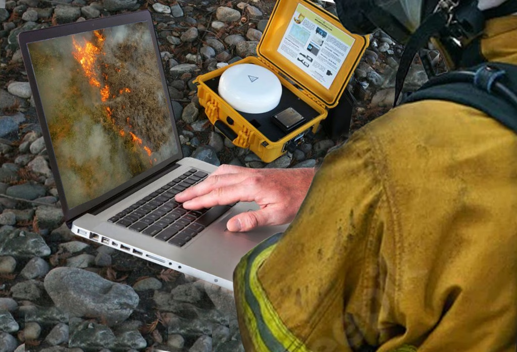
Portable, battery-operated devices like the MCD-4800 “The Football” or the MCD-MissionLINK create a WiFi hotspot of up to 1,000ft, providing broadband internet for up to 12 connected devices.
This delivers reliable access to email, text messages, Material Safety Data Sheets (MSDS), and mapping. It enables the tracking of manpower and equipment, and access to GIS data; as well as the ability to upload drone data and to monitor local TV news coverage.
Even a simple handheld device like the RockSTAR can save lives. This highly ruggedized equipment provides real-time tracking of your personnel, and can transmit IoT data such as their temperature and heart-rate.
Two-way text messaging is possible both via the device and via a Bluetooth-connected smartphone, and there are alert features if the device is dropped, or the person moves out of a pre-agreed trajectory.
Effective communication during major incidents is a tough nut to crack, but the technology exists today to overcome interoperability challenges, and the emerging MCPTT protocol holds great promise to banish this issue altogether. But it remains important to have options, like satellite, that don’t rely on terrestrial infrastructure. Terrestrial infrastructure – including that which supports LMR – will always be the default, but that makes it a high priority target for terrorist attacks. Plus, it remains vulnerable to natural disasters, and is absent from 23% of the US’ landmass.
Objective, expert advice
Ground Control is a satellite communications expert, having supplied emergency responders with solutions for over 20 years.
We work with multiple satellite network operators and partner with companies like Thales, Hughes, Cobham and Starlink to make sure you get the best possible solution for your circumstances. We’re here to help with objective, expert advice when you need it.
Enhancing law enforcement: the role of satellite communications in modern policing
Satellite communications have revolutionized the way police forces operate. Not only has satellite communication technology transformed the reach, reliability and robustness of global connectivity, but it has also provided law enforcement agencies with a powerful tool to enhance their capabilities and improve citizen safety.
In this blog post, we will explore the crucial role and key benefits of satellite-based communication in modern policing and law enforcement practices.
5 benefits of satellite communication for modern policing
1. Seamless connectivity
Satellite communications have the unrivaled ability to establish connectivity even in the world’s most remote and underserved areas. Traditional terrestrial communication networks are often unable to provide reliable coverage in rural regions, national parks, or disaster-stricken areas.
Unlike traditional terrestrial communication systems that often suffer from limitations such as range restrictions, network congestion, and vulnerability to natural disasters or deliberate disruptions, satellite provides a reliable and resilient communication infrastructure that can overcome these challenges. This capability enables law enforcement personnel to remain connected, allowing them to communicate and access critical information, regardless of location.
2. Rapid deployment and flexibility
Satellite communication systems offer rapid deployment capabilities, making them ideal for law enforcement operations that require immediate connectivity. Whether it’s establishing a temporary policing command post, setting up communication networks in disaster-stricken areas, or deploying resources to remote locations, satellite solutions can provide the required flexibility.
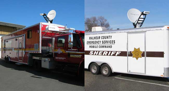
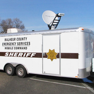
A mobile VSAT system could be mounted on the ground, on top of a vehicle, truck, trailer, or even transported in the back of an SUV. Deployment is rapid and suitable for any location – providing a robust, high-speed internet and communications solution. Police forces can subsequently reliably achieve quick, uninterrupted connectivity and operational effectiveness in dynamic and evolving situations.
3. Improved inter-agency collaboration
US law enforcement agencies need to collaborate with multiple agencies during joint policing operations, cross-border investigations, and when combining interagency task forces. Satellite communications enable the facilitation of seamless, secure communication and data sharing between these different agencies, regardless of their geographical location.
In rural areas, satellite-based connectivity can be the only way to achieve this as traditional communication systems like cellular and LMR are typically, much more limited. Satellite enabled messaging devices support rural-based police officers by providing reliable tracking and messaging anywhere in the world, powering collaboration across multiple regions, enhancing policing coordination, and strengthening the overall effectiveness of law enforcement efforts.
4. Real-time surveillance and intelligence gathering
Real-time surveillance monitors high-risk areas, tracks suspects, and shares data with other police forces and agencies for more coordinated operations and successful crime combating. Satellites equipped with high-resolution imaging sensors can provide real-time or near-real-time imagery of vast areas, enabling law enforcement agencies to monitor critical locations, track multiple suspects, or identify potential threats to life. This advanced surveillance capability helps to serve better public safety in the US and the world.
5. Coordinated disaster management and emergency response
During natural disasters, satellite communications play a crucial role in maintaining communication lines when terrestrial infrastructure is damaged, overloaded, or otherwise fails. When this happens, satellite serves as a lifeline for law enforcement agencies to coordinate response efforts, share critical information, and request additional resources. Furthermore, satellite connectivity enables mobile command centers to be established quickly so police can set up communication hubs out in the field during emergency and critical situations. This enables efficient coordination, resource allocation, and decision-making in real time. In the wake of the Boston Marathon bombings, police and the FBI relied on satellites as cellphones were unreliable in the bombing aftermath.
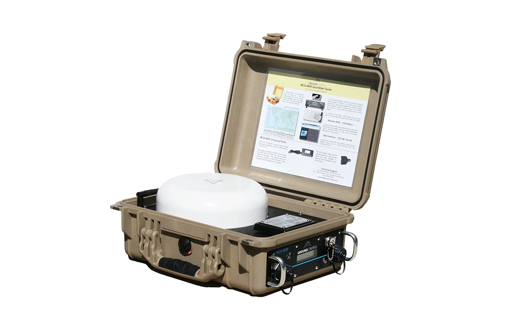
MCD-4800
For seamless connectivity in policing operations, the MCD-4800 provides instant infrastructure independent of terrestrial networks. Within a minute the MCD-4800 becomes a powerful WiFi hotspot accessible by any wireless device within a 300ft range for up to 5 hours on internal battery power alone. This capability enables law enforcement personnel to remain connected, allowing them to communicate and access critical information, regardless of location.
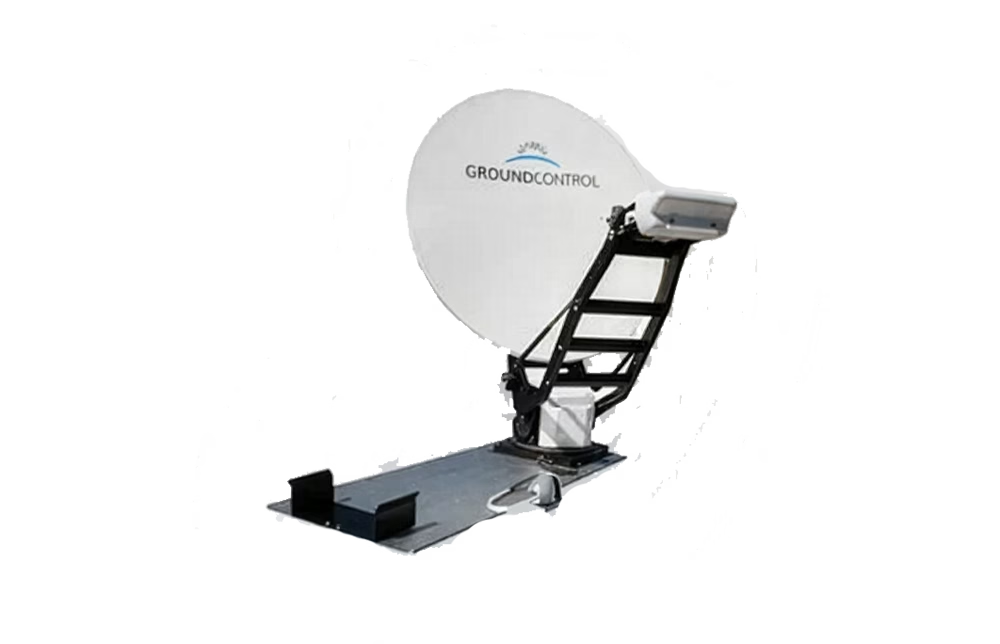
Toughsat Flyaway
The Toughsat Flyaway is designed to mount in all locations where a mobile VSAT system could be mounted, such as on the ground, on top of a vehicle, truck, trailer, or even transported in the back of an SUV. Deployment is rapid and suitable for any location – providing a robust, high-speed internet and communications solution. Police forces benefit from reliable connectivity and operational effectiveness in dynamic and evolving situations.
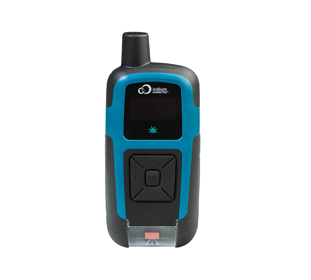
RockSTAR
RockSTAR is a handheld tracking and messaging device which transmits from anywhere in the world. Ruggedized, and with an astonishing 12 month battery life. RockSTAR makes sure that officers’ location is monitored, with alerts if the device is dropped, or moves out of the intended route / location. It can also transmit wearables’ data such as heart rate and blood pressure, making it a valuable health and safety addition for remote policing.
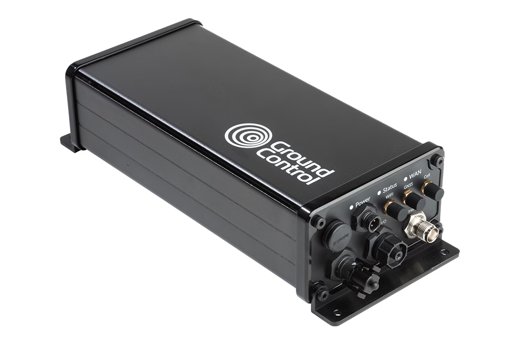
RockREMOTE Rugged
RockREMOTE Rugged is an IoT device utilizing the Iridium Certus network; this means it’s cost-effective to send relatively large amounts of IoT data, including compressed images. Forces around the world use RockREMOTE as part of camera traps, remote security checks and alarm systems. It’s also deployed on unmanned vehicles, including drones, to allow commands to be sent, and data received, from wherever the vehicle travels.
Closing thoughts…
Satellite communication technology offers numerous benefits to law enforcement agencies. From seamless connectivity in remote areas to enhanced surveillance capabilities, satellite technology has become an invaluable tool for improving operational efficiency and public safety. The ability to establish reliable communication during emergencies, support inter-agency collaboration, and provide global reach strengthens the overall effectiveness of law enforcement efforts all over the world.
By harnessing the power of satellite communications, law enforcement and policing agencies can adapt to the ever-evolving landscape of modern crime and ensure safer and more secure communities. As satellite grows in popularity, so too do the service options, and the competitiveness of the pricing. It’s anticipated that in the next few years, satellite and cellular networks will effectively merge, which will open up more possibilities to support policing and law enforcers.
Harness the Power of Satellite Communications
Satellite communication technology transformed what law enforcement agencies and police forces can achieve to enhance crime combating capabilities and improve citizen safety. See what Ground Control can achieve for you, your teams and your agency.
Contact us today. We’ll be able to help and offer impartial advice on the best solutions to improve your operational and connectivity challenges.
Why Connectivity Is Critical To Emergency Response Management
According to a recent poll by Gallop, one-third of Americans have faced extreme weather including hurricanes and blizzards, in recent years. In many respects, it’s surprising this figure isn’t higher. The United Nations (UN) reported a 153% increase in the number of extreme weather events in the last 20 years. And it’s clear the US has been significantly impacted, with 20 separate billion-dollar weather and climate disasters in 2021 alone.
NOAA is – fortunately – projecting an average hurricane season in 2023, due to the dampening effect of El Nino, but equally the Atlantic is unusually warm, which could counteract this effect. Of course even a below-average hurricane season can be deadly. And while the West Coast might be spared hurricanes, it’s increasingly vulnerable to wildfires. The National Significant Wildland Fire Potential Outlook projects a higher risk than normal for large stretches of Washington, Oregon, Idaho, Nevada and Montana (California’s snowpack may spare it the worst of the 2023 wildfires). Meanwhile, Canada’s wildfires are making global headlines, with millions of Canadians and Americans affected.
Given the significant impact just one of these events can have, we want to highlight why connectivity is so important during the emergency response.
Why is connectivity essential during an emergency response?
First responders don’t know what situation they’re stepping into. To ensure organizations can manage their response, safeguard their personnel and rapidly disseminate information to other relevant agencies and teams on the ground, connectivity certainty and thus communication certainty, is essential. Included below are some of the most common use cases our First Responder customers require and utilize our connectivity solutions for:
- Mapping and GPS data
- Access to GIS data – essential data regarding property and ownership, and MSDS sheets – delivering potentially life-saving information on material safety.
- Personnel and equipment tracking. Tracking the real-time location of every personnel member on the ground, in addition to equipment and assets, including emergency vehicles and helicopters, can all save invaluable time.
- Communication – enabling organizations and personnel to communicate via voice, email or even radio, with one another and with the Command Center, and disseminate information to other relevant Public Safety agencies.
- Monitor local news coverage – ensuring certain teams aren’t missing anything news outlets may have picked up on.
- Report and document response and progress. For example, the progress of a wildfire.
- Drone video backhaul. Utilizing connectivity to control and live stream video via drones to provide real-time information to those on the ground.
Mobile Satellite Internet for First Responders
Since satellite services connect with an orbiting satellite at least 550km above the Earth’s surface, they are not affected by cellular dead-zones or terrestrial infrastructure failure (temporary or otherwise), meaning satellite can deliver connectivity certainty.
Based on our 20 years’ experience working with corporations and public agencies, we know that not everyone will have a backup plan in place which caters for a situation without terrestrial connectivity. We’re well versed in the typical hurricane narrative: hurricane season begins, storms begin to form out at sea, concerned organizations begin to call us for information and lead times on satellite communication hardware… then storms pass or die out and all is forgotten. Or, as is more often the case in recent years, the aforementioned storms continue.
In all cases, the Ground Control team work as hard as possible to ensure agencies have confirmed delivery of the required, satellite-enabled equipment prior to any hurricane, tornado, wildfire, or other extreme weather event. But there are occasions, particularly when there has been a larger scale disaster, where shipping may be delayed or temporarily suspended, or even scaling hardware to meet demand is a challenge. As the number and severity of extreme weather events is increasing, we want to ensure all organizations can confidently mitigate risk, whatever the situation.
Introducing The Toughsat
Professional Grade Mobile Internet
Our Toughsat products are often used by emergency services that need a quick and portable VSAT antenna for both high-speed internet and VoIP phone services for on-site personnel.
Toughsat XP is Ground Control’s flagship professional series mobile satellite system, incorporating the best of our experience into a complete system. At the click of a button, the solution provides the speeds and bandwidth needed for robust Internet and communications, making it the perfect in-field communications solution.
The Toughsat XP delivers connectivity for up to 256 wireless capable devices such as smartphones, tablets and laptops or VoIP phones. Your team can be online in minutes, with 20 Mbps x 5 Mbps broadband internet speeds, worldwide. What’s more, the powerful broadband WiFi hotspot operates even in extreme weather conditions.
Ground Control’s emergency communications satellite equipment meets or complies with all SAFECOM requirements for emergency interoperable communication equipment. The Toughsat is also the only VSAT antenna listed by make and model in the US FEMA Cache list.
Comparing the Toughsat to a Starlink Device
Both the Toughsat (which utilizes the iDirect satellite airtime service – see special rates for first responders) and Starlink provide emergency responders with high speed, low latency internet access from anywhere with a clear view of the sky – there’s no dependency on terrestrial networks.
Both physical devices are ruggedized, and will stand up to a wide range of weather conditions, from extreme cold and heat to heavy rain and gale force winds. Neither the Toughsat nor the Standard Starlink is intended for use in-motion (if you have a requirement for high-speed internet while in-motion, we would recommend the Kymeta u8 or the MissionLINK 700).
Starlink devices are often low cost in comparison to other satellite internet hardware. Starlink doesn’t invite other manufacturers to build hardware to connect to the Starlink satellite constellation, and its intentionally disruptive business model is to sell directly to members of the public, undercutting incumbents like HughesNet and Viasat.
However, that last point provides a segue to a potential drawback of the Starlink service: it is extremely popular, and can be prone to network congestion. “The demand for Starlink service is outpacing the capacity of the network” according to Starlinkhardware.com, further noting that “you may notice your speeds slow way down… caused by too many Starlink customers trying to connect at the same time.”
For Emergency Responders this is a key potential risk to be aware of when deciding on your portable satellite solution. Other solutions – Toughsat among them – have dedicated airtime for emergency responders, guaranteeing reliable internet speeds irrespective of how much other traffic is utilizing the network. They cost more, but don’t face the network congestion challenges of Starlink.
Get in touch
If you’d like to know more, and discuss your requirements, please get in touch.
We have 20 years’ of experience and have served hundreds of emergency responders in that time. We design and build our own hardware, but we also partner with other leading manufacturers to make sure we have the best option for your needs.
How Satellite can Support all Four Phases of Emergency Management
Disasters can affect any area of North America and are most commonly the result of weather-related and geological events. Disasters include everything from wildfires to hurricanes, tornados to floods, earthquakes to dam failures. In 2023, the volume and severity of hurricanes is projected to be ‘normal’ by NOAA, but wildfires are expected to be above average (indeed an area larger than the Netherlands has already burned this year in Canada – that’s more than 5 million hectares).
A single disaster’s impact can significantly vary. From localized to widespread, predictable to unpredictable. That said, FEMA highlights that, as natural hazards are usually more predictable, it’s possible to identify which areas within the US may be most vulnerable to certain types of natural hazards. In addition, as each hazard has both unique characteristics and common elements, the combination of this knowledge enables agencies and organizations to better prepare and respond to natural disasters.
FEMA categorises disasters as recurring events with four phases: 1. Mitigation, 2. Preparedness, 3. Response, and 4. Recovery. The below diagram briefly describes each phase and illustrates the relationship of these four phases within emergency management.
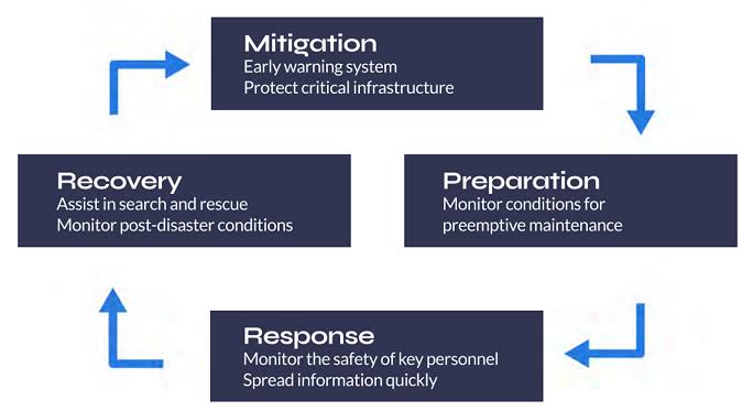
At Ground Control, we have 20 years experience working alongside First Responders and Emergency Personnel. While each situation and/or disaster is unique, there is consistency when it comes to exactly how satellite technology can support and aid teams within each phase.
Mitigation & Preparation – Utilizing IoT
The explosion of the Internet of Things (IoT) continues to revolutionize our world, and the first response sector is no exception to this. In recent years, the number of IoT applications to save human life, no matter how remote the disaster, has exponentially increased. Just a couple of examples include digitally connected gear with built-in sensors that measure air quality, toxins and motion, and protective clothing which continuously monitor vital signs.
Ground Control recently partnered with American Signal Corporation to deliver a Tsunami early warning system, in which the RockBLOCK Plus is utilized as their satellite transceiver. Although this type of technology is more common in larger organizations, we have also had customers successfully create an off-grid fire prevention system utilizing the monitoring capabilities of the RockBLOCK.
Response – Communication Certainty
The vast majority of our First Responder customers acquire our systems for use during emergency response. Generally speaking, our solutions revolve around ensuring teams on the ground have communication and connectivity certainty.
In a crisis, lack of or delayed situational awareness can cost lives, and often, mobility can prove a significant barrier. With SOTM “Satcom-on-the-Move”, teams can stay reliably connected with one another and their Command Center. Utilizing both portable and mobile connectivity solutions, teams can benefit from an almost instant, reliable 300-1000 ft WiFi hotspot. Meaning they can stay connected, even while surveying surroundings and interacting with the community.
In addition, personnel tracking devices such as the RockSTAR can ensure that the location of all personnel is accurately and reliably tracked, in real-time, with zero reliance on terrestrial connectivity. And push-to-talk devices and satellite phones ensure voice communications are achievable, no matter the circumstances. Additionally, features such as talk groups can further support team communications.
Recovery – Supporting Public Safety
First Responders’ main concern will always be public safety in the immediate crisis. However, the recovery phase is crucial. Following the mass destruction of hurricanes Irma and Maria in 2017, 900 VSAT terminals were deployed at sites around the affected region and critical locations including San Juan Airport.
Enabling wi-fi and communications means First Responders on the ground can continue to effectively communicate, and civilians are able to contact loved ones and make appropriate arrangements during the recovery phase.
At Ground Control, we help First Responders and public safety organizations and agencies prepare, providing teams with equipment they need to ensure more successful missions. Reliable communications and connectivity, allow emergency personnel to more safely focus on the task at hand. If you’d like talk to one our experienced team about how you can better support your people ground with satellite technology, simply email sales@groundcontrol.com.
Get in touch
With over 20 years experience facilitating emergency preparedness and response across the globe, we understand that in a crisis, every second counts. We’re constantly evolving and adapting our Public Safety offer and systems to best support teams on the ground. Which is just part of the reason Ground Control has been a trusted name in Emergency Responder satcom since 2002.
Whatever your communication or connectivity needs, we can help.
The Role Of Connectivity In Wildland Firefighting
The current landscape and impact of wildfires
In a recent announcement on wildfire incidents, the National Interagency Fire Center (NIFC) stated that, “through mid-May of 2022 there have been over 25,000 wildfires consuming 1.4 million acres”. This surpasses the 10 year annual average and it’s predicted that climate change will only exacerbate extreme heat and droughts, which along with severe storms, will make wildfire conditions worsen.
Spring and summer are the peak seasons for wildland fires. The consequences to wildlife can be devastating – ranging from significant loss of forest and areas of natural habitation to risks to residential areas, and from significant animal deaths to severe air pollution. One of the best tools to monitor, manage and even predict the spread of wildfires is through the use of satellites.
The importance of satellite connectivity
There are usually places within a forest or a remote wilderness area that don’t have adequate traditional communication coverage. When wildfires occur, communications are vital as wildfires can require the coordination of hundreds of firefighters and cover thousands of acres, causing millions of dollars of damage. During these emergency operations, existing cellular and radio communication infrastructure can be damaged, or even destroyed, cutting off the essential communication channels required by firefighting crews, agency headquarters and dispatch offices. The recovery teams and civilians in areas impacted by wildfire rely on critical connectivity tools for collaboration, coordination, and communication among themselves, other ground and in-flight rescue teams.
Responding to fires
Once fire crews are at the scene of a fire, there are four key stages to response:
1. Monitor
Essentially, observing the fire, its behavior and effects to evaluate whether fire management objectives are still being met.
Satellite mapping and drone images enable ground crews to effectively monitor the fire from their base of operations, and even predict the course and spread of the fire.

2. Confine and Contain
Managing a fire perimeter by a combination of direct and indirect actions. Taking the right course of action in this stage of response can reduce the damage and devastation caused by fire.
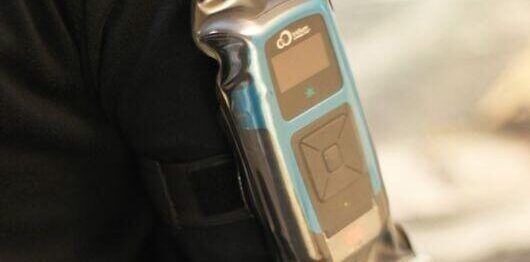
Utilizing portable communication devices such as the RockSTAR, personnel can communicate with one another and base operations with real-time assessments and outcomes of direct and indirect actions.
3. Point/Zone Protection
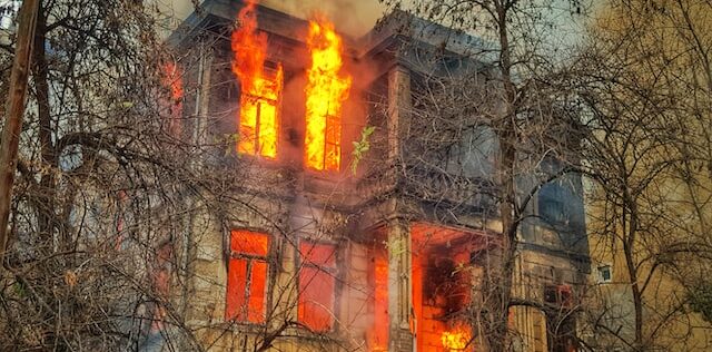
Assessment and protection of assets or highly valued resources, such as buildings.
Access to cloud-based GIS data for this assessment is helpful as it contains essential data regarding property and ownership.
4. Suppression
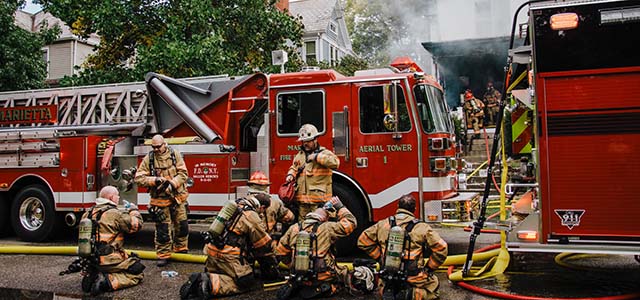
This is when teams are deployed, sometimes en masse, to extinguish or limit wildfire spread.
This can take a matter of hours, days or weeks and can involve huge and extensive collaborative efforts between states, agencies and crews to suppress a rampant wildfire. Reliable, robust, internet connectivity to track, monitor and manage personnel and response teams is essential to the safety of fire crews.
The role of satellite communication solutions
Portable satellite terminals that deploy quickly can be brought into affected areas to effectively replace, or complement, damaged terrestrial networks. As connectivity comes from space and the hardware is mobile and deployed outside of the fire-hit area, it’s always available. While the terrestrial infrastructure that more typically delivers this connectivity may be disrupted or destroyed, satellites are highly reliable and can deliver connectivity, anywhere, without any loss of quality or capability.
Satellite images and weather data also help not only to assess the current situation of fire and the impacted areas, but combined with algorithms, can also help predict the course of wildfires. This will help firefighters to control the spread of fires and reduce damage. The nearest critical supplies can also be located easily from the accurate GPS from satellite data. Furthermore, data messaging systems make it easier to send messages from satellite terminals to firefighters about any changes in weather or wind direction.
A mobile, portable satellite communication solution – MCD-4800 “The Football”
The MCD-4800 “Mobile Communications Device”, also known as “The Football”, is capable of providing high-speed internet, anywhere in the world, in less than one minute and with no specialist training. The auto-pointing BGAN satellite terminal is rugged, but lightweight, and can be used in extreme weather conditions.
Users simply place the weatherproof case on the ground or any surface with a clear view of the sky, turn it on and close the lid. Within a minute the MCD-4800 becomes a powerful WiFi hotspot accessible by any wireless device within a 100-meter range for up to 5 hours on internal battery power.
This auto-pointing solution uses the high-performance Hughes 9450TW in-motion BGAN terminal integrated with our proprietary mobile electronics for a ruggedized, self-contained, user-friendly, global communications link.
With the adoption of portable, mobile satcoms and internet, the response times to fire events can be vastly improved, communication and coordination with other teams significantly enhanced and advanced warning systems more accurate. Furthermore, the MCD-4800 satellite technology helps promote safety and efficiency of fire crews and responders during fire disaster. The device has already been used worldwide to monitor events, improve responses and drive resilience post-disaster, providing infrastructure support.
Ground Control’s emergency communications satellite equipment meets or complies with all SAFECOM requirements, for emergency interoperable communication equipment.
Can We Help You?
If you’d like to get in touch to discuss potential satellite solutions for your organization or agency, simply email hello@groundcontrol.com, complete the form, or call us.
We have over 20 years’ experience in providing reliable, robust satellite communication solutions, from IoT through to live video streaming, and we pride ourselves on providing expert and objective advice.
The Dejero GateWay: Combined Cellular And Satellite Airtime Service For The Toughsat
The Toughsat Auto Deploy Antenna is already established as a reliable, robust mobile satellite system – and we’re pleased to announce that we have secured an even more robust and cost-effective connectivity solution to accompany this. In addition to our Dual Matrix satellite service, we are now able to offer Ground Control customers an enhanced connectivity service via The Dejero GateWay. Utilizing Smart Blending Technology, the new service seamlessly blends multiple cellular and satellite networks into one pipe, resulting in better cost management and often, faster download speeds.
Used to facilitate phone and internet, in any location, our SAFECOM-compliant Toughsat series has proved particularly popular among First Responders, those with off-grid operations and for the purposes of disaster recovery.
As the world continues to become more interconnected and mobile, organizations and companies are increasingly turning to cloud-based solutions to support operations. In addition, many have become reliant upon autonomous data transmission, to drive and maintain operational efficiencies. For both, reliable connectivity is key. And for many, this connectivity is mission critical.
The Dejero Gateway
In simple terms, The Dejero GateWay is a certified, network aggregation device that uses Smart Blending Technology. We have been strengthening our Cell/Sat service across North America, and this enhanced cellular/satellite hybrid is now available to our Toughsat customers.
What is Smart Blending Technology?
Dejero explains, we “simultaneously blend together multiple wired (broadband, fiber) and wireless (3G/4G/5G, Wi-Fi, satellite) IP connections from multiple providers to form a virtual Dejero ‘network of networks’.
We dynamically and intelligently manage the fluctuating bandwidth, packet loss, and latency differences of individual connections in real-time.”
How does this help Ground Control customers?
We understand our customers require ubiquitous, powerful connectivity, under all circumstances. Especially in the case of First Responders, where real-time information is required to deliver situational awareness to both command center and teams on the ground. Many use cases also call for video streaming, which can prove challenging depending on the required bandwidth and speed of connection available.
With this new service, we can offer our customers ubiquitous, powerful connectivity, utilizing more cellular networks, meaning better cost management. And in some cases, as multiple cellular networks are simultaneously combined to deliver one robust connection, increased speeds. We recently ran our own tests utilizing our Toughsat XP and The Dejero Gateway, and saw download speeds over 180Mbps.
As an example, with a Dejero M6E6 GateWay device, we would provide SIMs on Verizon, AT&T and T-Mobiles networks (2 SIMs on each) and the Toughsat would use a Cat-5 to plug into the External WAN port on the Dejero. Any cellular and satellite service that the device can see would be blended/bonded together to deliver one usable, more robust internet connection. For instance, if the cellular networks seen, totalled 100x10Mbps, and the satellite was receiving 20x5Mbps, you would achieve speeds of 120x15Mbps.
What’s more, as the service plans assume some usage is going to be over cellular, after the hardware, airtime plans could drop by up to 30% over standard usage services.
At Ground Control, we have always aimed to optimize our customer’s connectivity, so data always gets through, and in the most cost-effective way. We are genuinely excited to see what this new service can provide for our customers.
The Toughsat XP is an auto-pointing VSAT satellite dish that’s available in different sizes and configurations. It is the only VSAT antenna listed by make and model in the US FEMA Cache list. The Toughsat delivers broadband internet speeds of 20 Mbps up and 5 Mbps down with our network service. Built for extreme weather, temperature and high winds, the range is very popular with emergency personnel.
Our complete systems are trusted by hundreds of Urban Search and Rescue agencies, State, County and City Law Enforcement and Fire Departments throughout the United States.
If you would like any further information, on our products or available airtime services, simply get in touch with our expert team at hello@groundcontrol.com.
Can We Help?
With over 20 years experience facilitating emergency preparedness and response across the globe, we understand that in a crisis, every second counts. We’re constantly evolving and adapting our Public Safety offer and systems to best support teams on the ground. Which is just part of the reason Ground Control has been a trusted name in Emergency Responder satcom since 2002.
Whatever your communication or connectivity needs, we can help.