Topic: Iridium
No Signal, No Problem: Enabling BVLOS Drone Operations Anywhere on Earth
Drones are no longer futuristic novelties. They’re already saving lives, cutting emissions, and driving efficiency across industries as diverse as healthcare, energy, and infrastructure.
The ability to fly Beyond Visual Line of Sight (BVLOS) is critical to unlocking these benefits at scale. Without BVLOS, most missions are limited to the operator’s direct line of sight, constraining both range and impact. With BVLOS, drones can cross oceans, inspect thousands of miles of pipeline, and deliver life saving supplies to remote communities.
But for BVLOS to be safe and effective, drones must maintain reliable, unbroken connectivity. And that’s where the challenge begins.
The Comms Reality Check
However, relying solely on terrestrial networks for drone connectivity can be a risky proposition, especially for BVLOS missions.
1. Vulnerability to inference and jamming
In contested or hostile environments, terrestrial links are vulnerable to deliberate interference or jamming. For example, during the conflict in Ukraine, both commercial LTE and unlicensed radio links have been targeted and disrupted, grounding entire fleets of drones and illustrating how fragile these systems can be when faced with intentional electronic warfare. Even in peacetime, terrestrial systems are not immune to accidental interference; for instance, at large sporting events or urban centers where multiple devices compete for spectrum, drones can lose connection at critical moments.
2. Coverage gaps in rural and offshore areas
Coverage is another major challenge. LTE and 5G networks work well in cities, but in rural or offshore areas, coverage gaps are common. This creates real problems for industries like pipeline inspection or offshore wind maintenance, where drones must operate hundreds of kilometers from the nearest tower.
3. Network failures during disasters
Even where coverage exists, networks can fail under stress: in natural disasters such as hurricanes or wildfires, cellular towers are often damaged or overloaded. For instance, during Hurricane Ian (2022), parts of Florida experienced complete cellular blackouts, leaving first responders unable to rely on mobile networks.
4. Technical limitations
Long missions also introduce technical issues like handover failures when a drone crosses between towers – a known problem for high speed UAVs flying over mixed terrain. Finally, legacy aviation bands like VHF are limited to strict Line of Sight, making them unsuitable for missions that span mountains, forests, or the open ocean.
The bottom line is that the only truly global, always-on network is in space. For many BVLOS missions, satellite connectivity is the primary link for safe command and control (C2). In other cases, it’s a failover that ensures uninterrupted operations if the primary terrestrial link drops or fails.
Choosing the Right Connectivity
The table below outlines the strengths and weaknesses of the most common BVLOS connectivity options.
| Direct RF (LoS) | Cellular (4G/5G) | LEO Satellite (e.g., Iridium) | Mesh / Relay Networks | Hybrid (e.g., LTE + Satcom) | |
|---|---|---|---|---|---|
| Range | Low-Mid (20–30 km) | High – wherever towers exist | Global (with constellation coverage) | Variable – range extends hop by hop | Global with redundancy |
| Coverage | Limited – range depends on altitude and obstructions | Urban/suburban areas, gaps in rural/remote regions | Requires clear view of the sky – partial blockage from terrain, buildings, or canopy can cause dropouts | Customizable – requires supporting nodes or relay drones | Global – seamless failover between links |
| Cost | Low | Moderate | High | Medium-High | High |
| Ideal Use Case | Close range inspections, small scale BVLOS in open terrain | Urban delivery, public safety, mapping | Remote BVLOS missions needing high bandwidth: offshore energy, maritime inspections, remote mining | Disaster response, temporary missions in areas with no infrastructure | Safety-critical commercial BVLOS, mixed terrain missions |
LEO vs GEO: Understanding the Differences
Satellites are positioned in either Low Earth Orbit (LEO), Medium Earth Orbit (MEO), or Geostationary orbit (GEO). Our blog post on Satellite Orbit Heights provides a more detailed explanation, but to summarise, the closer the satellite network is to Earth, the lower the latency – the time it takes for data to travel from the drone, to the orbiting satellite, and down to the ground station (from where it’s routed to the drone operator’s system). Latency is a key attribute for UAV operators looking for as close to real-time command and control as possible, so it’s worth reviewing LEO satellite networks such as Iridium, Starlink or OneWeb.
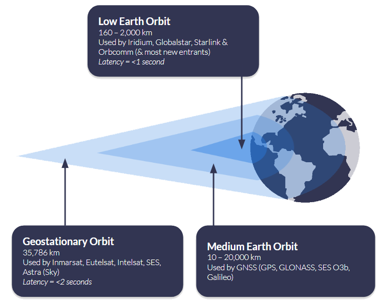
Another consideration is where your drone will be operating. If you are connecting to a satellite in Geostationary orbit, such as Viasat, the satellite remains in the same location overhead, and you need “line of sight” to that satellite. This works very well in wide open spaces, but if the signal could be blocked by infrastructure or mountains, for example, it’s not the best choice. Satellites in Low Earth Orbit need a “clear view of the sky”, but because the satellites are in motion overhead, rather than in a fixed point, it’s less rigid than GEO services. Read more about what’s meant by a clear view of the sky.
Also, consider the practicalities of hardware and power consumption when choosing between LEO and GEO networks. Terminals designed for LEO services are often smaller and lighter, making them well suited to drones where every gram matters and battery life is at a premium. Because these satellites are closer to Earth, they can typically operate at lower power levels, which helps maximize flight endurance. GEO terminals, while still compact, may draw more power and require slightly larger antennas to maintain a continuous connection with a single, fixed satellite.
Ultimately, the decision isn’t just about latency or coverage. It’s about balancing responsiveness, operating environment, and hardware constraints to select the right orbit for the mission. Whether it’s low-latency LEO for real-time control or the stable, wide-area coverage of GEO for long-range operations, matching the satellite architecture to the needs of the drone is key to safe and reliable BVLOS flight anywhere on Earth.
Hybrid Strategies: Best of Both Worlds
Whether you choose LEO for responsiveness or GEO for stability, no single connectivity method can cover every scenario perfectly. The most resilient BVLOS operations don’t rely on a single link at all; instead, they use a hybrid strategy, combining multiple communications paths to ensure that control of the aircraft is never lost, no matter what happens in the sky or on the ground.
A hybrid approach integrates multiple communication technologies, each serving a different role. This isn’t simply about adding a backup link; it’s about creating a system where the aircraft actively prioritizes and switches between links in real time, based on performance and availability.
At present, most commercial operators treat satellite as a failover link. Cellular and RF systems are used as the primary connection because they are cost effective and can handle large data streams such as live HD video or high-resolution sensor data. Satellite is kept in reserve as the safety net – the “final line of defense,” as Skylift UAV describes their use of the RockBLOCK 9603.
In their words, the satellite module provides the confidence to continue operating safely in the unlikely event of a complete communications blackout. This model works well for urban and suburban missions where cellular coverage is strong, or for flights where Line of Sight RF can be maintained most of the time.
However, as BVLOS missions grow in range and complexity, this dynamic is beginning to shift. In rural or offshore environments, cellular coverage is unreliable or entirely absent, and Line of Sight radios quickly become impractical. In these contexts, satellite is increasingly moving from failover to primary link, especially for critical command and control traffic. For example, during recent flight tests, pilots reported that LTE video streams were prone to frequent dropouts at altitude, but satellite remained reliably stable throughout.

A hybrid approach requires intelligent link management. The drone must be able to segment traffic by type and seamlessly prioritize the best available link without pilot intervention. For example, during an offshore mission, a drone may begin by streaming video over LTE while using satellite for command and control in the background. As it moves further out to sea and loses cellular coverage, the satellite connection continues uninterrupted, ensuring no loss of control. Later, if the drone comes back into range, LTE automatically resumes for payload data, but satellite remains quietly handling the critical link in the background. From the operator’s perspective, these transitions should be invisible, with the system maintaining continuous awareness and control throughout.
Many regulatory frameworks now encourage or require operators to demonstrate redundancy, often by using two independent communications paths so that a single failure cannot compromise control of the aircraft. This level of resilience is essential for operations such as pipeline patrols, offshore deliveries, or disaster response, where losing connectivity could have serious safety, regulatory, or financial consequences.
With a hybrid strategy in place, the next step is to match the satellite service to the mission profile.
Matching Satellite Services to Missions
Before you pick a hardware or service, think about your data rates, power and weight constraints, and how critical your command and position links are. The table below shows two tiers of mission profiles, one for simple commands such as go to the nearest rally point, go home, or terminate the flight, and another for full BVLOS operations, with the attributes you should aim for in each.
Simple Commands (Light Missions)
- Lightweight telemetry and commands only
- Ultra low power draw, so maximal flight time
- Small hardware footprint, minimal antenna gain
- Reliable even in remote environments, rough terrain, trees, or sparse coverage
Full BVLOS Operations
- Continuous, reliable command and control link
- Command response delays kept under ~700 ms
- Position updates as frequent as 1 second
- Enables safe separation from other aircraft and scalable BVLOS flights across mixed terrain and range
Ground Control’s RockBLOCK devices are optimized for simple commands, where size, power, and reliability under constrained conditions are the top priorities. Meanwhile, our Iridium Certus 100-based offerings (e.g. RockREMOTE UAV OEM) are built for BVLOS missions that need higher throughput, frequent updates, and strong command responsiveness. Adjusting your satellite choice to the mission kind avoids over-engineering, keeps costs manageable, and ensures safety without carrying unnecessary weight or power burden.
The following devices all leverage the Iridium satellite network, chosen because it is in Low Earth Orbit, so has very low latency, and truly global coverage. It has been tried and tested over years of operation, and is extremely reliable and resilient.
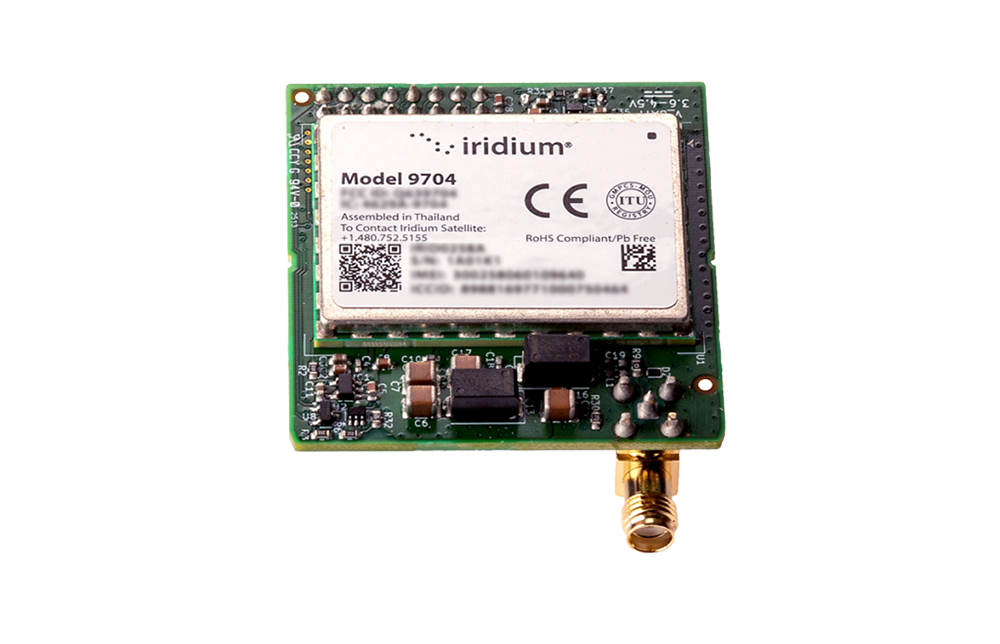
RockBLOCK 9704
RockBLOCK 9704 supports larger message payloads, giving operators more flexibility for richer telemetry and mission data.
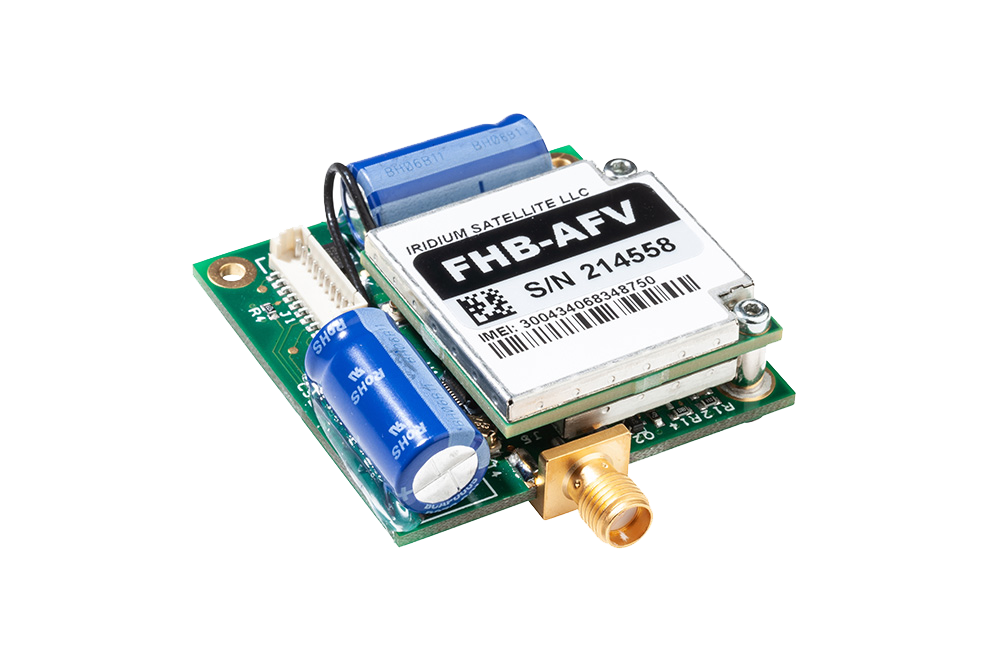
RockBLOCK 9603
RockBLOCK 9603 provides lightweight, low power satellite messaging for essential UAV tracking, telemetry and alerts.
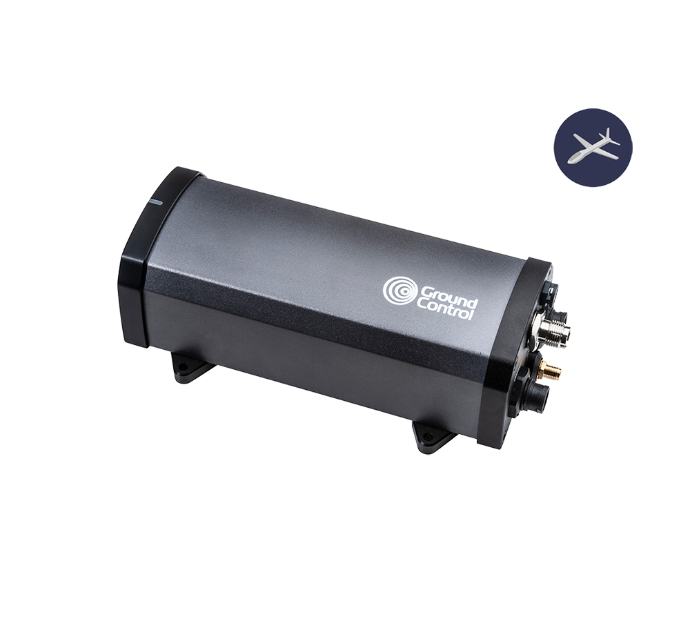
RockREMOTE UAV
RockREMOTE UAV delivers low power IP connectivity for UAV applications that need an always available satellite data link.

RockREMOTE UAV OEM
RockREMOTE UAV OEM brings the same IP connectivity into a compact embedded form for integration within the aircraft or payload system.
BVLOS drones are already proving their value across industries. In the UK, drones are delivering chemotherapy drugs to the Isle of Wight eight times faster than traditional transport, while in the offshore energy sector, companies like Skyports are replacing helicopter supply runs with drones, cutting emissions and reducing downtime. In the USA, long range drone patrols are helping to monitor thousands of miles of remote pipelines, and in the North Sea, offshore wind farms are being inspected in real time without costly, carbon intensive vessel missions.
Key Takeaways
When planning BVLOS operations, the priority should always be maintaining a reliable command and control link. Satellite connectivity is uniquely suited to this role because it offers consistent, global coverage that isn’t dependent on local infrastructure. Terrestrial networks such as LTE or RF can still play an important role, but they are best used for non-critical data like video streaming or payload telemetry rather than the core C2 function.
A hybrid approach delivers the best of both worlds. By combining satellite and terrestrial links intelligently, operators can use satellite for stable, predictable command and control while taking advantage of LTE or other networks for higher bandwidth data when coverage is available. This balance provides flexibility while keeping safety at the forefront.
Operational resilience comes from planning for failure. BVLOS systems should be designed with multiple communications paths and the ability to switch between them instantly, ensuring that connectivity is never lost if one link goes down. Continuous monitoring and rapid failover processes are essential to meeting safety and regulatory expectations as drone fleets grow in scale.
Finally, data management must not be overlooked. Tracking airtime, managing costs, and ensuring telemetry data is actionable are all key to running efficient, scalable operations. By keeping a close eye on data use and system performance, operators can make informed decisions that improve reliability and maximize return on investment.
Take Your BVLOS Operations Further
BVLOS connectivity doesn’t have to be a limiting factor. With the right mix of satellite and terrestrial links, your drones can stay connected and operational anywhere on Earth; from dense urban environments to the most remote locations.
Whether you need lightweight hardware for simple commands or a fully scalable solution for complex BVLOS missions, our team can help you design a system that’s safe, reliable, and ready to grow with your operations.
Email hello@groundcontrol.com or complete the form, and we’ll be in touch within one working day.
Your Top Questions About NTN NB-IoT, Answered
On September 4, 2025, we co-hosted a webinar on NTN NB-IoT Uncovered: What It Is, What It Isn’t, and Where It Wins with Viasat. This is emerging technology with a great deal of promise, and we had a large audience, with an accordingly large number of questions! We’ve collated these questions into several topics in this blog post, which we will keep updated as the roadmap progresses.
Quick Links:
- What is the expected cost of hardware (e.g., modem, antenna)?
- What will ongoing connectivity cost, for example at 50 KB per month or one transmission per hour?
- How does NTN NB-IoT communication cost compare to terrestrial NB-IoT and proprietary satellite solutions?
- Does the device include a subscription, and are any licenses required to use the service?
- What are the expected power requirements for receiving and sending messages?
- Will latency in satellite NB-IoT significantly impact battery performance?
- What counts as “small data volumes,” and how is data usage calculated (uplink vs downlink)?
- Is TCP/IP supported, or is NB-IoT limited to other protocols like UDP or NIDD?
- Are message acknowledgements supported, and do they consume billable data?
- What countries and regions are currently covered, and what are the rollout plans?
- Will the service work at sea or in harsh environmental conditions (e.g., offshore, deserts, extreme temperatures)?
- What are the main technical differences between NTN NB-IoT and cellular NB-IoT?
- How does NTN NB-IoT compare to proprietary satellite services like Iridium SBD?
- What frequencies are used, and how do they integrate with mobile networks?
- How does network selection work when both terrestrial and satellite networks are available?
- Is NIDD part of the 3GPP standard and supported by the network?
- Can we manage NTN NB-IoT devices and integrate using existing patterns in Cloudloop?
- What applications are best suited to NTN NB-IoT?
- How suitable is NTN NB-IoT for UAVs, HAPs, or other mobile applications?
- How does NTN NB-IoT compare to Starlink Direct to Cell?
- Could it replace or compete with services like Iridium or Starlink in the future?
- How well does it perform in environments with heavy metal or interference, such as steel plants?
- Does the service require direct line-of-sight, and how does it perform under partial obstruction (e.g., forest canopy)?
- Are the satellites GEO, LEO, or a mix?
Pricing and Licensing
What is the expected cost of hardware (e.g., modem, antenna)?
Hardware pricing varies widely depending on the capabilities your project requires. Some modules are designed purely as basic modems to connect to NTN NB-IoT networks and are relatively inexpensive, but they only provide connectivity.
Products like RockBLOCK RTU are far more than just a connection point. In addition to NTN NB-IoT access, they include:
- Edge processing to handle data locally and reduce transmission frequency (saving airtime and battery life).
- Configurable sensor reading and alerting, so you can trigger transmissions only when thresholds are met.
- A plug-and-play design, enabling faster deployment and simpler integration with cloud platforms like Cloudloop.
Because of this added functionality, RockBLOCK RTU and similar devices sit at a different price point than a simple dongle, but they often reduce overall project costs by lowering airtime usage, extending battery life, and minimizing field maintenance.
In short, the “right” hardware investment depends on whether you need just connectivity or a complete field-ready solution that simplifies operations and scales with your project.
What will ongoing connectivity cost, for example at 50 KB per month or one transmission per hour?
Viasat has not yet published official NTN NB-IoT pricing, but early indications suggest it will be competitive for the specific niche of very small, infrequent data transmissions. Final rates are expected to be announced in Q1 2026.
Because of the complexity and scale of satellite infrastructure, NTN NB-IoT data will not follow the same pricing model as terrestrial NB-IoT. In practical terms, this means far less data for a higher cost, making it best suited to scenarios where devices send tiny payloads, such as tens of bytes per hour, rather than continuous data streams.
When compared to proprietary satellite services, NTN NB-IoT can be more cost effective for ultra-low data volumes (typically below 30-50 KB per month per device). This makes it a strong choice for applications like remote sensors, infrequent tracking, and metering.
Around 50 KB per month, message-based services like Iridium Messaging Transport (IMT) and NTN NB-IoT become roughly equivalent in cost.
Above 50 KB per month, proprietary services like IMT quickly become far more economical, especially for higher data throughput or near-real time applications.
In summary, NTN NB-IoT fills a valuable gap for low data, low power use cases, but it is not simply a continuation of cellular NB-IoT pricing in space. For higher data needs, traditional satellite services remain the better fit.
How does NTN NB-IoT communication cost compare to terrestrial NB-IoT and proprietary satellite solutions?
Satellite NB-IoT is designed for very small, infrequent data transmissions, such as a few tens of bytes per hour or day. Because of the complexity of delivering data over satellites, the cost per kilobyte is much higher than for terrestrial NB-IoT, which benefits from existing cellular infrastructure and is inexpensive for high volume, high frequency data.
For ultra-low data applications, Satellite NB-IoT promises to be more affordable than traditional proprietary satellite services, which are built for higher throughput, always-on connections. However, as data usage rises beyond roughly a few dozen kilobytes per month per device, the cost of satellite NB-IoT can quickly become more expensive, making other satellite solutions like Iridium Messaging Transport, or Viasat IoT Nano, more economical.
In short:
- Terrestrial NB-IoT is the lowest cost option, but only works where there is cellular coverage.
- Satellite NB-IoT fills the gap where coverage is missing, offering lower costs than legacy satellite services for small, infrequent messages.
- Proprietary satellite solutions remain the best fit for higher data volumes, real time control, or truly global coverage.
Does the device include a subscription, and are any licenses required to use the service?
NTN NB-IoT works much like cellular IoT. Devices use a SIM card to authenticate on the network, and subscriptions are managed separately. These can be as short as one active month or discounted for 12 months or longer, depending on your needs.
No additional licenses are required as long as you are using a certified device. If you’re building your own hardware, it must first go through Viasat’s certification process before it can connect to the network.
Power Consumption
What are the expected power requirements for receiving and sending messages?
Final power profiles are still being confirmed, but early testing of devices shows very low power consumption, similar to cellular NB-IoT at the edge of coverage. Typical behavior is short, high-power bursts during transmission, with the device in deep sleep the rest of the time.
- Transmit (TX): Brief bursts at a few hundred milliamps for fractions of a second per message.
- Receive (RX): Much lower current for very short listening periods.
- Deep Sleep: Extremely low standby current between events.
For ultra-low data use cases – such as one small (50-byte) message per day – battery life can be measured in years. Even at one message per hour, multi-year operation is still realistic with careful design, especially when payloads remain small, retries are minimized, and devices have a clear view of the sky.
Tip: Use short, infrequent messages and Non-IP Data Delivery (NIDD) where possible to maximize battery life.
Will latency in satellite NB-IoT significantly impact battery performance?
Not directly. Latency in satellite NB-IoT (typically tens of seconds) affects how long a device stays “awake” waiting for confirmation or downlink data, but it doesn’t require the radio to transmit continuously. Most of the time, the device is idle and consuming minimal power.
Where battery performance can be affected is in retry scenarios. If poor antenna placement or obstructions cause repeated failed attempts, the radio will need to re-send messages, increasing total energy used. This is why clear line of sight and well planned message scheduling are key.
For applications sending small, infrequent messages, latency has little impact on battery life, and multi-year operation remains realistic, even when end-to-end message delivery takes longer.
Data & Protocols
What counts as “small data volumes,” and how is data usage calculated (uplink vs downlink)?
For NTN NB-IoT, small data volumes generally mean 30-50 KB per month per device. This roughly equates to one small message (around 50 bytes) every hour, making it ideal for applications like periodic sensor readings or exception-based reporting.
Data usage is calculated as the total of both uplink and downlink traffic, combined.
- Uplink: Data sent from the device, such as sensor readings or alerts.
- Downlink: Data sent to the device, such as configuration updates or acknowledgements.
In most deployments, uplink traffic dominates, with only small amounts of downlink data needed. However, frequent acknowledgements or commands sent to the device will eat into the monthly budget, so it’s best to minimize downlink usage wherever possible.
Rule of thumb: If your device sends a 50-byte message hourly, you’ll be close to the 30-50 KB/month sweet spot, but adding regular downlink messages or retries can quickly push usage higher.
Is TCP/IP supported, or is NB-IoT limited to other protocols like UDP or NIDD?
TCP/IP is not supported for NTN NB-IoT. By avoiding the heavy overhead of TCP/IP, devices can send and receive data far more efficiently, using fewer bytes per message and significantly reducing power consumption.
Instead, NTN NB-IoT uses lightweight protocols such as UDP and NIDD (Non-IP Data Delivery), which are purpose-built for small, infrequent IoT messages. This means:
- Lower airtime costs: No wasted data on headers or session management.
- Lower power draw: The radio stays on for less time per message.
- Simpler design: Devices can focus on sending just the essential payload.
Result: Your data goes further, your batteries last longer, and you stay well within the ideal 30-50 KB/month sweet spot for NTN NB-IoT.
Are message acknowledgements supported, and do they consume billable data?
In principle, acknowledgements are supported, but whether they’re available depends on the hardware and how it’s configured. Some devices, such as RockBLOCK RTU, can be programmed to generate acknowledgements, while others may not include this functionality out of the box.
Because an acknowledgement is just another downlink message, it does consume data and counts toward the device’s total monthly allowance (both uplink and downlink combined).
Frequent use of acknowledgements can quickly increase data consumption, so it’s best to:
- Use them sparingly, such as for critical alerts where confirmation is essential.
- Keep acknowledgement messages very small to stay within the <30 KB/month sweet spot.
- Design systems so that most reporting is uplink-only, with acknowledgements reserved for exceptions or configuration updates.
Tip: If battery life and cost are key priorities, minimize acknowledgements and focus on efficient, uplink-driven workflows.
Coverage & Availability
What countries and regions are currently covered, and what are the rollout plans?
Currently, NTN NB-IoT service is available in the United States, Canada, New Zealand, Australia and Europe (partially). It is globally capable, but not yet globally available; effectively, there have to be enough end points / applications in a particular region for the service to be unlocked. We anticipate that coverage will expand rapidly over the next 1-3 years.
Will the service work at sea or in harsh environmental conditions (e.g., offshore, deserts, extreme temperatures)?
The service is certainly capable of this, but today it isn’t available for maritime applications (see above). Instead, explore message-based solutions like Viasat IoT Nano or Iridium Messaging Transport (IMT) for an economical alternative that has truly global coverage.
Technical
What are the main technical differences between NTN NB-IoT and cellular NB-IoT?
These are summarised in the below table, and discussed at length in the webinar (watch the recording on Youtube).
| Standards-Based NTN NB-IoT* | Cellular NB-IoT | Proprietary Satellite IoT** | |
|---|---|---|---|
| Max Practical Payload | 1,000 bytes | 1,400 – 1,600 bytes | 16,000 bytes |
| Min. Practical Payload | 10-30 bytes | 30-50 bytes | 10 bytes |
| Typical Latency | Medium (10 – 60s); MVNO scheduling could increase this to 2 – 5 mins) | Low (1 – 10s) | 10 seconds under optimal conditions |
| Coverage | United States, Canada, Brazil, Australia, New Zealand and select European markets | Where supported by regional MNOs, and there is terrestrial infrastructure | Global, exc. Polar regions |
| Cost-Optimized Monthly Data Volume | < 50 KB | < 5 MB | < 1 MB |
*Based on Viasat NB-NTN | **Based on Viasat IoT Nano
How does NTN NB-IoT compare to proprietary satellite services like Iridium SBD?
NTN NB-IoT is designed for very small, infrequent data transmissions, such as tens of bytes per hour, making it a cost effective choice for applications like remote monitoring, tracking, and metering where usage stays below roughly 30-50 KB per month. It currently offers regional coverage rather than true global reach and has moderate latency, typically tens of seconds, which is acceptable for periodic updates but not for time-critical control.
Message-based proprietary services such as Iridium SBD share some similarities with NTN NB-IoT, as they also focus on small, discrete payloads and are well-suited for remote reporting. However, SBD offers truly global coverage, including oceans and polar regions, and has both lower latency and higher throughput, making it more robust for mobile or mission-critical assets.
In contrast, IP-based satellite services like Viasat IoT Pro or Iridium Certus 100 provide a continuous, always-on connection. This enables real time command and control, streaming data, and more complex integrations, something neither NTN NB-IoT nor SBD can deliver. These services are typically more expensive and consume more power, but they are essential for applications such as autonomous systems, live video feeds, or continuous telemetry.
In summary:
- NTN NB-IoT is ideal for ultra-low power, ultra-low data needs.
- Message-based services like SBD are better for mobile or global small data applications.
- IP-based services are the only option for real-time control and high throughput use cases.
What frequencies are used, and how do they integrate with mobile networks?
Viasat’s NTN NB-IoT service (and indeed all of its satellite IoT services) operates in the L-band (around 1–2 GHz), a frequency range well suited for satellite IoT because it enables reliable coverage, compact, low power antennas, and resilience to weather related interference.
Because Viasat’s service follows the 3GPP NB-IoT standard, a single SIM and chipset can, in theory, support both terrestrial (TN) and satellite (NTN) networks, allowing devices to roam or fail over between them when agreements are in place.
Although TN and NTN NB-IoT share the same core standard, they operate under very different data and power constraints. TN NB-IoT supports larger, more frequent data transfers, often over IP-based protocols. NTN NB-IoT is optimized for tiny, infrequent messages and while it can utilize UDP/IP, Non-IP Data Delivery (NIDD) is desirable to keep airtime and costs low.
As a result, systems designed for terrestrial NB-IoT often need re-architecting to perform well over satellite. Key factors such as payload size, message frequency, and downlink strategy should be carefully planned to avoid unexpected performance or cost challenges.
How does network selection work when both terrestrial and satellite networks are available?
Most devices come with lowest-cost routing built in, so will use terrestrial when available, switching to satellite when cellular drops out, and allow control over when the device will attempt a satellite connection once cellular is not available.
Is NIDD part of the 3GPP standard and supported by the network?
Yes. Non-IP Data Delivery (NIDD) is fully part of the 3GPP NB-IoT standard and is supported by Viasat’s NTN NB-IoT network. We are strong advocates of NIDD because it’s the key to unlocking the true economics and efficiency of satellite IoT.
Unlike traditional IP-based messaging, which adds significant overhead to every transmission, NIDD allows devices to send only the essential data payload, with no IP headers or session management. This brings three major benefits:
- Lower airtime costs – every byte transmitted is meaningful data.
- Lower power consumption – shorter transmissions mean devices stay in deep sleep longer, extending battery life.
- Simpler, leaner design – ideal for very small, infrequent messages typical of NTN NB-IoT use cases.
For ultra-low data applications like environmental sensors, asset tracking, or metering, NIDD is the preferred approach. While IP-based transport is still supported in the NB-IoT standard, it can quickly drive up airtime costs and power usage, especially over satellite links.
We’ve written a detailed explainer on why NIDD is so important for NTN NB-IoT; you can read it here: Unlocking NTN NB-IoT with NIDD.
Can we manage NTN NB-IoT devices and integrate using existing patterns in Cloudloop?
Yes. NTN NB-IoT devices can be fully managed and monitored within Cloudloop, alongside other satellite IoT devices, giving you a single, unified view of your entire deployment.
Through Cloudloop Data, information from NTN NB-IoT devices is automatically reformatted and standardized, so it can be delivered to a wide range of destinations, including cloud platforms, analytics tools, and third-party systems. This means you can continue using your existing integration patterns and workflows, with no need to rebuild or redesign your backend systems to handle NTN NB-IoT traffic.
Examples of integration destinations include:
- AWS IoT Core
- Azure IoT Hub
- Google Cloud IoT
- REST APIs and custom endpoints
- Webhooks for custom workflows.
Because Cloudloop is network- and protocol-agnostic, it works seamlessly with both standards-based NB-IoT devices and proprietary satellite solutions, making it ideal for organizations running mixed technologies.
Use Cases & Comparisons
What applications are best suited to NTN NB-IoT?
NTN NB-IoT, whether delivered via UDP/IP or NIDD, is ideal for low data, low power applications where devices send small, infrequent messages and where a short delay (latency) is acceptable. Because the technology is optimized for tiny payloads and long battery life, it excels in deployments where maintaining coverage in remote or hard to reach locations is the priority.
The three strongest application areas are:
- Monitoring – environmental sensors, infrastructure health checks, soil moisture, or weather stations.
- Tracking – livestock, wildlife, or remote assets where location updates are needed periodically, not in real time.
- Metering – water, gas, or energy usage reporting where daily or hourly readings are sufficient.
The service is designed to support large numbers of endpoints, each sending very small amounts of data. The sweet spot is around 30-50 KB per device per month, which equates to roughly one transmission per hour. This works well for applications like periodic sensor readings or basic status updates, but it’s not ideal for frequent updates, such as continuous tracking where you want to see location changes every few minutes.
How suitable is NTN NB-IoT for UAVs, HAPs, or other mobile applications?
NTN NB-IoT is not well suited for UAVs (Uncrewed Aerial Vehicles), HAPs (High-Altitude Platforms), or similar mobile applications. These platforms typically require an always-on, real time connection for tasks such as command and control, continuous telemetry, or video streaming.
NTN NB-IoT, by design, is optimized for tiny, infrequent data messages with latency measured in tens of seconds. This makes it perfect for periodic reporting, such as a water level sensor or asset tracker, but completely unsuited for dynamic, fast moving systems where constant situational awareness is required.
For UAVs, HAPs, and other highly mobile assets, you’ll need an IP-based satellite connection, which provides a continuous, reliable data link. Good options include:
- Iridium Certus 100 – a truly global service for mobile platforms, ideal for command and control and small data streams.
- Viasat IoT Pro – an IP-based L-band solution offering higher throughput for more complex or data-intensive applications.
- Hardware like the RockREMOTE Mini OEM, designed specifically for integrating into UAVs or other custom mobile systems.
How does NTN NB-IoT compare to Starlink Direct to Cell?
Starlink originally positioned Direct to Cell as a future option for LTE phones and IoT devices, including Cat 1 hardware. Its current roadmap, however, is focused much more heavily on extending mainstream mobile services to smartphones. The service has been rebranded as Starlink Mobile, with future development centred on higher speed data, voice, video and a terrestrial-like 5G experience for mobile subscribers. IoT is no longer prominent in Starlink’s current positioning.
That makes Starlink Mobile difficult to treat as a near-term alternative to NTN NB-IoT for industrial deployments. Availability still depends on agreements with mobile network operators, access to suitable spectrum and regulatory approval in each market. SpaceX’s agreement to acquire EchoStar’s AWS-4 and H-block spectrum supports its next-generation US service, but it does not remove the need for country-specific spectrum and commercial arrangements elsewhere.
For low power sensors and remote monitoring applications, NTN NB-IoT therefore offers the clearer and more mature development path. Starlink Mobile may eventually support a broader range of connected devices, but its present direction is toward consumer and mobile broadband rather than purpose-built, low power IoT.
The same application questions still matter when comparing satellite connectivity options: how much data must be transferred, how frequently and urgently it is needed, what power is available, whether the asset moves, and where it will operate. Ground Control can help assess those requirements and identify the most appropriate network, protocol and hardware.
Could NTN NB-IoT replace or compete with services like Iridium or Starlink in the future?
In the foreseeable future, the answer is no. NTN NB-IoT and proprietary satellite systems are designed to solve different problems and will coexist for many years to come. Viasat continues to invest in its IoT Nano and IoT Pro services, and similarly, Iridium is planning to launch its own NTN NB-IoT service in the next two years and that will exist alongside their SBD, IMT and Certus 100 IoT services.
NTN NB-IoT opens up entirely new classes of applications that were previously cost prohibitive, thanks to its lower device and connectivity costs. However, this comes with trade-offs in data volumes, latency, coverage, and potential congestion. It is, at its core, a cellular standard adapted for satellite use, whereas proprietary systems were purpose-built for satellite, optimized to send data as efficiently as possible while conserving power and bandwidth.
Looking further ahead, in the mid-2030s, we expect to see the introduction of NTN NR (New Radio), a next-generation standard that supports much higher data rates and lower latency. While this could significantly change the landscape, it’s too early to predict what the commercial proposition will look like or whether it could compete directly with purpose-built satellite services.
Ultimately, the physics of satellite communication impose unavoidable constraints: it will always be more expensive and power hungry than terrestrial cellular networks, which limits its use to specific scenarios. The deciding factor over the next decade will not just be technology, but commercial dynamics – which service delivers the best mix of coverage, performance, and cost for a given application.
How well does it perform in environments with heavy metal or interference, such as steel plants?
No satellite IoT service – including NTN NB-IoT – can transmit reliably through heavy metal structures. For successful operation, the antenna must have a clear, unobstructed view of the sky. In environments such as steel plants or shipping yards, this usually means placing the antenna outside the structure or in a location with minimal obstructions.
For more guidance on what “clear view of the sky” really means and how to plan antenna placement, see our article: What Does a Clear View of the Sky Mean?
Antenna Requirements
Does NTN NB-IoT require direct line of sight, and how does it perform under partial obstruction (e.g., forest canopy)?
Viasat’s NTN NB-IoT service requires direct line of sight between the antenna and the satellite because it operates on GEO (geostationary) satellites. If the signal is obstructed, for example, by buildings, thick forest canopy, or even certain vehicle structures, performance will degrade significantly, and the connection may fail altogether. This makes careful antenna placement essential.
By comparison, services using LEO (Low Earth Orbit) satellites, such as Iridium’s forthcoming NB-IoT service, NTN Direct, are a little more forgiving. With multiple satellites constantly moving across the sky, a general “clear view of the sky” is sufficient, and temporary obstructions are less of a problem.
For practical guidance, see our article: What Does a Clear View of the Sky Mean? This explains how to evaluate your site and position antennas for reliable connectivity, whether you’re dealing with trees, rooftops, or industrial environments.
Are the satellites supporting NTN NB-IoT GEO, LEO, or a mix?
Viasat’s IoT satellites are currently all geostationary (GEO), meaning they orbit approximately 35,786 km above the Earth’s equator and remain fixed over a point on the planet. Once a link is established with a GEO satellite, it’s highly stable (if the endpoint is static) and reliable; however the greater distance means longer latency than satellites in Low Earth Orbit (LEO).
In 2027, we anticipate Iridium will launch its NTN NB-IoT service on their LEO satellites. This will create competition and allow devices to potentially connect to both GEO and LEO satellites for the same class of service.
For anyone interested in diving deeper into how satellite orbit height affects performance, our definitive guide is here: How Satellite Orbit Heights Impact Satellite Communication.
In Summary
NTN NB-IoT opens up exciting new possibilities for connecting devices in remote or hard-to-reach locations, enabling low cost, low power communication at a scale that was previously out of reach for many industries. However, like any technology, it has its strengths and limitations. It’s best suited to small, infrequent transmissions where latency is acceptable, and less suited to real time or high data volume applications.
If you’d like to explore NTN NB-IoT further, we’ve included some recommended resources below. And if you still have questions or want to discuss how NTN NB-IoT might fit into your specific project, please get in touch using the form at the bottom of this page, or email hello@groundcontrol.com; our team will be happy to help.
Any more questions?
If you didn’t find the answer you were looking for, or if you’d like to discuss how NTN NB-IoT could fit into your project, our team is here to help.
Simply fill out the form, and one of our experts will get back to you to talk through your requirements, explore possible solutions, and help you plan your next steps.
Whether you’re just starting to explore NTN NB-IoT or are ready to move ahead with a deployment, we’ll work with you to find the right approach for your application.
Power, Payload, Performance: What Drone Manufacturers Ask Us About Satellite Connectivity
Unmanned aerial vehicles are no longer confined to the pilot’s line of sight. Today’s drone programs, from infrastructure inspection across deserts to search and rescue in the Arctic, depend on rock solid, global data links. Satellite connectivity has gone from “nice to have” to mission critical, but integrating it brings a fresh set of challenges: regulatory approvals for BVLOS, SWaP trade-offs inside a tiny airframe, keeping latency low for real time piloting, and building in fail-safe handovers when the sky gets crowded.
In this guide, we tackle the questions drone manufacturers ask most often. We’ll show you how to:
- Prove your link reliability for Beyond Visual Line Of Sight flights
- Choose and integrate a compact, power efficient satellite modem without busting your weight budget
- Optimize latency and throughput so your command links stay sharp
- Understand cost structures and usage patterns to build a viable business case.
Click on the above links to jump straight to your top concern, or read straight through for an end-to-end blueprint. Let’s get you connected.
Q: What Makes BVLOS so Challenging, and How Can Satellite Connectivity Help?
A: Flying Beyond Visual Line of Sight (BVLOS) introduces several core challenges which satellite connectivity can help mitigate using commercially available, aviation-tested technologies. The insights below draw on findings from Iridium’s excellent white paper, Monitored BVLOS Operations & Safe Separation, which we highly recommend reading in full.
1. Detect and Avoid (DAA)
Challenge: Drones must detect and steer clear of nearby aircraft, especially in non-segregated airspace.
Satellite role: By integrating Commercial Off-the-Shelf (COTS) avionics such as ADS-B In, and using satellite communications to deliver traffic data to the RPIC, operators can enhance situational awareness and support onboard or ground-based DAA strategies, even in regions with no ground infrastructure.
2. Reliable Command & Control (C2)
Challenge: Maintaining a robust, real-time command link is critical, but VHF is unavailable in remote areas and LTE coverage is patchy.
Satellite role: Iridium L-band communication links deliver consistent, uninterrupted C2 performance, even in remote and hostile environments where terrestrial networks fail. In test flights, satellite C2 links proved more reliable and continuous than LTE. Aircraft with dual independent L-band satcom systems also gain redundancy, ensuring control is maintained even if one link fails.
3. Communication with Air Traffic Control (ATC) and Other Aircraft
Challenge: Drones operating in controlled airspace still need to maintain communication with ATC and be aware of other traffic, even without VHF.
Satellite role: COTS satcom solutions can be used to maintain communication between RPICs and ATC where ground-based VHF isn’t an option. Integrating technologies such as ADS-B In and Out over satellite provides RPICs with the same traffic visibility expected of crewed IFR flights.
4. Regulatory and Certification Barriers
Challenge: Aircraft type certification processes were built for decades-long product cycles, not fast-evolving drone platforms. A 36 month certification timeline often means that core systems (e.g. batteries, avionics) are outdated by the time certification is complete.
Satellite role: While waiting for certification frameworks to catch up, drone operators can pursue BVLOS waivers for specific missions. Embedding a standardized Minimum Equipment List (MEL) of proven, COTS avionics and satcom hardware strengthens the case for safe, monitored BVLOS operations and supports a more scalable path toward regulatory approval.
Q: How Can I Integrate Satellite Connectivity Into My Drone Without Compromising on Size, Weight, or Power?
A: Thanks to ongoing improvements in satellite IoT hardware, it’s now possible to integrate satellite connectivity into a drone without breaking your SWaP budget, but there are trade-offs. Smaller, lighter, message-based modules like RockBLOCK 9603 and 9704 are ideal for sending telemetry or basic commands with minimal power draw. However, if your application demands real-time command and control, you’ll need a larger, IP-capable device like the RockREMOTE UAV OEM, which delivers more functionality, but at a higher cost in power and space.
1. Managing the SWaP Budget for Satellite Modules
Fortunately for UAV manufacturers, satellite IoT modules have been on a smaller, lighter, lower-power draw trajectory for several years, so it’s not usually difficult to find a module that will fit into your enclosure. Our most popular device is the RockBLOCK 9603, weighing just 36 g (1.27 oz) and measuring 45 x 45 x 15 mm. This incorporates a patch antenna, but because it usually sits within a metal enclosure, an external antenna is often deployed.
However, there are trade-offs between module size and capability. RockBLOCK 9603 utilizes Iridium’s Short Burst Data service (SBD), which is suitable for some drone applications, but not all.
It works well as a failover means of communication in the event that the primary means of communication (usually radio) drops; to transmit the drone’s position, altitude and speed, and to issue basic commands (go to the nearest rally point; go home; terminate flight etc.).
If you simply need to send more data – for example, compressed images or multiple sensor readings – RockBLOCK 9704, which utilizes Iridium Messaging Transport (IMT), delivers much larger data packets, and is similarly small and light (35 g / 48 x 52 x 16 mm for the SMA – external antenna – option).
Both of these solutions are message-based, however, which makes them less suited to real-time command and control of your UAV. For this purpose you need an IP-based transmission, and that means both a larger device, which draws more power.

2. Trade-Offs Between Module Size, Transmit Power, and Battery Life
An IP-based connection enables near real-time communication, making it ideal for applications like command and control, or remote diagnostics. However, this comes at a cost: IP-based modules require more processing power, memory, and a more complex operating system, which increases both size and power consumption. They also transmit higher volumes of data, which typically requires more energy per transmission.
Our recommended hardware for an IP-based connection is RockREMOTE UAV OEM, as this utilizes both the Iridium Certus 100 airtime service, running at 22/88 Kbps, and Iridium Messaging Transport, giving you the option to save power and potentially costs by transmitting some data in a packet format, and reserving the IP connection for real-time applications. It’s also one of, if not *the*, smallest and lightest options for UAV IP communication.
Q: How do I Manage Latency When Designing Satellite Connectivity for Drones?
A: LEO satellites offer low latency – typically 0.5 – 1.5 seconds for IP-based services – making them ideal for real time drone control, while message-based protocols (around 10 seconds latency) are better suited to delay-tolerant data like location or telemetry. GEO satellites add more delay due to distance, but can still be effective for non-urgent communications.
Latency – the time it takes for your data to do the trip from your drone to your application – is chiefly governed by the satellite orbit height. Simply, the further away from Earth the orbit, the longer the latency. Satellite networks in Low Earth Orbit (LEO), including Iridium and Starlink, are between 160 and 2,000 km above Earth, and the typical round-trip latency for an IP-based service like Iridium Certus 100 is between 500 – 1,500 milliseconds (0.5 – 1.5 seconds). This makes LEO services ideal for time-sensitive operations like piloting or real time alerts.
It’s worth noting that LEO round-trip latency is longer for a message-based service – around 10 seconds – because the message is queued, then forwarded to a ground station, vs. an always-on transmission model. So, for drone applications, message-based protocols are better suited to delay-tolerant applications (location, altitude, speed; basic commands; failover comms), reserving IP-based connectivity for real time command and control, or live diagnostics.
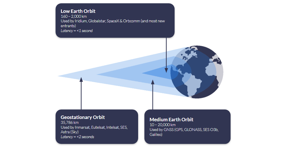
Satellites in Geostationary Orbit (GEO) are 35,786 km above Earth; because they’re so much further away, they can ‘see’ much more of the Earth’s surface, so fewer satellites are needed to provide wide coverage. The latency is longer – c. 2 seconds for an IP-based connection such as Viasat IoT Pro, and longer for a message-based solution such as Viasat IoT Nano – because the data has to travel further. However, if you can bake in some latency tolerance into your application, or simply reserve this means of communication for less time-sensitive telemetry, this offers an economical and often very stable means of communication.
Q: Is Satellite Connectivity Financially Viable for Drone Operations?
A: Satellite airtime can be tailored to match drone usage patterns and fleet scale, using flexible subscription models with clear pricing. For many drone operators, particularly those flying BVLOS or in low connectivity areas, satellite becomes cost effective with just 10 – 20 flight hours per month, especially when uptime is mission critical.
Flexible Subscription Models
Recognising that unmanned applications like drones are a key growth market, satellite network operators like Iridium offer increasingly diversified options for airtime. Ground Control, as a long-term Iridium partner, can offer UAV manufacturers and users monthly subscriptions, pay‑as‑you‑go, or annual commitments – all with transparent pricing and volume discounts for larger operations. Operators using existing Certus 100-compatible hardware can activate airtime instantly through Ground Control, simplifying deployment.
When Does Satcom Pay Off?
Although detailed cost breakdowns vary by mission profile, satellite connectivity often becomes cost effective at a relatively modest flight tempo. If your missions involve command/control, telemetry, or operations beyond cellular coverage, satellite ensures reliability that terrestrial networks can’t guarantee. With real time capabilities over Iridium Certus 100 and competitive airtime pricing, operational risk reduction often justifies the cost within 10 – 20 flight hours per month.
Connecting Drones Beyond Terrestrial Coverage
Satellite connectivity makes it possible to operate UAVs far beyond the reach of terrestrial networks, but integrating it requires thoughtful design. From managing size, weight and power to understanding latency, throughput and cost, this post outlines the key considerations for adding satcom to your drone system.
If you’re developing a satcom-enabled drone, our team can help you find the right hardware and airtime for your mission. Email hello@groundcontrol.com or complete the form, and we’ll be in touch within one working day.
Affordable BVLOS Drone Connectivity: Introducing Iridium Certus 100 Airtime Plans for Drone Operators
Flying drones Beyond Visual Line of Sight (BVLOS) is the new frontier for commercial and industrial operations. Whether you’re surveying expansive agricultural lands, monitoring critical infrastructure, or conducting environmental research in remote regions, reliable connectivity is the linchpin for mission success. Recognizing this need, we’re excited to unveil Iridium Certus 100 aeronautical airtime plans tailored specifically for drone applications.
Why Satellite Connectivity Matters for BVLOS
Traditional RF and cellular networks may falter once a drone ventures beyond visual range, leading to dropped links, latency spikes, and potential safety hazards. To mitigate these risks, many aviation authorities now mandate a secondary communication channel to serve as a failsafe if the primary link fails. For example, the EASA requires redundant communication systems for BVLOS flights to ensure operational resilience, while the UK Civil Aviation Authority’s guidance similarly calls for dual-link architectures as part of any BVLOS operational authorization. In the United States, the FAA’s UAS BVLOS Aviation Rulemaking Committee report recommends demonstrating multiple active command-and-control links – or an automated failover scheme combining cellular, radio, and satellite – to secure BVLOS waivers.
Why Iridium Works Best
Satellite networks offer coverage with no dependency on terrestrial infrastructure, but that doesn’t mean all satellite networks are the same. In this context, low latency – the time it takes for you to send a command to the drone, and for it to receive it and respond – is critical, and therefore, satellite networks in Low Earth Orbit (LEO) are preferable. This is simply because they are closer to Earth than networks in Geostationary orbit, and therefore the round trip of data takes less time.
Iridium’s satellite network is in Low Earth Orbit, and further, it utilizes the L-Band radio frequency. L-Band signals are extremely reliable, and penetrate poor weather conditions with ease; ideal for mission-critical applications where you can’t afford to lose contact with your asset.
With Iridium Certus 100, operators enjoy 22/88 Kbps of bi-directional data, low latency, and complete pole-to-pole coverage, so your drone’s telemetry, sensor data, and command/control signals remain rock solid. It can be used as a primary or failover means of communication.

Our new airtime plans capitalize on our decades-long partnership with Iridium to provide flexible data bundles that scale from single drone deployments to entire fleets. Whether customers prefer monthly subscriptions, pay-as-you-go usage, or annual commitments, each plan features transparent rates, with volume discounts available for larger scale operations.
Customers who already own an Iridium Certus 100-compatible device can simply activate their chosen plan through Ground Control, eliminating the need for additional purchases or complex installation processes.
Recommended Hardware for IP Over Satellite
For those seeking an out-of-the-box solution, RockREMOTE UAV OEM provides direct board-level integration of the Iridium Certus 9770 module in a compact, 288 g form factor. Optimized for low power consumption, all non‑RF connections (Ethernet, serial, GPIO) are routed through a single 30‑way header, and installation is as simple as four screw mounts – no external gimbals or moving parts required.
Configuration and firmware updates are managed over Bluetooth LE via a companion app or API, and operators only need to attach the specified MMCX and U.FL antennas for Iridium and GNSS. Rated for operation from –40C to 70C and 95% humidity, RockREMOTE UAV OEM ensures mission-critical stability and performance across extreme environmental conditions.
Real-world use cases for these new airtime offerings span multiple industries. In agriculture, farmers can obtain real-time soil and crop health data from remote fields, optimizing inputs and maximizing yields. Renewable energy and utilities companies can conduct continuous inspections of pipelines, power lines, and wind turbines, preventing costly downtime and enhancing safety.
During emergency response missions, drones equipped with Iridium Certus 100 connectivity can relay critical situational data from disaster zones or search and rescue sites, accelerating decision-making when every second counts. Researchers performing environmental monitoring can gather long-range data on wildlife habitats, forestry conditions, and ocean patterns, undeterred by geographic isolation. And for jurisdictions that require communication redundancy, our plans serve as a reliable secondary link, providing an essential failsafe that keeps aircraft controllable even if the primary link is disrupted.
With affordable, reliable satellite connectivity and built-in redundancy now within reach, your BVLOS aspirations can become reality. Ground Control’s UAV-specific Iridium Certus 100 airtime plans can help extend your operational envelope, enhance safety, and unlock new business opportunities.
Would You Like to Know More?
If you’d like to get a quote for your UAV airtime, please complete the form, or email hello@groundcontrol.com, and we will respond within one working day.
It’s helpful if you can tell us more about your application, i.e. what sort of function do you need to perform (command and control in real-time, or the transmission of telemetry on demand, for example); any SWaP constraints; where you’ll be operating the drones etc.
Ultra Low Power at Scale: Unlocking NTN NB-IoT with NIDD
According to IoT Analytics, the global market for satellite IoT connectivity is projected to grow at a CAGR of 26%, reaching $4.7 billion by 2030. Currently, the satellite IoT market is dominated by proprietary modules – meaning that if you want to use Iridium’s SBD service, you need an Iridium SBD module. These modules and accompanying protocols have been tailor-made for satellite communication, and can move large data payloads quickly and reliably, making them perfect for critical IoT applications such as alerts, command and control, and critical infrastructure.
The growth projected by IoT Analytics is anticipated to largely come from standards-based, rather than proprietary, IoT connectivity. This means using standards built for cellular to move data over satellite, so you can use the same chipset that you would use for cellular NB-IoT to access non-terrestrial NB-IoT (in this context, satellite-based connectivity is almost always referred to as NTN – non-terrestrial network). Analysts believe that the lower cost of modules, ability to switch suppliers, and extremely low power requirements will facilitate new, massive IoT applications.
That said, the cost of manufacturing proprietary modules – which have historically commanded a higher premium – is falling, as scale manufacturers like u-blox and Quectel have started to produce these at a much lower cost. Any massive IoT application which is not latency-tolerant, and/or needs to move larger volumes of data, will have options to explore in the proprietary module space, too.
In this blog post, however, we’re exploring NTN NB-IoT in detail, with the goal of helping systems integrators and network architects evaluate whether this emerging technology will suit their remote connectivity application.
What is NTN NB-IoT?
NB-IoT, or Narrowband Internet of Things, is a cellular technology standardized by 3GPP Release 13 in 2016. It was specifically designed for the Internet of Things. NB-IoT falls into the category of Low Power Wide Area Network (LPWAN) technologies. LPWAN technologies are tailored for devices with specific requirements, distinct from smartphones or mobile broadband connections. Key characteristics include:
Small Data Amounts
Devices are designed to send relatively small amounts of data, typically a few bytes or kilobytes, infrequently. This is suitable for simple sensor data or control commands.
Long Battery Life
Due to minimal data transmission and optimized radio usage, these devices are built to operate for extended periods on battery and/or solar power, often for several years.
Low Hardware Cost
LPWAN technologies typically have low cost hardware costs, which is essential for IoT deployments involving hundreds or thousands of devices spread over large geographical areas.
Wide Area Coverage
LPWAN technologies offer long range, low power, small packet connectivity over extensive areas, enabling huge numbers of devices to run for years on a single battery.
NB-IoT achieves these goals by using a subset of features from traditional LTE cellular technology, operating within a narrow slice of the radio spectrum (80 kilohertz bandwidth). This narrow bandwidth and simpler protocols are key to power efficiency and low cost, reducing the complexity and power consumption of the device’s modem. However, terrestrial NB-IoT devices can only send data in areas with reliable cellular coverage.
Non-Terrestrial Network Narrowband IoT (NTN NB-IoT) combines NB-IoT’s low power, low cost cellular technology with satellite communication, enabling devices to connect via satellites in addition to, or instead of, terrestrial towers.
NTN NB-IoT will, when fully mature as a technology, enable global IoT deployments, for projects involving large numbers of simple, low power, low data devices spread across remote areas and across borders. It extends the benefits of NB-IoT beyond its terrestrial limitations, delivering (depending on the satellite network) up to 100% global coverage.
What are the Benefits of NTN NB-IoT?
In addition to being extremely power efficient, the key benefits of cellular NB-IoT is that it operates in licensed spectrum controlled by Mobile Network Operators (MNOs) and standardized by 3GPP, which offers dedicated capacity, more flexibility in the cellular network for switching and roaming, and multi-vendor support for devices and network infrastructure.
NTN NB-IoT similarly operates within licensed spectrum, in this case, controlled by Satellite Network Operators (SNOs) like Viasat and Iridium. It is actively being standardized within 3GPP; initial support for NTN was introduced in Release 17, and Release 18 (launched mid-2024) is significantly advancing NTN integration into the 5G system. It uses a narrow spectrum of the L-Band, S-Band and Ka-Band frequencies, allowing IoT devices to communicate with LEO, MEO and GEO satellite constellations.
Mobile IoT devices equipped with NTN NB-IoT modules can move from terrestrial networks to satellite networks without needing to use a proprietary module. This means IoT devices can be built with a single chipset that delivers NB-IoT connectivity over both cellular and satellite networks, reducing hardware costs because of production economies of scale.
As noted earlier, proprietary modules are also set to benefit from these scale economics, as large chipset manufacturers like u-blox and Quectel are adding the production of these to their portfolio. A key distinction, however, is that a proprietary module will only allow you to connect with one satellite constellation, whereas an NTN NB-IoT module could connect to any satellite network that supports NTN NB-IoT, which could reduce airtime pricing thanks to competition. It will be some years before there is adequate coverage for this to be realized, however.
The promise of NTN NB-IoT lowering the cost of satellite connectivity has the potential to unlock new massive IoT applications in fields such as environmental monitoring, agriculture, and global asset tracking.
Challenges for NTN NB-IoT
Like its cellular counterpart, NTN NB-IoT is designed for large scale, battery-powered deployments. However, communicating with a satellite using a standards-based module, rather than a proprietary satellite modem, brings a new set of technical and economic challenges to overcome.

Higher Latency
While cellular NB-IoT can achieve sub-second latency, NTN NB-IoT introduces significantly higher delays due to the long round-trip to orbiting satellites. Latency can range from several seconds to tens of seconds depending on link quality, protocol, and retry mechanisms. Applications must be tolerant of delayed responses and asynchronous communication.

Increased Battery Usage
Satellite transmissions require higher power output from the radio module to maintain a stable link, particularly in marginal conditions or at low elevation angles. Combined with longer active sessions (due to higher latency), this can drain batteries faster than in terrestrial NB-IoT deployments. Efficient power management and optimized duty cycling become critical.

Antenna Positioning
Terrestrial NB-IoT signals can penetrate walls and underground spaces, allowing flexible antenna placement. NTN NB-IoT requires a clear, unobstructed view of the sky to connect to a satellite, and in many cases, line of sight to a specific satellite at a fixed angle. This can complicate deployments, especially in mountainous or forested environments.

Coverage
NTN NB-IoT coverage is currently limited to specific regions: spot beams lit over North America, Europe, parts of South America, and Australasia. Coverage is expanding, but it’s far from global. Cellular NB-IoT, by contrast, offers much broader regional coverage wherever networks have been deployed and roaming agreements are in place.

Costs
Although standards-based NTN NB-IoT is cheaper than some proprietary satellite services, it’s many times more expensive than cellular NB-IoT. It is more expensive than proprietary options if you exceed monthly data volumes ~30 kB. Cost models are evolving, but pricing will reflect the more limited spectrum and capacity available in space.

Network Congestion
Satellite networks have far less capacity than terrestrial ones, and as NTN NB-IoT adoption grows, so will contention. Congestion may lead to failed transmissions, backoff delays, or restricted access during peak times, especially in areas with high device density or where consumer direct-to-device (D2D) services compete for bandwidth.

Lower Data Rates
NTN NB-IoT operates at significantly lower physical data rates than terrestrial NB-IoT – typically 1-2 Kbps vs. tens or hundreds of Kbps – and enforces small message sizes (e.g., 256 bytes max). This makes it well-suited for small, infrequent payloads, but unsuitable for bandwidth-heavy or real-time applications.
Data Optimization for NTN NB-IoT
For remote NTN NB-IoT applications, sending occasional small data packets becomes essential to reduce signaling duration and battery energy usage, as well as to minimize costly per-byte satellite usage.
When it comes to selecting how data is transferred, there are two options provided by the key players in the industry: IP and Message-based protocols. And to meet the data constraints of remote NTN NB-IoT applications, these protocols become a choice between UDP/IP and NIDD (Non-IP Data Delivery).
Here’s an example to highlight the differences between UDP/IP and NIDD data packet sizes.
A simple water level sensor is sending a status reading and the raw data is 18 bytes long. On top of that, the application running on the device is using CoAP (Constrained Application Protocol), which adds a 4-byte header. This creates a payload of 22 bytes of application data.
To send this message using a traditional UDP/IP stack, the IP and UDP headers add a further 28 bytes, resulting in a total packet size of 50 bytes. By contrast, using NIDD the message is transmitted without any IP or UDP headers, so the total packet size remains just 22 bytes. This efficiency makes NIDD particularly well suited to low-power, low-data IoT devices operating over NTN networks, where every byte of airtime and every milliwatt of battery power matters.
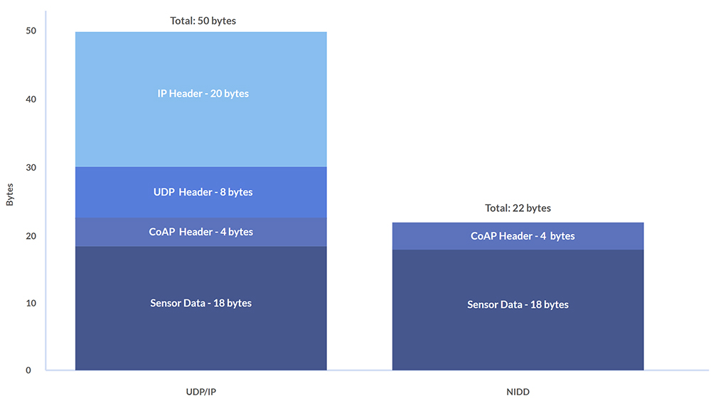
So, the case for using NIDD for NTN NB-IoT is that it reduces the size of data packets to be sent to the satellite, and therefore reduces satellite byte costs, while drawing less power. However, the key benefit of UDP/IP is that the same IP address can be used when moving between cellular and satellite, which is useful for applications which cover devices moving in and out of cellular range, such as maritime vessels or pipeline monitoring.
Comparing UDP/IP and NIDD Benefits
Depending on their agreement with the SNO, some NTN NB-IoT service providers will be offering UDP/IP and/or NIDD solutions, and there are benefits and drawbacks to both. Here is a comparison table to highlight the key differences between each method of data transfer.
| UDP/IP over NTN NB-IoT | NIDD (Non-IP) over NTN NB-IoT | |
|---|---|---|
| Protocol Overhead | IPv4+UDP adds 28 bytes header per packet. Some NTN offerings bill with a 50-byte minimum that includes this IP/UDP header. | No IP/UDP header; payload is carried on signaling (control-plane), avoiding the 28-byte IP/UDP overhead of UDP. |
| Power Consumption | Higher than NIDD for tiny, intermittent messages because you transmit extra header bytes and maintain an IP data session. | Lower for small, sporadic messages by eliminating IP overhead and using signaling paths designed for low power. |
| Integration | Easier for standard IP apps; minor firmware/backend changes may be needed. | Requires SCEF/I-API support and backend changes to map messages to your application. |
| Security | Runs over the Internet path; secure with DTLS/TLS and/or VPN. NAT/VPN commonly recommended for inbound traffic. | Data doesn’t traverse the public Internet; operator exposure functions provide an extra security boundary. |
| Roaming | Single IP address when moving terrestrial ↔ satellite. | Satellite‑only: no IP address for cellular roam; each uplink uses the NTN pathway. |
| Best For… | Applications that move in/out of cellular coverage (e.g., maritime, logistics). | Ultra‑low data, stationary sensors where minimizing airtime and power is paramount. |
Cost & Minimum Payload Considerations
The economics of NTN NB‑IoT hinge heavily on each provider’s minimum supported packet size. Today, Skylo enforces a 50 B floor (including headers) on every UDP/IP message, effectively eliminating NIDD’s payload‑size savings until true NIDD support arrives. Likewise, Sateliot offers standard 3GPP Rel‑17 NB‑IoT over satellite (UDP/IP only) and hasn’t published any reduced‑overhead or NIDD option, so ultra‑small packet users are forced into that same ~50 B envelope.
Until more satellite operators clarify their packet‑size limits or introduce truly NIDD‑capable services, many “tiny telemetry” applications will find themselves priced out of the savings NIDD could otherwise deliver.
The first full NIDD offerings won’t arrive until H1 2026, when Viasat NB-NTN launches its satellite‑only NB‑IoT SIM, complete with both UDP/IP and NIDD modes. Shortly after, Iridium NTN Direct – built on 3GPP Release 19 NTN enhancements – will also bring standardized NIDD support (devices expected in 2026).
In the meantime, proprietary satellite‑IoT networks such as Iridium SBD and Viasat IoT Nano bill in 10 B increments, making them the only current options for truly tiny, cost‑efficient uplinks – albeit at the price of custom hardware and vendor lock-in.
NTN NB‑IoT Service Timeline
Early 2024 – Summer 2025
- Skylo rolls out its Release 17-based service (UDP/IP only) via partner MNOs across the United States, Canada, Brazil, Australia, New Zealand and select European markets
- Sateliot operates a demo LEO fleet for Rel 17 NB‑IoT trials; today’s service is UDP/IP only, with no published NIDD option.
H2 2025 (Pilot & Dev Kits)
- Viasat NB-NTN appears in partner POCs and developer previews (e.g., Ground Control’s Cloudloop integration), with two way NB‑IoT over L‑band. UDP/IP today, NIDD to follow.
H1 2026 (Projected Commercial Launch)
- Viasat NB-NTN full release: satellite‑only NB‑IoT SIM supporting both UDP/IP and NIDD payloads
- Iridium NTN Direct enters commercial service built on 3GPP Release 19 NTN enhancements (including standardized NIDD support).
Will NTN NB‑IoT Open New Markets for Satellite IoT?
NTN NB‑IoT holds clear potential to bring truly global, low‑power IoT to industries unable to leverage terrestrial networks; think widespread environmental sensing, remote infrastructure monitoring and asset tracking in the world’s most isolated regions. However, two pivotal commercial variables will determine how far it can go:
- Cost per Byte & Minimum Packet Size: Until services offer sub‑30 B NIDD payloads at competitive rates (versus today’s 50 B UDP/IP floors or proprietary 10 B options), many micropacket use cases will remain marginal.
- Network Capacity & Congestion Management: Supporting massive fleets of devices over narrow satellite channels requires robust scheduling, interference mitigation and priority handling – features still under development in Rel 17/18 NTN specs and vendor implementations.
Importantly, NTN NB‑IoT does not replace today’s proven proprietary services; it adds to the IoT toolbox. Solutions like Iridium SBD/IMT and Viasat IoT Nano will continue to serve critical, higher throughput or low latency applications, where SLAs, two‑way command/control and strong QoS are non‑negotiable. And, as discussed, the advent of scale manufacturers taking over the production of proprietary modules is set to bring down the cost of these services. NTN NB‑IoT, by contrast, unlocks a new class of latency-tolerant, very small data deployments of homogenous hardware across areas with a mix of cellular and satellite coverage.
Once Viasat NB-NTN and Iridium NTN Direct deliver standardized NIDD in 2026, expect a step‑change: low power, low cost satellite IoT scaling from niche pilots into planet‑wide solutions, while incumbent proprietary networks remain the go‑to for mission‑critical workloads.
Talk to Us About NTN NB-IoT
We’re experts in satellite IoT and asset tracking, and are actively working on new NTN NB-IoT enabled hardware and service integrations with our IoT platform, Cloudloop.
If you have questions about how NTN NB-IoT could enable your IoT projects, please email hello@groundcontrol.com or complete the form to tell us about your requirements, and we’ll reply within one working day.
Using a Campbell CR1000 (CRBasic) with a RockBLOCK RTU (SBD Device)
In today’s rapidly evolving landscape of remote monitoring and data acquisition, integrating reliable communication systems is crucial. RockBLOCK RTU integration provides a robust solution for industries such as environmental monitoring, agriculture, and industrial automation, ensuring seamless data collection and transmission from remote locations.
In this post, we will discuss the integration of RockBLOCK RTU, and show how we have configured it to work with the Campbell Scientific CR1000.
What is RockBLOCK RTU, and Why Does it Matter?
RockBLOCK RTU is a low power, rugged, waterproof remote I/O device designed for permanent installation in harsh outdoor environments. Utilizing Iridium’s Short Burst Data (SBD) satellite service, RockBLOCK RTU supports two way communication anywhere on the globe, ensuring reliable connectivity even in the most remote locations.
Combined with Ground Control’s Cloudloop Services Suite (Subscription Manager and Cloudloop Data), RockBLOCK RTU allows users to land, visualize, store and forward their data in a flexible environment that is easy to integrate with. Aside from the Cloudloop suite, the RockBLOCK RTU supports physical analogue and digital inputs and outputs that can be locally programmed to trigger based on thresholds or actions.
How we integrated the CR1000 with the RockBLOCK RTU
Step 1: Understanding the Data Format
The RockBLOCK RTU system supports a structured data format that includes:
- Channels CH16 to CH31 mapped to General Purpose Sentence (GPS) data
- Each channel supports 5-digit values (00000 to 65533)
- Comma-separated values within the data string.
Example Data String:
STXGP0,…,GP15,ETXCHECKSUMCRLF

STX = 0x02 (HEX) – (Start of Sentence)

ETX = 0x03 (HEX) – (End of Sentence)

CHECKSUM = Between STX and ETX (Excluding them) formatted as 5 digits, zero padded

CR = 0x0D (Carriage Return)

LF = 0x0A (Line Feed)

STX00000,00000,00000,00000,00000,00000,00000,00000,00000,00000, 00000,00000,00000,00000,00000,00000,ETXCHECKSUMCRLF
Step 2: Configuring Cloudloop for RockBLOCK RTU
- Create Channel: Map channels 16 to 31
- Type: Analog Input
- General Purpose Data String-related Device Channel Configuration:
-
- Mode: RAW
- COV (Change of Value): 0 for no COV, 1 for COV enabled
- Group Transmission Size: Minimum 1
Note: Channels should get created automatically in Cloudloop Data once valid data is passed through, although each channel can still be re-configured or pre-configured via Cloudloop Data. It is also important to note that the RTU needs to be active, powered and have a good view of the sky for it to receive the channel configurations via the satellite link.
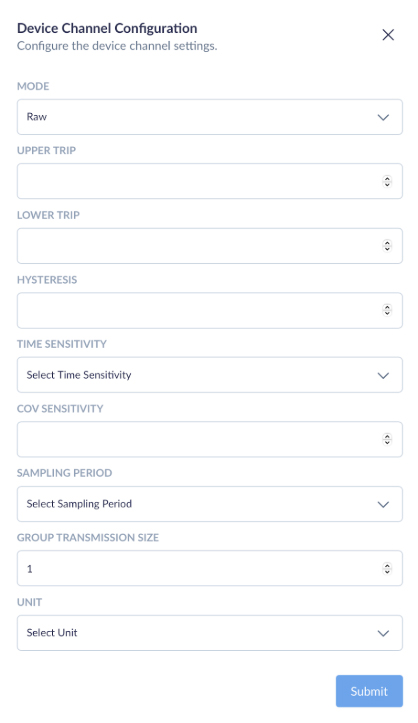
Example of Cloudloop Data Insights
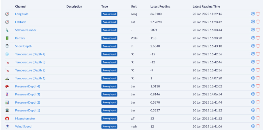
This screenshot showcases the Cloudloop platform’s data visualization capabilities when integrated with RockBLOCK RTU. Each channel represents a specific parameter being monitored, such as location (latitude and longitude), battery voltage, snow depth, temperature at various depths, pressure readings, and wind speed. All of which can be named and customized per your requirements. we have chosen the aforementioned parameters for illustration purposes.
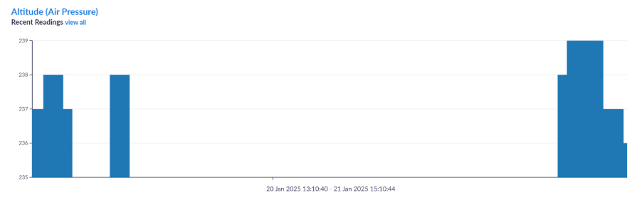
Step 3: Setting Up Communication
- Connect Serial COM2 TX to RX (PINK) on RockBLOCK RTU
- Set baud rate to 19200, which is the default for RockBLOCK RTU
Step 4: Implementing the CRBasic Code
The CRBasic code constructs data strings in stages to accommodate memory constraints. Temporary strings (TempStr variables) are concentrated to form the final 16 channel DataString.
Example CRBasic Code:
This integration will allow up to 16 sensor values to transmit from the CR1000 through the RockBLOCK via SBD to Cloudloop Data (Insights) and optionally forward to a chosen destination. By introducing Cloudloop Data in the middle of the data transfer, you allow for much more than just data display or remote configuration, but the ability to set email alerts depending on thresholds and even set actions – such as controlling a separate RockBLOCK RTU anywhere in the world autonomously.
Imagine a scenario where one RockBLOCK measures the water level at a dam, and a second RockBLOCK controls a valve on pre-set thresholds.
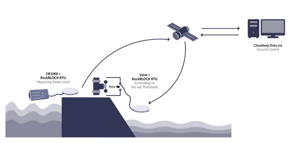
Ready to get started?
If you’re interested in learning more about how RockBLOCK RTU can transform your remote monitoring capabilities, contact us for a personalized consultation.
Also, have a look at our RockBLOCK RTU documentation website.

Michael Mitrev – Solutions Architect
Graduating with a 1st Class Degree in Computer Systems and Networks Engineering and joining the team in 2024, Michael has been closely involved in the development of the RockREMOTE Mini and is passionate about its growth and success. He’s also contributed to the RockBLOCK RTU, ensuring both devices integrate seamlessly with data loggers to create highly sought-after solutions – primarily focusing on testing with Campbell’s CR1000.
Transform your CR1000 into a powerful remote monitoring solution
Whether you’re tracking snow depth, water levels, or environmental conditions, the RockBLOCK RTU + Cloudloop integration offers reliable, global data delivery.
Complete the form, or email hello@groundcontrol.com for expert advice; we’ll respond within one working day.
How RockBLOCK APNT Ensures Resilient Tracking For Military In GPS-Denied Environments
In today’s digital battlespace, Assured Positioning, Navigation, and Timing (APNT) is more than a utility; it’s the invisible infrastructure behind every mission. As adversaries grow more technologically capable, the reliability of conventional GPS-based systems is increasingly at risk. Electronic warfare tactics, such as GPS jamming and spoofing, can create blind spots and disrupt mission-critical functions. A resilient solution is needed, designed to maintain accurate, trusted location and timing data even when GPS is spoofed, faked or denied.
From satellite tracking and coordinated troop movements to secure communications and synchronized operations, reliable PNT enables modern militaries to act with speed, accuracy, and global reach.
Encapsulated within Ground Control’s RockBLOCK APNT device, reliable, global, and jamming-resilient positional awareness can be achieved by military personnel in hostile, GPS-contested environments. This blog examines the modern-day need for reliable location assurance beyond GPS for military effectiveness.
Why PNT Is Critical for Military Success
PNT systems, chiefly GPS and GNSS, are foundational to all branches of modern defense, forming the backbone of situational awareness, coordination, and operational execution. Real-time, accurate positioning provides the precise geolocation of military forces, vehicles, and critical assets, allowing commanders to make informed decisions in real time.
Navigation enables units to move accurately and more safely across land, air, or sea to ensure missions stay on course and with optimum execution. Timing is crucial for synchronizing a wide range of activities, from encrypted communications and sensor network operations to financial transactions and time-sensitive Intelligence, Surveillance, and Reconnaissance (ISR) data processing.
Numerous military functions rely on accurate and uninterrupted PNT, including Blue Force Tracking (BFT) – a system that utilizes GPS technology to track the location of friendly forces, cybersecurity command and control (C2) systems, precision time-stamping for ISR platforms, and the coordination of multi-domain operations. Without reliable PNT systems and GPS/GNSS, these operations can quickly become disjointed, inefficient, and vulnerable, jeopardizing both mission success and the safety of military personnel.
The GPS Vulnerability Problem
While GPS remains the backbone of PNT, it is vulnerable. GPS signals are low power, unencrypted and easy to jam, spoof, or fake with relatively inexpensive equipment.
In hostile environments, such as near-peer conflict zones and congested battlespaces, adversaries often target GPS to disrupt coordination, conceal positions, or disable military tracking systems.
Even in peacetime or humanitarian missions, natural obstructions like urban canyons, mountains, and indoor locations can degrade signal reception.
APNT is different. A key component of APNT is the use of one-way, secured signals transmitted from Low Earth Orbit (LEO) satellites. These signals are significantly stronger than traditional GPS – up to 1,000 times more powerful in some systems – making them far more resistant to jamming and interference. When integrated into a layered APNT architecture, these satellite-based signals help ensure trusted timing and location data even in GPS-denied environments.
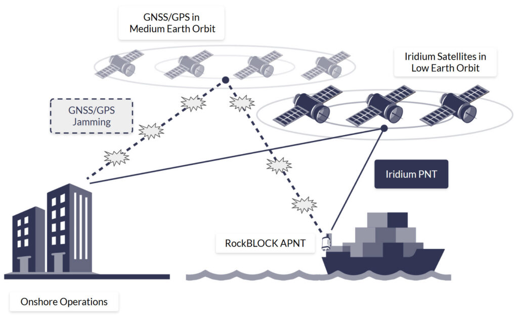
It’s worth noting that APNT is designed to complement, not replace, GPS and GNSS-based systems. PNT and APNT signals are compatible with some of the same hardware that supports GPS, allowing for seamless integration into existing navigation solutions. This makes APNT an ideal component of a layered satellite-tracking system strategy, enhancing resilience,
security, and continuity of positioning and timing services in critical military applications.
RockBLOCK APNT For Assured PNT Beyond GPS
For unmanned or unattended deployments, RockBLOCK APNT offers resilient satellite time and location capability in a compact, ruggedized form factor. Designed for integration into autonomous systems, remote infrastructure, and stationary platforms, it ensures critical operations remain synchronised and secure, even in heavily contested GNSS environments.
With the ability to transmit APNT data, as well as text-based messages and telemetry data (up to 100 KB per transmission), RockBLOCK APNT also serves as an effective failover
communication channel when primary systems are compromised or unavailable. Its versatility and resilience make it a valuable asset for mission-critical operations where assured connectivity is essential.
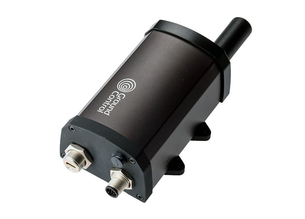
A Layered PNT Strategy for Modern Defense
As militaries shift toward Multi-Domain Operations (MDO), the security and reliability of PNT and GPS are strategic priorities. Relying solely on GPS is no longer acceptable. The U.S. Department of Defense and allied nations are actively pursuing Assured PNT (APNT) initiatives, combining multiple sources to create a layered, fault-tolerant system. RockBLOCK APNT is a key enabler of this strategy in providing a complementary, GPS-independent signal that strengthens the PNT architecture.
Gain The Advantage With Mission Ready Satellite IoT
For over 20 years, we’ve partnered with defense forces, government agencies, and security contractors to develop a number of military-grade devices, harnessing APNT.
Learn how this technology can give you the tactical advantage in your mission-critical operations.
Can we help?
Our satellite-enabled RockBLOCK APNT solutions offer robust positional data connectivity when GPS fails, for defense applications and more. Partner with us to explore all our satellite solutions that safeguard your military operations anywhere in the world.
Complete the form or email hello@groundcontrol.com and we’ll get back to you within one working day.
Tackling Maritime GPS Spoofing and Jamming Threats with RockFLEET Assured
One of the most disruptive threats to commercial and military maritime operators is the manipulation of Global Navigation Satellite Systems (GNSS), primarily by low-cost GPS jammers, state-sponsored GPS spoofing campaigns, and cyber-physical interference. From oil tankers seized via spoofed coordinates to cargo ships disappearing from satellite tracking due to jamming, the vulnerabilities of GNSS reliant systems are no longer theoretical, they’re operational hazards. These disruptions compromise navigation, safety, and compliance monitoring, particularly in high-risk regions such as the Baltic Sea, Eastern Mediterranean, and other areas with geopolitical tensions.
GPS Jamming Issue Grows in Eastern Mediterranean and Black Seas
Daily, October 1, 2023 – April 4, 2024
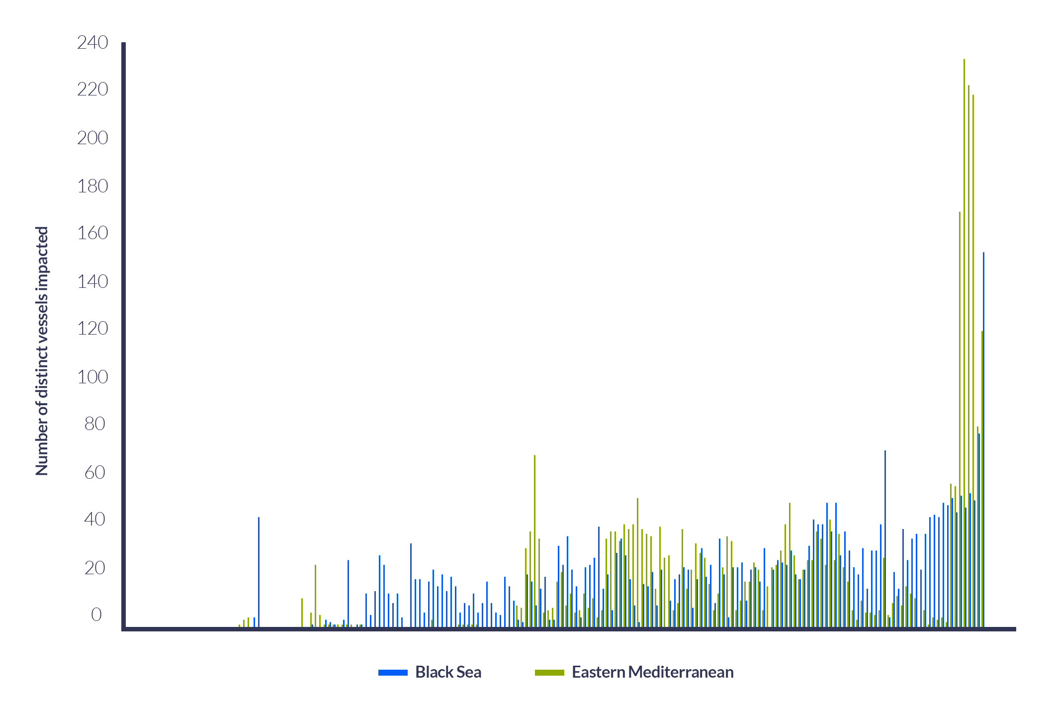
GNSS/GPS manipulation has far-reaching implications, from compromised navigation to operational disruptions. While there are various satellite-based techniques for detecting spoofing and jamming, RockFLEET Assured offers a truly resilient alternative. In this blog, we explore how it works and why it matters.
Key Differences Between Jamming and Spoofing
| Jamming | Spoofing | |
|---|---|---|
| Definition | Overwhelms GNSS signals with noise to block reception | Sends fake GNSS signals to mislead the calculation of a false position/time |
| Mechanism | High power RF signals on GNSS frequencies disrupt signal acquisition | Fake signals mimic legitimate ones, often stronger, to deceive the vessel |
| Goal | Denial of service (DoS) – prevents GNSS-based operation | Deceives the receiving vessel into believing a false position or time |
| Effect on receiving vessel | Loss of satellite lock; receiving vessel cannot determine position/time | The receiving vessel continues to operate, but with incorrect data |
| Detection difficulty | Often easy to detect due to complete signal loss | Harder to detect, may go unnoticed as the vessel operates normally |
| Signal power | High (to overpower weak satellite signals, typically > -100 dBm) | High (to overpower weak satellite signals, typically > -100 dBm) |
| Legality | Illegal in most countries | Also illegal, often more complex to execute and trace |
| Hardware requirements | Relatively simple – can be handheld or vehicle-mounted | More complex, requires GNSS signal generation and precise timing |
| Use cases (malicious) | Disrupt vessel navigation, leave crew and cargo vulnerable to attack | Mislead ships, expose ships to hijacking, steer vessels into dangerous waters |
Implications for the Shipping Industry
The interception and denial of GNSS/GPS connectivity pose significant risks to the commercial shipping industry. GPS spoofing, for example, misleads shipping vessels into believing they are on a safe course when in reality, they may be heading into dangerous waters or restricted areas. Reports indicate that vessels in the Eastern Mediterranean have been falsely located at airports, and other instances have shown ships being misled into high-risk territories. Many vessels, especially those without backup navigation systems, are vulnerable to these attacks.
In July 2019, the UK-flagged oil tanker Stena Impero, operated by Stena Bulk, was seized by Iranian forces while transiting the Strait of Hormuz. Investigations suggest that the vessel’s navigation systems were subjected to GPS spoofing, causing it to deviate into Iranian territorial waters. Analysis of AIS data indicated anomalies consistent with spoofing attacks, where counterfeit signals misled the ship’s navigation systems. This incident highlighted the vulnerabilities in maritime navigation and the potential for state actors to exploit them.
Later in 2019, vessels operating near Chinese ports, particularly around Shanghai, reported widespread GPS anomalies. Ships experienced sudden changes in reported positions, with some appearing to move erratically or vanish from tracking systems. Investigations revealed that these anomalies were due to GPS spoofing attacks, affecting hundreds of vessels and disrupting port operations. The incidents raised concerns about the potential for such attacks to be used for strategic or economic purposes, with the United Nations urging the protection of satellite navigation from interference.
Spoofing and Jamming Detection via Satellite
Satellite systems can detect GNSS/GPS spoofing and jamming by identifying inconsistencies via a number of indicators and parameters.
Positional behavior can indicate spoofing or jamming. Satellite systems can identify positional and movement abnormalities and send alerts when ships “jump” positions, show physically impossible maneuvers, such as a 90° turn at high speed, or appear in two locations simultaneously, known as ghost ships. Further, comparison with terrestrial radar and sensors is a method of spoofing detection. Satellites compare reported Automatic Identification System (AIS) data with ground radar or visual surveillance, and mismatches may indicate spoofing.
To avoid and prevent spoofing and jamming attacks, commercial shipping companies can support risk-based routing. Here, shipping companies use historical spoofing “heat maps” to reroute vessels around known interference zones, such Baltic Sea, Eastern Mediterranean, and any other region or zone with geopolitical tensions.
These detection techniques are effective, but the vulnerabilities of GNSS/GPS signals remain. A secure and resilient solution is required for complete visibility and confidence of vessel positioning at sea.
Iridium PNT For GNSS/GPS Protection at Sea
While satellite-enabled detections exist to combat traditional GNSS/GPS spoofing and jamming, Iridium offers an uncontested solution – a secure alternative for acquiring positioning, navigation, and timing (PNT) information anywhere in the world.
Iridium PNT is a one-way signal broadcast via the Iridium satellite constellation, 1,000 times stronger than GPS, making it far more resilient to jamming. Leveraging Iridium’s LEO satellite constellation and thus, a signal 25 times closer to the Earth than GNSS, Iridium PNT delivers accurate time and position data without needing traditional GNSS visibility, giving commercial ships and maritime systems trusted positioning even when GPS is denied.
Iridium PNT is not designed to replace GNSS; rather, it’s designed to complement it. Many existing GPS/GNSS receivers are capable of receiving Iridium PNT signals, making it easy to incorporate as part of a layered approach to reliable, secure and resilient tracking and positioning.
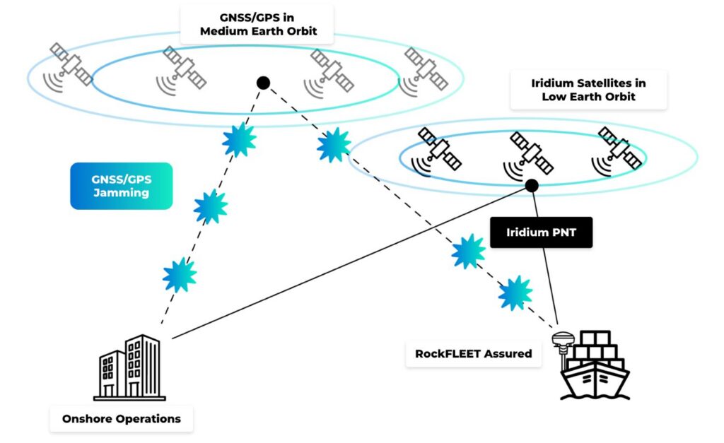
How RockFLEET Assured Utilizes Iridium PNT for Jamming-Resilient Maritime Tracking
RockFLEET Assured is a ruggedized, compact satellite-based tracking solution that harnesses the power of Iridium PNT to deliver a secure signal independent of terrestrial or GNSS infrastructure. This PNT service offers an alternative when GPS or GNSS Global signals are absent, denied, or disrupted.
Traditional GPS signals are vulnerable and easy to overpower or imitate with spoofing equipment. Iridium PNT, by contrast, resists these threats through cryptographic techniques so spoofers cannot easily mimic the signals. Complementing traditional GPS / GNSS and delivering a reliable backup, RockFLEET Assured enables transmission of vessel location updates even when GPS / GNSS is being denied, spoofed, or jammed.
This is vital for commercial ships as well as vessels transiting piracy or cyber-prone regions, unmanned surface vehicles (USVs) operating in contested waters and NATO and allied vessels conducting patrols in high-risk areas.
The technology encapsulated within RockFLEET Assured is designed for easy integration with existing maritime equipment. The device is a single above-deck terminal with no below-deck electronics required, without the optional bridge view, and setup/status are provided via a Bluetooth LE mobile app. RockFLEET Assured is compact, IP67 waterproof – ideal for harsh marine conditions – and features a marine-grade smart antenna that integrates the Iridium PNT module to support A-PNT workflows and Iridium Messaging Transport (IMT) to enable routine position reports.
Purpose-built, RockFLEET Assured is an ideal satellite-enabled, secure and rugged solution for shipping companies to tackle the ongoing threat of GPS spoofers and jammers.
Operational Scenarios with RockFLEET Assured
There are several operational scenarios where RockFLEET Assured provides an uncontested, reliable solution to GPS-denied environments, spoofing, and jamming:
Anti-Spoofing for Cargo Ships: A container vessel approaching a spoofing hotspot in the Eastern Mediterranean receives conflicting GPS signals. RockFLEET Assured continues to deliver trusted positioning, allowing the bridge crew and HQ to detect the spoof and maintain safe routing.
Naval Operations in Denied Environments: A patrol vessel operating under electronic warfare conditions near contested maritime borders loses GPS functionality. Utilizing RockFLEET Assured, onboard systems retain accurate time and position data, crucial for navigation, targeting, and tactical coordination.
Unmanned Maritime Drones: An autonomous surface vessel in the Arctic Circle cannot acquire GPS due to interference. RockFLEET Assured ensures connectivity, continuity and remote GPS monitoring via Iridium.
Secure Positioning When GPS Goes Dark
From bulk carriers drifting off-course in the Black Sea to naval vessels being targeted in the Red Sea, GNSS/GPS interference has shifted from a rare anomaly to a strategic weapon. The rise of low-cost jammers, state-sponsored spoofing campaigns, and cyber-physical interference has exposed a serious blind spot in global shipping: overdependence on vulnerable, unprotected GNSS/GPS satellite signals. RockFLEET Assured provides an essential layer of protection, ensuring a secure, resilient, and critical connection to vessels at sea.
With RockFLEET Assured, Ground Control offers a compact, secure, and rugged satellite-based solution that ensures maritime assets stay online, stay located, and stay safe, even when GPS goes dark.
Can we help?
Partner with us to implement satellite technology that safeguards your maritime operations and enhances secure, real-time data transmission wherever your journey takes you.
Complete the form or email us at hello@groundcontrol.com and we’ll get back to you within one working day.
RockBLOCK Pro is the World’s First Certified Iridium Certus 9704 Device
Ground Control has launched the RockBLOCK Pro, the first certified Iridium Certus 9704 device available through an Iridium partner. This rugged satellite IoT gateway utilizes the new Iridium Certus® 9704 module and Iridium Messaging Transport (IMT). The RockBLOCK Pro delivers enhanced performance compared to earlier RockBLOCK versions, and features faster speeds, substantially increased message size capabilities, and improved power efficiency. This makes it well-suited for critical remote operations.
RockBLOCK Pro utilizes the Iridium 9704 module to send bi-directional messages from 25 bytes up to 100 KB, supporting aggregated sensor data, imagery and audio clips while maintaining end-to-cloud latency under 10 seconds. Compared to the Iridium 9602 and 9603 modules, the 9704 achieves up to an 83% reduction in idle power consumption, making it the most power-efficient Iridium module ever.
Engineered for harsh outdoor and industrial use, RockBLOCK Pro is rated IP66 and can be specified with either the built-in high-gain antenna or an external antenna. Full support for the legacy Iridium AT command set ensures a drop-in upgrade path for existing SBD deployments, with no need to alter host firmware or development toolchains.
For seamless end-to-end messaging, RockBLOCK Pro integrates tightly with our Cloudloop Data platform, which delivers messages via direct cloud-platform integrations, including AWS, Azure and Google Cloud environment, or can be routed via HTTP webhooks, MQTT streams, or even email. Onboard GNSS, Bluetooth, and configurable digital I/O further expand its utility in telemetry, asset tracking, environmental monitoring, and autonomous applications.
Alastair MacLeod, CEO of Ground Control, said: “RockBLOCK Pro redefines the satellite IoT gateway category by bringing together power efficiency, rugged design, and data capacity in a compact footprint, unlocking smarter, more responsive systems in the world’s most remote places. As the first partner to bring a certified Iridium Certus 9704 product to market, we’re proud to lead the next chapter of global IoT.”
“The Iridium Certus 9704 packs a lot of power in a compact module, making it ideal for IoT applications that require real-time data analysis, analytics and automated decision-making,” said Tim Last, executive vice president of sales and marketing, Iridium. “Ground Control has been a trusted Iridium partner for many years, with a proven track record of delivering high quality developer hardware built on Iridium technology. We’re excited to see them leading the way with innovative solutions that bring high performance satellite IoT connectivity to the most remote parts of the world.”
Get in touch
Discover if the RockBLOCK Pro is the right device for your remote connectivity needs.
To learn more or to discuss your deployment, please complete the form.
Cutting Through the Hype: What Direct-to-Device (D2D) IoT Really Means
Direct-to-Direct (D2D) satellite connectivity is one of the most talked about innovations in IoT right now. It promises seamless global coverage, allowing connected devices, from smartphones to smart sensors, to communicate with satellites without the need for additional hardware such as a specialized antenna.
At first glance, D2D sounds like the ultimate solution for remote IoT applications. But there’s a problem: the term is being used too broadly and too optimistically. Many assume that D2D is synonymous with standards-based satellite IoT, like NTN NB-IoT or LTE Cat-1 over satellite. In reality, these are adjacent but distinct technologies, each with very different capabilities, timelines, and trade-offs.
In this post we’ll cut through the noise to discover what’s actually available today, and what will be available in six months, one year, and beyond. We’ll look at the benefits and limitations of D2D, and explore whether you would be better off focusing on standards-based satellite IoT as you consider what’s best for your IoT deployment.
What Direct-to-Device (D2D) Actually Means
Direct-to-Device (D2D) connectivity means that a device – typically a smartphone – can communicate directly with a satellite (part of a non-terrestrial network, or NTN) without requiring additional external hardware like a specialized antenna / dongle.
D2D is a capability, not a standard. It means a device can talk directly to a satellite, but that doesn’t necessarily mean it uses NB-IoT or LTE.
The most well-known example is Apple’s agreement with Globalstar. Newer iPhones embed chipsets that allow them to access the Globalstar satellite constellation where available. This is a proprietary technology, meaning iPhones cannot connect to other satellite networks.
While still relevant, the Globalstar/Apple partnership is an outlier. Today, D2D is often referenced in the context of standards-based connectivity – but that’s where definitions start to blur.
D2D and Standards-Based Connectivity: Not the Same Thing!
Standards-based NTN connectivity refers to satellite networks that adhere to existing cellular standards, e.g. NB-IoT and LTE Cat 1.
A key benefit of this is that you don’t have to modify your data to send it through a proprietary satellite protocol. Standards-based connectivity also opens the door to switching networks for broader coverage or better pricing – a flexibility not available with proprietary solutions.
But here’s the key distinction:
D2D
Standards-Based NTN
D2D is about the physical capability for a device (e.g., smartphone or sensor) to connect to a satellite without extra hardware.
Standards-based is about ensuring that the satellite connection adheres to existing cellular protocols like NB-IoT and LTE Cat 1.
The connection can be proprietary or standards-based.
Compatible devices may still require separate hardware to connect, especially today.
Pure D2D for IoT is limited today and requires ideal antenna positioning and sky visibility.
You can access standards-based NTN today, usually via an external transceiver / dongle.
What’s Available Now (Early 2025)?
There are two cellular standards being adopted by satellite network operators: NB-IoT and LTE Cat 1.
- NB-IoT uses very little bandwidth and is being rolled out by providers like Iridium and Viasat to complement their proprietary solutions.
- LTE Cat 1 requires more bandwidth and is being pursued by newer entrants like Starlink and AST SpaceMobile, who partner with mobile network operators (MNOs) to access spectrum.
The standard closer to delivery is NTN NB-IoT. Skylo is not a satellite network operator, but has done a lot of work to make NB-IoT work over existing satellite networks. They have partnered with multiple satellite networks, including Viasat and Ligado Networks, to bring a solution to market in the USA, Canada, Australia, New Zealand and Brazil.
Some satellite network operators are already offering this service in a limited capacity – Sateliot were among the first to market with a proposition. However, they’re in the process of scaling their satellite IoT services; initial store-and-forward services are available, but fully operational coverage will be c. 2028.
At the moment, the hardware being built for IoT tends to take the form of a unit that can be attached to a sensor or gateway to facilitate NTN connectivity.
Why is Separate Hardware Still Needed for IoT?
- Many sensors or gateways don’t yet support NTN NB-IoT or LTE Cat 1 and will need to pass data through a connected device which can re-format the data to work with the appropriate standard.
- Satellite connectivity requires a clear view of the sky. Devices embedded in machinery or under panels (like an OBDII port or solar-powered sensor) are unlikely to maintain a reliable satellite link.
What Will Be Available In Six Months (Mid-Late 2025)?
In terms of NB-IoT, Viasat’s “NB-NTN” is currently in beta mode, before a full release in the second half of 2025. This will deliver global NB-IoT capabilities for connected devices, and we’re particularly excited about this development.
We also expect the first LTE Cat 1 service for IoT from Starlink to be available before the end of 2025. Starlink’s “D2C” model depends on cooperation from mobile network operators, and rollout will begin in countries with large land masses and low population density, where unused spectrum is more available.
Current rollout countries are the USA, Canada, Australia, New Zealand, Chile, Peru, Ukraine, Switzerland, and Japan.
What Will Be Available in One Year?
We should see more integrated, true D2D devices that can connect to both cellular and satellite networks using standard protocols, without needing separate antennas. But these are unlikely to be materially lower cost than the current, proprietary options available. This is because it is both economies of scale and competition that drives prices down, and that will take a little longer to come to fruition.
Starlink will likely have its first competitor in the LTE space (no pun intended) with the commercial launch of AST SpaceMobile anticipated in early 2026. However, AST SpaceMobile is focused squarely on the cellphone market rather than IoT devices; it will probably be another 12 months (early 2027) before IoT devices can connect to the AST SpaceMobile network. It’s also worth mentioning that AST SpaceMobile also needs agreements with MNOs to deliver its service; it will not be global at launch.
The Future (2-5 Years)
The update that allowed cellular standards to be used over satellite is called 3GPP Release 17. While Rel-17 made it possible to use cellular standards in satellite communication, it didn’t make it easy, with companies like Skylo having to do a considerable amount of engineering to make NB-IoT transmissions over satellite a reality.
Iridium, currently the world’s only global satellite IoT network, was a little late to the party in developing a standards-based proposition, but now that it is, it’s working very closely with the 3GPP to extend the functionality of NTN NB-IoT. This collaboration means that 3GPP Release 19 (anticipated in late 2025) will remove many technical challenges and hasten the widespread availability of industry standard chipsets.
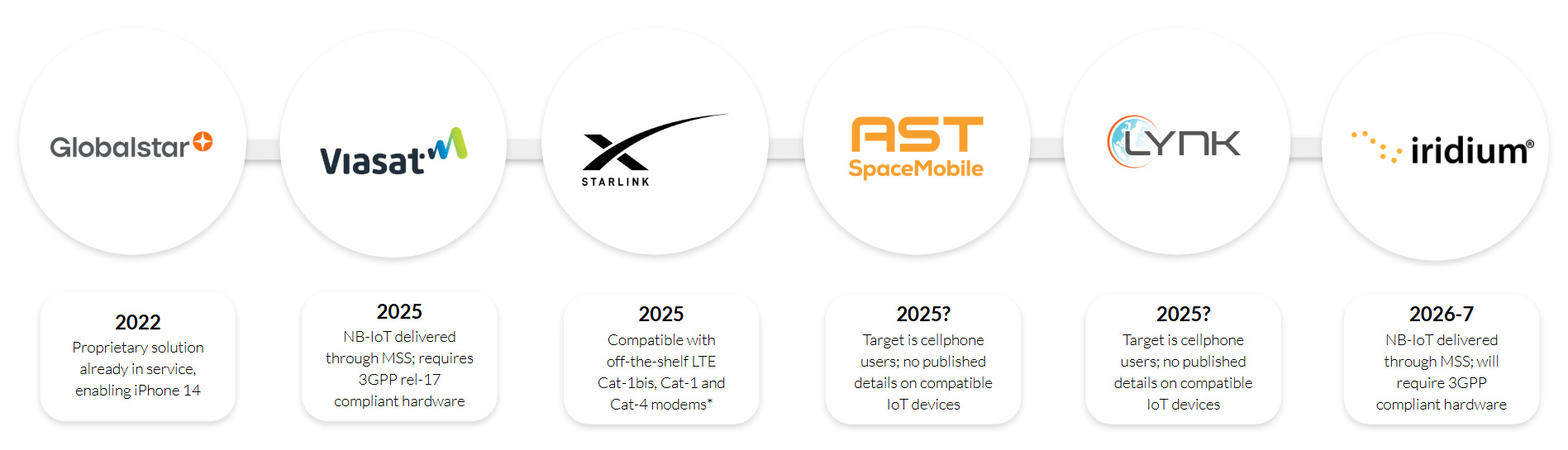
*3GPP compliant release 10 or newer, modem must support existing bands of operation in intended service countries
We also anticipate that we’ll see increased data throughput, greater power efficiency, and lower latency as these advanced protocols coupled with new satellite modems filter through, enabling smaller, lower cost and longer lasting IoT devices.
The reason this falls into the 2-5 years section is because the benefits take several years to reach end users. Firstly, network operators, device manufacturers and other industry stakeholders will need time to implement the new standards, which can involve significant hardware and software updates, plus extensive testing.
Deployment of the new technology across networks is often piecemeal, too, rolled out across regions and service providers at different times – meaning that it will take time to become widely available. And, of course, end users’ devices must be compatible with the new standards; this will include firmware changes to support the lower speeds and smaller message sizes available over NTN NB-IoT.
While NB-IoT remains the most popular choice for delivering NTN standards-based connectivity, by this time we’d anticipate also having IoT propositions from AST SpaceMobile and Lynk using the LTE Cat 1 standard. These new satellite network operators, along with Starlink, will undoubtedly create more commercial agreements with mobile network operators, extending the reach of NTN LTE Cat 1 services.
What Should IoT Businesses Do Now?
It depends on the criticality and data requirements of your application. While NTN NB-IoT services are reaching the market, the throughput is very small, and data transmission is infrequent, so it best serves applications where there are a high number of end points, but real-time information is not required (e.g., livestock tracking, environmental monitoring, agriculture, basic fleet management, and wearables).
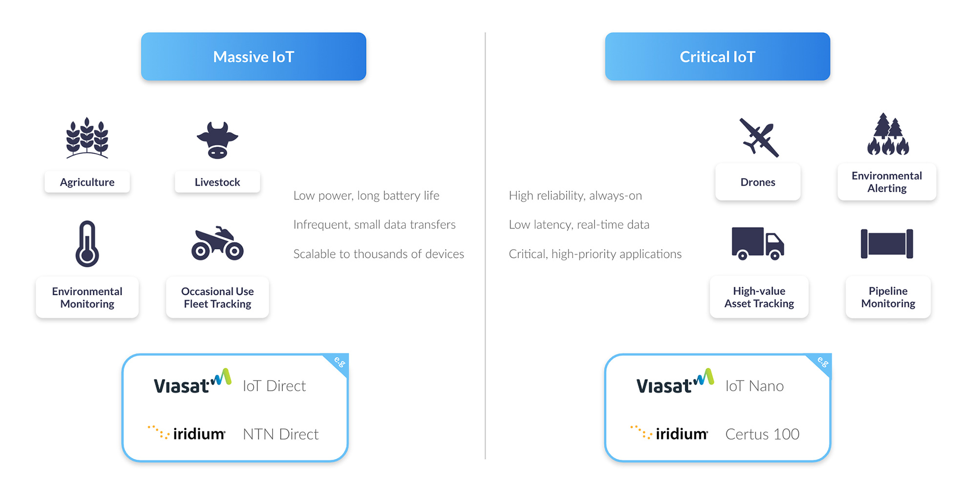
If this describes your application, get in touch with a service provider like Ground Control to get advice on the best network and hardware for your application. Note that this will almost certainly involve additional hardware, as the satellite industry is some way from solving the issues around device compatibility and antenna siting mentioned earlier.
If you need higher volumes of data and closer to real-time data, you will still be better served by a proprietary solution such as IMT / Certus 100 from Iridium, or IoT Nano from Viasat. These services are well established and globally available; they will co-exist alongside the standards-based solutions for the foreseeable future.
Finally, don’t get too preoccupied with D2D; it offers exciting possibilities, but it’s still a developing technology that won’t be widely available for some time, and will only be appropriate for certain use cases.
Ready to explore your options?
If you’re exploring how to keep your IoT devices connected beyond the reach of terrestrial networks, we’re here to help. At Ground Control, we work across both proprietary and standards-based satellite networks to recommend the best-fit solution for your use case – today, and in the future.
Whether you’re ready to deploy now or just starting to assess the landscape, we’d love to talk. Get in touch for practical, honest advice on devices, networks, and everything in between. Email hello@groundcontrol.com or complete the form, and we’ll be in touch within one working day.
Securing Remote Facilities: Cost-Effective Video Streaming Over Satellite
Critical national infrastructure is an increasingly attractive target for state-sponsored activists and extremist groups. Remote infrastructure – everything from outstations to wind farms, wellheads to pump stations, haul roads to transport hubs – is particularly vulnerable because of the challenges in creating robust security solutions in these locations. This blog post seeks to present a solution to these challenges, but first, let’s dig into the issues in more detail.
The Growing Threat to Remote Infrastructure
The vulnerability of utility and energy production sites to cyber attacks is well documented; from 2023 to 2024, US-based utilities experienced a 70% surge (Reuters). Less frequently reported is that physical attacks on infrastructure also rose 73% from 2020 to 2022 (Axios), with incidents including a gunfire attack on two substations in North Carolina, USA, which left 45,000 customers without power.
In Nigeria, in early 2024, the power sector faced escalating vandalism of high-voltage transmission infrastructure; incidents tripled during a 15 week span, including explosives being used to destroy transmission line towers (The Electricity Hub).
In Australia, thefts from unmanned construction sites reached a 10 year high in September 2024, with a 22% increase in theft-related offences during the same period (Herald Sun). And in the UK, the cost of theft of agricultural equipment escalated to an estimated £52.8 million in 2023, a 4.3% increase from the previous year (NFU).
In addition to a growth in isolated incidents is the underlying strategy to destabilize infrastructure, driven by alliances between state actors like Russia, and organized criminal gangs. These activities include sabotage, arson and cyber attacks, aimed at undermining critical infrastructure (The Guardian).
Attacks are increasing: companies, governments and individuals with hard-to-protect, high value assets are fighting a rising tide of criminal activity.
The Challenge of Traditional Security Measures
The infrastructure we’re describing here – transport, energy production, heavy industry – operates across vast areas, making it impractical to station physical security at every location which could be a target. Assuming a single security guard is stationed at a site for 8 hours a day, 7 days a week; the cost of an unarmed guard would be c. $3,600, and c. $6,000 for an armed guard (Deep Sentinel).
Statistically, most theft takes place after dark, and are more frequent in winter; long weekends and holidays are also attractive (Site Watch Group). Thus, 24 hour cover would be prudent at least over weekends, adding substantially to the cost.

Another option is to use fences coupled with cameras and sensors to detect intruders, and provide real-time alerts to a remote monitoring center. The security personnel there can monitor multiple sites remotely, reducing on-site staffing costs. Upon receiving an alert, they can choose to dispatch security personnel to the affected site, alert local law enforcement or trigger some localized deterrent such as alarms, voice sirens or lights.
The pros of this approach is that it’s lower cost, delivers 24/7 surveillance, and can be rapidly and cost-effectively scaled up. However, it requires a reliable, secure and cost-effective means of transmitting the video stream (and potentially also audio and movement sensors). Within cellular connectivity this is pretty straightforward, but in a remote site, satellite is often the only viable option.
Finding the Right Satellite Connection for Remote Surveillance
Satellite connectivity isn’t a homogenous blob. There are multiple radio frequencies used, and the type used strongly influences the form factor of the satellite transceiver. For example, people seeking broadband internet access over satellite – Starlink, Hughesnet, OneWeb etc. – will be using Ka-band, as this supports higher data rates, and there’s plenty of bandwidth available (i.e. limited congestion issues).
The drawback of Ka-band is that it is both susceptible to rain fade (signal loss in bad weather), and the antenna size is large, power hungry, and needs to be precisely positioned. This is not an issue for home installation, but in a remote outstation, there may be mountains, trees or the outstation itself preventing the ideal siting of the antenna.
The fix to this – phased array antennas which electronically steer themselves to optimal positions – has the drawback of consuming significantly more power. Indeed, it would be challenging to power any Ka-band antenna via a solar-powered battery, particularly for the sorts of continuous operation that a surveillance system requires.
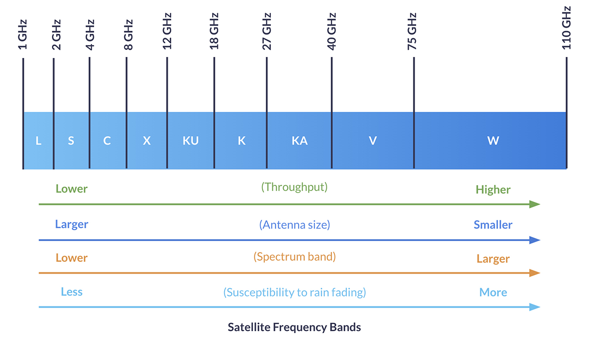
Satellite services that operate in the L-band spectrum, on the other hand, have very small antennae, and low power requirements compared to Ka-band. Iridium and Viasat (previously Inmarsat) utilize L-band for data transmission, which makes them perfect for IoT applications where the data requirements are lower, and a small, discreet, battery-operable antenna is an asset – sometimes a necessity. L-band transmissions are unaffected by weather conditions, and very hard to intercept, making them ideal, in principle, for mission critical applications like remote surveillance.
However, video streaming from remote, potentially unpowered locations, is an awkward fit for both Ka- and L-band. It’s a high bandwidth transmission, but as discussed, high bandwidth satellite services are power hungry, easy to identify (and therefore to put out of action), and difficult to position. L-band fixes all those challenges, but to send video over L-band, which is a much more constrained frequency band, is very expensive.
Until now…
A Breakthrough in Remote Video Surveillance
There have been two key developments that have made it possible to send video over an L-band satellite connection cost-effectively. The first is the advent of low bandwidth video. Our partner Videosoft has developed video compression and transmission technology that delivers real-time, low-bit rate video. They’ve coupled this with an image enhancement feature that lets users specify and download high-res pixels from an area of interest in a scene.
Videosoft’s technology works with most off-the-shelf hardware, including video cameras, CCTV, audio microphones, GPS tracking antennae, and other I/O devices.
The second development is the availability of midband (higher throughput) transmissions in the L-band spectrum; notably Viasat’s IoT Pro service, and Iridium’s Certus 100 service. The latter is particularly well suited to remote surveillance because the satellites are in Low Earth Orbit, which means the latency is very low – critical when you need real-time alerts if a facility has been penetrated, or an asset is moving outside of schedule.
Additionally, Iridium has a cross-linked network of 66 satellites, which means you don’t need to point your antenna at the satellite; if your facility or asset is in a wooded or mountainous area, this could be a critical advantage.
Watch our webinar recording to see a demo of Videosoft.
RockREMOTE Rugged: A Simple and Secure Solution
There are a number of Iridium Certus 100 transceivers available – we design and build several ourselves – but the one we’ve focused on for remote surveillance is the RockREMOTE Rugged. This is because, most importantly, it has the compute power to natively run the Videosoft program without needing any additional hardware. It’s simply a matter of plugging your camera into the RockREMOTE, and working through some simple config steps to get started.
RockREMOTE Rugged is very easy to install; it’s IP67 rated, and designed for permanent outdoor installation in harsh environments. Its omni-directional passive antenna is small and discreet, making it harder to identify by bad actors.
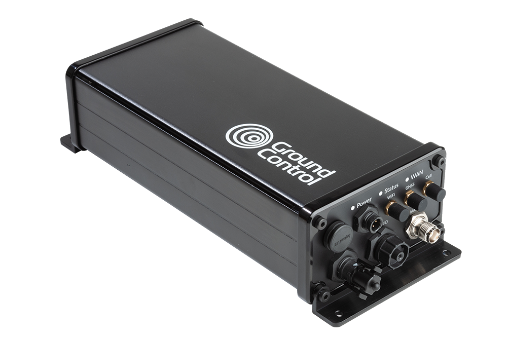
Thus, securing a remote site becomes smarter and more cost effective. Choose from a very wide range of cameras, audio equipment, motion detectors etc., then plug them in to the RockREMOTE Rugged. The onboard Videosoft technology will compress the data so it can be sent cost-effectively over the Iridium Certus 100 network, in real-time, to your remote monitoring center.
A Smarter Approach to Remote Security
Protecting remote infrastructure has never been more critical – or more challenging. While traditional security measures struggle to balance cost and coverage, the combination of low-bit rate video, real time image enhancement, and power efficient satellite connectivity presents a game changing solution.
With RockREMOTE Rugged and Videosoft’s technology, organizations can deploy surveillance systems that are reliable, cost effective, and optimized for remote environments. Whether safeguarding critical national infrastructure or protecting high value assets, this technology ensures security teams have the visibility they need, when they need it most.
Smarter Security for Remote Infrastructure
Protect your critical sites with real-time video surveillance over satellite. Our RockREMOTE Rugged, combined with Videosoft’s low-bandwidth streaming, delivers cost-effective, 24/7 monitoring, even in the most challenging locations.
Complete the form, or email hello@groundcontrol.com to learn more. We’ll reply to your inquiry within one working day.
The Role of RockFLEET in Securing Undersea Cables
Undersea internet cables are essential for global communications and economic security. The entire global network of cables is more than half a million miles long and comprised of more than 200 independent but interconnected systems. These cables span vast distances, connecting continents and enabling everything from international internet services to military communications. But with increasing geopolitical tensions and the growing importance of digital infrastructure, the threat to these cables has risen on the international agenda.
The strategic importance of undersea cables, which carry 99% of international telecommunications, makes them attractive – and vulnerable – targets.
In January 2025, the Royal Navy closely monitored the Russian vessel Yantar, officially an ocean research ship but considered a spy ship, as it entered UK waters and mapped underwater infrastructure.
Additionally, a NATO flotilla, including ships from the Netherlands, Germany, and France, assembled off Estonia to protect undersea cables in the Baltic Sea from potential sabotage, primarily by Russia.
Guard and patrol vessels play a pivotal role in deterring and responding to potential threats, ensuring the integrity of essential communication networks.
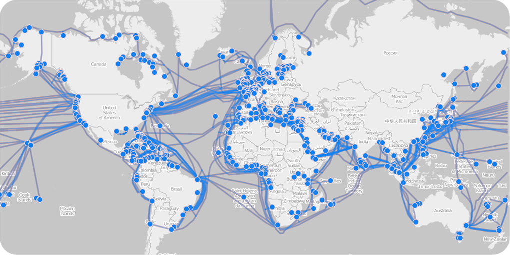
Data from the TeleGeography Submarine Cable Map shows that damage to undersea cables is a common occurrence. According to a report by the International Cable Protection Committee (ICPC), around 300 cable breaks are reported every year. Most of these are accidental, caused by fishing trawlers, ships’ anchors, or natural events like earthquakes. However, the risk of deliberate attacks or sabotage by state or non-state actors is also increasing.
The potential for geopolitical tensions to spill into the maritime domain has been highlighted in various reports. For instance, the United States Department of Defense (DoD) has raised concerns about the vulnerability of critical undersea infrastructure to foreign adversaries. This type of attack can have devastating effects on global data flow, cybersecurity, and national security.
Internet traffic, military transmissions and financial transactions all depend upon submarine cables, so any disruption can cause significant economic damage, loss of access to critical services, and widespread instability in communication.

The Role of RockFLEET in Securing Submarine Cables
Guard boats are increasingly deployed as vital protectors of undersea cabling infrastructure. These guard boats, often repurposed fishing vessels, act as sentinels over subsea cables, ensuring their security by warning nearby vessels to keep a safe distance.
Tracking guard boats efficiently in remote and challenging maritime environments requires an advanced tracking solution. RockFLEET is a compact, robust, and highly reliable tracking device designed specifically for use in harsh maritime conditions. It operates through satellite-based communication via the global Iridium network, ensuring seamless tracking of guard boats even in areas with no cellular coverage, anywhere in the world.
This capability is essential as guard boats often patrol vast stretches of ocean far from terrestrial networks. With RockFLEET, maritime authorities and operational teams can monitor the precise location of each guard boat, ensuring the vessels are where they need to be to protect the cables effectively.
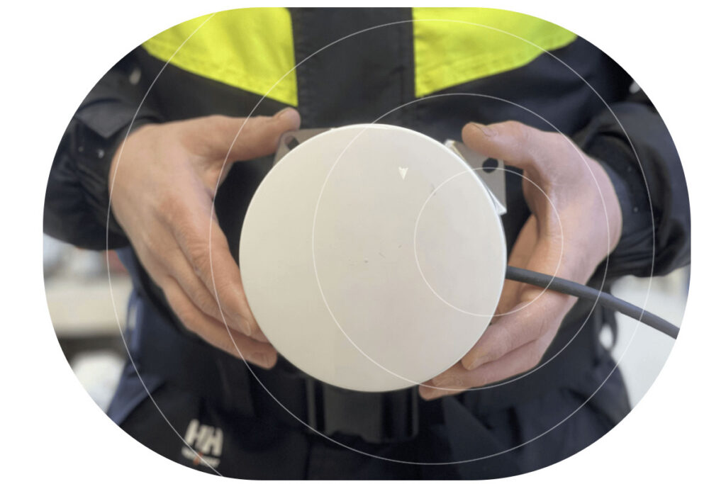
Three Ways RockFLEET Supports Guard and Patrol Vessels

Real Time Positional Data
One of the key features of RockFLEET is its ability to provide real-time positional data, which allows maritime coordinators to track the movement of guard boats and assess their effectiveness in securing undersea cables. If a guard boat drifts away from its designated patrol zone, RockFLEET alerts the operational team, enabling quick corrective action. This constant monitoring ensures that no section of the subsea cable remains unprotected due to navigational drift or unforeseen circumstances.

Estimated Arrival Times
Another critical function of RockFLEET is providing estimated arrival times (ETA) for guard boats. When repositioning guard boats due to shifting threats, adverse weather conditions, or maintenance schedules, knowing the vessel’s precise ETA is crucial. RockFLEET transmits accurate ETA data, allowing for better planning and coordination. This information helps ensure that there are no gaps in cable coverage and that another vessel is available to take over if one needs to leave its position.

Enhanced Vessel Safety
Safety is also a significant concern for guard boat crews. Since these vessels often operate in remote and sometimes hazardous conditions, having a reliable tracking system ensures that their locations are known at all times. In case of an emergency, RockFLEET provides real-time location updates, enabling rapid response and assistance from support teams. This enhances the overall security of both the vessels and the critical cabling infrastructure they protect.
The Future of Undersea Cable Security
As the threats to undersea cables continue to evolve, governments, cable operators, and multinational organizations are increasingly prioritizing the security of this infrastructure, given its direct impact on everything from national security to economic stability. New initiatives like the UK’s ‘Nordic Warden‘, which aims to track the movement of vessels suspected of malicious damage, should enable faster response times.
Guard boats and patrol vessels in their preventative capacity will remain an essential part of this response. RockFLEET plays an essential role in ensuring the effective tracking and monitoring of guard boats tasked with the protection of undersea cables. By providing accurate location tracking, monitoring movement, estimating arrival times, and enhancing overall vessel safety, RockFLEET helps to safeguard the vital cable infrastructure that underpins global communication and commerce.
Protect Critical Infrastructure with Smarter Maritime Monitoring
As threats to undersea cables and maritime assets increase, guard and patrol vessels play a crucial role in safeguarding global communications. Our advanced satellite tracking and monitoring solutions ensure these vessels operate with maximum efficiency, real-time situational awareness, and enhanced safety – no matter how remote the mission.
Equip your fleet with the technology to stay ahead of emerging threats. Contact us today to learn how our solutions support maritime security operations. Complete the form, or email hello@groundcontrol.com.