Topic: Security & Defense
How Zero-Transmit Devices Are Changing Military Field Communications
In high risk military environments, reliable communication is critical, but it can also create risk. Every transmission from a radio, satellite phone, or mobile device generates a signal. In stable environments, those signals enable coordination and operational effectiveness. In contested or electronically monitored settings, they can become liabilities, exposing teams to detection, interception, or exploitation.
For military communications teams, special operations planners, and defense capability leads, this creates a difficult operational challenge: how to deliver critical information to personnel in the field without increasing their electronic signature.
Zero-transmit devices offer a different approach. By allowing personnel to receive messages without sending anything back, they provide a discreet communication channel for scenarios where transmitting from the field may compromise operational security.
The Hidden Risk in Traditional Communications
Most conventional communication systems are built around two way exchange. Radios, cellular devices, and satellite communications all rely on outbound signals to send information, establish connectivity, or acknowledge receipt.
For decades, this has been the foundation of operational coordination. But the same characteristics that make these systems useful can also create vulnerabilities. Whether it’s a handheld radio checking into a network, a satellite phone establishing a connection, or a mobile device searching for coverage, each transmission emits radio frequency energy that may be detected and analyzed.
For covert military units and special operations teams, this can compromise mission integrity and personnel safety. A single transmission may be enough to indicate that a unit is present in a contested area. Even encrypted communications, while protecting message content, can still expose metadata such as signal origin, timing, frequency, and transmission behavior, all of which may provide useful intelligence to an adversary.
Operating Where Transmissions Create Tactical Risk
Military and defense organizations increasingly plan for operations in denied, degraded, and disrupted environments. In these settings, the issue isn’t just whether a message can get through, but whether sending or acknowledging a message creates additional risk.
For covert teams, forward-deployed personnel, special operations units, and others working in surveillance heavy environments, this creates a difficult trade-off. Teams need to receive updates, alerts, or instructions, but transmitting from the field may expose their position, pattern of movement, or operational presence.
Zero-transmit communication changes that model. By removing the need for the endpoint device to transmit, acknowledge, or handshake with a network, critical information can be delivered without creating an RF footprint from the user’s location.
This doesn’t replace two way communications in every scenario; rather, it provides an additional channel for situations where receiving information safely is more important than maintaining a continuous two way link.
Receive-Only Satellite Messaging with No Endpoint RF Footprint
RockSTAR Burst is a receive-only satellite messaging device designed for military and defense teams that need to receive critical information without transmitting from the field.
Messages are sent via the Iridium Burst® service and delivered directly to authorized devices, where they can be received and decrypted without any outbound communication from the device itself. There’s no handshake, no acknowledgement, and no return signal from the endpoint.
This creates a secure one way channel for delivering mission updates, alerts, or instructions to personnel operating in covert, contested, or surveillance-heavy environments.
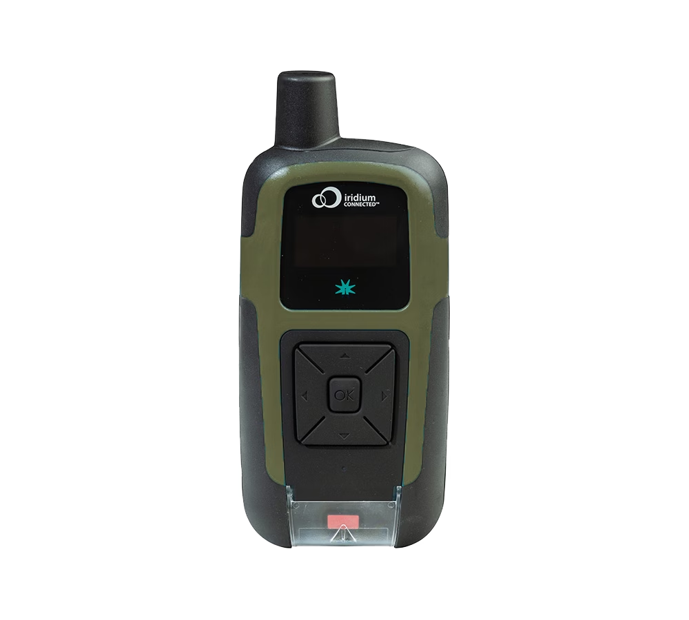
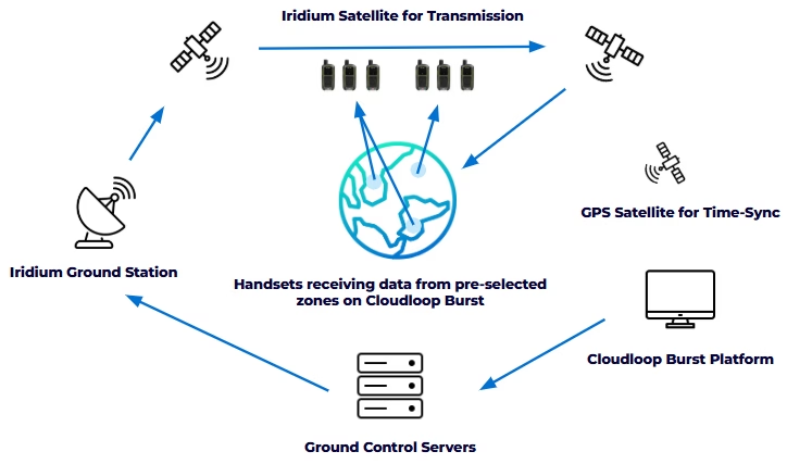
Because RockSTAR Burst doesn’t transmit, it creates no RF footprint at the user’s location. This significantly reduces the risk of detection, geolocation, or targeting based on endpoint transmissions, while still allowing command teams to reach personnel in the field.
Messages can be sent to individual users, designated operational groups, or entire fleets and convoys, enabling rapid dissemination of time sensitive information across dispersed teams.
Leveraging Iridium’s Low Earth Orbit satellite network, RockSTAR Burst provides global reach and near-real time message delivery, typically in fewer than 20 seconds.
Although designed primarily for outdoor use, Iridium Burst® transmissions can penetrate some buildings, partial obstructions, and adverse weather conditions, helping maintain message delivery in challenging field environments.
From Technology to Tactical Advantage
The value of RockSTAR Burst becomes clearest when mapped to military operational needs. Command teams can push intelligence, alerts, or mission updates to personnel in the field without requiring those personnel to check in, acknowledge receipt, or expose their position through outbound RF activity.
This is particularly valuable when teams need to maintain a low electronic signature but still remain informed. A change in tasking, threat warning, movement instruction, extraction update, or short mission critical alert can be delivered without asking the endpoint device to transmit.
RockSTAR Burst isn’t intended to replace two way tactical communications. Voice, data, and command and control systems remain essential in many operational scenarios. Instead, it adds a discreet one way channel that can sit alongside existing communications, giving commanders another option when transmitting from the field is undesirable or unsafe.
Used in this way, RockSTAR Burst supports a layered communications strategy: two way systems where interaction is necessary, and receive-only satellite messaging where the priority is to deliver information without increasing the user’s RF signature.
The Case for Zero-Transmit Devices in Modern Military Operations
As military operating environments become more complex, contested, and electronically monitored, the assumptions behind traditional field communications are being challenged.
More connectivity is not always better. In some scenarios, transmitting from the field can increase risk by creating an RF signature that may reveal a team’s presence, activity, or location.
RockSTAR Burst reflects a different approach. By combining global satellite reach, encrypted message delivery, targeted broadcast capability, and zero-transmit operation at the endpoint, it gives military and defense organizations a discreet way to keep personnel informed without increasing their RF footprint.
It doesn’t replace two way tactical communications, but it does add an important option for situations where the safest communication is one that does not require the field user to respond.
Achieve Zero RF Footprint for Operational Advantage
Our satellite-enabled RockSTAR Burst solution offers robust communication and connectivity for defense applications and more. If you need a zero-transmission, secure and controlled communication solution in hostile or degraded environments, we can help.
Partner with us to explore all our satellite solutions that safeguard your military operations anywhere in the world. Just complete the form, or email hello@groundcontrol.com and we’ll reply within one working day.
Emergency Response Has Outgrown “Good Coverage”
In 2024, a nationwide AT&T outage disrupted emergency communications, and affected access to 911 services in the US. More than 25,000 attempts to reach 911 were blocked, and service was disrupted for more than 125 million devices. At the same time, multi-state 911 outages continue to occur. Increasingly, for emergency response, the issue is not just whether networks are available, but how they perform when conditions change.
For the teams responding to calls or disaster events, working with real time video, data, and mobile command environments as part of day to day operations brings a different kind of pressure. Coverage alone is no longer enough; what matters is whether the connectivity remains usable under pressure, across networks, locations, and conditions.
Operating across multiple networks such as FirstNet or commercial LTE, traditional satellite, and increasingly LEO services such as Starlink introduces new complexity and inefficiency. Those issues now need to be addressed if emergency teams are to stay reliably connected.
Why Performance Matters as Much as Coverage
You can have a strong signal and still struggle to get the performance you need. During major incidents, networks rarely fail completely; congestion builds, latency increases, packets drop, and throughput becomes inconsistent. Even with signal present, performance becomes unpredictable. The FCC has highlighted how disasters expose these types of resilience gaps.
At the same time, operational demands are increasing. With the transition to Next Generation 911 (NG911), video, images, and real time data are becoming part of standard workflows. If communication links drop, the result is video feeds that struggle to stay stable; slower or unreliable access to CAD and GIS systems; and inconsistent performance between vehicles, command posts, and field teams.
Multiple networks: LTE, 5G, LEO satellite, and legacy GEO systems, are often all in play, whether by design or through gradual adoption. And this reflects a broader shift. Managing multiple technologies and networks is now part of the operational reality. So the challenge isn’t whether there is enough connectivity. It’s how well those networks work together when it matters.
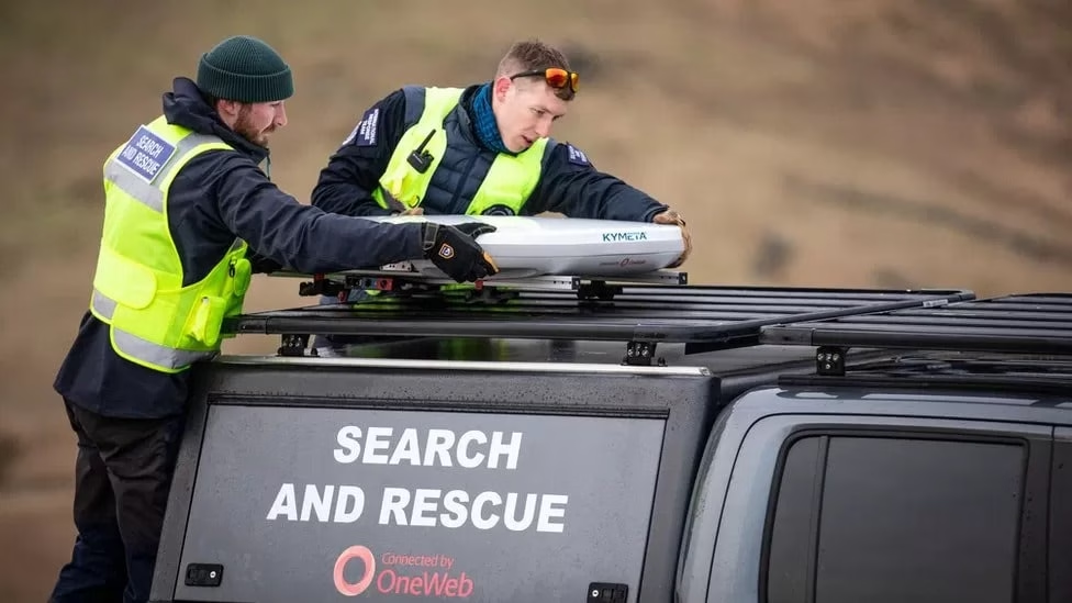
Why Failover Based Connectivity Can Fall Short
Many setups still rely on failover. One network is primary, and others act as backup. It works when a network drops completely. It doesn’t work as well when performance degrades. In most incidents, what you actually see is:
- Increasing latency
- Packet loss
- Reduced throughput
- Unstable performance.
But failover only responds once a threshold is crossed, and by then, performance has already dropped below what applications need. There’s a delay between degradation and recovery, and during that time, services like video, VoIP, and real time data are disrupted.
It also means you’re not making full use of the networks available to you. Failover reacts to failure. It doesn’t actively optimize performance, which is the key.
Adding Starlink or Multiple Networks Doesn’t Solve the Problem Alone
You may already have addressed coverage gaps by adding services like Starlink. That improves reach and bandwidth, especially in remote or hard to cover areas. But adding more networks introduces its own complexity: multiple providers and contracts, different data plans and cost models, networks with very different performance characteristics.
Without coordination, those networks sit alongside each other, rather than working together. This often leads to manual switching between connections; static rules that don’t reflect real time conditions; uneven data usage across devices, and limited visibility into what’s actually happening across the whole response setup. So while you have more connectivity available, it’s not always being used in the most effective way.
What Multi-Network Connectivity Should Look Like in Practice
The shift here is not about adding more. It’s about changing how you use existing services, managing continuous, multi-network connectivity. In practice, that means multiple connections active at the same time and traffic routed dynamically based on real time conditions.
Instead of waiting for a connection to fail, the system adapts continuously, using the most appropriate network path at any given moment, based on latency, packet loss, and bandwidth. This is the principle behind Dejero Smart Blending technology, which routes traffic across multiple connections in real time rather than switching between them.
The outcome is more consistent performance, with fewer connectivity interruptions and less need for manual intervention. Making reliability less about network uptime, and more about service usability. It supports the wider move toward IP-based emergency communications, where video, data, and voice increasingly need to work across different networks and locations. And supports what matters most: not the status of one link, which is still important, but whether the overall service remains usable and effective at all times, providing true resiliency.
How Ground Control Multipath Optimizes Connectivity
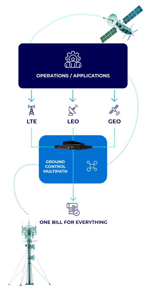
Ground Control Multipath is designed to help you bring all of your networks together into something that works as a whole. It builds on what you already have: your existing LTE and 5G connectivity, your current satellite services, including LEO and GEO, and additional capacity where it makes sense.
Those connections are then managed through a routing layer that continuously selects the most appropriate path based on real time conditions. From your perspective, that means less time managing networks individually, more consistent performance across devices and locations, shared data usage instead of isolated plans, and reduced reliance on manual failover. The goal is not to replace your existing setup; it’s to make it work more effectively as a system.
The Multipath and Dejero TITAN fit
Ground Control Multipath provides the overall solution. It’s designed around your operation, and brings your available networks together so they work more effectively as one. Dejero TITAN is the device that brings your connectivity together, helping to manage multiple live connections, ensuring a seamless switch between networks, or combining them where needed, making bandwidth usage efficient and reducing your costs. In other words, Multipath is the overall service approach; TITAN is the enabling technology that can deliver it.
What This Means for Your Operations
When your networks work together properly, you see more consistent performance across video and data services, even when individual networks degrade. You make better use of the connectivity you’re already paying for, with data shared and optimized across the deployment. And you gain confidence in how your systems will behave during an incident, not because networks don’t fail, but because your setup adapts when they do.
Most agencies now operate across multiple networks, whether intentionally or not. The next step is making those networks work together. So this is not about adding more connectivity, it is about improving how it’s used. Good coverage is no longer enough. What matters is consistent, usable performance when it matters most.
Review Your Current Connectivity Setup
If you want to make better use of the connectivity you already have, we can help. Our team offers a no cost review of your current setup to identify where performance can be improved and costs reduced. It’s a practical conversation based on how you operate today.
Complete the form or email us at hello@groundcontrol.com and we’ll get back to you within one working day.
How RockBLOCK Pro APNT Ensures Resilient Tracking For Military In GPS-Denied Environments
In today’s digital battlespace, Assured Positioning, Navigation, and Timing (APNT) is more than a utility; it’s the invisible infrastructure behind every mission. As adversaries grow more technologically capable, the reliability of conventional GPS-based systems is increasingly at risk. Electronic warfare tactics, such as GPS jamming and spoofing, can create blind spots and disrupt mission-critical functions. A resilient solution is needed, designed to maintain accurate, trusted location and timing data even when GPS is spoofed, faked or denied.
From satellite tracking and coordinated troop movements to secure communications and synchronized operations, reliable PNT enables modern militaries to act with speed, accuracy, and global reach.
Encapsulated within Ground Control’s RockBLOCK Pro APNT device, reliable, global, and jamming-resilient positional awareness can be achieved by military personnel in hostile, GPS-contested environments. This blog examines the modern-day need for reliable location assurance beyond GPS for military effectiveness.
Why PNT Is Critical for Military Success
PNT systems, chiefly GPS and GNSS, are foundational to all branches of modern defense, forming the backbone of situational awareness, coordination, and operational execution. Real-time, accurate positioning provides the precise geolocation of military forces, vehicles, and critical assets, allowing commanders to make informed decisions in real time.
Navigation enables units to move accurately and more safely across land, air, or sea to ensure missions stay on course and with optimum execution. Timing is crucial for synchronizing a wide range of activities, from encrypted communications and sensor network operations to financial transactions and time-sensitive Intelligence, Surveillance, and Reconnaissance (ISR) data processing.
Numerous military functions rely on accurate and uninterrupted PNT, including Blue Force Tracking (BFT) – a system that utilizes GPS technology to track the location of friendly forces, cybersecurity command and control (C2) systems, precision time-stamping for ISR platforms, and the coordination of multi-domain operations. Without reliable PNT systems and GPS/GNSS, these operations can quickly become disjointed, inefficient, and vulnerable, jeopardizing both mission success and the safety of military personnel.
The GPS Vulnerability Problem
While GPS remains the backbone of PNT, it is vulnerable. GPS signals are low power, unencrypted and easy to jam, spoof, or fake with relatively inexpensive equipment.
In hostile environments, such as near-peer conflict zones and congested battlespaces, adversaries often target GPS to disrupt coordination, conceal positions, or disable military tracking systems.
Even in peacetime or humanitarian missions, natural obstructions like urban canyons, mountains, and indoor locations can degrade signal reception.
APNT is different. A key component of APNT is the use of one-way, secured signals transmitted from Low Earth Orbit (LEO) satellites. These signals are significantly stronger than traditional GPS – up to 1,000 times more powerful in some systems – making them far more resistant to jamming and interference. When integrated into a layered APNT architecture, these satellite-based signals help ensure trusted timing and location data even in GPS-denied environments.
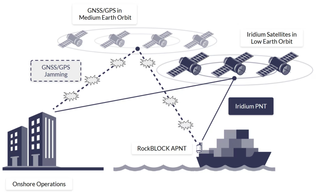
It’s worth noting that APNT is designed to complement, not replace, GPS and GNSS-based systems. PNT and APNT signals are compatible with some of the same hardware that supports GPS, allowing for seamless integration into existing navigation solutions. This makes APNT an ideal component of a layered satellite-tracking system strategy, enhancing resilience,
security, and continuity of positioning and timing services in critical military applications.
RockBLOCK Pro APNT For Assured PNT Beyond GPS
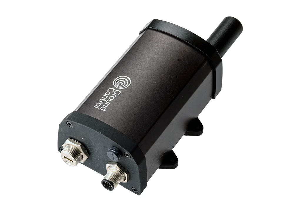
For unmanned or unattended deployments, RockBLOCK Pro APNT offers resilient satellite time and location capability in a compact, ruggedized form factor. Designed for integration into autonomous systems, remote infrastructure, and stationary platforms, it ensures critical operations remain synchronised and secure, even in heavily contested GNSS environments.
With the ability to transmit APNT data, as well as text-based messages and telemetry data (up to 100 KB per transmission), RockBLOCK Pro APNT also serves as an effective failover communication channel when primary systems are compromised or unavailable. Its versatility and resilience make it a valuable asset for mission-critical operations where assured connectivity is essential.
A Layered PNT Strategy for Modern Defense
As militaries shift toward Multi-Domain Operations (MDO), the security and reliability of PNT and GPS are strategic priorities. Relying solely on GPS is no longer acceptable. The U.S. Department of Defense and allied nations are actively pursuing Assured PNT (APNT) initiatives, combining multiple sources to create a layered, fault-tolerant system. RockBLOCK Pro APNT is a key enabler of this strategy in providing a complementary, GPS-independent signal that strengthens the PNT architecture.
Gain The Advantage With Mission Ready Satellite IoT
For over 20 years, we’ve partnered with defense forces, government agencies, and security contractors to develop a number of military-grade devices, harnessing APNT.
Learn how this technology can give you the tactical advantage in your mission-critical operations.
Can we help?
Our satellite-enabled RockBLOCK Pro APNT solutions offer robust positional data connectivity when GPS fails, for defense applications and more. Partner with us to explore all our satellite solutions that safeguard your military operations anywhere in the world.
Complete the form or email hello@groundcontrol.com and we’ll get back to you within one working day.
Securing Remote Facilities: Cost-Effective Video Streaming Over Satellite
Critical national infrastructure is an increasingly attractive target for state-sponsored activists and extremist groups. Remote infrastructure – everything from outstations to wind farms, wellheads to pump stations, haul roads to transport hubs – is particularly vulnerable because of the challenges in creating robust security solutions in these locations. This blog post seeks to present a solution to these challenges, but first, let’s dig into the issues in more detail.
The Growing Threat to Remote Infrastructure
The vulnerability of utility and energy production sites to cyber attacks is well documented; from 2023 to 2024, US-based utilities experienced a 70% surge (Reuters). Less frequently reported is that physical attacks on infrastructure also rose 73% from 2020 to 2022 (Axios), with incidents including a gunfire attack on two substations in North Carolina, USA, which left 45,000 customers without power.
In Nigeria, in early 2024, the power sector faced escalating vandalism of high-voltage transmission infrastructure; incidents tripled during a 15 week span, including explosives being used to destroy transmission line towers (The Electricity Hub).
In Australia, thefts from unmanned construction sites reached a 10 year high in September 2024, with a 22% increase in theft-related offences during the same period (Herald Sun). And in the UK, the cost of theft of agricultural equipment escalated to an estimated £52.8 million in 2023, a 4.3% increase from the previous year (NFU).
In addition to a growth in isolated incidents is the underlying strategy to destabilize infrastructure, driven by alliances between state actors like Russia, and organized criminal gangs. These activities include sabotage, arson and cyber attacks, aimed at undermining critical infrastructure (The Guardian).
Attacks are increasing: companies, governments and individuals with hard-to-protect, high value assets are fighting a rising tide of criminal activity.
The Challenge of Traditional Security Measures
The infrastructure we’re describing here – transport, energy production, heavy industry – operates across vast areas, making it impractical to station physical security at every location which could be a target. Assuming a single security guard is stationed at a site for 8 hours a day, 7 days a week; the cost of an unarmed guard would be c. $3,600, and c. $6,000 for an armed guard (Deep Sentinel).
Statistically, most theft takes place after dark, and are more frequent in winter; long weekends and holidays are also attractive (Site Watch Group). Thus, 24 hour cover would be prudent at least over weekends, adding substantially to the cost.
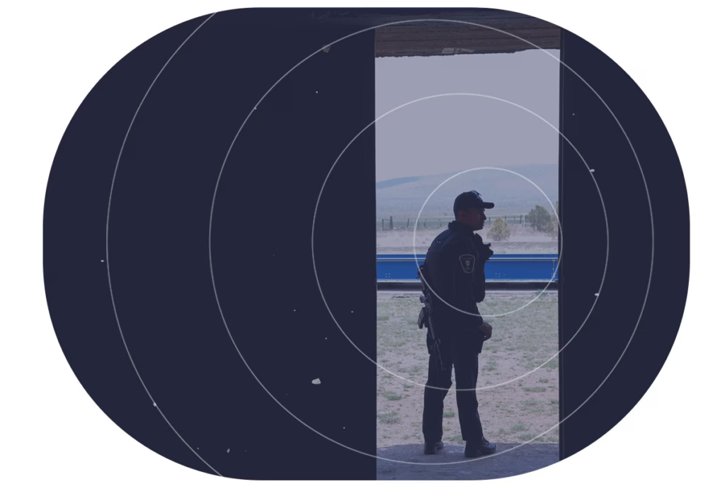
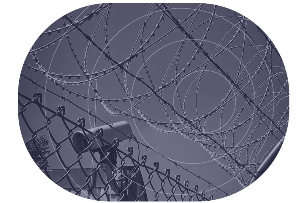
Another option is to use fences coupled with cameras and sensors to detect intruders, and provide real-time alerts to a remote monitoring center. The security personnel there can monitor multiple sites remotely, reducing on-site staffing costs. Upon receiving an alert, they can choose to dispatch security personnel to the affected site, alert local law enforcement or trigger some localized deterrent such as alarms, voice sirens or lights.
The pros of this approach is that it’s lower cost, delivers 24/7 surveillance, and can be rapidly and cost-effectively scaled up. However, it requires a reliable, secure and cost-effective means of transmitting the video stream (and potentially also audio and movement sensors). Within cellular connectivity this is pretty straightforward, but in a remote site, satellite is often the only viable option.
Finding the Right Satellite Connection for Remote Surveillance
Satellite connectivity isn’t a homogenous blob. There are multiple radio frequencies used, and the type used strongly influences the form factor of the satellite transceiver. For example, people seeking broadband internet access over satellite – Starlink, Hughesnet, OneWeb etc. – will be using Ka-band, as this supports higher data rates, and there’s plenty of bandwidth available (i.e. limited congestion issues).
The drawback of Ka-band is that it is both susceptible to rain fade (signal loss in bad weather), and the antenna size is large, power hungry, and needs to be precisely positioned. This is not an issue for home installation, but in a remote outstation, there may be mountains, trees or the outstation itself preventing the ideal siting of the antenna.
The fix to this – phased array antennas which electronically steer themselves to optimal positions – has the drawback of consuming significantly more power. Indeed, it would be challenging to power any Ka-band antenna via a solar-powered battery, particularly for the sorts of continuous operation that a surveillance system requires.
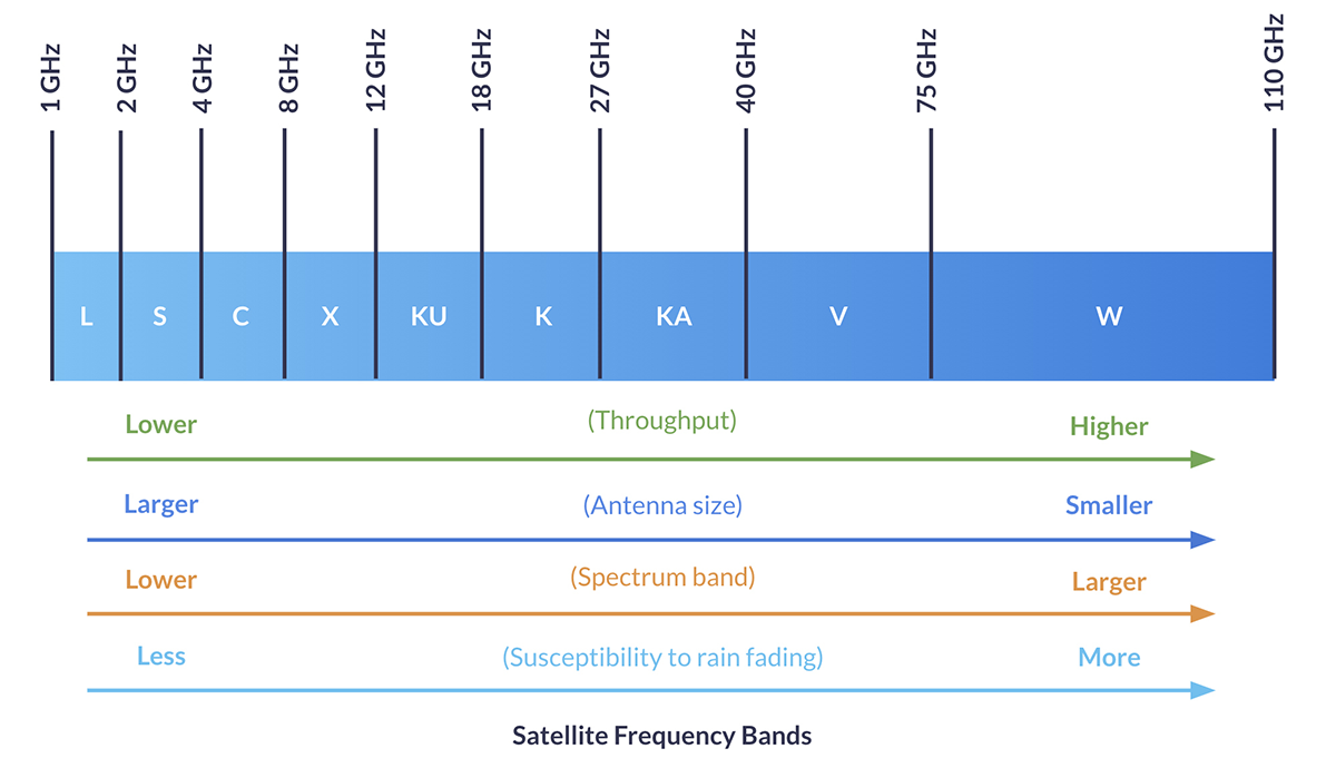
Satellite services that operate in the L-band spectrum, on the other hand, have very small antennae, and low power requirements compared to Ka-band. Iridium and Viasat (previously Inmarsat) utilize L-band for data transmission, which makes them perfect for IoT applications where the data requirements are lower, and a small, discreet, battery-operable antenna is an asset – sometimes a necessity. L-band transmissions are unaffected by weather conditions, and very hard to intercept, making them ideal, in principle, for mission critical applications like remote surveillance.
However, video streaming from remote, potentially unpowered locations, is an awkward fit for both Ka- and L-band. It’s a high bandwidth transmission, but as discussed, high bandwidth satellite services are power hungry, easy to identify (and therefore to put out of action), and difficult to position. L-band fixes all those challenges, but to send video over L-band, which is a much more constrained frequency band, is very expensive.
Until now…
A Breakthrough in Remote Video Surveillance
There have been two key developments that have made it possible to send video over an L-band satellite connection cost-effectively. The first is the advent of low bandwidth video. Our partner Videosoft has developed video compression and transmission technology that delivers real-time, low-bit rate video. They’ve coupled this with an image enhancement feature that lets users specify and download high-res pixels from an area of interest in a scene.
Videosoft’s technology works with most off-the-shelf hardware, including video cameras, CCTV, audio microphones, GPS tracking antennae, and other I/O devices.
The second development is the availability of midband (higher throughput) transmissions in the L-band spectrum; notably Viasat’s IoT Pro service, and Iridium’s Certus 100 service. The latter is particularly well suited to remote surveillance because the satellites are in Low Earth Orbit, which means the latency is very low – critical when you need real-time alerts if a facility has been penetrated, or an asset is moving outside of schedule.
Additionally, Iridium has a cross-linked network of 66 satellites, which means you don’t need to point your antenna at the satellite; if your facility or asset is in a wooded or mountainous area, this could be a critical advantage.
Watch our webinar recording to see a demo of Videosoft.
RockREMOTE Rugged: A Simple and Secure Solution
There are a number of Iridium Certus 100 transceivers available – we design and build several ourselves – but the one we’ve focused on for remote surveillance is the RockREMOTE Rugged. This is because, most importantly, it has the compute power to natively run the Videosoft program without needing any additional hardware. It’s simply a matter of plugging your camera into the RockREMOTE, and working through some simple config steps to get started.
RockREMOTE Rugged is very easy to install; it’s IP67 rated, and designed for permanent outdoor installation in harsh environments. Its omni-directional passive antenna is small and discreet, making it harder to identify by bad actors.
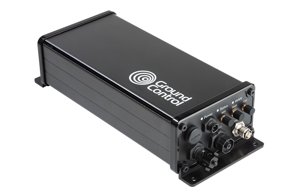
Thus, securing a remote site becomes smarter and more cost effective. Choose from a very wide range of cameras, audio equipment, motion detectors etc., then plug them in to the RockREMOTE Rugged. The onboard Videosoft technology will compress the data so it can be sent cost-effectively over the Iridium Certus 100 network, in real-time, to your remote monitoring center.
A Smarter Approach to Remote Security
Protecting remote infrastructure has never been more critical – or more challenging. While traditional security measures struggle to balance cost and coverage, the combination of low-bit rate video, real time image enhancement, and power efficient satellite connectivity presents a game changing solution.
With RockREMOTE Rugged and Videosoft’s technology, organizations can deploy surveillance systems that are reliable, cost effective, and optimized for remote environments. Whether safeguarding critical national infrastructure or protecting high value assets, this technology ensures security teams have the visibility they need, when they need it most.
Smarter Security for Remote Infrastructure
Protect your critical sites with real-time video surveillance over satellite. Our RockREMOTE Rugged, combined with Videosoft’s low-bandwidth streaming, delivers cost-effective, 24/7 monitoring, even in the most challenging locations.
Complete the form, or email hello@groundcontrol.com to learn more. We’ll reply to your inquiry within one working day.
The Role of RockFLEET in Securing Undersea Cables
Undersea internet cables are essential for global communications and economic security. The entire global network of cables is more than half a million miles long and comprised of more than 200 independent but interconnected systems. These cables span vast distances, connecting continents and enabling everything from international internet services to military communications. But with increasing geopolitical tensions and the growing importance of digital infrastructure, the threat to these cables has risen on the international agenda.
The strategic importance of undersea cables, which carry 99% of international telecommunications, makes them attractive – and vulnerable – targets.
In January 2025, the Royal Navy closely monitored the Russian vessel Yantar, officially an ocean research ship but considered a spy ship, as it entered UK waters and mapped underwater infrastructure.
Additionally, a NATO flotilla, including ships from the Netherlands, Germany, and France, assembled off Estonia to protect undersea cables in the Baltic Sea from potential sabotage, primarily by Russia.
Guard and patrol vessels play a pivotal role in deterring and responding to potential threats, ensuring the integrity of essential communication networks.
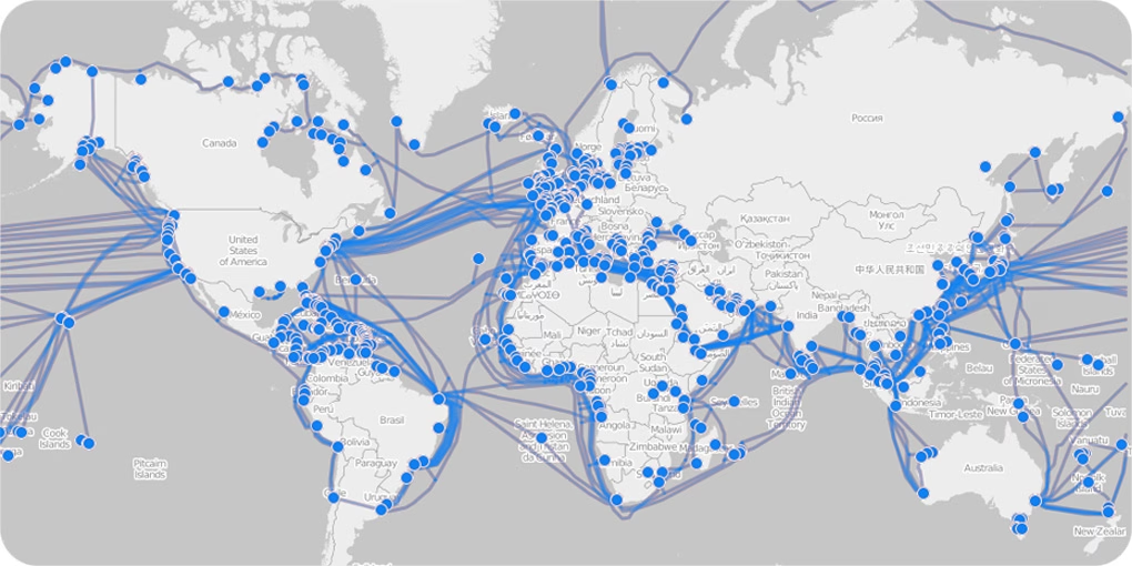
Data from the TeleGeography Submarine Cable Map shows that damage to undersea cables is a common occurrence. According to a report by the International Cable Protection Committee (ICPC), around 300 cable breaks are reported every year. Most of these are accidental, caused by fishing trawlers, ships’ anchors, or natural events like earthquakes. However, the risk of deliberate attacks or sabotage by state or non-state actors is also increasing.
The potential for geopolitical tensions to spill into the maritime domain has been highlighted in various reports. For instance, the United States Department of Defense (DoD) has raised concerns about the vulnerability of critical undersea infrastructure to foreign adversaries. This type of attack can have devastating effects on global data flow, cybersecurity, and national security.
Internet traffic, military transmissions and financial transactions all depend upon submarine cables, so any disruption can cause significant economic damage, loss of access to critical services, and widespread instability in communication.
The Role of RockFLEET in Securing Submarine Cables
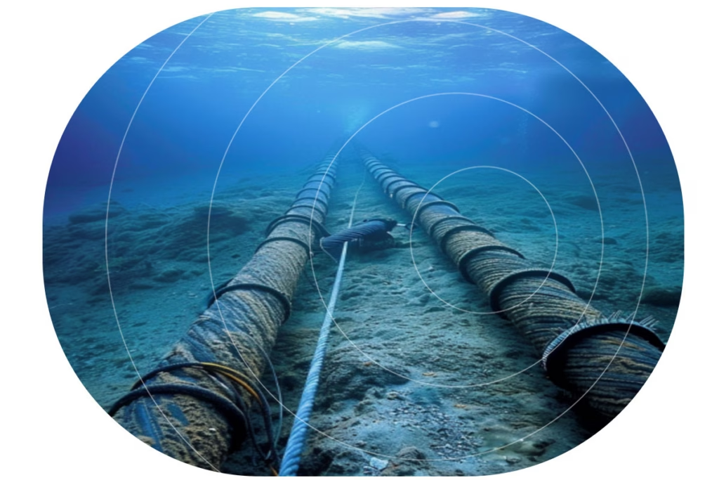
Guard boats are increasingly deployed as vital protectors of undersea cabling infrastructure. These guard boats, often repurposed fishing vessels, act as sentinels over subsea cables, ensuring their security by warning nearby vessels to keep a safe distance.
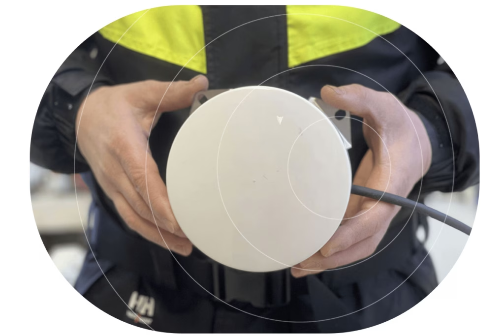
Tracking guard boats efficiently in remote and challenging maritime environments requires an advanced tracking solution. RockFLEET is a compact, robust, and highly reliable tracking device designed specifically for use in harsh maritime conditions. It operates through satellite-based communication via the global Iridium network, ensuring seamless tracking of guard boats even in areas with no cellular coverage, anywhere in the world.
This capability is essential as guard boats often patrol vast stretches of ocean far from terrestrial networks. With RockFLEET, maritime authorities and operational teams can monitor the precise location of each guard boat, ensuring the vessels are where they need to be to protect the cables effectively.
Three Ways RockFLEET Supports Guard and Patrol Vessels

Real Time Positional Data
One of the key features of RockFLEET is its ability to provide real-time positional data, which allows maritime coordinators to track the movement of guard boats and assess their effectiveness in securing undersea cables. If a guard boat drifts away from its designated patrol zone, RockFLEET alerts the operational team, enabling quick corrective action. This constant monitoring ensures that no section of the subsea cable remains unprotected due to navigational drift or unforeseen circumstances.

Estimated Arrival Times
Another critical function of RockFLEET is providing estimated arrival times (ETA) for guard boats. When repositioning guard boats due to shifting threats, adverse weather conditions, or maintenance schedules, knowing the vessel’s precise ETA is crucial. RockFLEET transmits accurate ETA data, allowing for better planning and coordination. This information helps ensure that there are no gaps in cable coverage and that another vessel is available to take over if one needs to leave its position.

Enhanced Vessel Safety
Safety is also a significant concern for guard boat crews. Since these vessels often operate in remote and sometimes hazardous conditions, having a reliable tracking system ensures that their locations are known at all times. In case of an emergency, RockFLEET provides real-time location updates, enabling rapid response and assistance from support teams. This enhances the overall security of both the vessels and the critical cabling infrastructure they protect.
The Future of Undersea Cable Security
As the threats to undersea cables continue to evolve, governments, cable operators, and multinational organizations are increasingly prioritizing the security of this infrastructure, given its direct impact on everything from national security to economic stability. New initiatives like the UK’s ‘Nordic Warden‘, which aims to track the movement of vessels suspected of malicious damage, should enable faster response times.
Guard boats and patrol vessels in their preventative capacity will remain an essential part of this response. RockFLEET plays an essential role in ensuring the effective tracking and monitoring of guard boats tasked with the protection of undersea cables. By providing accurate location tracking, monitoring movement, estimating arrival times, and enhancing overall vessel safety, RockFLEET helps to safeguard the vital cable infrastructure that underpins global communication and commerce.
Protect Critical Infrastructure with Smarter Maritime Monitoring
As threats to undersea cables and maritime assets increase, guard and patrol vessels play a crucial role in safeguarding global communications. Our advanced satellite tracking and monitoring solutions ensure these vessels operate with maximum efficiency, real-time situational awareness, and enhanced safety – no matter how remote the mission.
Equip your fleet with the technology to stay ahead of emerging threats. Contact us today to learn how our solutions support maritime security operations. Complete the form, or email hello@groundcontrol.com.
Drones in Modern Warfare: Enhancing UAV Capabilities with Satellite Connectivity
Drones, or Unmanned Aerial Vehicles (UAVs), have become an integral part of modern military operations. Initially developed for reconnaissance and surveillance, drones have evolved into versatile platforms capable of executing various missions, from intelligence gathering to precision strikes. However, the full potential of UAVs is realized when enhanced with satellite connectivity, removing the limitations of traditional line of sight or terrestrial based communication, and enabling real time communication and coordination across vast distances and hostile environments.
While satellite connectivity has enhanced UAV capabilities, the utilization of UAVs in warfare is nothing especially new, and has instead, evolved significantly over the past century. Early concepts of UAVs emerged during World War I, with the development of rudimentary unmanned aircraft such as the “Kettering Bug”, – a drone prototype designed purely for bombing missions. However, these early models were not widely operational.
It wasn’t until World War II that UAV technology saw further development, particularly with the creation of the German V-1 flying bomb – essentially an early form of a cruise missile. The Cold War era spurred advancements in UAVs, primarily for reconnaissance purposes and the U.S. developed drones like the Ryan Firebee, which were used for surveillance during the Vietnam War.
The 1990s marked a turning point in UAV usage, particularly during the Gulf War, when drones like the RQ-2 Pioneer provided critical intelligence. Then in the early 2000s, UAVs like the MQ-1 Predator and MQ-9 Reaper – American remotely piloted aircrafts – gained worldwide attention for their role in counterterrorism operations. Powered by global satellite connectivity, these drones could carry out targeted strikes with high precision, far out of the reach of cellular and telecommunication networks. Step forward into 2024, and the role of UAVs in modern warfare has only continued to advance.
As the roles of UAVs broaden from strike and EW to logistics and ISR, the conversation is increasingly about how they’re used to protect people and infrastructure. Alongside the well known offensive missions, we’re seeing rapid growth in defensive and humanitarian applications enabled by resilient satellite links. Let’s explore some of these key roles in more detail.
Surveillance and Reconnaissance
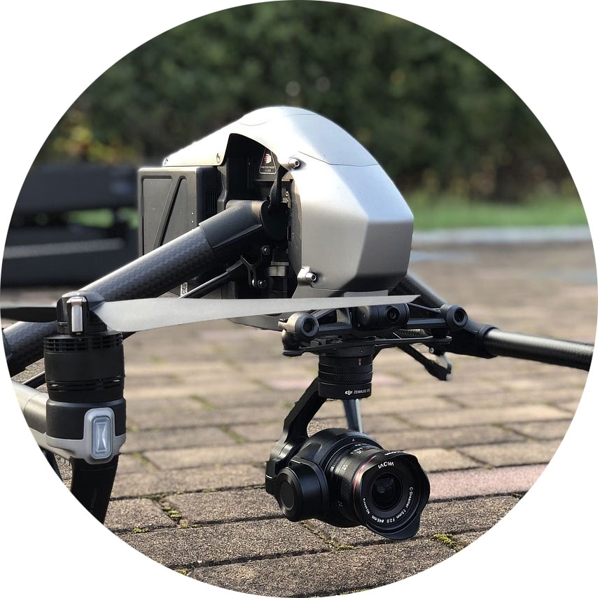
Drones are extensively used for Intelligence, Surveillance, and Reconnaissance (ISR) missions. UAVs have the ability to capture real time video and image data, which is transmitted back to command centers for analysis, without the need for soldiers to be physically present in hostile or rugged environments. The drones often operate at high altitudes, across multiple geographies.
Search and Rescue
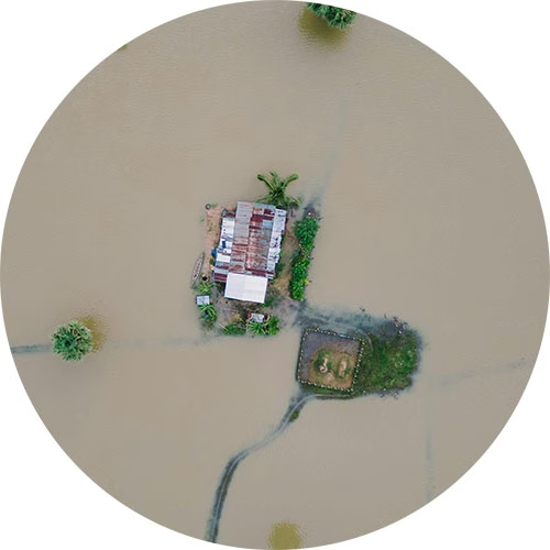
In post-conflict or disaster scenarios, UAVs can locate survivors and assess damage in areas too dangerous or inaccessible for physical teams. This can prevent further human loss and lead to the identification, location and administration of aid to ground-based defense teams. Drones have also been know to guide troops to safe areas, and away from enemy fire.
Aid and Supplies
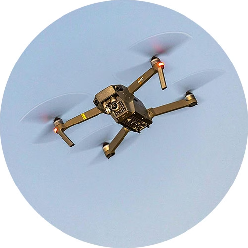
UAVs can be adapted for resupply missions in hard to reach areas and have been deployed to help soldiers on the battlefield to receive essential supplies like food, water, and medical equipment. This capability becomes especially crucial in situations where ground convoys may face delays due to hostile terrain, enemy activity, or other logistical challenges.
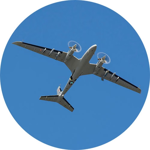
Precision Strikes
UAVs equipped with precision-guided munitions allow military forces to carry out highly targeted strikes with minimal collateral damage. Their precision has made them instrumental in counter-terrorism operations and eliminating high-value targets while protecting civilian lives. Further, the remote strike action removes the need for ground forces.
Electronic Warfare
UAVs fitted with highly sophisticated sensor systems are designed to gather signals intelligence (SIGINT) by detecting and analyzing enemy radio transmissions, as well as electronic intelligence (ELINT) by monitoring radar emissions. This data can provide comprehensive insights into the structure, capabilities, and operations of enemy networks.
Satellite Devices Best Suited for Military Drone Applications
Satellite connectivity is a reliable, secure means of communicating with UAVs far beyond the reach of terrestrial networks. These devices are our top picks for command and control, piloting BVLOS, and transmitting real time video footage from UAVs, for civil and defensive applications only.
Simple Command and Control with RockBLOCK 9603
Command and control of UAVs requires stable, low latency communication channels.
RockBLOCK 9603 enables basic two way communication over the Iridium satellite network, allowing operators to send flight commands or adjust mission parameters approximately once every 10-15 seconds, regardless of their geographical location.
For example, RockBLOCK 9603 could send positional data, informing operators of any need to make altitude adjustments or course corrections during a mission. This level of sophisticated satellite-enabled C2 is essential for UAVs operating in areas where ground communication networks are compromised or unavailable.
RockBLOCK 9603 is especially suited to applications where space is at a premium. It’s designed to make adding Iridium Short Burst Data (SBD) satellite connectivity super easy.
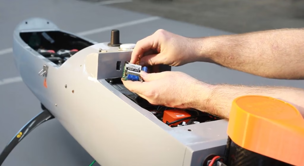
Piloting BVLOS with RockREMOTE Mini OEM
One of the most significant challenges in drone warfare is piloting UAVs beyond visual line of sight (BVLOS) – a necessity for long range missions or operations in hostile areas.
Solutions like the RockREMOTE Mini OEM provide satellite-based connectivity designed for such operations involving on the move assets.
RockREMOTE Mini OEM is lightweight, designed to draw as little power as possible, and harnesses the Iridium Certus 100 satellite network service, delivering virtually real time IP connectivity.
This technology allows for piloting and navigation adjustments, crucial for UAVs conducting missions deep into enemy territory. Furthermore, satellite-based communication ensures the operator maintains constant control over the UAV’s flight path, even when thousands of kilometers away.

Capturing Real Time Video Footage with RockREMOTE Rugged
Arguably, one of the most critical functions of UAVs in modern warfare is real time video reconnaissance.
RockREMOTE Rugged coupled with Videosoft video compression technology facilitates the transmission of high definition video feeds from drones to ground stations, enabling military forces to monitor enemy activities and gather intelligence without delay. This helps military operators to respond to threats or gather information promptly, enhancing battlefield awareness and operational decision making.
RockREMOTE Rugged does not require antenna pointing, and even with a poor or changing view of the sky, RockREMOTE Rugged can reliably and securely transfer data in close to real time via the Iridium satellite network.
Selecting the Right Satellite-Enabled Solution
 RockBLOCK 9603 RockBLOCK 9603
|
RockREMOTE UAV OEM
|
RockREMOTE Rugged
|
|
|---|---|---|---|
| Size | 45 x 45 x 15 mm | 175 x 60 x 37 mm | 250 x 97 x 61 mm |
| Weight | 36 g | 287 g | 1.2 kg |
| Power | Max 450mA | <30mW (sleep), <0.25W (idle), <7.5W (average transmit) | 0W (sleep), 5W (idle), 9W (average transmit) |
| Satellite Service | Iridium Short Burst Data (340 bytes ↑ 270 bytes ↓ per message) | Iridium Certus 100 (22/88 Kbps) + IMT (100 kB per message) | Iridium Certus 100 (22/88 Kbps) + IMT (100 kB per message) |
| Interfaces | Molex PicoBlade 1.25mm pitch | Ethernet (available on pin out), Serial RS232, RS485, GPIO (2xI, 2xO) | Ethernet, Wi-Fi, Serial RS232, RS485 |
| Antenna | Built in 1621 Mhz tuned patch antenna (or use optional SMA connector for external antenna) | External – various approved options | External – various approved options |
| Hosted Applications | |||
| Ideal For | Simple Commands / Failover Comms | Piloting BVLOS; Sending Compressed Images | Transmitting Real Time Video Footage |
| View Product | View Product | View Product |
Edge AI, BVLOS, and the Next Wave of UAV ISR
UAV use is expanding across military missions, including kinetic applications; however, the fastest day to day gains we see are in defensive ISR and mission support; secure C2 beyond line of sight, wide area monitoring, and comms relay. Expect more drones running AI at the edge to spot “needles in the haystack” (changes on a perimeter, vessels of interest, wildfire flare-ups) before sending only the useful bits over constrained links, cutting bandwidth while speeding decisions. That’s already a theme in ISR tooling and video workflows.
Connectivity will remain the backbone. Iridium-powered BVLOS links, facilitated by devices like the RockREMOTE Mini OEM, are being adopted to extend C2 and push telemetry/video from places cellular can’t reach, central to safe separation concepts and multi-aircraft operations.
Swarm and multi-UAV teaming are also trending for search & rescue, disaster assessment, and wide area reconnaissance, using multiple small platforms to map faster, hand off targets, and maintain comms. Agencies are likewise exploring comms-relay roles so one asset can keep others connected in difficult terrain.
Looking ahead, one area we’re excited about is humanitarian demining. Drones can scan from above, use onboard AI to flag likely contamination, and then alert clearance teams over satcom. As those edge models improve, triage gets quicker and tasking more precise.
In short, whether it’s low rate C2, BVLOS piloting, or near-real time ISR video, pairing UAVs with reliable satellite links is unlocking new defensive capabilities, and doing it in ways that help reduce risk to people on the ground.
Can we help?
Working on UAV command and control, BVLOS piloting, or real time ISR video?
We can help you choose and integrate the right Iridium-powered solution, from RockBLOCK for simple C2 to RockREMOTE for IP video, so you get reliable, global connectivity faster. We support civil and defensive applications; tell us about your mission profile and we’ll recommend a build that fits.
Complete the form or email hello@groundcontrol.com and we’ll get back to you within one working day.
Unlocking Potential With Remote Video Surveillance
Developing Video Capability
In today’s interconnected world, the ability to monitor and manage assets remotely has become not just a convenience but a necessity. From sprawling agricultural fields and remote unmanned industrial sites, to vast stretches of pipeline and border control areas, the challenges of ensuring security, efficiency, and productivity in remote, often environmentally challenging locations, are ever-present.
Integrating advanced video surveillance technologies with satellite connectivity is revolutionizing how industries approach these challenges. Ground Control’s recent partnership with Videosoft exemplifies this transformation, bringing real-time, low-bandwidth video streaming over satellite to the forefront of remote off-grid operations.
This article delves into the transformative impact of satellite-enabled video surveillance across three critical applications: preventing remote solar panel theft and protecting parked vehicles like quadbikes, all-terrain vehicles (ATV) and heavy vehicles; leveraging aerial video footage over satellite for agricultural and forestry monitoring; and enhancing remote border control operations.
1. Safeguarding Remote Assets
Solar panels are increasingly being deployed in remote, often unmonitored locations as renewable energy installations proliferate. PV installations for solar farms and solar as a power source in remote industries present an increasing global opportunity for crime.
The attractiveness of solar panels to thieves is primarily because of their high value and the perceived ease of theft, especially from remote, poorly secured installations. Europe reports over 5,000 major solar thefts annually, with southern Italy experiencing rates ten times the European average. The problem is global; in Nigeria and South Africa, solar panel theft is stifling renewable energy growth.
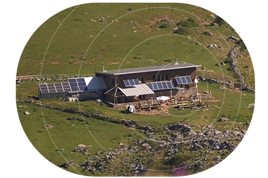
Similarly, in industries like mining, agriculture, and construction, frequently stationed valuable vehicles and equipment, such as ATVs (all-terrain vehicles) or heavy vehicles, in isolated areas are at risk. These assets are prime targets for theft and vandalism due to their high value and minimal on-site security. The UK agricultural sector alone saw an estimated £49.5 million in stolen equipment in 2023.
There are known illicit global markets for farming and technology equipment, where criminals can sell their stolen wares for much higher prices. This specific type of theft has been triggered by soaring values, particularly in relation to metals and machinery and the low supply of farm machinery worldwide.
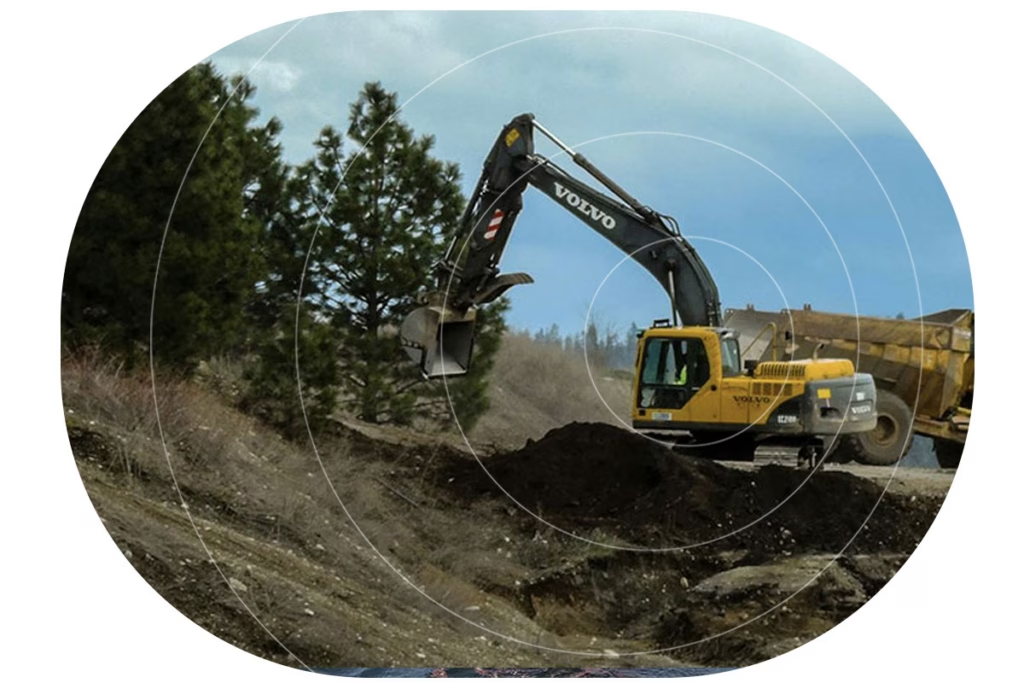
The Problem With Off-Grid Locations
While traditional camera surveillance methods provide a deterrent to criminal activity, they often rely on cellular networks which may not be available in remote locations. The network gap leaves off-grid assets vulnerable, with limited options to monitor and protect investments effectively and cost efficiently.
The Solution: Video Compression Over Satellite
Integrating Videosoft’s high-compression, low-latency, off-grid video streaming technology into Ground Control’s RockREMOTE Rugged device offers a robust solution. This facilitates real-time video surveillance over the Iridium satellite network, ensuring continuous monitoring even when there is zero cellular network availability.
Deploying a remote video monitoring strategy means action can be taken before a crime occurs. Video compression ensures quality image capture, and with RockREMOTE’s powerful edge computing capabilities, multiple sensor connection options, and real-time connectivity, it can detect certain events, like a person loitering after hours or jumping a fence. Follow-on actions can be automated or taken remotely, server-side, to deter a potential criminal’s next steps. By activating specific deterrents, like recorded announcements, alarms, and flashing lights, asset protection management can respond from anywhere in real-time to prevent a potential crime.
The cost-effectiveness of this solution lies in its data efficiency. By compressing video at the edge, data transmission costs are minimized without compromising the quality of the recording, making high-quality real-time surveillance financially viable over the Iridium satellite link.
2. Revolutionizing Forestry Monitoring
Agriculture, environmental and forestry monitoring can often span vast, remote areas, making it challenging to monitor crop health, forest conditions, or illegal logging. Drones have emerged as a powerful tool for aerial surveillance, but their reliance on local storage or cellular networks for data transmission limits their efficacy in remote regions.
Drones are also restricted in the altitude at which they can fly, limiting their coverage for each flight. They are ideal for short-range, lower-altitude video capture, but they have range and battery life constraints, and many do not offer the zoom options available from an aircraft. Aircraft can transmit video over much longer distances and cover vast areas unaffected by obstacles in the terrain.
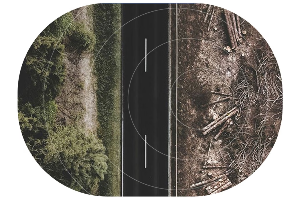
However, sending video in real-time over satellite has been expensive, often reserved for emergency services and search and rescue operations. Yet, the need for accurate imagery, delivered cost effectively, in real-time, is increasingly critical in remote land surveillance and monitoring.
The Problem of Deforestation
In North America, illegal logging costs over $1 billion annually, with the U.S. Forest Service estimating $100 million in losses from public lands alone. Romania faces similar challenges, losing valuable primeval forests to illegal logging. New technology to combat these types of losses can’t come quick enough. A new report says deforestation globally increased by 4% in 2022 compared with 2021, with the loss of over 6.6 million hectares of forest. Although there was a decrease of 18% in tropical Asian countries, the world is now 21% off track to eliminate deforestation by 2030.
The Solution: Aerial Video Recording Operations
The encouraging part of Ground Control’s collaboration with Videosoft is that aircraft equipped with cameras to stream live footage can drive real-time insight while keeping aerial transmission costs down. RockREMOTE Rugged, combined with Videosoft’s compression technology, ensures efficient transmission of high-definition video over the Iridium Certus IP connection. Operators can remotely adjust camera focus, zoom, and capture high-resolution video for detailed analysis in real time, whether from the plane or the ground. Access to live feeds enables instant assessment, issue identification, and monitoring, facilitating real-time responses.
The RockREMOTE’s LTE failover feature switches between cellular and satellite networks as needed, maintaining the efficient video transfer and minimizing data costs. With aerial video over satellite, monitoring for illegal logging or assessing the health of farmland or forest canopy becomes significantly more manageable.
3. Enhanced Border Security
Border regions, especially those spanning vast and inhospitable terrains, pose significant challenges for security agencies. Monitoring these areas to prevent illegal crossings, trafficking, or other illicit activities is difficult, mainly due to the hostile terrain, remoteness, and sheer expanse. Traditional surveillance infrastructure is often impractical due to the need for cellular connectivity or the high costs of establishing and maintaining such systems.
Many factors influence the off-grid solution: the degree of threat posed by unsanctioned activity, the conditions for monitoring equipment and transportation, the ruggedness of the terrain, local data and available power supply.
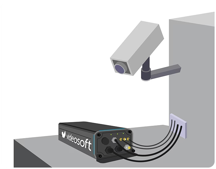
The Solution: Satellite-Enabled Surveillance
From RF spectrum monitoring, to Thermal imaging, RockREMOTE Rugged’s broad range of connection interfaces and containerized edge computing capability enable it to operate with other key security sensors, cameras and applications. The system supports simultaneous live streaming from multiple cameras, providing comprehensive border coverage.
Further, RockREMOTE Rugged’s antenna is omni-directional, with no pointing required; ideal for fixed deployment in hilly or woody locations, or for on-the-move applications. It will also connect from a mobile surveillance unit.
Beyond Surveillance: The Broader Implications
The applications discussed represent a fraction of the potential unlocked by integrating advanced video compression technology with satellite connectivity. From conservation efforts and monitoring endangered species, to reducing remote off-grid crime, the possibilities are vast. Whether it’s safeguarding remote solar installations, leveraging aerial surveillance to protect forests, or enhancing the security of national borders, the ability to transmit real-time, high-quality video over satellite networks is a game-changer. As industries continue to operate in increasingly remote and challenging environments, such innovations are not just advantageous—they are essential.
Would you like to know more?
With over 20 years of satellite experience, the Ground Control team is well placed to help you keep an eye on the things that matter most.
Whatever your remote surveillance needs, we can help. Complete the form to be connected to one of our team to discover more about the innovative video software, RockREMOTE Rugged and how our solutions can support your project.
Military Satellite Communications: From IDSCS to Space Force and Beyond
With their reliable, secure and global connectivity, satellites have been instrumental in military communications for over half a century. Applications have covered everything from surveillance to operation support, and monitoring personnel to facilitating mobile command centers. A 2022 report revealed that the government and defense sector accounted for a staggering 42% of the $78.22 billion global satellite communication market. Looking ahead, the global military communication market is projected to reach $54.11 billion by 2029, driven by advancing technologies, including the Military Internet of Things (MIoT).
Throughout history, military personnel have relied on secure and dependable channels to transmit vital information across vast distances. Satellites have played a transformative role in revolutionizing military communications, empowering rapid data transfer, real-time intelligence gathering, and precise targeting. To fully grasp the significance and influence of military satellite communications on the defense industry, it’s essential to delve into its evolutionary journey.
Initial Defense Communications Satellite Program (IDCSP)
Official efforts to create a military communications satellite started in 1960 and since then, the United States has relied largely on four different satellite constellations to deliver timely, reliable communications. The Initial Defense Communications Satellite Program (IDCSP) created the Pentagon’s first near-geosynchronous communications system – the Initial Defense Satellite Communication System (IDSCS). The first satellite of this constellation was launched in 1966, and by July 1967 consisted of 19 satellites in total. These satellites enabled the transfer of high-resolution photographs during the Vietnam War, allowing for near real-time battlefield analysis.
Defense Satellite Communications System II (DSCS II) and DSCS III
Subsequently, constellations Defense Satellite Communications System II (DSCS II) and DSCS III, were launched between 1971 and 2003. The constellations comprised 16 and 14 satellites respectively. The transition from IDCSP to DSCS II and DSCS III marked a significant modernization of military satellite communication systems. Advantages included increased communications privacy and better compatibility with ground-portable units, enabling satellite communications in more dynamic environments.
Wideband Global SATCOM (WGS) Network
Initiated in 2002 by the Department of Defense, the Wideband Global SATCOM (WGS) network holds a significant position within military satellite communications today – welcoming a new era of capabilities and flexibility. First, each WGS satellite offers more SATCOM capacity than the entire DSCS constellation, providing a quantum leap in communications capacity.
Recognizing the system’s potential, in 2012 the WGS network expanded internationally, attracting partner countries including Canada, Denmark, Luxembourg, the Netherlands, and New Zealand. According to Heidi Grant, Deputy Under Secretary of the Air Force for International Affairs, these collaborations aimed to enhance interoperability, bolster trust, and increase capabilities and capacity for all partners.
The WGS system operates through three principal segments: Space (satellites), Control (operators), and Terminal (users). The space segment consists of 10 cost-effective, high-throughput Ka- and X-band satellites; controlled and managed by the USSF Space Delta 8’s 4th Space Operations Squadron and 53rd Space Operations Squadron. The ground segment boasts thousands of tactical SATCOM terminals. Today the system provides worldwide, high-capacity communications for various government agencies, the Department of Defense (DOD), international partners, and NATO.
The WGS network is a critical part of the US military’s communications infrastructure, but it’s important to note that it is not the only network they use. The US military utilizes a variety of other networks, including the Defense Information Systems Network (DISN) and the Joint Tactical Radio System (JTRS).
Satellite Military Communications Today: Introducing United States Space Force
The United States Space Force (USSF) was officially established in December 2019, when President Trump signed the National Defense Authorization Act for Fiscal Year 2020 into law. With a mission to “secure our Nation’s interests in, from, and to space”, the USSF became the sixth branch of the U.S. military.
The establishment of the United States Space Force had been proposed and discussed for several years prior, with many recognizing the growing importance of space within the larger context of military and national security concerns. Its creation consolidated satellite acquisition, budget and workforce, across more than 60 organizations enabling a more efficient, effective service for space operations.
One of the early successes of the Space Force was its role in providing early warnings of missile strikes against U.S. troops. Most recently, in August 2023, the USSF formed a new combative unit the 75th Intelligence, Surveillance and Reconnaissance Squadron (ISRS). The ISRS unit was formed with a clear mission: targeting adversary satellites, ground stations, and counter-space forces that can disrupt satellite systems during conflicts.
Russia and China, possessing ground-based anti-satellite weaponry, both pose significant threats to the WGS. Additionally, they’re developing a “peaceful” spacecraft, designed to reduce orbital debris. However, this “peaceful” spacecraft could, in theory, dismantle U.S. satellites, siphon fuel, and damage components including antennae and solar panels, raising concerns regarding the true intentions and implications for space security.
The Future of Military Satellite Communications
In the ever-evolving landscape of military satellite communications, the demand for robust and widespread connectivity is surging. As Mike Tierney, industry analyst at Velos puts it – “the one thing that is always needed is more comm… We never have enough comm to get after what we need to do. We need more comm to support the fight.” Notably, the government and defense sector’s increasing reliance on satellite communications, driven by the transformation of operational environments and a growing dependence on sensor data and ISR platforms, further propels this growth. This shift is evident in the escalating demand for High Throughput Satellite (HTS) capacity to meet the evolving requirements of government and military applications.
Charting the Course of Military Satellite Communications
- Security: Safeguarding the Final Frontier
- The Future Hub of Space Operations
- Combination of Commercial and Owned Communications
Security: Safeguarding the Final Frontier
As satellite reliance grows, security becomes not only paramount but also twofold. First, the war in Ukraine underscored satellite systems’ vulnerability to cyber warfare. In February 2022, a cyberattack disrupting Viasat’s satellite communications network was attributed to Russia’s military. Using wiper malware, the attack “bricked” KA-SAT modems across Europe, impacting tens of thousands of users, including Ukraine’s military. With cyber attacks becoming integral to military arsenals, the imperative for a robust defense strategy intensifies.
Second, the physical security of satellites demands attention. China’s pursuit of satellites with on-orbit repair capabilities raises concerns, as some could double as weapons. Similarly, Russia is developing laser weapons to target adversary satellites. DARPA’s (Defense Advanced Research Projects Agency) robotic arm, set to launch in 2024, aims to repair satellites in geosynchronous orbit and could serve as “bodyguards” against threats. Safeguarding satellites requires a comprehensive approach, addressing both cyber vulnerabilities and physical defense mechanisms.
The Future Hub of Space Operations
Beyond Space Force, plans for a military space station are underway. The Defense Innovation Unit (DIU) is soliciting proposals for an autonomous orbital outpost, laying the foundation for potential human habitation and docking with manned spacecraft. The DIU envisions the outpost supporting diverse functions, from microgravity experimentation to logistics and training. While its primary goal is currently experimentation, the solicitation hints at broader ambitions, including a military presence in geosynchronous orbit.
Combination of commercial and owned communications
The war in Ukraine also highlighted the agility and responsiveness of commercial satellites, particularly in critical infrastructure support and imaging during conflict. Commercial providers like SpaceX’s Starlink played pivotal roles. Lt. Gen. Michael Guetlein emphasizes a pragmatic approach: “buy what we can and only build what we must.”
However, in allocating nearly $13 billion over the next five years, the Pentagon signals a continued commitment to the importance of government-owned capabilities. As Mike Tierney from Velos notes: “this budget doesn’t reflect a pivot to a greater adoption of commercial capabilities in lieu of government-owned and operated capabilities.” Suggesting that the delicate balance between security, innovation, and pragmatic resource utilization is steering the future trajectory of military satellite communications.
Need a Defense Communications Solution?
At Ground Control our dedication to supporting defense and government organizations reflects our ongoing efforts to evolve with the dynamic landscape of the defense sector. As a trusted partner, we are committed to offering the highest level of service, straightforward procurement processes, and around-the-clock support.
So if you’re looking for reliable and cutting-edge satellite communication solutions tailored to the unique requirements of the defense industry, contact our team today to explore how our solutions can enhance your communication capabilities and contribute to the success of your mission.
Harnessing Water, Defending Data: Cybersecurity in Hydropower and Dam Facilities
Dams and hydropower facilities have long been attack targets, with a history that spans wartime conflicts. During World War II, the British Royal Air Force formed a group of pilots known as the Dambusters. Their mission: to destroy critical dams in Germany; considered ideal targets due to the significant disruption they could inflict on both water and power supplies.
In 2023 however, the landscape has somewhat shifted. The global cost of cybercrime is projected to soar to $8 trillion. Due to the immense value of data and the potential for widespread disruption, energy and utility companies continue to be prime targets.
Today, the hydropower and dam industries, like many others, stand at a crossroads where innovation and cybersecurity converge. Even a seemingly minor misstep, for instance, untimely dam operations, can unleash havoc upon nearby towns, significantly hampering supply chains and inflicting widespread destruction upon adjacent regions.
Types of cyber threats: State-sponsored and hobby
Cyber threats can be split into two main types. The first is state-sponsored cyber attacks. Those that are planned and funded by governments or nation-states. Kevin Curran, professor of cyber security at Ulster University, recently described cyberattacks by the UK’s enemies as becoming “relentless”. As an example, the Cozy Bear and LockBit hacker groups are believed to be associated with one or more intelligence agencies of Russia, the latter having known links to Russian nationals.
Secondly, hobby-hacker attacks. These hackers are usually motivated by either monetary gain or a wish to cause mischief. One of the most notorious examples is the Colonial Pipeline attack. The company paid the hacker group known as DarkSide 75 bitcoin ($4.4 million) to obtain a decryption key which enabled the company’s IT staff to regain control of its systems.
Growing intricacies of infrastructure create more vulnerabilities
The rising integration of Internet of Things (IoT) devices and sensors within the hydropower and dam sector has brought greater infrastructure complexity, creating more vulnerabilities for several reasons:
- Increasing number of attack surfaces: Every device connected to the network becomes a potential target for attackers. The more IoT devices, sensors and so on that are introduced, the further the range for potential attacks is increased.
- Device security: The substantial volume and often remote location of IoT devices increases the difficulty of keeping firmware and software up-to-date. Moreover, their physical dispersion can expose them to theft and tampering.
- Lack of standardization: Different manufacturers exercise varying levels of security. The lack of standardisation can make it challenging to implement consistent security practices across all devices.
- Legacy systems: Many critical infrastructure systems still rely on older, legacy technology that may not have been designed with modern cybersecurity standards in mind. These systems are often more vulnerable to attacks.
- Interoperability challenges: Ensuring that different IoT devices and systems work together can be challenging. This can lead to security compromises to enable connectivity, potentially weakening overall security.
- Network visibility: Depending on the network’s connectivity and device location, a 360 view can be difficult to achieve and maintain, making it more difficult to detect and respond to cyber attacks.
- Data privacy: IoT devices often collect and transmit sensitive data. Inadequate data protection measures can lead to data breaches, compromising privacy and potentially providing valuable information to attackers.
The convergence of operation and information technology
Traditionally operational technology (OT) and information technology (IT) data streams remained distinct, which had the benefit of keeping OT systems ‘air gapped’ from the internet, and therefore at limited risk from hacking. As technology unifies OT and IT, it brings both efficiencies and risks. The efficiencies are numerous: by combining SCADA data with the systems that manage physical infrastructure, you can autonomously optimise performance.
But because OT systems haven’t been targets in the past, they’re not always built with security in mind. Passwords are often left at the default character string; remote monitoring for suspicious behaviour hasn’t been implemented; patches are not implemented as frequently as they should be.
In this evolving landscape, it’s critical that security teams are aware of these vulnerabilities and take steps to address them, safeguarding critical infrastructure in the hydropower and dam sector.
Lessons from successful cyber attacks
A successful cyber attack involved Queensland’s Sunwater, a water supplier targeted in a nine-month-long breach. The breach, occurring between August 2020 and May 2021, exploited vulnerabilities in an older system version, granting unauthorised access to customer information stored on their web server. While the hackers didn’t compromise financial or customer data, they left behind suspicious files, redirecting visitor traffic to an online platform.
The subsequent Water 2021 report underscored the importance of immediate action to rectify ongoing security weaknesses, emphasising software updates, stronger passwords, and vigilant network traffic monitoring as crucial safeguards.
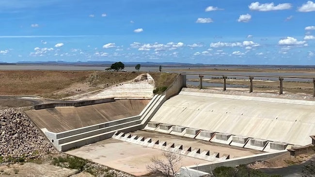
In another notable case, the LockerGoga ransomware group inflicted significant damage upon Norsk Hydro. Norsk Hydro was forced to shut down multiple production facilities, impacting 35,000 employees, across 40 countries and resulting in approximately $71 million in financial losses. The cyberattack stemmed from an employee unknowingly opening an infected email three months prior.
Norsk Hydro’s response, however, garnered accolades. The company chose not to pay the ransom, instead engaging with Microsoft’s cybersecurity team to restore operations and remained committed to transparency throughout the ordeal. As Torstein Gimnes, Corporate Information Security Officer emphasised – “You need to rebuild your infrastructure to be safe and be sure that the attacker is not still part of it.”
An immediate IT shutdown was implemented to prevent further spread and only trusted backups facilitated by Microsoft’s team were used. Following the attack, a commitment to employee training, multi-factor authentication, regular updates, and resilient backup solutions were introduced to bolster security.
These cyber attacks underscore the importance of proactive measures and resilience in the face of evolving threats and crucially, they highlight the importance of engaging and sharing knowledge between peers. As Eric Doerr, General Manager of the Microsoft Security Response Center puts it – “When companies do this, it makes us all better and makes the attackers work harder.”
Ensuring the security of critical components in hydropower and dam facilities
Assess cyber risks
- Identify critical assets: Which assets are most important within the facility/network?
- Assess potential risks: What are the potential threats to the identified critical assets? Data breaches, malware attacks, etc.
- Prioritise risks: Which potential risks are more likely to occur and which would have the most significant impact? By prioritising risks, companies can focus resources accordingly.
Mitigate cyber risks
1. Safeguard data
Ensuring data security encompasses data encryption and authentication protocols, coupled with monitoring and restricting physical access to facilities. While firewalls and VPNs serve as effective safeguards when data traverses public internet infrastructure, companies can mitigate these risks entirely with the deployment of private lines or a secure private satellite network like TSAT – designed specifically for SCADA data.
In addition, as mentioned above, recent trends show organisations gravitating toward a unified data stream for both IT and OT. Companies wishing to do this must ensure they have appropriate control system boundary protection to prevent unauthorised access, for example, SD-WAN coupled with a next generation firewall.
2. Secure physical access
Physical security measures not only deter potential threats but also serve as the first line of defence against cyberattacks. By strictly limiting and monitoring who can physically access a facility, organisations can significantly reduce the risk of malicious actors gaining direct entry to sensitive systems and data.
Further, when physical access is under surveillance, companies can identify unauthorised access or unusual activity, allowing them to swiftly intervene and halt a hacker’s progress.
3. Prioritize firmware and software updates
Software and firmware updates are essential tools in addressing known vulnerabilities, strengthening system resilience, and ensuring the integrity of critical software components. By regularly applying updates, organisations stay ahead of cyber threats that often exploit outdated software to breach systems and steal sensitive information.
Firmware updates for hardware devices, on the other hand, enhance device functionality and bolster security by patching potential vulnerabilities. Emphasising the importance of prompt updates and establishing a structured update management process is key. If your dam or hydropower facility is in a remote, unmanned location, ensure that you have the ability to remotely protect your infrastructure with over-the-air (OTA) firmware updates.
4. Staff training
Human errors often open the door to cyber incidents, so it’s crucial organisations equip their employees with the latest cybersecurity knowledge. Early detection and response, facilitated by well-informed and vigilant employees, can prove instrumental in preventing breaches. A prime example is a vigilant staff member who thwarted an attempt to tamper with sodium hydroxide levels in Florida’s water supply last year.
Moreover, robust incident response plans are essential. Employees must know how to contain incidents, restore systems, and investigate root causes. Ultimately organisations need to be confident that if their facility does experience a cyber attack, staff can react efficiently and effectively. Bolstered by continuous training, workshops, webinars, and the cultivation of a security-conscious culture, enhances cybersecurity resilience. It also promotes information sharing among peers, strengthening collective efforts to combat cyber threats.
5. Redundancy and backup
Redundancy and backup systems serve as critical safeguards against unforeseen vulnerabilities and disruptions within network infrastructure. By creating duplicate or alternative pathways for data transmission and network operations, redundancy measures ensure that even if a primary system or connection fails, there’s an immediate and seamless switch to a secondary, secure option. This not only mitigates the risk of single points of failure but also enhances the overall reliability of the system.
One of our largest clients has satellite implemented as their third connectivity failover (cellular first, fibre second). Their satellite setup hasn’t failed once in 27 years and is the system they consider the most reliable. With the hydropower and dam sector increasingly reliant on interconnected digital systems, redundancy and backup solutions stand as formidable defences, ensuring continuous operations and protecting against potential cyber threats and disruptions.
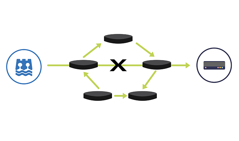
The above list is by no means exhaustive, but it does highlight a fundamental truth: In the constantly evolving landscape of cybersecurity, proactive measures are a necessity. Anticipating and addressing vulnerabilities before they become threats is pivotal to achieving and maintaining robust cybersecurity practices. If you would like to explore your connectivity and/or data security options with our experienced team, don’t hesitate to get in touch by emailing hello@groundcontrol.com.
Secure Your Infrastructure
Our team are experts in getting data from hard-to-reach places – so you don’t have to be.
To talk to the team about your connectivity options, challenges and associated data security, simply fill in the form.
Satellite IoT use cases: truly global connectivity for real world applications
Satellite IoT is growing in popularity, providing reliable connectivity to remote locations that would otherwise be challenging or even impossible to reach with terrestrial networks. As the world becomes more connected, the demand for real-time data from even the most remote locations has increased. Satellite IoT provides the solution to this need by offering truly global connectivity for real-world applications.
Satellite IoT is being used in a variety of industries, including healthcare, agriculture, workforce safety, and more. Let’s dive into just some of the most prominent use cases for satellite IoT…
1: Healthcare
IoT has revolutionised the healthcare industry by providing innovative solutions to improve patient care, reduce costs, and increase efficiency. IoT in healthcare refers to the use of connected devices, sensors, and data analytics to collect and analyse patient health data in real-time. This could include remote patient monitoring, smart medical devices and wearable technology like fitness trackers and smart watches.
Satellite IoT can also facilitate medical and healthcare accessibility to patients in remote areas who are unable to travel. For example, utilising the RockBLOCK 9603 technology, satellite IoT has enabled the transportation and delivery of emergency and essential medical supplies to vulnerable people who are at high risk if they travel.
Read Healthcare By Drone
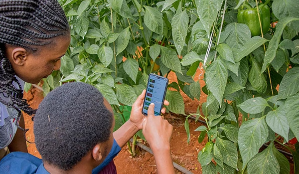
2: Agriculture
The agriculture industry is utilising satellite IoT to enhance productivity and lower expenses. By monitoring soil moisture, temperature, and other environmental factors, farmers can optimise their crop yield and reduce waste. This is sometimes referred to as Smart Farming. Satellite IoT can also be used to track livestock and monitor their health – improving overall animal welfare and reducing losses.
COSMOS-UK has installed Viasat IoT Pro terminals at remote soil moisture monitoring locations, to help combat climate change. The soil moisture data intelligence delivered by the Hughes 9502 specifically, to agricultural and environmental scientists, has the potential to transform the way we understand and model the natural environment.
Furthermore, satellite IoT has supported Synnefa in Kenya, to operate outside of terrestrial infrastructure by transmitting sensor data to enable smarter predictions for optimum harvesting times. The introduction of precision farming has been so successful, Synnefa has been able to help farmers:
- Save water by over 50%
- Reduce fertiliser application rates by 41%
- Increase production by 30% when compared to yields prior to the use of their devices.
3: Asset Tracking and Monitoring
Tracking and managing assets in real-time, providing valuable data on asset location at any given time is made possible with IoT technology. With satellite-enabled tracking devices, businesses can keep track of their assets no matter where they are in the world, even in the most remote locations. But here, it’s not just vessels, wind turbines and remote workers who can be tracked – animals can be too!
Illegal poaching is a big problem in Gabon, Africa. RockREMOTE with IMT enablement has equipped the rangers in Gabon with the latest in AI-powered camera trap technology to effectively monitor and prevent illegal poaching in the forest. With this advanced technology, endangered African species and iconic African wildlife have greater protection from poachers for this generation and the next.
Read More About Poaching in Gabon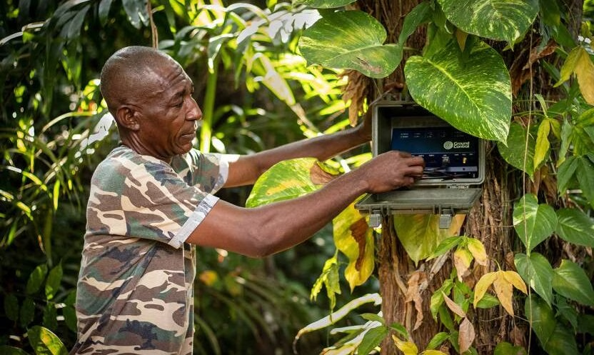
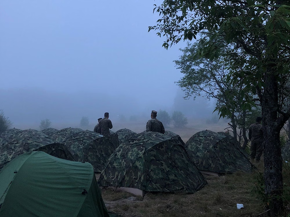
4: Workforce and Personnel Safety
Satellite IoT can be harnessed to monitor the safety of lone or remote workers in hazardous environments. By providing real-time alerts in the event of an incident or emergency, companies can respond quickly and potentially save lives. For example, workers in mining or oil and gas operations can wear wearable devices that monitor their location and vital signs, alerting supervisors in the event of an accident or injury. In addition, monitoring remote military personnel and natural disaster response teams is critical to their safety and well-being.
For example, the RockSTAR device has been used by the Ministry of Defence in their training. The RockSTAR was paired with bluetooth heart rate monitors, meaning biometrics could be monitored throughout with the added benefit of worldwide tracking and two-way communications. As well as critical monitoring, satellite IoT can also be leveraged for more leisure-based tracking and monitoring applications – including ultra-marathon runners via the RockSTAR tracking and two-way communications device.
See Tracking in Action5: Energy and Renewables
The energy sector is also seeing the benefits of satellite IoT. The technology enables remote monitoring of renewable energy infrastructure in real-time, allowing for early identification of any faults or issues, thus preventing downtime and maximising energy output. The performance of renewable energy assets is also optimized by collecting and analysing data on weather patterns, energy production, and equipment performance. This data can be used to improve efficiency, reduce costs, and even enhance the lifespan of renewable energy assets.
With five hydroelectric power stations in Snowdonia, North Wales, RWE maximises its renewable energy output from the reservoirs with a remote IoT solution – the Hughes 9502.
Read About Facilitating Renewable Energy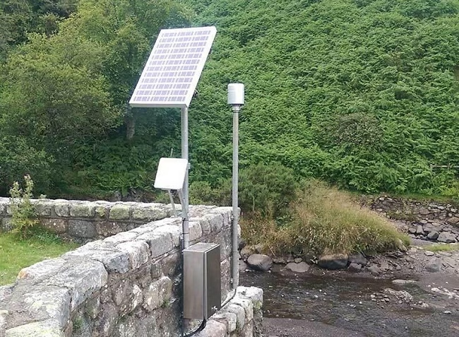
Satellite IoT vs. Traditional Cellular Networks
While traditional cellular networks are sufficient for many use cases, they have limitations when it comes to remote locations.
One of the biggest advantages of satellite IoT is that it provides truly global connectivity, even in the most remote and inaccessible locations. Unlike traditional cellular or Wi-Fi networks, satellite signals can reach anywhere on the planet, making it ideal for industries where assets are remote or located in harsh environments.
With satellite IoT, data can be transmitted from quite literally anywhere in the world, making it ideal for applications where cellular coverage is limited or even non-existent. Satellite IoT is also more reliable than cellular networks in many cases, as it is resilient to interference or disruption from extreme weather events.
However, it’s not necessary to choose either terrestrial or satellite connectivity. Satellite networks can be deployed quickly and easily, using the same messaging protocols as terrestrial networks, allowing businesses to scale their operations up or down as needed without having to worry about the limitations of traditional networks. What’s more, for businesses and industries that require global connectivity, the cost of deploying and maintaining satellite IoT devices can often be less expensive than building and maintaining traditional terrestrial networks from scratch. It can also be cheaper than deploying remote field engineers to remote sites.
In Summary…
Satellite IoT provides reliable connectivity to remote locations; bridging the connectivity gap that would otherwise be difficult or impossible to achieve with traditional cellular networks alone.
From reliable communication to real-time data collection and analysis, satellite IoT is changing the game for businesses and entire industries that need to stay connected no matter where their assets are located. Furthermore, as satellite technology continues to evolve and become more affordable, we can expect to see even more innovative use cases emerge in the coming years.
Unlock the Full Potential of Your IoT Project
Incorporating satellite IoT into your existing business operations can revolutionise what you can achieve. With satellite IoT, you can access data and insights that were previously unavailable or difficult to obtain with traditional networks and connectivity options.
Contact us to discover the added value of satellite IoT to your business today. We’re here to help and provide solutions to your connectivity challenges.
How RockSTARs Are Being Used to Keep Remote Personnel Safe
Most of us are familiar with the limitations of terrestrial networks. However, for those working as a field engineer or as part of an expedition team; who have been a competitor in a yacht race or taken part in military training; you’ll also know how important it is to overcome this limitation. Cellular connectivity only covers 15% of the globe and there are many reasons why someone may take the roads less travelled. For the purpose of this blog, the term remote personnel refers to anyone travelling outside cellular coverage regularly, or for an extended period of time – be that for work or leisure.
For both safety and well-being, it’s essential that remote personnel have access to two-way communication that functions both in and out of cellular range. Determining a tracking and communication plan will reduce the chance of accidents and ensure swift response times in the case of an emergency; and by encouraging the use of two-way notifications and alerts, deliver peace of mind. This is where Ground Control’s RockSTAR device can help.
Introducing the RockSTAR
The RockSTAR is a lightweight, rugged, handheld device that can be used to send and receive short messages (like SMS and short emails) and track GPS location, through the Iridium satellite network and back to Earth. Simply, if the unit has a clear view of the sky, it’ll deliver two-way communications and virtually real-time tracking, anywhere and everywhere.
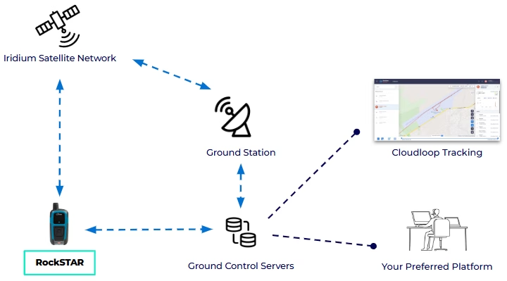
How do RockSTAR devices work?
Each RockSTAR unit houses an Iridium 9602 modem. This modem allows the device to leverage the Iridium Satellite network – using the ‘short burst data’ (SBD) service, to support location and messaging data transmission.
The RockSTAR can be set to ‘wake up’ and transmit your location anywhere between 15 seconds and once a day. It’ll obtain a position using the GPS satellite network, and then transmit that position back to Ground Control HQ using the Iridium satellite network. In 1-2 seconds, the position can then be visualised on our easy-to-use web-based system or automatically set up to relay this information direct to your application.
For example, if you’re a field technician working in a remote area, location data can be sent direct to whichever security tracking application your employer is using. What’s more, RockSTAR units have a great battery life. Even transmitting location data every 15 minutes, a device will last 3 weeks between charges.
In addition to SBD being relatively low cost, there are no annual contracts, delivering flexibility for those who only require a satellite device like the RockSTAR for a specific trip or project. In short, if you or your team don’t need to use a device for a month or more, there won’t be any monthly fee, simply pay ‘per month, per device’.
Additional RockSTAR features
Designed and built in the UK, the RockSTAR satellite device has also evolved throughout the years to better meet customer needs. The form factor has noticeably contracted, with the current device standing at just 144mm; other developments have helped create a feature-packed handheld unit.
RockSTAR units can be used to send and receive short messages, including SMS and short emails to nominated groups. Groups are created and amended in the device’s settings and can include mobile phone numbers, email addresses and servers. Using the device itself, you can send pre-set messages or free text; the RockSTAR can also be paired with a mobile or tablet via bluetooth, enabling truly global two-way communications.
The RockSTAR unit is configured with a number of alert options; for full details please see our article on RockSTAR alerts. All six device buttons can be activated by a user in gloves and the main SOS function is initiated via the button at the bottom of the device. When pressed, the unit immediately transmits your location and pre-set emergency message to those nominated within the device’s first-responder group.
The RockSTAR unit can also be used for waypointing, so key points of interest or concern (in the case of wildland firefighting) can be marked while you’re out in the field, and then viewed on our web-based system.
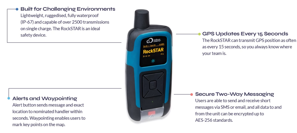
Common RockSTAR applications
Because the RockSTAR device is ruggedized and waterproof, with a great battery life, the applications are vast. Our RockSTAR customers aren’t just worldwide, they’re travelling by land, air and sea. Operating in some of the most remote and harsh environments on Earth. To demonstrate this range, we’ve collated some of the most common remote personnel use cases supported by our RockSTAR devices today.
MILITARY EXERCISE MONITORING
Military training exercises are often held in remote locations, under challenging conditions. This can place significant strain on soldiers, thus tracking services are often employed for peace of mind and if needed, timely, mission-critical response. Ground Control worked in partnership with JCSys to tailor the RockSTAR hardware and firmware to meet the very specific and stringent requirements of the UK’s Ministry of Defence. The result? A compact and durable device able to track soldiers in all weather and military attire, and pair with BLE heart rate monitors. Additionally, developer-friendly APIs meant JCSys were able to securely receive telemetry data and add the required context to support a safe training environment.
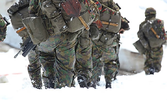

TRACKING ANTARCTIC EXPLORERS & RESEARCHERS
RockSTAR devices are ideal for use in extreme environments where wifi or cellular coverage isn’t widely available. As well as being waterproof, units can operate in temperatures between -30 to 60 degrees Celsius and be operated by users in gloves. What’s more, currently Iridium is the only network able to offer truly global coverage – including both poles. We’re proud to have supported both researchers and explorers on multiple Antarctic trips, and our RockSTAR devices have even been used to monitor icebergs across Northern Canada.
SUPPORTING RURAL-BASED POLICE OFFICERS
It is the duty of all law enforcement to “protect life and property through the enforcement of laws and regulations”. This includes serving those in rural-based communities, where cellular coverage may not be available, or intermittent. As all data to and from RockSTAR units can be encrypted up to AES-256 standards, the RockSTAR can be a great, relatively inexpensive solution for two-way communications. We’ve worked with various police units and law enforcement rangers, ensuring personnel maintain connected and tracked at all times.

SAFEGUARDING REMOTE MEDICAL WORKERS
It’s essential that when medical personnel are caring for patients in remote areas, they can be reliably tracked and monitored. To ensure their safety, devices which are lightweight and discreet, with a long battery life are essential. Many security firms have specific applications for remote and lone worker safety, that can be utilised alongside devices such as the RockSTAR to provide a complete, secure solution. We have worked with many companies, creating/enabling specific alert criteria via our RockSTAR devices, even simplifying our menu to ensure it’s as easy as possible for users to access key functions.
What sets the RockSTAR apart from other satellite devices?

Flexible, Secure APIs
We understand many customers will have their own remote worker and/or security applications – so we make getting that data easy. All data to and from the unit can be encrypted up to AES-256 standards, but we’re still able to give customers access to some of the lowest lines of code. This ensures all data transmissions are available in the required format, without compromising security.
Truly Ruggedized
The RockSTAR has been built to withstand the most challenging environments. Tried and tested everyday, everywhere from the Antarctic to the Australian desert, the Pacific Ocean to Rocky Mountains in North America. The device has a number of certifications including FCC and CE MIL-810 F/G for ruggedness, and is waterproof to IP-67.

Customization Opportunities
As manufacturers we have the flexibility to customise the device on larger orders. These ensure the RockSTAR is the best fit for our client’s project. They also enrich the device’s functionality for future users. For example, when working with JCSys, to better safeguard soldiers in the UK, RockSTARs were adapted to disable switch off without a PIN code.
GPS Tracking for Teams
Whether you and your team have one RockSTAR or 1,000, Ground Control’s easy-to-use web platform simplifies device management. From the platform, you can track all of your field workers’ positions simultaneously, both in real-time and across set periods of time.
Users can divide devices into relevant groups and set up multiple platform users with differing permissions. For example, some team members may only need to ‘view’ RockSTAR positions, while others could be allowed to send commands and configure devices in the field.
Within the platform users are also able to:
- Add line rental and credits
- Monitor alerts from all devices
- Set up relevant geofences, ensuring teams receive early warning if a device enters/exits specified areas.
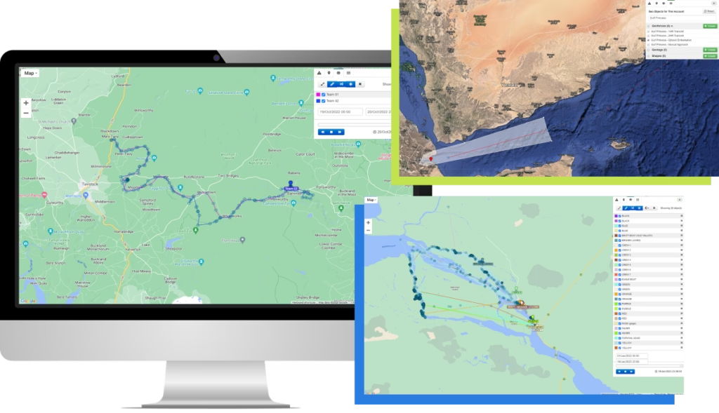
If you’re interested in learning more about the RockSTAR device and how units are supporting remote personnel with ubiquitous connectivity, take a look at our related content: RockSTAR Alerts | Case study – RockSTAR Provides Vital Tracking Telemetry for Soldiers and Ultra Runners | RockSTAR Used in Iridium Certus Demo.
Likewise, if you have any queries you’d like to discuss with our team, simply fill in the contact form below.
Got questions?
Ground Control’s RockSTAR device helps deliver peace of mind to anyone working or travelling within remote locations – unit’s have literally saved lives. From security personnel to armed forces, humanitarian aid workers to aviators, the RockSTAR might be just what you need.
For more information on how we can help solve your remote communication challenges and better safeguard you and your team, fill in the form and we’ll match your enquiry with one of our experts.
Lone worker safety: a snapshot of operations in North America
In its most basic term, lone workers are defined as employees who perform an activity in isolation from other workers, without close or direct supervision. Working in numerous industries, there are an estimated 53 million lone workers across the globe, with almost half (25 million) operating within North America.
In addition to safety concerns faced by lone workers simply as a result of being alone, many also work in remote areas. Communication plans and tracking can reduce the chance of accidents when lone working and ensure swift response times in the case of an emergency. While there are regulatory and contractual standards in place for lone workers, procedures surrounding lone worker safety are very much evolving.
With rapidly changing needs and increasingly challenging environments, it’s imperative organisations continually evaluate their strategies, hardware and software to ensure they are able to maintain worker safety and operational efficiency.
To better understand how lone workers in North America currently remain safe and connected when out of cellular range, Ground Control in partnership with TracPlus, surveyed almost 250 lone workers and individuals responsible for the safety and supervision of lone workers.
Lone worker operations in North America today
How often do lone workers travel out of mobile phone range?
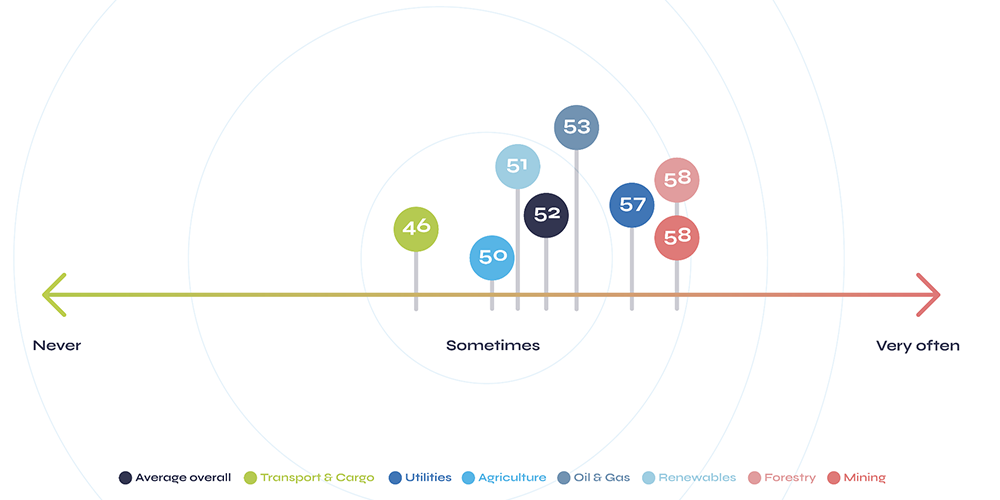
Lone workers and lone worker supervisors were asked to indicate on a scale from 0 – 100, whether they ever travelled out of mobile phone range. As can be seen in the above graph, on average, lone workers sometimes travel out of mobile phone range. It’s also worth noting that lone workers actually responded with a lower than average figure than those responsible for them (52 vs 58).
Our data also indicates that 10% of respondents are quite often out of mobile phone range, as these reported a figure of 75 or above.
When analysing the data grouped by industry, recipients from the Mining, Forestry and Utilities sectors provided the highest average scores, and those within Transport & Cargo, the lowest. This indicates that those working within Mining, Forestry and Utilities, are more likely to travel out of mobile phone range than those in the Transport & Cargo sector.
How many lone workers have experienced the following situations?
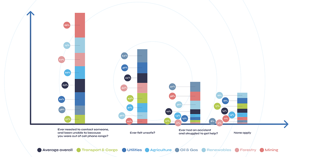
Results show over 60% of lone workers surveyed have been in a situation where they have needed to contact someone and were unable to, due to lack of mobile phone reception. Comparatively, for those within the Mining and Renewables industries, this figure rose to 88% and 73% respectively.
Further, almost one fifth (19%) of those surveyed reported having an accident, and struggling to get help. Encouragingly, none of the lone workers from the Forestry sector indicated having an accident when lone working, but this increased to over 40% within the Oil and Gas industry. Subsequently, workers within Oil and Gas were also most likely to report having felt unsafe (54%); 10% above the overall average.
How frequently do those responsible for lone workers check in with them?
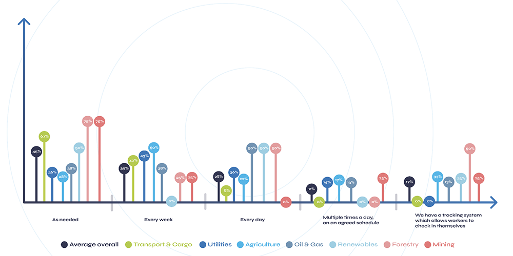
Overall 28% of respondents reported daily check-ins with their lone workers, 39% weekly and 45% as needed on a demand basis. Just 17% confirmed having a tracking system which allows lone workers to check in themselves, and over 10% disclosed checking in multiple times per day.
Interestingly, those within the Forestry sector were most likely to report more frequent check-ins – 75% indicating as needed and 50% every day. Additionally, 50% of those within Forestry also confirmed having a tracking system whereby their workers could check themselves in. This is particularly significant, considering the overall average reported was just 17%. In contrast, none of the respondents within the Transport & Cargo nor Utilities industries, indicated having a tracking system lone workers could use. Given the operational efficiency benefits these types of systems can deliver, this is quite surprising.
How robust are current lone worker communication strategies?
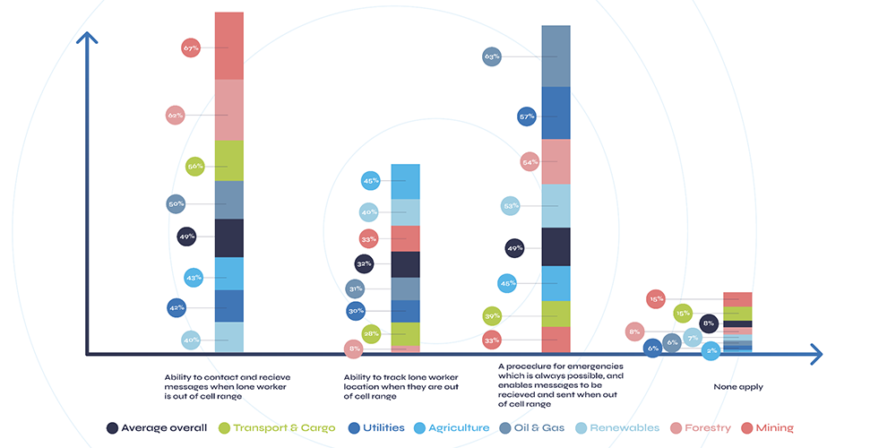
As illustrated above, only 49% of respondents reported having the ability to both send and receive messages while lone workers were out of mobile phone range. This figure remained the same when recipients were asked whether they had a procedure which could always be followed (even if there had been an accident or equipment failure), that enabled messages to be sent and received without mobile phone reception. Interestingly for those within the Mining industry, despite 67% reporting the ability to send and receive messages while out of mobile range, just 33% confirmed the ability to do this under all circumstances, for example in the event of an accident or equipment failure.
Additionally, less than one third (32%) of respondents overall confirmed they were able to track the location of a lone worker out of mobile phone range. This fell to just 8% in the Forestry industry.
Finally, 8% of respondents overall and 15% of those within the Transport & Cargo and Forestry sectors, indicated that they were unable to support any of these communication scenarios.
In summary, although our research represents just a snapshot of lone worker operations in North America, it does highlight that organisations still have some way to go in terms of safeguarding lone workers; a sentiment which holds true across all surveyed industries.
The future of lone worker safety: The RockSTAR
Communication plans and tracking are imperative to lone worker safety and increasing operational efficiency. With this in mind, it would be remiss of us to not talk about the RockSTAR device by Rock Seven (now trading as Ground Control). This powerful, handheld device allows the user to send and receive short messages from anywhere on Earth with a clear view of the sky. The unit is waterproof, ruggedized, and built to withstand the most challenging environments. And perhaps most importantly, the RockSTAR is able to transmit every minute with 15-second updates, ensuring teams know the whereabouts and safety of their lone workers at all times.
What is TracPlus?
TracPlus is a trusted real-time tracking and communication platform of first responders, government agencies, militaries, and other critical operators around the world. It has been developed to deliver situational awareness to first responders, irrespective of who owns the asset, what the asset is, who provides the tracking, or what the platform or signal type is – be it radio, cellular or satellite.
Get in touch
Ground Control and TracPlus have worked in partnership for over eight years, developing essential, cost-effective solutions for organisations and their remote field workers all over the world.
If you’d like to get in touch with our expert team, simply complete our online form, or you can email sales@groundcontrol.com or phone us on +1.805.783.4600 (USA) or +44 (0) 1452 751940 (UK).