Topic: Environmental
Remote Conservation at Wildfire Risk: Monitoring and Alerting with Satellite IoT
For teams managing remote conservation areas, wildfire risk is becoming harder to predict and harder to plan for, even in regions that have not historically been considered fire prone. Rising temperatures and longer dry periods are changing how fire behaves across forests, reserves, and protected land. One recent study found that 83.9% of wildfire-vulnerable species are now exposed to increased fire risk, with fire seasons projected to more than double in some regions. This isn’t limited to traditionally fire-prone zones. Fire seasons are lengthening, and fire behaviour is becoming less predictable and harder to contain.
You may already be seeing the signs: vegetation staying dry for longer, water sources becoming less reliable, and more ignition points across a wider area. For smaller teams covering large territories, this shifts wildfire from a seasonal concern to an ongoing operational risk.
Why remote sites are exposed
Remote conservation areas come with structural challenges that make wildfire response harder. Teams often work across large, varied terrain with limited visibility, minimal infrastructure, and inconsistent or absent cellular coverage. Ranger teams are small, but the areas they cover are not.
When a fire starts, response depends heavily on what you can detect and communicate locally. In Madagascar, one protected reserve lost around a third of its forest in a single year due to wildfire pressure linked to rising temperatures and prolonged dry conditions. Events like this highlight how quickly impact scales when detection or response is delayed.
Distance from emergency services also increases pressure on conservation teams, while budget constraints shape what can realistically be deployed. And when habitats support endangered species, even a single event can cause long-term ecological damage.
What monitoring looks like today
Wildfire monitoring is typically shaped by scale and budget. In practice, teams may rely on ranger patrols and visual observation, weather tracking such as temperature, wind, and humidity, external satellite data sources, camera systems, or WAN sensor deployments.
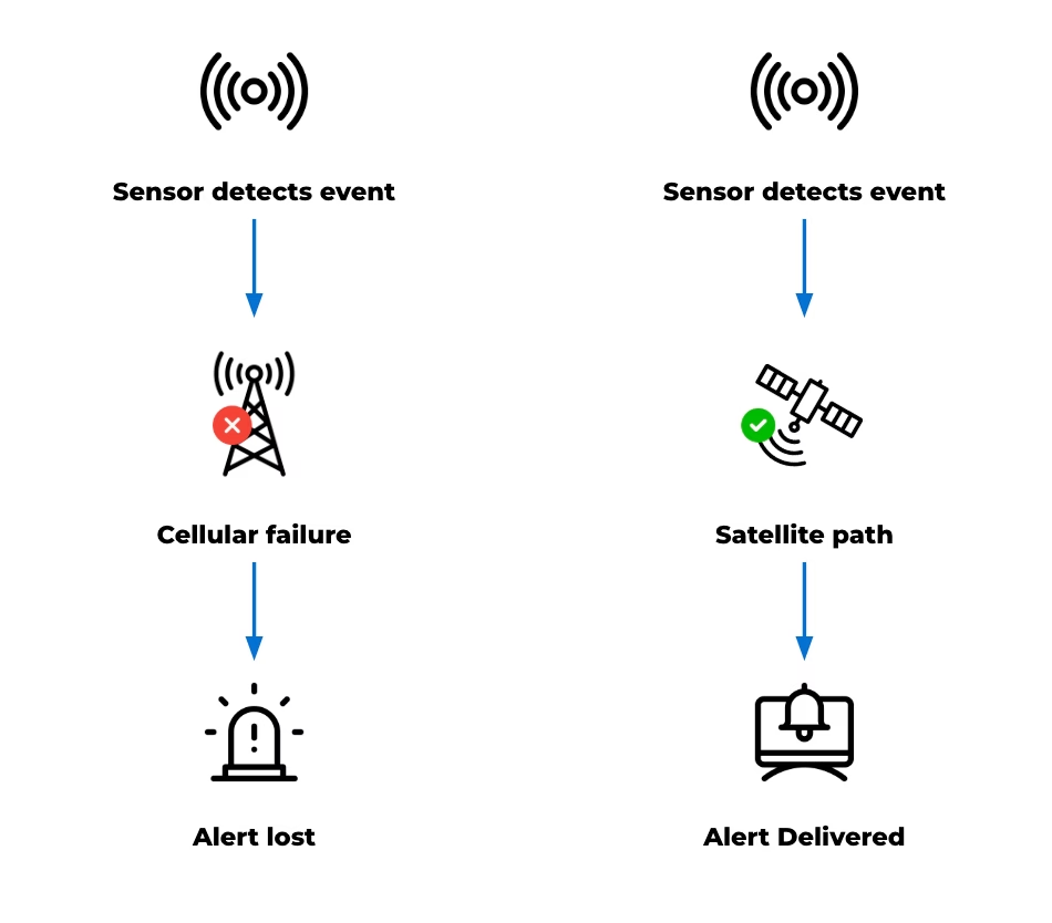
These tools are valuable. They provide signals, support situational awareness, and in some cases trigger real time responses. However, while the capability to monitor exists, the limitations of existing approaches are largely practical. Detection may depend on chance observation and can come too late, while reliance on cellular communication can fail under the stress of an unanticipated emergency that disrupts the very channels needed for response.
Even when sensors are deployed, reliably transmitting alerts can be difficult. Data may be captured but not delivered effectively, creating a gap between detection and awareness. Constraints like these become more visible as wildfire risk increases.
Why time is of the essence
Delays in detecting early-stage fires reduce the available window for intervention. In fast-moving conditions, even short delays can significantly increase the scale of an incident. At the same time, teams may be distributed across the landscape, and lone workers need reliable communication for both safety and coordination.
The 2024 Jasper National Park wildfire shows how quickly situations can escalate, even in well-managed environments. The event led to around 25,000 evacuations and the loss of hundreds of structures. In more remote settings, with fewer resources, the margin for delay is even smaller.
Detection works. Delivery is the problem
Deploying sensors to monitor temperature, humidity, and smoke across high risk areas can provide meaningful early signals from systems that run for long periods on minimal power.
The FireFly project in Northern Thailand is a strong example. Distributed sensor nodes monitored forest conditions and identified early fire risk, with UAVs used to confirm ignition points. The system was designed specifically for remote, low infrastructure environments with cost in mind. But field observations highlighted a recurring issue: antenna placement and enclosure design affected system reliability, while dense vegetation and uneven terrain disrupted connectivity. Environmental conditions directly influenced whether data could leave the site. In other words, detection worked, but alert delivery didn’t always follow.
The same pattern appears in field-based wildfire and peatland monitoring projects more broadly. Sensors can detect early stage fire risk, land degradation, or changing environmental conditions, but the value of those systems depends on whether data can leave the site quickly and reliably. Studies of IoT wildfire detection systems highlight communication reliability, limited cellular coverage, packet loss, latency, and energy consumption as practical deployment challenges in remote environments. The communication channel, or “last mile” connection, is therefore critical to whether early detection becomes timely awareness.
Solving the last mile with Satellite IoT
In remote conservation areas, terrain, vegetation, and distance from infrastructure all affect signal performance. Systems that depend on terrestrial networks introduce gaps and points of failure. Satellite IoT removes that dependency.
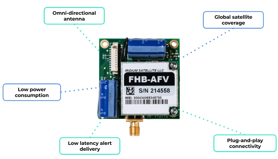
By integrating a compact modem such as RockBLOCK 9603, a sensor monitoring system can send data over the Iridium satellite network with no reliance on local infrastructure. That creates a direct path from your sensor to you, without relying on local coverage.
In practice, the workflow is simple:
- Sensors monitor defined environmental thresholds
- Local logic determines when conditions require attention
- A short alert message is generated
- That message is transmitted via satellite to your team.
Messages remain small, and transmission can be event driven, supporting low power operation and long deployment lifetimes. For conservation teams, this enables a focused deployment model: a limited number of sensors placed in high risk areas, with a communication path that remains consistently available.
When a fire is detected, the system alert is delivered, reliably, and in time to act.
When you need more field capability
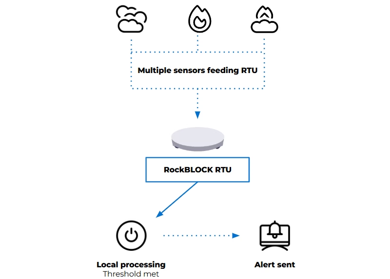
For some deployments, a compact satellite modem may be enough to connect an existing sensor system. For others, the monitoring setup needs to handle multiple sensor inputs, apply logic locally, and decide when an alert should be sent.
That’s where a device such as RockBLOCK RTU can be useful. It aggregates sensor inputs from a range of sources and applies threshold logic in the field. When defined conditions are met, it generates alerts and transmits telemetry via its satellite connection.
This approach reduces dependency on continuous connectivity and avoids the need to send raw data elsewhere for processing. Decisions are made where the data is generated, according to the conditions being monitored. Reducing unnecessary data transmission also helps keep satellite costs to a minimum.
In practice, that gives you:
- One unit integrating multiple sensors
- Configurable thresholds based on your environment
- Event-based alerting instead of continuous transmission
- Context included with each alert.
The right approach depends on the scale of the site, the number of sensors required, and how much processing needs to happen in the field.
Designing for increased wildfire risk
Effective wildfire monitoring systems prioritize early detection and dependable alert delivery. They need to operate with limited power, minimal infrastructure, and changing environmental conditions, while remaining simple enough to deploy and maintain and reliable enough to trust when something happens.
Recent events reinforce the need for this approach. Reliability, simplicity, and clear information delivered to the right people at the right time can protect lives and support more effective response.
Facing a remote monitoring or alerting challenge?
If your team needs to detect environmental risk, transmit alerts from areas without reliable cellular coverage, or keep remote systems connected, we can help you explore the right satellite IoT approach.
Complete the form, or email hello@groundcontrol.com to discuss your use case with our team – we’ll reply within one working day.
From Alerts to AI: Satellite IoT in Landslide and Earthquake Monitoring Systems
April 2026’s reports of seismic activity and tsunami warnings in Japan have again highlighted how critical early warning systems are. Events like these reinforce a consistent reality: detection is only part of the system. The ability to communicate alerts quickly and reliably remains central to reducing impact.
As landslide, earthquake and tsunami monitoring systems evolve, this communications challenge is becoming more complex. Monitoring is moving beyond single parameter approaches toward multi-sensor systems that integrate different data types to improve situational awareness and reduce false positives. At the same time, research institutions are applying machine learning and deep learning techniques to identify patterns that may be difficult to detect through rule-based models alone.
These developments increase system capability, but they also change system requirements. More sensors generate more data. AI-driven approaches require datasets that are larger, more continuous and better contextualized. As a result, monitoring system design now has to account not only for detection, but also for power, data volume, transmission frequency, and the role of processing at the edge.
Detection is only useful if the alert gets through
Detection capability has improved significantly, and monitoring systems can often identify early signs of instability. But detection only matters if alerts reach the right people in time. That remains difficult in remote terrain. Monitoring sites are often located where infrastructure is limited, ground conditions are unstable, and access is restricted. Power depends on what the natural landscape allows, while cellular networks may be unavailable, unreliable, or vulnerable during an event.
As a result, a system can continue collecting data even when its communications path fails. This creates a gap between detection and action, reducing the value of the system no matter how capable the sensing layer is. International frameworks on early warning systems highlight that coverage is improving globally, but reliability and last-mile delivery remain key challenges.
Satellite connectivity can help close that gap. Because it does not rely on local infrastructure, it provides an independent communications path for remote or vulnerable locations. Ground Control’s earlier work in tsunami early warning systems in Thailand demonstrates how satellite connectivity can support resilience and last-mile data delivery, helping ensure that critical alerts can reach emergency response systems when local infrastructure is limited or unavailable.
Natural hazard monitoring is becoming more data intensive
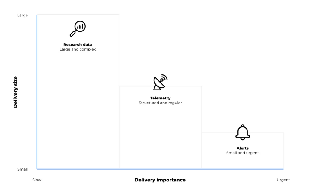
As scientific research continues to evolve, natural hazard monitoring systems can generate a broad range of data. Traditional threshold-based systems typically produce discrete, event driven messages. Multi sensor deployments and research programs, by contrast, may generate continuous and contextual datasets that support analysis, model development, and validation. Within a single monitoring system, data may include:
- Time critical alerts
- Ongoing telemetry
- Device and system health data
- Larger datasets used for analysis and research
- Photographic, mapping, audio, or video data.
Modern systems may combine LoRaWAN sensor networks, remote sensing methods such as radar, terrestrial and non-terrestrial communications, and both edge and cloud processing. Satellite devices are introduced into these systems to address coverage gaps, provide an independent communication path, or support resilience where terrestrial networks are limited.The key point is that not all data behaves in the same way. A short emergency alert has very different requirements from periodic telemetry or a large dataset used for research. In practice, satellite IoT devices can support different roles depending on the size, urgency and value of the data being transmitted.
Three types of data, three connectivity roles
In earthquake, landslide and tsunami monitoring, the connectivity question encompasses what kind of data needs to move, how urgently it needs to move, and how much processing should happen before it leaves the site. Broadly, data requirements fall into three categories:
| Alerts | Telemetry | Research and AI Data | |
|---|---|---|---|
| Typical Behavior | Small, urgent, event driven | Regular, structured, operational | Larger, richer, less time critical |
| Main Requirement | Must get through | Efficient visibility over time | Filtering, storage and selective |
| Satellite IoT Role | Resilient short message transmission | Periodic monitoring and backhaul | Edge processing and higher capacity |
1. Time critical alerts: small messages, high consequence
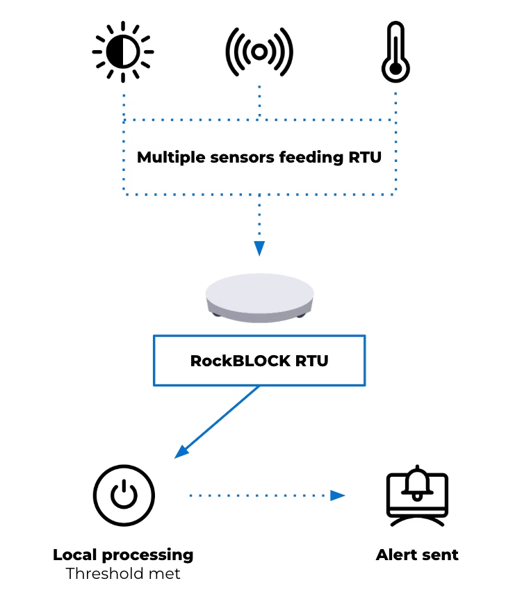
For alert generation, the desired output may be a critical message triggered by defined thresholds or rules. When conditions are met, an alert can be generated at the device level and transmitted as a short message. This reporting by exception approach reduces dependence on continuous connectivity and helps keep satellite airtime costs to a minimum. Alerts are triggered by local conditions and transmitted when a predefined perimeter is breached.
This isn’t to suggest that hazard monitoring is simple. Rather, some parts of the system still depend on very small, high priority messages: a threshold has been crossed, a device has changed state, or an alarm needs to be raised.
Devices such as RockBLOCK RTU are designed for this type of integration and event driven monitoring. Supporting multiple sensor inputs and enabling local data batching at the edge, the RTU allows data output to remain minimal in size but critical in importance.
This reflects the same principle seen in the tsunami early warning system mentioned earlier, where the priority is ensuring that critical signals can be generated and transmitted under constrained conditions. The RTU also offers sensing, data logging and action on basic threshold triggers. It’s not designed for high level data processing, but it can play an important role in raising an alarm, warning a community, and ensuring that the message gets through.
2. Telemetry: maintaining visibility between events
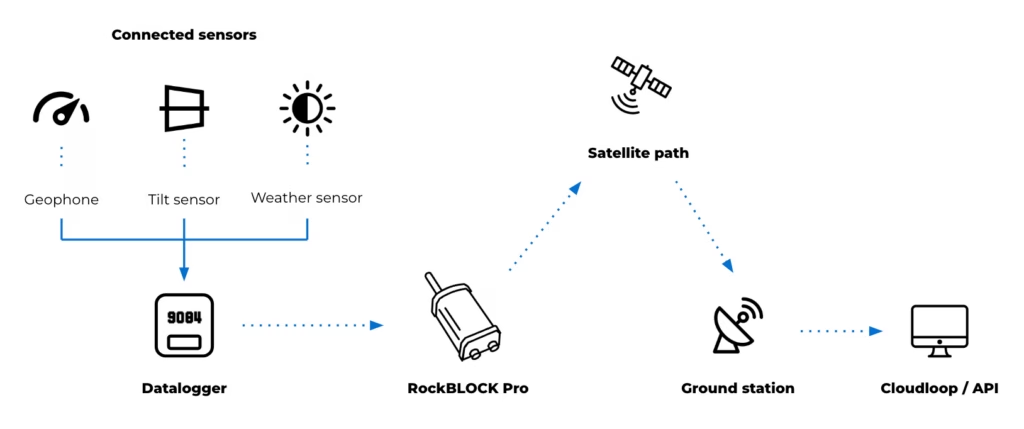
Alerting is only one layer of a monitoring system. Beyond emergency messages, earthquake and landslide monitoring systems also require ongoing visibility into environmental conditions and system status. Telemetry requirements may include periodic sensor readings, device diagnostics, system health information, and environmental trends over time. This data supports the interpretation of conditions leading up to and following an event. It can also be used to validate system performance and support operational decision making.
Here, architectural decisions often depend on project cost, power budget and the frequency of transmission. Compared with short alert messages, telemetry may require greater data capacity and more regular communication. It remains structured and predictable, but introduces additional considerations around bandwidth and power usage.
For these purposes, devices operating over services such as Iridium Messaging Transport (IMT) may support this type of data flow. RockBLOCK Pro delivers faster throughput and enables larger payloads than SBD, supporting aggregated sensor data, images and audio clips up to 100kB. This provides more flexible data transmission patterns compared to low bandwidth messaging.
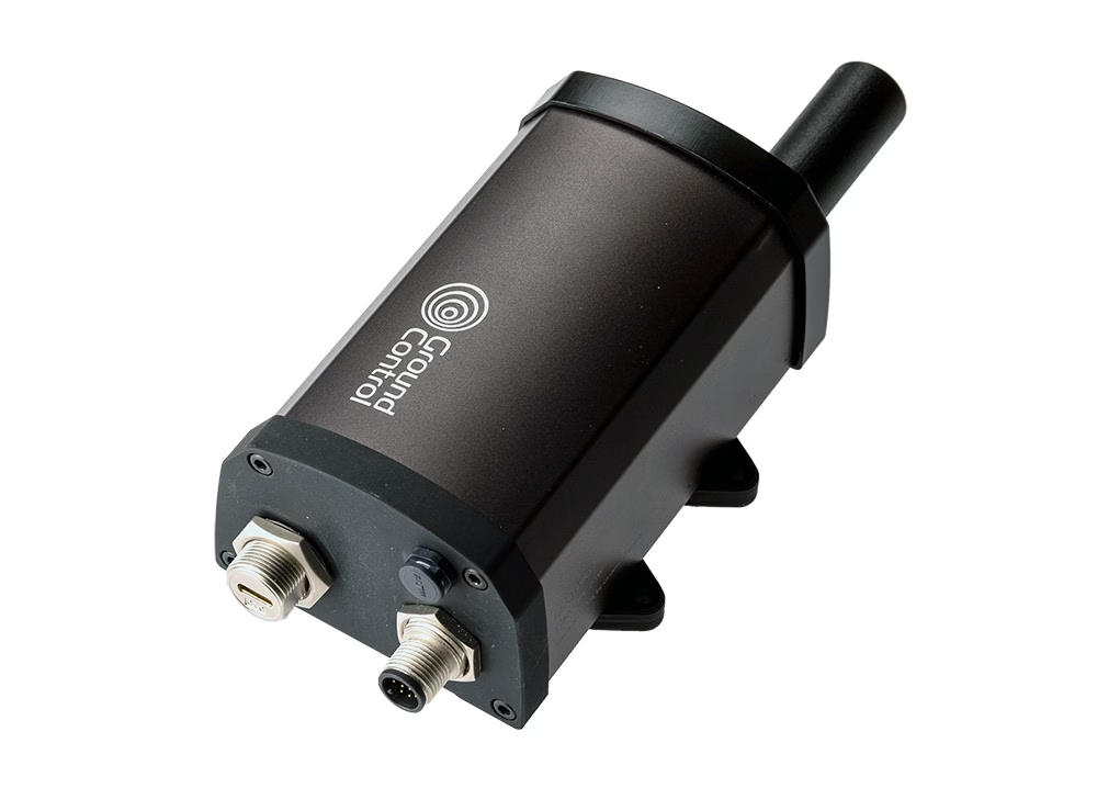
As an IP66 rated terminal, RockBLOCK Pro has a rugged design with a built in Iridium Certus antenna. Its combination of GNSS and serial interfaces (such as RS232/RS485) allows it to integrate with external systems or data sources, acting as a communications layer for structured telemetry and providing a means to transmit aggregated or processed seismology and landslide data. This may include:
- Ground movement sensors such as geophones and accelerometers
- Tilt and deformation sensors for slope and structural monitoring
- Pressure and moisture sensors for groundwater and subsurface conditions
- Threshold-based triggers such as seismic switches for alert activation
- Environmental sensors including rainfall and wind
- Serial connected instruments using RS485 or RS232
- USB field access for configuration, data retrieval and maintenance.
The introduction of RockBLOCK Pro for backhaul or resilience provides additional monitoring capability and a significant increase in capacity to support a wider remote natural hazard monitoring system.
3. Research and AI workloads: when raw data is too large to send continuously
As monitoring systems expand to support research and model development, data requirements extend beyond alerts and telemetry. These datasets may include high resolution sensor data over extended periods, multi sensor correlations across locations, and inputs used for training and validating analytical models. This type of data is higher in volume and less time sensitive, but still requires a reliable path from remote environments.
Systems often store or buffer data locally and transmit it based on available bandwidth, power and connectivity. This may involve scheduled transfers, event-based uploads, or selective transmission of processed data. Devices such as RockREMOTE Rugged support this role by combining higher throughput connectivity with embedded compute capability. They act as an interface between field deployments and cloud-based systems, enabling data handling, filtering and integration with external platforms.
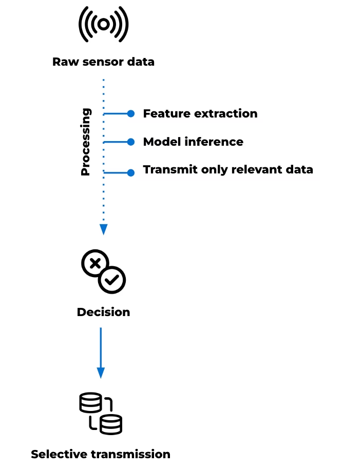
At this point, the device’s role isn’t limited to communication; it becomes part of the data management architecture. High frequency sensing, particularly in seismic monitoring, can generate more data than can be transmitted continuously over constrained links. Local processing allows this data to be reduced before transmission. Tasks such as filtering, segmentation and feature extraction can be applied at the point of collection, allowing derived parameters to be transmitted in place of raw data.
This preserves the characteristics needed for analysis while maintaining manageable data volumes. Edge computing can also support lightweight analytical models at the edge, depending on the application deployed.
These models, typically trained on historical datasets, can be applied to live data streams to identify signals of interest. This may include distinguishing between background activity and patterns associated with instability or early seismic events. In these scenarios, transmission is based on relevance rather than volume. Data is prioritized according to its analytical value, rather than transmitted continuously.
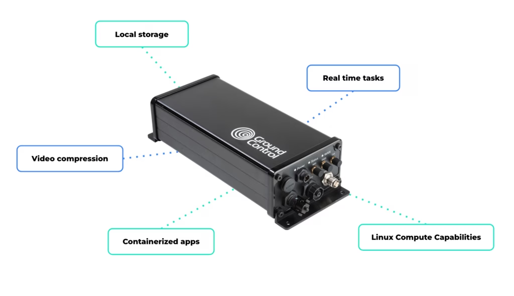
RockREMOTE Rugged’s Linux-based environment supports custom applications, enabling user-defined data processing and integration and allowing custom processing pipelines or models to be deployed at the edge. Local storage enables data retention where continuous transmission is not practical, while connectivity over Iridium Certus 100 and cellular networks provides a path for data to move to cloud environments when required.
This supports a range of system behaviors, including:
- High frequency data capture with selective transmission
- Local feature extraction to reduce bandwidth requirements
- Model inference at the edge to support early interpretation
- Buffered storage for later retrieval or batch upload
- Video compression before transmission
- Running real time tasks such as filtering, segmentation, or frequency-domain analysis
- Saving high resolution data locally
- Transmitting exception summaries via satellite.
In earthquake and landslide monitoring, the value of this compute power is in its ability to manage complex data flows locally, reduce unnecessary transmission, and support more autonomous system behaviour through locally defined logic or processing in remote environments.
Satellite IoT as part of the monitoring infrastructure
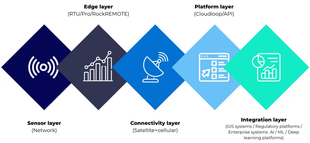
The evolution of landslide and earthquake monitoring systems is shaped by two parallel developments. The range of observable data is increasing through multi-sensor integration, remote sensing and advanced analysis. At the same time, environmental and operational constraints remain consistent. Monitoring sites are often remote, power limited and difficult to access. Communications infrastructure may be unavailable, unreliable or exposed to the same hazards the system is designed to monitor.
Within this context, connectivity supports the movement of different types of data, from time critical alerts to larger datasets used for analysis. Satellite enabled devices extend coverage and enable communication where other infrastructure is limited. Different device types support different roles within the system. Some are suited to edge-based alert generation. Others support structured telemetry and system visibility. Higher capacity devices with embedded compute power can help process, prioritize and transmit larger datasets for research and AI-assisted monitoring.
The most effective system design starts with the data: its urgency, size, frequency and operational value. From there, satellite IoT can be used as a resilient layer within a wider monitoring architecture.
Building the connectivity layer for modern monitoring systems
Whether you’re building threshold based alerts, expanding telemetry, or exploring edge processing for AI driven monitoring, the challenge is the same: getting the right data through, at the right time, under real world constraints.
We work with system integrators, scientists, and engineers, to design connectivity architectures that balance power, cost, data volume, and resilience across satellite and hybrid networks.
Complete the form or email hello@groundcontrol.com, and we’ll be in touch within one working day.
How Satellite IoT Can Underpin Confidence in Remote Water Systems Monitoring
Water quality monitoring no longer sits at the edge of operational strategy. It’s at the center of regulatory exposure, public reporting, and engineering accountability.
Designing or managing remote water quality monitoring systems lays the foundation for data continuity, defensible timestamps, and structured reporting outputs that withstand regulatory scrutiny. Across the UK, the United States, and other regulated markets, compliance expectations are tightening. Monitoring systems must now deliver continuous data, auditable records, and structured exports suitable for regulator portals and public dashboards.
Satellite IoT plays a defined role in meeting this regulatory need. The right architecture for the job reduces reliance on intermittent or patchy cellular coverage and strengthens confidence in the data transfer. The result is not simply connectivity; it’s system resilience and credibility.
Here we explore two remote water monitoring examples, and what they show about building confidence in the audit trail that follows.
How Regulatory Pressure is Reshaping Monitoring Design
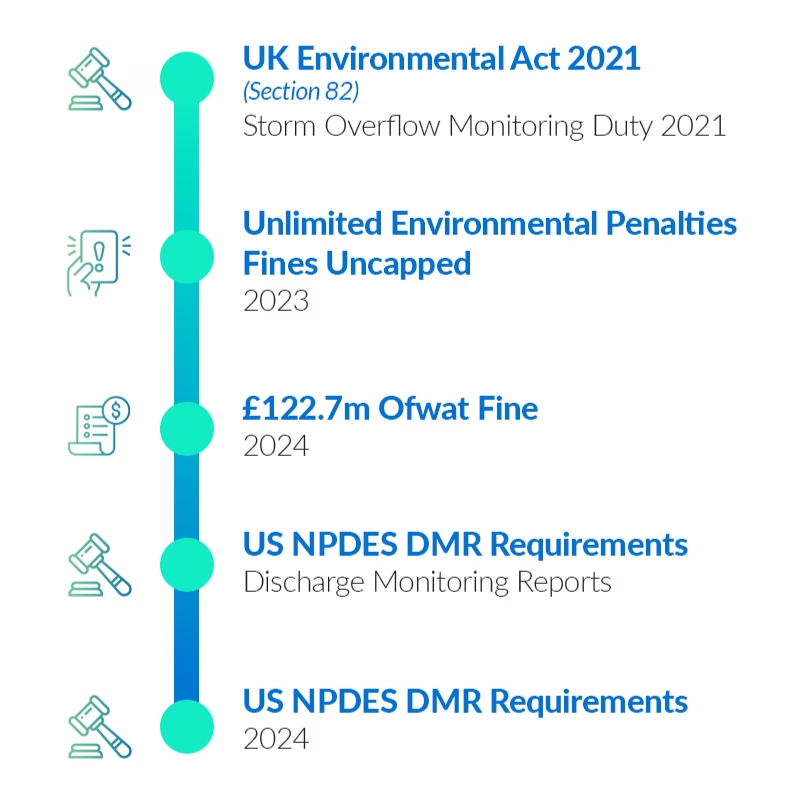
In the UK, the Environment Act 2021 introduced statutory duties around monitoring upstream and downstream of storm overflows and sewage disposal works (Section 82). The UK’s storm overflow policy guidance outlines expectations for monitoring and transparency. Following on in 2023, environmental penalties in the UK were uncapped, removing the previous £250,000 ceiling for serious breaches. Enforcement activity has since reflected this increased accountability.
In the United States, the Clean Water Act operates through the National Pollutant Discharge Elimination System (NPDES). Submitting Discharge Monitoring Reports (DMRs), and reporting violations contribute to the Significant Noncompliance status. In summary, regulatory frameworks are established; what continues to evolve is their technical implication.
How Water Monitoring Systems Support Regulatory Standards
Why Connectivity Determines Confidence
Many remote river gauges, reservoirs, and discharge sites sit outside reliable cellular coverage. Even where coverage exists, service continuity can degrade during extreme weather, power disruption, or infrastructure failure. Total reliance on cellular connectivity introduces exposure.
Satellite IoT addresses this constraint directly. Low Earth Orbit (LEO) networks provide global coverage without dependence on local infrastructure. While satellite is not the right fit for every data profile, it offers coverage certainty where terrestrial networks cannot.
For message-based telemetry, Iridium Short Burst Data (SBD) supports low latency, small payload messaging suited to alarms, status updates, and exception-based reporting. That makes it particularly relevant where compliance-related events need to be captured and transmitted reliably from remote locations.
In practice, resilient remote monitoring often combines connectivity approaches to balance immediacy, scale, and power constraints. The examples below show what that can look like in water utility operations.
Case Study 1: Reservoir Monitoring and Remote Pump Control
The first example involves a remote reservoir that requires dependable monitoring and controlled pump activation despite unreliable cellular coverage. Two RockBLOCK RTUs were installed.
The upper unit measures water level and flow. It operates outside cellular range and uses Iridium SBD to transmit short command and status messages. When the water level is sufficient, it signals the lower RTU to activate the pump.
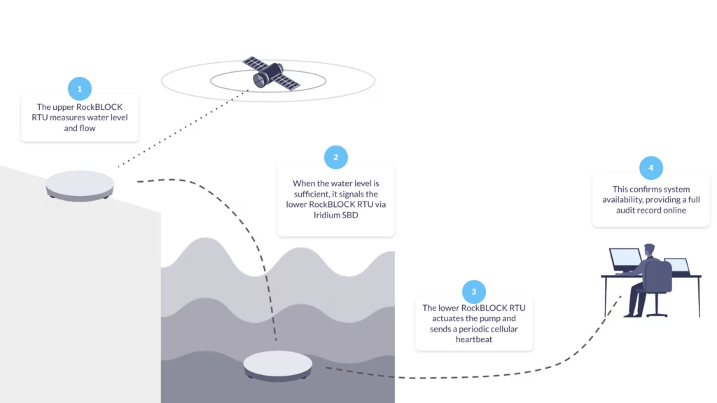
The lower RTU actuates the pump and sends a periodic cellular heartbeat to confirm system availability, providing near-real time confirmation of upstream conditions, controlled pump activation, documented event timestamps, and independent verification of site status.
From a compliance perspective, the Cloudloop platform retains a time sequenced record of level measurement, command transmission, pump activation, and heartbeat confirmation. Therefore, if questioned, the operational timeline can be reconstructed.
Case Study 2: River Health Monitoring With Micro Data Logging
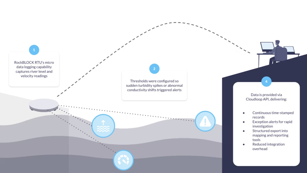
In our second deployment example, a local water authority needed to measure river level and velocity, derive discharge, and capture core water quality indicators. Rather than installing a full stand-alone data logger with integrated satellite comms, RockBLOCK RTU’s micro data logging capability was used to capture essential metrics.
Thresholds were configured so sudden turbidity spikes or abnormal conductivity shifts triggered alerts. Measurements flowed directly into the connected software via Cloudloop API integration.
This approach provided continuous, time-stamped records, exception alerts to support rapid investigation, structured export into mapping and reporting tools, and reduced integration overhead. For remote water monitoring more broadly, logging infrastructure and communications layers remain unified rather than fragmented across separate systems.
Building an Auditable Data Pathway
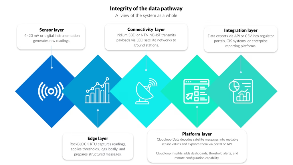
Confidence in remote water quality monitoring doesn’t come from a single device, but from the integrity of the whole data pathway. When time stamps are preserved across each layer, transmissions are acknowledged, and configuration changes are logged, reliance on manual consolidation falls, reducing errors and saving both time and money.
Auditability Across the Monitoring Chain
Within the layered architecture described above, the platform layer is where telemetry becomes a structured operational record.
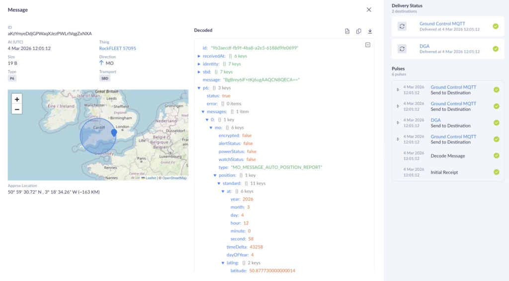
Cloudloop Data provides the ingestion and decoding layer between satellite transmission and operational systems. Messages received from RockBLOCK RTU are converted into readable sensor values, normalized, time stamped, and made available through a secure portal or API.
This removes the need to manage raw payload parsing internally and helps ensure each transmission is logged with the metadata needed for traceability, including device identity, transmission time, and delivery status.
In the reservoir monitoring example, level measurements, command triggers, and pump activation confirmations are preserved as a time-sequenced operational record.
In the river health deployment, turbidity and conductivity alerts are decoded and logged with consistent metadata before export into reporting and GIS tools.
Visualizing and Integrating Monitoring Data
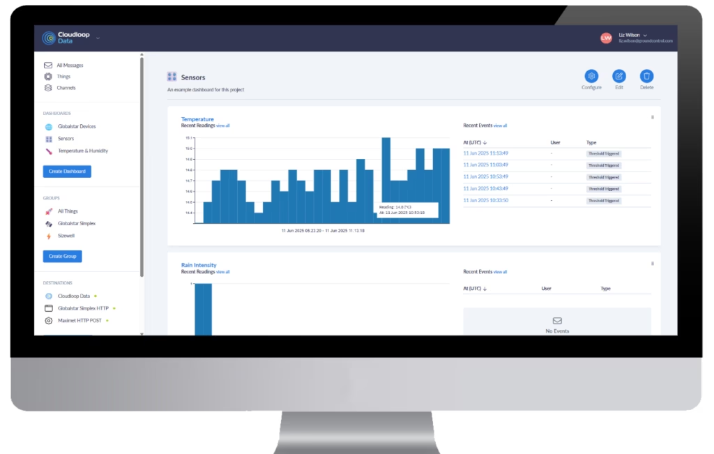
Cloudloop Insights builds on that structured data foundation by providing visualization, threshold configuration, and remote device control. Dashboards show both live and historical values, while threshold breaches, device status changes, and configuration updates are retained as part of the operational record, helping link system behavior back to defined monitoring parameters.
Both Cloudloop Data and Cloudloop Insights expose APIs, allowing telemetry and control data to flow into regulator submission tools, GIS environments, enterprise asset management systems, and custom EMS platforms. This API-first approach supports automated export for NPDES or UK reporting workflows, structured integration with mapping systems, programmatic access to historical telemetry, and closer alignment between remote measurement and institutional record-keeping.
As remote water quality monitoring comes under greater regulatory scrutiny and public visibility, monitoring systems need to support continuous measurement, structured reporting, and reconstructable data lineage across distributed, infrastructure poor environments. Together, these examples show how message-based satellite telemetry, edge logging, and structured platform integration can support compliance-grade monitoring.
Can we help?
If you are reviewing or upgrading a remote monitoring architecture, our Technical Solutions team can help assess site conditions, regulatory obligations, sensor requirements, latency needs, and audit trail completeness.
Complete the form or email hello@groundcontrol.com and we’ll get back to you within one working day.
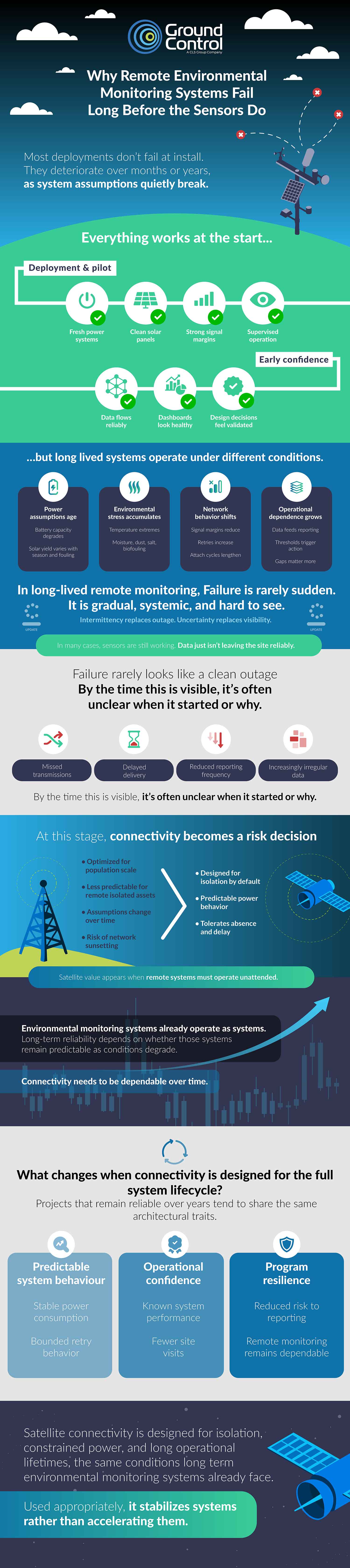
Infographic: Why Remote Environmental Monitoring Systems Fail
Plus, How to Create Long Term Monitoring Stability
Remote environmental monitoring systems rarely fail all at once. Performance erodes gradually; data gaps widen, devices fall offline intermittently, power budgets tighten, and maintenance intervals shrink. Over time, reliability drops below what the original design assumed. The infographic below summarizes the most common technical and operational factors behind that decline, based on long term field observations across utilities and remote environmental monitoring deployments.
Many of these patterns may be familiar to you, yet their cumulative impact over five to ten years is less visible. Long term degradation is typically captured in post-mortems, warranty data, and support logs rather than formal reporting, so systemic reliability issues are often inferred from truck rolls or unexplained data loss instead of addressed at the design stage. Connectivity selection, power design, enclosure strategy, and remote management capability all shape lifecycle performance. Understanding these failure modes helps frame more durable trade-offs early, particularly where hybrid cellular and satellite options are being considered.
Helping OEMs Choose
For sensor OEMs, long term reliability increasingly shapes product selection and channel acceptance. Coverage variability, power constraints, integration overhead, and regulatory requirements all influence whether satellite or hybrid connectivity is commercially viable within your portfolio.
Our Environmental Sensor OEM connectivity guide outlines practical integration models, device classes, lifecycle considerations, and where satellite and hybrid designs materially reduce field failure risk. It is structured to support internal technical and commercial evaluation.
View Guide
Designing for Long Term Remote System Performance
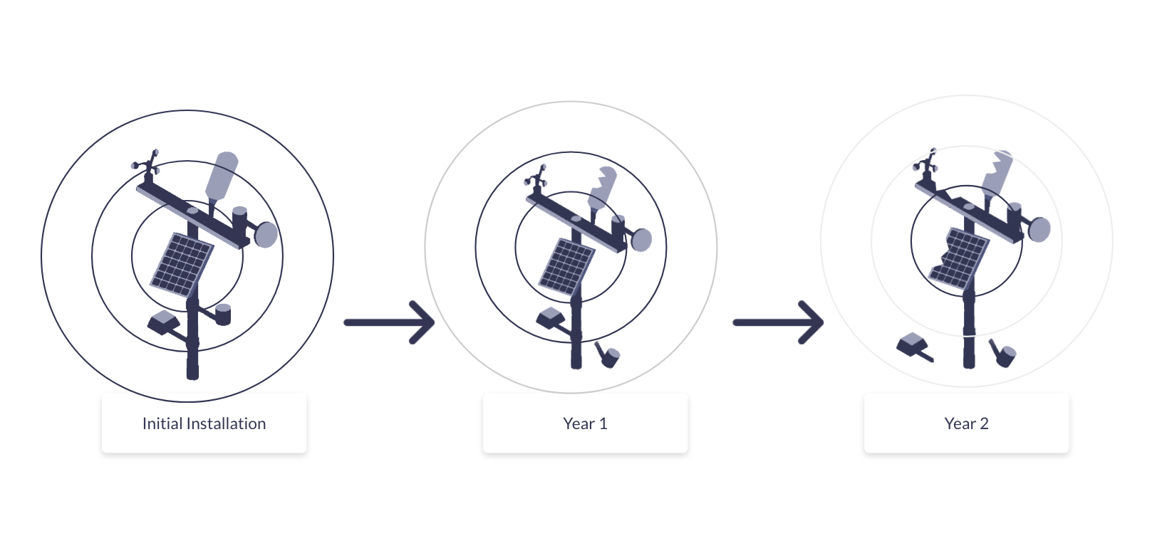
If you’re designing for durable performance over the full deployment lifecycle of your remote environmental monitoring system, that means balancing coverage, power budget, data volume, enclosure design, remote management, and maintenance costs before scale amplifies weaknesses.
Satellite and hybrid architectures introduce different trade-offs depending on reporting frequency, firmware strategy, and site accessibility. Reviewing these options early helps reduce unplanned site visits and sustain data continuity over years, not quarters.
We’ve written more about this in our blog: Designing for Power and Reliable Data Delivery Under Uncertain Connectivity.
Find out more
If you are reviewing a current deployment or planning a new one, we can provide structured technical input based on your use case, power constraints, data profile, and coverage requirements. We design and manufacture our own devices and also support third party satellite hardware, so recommendations are aligned to lifecycle performance rather than a single product line.
If you complete the form with a brief outline of your application and constraints, a member of our engineering or technical support team will respond with impartial, practical guidance.
Designing for Power and Reliable Data Delivery Under Uncertain Connectivity
If you integrate remote environmental monitoring systems, you will eventually encounter a site where connectivity becomes the dominant uncertainty. Sensors continue to sample correctly. Local electronics remain operational. Yet data delivery becomes intermittent or unpredictable. In many cases, the issue is not outright loss of coverage, but changing network conditions at sites that were always near the edge of what terrestrial connectivity could reliably support.
At that point, the problem shifts. It’s no longer about sensor selection or firmware optimization, but rather a system design question: how do you maintain low power operation and predictable data delivery when network behavior cannot be assumed to be stable over time? This is where system integrators typically start comparing architectural options rather than individual bearers.
The first of these options is terrestrial cellular, using LTE-M or NB-IoT, where coverage is stable and well characterised over time. The second is proprietary satellite connectivity, where coverage reach and low duty cycle operation are prioritized over throughput. The third, emerging option is Non Terrestrial Network (NTN) NB-IoT, defined in 3GPP Release 17, which aims to extend cellular standards beyond terrestrial infrastructure using satellite networks.
Each model behaves differently at the system level. None is universally good or bad. The challenge for the system integrator is determining which operating envelope matches the realities of a given deployment.
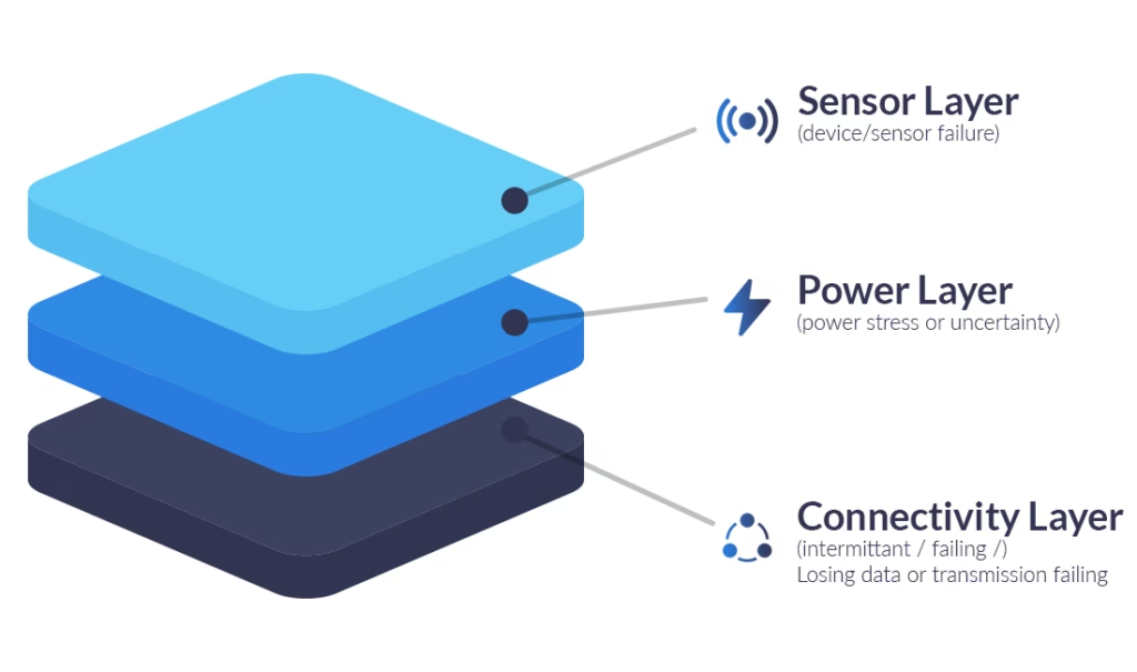
A Practical Decision Framework for Remote Monitoring Sites
In practice, connectivity decisions are best framed around a small number of system-level criteria:
- How stable is coverage over seasons, vegetation cycles, and weather, not just at installation?
- How defensible does the connectivity choice need to be over a multi-year deployment?
- Is the team building a custom node, or does it prefer an integrated monitoring device?
- How constrained is power, and how expensive is site access if batteries deplete early?
- What is the expected payload size per reporting interval?
- How often does the device need to wake and transmit, and how tolerant is the application to latency?
In remote environmental monitoring, these questions are often more predictive of long term system than headline bandwidth figures or nominal coverage maps. They surface how connectivity behaves over time, how often radios wake, and how energy is actually consumed under real site conditions.
Technical Connectivity Matrix
The matrix below helps match connectivity options to their most defensible operating envelopes, and is most useful when applied to site conditions rather than connectivity technologies in isolation. In marginal or variable RF, devices may spend longer acquiring the network and retrying transmissions, which increases energy consumption and reduces delivery reliability / latency predictability. Those risks can matter as much as nominal coverage.
| Cellular NB-IoT | Proprietary Satellite* | NTN NB-IoT** | |
|---|---|---|---|
| Primary Strength | Lowest cost per KB; high throughput | Global reach; predictable power profile | Converged hardware model; emerging reach |
| Coverage Stability | Variable at cell edges; sensitive to vegetation | High, assuming hemispherical sky view | Emerging; constellation dependent |
| Low Power Operating Modes and Sleep Opportunity | Supports PSM (very low average possible), but sleep opportunity depends on operator timers + coverage | Supports true deep sleep via power gating between scheduled bursts (system design dependent) | Early estimates ~10–50 µA |
| Transmit Load Profile | TX current is variable (uplink power control, coverage enhancement). Worst case energy / on time can increase due to repetitions, attach / resume behavior, and retries | TX is typically short burst transmissions with an implementation defined retry cap; peak can be amp class depending on module / rail, but event duration and attempt count can be tightly bounded | Low power operation expected; current figures are highly implementation- and network-dependent |
| Max Practical Payload | 1,400-1,600 bytes | 100 KB | 1,200 bytes |
| Min Practical Payload | 30-50 bytes | 10 bytes | 10-30 bytes |
| Typical Latency | ~100 ms to several seconds | ~10 seconds | 10 – 60s; MVNO scheduling could increase this to 2 – 5 mins) |
| Risk Factors | Network maintenance signalling and retries in marginal RF | Relatively high peak current; antenna placement and sky visibility | Immature ecosystem; coverage and delivery reliability still variable / under validation (latency and transaction timing may be less predictable than terrestrial) |
| Deployment Status | Mature and ubiquitous | Mature and proven | Early commercial trials |
*Based on Iridium Messaging Transport (IMT)
**Based on Viasat NB-NTN service – specification subject to change
Why Connectivity Dominates Lifetime Uncertainty
Long life environmental monitoring nodes are designed to sleep almost all the time because field power is expensive; whether that’s truck rolls for batteries or solar constrained by canopy, weather, latitude, and vandalism risk.
In most deployments, the sensing and compute workload is predictable and easy to budget. What’s harder to budget is communications: acquisition time, repetitions / retries, and delivery uncertainty can swing dramatically with site RF conditions and seasonality. That variability often becomes the biggest driver of both battery life uncertainty and operational reliability, more so than the sensor workload itself.
How Terrestrial Cellular Behaves in Remote Environments
Cellular connectivity performs well when coverage is stable and predictable. In those conditions, LTE-M and NB-IoT are often the most cost effective and operationally simple choice.
Challenges arise in remote environments where coverage quality fluctuates rather than failing completely. Field experience from utilities, water monitoring, and environmental telemetry deployments shows that link conditions at unattended sites often vary over time due to terrain, vegetation growth, weather, and seasonal effects, even when initial installation is successful.
From a power perspective, this variability matters. Under marginal coverage conditions, devices may attempt repeated attachment or transmission cycles before successful delivery. These retries consume energy without proportional data transfer.
Operationally, this can result in systems that appear functional but are difficult to predict. Batteries deplete faster than expected, and data gaps are harder to diagnose remotely. This does not mean cellular is unsuitable for remote monitoring. It highlights the importance of understanding how cellular behavior evolves within a specific deployment context, particularly at marginal coverage sites where energy risk can be as significant as coverage risk.
If your design needs predictable energy and diagnosability under uncertain RF, you may prefer a connectivity model that is explicitly scheduled and bounded: this is the key shift introduced by satellite IoT.
How Satellite IoT Architectures Change System Assumptions
Satellite IoT spans two broad architectural models: message-based services (store and forward / burst messaging) and IP-based services. Message-based links are naturally aligned to low duty cycles: devices wake on an application defined schedule to transmit a small payload, optionally open a short receive window, and then return to deep sleep. In this model there is no requirement for continuous “always-on” participation, and average energy use is closely coupled to reporting cadence, retry policy, and power domain design.
IP-based satellite terminals can provide richer connectivity and more interactive downlink, but may incur additional idle overhead to maintain readiness or session behavior, even when user traffic is low.
For long life environmental monitoring, the most defensible operating envelope is typically scheduled messaging with deep sleep between sessions, not continuous reachability. The remainder of this post therefore focuses on message-based satellite IoT, and on implementation patterns that make the comms link behave like any other managed subsystem with predictable states and budgets. We start with Iridium Messaging Transport (IMT) via RockBLOCK modules (particularly the 9704), as it fits naturally into a wake > transmit > sleep design.
Implementation path one: Message-based satcom as a managed subsystem (RockBLOCK 9704)
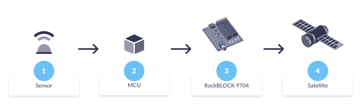
RockBLOCK 9704 is built around the Iridium Certus 9704 module and uses Iridium Messaging Transport (IMT): a cloud connected, two way messaging service for small to moderate payloads (up to ~100 KB) designed for IoT devices rather than continuous IP sessions.
In a long life monitoring node, it’s best treated as a schedulable subsystem inside a wider embedded design. In practice, integrators typically:
- Power-gate the modem (load switch/PMIC) so “off” is truly off
- Wake it only after sampling / validation, when there’s something worth sending
- Transmit in short, scheduled sessions, with an explicit retry policy
- Return to deep sleep (or fully unpowered) immediately after the exchange.
The key engineering advantage is boundedness: reporting cadence, session timing, and retry limits are largely under host control, so you can model energy around a small set of well defined states (off / boot / transmit / receive window).
Peak transmit current can be high because closing a link to a LEO constellation requires substantial instantaneous RF power. In a messaging oriented design this draw occurs in short, intentional transmit bursts with bounded duration. The design trade shifts from minimising peak current to ensuring the power system comfortably supports short peaks (battery internal resistance, regulator headroom, local capacitance), while keeping average energy dominated by how often you transmit.
RockBLOCK 9704 doesn’t manage your sensor rails or MCU sleep states – those remain the job of the embedded design – so standard low power techniques (switched sensor rails, unpowered analog front ends outside measurement windows) still apply.
Because IMT is a two way messaging service, you can make delivery outcomes explicit at the application layer: buffer locally, send, then check for confirmation on the next scheduled wake window, without keeping the node awake. This keeps reliability mechanisms aligned with the same duty cycled philosophy as sensing. The important caveat is that network availability (constellation / service uptime) is not the same as guaranteed delivery in every installation: local RF conditions still dominate, i.e. sky view, canopy, terrain, enclosure losses, and antenna placement.
That integration pattern works well when you’re building your own node around a messaging modem. When you’d rather avoid custom hardware and firmware integration, the same principles can be applied at the system level:
Implementation path two: RockBLOCK RTU as an integrated low power monitoring device
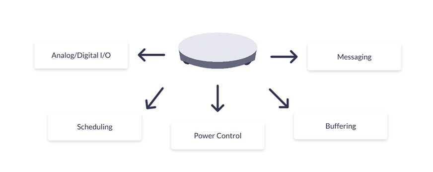
If you don’t want to integrate and power manage a satcom module inside your own node, RockBLOCK RTU packages the same sleep dominant principles at the system level: sensing, scheduling, local buffering, and messaging in one device. RockBLOCK RTU uses Iridium Short Burst Data (SBD), Iridium’s classic two way short-packet messaging service, so it naturally fits duty cycled environmental monitoring workloads.
RockBLOCK RTU is designed around a sleep dominant lifecycle:
- Extended low power sleep as the default state
- Wake events driven by schedule, thresholds, or external triggers
- Short transmission windows
- Immediate return to sleep.
Sensor power is explicitly controlled so sensors are energised only during measurement windows, eliminating standing analog bias currents. This mirrors best practice low power sensor design without requiring custom analog switching. Because message-based satellite operation can be scheduled without continuous reachability, RockBLOCK RTU avoids some of the standing ‘network-reachable’ overhead that can appear in terrestrial designs (depending on configuration and coverage).
In addition to sensing, RockBLOCK RTU provides system level control and observability that are often important in unattended deployments. Configurable digital outputs can switch sensor power rails or external loads, and analog inputs can monitor system voltages (battery, supply rails, excitation lines).
This enables remote verification of power health, detection of brownout conditions, and confirmation that sensors are energised only when expected, helping distinguish sensing issues, power delivery problems, and comms failures without site access.
Time Alignment and Operational Visibility
A recurring operational challenge in unattended monitoring is ambiguity: when data is missing, it’s often unclear whether the system failed to measure or failed to report. RockBLOCK RTU reduces this ambiguity with an internal clock and UTC-aligned timestamps (GNSS when available), making it easier to correlate measurements with expected reporting intervals and separate sensing gaps from delivery failures.
When Proprietary Messaging Satcom is Usually the Wrong Tool
Message-based proprietary satellite IoT is optimized for predictable, low duty telemetry – not high volume data or near real time streaming. Where cellular coverage is stable and power is plentiful, terrestrial LPWAN/cellular often remains the simplest and most cost effective option.
The interesting middle ground is NTN NB-IoT, which aims to extend cellular-style connectivity via satellite, so it’s worth understanding how much of the terrestrial behavior (and variability) it inherits.
NTN NB-IoT as an Emerging Option
Non-Terrestrial Network (NTN) NB-IoT, standardized in 3GPP Release 17, extends familiar NB-IoT device and core concepts to satellite links and is often framed as a bridge between terrestrial cellular and proprietary satellite IoT.
For environmental monitoring engineers, the key point is the capability shape: NTN NB-IoT is still fundamentally a low data, latency tolerant telemetry channel , not a streaming link , while aiming to preserve cellular style device models and tooling.
Commercially, it remains an emerging option: footprints, roaming models, and integration paths are operator and region dependent, and multi year public field data on power variance and failure modes is still limited compared with mature terrestrial PSM deployments. That doesn’t imply worse power performance; only that it’s harder (today) to treat it as a fully characterized default for unattended multi-year deployments.
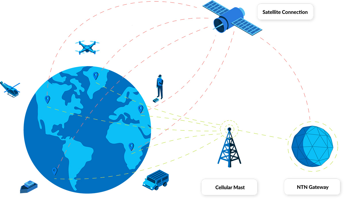
As an illustrative example, Viasat’s NB-NTN positioning is bidirectional messaging with practical payloads around 10–30 bytes up to ~1,200 bytes, typical latency on the order of 10–60 seconds (potentially minutes depending on scheduling), and cost optimized for very small monthly data volumes (e.g., <50 KB).
One implementation detail worth flagging is NIDD (Non-IP Data Delivery). Where supported end to end by the operator and device stack, NIDD can reduce protocol overhead for tiny messages versus UDP/IP, which can materially help battery life at scale; but it’s worth confirming early whether your chosen NTN integration path actually exposes it in practice.
RockBLOCK RTU and NTN Evaluation Paths
An NTN-enabled RockBLOCK RTU is being used in early programs on Viasat’s NB-NTN service. The point isn’t that NTN performance is already fully proven; it’s that you can test and measure it using a monitoring device with a known low power architecture and good instrumentation.
Because RockBLOCK RTU already implements a sleep-dominant lifecycle (scheduled wake, short transmit windows, controlled sensor power, UTC-aligned timestamps, and supply-voltage monitoring), it provides a consistent baseline for evaluating NTN energy use, delivery timing, and variability without redesigning the sensing node.
If you’re considering NTN NB-IoT for an environmental monitoring deployment, Ground Control can support trial deployments and share an evaluation plan.
Practical Implications for System Integrators
For system integrators working in remote environmental monitoring, connectivity decisions are rarely static. Alignment between duty cycle, power constraints, coverage stability, and operational risk tends to determine long term system performance.
Cellular, proprietary satellite messaging services, and NTN NB-IoT each occupy different operating envelopes. Understanding those differences enables decisions to be defended throughout the lifecycle of a deployment.
Where coverage stability cannot be assumed, satellite connectivity provides an architectural alternative that aligns well with how low power remote monitoring systems are typically designed to operate. NTN NB-IoT represents a promising but still emerging option, particularly in contexts where long-term unattended power and reliability characteristics are still being established.
Planning for Intermittent Connectivity is a System Decision.
If you’re assessing where proprietary satellite, NTN NB-IoT, or hybrid connectivity fits into your architecture, we can help you evaluate the trade offs early, before reliability or power becomes the constraint.
Complete the form, or email hello@groundcontrol.com and we’ll reply within one working day.
The Truth About “Everywhere IoT” for Water Monitoring
Whether you’re working in oceanographic science, hydrology, utilities, aquaculture or offshore renewables, you’ve probably heard some of the noise around “NTN” – using cellular IoT standards like NB-IoT and LTE Cat-1 to send data over satellite. It’s very promising: one chipset roaming between cellular and satellite networks, lowering hardware costs, broadening coverage and simplifying integration.
As is so often the case, the reality is a little more nuanced. In this blog post, we aim to separate myth from reality, and help teams capturing data from remote water sensors design robust data paths that will stand the test of time. We’ll start with one of the most pervasive myths.
Myth #1: Satellite Coverage Is Global
Reality: It depends heavily on the network and the service.
This is routinely overstated, particularly by cellular IoT specialists now branching out into satellite – “true global coverage” appears all over their marketing material.
Here’s what you need to know.
First, you usually need to separate networks designed for IoT services from networks designed for broadband internet. The services designed for broadband internet generally use radio spectrum in the Ku- and Ka-bands. This is ideal for carrying large volumes of data, but has several drawbacks for IoT applications: they’re power hungry and not well suited to battery or small solar installations; and they’re affected by poor weather conditions. If your asset is frequently exposed to rain, high winds, spray or sea fog (which is often the case at sea or up in the mountains), your data will not transmit reliably.
The sweet spot for satellite IoT is services in the L-band radio frequency, as these need very little power and are largely unaffected by poor weather. They’re suited to much smaller data volumes, and fit an IoT use case perfectly, for example, regular level and water quality readings from a buoy, float, or river gauge.
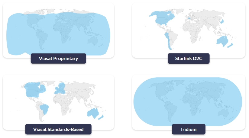
So, who offers L-band services? The pre-eminent Satellite Network Operators (SNOs) are Iridium, Viasat (Inmarsat) and Globalstar. Of these three, Iridium is the only one that is truly global. Viasat has great coverage but doesn’t cover the poles, and Globalstar has some big gaps over Asia, the polar regions and the oceans.
Now we have to go one level deeper (sorry!). Of these three, currently Viasat is the only network that offers both proprietary and standards-based services.
- “Proprietary” means that you have a Viasat chipset that works with Viasat satellites; you can’t use it to communicate with Iridium satellites, or vice versa.
- “Standards-based” refers to the use of cellular standards over satellite, namely NB-IoT and LTE Cat-1. As these are all built to the same standard, it should – when the services mature – be possible to switch supplier without needing to change your hardware.
Viasat’s proprietary services (IoT Nano, IoT Pro) are well established and available everywhere where Viasat’s satellites can see the Earth. Their standards-based service, NB-NTN, is in its infancy, and they’re turning on coverage where there’s sufficient demand. Currently that’s North America, parts of Europe, Brazil, Australia and New Zealand. Huge swathes of the ocean are not covered, and if your application is in South America (excluding Brazil), Africa or much of Asia, you’re also out of luck.
In short, check coverage carefully, particularly for maritime devices like offshore buoys, USVs or drifting floats, as claims often don’t live up to reality. For inland water sensing, don’t assume that “country-wide” includes your upland reservoir or remote abstraction point either.
Myth #2: More Bandwidth Solves Everything
Reality: Power, airtime and antennas still call the shots.
As mentioned earlier, the higher bandwidth services (e.g. Starlink, OneWeb) operate in Ku- and Ka-bands, and while these are great for moving large volumes of data, the trade-off is a higher power draw and larger, more complex antennas. If you’re operating a coastal station or treatment works with reliable power and solid mounting options, they may be a good fit. If you’re building a wave buoy with tiny solar panels, they simply can’t power these sorts of satellite terminals.
If you don’t have mains power, and therefore do need a power-efficient satellite terminal, L-band IoT services will best serve your needs. Viasat and Iridium have a wide range of IoT services that span from IP-based options such as Iridium Certus 100 (speeds up to 88 kbps) to message-based services like Viasat NB-NTN (optimized for ~50 bytes per message).
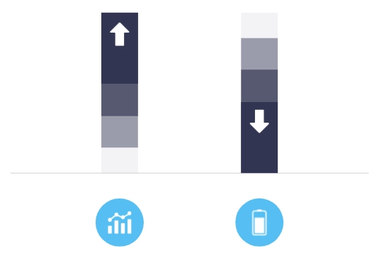
Even within specialist services for IoT, the more throughput or volume you need, the larger the antenna, and the greater the power draw. Message-based services can be more challenging to work with (we’ll come back to this), but they are the most efficient means of utilizing a satellite link, especially for water sensors that only need to report periodically.
The following simplified table lays out the trade-offs.
| NB-NTN | Short Burst Data (SBD) | Iridium Messaging Transport (IMT) | Certus 100 | IoT Pro (BGAN M2M) | |
|---|---|---|---|---|---|
| Operator | Viasat | Iridium | Iridium | Iridium | Viasat |
| Link Type | Message-based (NTN NB-IoT) | Message-based (proprietary) | Message-based (proprietary) | IP-based | IP-based |
| Data Volume | 50 bytes per message* | Up to 340 bytes per message | Up to 100 kB per message | 22/88 kbps | 464 kbps |
| Power Consumption | Very low | Very low | Low | Medium | Medium |
*There’s no hard protocol limit that stops you above a certain size; NB-IoT can technically carry up to around 1.6 kB of user data in a single packet. But current NTN NB-IoT services are engineered around tiny messages (tens of bytes) and tens of kilobytes per month per device. Anything bigger quickly becomes slow, power hungry, and uneconomic.
Myth #3: Standards Make It Simple
Reality: Coverage gaps and physical constraints still apply.
We’re very excited about the potential of standards-based (or NTN) satellite connectivity; once it matures, it should unlock massive IoT use cases that would be cost prohibitive for a proprietary solution. But it isn’t a lower cost version of the proprietary solutions that exist today; it’s a different class of connectivity.
NTN NB-IoT is designed to connect a large number of latency tolerant end points sending very small amounts of data, such as a grid of rainfall and runoff gauges across a catchment for flood risk modelling. It’s not designed for more than around 50 kB of data per month per device, and it’s not suited to real-time communication.
This is in contrast to cellular NB-IoT, which can move 1-2 kB per transmission, and is generally economically viable up to ~5 MB of data per month per device. That’s more than enough for frequent level and quality readings from a river, reservoir or pipeline monitoring point, but if you try to replicate that pattern over satellite, both cost and power consumption quickly become challenging.
If you’ve been working with cellular NB-IoT and enjoying the larger volumes of highly economical transmissions that terrestrial networks facilitate, you’re in for a bit of a shock when it comes to moving that data over satellite. You will need to be able to work within the data constraints of the NTN version, which is likely to need some data optimization (we’ll come back to this shortly).
Another consideration that may stand in the way of seamless transition between cellular and NTN NB-IoT is your antenna.
- Cellular NB-IoT is designed to work with small, low gain antennas – often just a simple PCB or stub antenna in a plastic box. While antenna placement requires some forethought (not inside a metal box, not under a pump skid etc.), it doesn’t need to be outdoors.
- NTN NB-IoT over GEO satellites is a different beast. Connecting to a satellite which is – in the case of Viasat NB-NTN – 35,786 km from Earth requires a higher gain antenna and clear line of sight to the satellite. The antenna needs to be on the roof, on a mast, on top of a buoy, not buried in a pit or down in a plant room.
Not dissimilarly to your cellphone trying to find a network, a poorly positioned antenna drains power and is more likely to drop data.
The bottom line is that NTN is viable and workable for a myriad of water-sensing applications; just not all of them. And while working with data constraints might take some getting used to, doing so has cost, power and battery life benefits. So here are our top tips for optimizing your data for streamlined transmissions.
Working With the Constraints: Design Patterns That Actually Work

Send Data Less Frequently
Instead of transmitting every second, trigger messages only on events or stretch your interval to every few minutes or hours, so you cut airtime and power without losing useful insight.

Send Less Data
Replace continuous raw streams with compressed or aggregated values (min/max/average/exceptions), sending only the fields your application actually needs rather than every sample.

Choose the Right Transport
Where you don’t need interactive sessions, use compact, message-based protocols instead of IP to avoid chatty handshakes and headers, reducing connection time, airtime use and power draw.
Position Your Antenna Well
If your satellite network is in geostationary orbit (e.g. Viasat) you need line of sight to the satellite; if it’s in Low Earth Orbit (e.g. Iridium, Globalstar) you need a clear view of the sky as the satellites move overhead
Most of the above is fairly self-explanatory, but it’s worth a quick dive into message-based protocols, because this is where many water monitoring applications can win back cost and battery life.
Why Message-Based Protocols Matter
Because cellular connectivity is abundant and cheap, most IoT applications use an IP connection to move data. We often liken this to a telephone call: an interactive, two way communication path which, while very widely used, has some drawbacks from an IoT perspective, particularly when operating with data constraints.
Firstly, the real time “conversation” between the sensor and your control centre is relatively hard on battery life. Secondly, the amount of overhead passed over that connection in addition to the actual data you need is considerable.
When you’re sending data into space, every byte matters.
Sending data over IP is not the most cost-effective, nor battery-conservative, means of using satellite IoT.
The alternative is a message-based solution, which we touched on earlier. NTN NB-IoT is message-based, as are Iridium SBD and IMT, and Viasat IoT Nano. Message-based connections are more like a text message: you send the message, receive an acknowledgement (note: not all services include this), and close the connection.
The message contains much less overhead, and the connection stays open only as long as is needed to transmit. This is the most economical way to use satellite IoT, both from a cost and power perspective. While it often requires a little more engineering work to format your data appropriately, it is usually worth the effort.
On the server / cloud side, platforms like Ground Control’s Cloudloop will decode the data on receipt and send it to your destination of choice, properly formatted, so there’s no need for engineering work on the cloud / server side.
Many applications can move to message-based transmission: data buoys, weather stations, reservoir level sensors, groundwater monitoring wells, water quality sondes and static flow/abstraction meters where data isn’t needed in real time.
If you do need real-time command and control, for example, remotely piloting a USV, or actively managing gates and valves in a complex hydraulic system, there are reliable services available, including Iridium Certus 100 and Viasat IoT Pro. But it’s definitely worth investigating message-based services if you can work with a few seconds’ latency and slightly less interactivity.
Choosing a Network: Matching Technology to Use Case
To bring this to life, we’ve put together this table to illustrate a few use cases.
| USV | Data Buoy | Profiling Float | Reservoir Level Station | |
|---|---|---|---|---|
| Movement | Mobile | Stationary | Free floating | Stationary |
| Location | Open ocean | Open ocean | Open ocean | Upper catchment / remote reservoir |
| Power Source | Solar | Solar | Battery | Solar |
| Data Volumes | High | Medium | Low | Low-Medium |
| Transmission Frequency | Real time to every 5 minutes | Hourly | Hourly to every 10 days | Every 5-15 minutes + event driven |
| Suggested Service | Iridium Certus 100 or Viasat IoT Pro | Iridium Messaging Transport (IMT) | Iridium Short Burst Data or (if within coverage) Viasat NB-NTN | Iridium Messaging Transport (IMT) |
| Suggested Device | RockREMOTE Mini | RockBLOCK 9704 | RockBLOCK 9603 | RockBLOCK Pro |
If the device needs a real time connection, it needs an IP-based service, but if it’s solar powered, it needs to couple that requirement with high power efficiency. Iridium Certus 100 or Viasat IoT Pro meet both requirements, and are your best options here.
If the device is running exclusively on a battery, and has very low data requirements, this is a great application for NTN NB-IoT (Viasat’s brand for this service is NB-NTN). However, you need to check coverage. If coverage is not available, Iridium’s Short Burst Data (SBD) service is a cost effective and global alternative.
If data volumes are larger, Iridium Messaging Transport (IMT) can carry up to 100 kB per message, and the modules can also be powered by a battery. In each case, there are several options for the device that houses the module, ranging from enclosed and vibration-tested devices with simplified commands (RockBLOCK Pro) to developer PCBs with a choice of internal or external antennas (RockBLOCK 9704 / 9603).
Designing the Right Data Path for Your Water Sensors
The headline story around NTN is seductive: one chipset, everywhere connectivity, cellular-like costs. For water monitoring teams under pressure to instrument more assets – more rivers, more reservoirs, more outfalls, more offshore platforms – it sounds like the silver bullet we’ve all been waiting for.
It isn’t. But it can be a powerful new tool in the box if you treat it as such.
If there’s one takeaway from this post, it’s this: everywhere IoT is not something you buy; it’s something you design.
For water sensing, that design work boils down to a handful of questions:
- Where are my sensors, really? Open ocean, estuary, upland catchment, plant room? Coverage claims matter less than the actual map.
- How is each device powered? Battery, micro-solar, or a nice fat cable from the control room?
- How quickly do I genuinely need the data? Seconds, minutes, hours?
- How much data do I actually need to move? Raw streams, or carefully chosen summaries and alarms?
Answer those honestly, and the right combination of L-band IoT, NTN, cellular and (where appropriate) broadband satcom usually reveals itself.
Need Help Getting Data Home?
If you’re looking at a new water-monitoring project, from data buoys and USVs to flood-warning networks and smart reservoirs, and you’re not sure where to start, we’re happy to help.
Ground Control has spent the last two decades getting data out of some of the world’s most awkward places. We can’t promise magic, but we can promise clear advice, realistic trade-offs, and solutions that actually work when it’s dark, cold and raining sideways.
Complete the form, or email hello@groundcontrol.com, and we’ll reply within one working day.
Remote Environmental Monitoring: Matching Connectivity to the Challenge
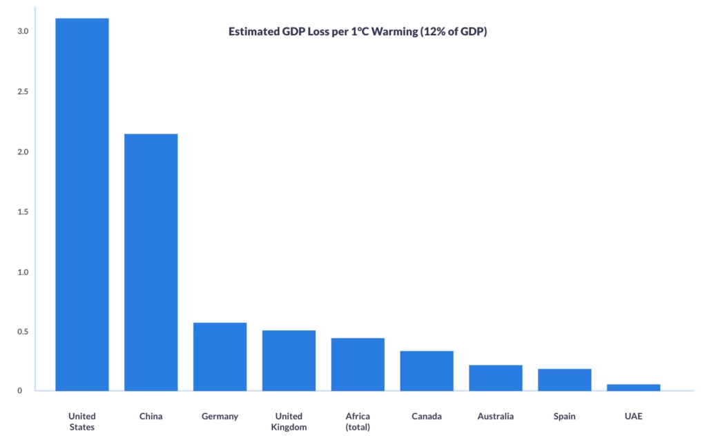
A recent macroeconomic study cited by the World Economic Forum suggests climate warming could cost the world 12% of GDP per °C of temperature rise.
Applied to national economies, this equates to annual losses of over $3.2 trillion for the United States, more than $2.1 trillion for China, and hundreds of billions for other major economies and regions such as Germany, the UK, Africa, and Australia.
These figures underline why investment in environmental monitoring and early warning systems is not just planet saving, but economically essential.
IoT opens new possibilities for environmental insight and protection, but many monitoring sites lie beyond cellular networks, making connectivity difficult.
The Challenge of Monitoring Our Planet
Why is environmental monitoring so hard in remote areas?
Often, the places we most need data from are the hardest to reach. Accessing remote rainforests, high mountain ranges, vast deserts, polar caps and oceanic regions can be difficult, costly, and dangerous. They don’t have cell towers or power lines, and sending people out to check sensors manually isn’t just impractical, it’s unsustainable. IoT for climate monitoring has opened the door, but the logistics of gathering reliable, continuous data in these places remain challenging.
One essential component of success is collaboration. Environmental monitoring is not something one agency or organization tackles alone. Governments, NGOs, researchers, universities and private tech providers all bring pieces of the puzzle, from scientific insight to provision of physical sensor networks, to the connectivity and platforms that make data flow. When these threads are woven together, they provide a picture accurate and complete enough to act on, but without them, data is disparate, narrow, and potentially unreliable.
Today, many of these agencies rely on proprietary satellite IoT to monitor the environment and keep people safe.
Environmental Monitoring via Proprietary Satellite IoT
Proprietary satellite IoT refers to connectivity solutions built on closed, vendor specific satellite networks, platforms and hardware. With a history of reliability and low latency, they’re trusted for mission critical applications, and form the backbone of systems that send wildfire alerts from remote forests, trigger flood warnings when rivers surge, or provide SOS capabilities for Rangers far from cellular coverage. These use cases work, and they save lives.
For reference, here’s a quick refresher on a couple of established proprietary satellite services, but feel free to skip ahead if you’re already familiar.
Iridium runs a Low Earth Orbit (LEO) satellite network using L-band spectrum. Coverage is truly global, including the poles, and terminals don’t require antenna pointing. For IoT, Iridium Short Burst Data (SBD) and Iridium Messaging Transport (IMT) handle low-power telemetry and tracking, while Iridium Certus 100 provides lightweight IP backhaul at up to 88 kbps down / 22 kbps up.
Viasat (through its acquisition of Inmarsat) operates primarily in Geostationary Orbit (GEO) at ~35,786 km. GEO satellites appear fixed in the sky, so you get near-global coverage (excluding the polar regions) but you do need to point the antenna and you’ll see higher latency than LEO. Viasat’s proprietary IoT options – IoT Nano and IoT Pro (previously called BGAN M2M) – are chosen for economical, stable, and reliable links where there’s a clear line of sight to the satellite.
Proprietary satellite IoT is trusted because it is proven. Networks like Iridium and Viasat offer global reach, near-real time communication, a broad range of data capacity tariffs, and connectivity that covers the most inaccessible global locations. In situations where seconds or accurate time-stamped data count, that reliability is non-negotiable.
But this approach does come with trade offs. Proprietary satellite IoT devices have added cost, limiting their widespread deployment. Agencies also face vendor lock in due to a lack of interoperability. And the data can end up siloed, with wildfire sensors on one platform, flood gauges on another, and SOS devices elsewhere. The result is a patchwork of insights that are difficult to unify. We’ve previously highlighted the problem of global data disparity and its impacts. The tension between reliability, availability and scalability, proven systems and siloed ones, defines the current status quo.
The Expanding Toolkit: LoRaWAN and NTN
Over the last decade, LoRaWAN broadened the toolkit for low power, local sensor networking, and now 3GPP’s Non-Terrestrial Networks (NTN) are emerging to extend cellular protocols such as NB-IoT and LTE into areas with no terrestrial networks.
Market Incumbents:
LoRaWAN
An open, community-driven protocol maintained by the LoRa Alliance, LoRaWAN gained momentum from ~2015 onward for low power, low cost sensing. It’s ideal for clustered local or regional deployments (e.g., watersheds, forest plots, landslide corridors). Sensors communicate to nearby gateways; those gateways then backhaul data to the cloud, often over satellite in truly remote sites. LoRaWAN is inexpensive, flexible, and easy to deploy, but coverage is only as broad as your gateway network – there’s no inherent global reach.
Proprietary Satellite IoT
Where time- or mission-critical alerts and global reach are non-negotiable, proprietary satellite services remain best in class. They offer deterministic delivery, global footprints (often including the poles), and proven reliability for safety of life or regulatory use cases. The trade off is cost, which can limit the number of sensors you can field at scale.
Market Newcomers:
Standards-Based Satellite (NTN)
3GPP Release 17 (2022) brought Non-Terrestrial Networks (NTN) to life; extensions that take familiar cellular IoT into space. In practical terms, standards like NB-IoT and LTE-M can now connect via satellite using widely available, standards-based chipsets instead of proprietary hardware.
For remote environmental IoT, that shift really matters. A unified ecosystem means terrestrial and satellite links share the same standards, improving roaming, module availability, and making it easier to switch suppliers. Devices can stay simpler too: the same class of modules can reach the network by satellite when there’s no ground coverage, reducing hardware variants across deployments. And as NTN coverage and device support expand, you can scale sensor footprints without redesigning your stack – ideal for basin-scale hydrology, fire risk perimeters, or multi-site geohazard monitoring.
It’s important to be aware that NTN coverage is still limited, so availability will be patchy for some time. Data rates are small (under 50 KB per month) and duty cycles are constrained, so plan for tiny payloads, compression, and aggressive batching. Applications must be latency-tolerant, with buffering, retry, and out-of-order handling. Unlike cellular, antenna positioning and sky view become first-order concerns, and power budgets are tighter due to longer air-time and higher TX demands.
In this expanding marketplace, there is no single winner in terms of connectivity choices. The toolkit is widening, broadening opportunities and use cases.
Within the current climate (pun intended), with high demand and fast evolving tech, the expertise lies in matching the right connectivity to the right environmental challenge, and future proofing the technologies selected.
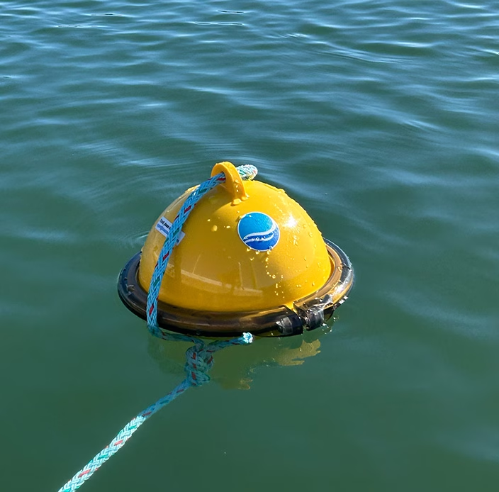
Marine Pollution Tracking
For high-priority stations (spills, hypoxia, critical metrics), proprietary satellite IoT delivers dependable, low latency, global links for continuous reporting.
For dense regional warning nets, NTN NB-IoT can enable hundreds of small, cheap nodes (open-ocean coverage still limited). Near shore, LoRaWAN meshes clusters and backhauls via cellular or satellite, avoiding coastal congestion.
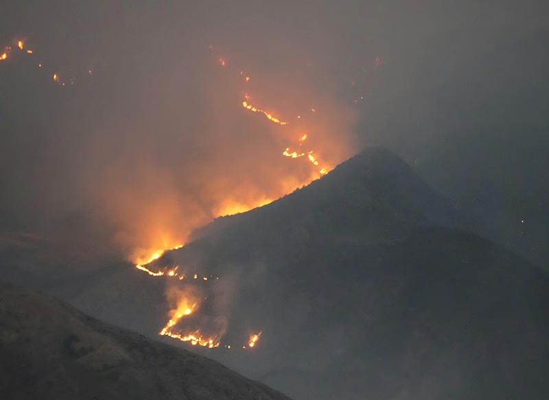
Wildfire Detection
For split-second fire alerts, proprietary satellite links are best: low latency, global reach, reliability when smoke / weather / power knock out terrestrial, and reserved capacity that avoids congestion in crises.
For predictive fire risk monitoring across thousands of low cost sensors, NTN NB-IoT excels: standards-based, massively scalable, and usable as primary or failover connectivity.
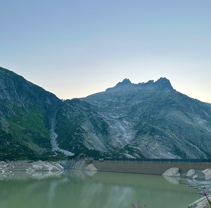
Flood Monitoring
For dam breach or flash flood alarms, proprietary satellite IoT is best: real time, low latency alerts that bypass damaged ground networks and keep working when towers or power fail.
For regional flood modelling – rainfall, soil moisture, groundwater – use NB-IoT NTN or LoRaWAN clusters with satellite backhaul: dense, long term data at scale for forecasting and early mitigation.
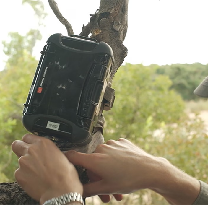
Biodiversity Tracking
For remote conservation patrols, proprietary satellite GNSS trackers are essential, delivering reliable two way comms, SOS, and precise location in forests or mountains.
For large scale tagging (cattle, migration studies), standards-based NTN NB-IoT fits: smaller, cheaper tags sending intermittent updates, delivering months-to-years battery/solar life and scalable data for movement, breeding, and habitat models.
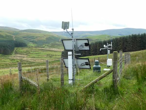
Soil and Water Quality Monitoring
For regional farm networks and watersheds, choose by balancing coverage, power use, and data density. Proprietary satellite IoT fits isolated test sites or large estates needing guaranteed uptime and two way control.
Standards-based NTN NB-IoT enables thousands of low cost soil/moisture sensors across distributed fields, ideal for basin-wide modelling and predictive irrigation.
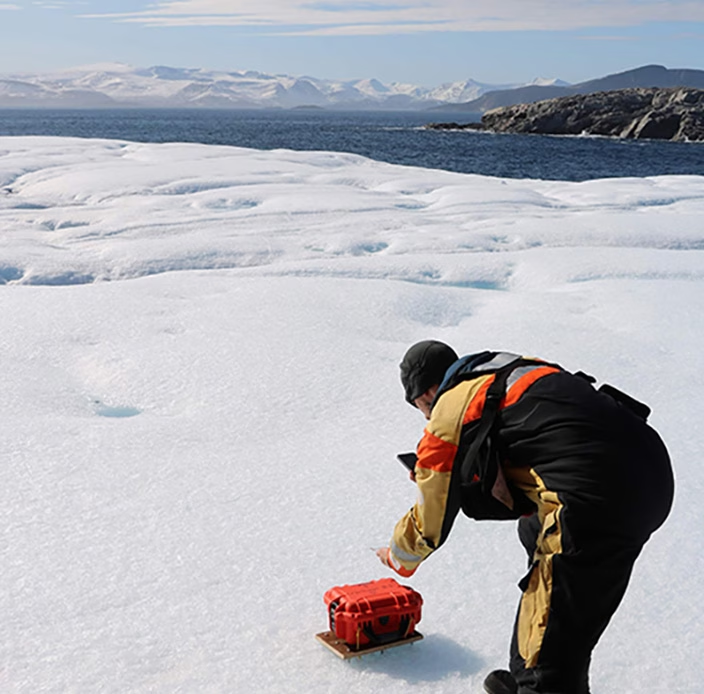
Glacial and Permafrost Monitoring
For polar or alpine deployments with extreme conditions and no cellular, proprietary L-band satellite IoT is the only mature option for real-time, all weather, pole to pole links.
Where coverage allows, NB-IoT NTN can send intermittent, timestamped updates – think small payloads and higher latency.
Exploring the Deployment Realities
Let’s talk coverage: How “global” are these options?
- Proprietary Satellite IoT
Iridium: Truly global, pole to pole, provided the device has a clear view of the sky. No antenna pointing required.
Viasat (Inmarsat L-band): Near-global footprint excluding the extreme polar regions; requires antenna pointing for a stable link. Best when you want economical, stable links, and have a clear line of sight to the satellite. - LoRaWAN
Coverage is inherently regional: each node talks to a nearby gateway. In open areas, practical node-to-gateway distances are roughly up to ~15–16 km (terrain and clutter can reduce this). If your monitored area is wider than that, you either give each endpoint its own satellite connection, or build a local LoRaWAN network and backhaul one or more satellite-connected gateways. - NTN (e.g. NTN NB-IoT, NTN LTE Cat-1, NTN LTE-M)
Coverage is early and patchy. Commercial availability today is concentrated in specific countries/regions with little to no ocean coverage (view current NTN coverage map from Viasat). Viasat has the most coverage, but is restricting services to areas where there is sufficient demand; thus, as more hardware / devices reach the market, and the use cases become clearer, we would anticipate coverage growing.

Reducing Silos With a Unified Data Plane
Successful deployments depend on how easily devices, platforms, and networks exchange data. The practical goal is a single pane of glass where you can see, manage, and act on data from mixed networks – proprietary satellite, NTN (as it rolls out), and, where available, cellular- without rewriting everything each time you add a site or change a bearer.
A pragmatic way to get there is an API-first platform that’s device- and network-agnostic. For example, Cloudloop is designed to ingest data from heterogeneous bearers and present it through one interface. It doesn’t make coverage universal, but it can reduce integration work and lower the risk of data silos as footprints grow.
Security: Keeping Environmental Data Trustworthy
Environmental monitoring data increasingly informs safety, regulation, and policy, so protecting its integrity matters as much as collecting it. For remote environmental monitoring, satellite IoT reduces exposure to common internet borne threats because links don’t rely on local terrestrial infrastructure or public ISPs. In practice, that means fewer attack surfaces between field sensors and your platform.
Advantages and limitations of satellite IoT security:
High Encryption Standards by Default
Professionally operated, mature satellite networks such as those operated by Iridium and Viasat encrypt data using AES-256, a symmetric block cipher algorithm recognized for its security and efficiency.
Avoids Man-in-the-Middle Attacks
Satellite networks are much harder to compromise via MitM attacks due to their direct transmission methods, reduced ISP reliance, high-altitude signal paths, and strong encryption. However, they’re not completely immune. The means by which data is routed from the ground station to the user’s application needs consideration.
There are several options here with varying degrees of security:
- VPNs / Firewalls – The most commonly deployed method for securing data being moved from a ground station is to utilize a combination of firewalls and VPNs.
- Private Wire – Private wire connections create a direct, secure link between a satellite ground station and a customer’s network, bypassing the public internet entirely. This can be achieved through dedicated leased lines or private Layer 2 circuits (such as MPLS or SD-WAN). This results in a closed, high-security data path that prevents exposure to cyber threats like DDoS attacks or data interception.
The bottom line: Satellite won’t eliminate risk, but its independence from local infrastructure, combined with private routing, encryption, segmentation, and failover, gives environmental programs a materially stronger default security posture than relying on terrestrial connectivity alone.
From Insight to Action: Key Considerations for Choosing the Right Connectivity
Understanding these findings is just the start. The next step is applying them, choosing the right technology mix to meet real world monitoring goals while staying compliant, scalable, and resilient.

“We can only afford a handful of sensors, but we need scale.”
Utilize NB-IoT/NTN NB-IoT for assured security or LoRaWAN sensor networks with satellite backhaul for affordable, dense deployments.

“We need reliable alerts for emergencies.”
Use a proven, proprietary L-band satellite IoT link e.g., Iridium SBD/IMT or Certus 100, or Viasat IoT Nano/Pro that’s stress-tested for mission critical use.
“Coverage is patchy, how do we know what will actually work in our region?”
Iridium’s proprietary services are global, LoRaWAN is regional, and NTN NB-IoT is emerging. Check coverage maps for more detailed information, or speak to a remote connectivity professional.
“Our systems don’t talk to each other.”
Utilize Cloudloop functionality with APIs for interoperability. Consume your data in a way that is right for the collaboration, including sending data securely to multiple (pre-integrated) destinations.

“We’re worried about data security and compliance.”
Choose partners that prioritize end-to-end encryption, secure APIs, and compliant cloud hosting. Ground Control’s Cloudloop platform ensures data integrity across hybrid networks while maintaining full customer control over data destinations.

“We can’t do this alone.”
With proven expertise, Ground Control is a valued technical partner, not just a provider. Helping NGOs, agencies, and companies to deploy hybrid, collaborative solutions.
Building a Smarter, More Connected Planet
The future of environmental monitoring isn’t about replacing one connectivity technology with another; it’s about building hybrid IoT networks that combine the best of each. Proprietary satellite IoT will continue to deliver life- and mission-critical reliability, providing resilient links and accurate, time stamped data from even the most remote regions. Meanwhile, standards-based NB-IoT and LoRaWAN are unlocking scalable, low-cost sensor deployments bringing environmental data collection to new levels of density and insight.
When agencies, NGOs, and research partners collaborate across these ecosystems, we can turn isolated measurements into continuous, planetary-scale intelligence.
Looking to Find Your Connectivity Partner ?
At Ground Control, we bridge today’s proven systems with tomorrow’s scalable standards, helping organizations deploy what works now while preparing for what’s next. If you’re exploring how to expand your monitoring capability, talk to our team about designing a solution that fits your goals, your environment, and your stakeholder needs.
Email hello@groundcontrol.com or complete the form, and we’ll be in touch within one working day.
Protecting Bats at Wind Turbines: How Technology Is Reducing Wildlife Impact [Infographic]
As vital as wind energy is in reducing reliance on fossil fuels, it has created unintended challenges for wildlife, particularly bats. A 2021 survey found that 40% of people fear bats, though they play an essential role in pest control and pollination. By consuming insects, bats save U.S. agriculture billions of dollars in natural pest control each year, a service valued between 3.7 and 53 billion dollars. They also help pollinate crops like bananas, mangoes, and agaves (the central ingredient in tequila!), making them critical to both ecosystems and the economy.
Unfortunately, the growing number of wind turbines poses a real risk to bats. Tens, and possibly hundreds of thousands of bats are estimated to die each year due to wind turbines, with tree bats — species that migrate and roost in trees — being the most affected. These bats may confuse the towering structures with trees, bringing them dangerously close to the blades. While turbines can be temporarily slowed down to protect bats, this approach reduces the amount of clean energy produced, costing operators up to 3.5% of their annual output.
A more sustainable solution involves new technology that deters bats using ultrasound. Bats rely on echolocation to navigate, and the ultrasonic deterrent emits sound waves from the turbine that cause bats to alter their flight path, reducing collisions. The system monitors its own health to ensure reliability, and for remote locations, Satellite IoT transmits status data, ensuring operators can maintain its functionality, and demonstrate performance to regulatory authorities if needed.
Early results from this deterrent system show a 50-67% reduction in bat fatalities, with even greater results when combined with low-level curtailment. With continued innovation, wind farms can operate more harmoniously alongside bat populations, reducing wildlife impact while contributing to a greener energy future.
Enjoy our infographic, and please share to spread the word of this incredible innovation!
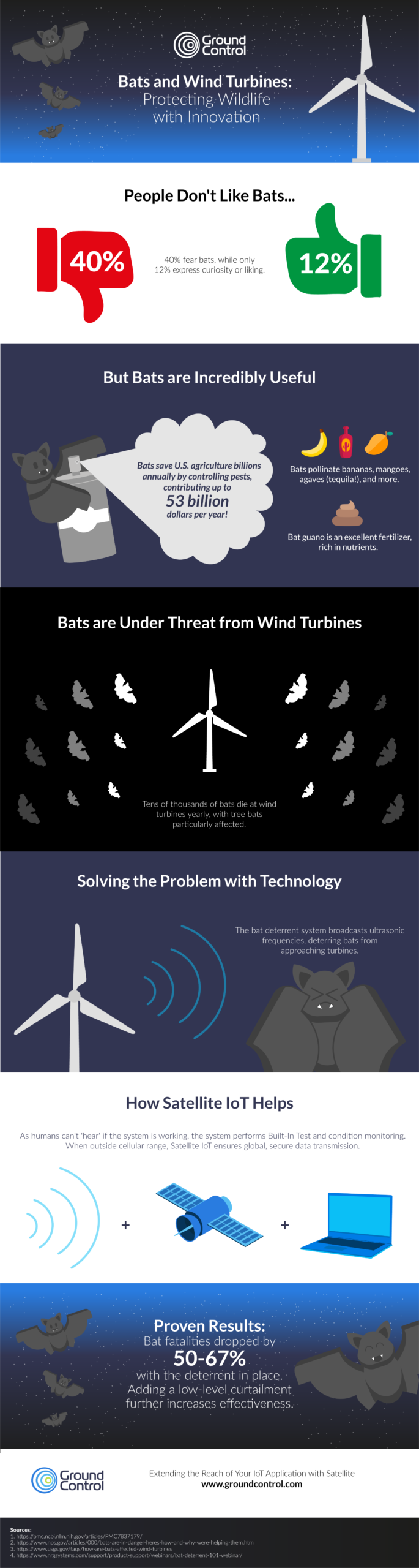
Can we help you with a remote IoT challenge?
We are specialists in remote connectivity. We work with several tried and trusted satellite network operators to deliver our customers with reliable, cost-effective solutions for communicating with your remote assets and sensors.
We’ve been doing this for more than 20 years, so if you’d like expert, impartial help with your IoT application, please email hello@groundcontrol.com, or complete the form.
Five Ways to Tackle Climate Change with Satellite Tracking
As climate change continues to pose significant challenges to our planet, innovative technologies are emerging as critical tools in our efforts to mitigate its effects. Satellite tracking and the Internet of Things (IoT) are at the forefront of this technological revolution, providing invaluable data and insights across various domains.
From monitoring endangered species and tracking glacial retreat to combating illegal fishing and preserving forest health, these technologies are playing a vital role in understanding and addressing climate change. This blog post explores five key ways in which satellite tracking and IoT are transforming the fight against climate change.
1. Tracking Endangered Species
While estimates vary, scientists agree that extinction rates are far higher than the natural rate, due to loss of habitat, climate change and poaching. A 2019 United Nations report puts the figure at 30 to 50 percent of all species going extinct by 2050. This loss of biodiversity threatens ecosystems that support all life – and there are further negative implications for medicine, agriculture and recreation.
Technology has a vital role to play in arresting this decline. Animal tracking through collars and tags helps in several ways: firstly, the data captured can help scientists prioritize habitat conservation, and justify seasonal closures of sensitive areas to the public.
Secondly, it helps us understand the impact of climate change, and both natural and human-driven disasters on wildlife, such as how sperm whales were affected by the Deepwater Horizon oil spill.
Finally, animal tracking can prevent poaching, both by helping to predict endangered species’ movements, and in turn, the hunters trying to evade detection. In this instance, tracking collars are often also combined with intelligent camera traps, giving security forces more information on the threat, so they can respond appropriately.
Satellite connectivity is essential for tracking animals traveling outside of cellular coverage. Modems such as the Iridium 9603N are increasingly small and lightweight, and can be built into the tracking collars for mammals starting at 15 Kg body weight.
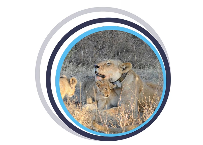
2. Monitoring Glacial Retreat
Glaciers are shrinking rapidly, with profound impacts on local hydrology, rising global sea levels, and the acceleration of natural hazards such as the creation of icebergs. However, the processes that go into glacial retreat are not well understood, leaving gaps in models designed to predict future impact.
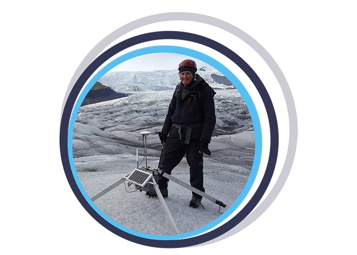
Environmental scientists are working hard to plug these gaps, not least the team at the University of Southampton, who build and deploy Subglacial Probes and Ice Trackers. The Ice Tracker is a web-connected RTK GNSS-solution which measures glacier change and flow. It utilizes the RockBLOCK 9602 to transmit its data reliably and cost-effectively, with no dependency on terrestrial network availability.
After rigorous testing in Iceland, the goal is to roll out this technology around the world to see how different glaciers respond to global warming, and thus create more accurate models for predicting their impact.
Similarly, scientists from the Water and Ice Research Laboratory at Carleton University have developed a low-cost, satellite-enabled device to track icebergs. In the Arctic, as the sea ice retreats, more large icebergs are being calved; at the same time, shipping and fishing vessel traffic in the area has increased by 111% and 41% respectively.
Despite advances in monitoring, ships do still collide with icebergs; in the northern hemisphere, from 1980 to 2005, there were 57 incidents involving icebergs. With the addition of more icebergs and more ships, this risk has exponentially increased.
Tracking – and therefore being able to better predict the behavior of – icebergs mitigates the risks to marine vessels, and also supports scientific research into the effects of iceberg melt on ocean infrastructure and marine life.
The Cryologger is a data recording and telemetry platform that has been ruggedized so it can operate at Arctic temperatures. It utilizes a GNSS receiver, accelerometer, magnetometer and a RockBLOCK 9603 to transmit the data packets.
Data retrieved has already contributed to a database of iceberg tracking beacon tracks, providing insight into drift characteristics and distribution.
3. Combating Overfishing
According to Fishforward.eu, 29% of the world’s fish stocks are overfished; and a further 12-28% of the fishing world-wide is constituted by illegal and unregulated fishing. This is driven by demand, with each individual eating around twice as much fish as was consumed 50 years ago.
Right now, it’s other marine life that suffers the impact of overfishing. 71% of specific shark populations have been wiped out, and more than one-third of sharks, rays and skates are threatened with extinction.
And if nothing changes, in a few years time – some researchers predict as soon as 2048 – the world’s oceans will be virtually empty, leaving billions of people without their key source of protein, and millions of people missing their livelihood.
There are several solutions to this problem, as outlined by the Marine Stewardship Council; among them robust and enforced regulations preventing overfishing. The means of monitoring compliance is a Vessel Monitoring System, or VMS.
The device used to capture the telemetry on a vessel’s present and historical location, fuel used, catch size etc. needs to be tamper-proof and withstand the harsh marine environment. It needs to be reliable, accurate and have no connectivity ‘dead areas’.
VMS specialists Dualog (trading as Fangstr) and Pivotel chose the RockFLEET for their transmissions; it can use cellular when within range of a terrestrial network, and switches to the globally available Iridium satellite constellation when cellular is not available.
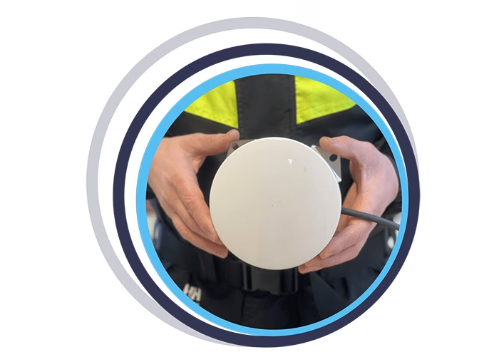
4. Preventing Deforestation
Forests are both affected by climate change, and a key defense against it. Forests capture and store carbon, but when forests are cleared, burned or degraded, they release that carbon back into the atmosphere as carbon dioxide, which contributes to climate change.
Deforestation – the clearing of forests, usually to plant crops in its place – contributes 12 to 20 percent of global greenhouse gas emissions. Degraded forests also contribute; a degraded forest may emit more carbon than it captures, becoming a carbon source rather than a carbon sink. Degradation typically occurs when illegal logging operations take place; loggers bulldoze their way in, extract high value trees, and drag them out, leaving behind roads, clearings and ravaged undergrowth.
The Rainforest Foundation UK is supporting national and local authorities by providing an early warning system for illegal logging activities. They enlist the help of the indigenous people whose way of life is also being threatened by deforestation; when they see signs of illegal logging, mining, or oil spills, they use the free ‘ForestLink’ system to send an alert to the authorities.
When cellular coverage isn’t available, the ForestLink system switches to the global Iridium satellite constellation, allowing the monitors’ smartphones to exchange data anywhere with a clear view of the sky. Rainforest Foundation chose the RockBLOCK Plus for its ruggedized exterior and economical and reliable transmissions.
5. Measuring Ocean Currents to Understand Global Climate Patterns
Our oceans absorb most of the sun’s heat, and then ocean currents distribute that heat around the globe. NOAA describes this as a conveyor belt, moving warm water and rain to the polar regions. There the water cools and sinks, which has the effect of pushing cold water towards the equator, helping to moderate temperatures. Without them, temperatures would be far more extreme – very hot at the equator, very cold at the poles – and much less of Earth’s land would be habitable.
Climate change is believed to be affecting ocean currents; the currents are not only warmer, but also 15 percent faster (measured between 1990 and 2013). This is damaging marine life and speeding up the melting of the sea ice at the poles, leading to global sea level rises. It’s also likely to disrupt the conveyor belt; if the water reaching the poles is too warm, it won’t sink. This could have the effect of slowing down or even stopping ocean currents in some places, notably the Gulf Stream. Western Europe would feel very different without the effect of this warming current.
High sea surface temperature (SST) is an important parameter in predictive weather and climate modeling. To capture this data, fixed and drifting data buoys are deployed all over the world to take measurements of surface and subsurface water temperature, atmospheric pressure, winds, salinity and wave patterns. And for the drifting data buoys, their historical location data allows scientists to profile ocean currents.
Because many of these data buoys are outside of cellular coverage, satellite connectivity is essential to transmit their data. Ground Control works with a number of data buoy companies, who need a satellite modem that’s reliable, robust, and delivers global coverage. RockBLOCK 9603 is a popular choice as it’s cost effective and has very low power consumption, allowing for the data buoys to drift for several years on battery power, or a small solar panel.
Some of Ground Control’s data buoy partners include Sofar Ocean, Maker Buoy, Akrocean, Running Tide and MTE Instruments.
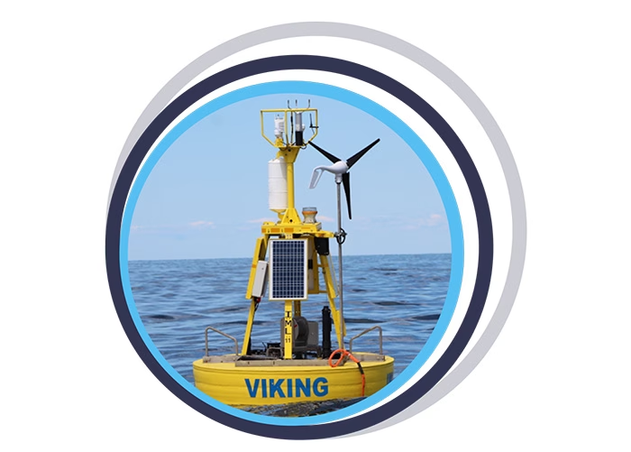
In Summary
The integration of satellite tracking and IoT technologies offers powerful solutions to some of the most pressing environmental challenges we face today. By enabling real-time data collection and analysis, these technologies help scientists, conservationists, and policymakers make informed decisions to protect our planet.
As we continue to innovate and expand the applications of these tools, their role in combating climate change will only become more significant. Embracing and investing in these technologies is essential for creating a sustainable future for generations to come.
Can we Support You?
Based in the UK and USA, Ground Control designs and builds satellite-enabled tracking and IoT solutions. We have over 20 years’ experience, and work with leading satellite network operators to ensure all of our customers get the best combination of coverage, cost, data throughput and latency.
If you have an asset that’s moving in and out of cellular coverage, we ensure that you always stay connected. We work directly with end users like Digital Forest, and often indirectly through our partner network of companies building animal tracking collars and data buoys, for example.
Please email hello@groundcontrol.com or complete the form, and we’ll reply within one working day.
Five Design Considerations for Energy Conservation in Remote IoT Applications
Energy consumption and industrial ambition toward becoming Net Zero are of global consequence. On the macro scale, as we build more and utilize more digitally and electronically, “the ongoing electrification of everything” makes it imperative to find ways of conserving and managing power consumption.
Integrators and engineers have managed this for some time, born of necessity and innovative thinking. In the last decade, IoT has revolutionized measuring and monitoring the impact of industrial energy consumption and its environmental impact. This involves developing ecological monitoring, renewable energy use cases, HVAC systems for facility management, and IoT energy monitoring systems for better efficiency in utilities and factories.
The Energy Impact and Growth of IoT Development
However, the world’s data demands continue to grow, not least from the massive processing power required by AI / machine learning technologies. UK National Grid CEO John Pettigrew called data centers a source of systemic stress, saying, “Power demands are expected to increase by 500% over the next 10 years.”
A peer-reviewed study in the same report estimates that AI power consumption could reach between 85 and 134 terawatt hours (TWh) annually by 2027. (That is in the range of what Sweden and Argentina each use in a year and would constitute about 0.5% of what the world currently uses.)
AIOTI, an industry alliance tasked with advancing Europe’s digital and green transformations, has identified energy efficiency as one of its 18 strategic research and innovation priorities. The goal is to evolve IoT technologies into an integrated digital ecosystem to advance hyper-automation in all industrial sectors. Specifically, AIOTI identifies three research topics: energy harvesting, with its potential to remove the dependency on batteries for power and their need for periodic replacement; the energy efficiency of hardware, and the energy efficiency of data processing. More on these in our satellite use cases later.
Why is Energy a Design Constraint in Satellite IoT?
Satellite IoT is a means of transmitting very remote IoT data over satellite. Satellite modems can be paired with individual sensors or can backhaul the data from LPWAN gateways. Power usage is often a constraint within these types of IoT applications because mains power is frequently unavailable. Therefore, it matters that the system’s energy consumption and a ‘Low Power Mindset’ are part of the IoT system design process.
Five Power Conservation Examples in Remote Satellite IoT
Here, we explore five design considerations in Satellite IoT that have helped remotely manage IoT energy consumption. Utilizing what energy is available, making it go further, and where possible, reducing the industrial carbon footprint.
1. Minimize What Data You Send, and how Frequently You Send it
Low power design considerations were recently explored in our webinar for IoT Central, covering Data Optimization, Interoperability, Coverage and Power Consumption in Satellite IoT design. Deep-diving into the section on power, the more data bandwidth a satellite IoT system utilizes, and the more frequently it sends data, the more power-hungry the satellite IoT device will be.
A key takeaway from the discussion: since both the send and idle mode for the device consume energy, keeping the device send mode to a minimum and utilizing a satellite device with low resting energy consumption in idle, are important considerations. This video snippet discusses the key design considerations for preserving power in Satellite IoT design. For a longer summary of the webinar, you might enjoy our post: A Guide to Satellite IoT for Cellular IoT Specialists
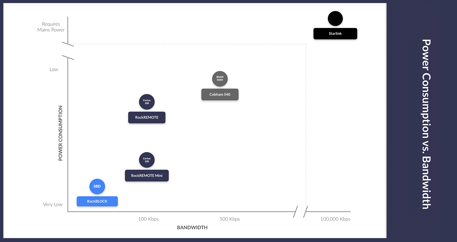
2. Data Processing at the Edge
Every time data is sent over a network, there is some level of energy cost in terms of power used; this is no exception with satellite networks. Satellite IoT connectivity requires more power than terrestrial networks to establish and maintain communication links with satellites in space. Edge computing utilizes light algorithms and task offloading to execute intensive tasks at the network’s edge. It can conserve energy on satellite IoT devices, make smart task decisions, decrease task delay, and reduce the volume of data sent over the network.
RockREMOTE’S edge computing capabilities have helped reduce system energy by analyzing data at the data collection point. Its capabilities include reporting by exception, defining data prioritization, and the ability to compress the data at the edge before sending it over the satellite network. With LTE-M, Certus 100, and IMT capabilities, the device switches between networks for uninterrupted connectivity. This provides 100% connectivity, balancing data transfer costs, appropriate network selection, and minimizing network energy consumption. This short video talks more about RockREMOTE’s edge processing capabilities in a use case on African Game Reserves.
3. Energy Harvesting – Solar Energy for Satellite IoT Sustainability
Energy harvesting can provide an inexhaustible electrical energy supply captured from renewable sources: solar, wind, hydroelectric, biomass, tidal, and wave energy. Depending on the application and the supply, this energy can supplement or replace a primary cell or battery. Harvested energy can be used to power the circuitry directly or stored in the buffer until needed.
A recent use case for RockBLOCK RTU involved a customer measuring water levels in fracking sites in northern Canada. The localities were remote, unmanned, and unpowered, and temperatures frequently dropped below -32°C (-25.6°F). The solution needed to be self-powered, extremely robust, and reliable. The RockBLOCK RTU satellite transceiver is highly ruggedized to cope with harsh weather conditions and has very low power requirements. Accordingly, it consumes less than 380mW with a five-minute value transmission interval. Connecting it to a small solar panel array, combined with a lithium-based cell, harvested more than enough solar power to send two daily messages over satellite, plus an immediate alert if water levels exceeded predefined parameters.
4. Power and Cabling Efficiencies with Power over Ethernet (PoE)
Piggybacking off existing power supply with PoE eliminates the need for a separate power supply by delivering DC power to a device from the existing Ethernet infrastructure. Strictly speaking, this example means that the power cabling already exists, and a power supply for other technology is available to share. Think offshore platforms, ships, or buoys to bring to life some, (not all) examples of this use case: some power, but with limited cellular connectivity. Utilizing PoE to supply the satellite device reduces standby power consumption and overall energy usage.
A centralized power management approach can also enable more efficient resource allocation and reduce energy waste compared to individual power adapters for each connected device. PoE standards, such as IEEE 802.3af and IEEE 802.3at, include power-saving mechanisms like sleep modes and low-power states. This enables connected devices to operate more efficiently and intelligently, managing power consumption based on usage patterns leading to overall energy savings.
The pictured RockREMOTE Mini keeps satellite device power consumption very low, with less than 0.25W in receive mode. In addition to its optimized power consumption, it has two power supply options: a 10-30V supply or PoE+ (802.3at). This flexibility provides a convenient and efficient solution for powering the device and eliminates the need for a separate power source, reducing installation cost and design complexity.
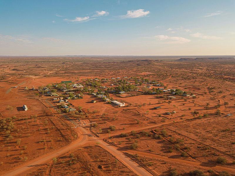
5. Pulse Width Modulation in Remote Locations
Pulse Width Modulation (PWM) is a technique for controlling the amount of power delivered to an electronic device by rapidly switching the power on and off. The key to PWM is controlling the duty cycle, which is the percentage of time the signal is “on” versus the time it is “off” during each cycle.
Imagine a light dimmer that can adjust the brightness of a light. Instead of providing a steady flow of electricity, the dimmer rapidly switches the light on and off. The average brightness of the light depends on the proportion of the time it is on versus the time it is off:
High Duty Cycle: If the light is on 90% of the time and off 10% of the time, it will be very bright.
Low Duty Cycle: If the light is on 10% of the time and off 90% of the time, it will be dim.
PWM works similarly with other devices, like motors, where it controls speed, or heaters, where it controls temperature.
In the vast, sparsely populated Australian Outback, isolated and off-grid locations such as cattle stations and small farms require satellite technology to manage solar power systems for water pumps, electric fences, and communications equipment, ensuring continuous operation. Ensuring the battery life of the equipment is essential to keeping everything in operation and managing energy usage efficiency.
The RockBLOCK RTU’s PWM controls the battery charging current from connected solar panels. By adjusting the duty cycle, the charge controller regulates the voltage and current, preventing overcharging and optimizing battery life. The RockBLOCK RTU Micrologger device is designed to operate with minimal power, which is crucial for keeping the remote installations running without over-drawing energy from the overall system. Triggering on/off switching can be key to managing resources, conserving, and managing the power supply, and extending battery lifetime in remote and/or unmanned locations.
With power supply and energy management as consistent considerations in developing satellite IoT projects, these use cases highlight the variety of innovations that have been used to navigate the physical, logistical, and infrastructure limitations of remote off-grid locations. Once the parameters of the Satellite IoT project are established, often the most appropriate solution is obvious. Our engineers love a challenge, so if there is an energy constraint holding your remote IoT project back, get in touch, and our technical and development teams will be happy to help.
Would you like to know more?
If you’re tackling an remote connectivity challenge, with constraints on power, we can almost certainly help.
Call us on +44 (0) 1452 751940 (UK) or +1.805.783.4600 (USA); email hello@groundcontrol.com, or complete the form.
We have over 20 years’ experience designing and building satellite communication devices, and our expert team is standing by to offer support and suggestions.
Bridging the Gap: Addressing Data Inconsistencies in Global Disaster Monitoring
The natural disaster detection IoT market is projected to grow from $6.6bn in 2023 to $37.3bn by 2030, at a Compound Annual Growth Rate (CAGR) of 27.85%, according to 360iResearch.
Natural disasters are a growing phenomenon, due to rising temperatures and climate change. IoT has an important role to play in monitoring environments and detecting natural disasters. It can help to warn, and somewhat mitigate the risk to, vulnerable populations, wildlife and commercial centers from events such as earthquakes, landslides, tsunamis, hurricanes, flooding, wildfire and temperature extremeties.
Further, technologies such as Machine Learning (ML) and Artificial Intelligence (AI) are helping to predict, measure and pre-empt environmental change. This minimizes costs both in terms of lives, businesses, and urban infrastructure.
This innovative use of technology will help save lives through preventive measures and early warning systems. But while global warming is – the clue is in the name – a global concern, early detection and data insight isn’t happening at the same rate across the globe.
Worryingly, in the same parts of the globe where early detection is needed most, the data to facilitate this is missing or not being gathered. With the growth of IoT connectivity, all countries should be able to utilize environmental monitoring and disaster recovery data to their advantage, but this isn’t actually the case.
The Problem of Missing Data
The problem of ‘missing data’ forms part of an environment research paper for iopscience. The authors report that data gaps and missing data are commonplace across real world datasets, including global disaster databases. Global disaster databases, and recorded disaster data, are increasingly utilized by decision-makers and researchers to inform disaster mitigation and climate policies. So with significant chunks of data missing, the researchers question the conclusions drawn and the risks of unreliable study results. After all, a reliable evidence base is a prerequisite for effective decision making.
So why is there an inconsistency in the data that is gathered and why are some countries not collecting the data they need? There are numerous reasons cited, including technological limitations in the surveillance of disaster events (which we will explore in more detail here), and factors such as the income status of the affected country, and the types of disaster event that occur. Global databases on environmental extremes, and analysis of their impacts, is largely carried out by research organizations in western nations. This means that there is a bias towards events in these countries. It’s an ‘unnatural disaster’ that some parts of the globe are still not able to monitor and measure the environmental changes that could save lives.
The commercial world is being called upon to build the infrastructure needed to supply NGO, local communities and emergency services with the information they desperately need. Fixed sensors can capture temperature change, rising water levels, earthquake shock readings; drones can monitor volcanic activity and large bodies of water. This information delivers the insight necessary to inform and reduce loss of life.
However, this comes with some significant investment, namely the network infrastructure needed to transmit the data, and ongoing funding – hence there being more complete data sets from countries of higher economic GDP.
If the infrastructure does not exist to support environmental monitoring, or research is inhibited by poor or intermittent cellular connectivity, what can be done? Terrestrial networks are expensive to set up, and vulnerable themselves to natural disasters. As we reported in an earlier blog post, during a prolonged spell of rain in 2022, 1,200 cell towers were impacted in South Africa alone due flooding and landslides.
Many countries and localities are simply not equipped to provide the power or networking to support cellular IoT. Not only is network coverage much lower in least developed countries than in the rest of the world, but mobile data usage can also be significantly more expensive.
Solving the Communications Infrastructure Problem
Satellite IoT can solve the communications infrastructure problem. It provides global connectivity to locations where cellular connectivity is missing or intermittent, enabling the kind of sensor data required for environmental monitoring to be transferred to and from the farthest reaches of the earth. All that’s needed is a satellite transceiver, antenna and clear view of the sky.
As an example, Slide Sentinel provides a fully automated landslide monitoring system using Real Time Kinematics. This provides early detection and forewarning as well as limiting the use of invasive and expensive landslide monitoring drilling techniques. The system is capable of reliably detecting catastrophic landslides and centimeter movement in land mass and offers valuable information about gradual changes in land soil displacement.
It’s a low-cost solution consisting of a network of remote low power sensors that detect fast linear slides and eventually lower soil movements such as creep. Long range low-power (LoRa) radio connections on these sensor nodes wirelessly transmit three-dimensional acceleration, Real Time Kinematic (RTK) GPS coordinates, and sudden shifts in soil movement to a gateway. This data is backhauled via satellite to the cloud from where it can be exported to anywhere on Earth.
Read more about the Sentinel project and their work in the Pacific West.
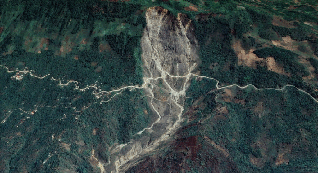
It’s not just the connectivity options that can limit research and data gathering. Harsh external conditions can make devices and data capture vulnerable to the elements. No two use cases are the same, and devices used for monitoring and sending data need to withstand temperature, wind and precipitation extremities, as well as the conditions during an actual disaster.
A great example is the work by American Signal Corporation (ASC). The 2004 Indian Ocean earthquake and tsunami (known as the “Boxing Day Tsunami) devastated lives, businesses and homes across SE Asia. An estimated 227,898 people died across 14 countries. With no early warning system of the approaching tsunami, no early evacuation procedures were undertaken, despite there being several hours between the earthquake and ensuing tsunami, with devastating consequences and huge loss of life.
Following on from the disaster and working with the Thai Government, ASC installed a nationwide network of devices, including high powered speaker arrays, sensors and alerting devices together with bespoke management software to alert people to threats posed by tsunami, floods and other possible natural/manmade disasters. The critical nature of the solution required a connectivity option that could provide global coverage and network reliability with the lowest idle power requirement. They also needed a device that was robust, and could withstand the elements and the test of time.
They opted for Ground Control’s RockBLOCK Plus satellite IoT transceiver to backhaul data from 1500 alerting devices across the country. The RockBLOCK Plus is waterproof, ruggedized, highly UV resistant and has a marine-grade Kevlar cable, making it ideal for long term outdoor deployment in the most severe environments.
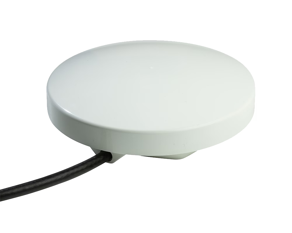
Counting the Cost of Satellite Connectivity
While satellite has a reputation for being expensive, it has decreased in the last few years, with diversified services and new entrants bringing prices down. The investment locally is not as expensive or as vulnerable to damage as building the cellular network infrastructure. With global satellite coverage already in place, satellite IoT provides a means of gathering intelligence without the greater cost of building and managing network infrastructure development.
Satellite networks already contribute to programmes of meteorological measurement providing global data mapping of environmental change. However, further gains can be made if localised monitoring and data management are made accessible. Satellite IoT lends itself to solving this problem due to the flexibility with which data can be packaged and sent.
Local sensor data can be passed in small data packets and transferred as messages without the chatty protocol overheads of IP connectivity. With a little development expertise and guidance, the data costs can be kept to a minimum so that you’re only transferring the essential information that is needed. If it’s life saving data that’s helping monitor global environmental health, it really shouldn’t cost the earth!
Would you like to know more?
If you’re tackling an remote connectivity challenge, with constraints on power, budget and latency, we can almost certainly help.
Call us on +44 (0) 1452 751940 (UK) or +1.805.783.4600 (USA); email hello@groundcontrol.com, or complete the form.
We have over 20 years’ experience designing and building satellite communication devices, and our expert team is standing by to offer support and suggestions.
Conquering Infrastructure Obstacles in Sustainable Development Projects
The World Economic Forum’s IoT Guidelines for Sustainability report states that 84% of IoT deployments are addressing, or have the potential to address, the UN’s Sustainable Development Goals. These SDGs include combating climate change, sustainable production patterns and ensuring availability of clean water.
But as the report points out, “No services are possible without the infrastructure in place. Particularly in the case of IoT, at some point in the future revenues may come from the services associated with data, but without addressing the infrastructure solutions first, that day is still far away.”
In this post, we’re exploring challenges that are preventing the roll-out of IoT solutions in the areas that need it most, and offering some ideas to resolve these issues. It’s not a fully comprehensive list of challenges. We’ve left out the issue of national and municipal government buy-in, and conflict / war zones, as while they’re unquestionably barriers, we’re realistic about the ability of a blog post to provide a practical solution to them!
The two barriers to IoT infrastructure we’re addressing are affordability and geography.
Where in the world is the lack of IoT infrastructure most acute?
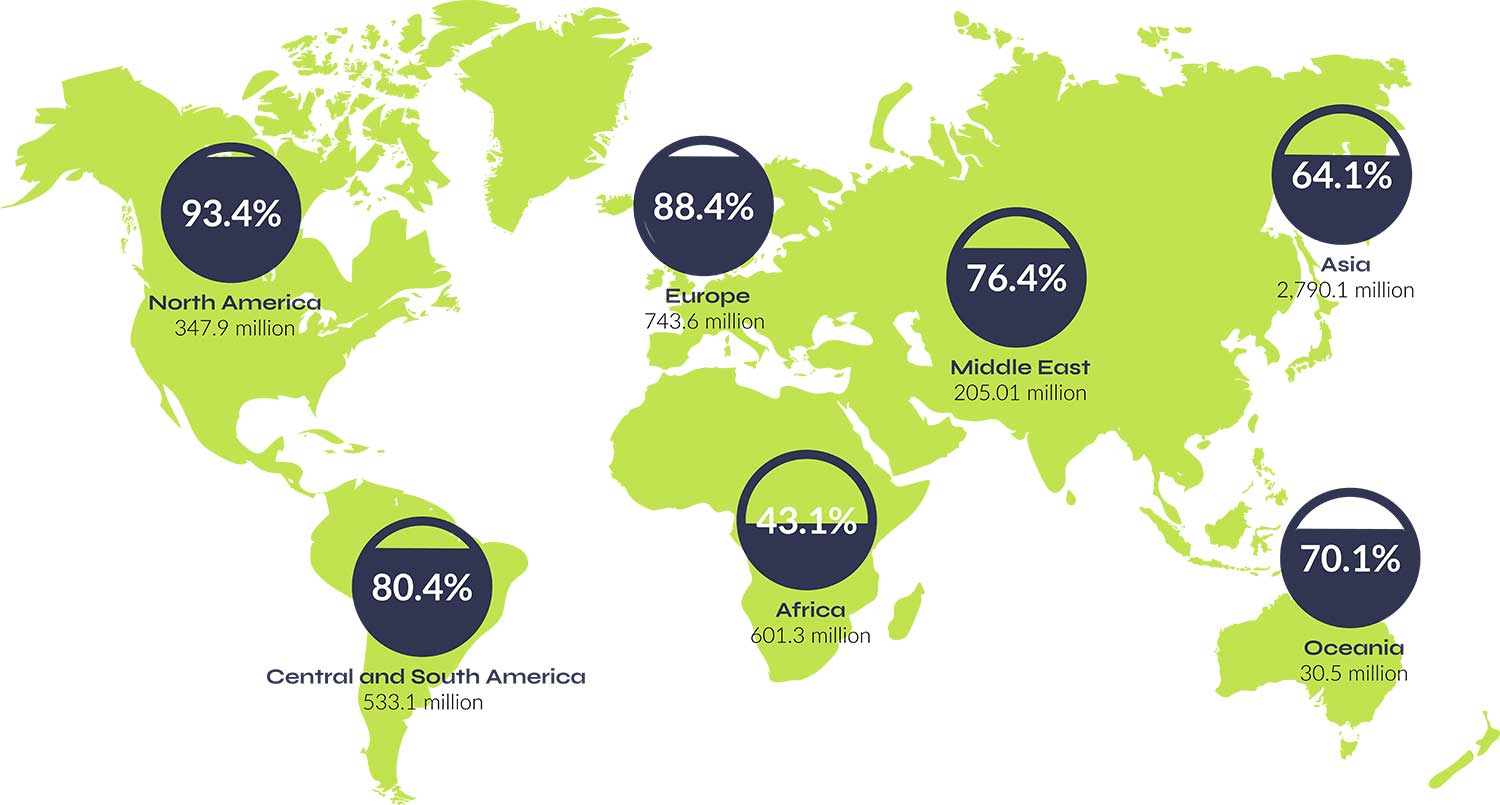
This graphic illustrates the impact of the digital divide. This relates to the gap between demographics and regions that have access to modern information and communications technology, and those that don’t. The statistics are shocking: 43% of Africans can use the internet, compared to 93% of Americans and 88% of Europeans. Even in more developed regions like the Americas, four out of 10 Latin Americans in rural areas have no way to connect to the internet (source) – because terrestrial networks are prohibitively expensive to set up in non-densely populated areas.
And the digital divide doesn’t only affect individuals’ access to the internet. The lack of infrastructure also means businesses and governments can’t deliver the benefits of IoT connectivity: improvements in energy efficiency; healthcare outcomes; public safety; environmental monitoring; transport planning; agriculture sustainability – the list goes on.
As just mentioned, the main reason for this is that cellular networks rely on a dense network of base stations and antennas to provide coverage, which is expensive and challenging to deploy, and there’s limited financial incentive for the private sector to support this outside of urban areas.
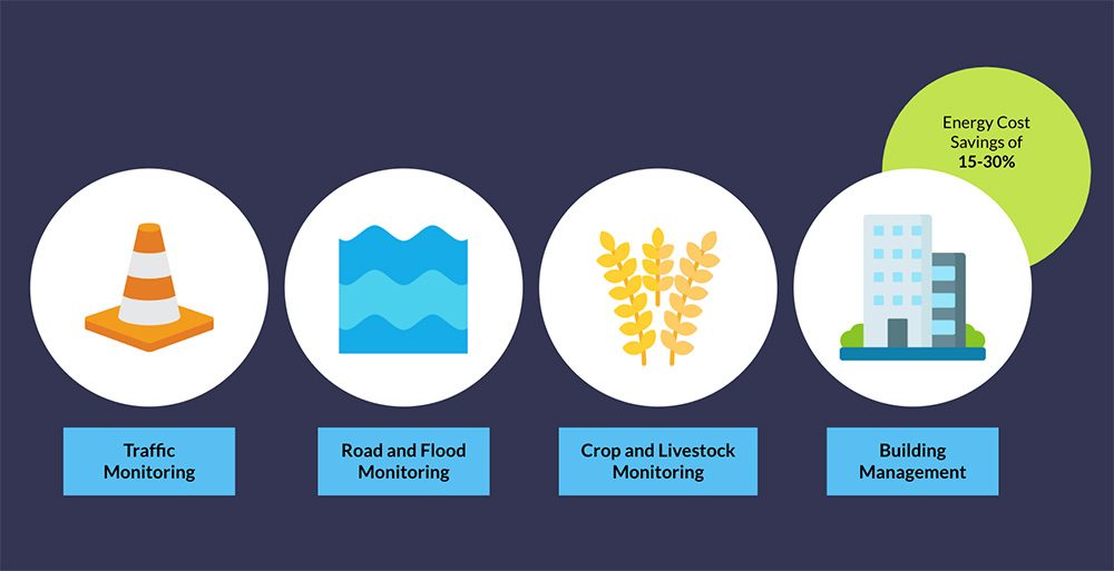
One proposed solution to the IoT connectivity challenge is to create coverage through LPWAN technology. A group of academics in the United States received funding for just such a project in 2021, with the goal of enabling small communities in upstate New York to benefit from IoT applications including remote meter readings for utility firms; traffic monitoring; real-time road and flood monitoring; crop and livestock monitoring for farmers, and building management.
Early returns for the latter indicated energy cost savings of between 15-30%; great news for the bill payer and the environment alike (source).
While there’s a lot to recommend this, there are a couple of additional considerations: firstly, the gateway that controls the network and aggregates the data from the nodes needs to be able to connect to the cloud, and for that it needs another means of connectivity. If you can position your gateway within cellular coverage, adding a cellular modem to your gateway will resolve this challenge. If you are out of cell tower range, a satellite modem such as Ground Control’s RockREMOTE will have the same effect.
The second consideration is mobility: neither of the two most popular LPWAN technologies – NB-IoT and LoRaWAN – were intended for mobile applications such as fleet monitoring or animal tracking. LoRaWAN can be used to connect moving sensors, but there’s a greater risk of transmission interference as a result of signal collision if a large number of nodes are connected (read more). This has an associated effect of increasing the energy consumption as packets are retransmitted, and changes in device location sometimes resulting in a higher spreading factor (SF).
To solve the mobility issue in areas with no terrestrial infrastructure, you may want to explore satellite transceivers, but be sure to look for devices with omni-directional antennas with no requirement to ‘point’ them at the satellite network overhead. The tiny RockBLOCK 9603, which transmits very small packets over the Iridium network, is ideal for sensor data transmission from animal tracking collars, UAVs, and drifting data buoys. If you need to send and receive higher volumes of data, something like the RockREMOTE Rugged works well for heavy machinery monitoring and control, including autonomous tractors and mobile generators.
But isn’t satellite IoT prohibitively expensive?
Satellite IoT has experienced a huge growth in demand and service providers as – largely thanks to Space X – the cost of launching a satellite has decreased from $85K per KG in the 80s to just $1K per KG in 2020 (source). This means plenty of competition and service diversification, which has driven down costs. As an example of this, a customer of ours, Synnefa, facilitates remote farming for smallholders in Kenya.
By providing them with accurate, real-time data on soil moisture, temperature, nutrient levels in the soil, and light intensity, Synnefa enables these remote farmers to optimise productivity while reducing waste, and it’s working:
- 50% Water savings
- 41% reduction in fertiliser usage
- 30% increased production.
Synnefa uses terrestrial connectivity where available, and Kenya is better connected than much of Africa, but as the map shows, there are huge swathes of agricultural land that have no access to cellular networks. So the Synnefa team ship their FarmShield device with a RockBLOCK 9602; if the sensor is out of terrestrial communication range, it can use satellites to send data.
But the critical point here is that Synnefa charge their customers no more for cellular than they do for satellite; there is a difference in cost to Synnefa, but it’s not so significant that they have to pass it on. Synnefa’s customers can benefit from more sustainable and productive farming wherever their farm is located.
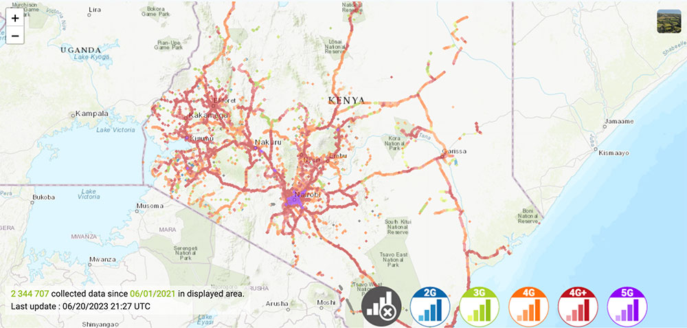
Satellite connectivity continues to get more affordable, and we’re excited to watch the progress of SatelioT who are in the process of launching nanosatellites into Low Earth Orbit just 500 KM above us; that’s so close they don’t even need an antenna to create terrestrial connectivity. The purpose of these nanosatellites is to act as telephone towers in space, extending the reach of 5G NB-IoT connectivity to basically anywhere on Earth. So in principle, and hopefully soon in practice, you’ll be able to connect your IoT device to this Non-Terrestrial-Network (NTN) without needing an additional transceiver or antenna. This would be a huge step forwards for isolated communities, and with no new hardware needed, would greatly speed up the introduction of remote monitoring applications.
As with all of these newer entrants, including Swarm (now owned by SpaceX), who’s probably the best known of the nanosatellite manufacturers, it’s worth noting that for at least the next 2-3 years, the frequency with which your device will be able to send and receive data will be much slower than established satellite constellations like Iridium or Inmarsat. This is because there are simply fewer satellites overhead, so you’ll need to wait longer before your device signal is picked up. And you’ll also need to check if the region you’re aiming to connect is covered by an orbiting satellite, as few satellite operators have truly global coverage. But if you have coverage, and your application can manage with store-and-forward delivery, these are low cost options that may hold the key to unlocking some missing infrastructure and financing challenges.
IoT can help combat climate change – but climate change is making it harder to create IoT infrastructure
Another barrier to leveraging IoT for sustainable development is the increased frequency, duration and magnitude of extreme events, including droughts, flooding and extreme heat. And the countries most likely to be affected by these conditions are often the countries with the least ability to adapt. Projections indicate that Sub-Saharan Africa will bear the brunt of climate change impacts on food security, due to its reliance on rain-fed agriculture. Projects such as solar irrigation, rainwater harvesting and irrigation systems will be essential to enhance water availability, but their efficacy is limited without sensors.
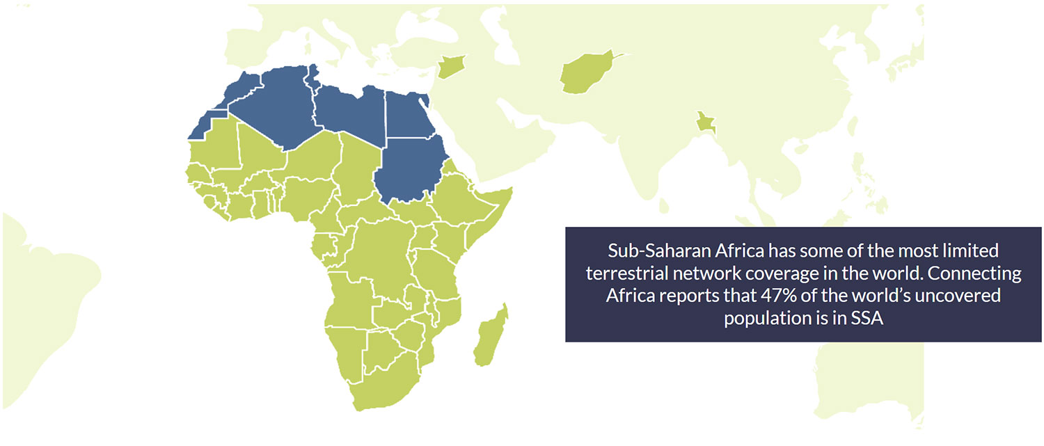
Knowing what resources you have, where they are, and where and when they’re most needed is fundamental to the successful deployment of smart irrigation technology. You can send someone to gather and report sensor data, or you can utilise IoT to get real-time data, and vastly speed up your reaction time to new data, while better modelling future needs. Sub-Saharan Africa, however, has some of the most limited terrestrial network coverage in the world. Connecting Africa reports that 47% of the world’s uncovered population is in SSA (source).
Further, terrestrial networks where they do exist are susceptible to natural disasters; flooding, hurricanes and earthquakes and ensuing landslides can create power outages and damage cell towers; fibre ducts can become waterlogged; repairs can be delayed due to road damage. In 2022, 1,200 cell towers were impacted in South Africa alone due to a prolonged spell of heavy rain and the ensuing flooding and landslides (source). In developing countries, infrastructure such as the electricity grid and piped water are often the responsibility of county-level or national government, and it can take years before damage is rectified. One study in Kenya found that 62% of electrical grid failures caused by floods were never repaired (read more). This presents massive challenges for IoT deployment that relies on terrestrial communication networks like BLE, WiFi and Cellular.
So, we turn again to the twin options of LPWAN – specifically LoRaWAN here, because of its independence from 4G / 5G cellular tower infrastructure – and satellite; sometimes deployed separately but often combined to provide low cost coverage over a wide area, with no dependency on terrestrial networks for data backhaul.
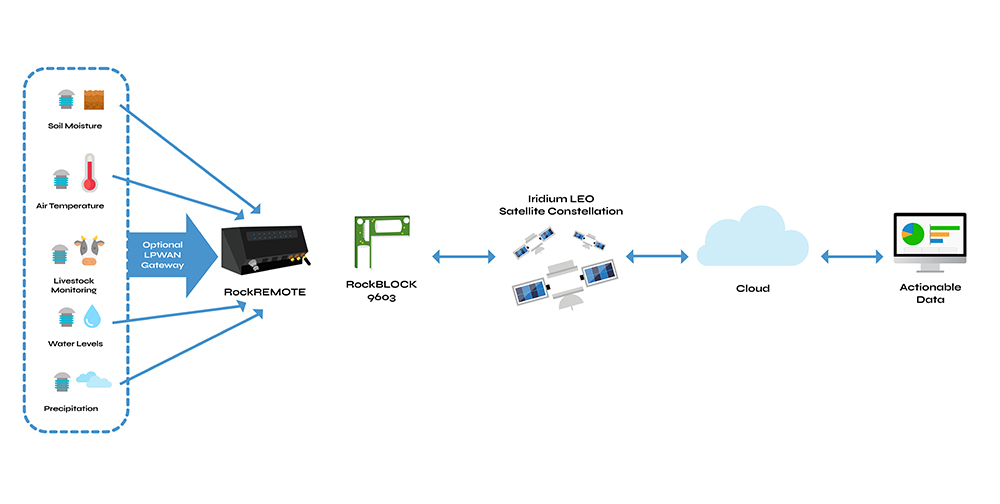
Neither of these options are immune to damage but they are more resilient. LoRaWAN gateways are, of course, much smaller than cell towers, and the signal is largely unaffected by wind and rain. They’re available in IP68 rated enclosures with automated leak detection and remote configuration options – essential if you’re not going to be able to reach the device for long periods of time.
Similarly, satellite transceivers are often built into highly ruggedised enclosures, or are shipped with such enclosures. Some are solar powered; others will work off a single battery for years. Devices like the RockREMOTE Rugged also support Over The Air (OTA) device configuration. Paired with a sensor array or data logger, you’ve got a IoT solution that is highly resilient against adverse weather, as the transmission is going to, or being received from, satellites orbiting far above the Earth (some not as far as they used to be, but still well out of trouble!). The ground stations used by satellite network operators are carefully chosen for their stability and security; it’s why satellite connectivity is so often deployed in emergency situations, when terrestrial networks have failed.
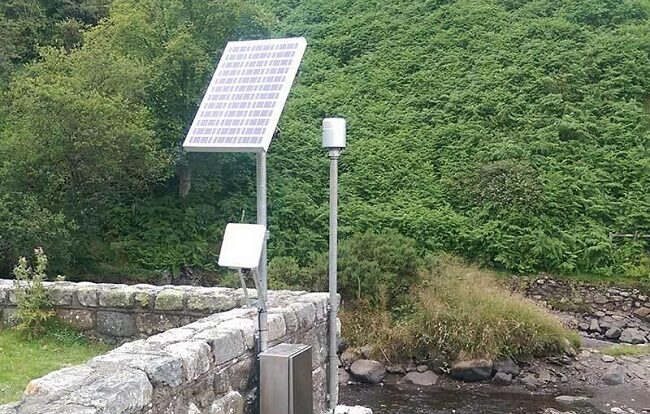
Leading renewable energy provider RWE has installed hydrology stations which monitor water levels, precipitation, air and water temperatures, and relative humidity, to detect excess rainfall in remote parts of Wales, UK. These hydrology stations are located at hydroelectric power stations; reservoirs which pipe water through turbines to supply renewable energy to the grid.
If there’s excessive rainfall, the operators can push more water through the turbines, which provides more green energy; and there’s a huge added benefit in that this also greatly reduces the chances of localised flooding, as the reservoir’s capacity to absorb more water grows.
In the complete absence of cell towers – this being a particularly beautiful and remote part of the UK – these hydrology stations use satellite connectivity, in this case Viasat IoT Pro, to transmit the data in real-time back to the operations centre. The cost is managed through edge computing, which allows the frequency of transmission to be increased to every 15 minutes if data falls outside of normal parameters, but is usually set to transmit every 3 hours.
In summary, the places that would benefit the most from IoT to help with sustainable development goals are often the places most under-served by terrestrial networks – because it’s too difficult, too expensive, or too risky to install them. Outside of urban areas, coverage in Africa, Asia and Oceania is extremely limited, and yet these regions are some of the most at-risk from rising sea levels, drought, flooding and other extreme weather conditions.
In order to bridge the digital divide, we need to look to low cost, resilient and easy to deploy connectivity solutions. Some are available today – LoRaWAN and satellite IoT, both combined and independent of each other, are entirely viable options. And it’s very exciting to see what’s coming in the next few years from innovations which will bring satellite and cellular networks together.
Would you like to know more?
If you have an IoT project with connectivity challenges, you’re absolutely in the right place to get expert help. Call or email us, or complete the form and we’ll be happy to talk through your options.
We design and build our own satellite transceivers, and also work with trusted third parties to offer a wide range of connectivity options and airtime partners.