Topic: Asset Tracking
Globalstar Tracking Devices Now Integrated with Cloudloop
Ground Control’s tracking platform, Cloudloop, now supports Globalstar’s GSat Solar and SmartOne C tracking devices. The integration provides a budget friendly satellite tracking option for businesses and organizations that need occasional location updates without the expense of more advanced two-way communication systems.
This integration expands the range of options available through Cloudloop Tracking, allowing users to deploy low power, long lasting satellite tracking solutions that are ideal for monitoring assets in remote or off grid locations where cellular coverage is unreliable or unavailable.
Globalstar operates a constellation of Low Earth Orbit (LEO) satellites, providing cost-effective tracking solutions for businesses. Devices transmit location and status updates to the satellite network at predefined intervals, and in the case of the selected hardware, only send data one way. While this has some limitations (they’re not suitable for real-time tracking of high value assets), it means the devices are significantly cheaper than two-way communication alternatives. They also draw very little power, and can run for years without maintenance, making them ideal for remote asset tracking. Their compact size and flexible mounting options also make Globalstar trackers easy to install on various assets.
Globalstar’s services are regionally available, mainly in North America, Europe, and parts of South America (see coverage map).
Why Choose Globalstar for Asset Tracking?
Lower Cost, Simple Tracking
Globalstar’s tracking solutions provide a cost-effective way to monitor assets that do not require real-time oversight. If you need to be 100% certain of an asset’s position at all times or require two-way messaging, other solutions (like Iridium-based tracking) will be more suited. However, compared to premium two-way satellite tracking solutions, Globalstar devices significantly reduce tracking expenses while still offering a reliable means of monitoring asset movements. For businesses managing large fleets of lower-value assets, the cost savings can be substantial.
Battery Powered and Compact
Both the GSat Solar and SmartOne C are designed for easy deployment without the need for a constant power source. The GSat Solar harnesses solar energy, making it an excellent choice for long-term, low-maintenance tracking. The SmartOne C, on the other hand, operates on replaceable batteries, ensuring flexibility for different use cases where solar charging may not be practical or possible. Their compact form factors also make them easy to install on a variety of asset types, such as shipping containers, vehicles and even animals.
Globalstar Tracking Devices
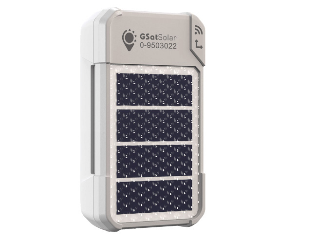
GSat Solar
GSat Solar is an ultra-low power, solar powered tracking device designed to provide long term asset visibility with minimal maintenance. With its solar-powered operation, GSat Solar ensures extended battery life, reducing the need for manual intervention and making it a reliable choice for long term deployments. Its compact and rugged design enhances durability, allowing it to withstand harsh environmental conditions while continuing to deliver accurate location data. The device operates on a scheduled reporting system, providing periodic updates on asset movements, ensuring that businesses can efficiently monitor and manage their assets with ease.
It is an ideal solution for tracking equipment, livestock, and other mobile assets in remote locations, offering a cost-effective option for asset managers who require periodic location updates without the need for constant oversight.
SmartOne C
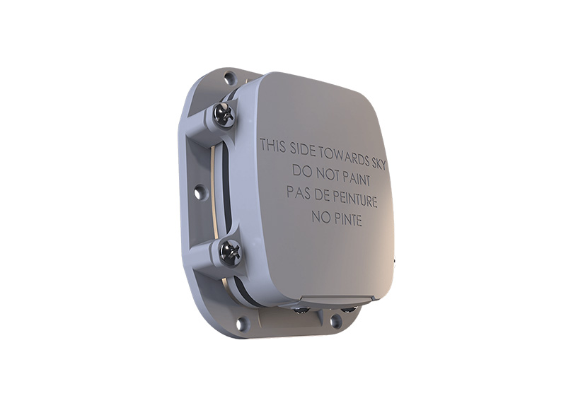
SmartOne C is a versatile, battery powered tracking device designed for reliable asset monitoring and is an excellent solution for tracking equipment, trailers, and other valuable assets that require periodic location updates without the need for a wired power source. The device supports configurable reporting intervals, enabling businesses to balance tracking frequency with battery life, ensuring efficient and cost effective asset management.
With its user replaceable batteries, SmartOne C offers flexibility for deployments where solar charging may not be practical, ensuring long-lasting performance in the field. Its durable and rugged design also allows it to withstand tough environmental conditions, making it suitable for use in remote or harsh locations.

Transport & Logistics
Logistics companies often prioritize cost efficiency, and a device that delivers scheduled location updates is sufficient to confirm that cargo is moving along its intended route. Globalstar trackers are especially valuable for monitoring shipments that traverse remote areas or international borders where terrestrial coverage may be unreliable or unavailable.
Construction
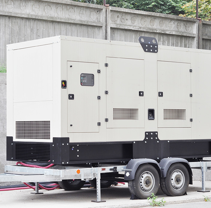
Theft and unauthorized use are common concerns, making periodic tracking an effective way to ensure assets remain where they should be. Since Globalstar devices operate on long life battery power or solar energy, they provide an ideal solution for tracking assets that lack an onboard power source, reducing maintenance requirements while maintaining visibility.

Agriculture
Farmers rely on mobile infrastructure such as irrigation pumps, fencing, and storage tanks, which are often placed in remote fields or rotational grazing areas. As this type of equipment is rarely moved but remains valuable, periodic tracking provides an affordable alternative to high end, real time tracking solutions.

Rental Equipment
Businesses that lease out assets such as portable lighting, sanitation units, storage containers, or temporary fencing, need a way to ensure their equipment remains in designated locations. A tracking device helps mitigate asset loss and facilitates billing verification by providing periodic location reports, ensuring that rented equipment is where it is supposed to be throughout the rental period.

Seasonal Vehicles
For snowplows, ATVs, or specialized agricultural machinery, continuous tracking is rarely required, making a low cost, long battery-life tracking solution more practical than traditional GPS systems that require frequent recharging. Globalstar devices allow asset owners to periodically check in on vehicle locations, ensuring they have not been moved or stolen during off-seasons.
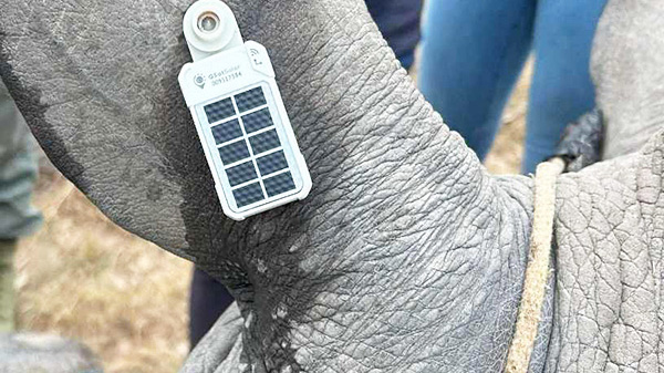
Animal Tracking
Ranchers can deploy these devices on cattle to verify herd locations and grazing patterns. Conservationists and researchers can gather movement data. As the devices are built for rugged environments and have extended battery life, they can remain operational for long periods, making them particularly useful for tracking animals in remote or ecologically sensitive areas.
Simplifying Globalstar Tracking & Data Management
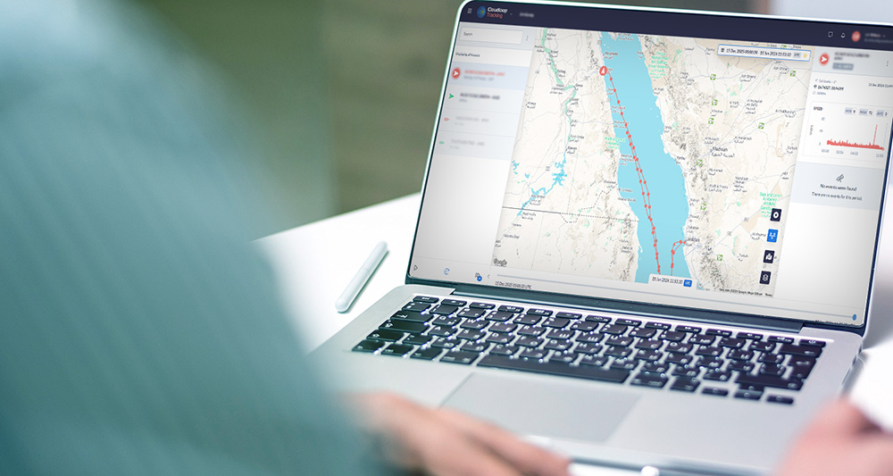
Cloudloop Tracking offers a centralized and intuitive interface that streamlines the monitoring and analysis of Globalstar’s location data. Cloudloop Tracking consolidates tracking information from one, or multiple devices, into a single view, allowing for effortless oversight of asset locations at any time.
The platform enables users to configure customizable alerts and reports, ensuring immediate notifications for asset movements, unauthorized relocations, or scheduled status updates. Its secure, scalable cloud storage guarantees that historical records and analytics remain accessible whenever needed, providing valuable insights for long term asset management.
By combining Globalstar’s cost-effective tracking devices with Cloudloop’s robust, cloud-based ecosystem, businesses gain an advanced tool for data visualization, alerting, and reporting. Whether monitoring shipping containers, rental equipment, or livestock, Cloudloop Tracking ensures users have the right insights at their fingertips to make informed decisions.
A Smart Choice for Cost-Effective Tracking
Globalstar tracking devices offer a powerful and economical solution for businesses and organizations requiring scheduled asset monitoring without the overhead of real time tracking. While Globalstar tracking solutions are not ideal for critical, high value assets or applications that demand real time global coverage, the devices offer an excellent balance of affordability and reliability for periodic tracking needs. Whether used for logistics, construction, agriculture, rental services, seasonal asset management, or wildlife monitoring, the Globalstar GSat Solar and SmartOne C devices provide a dependable and efficient way to enhance asset visibility while keeping costs under control.
Low-Cost Asset Tracking and Monitoring
If your business needs a cost-effective way to keep tabs on shipping containers, rental equipment, agricultural assets, or even livestock, Globalstar’s GSat Solar and SmartOne C trackers could be the perfect fit.
Equip your assets with reliable, cost-effective tracking solutions powered by Globalstar and seamlessly integrated with Cloudloop. Contact us today to discover how our technology can enhance your asset visibility and security. Complete the form, or email hello@groundcontrol.com.
The Role of RockFLEET in Securing Undersea Cables
Undersea internet cables are essential for global communications and economic security. The entire global network of cables is more than half a million miles long and comprised of more than 200 independent but interconnected systems. These cables span vast distances, connecting continents and enabling everything from international internet services to military communications. But with increasing geopolitical tensions and the growing importance of digital infrastructure, the threat to these cables has risen on the international agenda.
The strategic importance of undersea cables, which carry 99% of international telecommunications, makes them attractive – and vulnerable – targets.
In January 2025, the Royal Navy closely monitored the Russian vessel Yantar, officially an ocean research ship but considered a spy ship, as it entered UK waters and mapped underwater infrastructure.
Additionally, a NATO flotilla, including ships from the Netherlands, Germany, and France, assembled off Estonia to protect undersea cables in the Baltic Sea from potential sabotage, primarily by Russia.
Guard and patrol vessels play a pivotal role in deterring and responding to potential threats, ensuring the integrity of essential communication networks.
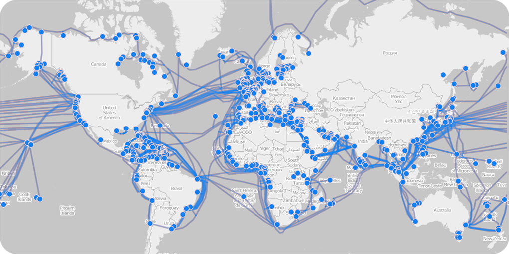
Data from the TeleGeography Submarine Cable Map shows that damage to undersea cables is a common occurrence. According to a report by the International Cable Protection Committee (ICPC), around 300 cable breaks are reported every year. Most of these are accidental, caused by fishing trawlers, ships’ anchors, or natural events like earthquakes. However, the risk of deliberate attacks or sabotage by state or non-state actors is also increasing.
The potential for geopolitical tensions to spill into the maritime domain has been highlighted in various reports. For instance, the United States Department of Defense (DoD) has raised concerns about the vulnerability of critical undersea infrastructure to foreign adversaries. This type of attack can have devastating effects on global data flow, cybersecurity, and national security.
Internet traffic, military transmissions and financial transactions all depend upon submarine cables, so any disruption can cause significant economic damage, loss of access to critical services, and widespread instability in communication.
The Role of RockFLEET in Securing Submarine Cables
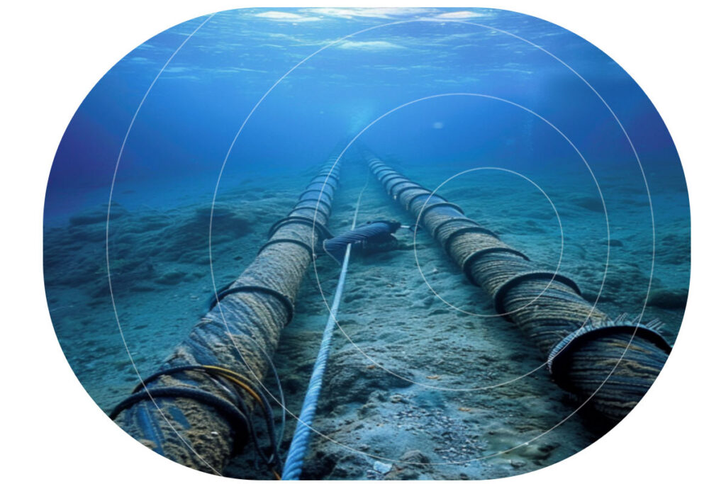
Guard boats are increasingly deployed as vital protectors of undersea cabling infrastructure. These guard boats, often repurposed fishing vessels, act as sentinels over subsea cables, ensuring their security by warning nearby vessels to keep a safe distance.
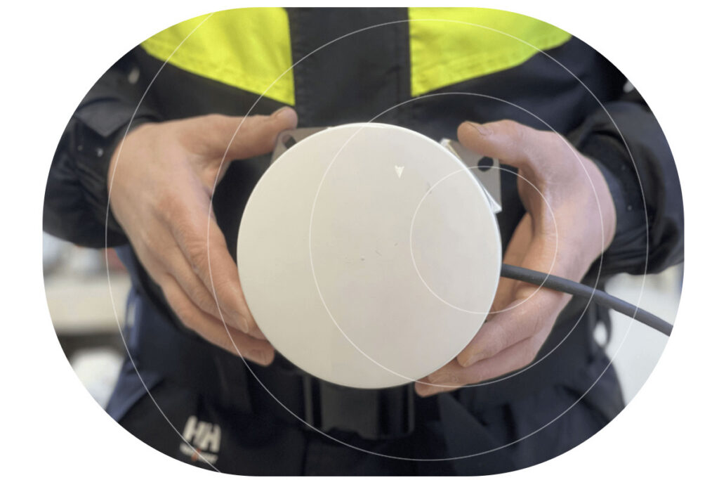
Tracking guard boats efficiently in remote and challenging maritime environments requires an advanced tracking solution. RockFLEET is a compact, robust, and highly reliable tracking device designed specifically for use in harsh maritime conditions. It operates through satellite-based communication via the global Iridium network, ensuring seamless tracking of guard boats even in areas with no cellular coverage, anywhere in the world.
This capability is essential as guard boats often patrol vast stretches of ocean far from terrestrial networks. With RockFLEET, maritime authorities and operational teams can monitor the precise location of each guard boat, ensuring the vessels are where they need to be to protect the cables effectively.
Three Ways RockFLEET Supports Guard and Patrol Vessels

Real Time Positional Data
One of the key features of RockFLEET is its ability to provide real-time positional data, which allows maritime coordinators to track the movement of guard boats and assess their effectiveness in securing undersea cables. If a guard boat drifts away from its designated patrol zone, RockFLEET alerts the operational team, enabling quick corrective action. This constant monitoring ensures that no section of the subsea cable remains unprotected due to navigational drift or unforeseen circumstances.

Estimated Arrival Times
Another critical function of RockFLEET is providing estimated arrival times (ETA) for guard boats. When repositioning guard boats due to shifting threats, adverse weather conditions, or maintenance schedules, knowing the vessel’s precise ETA is crucial. RockFLEET transmits accurate ETA data, allowing for better planning and coordination. This information helps ensure that there are no gaps in cable coverage and that another vessel is available to take over if one needs to leave its position.

Enhanced Vessel Safety
Safety is also a significant concern for guard boat crews. Since these vessels often operate in remote and sometimes hazardous conditions, having a reliable tracking system ensures that their locations are known at all times. In case of an emergency, RockFLEET provides real-time location updates, enabling rapid response and assistance from support teams. This enhances the overall security of both the vessels and the critical cabling infrastructure they protect.
The Future of Undersea Cable Security
As the threats to undersea cables continue to evolve, governments, cable operators, and multinational organizations are increasingly prioritizing the security of this infrastructure, given its direct impact on everything from national security to economic stability. New initiatives like the UK’s ‘Nordic Warden‘, which aims to track the movement of vessels suspected of malicious damage, should enable faster response times.
Guard boats and patrol vessels in their preventative capacity will remain an essential part of this response. RockFLEET plays an essential role in ensuring the effective tracking and monitoring of guard boats tasked with the protection of undersea cables. By providing accurate location tracking, monitoring movement, estimating arrival times, and enhancing overall vessel safety, RockFLEET helps to safeguard the vital cable infrastructure that underpins global communication and commerce.
Protect Critical Infrastructure with Smarter Maritime Monitoring
As threats to undersea cables and maritime assets increase, guard and patrol vessels play a crucial role in safeguarding global communications. Our advanced satellite tracking and monitoring solutions ensure these vessels operate with maximum efficiency, real-time situational awareness, and enhanced safety – no matter how remote the mission.
Equip your fleet with the technology to stay ahead of emerging threats. Contact us today to learn how our solutions support maritime security operations. Complete the form, or email hello@groundcontrol.com.
Is Direct to Device (D2D) Technology the Answer to Lone Worker Safety?
What is D2D?
D2D refers to the ability for an unmodified device – such as a cellphone – to access satellite connectivity. This was pioneered by Apple and Globalstar as they partnered to provide an emergency satellite communication service for iPhone users in 2022.
How Does D2D Work?
There are two ways D2D can be delivered. The first is by building a chipset into the device that allows it to access a specific satellite network. This is the option chosen by Apple, and its satellite network partner Globalstar. The benefit of this approach is that Globalstar has licensed radio spectrum that allows it to provide a service anywhere where it has a satellite overhead. The downside is that the device can only communicate with a single satellite network.
The second way to deliver D2D is to adapt the satellites themselves so that they are compatible with the communication protocols already in use by cellphones and other devices – i.e. 4G, 5G etc. This is the approach chosen by Starlink, AST SpaceMobile and Lynk, all of whom are in the process of launching satellites compatible with terrestrial network communication standards.
The benefit of this approach is that, in theory, all compatible satellite networks are available to the cellphone user as simply another network on which to roam, and they can do so depending on what their commercial agreement is with their usual network service provider (e.g. Vodafone, AT&T etc.).
The downside is that because these are new satellite networks, they do not have licensed radio spectrum through which to deliver their service; this is already distributed among older, more established satellite constellations. So to deliver service, the new satellite network operators need to partner with a terrestrial network operator to ‘borrow’ some of their licensed radio spectrum. Services are only available where these partnerships exist, so they are not global. Starlink, for example, has partnerships in 10 countries; outside of these countries, it cannot provide service.
How Could D2D Benefit Lone Workers?
In 2021, we asked lone workers across multiple industries if, as part of their job, they sometimes or often travelled out of cellular coverage. 51% responded yes. We then asked about the implications of this; did they ever feel unsafe, for example, or been unable to send or receive a message when they needed to.
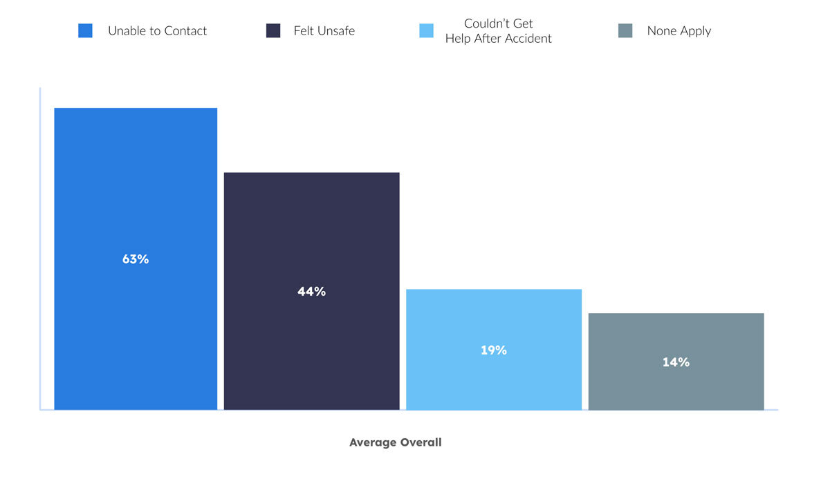
As the graph illustrates, lone workers operating in areas without voice, text or internet services feel – and are – more vulnerable. 15% of the overall workforce are considered lone workers, and NSC data indicates that working alone increases both the likelihood of incidents, and the severity of adverse outcomes.
Although we can’t draw a parallel, it’s striking that industries with a high number of lone workers – Utilities & Renewables, Oil & Gas, Forestry, Emergency Response, Community Healthcare – are also struggling with staff retention.
- 80% of Oil & Gas workers are considering leaving the industry
- The US Forest Service has lost nearly half of its permanent employees in the last three years
- In the UK, 32% of social care workers leave their roles every year – an increase of 9.1% over the last decade.
While it’s not a silver bullet, the benefits of lone worker monitoring technologies are well documented: improved safety outcomes and staff morale, leading to greater staff retention, and saved costs in recruitment and insurance premiums.
An estimated 2.3 million lone workers in Europe, North America, and Australia & New Zealand now have access to a lone worker safety solution, with the market estimated to grow at a rate of 7.1% between 2024 and 2029 – further indication of the value of these platforms.
But if they can’t be accessed because the worker is outside cellular coverage, they fail. D2D with its ability to confer internet access to any compatible cellphone with a relevant commercial agreement, unlocks the ability to access these platforms from very remote locations where cellular coverage is nonexistent.

Overheating and Thermal Shutdowns
Satellite connections require the phone to transmit at higher power levels, which generates more heat than cellular communication. Many phones will automatically shut down when internal temperatures exceed safe limits, leaving users without a means of communication.

Drop and Impact Vulnerability
A cracked screen or internal damage from a fall can render a phone unusable, preventing emergency communication. Even flagship smartphones can shatter from waist-high drops, whereas ruggedized satellite communicators are built to withstand extreme impacts.

Battery Drain and Cold Weather Failure
Phones in satellite mode will often use higher transmission power and spend more time searching for signals, draining the battery faster. Further, cold weather severely affects lithium-ion battery performance.

Lack of Physical Controls for Emergency Use
In emergency situations, speed matters. Unlike dedicated satellite devices, which often feature an SOS button that can be activated instantly, smartphones rely on touchscreen controls that may be difficult to use with wet, cold, or gloved hands.

Weak Antenna and Poor Signal Reception
Smartphones’ internal antennas are optimized for terrestrial networks, meaning signal reception in satellite mode will often be weaker and less reliable. Dedicated satellite communicators feature larger antennas that ensure consistent connectivity even in difficult environments.
The Safer Alternative: Dedicated Satellite Communicators
In life-critical situations, reliable communication is essential. The RockSTAR rugged satellite communicator outperforms standard devices with extended battery life, superior durability, and truly global coverage. Designed for extreme environments, it ensures emergency responders, remote workers, and adventurers stay connected when it matters most. With near-instant messaging and a one-button SOS feature, help is always within reach.
The RockSTAR offers a ≈12-month battery life on a single charge, operates in extreme heat and cold, and withstands rough conditions. With ≈10-second latency, it provides real-time tracking and updates. Its easy-to-reach SOS button ensures immediate distress signals, making it the ultimate safety tool for remote and high-risk environments.
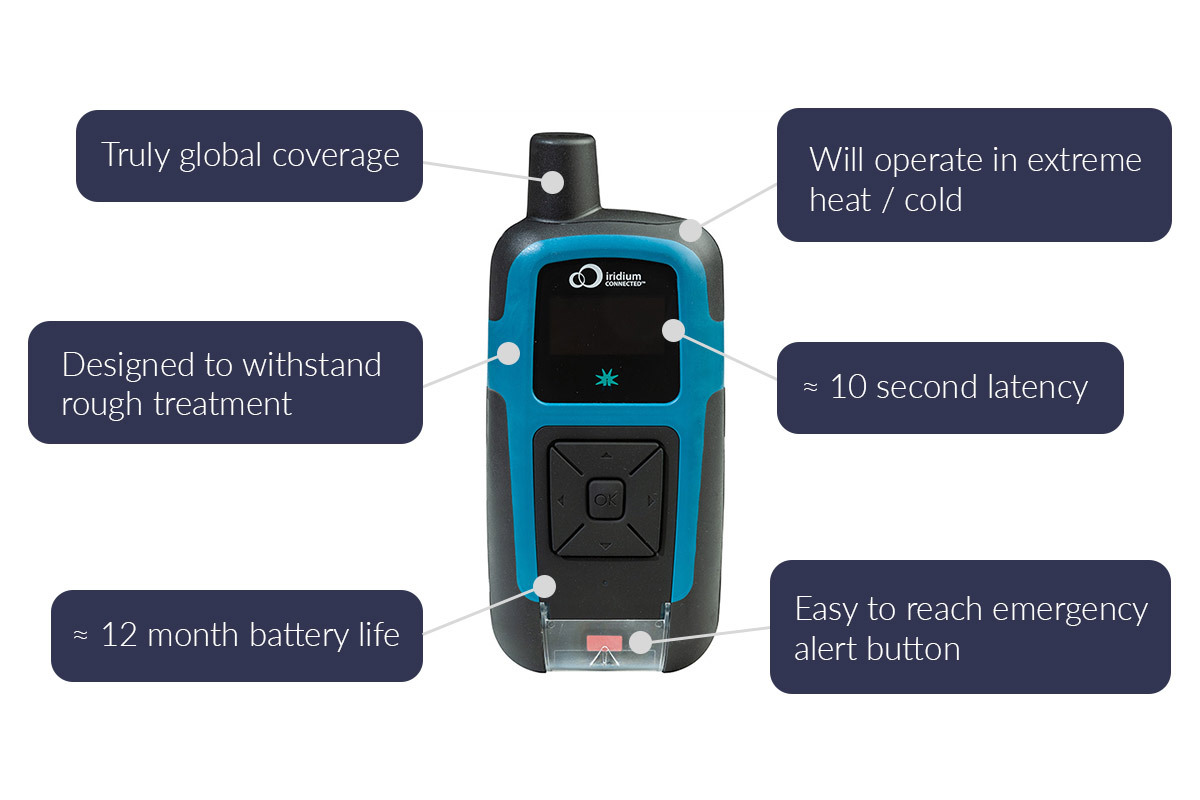
RockSTAR is more than just a rugged satellite tracker; it’s a powerful solution for real-time visibility, safety, and communication in the world’s most remote environments. When paired with Cloudloop Tracking, it offers an intuitive platform for monitoring, messaging, and emergency response, ensuring that lone workers, field teams, and mission-critical personnel remain connected no matter where they operate.
For organizations with specialized requirements, we work with trusted partners like Locate Global and JCSys, who provide advanced functionality for healthcare, emergency response, and military applications.
Additionally, our well-documented API allows operators to seamlessly integrate location, messaging, and event data into their own preferred platforms, giving them complete control over their tracking and communications ecosystem. Whether using Cloudloop Tracking or integrating with an existing system, RockSTAR ensures reliable, global connectivity for those who need it most.
Get In Touch
If we can support your efforts to improve lone worker safety and communication, please get in touch. We have delivered satellite-enabled tracking and messaging services since 2005, and provide support to a diverse set of users – from soldiers to remote site inspectors.
Email hello@groundcontrol.com to tell us about your requirements, or complete the form, and we’ll be in touch within one working day.
How Satellite IoT Makes Predictive Maintenance Possible Anywhere
Manufacturing and Heavy Industry operations around the world rely on their machinery to get the job done, efficiently and effectively. The cost of equipment failure and the resulting unplanned downtime has serious consequences for the bottom line, with medium unplanned downtime costs approximately $125,000 per hour. When inflationary pressures, supply chain demands and raw material costs are factored in, unplanned downtime costs for Heavy Industry were calculated as $59 million per year in 2023.
Faced with the need to minimize the business impact of unplanned downtime for critical equipment, industries with heavy assets and significant downtime costs, such as oil & gas and mining, are leading the way in adopting Predictive Maintenance solutions.
By incorporating satellite connected IoT sensors, Heavy Industries operating in remote locations can reliably monitor machinery in real time and react quickly to avoid equipment failures and keep assets operational. The data from satellite-connected sensors on equipment forms a vital component of deploying Predictive Maintenance programs in industries with high asset costs.
What is Predictive Maintenance?
Predictive Maintenance (PdM) is a proactive, data-driven approach that uses advanced technologies – such as condition monitoring, machine learning (ML) and IoT devices – to anticipate equipment failures and schedule maintenance before disruptions occur. By analyzing real-time data from sensors installed on machinery, PdM identifies early signs of wear, faults, or deterioration, enabling timely intervention to prevent costly downtime.
Unlike time-based or reactive maintenance, PdM optimizes equipment performance by triggering maintenance tasks only when specific conditions indicate a need. This approach improves equipment reliability, reduces maintenance expenses, and extends the lifespan of assets. AI-powered analytics and IoT-enabled sensors track key metrics like temperature, pressure or vibration, providing continuous insights into machine performance. When thresholds are exceeded, PdM systems issue alerts or initiate maintenance work orders.
The goal of PdM is to enhance operational efficiency by minimizing unplanned downtime, lowering maintenance costs, and ensuring asset reliability. Industries such as manufacturing, energy, and transportation rely on PdM to align maintenance activities with actual equipment conditions, maximizing productivity and supporting cost-effective, sustainable operations.

What is the Difference between Predictive and Preventive Maintenance?
Although often used interchangeably, Predictive Maintenance (PdM) and Preventive Maintenance (PM) are distinct approaches to equipment upkeep, each suited to different operational needs.
Preventive Maintenance follows a scheduled approach, performing maintenance at regular intervals based on time or measurable usage units, such as engine hours or production cycles. This method ensures equipment is inspected and maintained before issues arise, but it does not consider the actual condition of the asset.
For instance, a Mining operation may replace drill components every six months, regardless of whether those components show signs of wear. While this minimizes the chance of failure, it may result in premature replacements or unnecessary downtime.
Predictive Maintenance leverages real-time data from IoT sensors and advanced analytics to monitor the actual condition of assets. Maintenance is performed only when necessary, based on insights into potential failures or performance degradation.
For example, IoT sensors on a Combine Harvester may detect rising temperatures or irregular vibrations, indicating wear and tear. Predictive maintenance enables technicians to address the issue before a failure occurs, minimizing downtime and repair costs.
Comparing the Two Approaches
| Preventative Maintenance | Predictive Maintenance | |
|---|---|---|
| Basis for Maintenance | Time or Usage Intervals | Real Time Condition Monitoring and Analysis |
| Frequency | Regular, Fixed Schedule | As Needed, Based on Data Insights |
| Costs | Lower Initial Costs, Higher Cumulative Costs | Higher Initial Investment, Lower Long Term Costs |
| Downtime | May Require Equipment Stoppage | Often Avoids Downtime by Scheduling During Low Impact Periods |
| Efficiency | May Result in Unnecessary Maintenance | Targets Specific Issues, Optimizing Resources |
Types of Predictive Maintenance
There are three distinct types of Predictive Maintenance: Indirect Failure Prediction, Anomaly Detection, and Remaining Useful Life (RUL). Each approach differs in its desired objectives, the analytical methods used, and the type of information output provided.
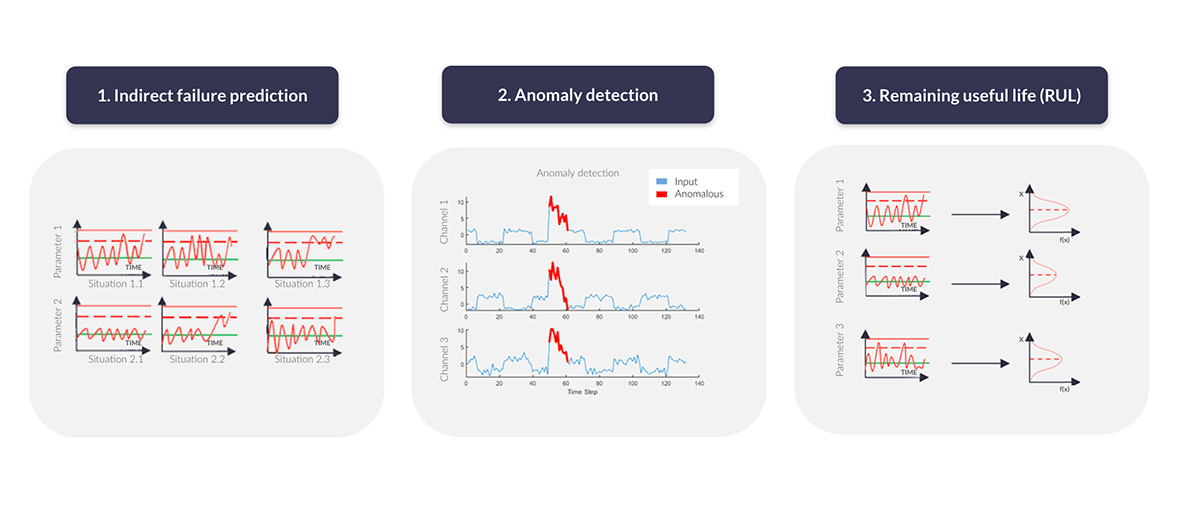
Image adapted from the IoT Analytics Asset Performance & Predictive Maintenance Market Report 2023–2028
Indirect Failure Prediction
Estimates equipment health by calculating a ‘health score’ based on known maintenance requirements, operating conditions and historical performance data. When sufficient data is available, supervised machine learning can be applied to refine the predictions. This approach is scalable since it relies on manufacturer specifications, and it is cost-effective because it uses existing sensors.
Its dependence on large volumes of historical data may render it unsuitable for industries like heavy machinery, where high downtime costs necessitate more immediate and accurate insights.
Anomaly Detection
Identifies potential failures by detecting deviations from normal operating conditions in real time. Unlike methods that require historical data, it relies on current sensor data, making it particularly suited to organizations without extensive machinery usage records. This approach improves predictive accuracy by considering real-time environmental and operational factors rather than predefined maintenance parameters set by the manufacturers.
The risk of false positives can pose challenges, as unnecessary alerts may disrupt operations and complicate machine learning algorithm performance.
Remaining Useful Life (RUL)
Focuses on predicting the time left before equipment failure based on specific machine metrics such as operational hours, distance traveled, or activity cycles. By analyzing sensor data, this method identifies condition indicators that highlight whether the equipment is performing as expected or if faults have accelerated its degradation. RUL models are trained using system data collected under known conditions and applied to predict outcomes under new or variable circumstances.
While this method is highly robust and reliable, it requires detailed, high-quality data for accurate predictions, making it particularly effective for critical equipment in complex environments.
The Benefits of Predictive Maintenance
Predictive Maintenance brings many benefits to organizations through its advanced approach to equipment upkeep, using technology and data analysis to improve asset reliability and efficiency. By identifying potential issues before they lead to failures, PdM helps organizations reduce downtime, optimize resources, and maintain safer working environments.
Research, including findings from the US Department of Energy, highlights the tangible impact of Predictive Maintenance. Compared to preventive maintenance programs, it offers cost savings of 8% to 12%, and when compared to reactive maintenance, cost savings increase to 30% to 40%. These programs also enable a reduction in maintenance costs by 25% to 30% and minimize equipment breakdowns by 70% to 75%.
In addition to cost savings, PdM improves operational efficiency by reducing downtime by 35% to 45% and increasing production capacity by 20% to 25%.
How to Implement Predictive Maintenance
1. Establish Baselines and Data Collection
Baseline performance metrics are identified for the assets by monitoring its condition to set the normal performance benchmarks. Once the baseline is established, sensors are installed to capture real-time data, enabling continuous performance monitoring.
2. Install IoT Sensors on Equipment
IoT sensors are installed on critical equipment to monitor various parameters such as vibration, temperature, pressure, and noise. These sensors continuously collect data on the equipment’s condition and the data gathered is then transmitted to a centralized system for analysis.
3. Data Integration and System Setup
The data collected from the IoT sensors needs to be integrated with the PdM system. This involves connecting the sensors to a computerized maintenance management system (CMMS) or a remote dashboard which allows for real-time monitoring and data analysis.
4. Set Maintenance Thresholds and Automate Alerts
Organizations need to define thresholds for acceptable performance levels. When these thresholds are exceeded, the system automatically triggers maintenance alerts, enabling timely interventions before equipment failure occurs.
5. Select and Implement the Right Analytics Tools
An analytics platform is required to handle the large volumes of data, apply predictive models, and generate actionable insights. Machine learning and AI algorithms are crucial for analyzing sensor data and predicting future equipment failures based on historical data.
6. Develop Predictive Models and Train the System
Predictive models are developed using historical data, maintenance logs and sensor data to forecast future equipment behavior. These models are trained to identify patterns in the data that may signal the onset of failure.
7. Integration with Existing Maintenance Systems
The PdM system is integrated with existing workflows, maintenance management systems, and enterprise resource planning (ERP) systems. This enables seamless communication across platforms and allows for data-driven decision-making.
8. Monitor and Optimize the Program
After implementation, the PdM program should be monitored to evaluate its effectiveness. Continuous data collection and model refinement will help improve prediction accuracy over time.
Industrial Applications of Predictive Maintenance
Predictive Maintenance is becoming increasingly common practice in asset-intensive industries that depend on their large, complex machinery. For industries with assets in remote locations or critical communication requirements, satellite connected IoT devices can transmit real-time sensor data for PdM programs.

Energy and Utilities
The risk of equipment failure in energy production and utilities management can lead to significant financial losses and customer dissatisfaction. Power plants, wind farms, and utility grids employ PdM programs to ensure the continuous operation of critical assets like turbines, generators, and transformers. IoT sensors monitoring parameters such as vibration, temperature, and pressure are used to detect early signs of failure.
By analyzing these data points in real time with advanced predictive models, utility providers can prevent catastrophic failures, optimize energy production, and ensure compliance with regulatory standards. This is particularly important in industries where unexpected downtime can have widespread consequences on both financial performance and customer trust.

Railways and Transportation
PdM is crucial in the transportation industry for ensuring the safety and reliability of infrastructure such as railway tracks, trains, and airport ground equipment. IoT sensors on trains and other critical assets monitor parameters like pressure, temperature, and vibration to detect early signs of wear or failure.
For example, PdM can be used to monitor brake systems or detect track deformations, preventing accidents and service interruptions. By integrating sensors with automated maintenance management systems (CMMS), transportation companies can schedule repairs before a component fails, enhancing passenger safety and reducing operational disruptions.

Oil and Gas
In remote locations such as offshore platforms or desert pipelines, Oil and gas operations face unique challenges in maintaining equipment. PdM is highly beneficial in these situations, as it helps companies remotely monitor the condition of critical machinery like pumps, compressors, and valves.
Satellite-connected IoT sensors track parameters such as pressure, temperature, and vibration to detect signs of imminent failure. Real-time data is sent to cloud-based platforms for analysis, and predictive algorithms generate alerts to maintenance teams, allowing them to address issues before they result in costly downtime or safety hazards.

Mining
With Mining machinery operating in harsh conditions, the risk of unexpected breakdowns can lead to costly delays and safety hazards. Predictive maintenance helps to monitor heavy equipment such as crushers, drills, and loaders, which are critical to mining operations.
Satellite-enabled IoT sensors measure variables like temperature, pressure, and vibration, providing continuous health checks of the machinery. Predictive models analyze these data streams to identify wear patterns and predict when maintenance is required.
Sensor Technologies in Predictive Maintenance
Predictive Maintenance utilizes a range of sensor technologies to monitor the condition of equipment and to detect and address potential failures before they lead to unplanned downtime.
Infrared Thermography
Also known as thermal imaging, infrared cameras identify heat spots which can indicate issues such as friction, electrical resistance, or misalignment in mechanical systems. It is particularly valuable in identifying worn-out components or malfunctioning circuits that tend to overheat.
Infrared thermography allows for real-time monitoring without disrupting machine operation and is frequently used in industries like power generation to track turbine blade conditions and ensure equipment runs efficiently.
Acoustic Monitoring
Using specialized equipment, maintenance personnel can detect ultrasonic or sonic emissions from machinery, which may indicate leaks, electrical discharges, or mechanical wear. Sonic monitoring is typically applied to lower-speed equipment, while ultrasonic analysis is more accurate and applicable to both low- and high-speed machinery.
Ultrasonic analysis is widely used in industries like construction and heavy equipment operations, where hydraulic systems and machinery require constant monitoring to ensure seamless operation and prevent project delays.
Vibration Analysis
Sensors track vibration patterns that help technicians identify potential issues like misalignment, unbalanced components or bearing failures in high-speed rotating equipment, such as motors, drills and fans.
Each machine has a unique vibration signature, and deviations from this pattern can be a strong indicator of mechanical problems. The ability to monitor vibration in real-time allows for early intervention, preventing costly repairs and downtime.
Oil Analysis
By analyzing oil for contaminants, viscosity changes, and particle counts, technicians can pinpoint wear and tear in machine components. Chemical analysis of oil can also reveal overheating or chemical degradation, providing early warnings of issues that could lead to failure.
This technology is often used in heavy industries, such as energy production or oil drilling, where machinery components are subject to extreme operating conditions.
Current and Voltage Sensors
These sensors track electrical characteristics like overloads, short circuits, and failing components. In industries such as mining or energy, where electrical systems are critical, monitoring these parameters ensures safety and minimizes downtime caused by electrical failures.
For example, real time analysis of electrical data in mining operations can help identify potential issues in equipment like excavators or conveyors, allowing operators to address problems before they cause equipment failure and disrupt production.
Predictive Maintenance and Satellite IoT
For remote operations, such as those found in mining or offshore environments, Satellite IoT becomes a crucial part of the Predictive Maintenance Program. When assets are located in areas with unreliable or no cellular connectivity, traditional IoT solutions relying on cellular networks may fail to transmit vital data. Satellite IoT solutions overcome this challenge by enabling real-time data transmission via satellite, ensuring that assets can be monitored regardless of their location or environment.
Beyond just sensor data collection, Satellite IoT can enable remote control of assets. If an asset is detected to be operating in an unsafe condition, it can be remotely shut down to prevent catastrophic damage or safety incidents. This combination of real-time monitoring and remote intervention significantly enhances worker safety and helps avert equipment breakdowns before they escalate into more serious issues.
Get in Touch
At Ground Control, we design and build Satellite IoT devices leveraging the Iridium global network, providing reliable real-time data transfer from anywhere on Earth. Our feature-rich IoT platform, Cloudloop, can monitor and analyse sensor data and offers a simplified and well-documented API to connect to your existing Predictive Maintenance and Asset Performance Management (APM) toolkits.
With over 20 years of experience, we can help you make the best choices based on your requirements.
Monitoring Heavy Equipment Fleets with Satellite IoT Connectivity
Heavy industrial sectors have continued to push the boundaries of what is possible in some of the most remote and challenging locations on the planet. Industry 4.0 has been a transformative technological leap for the traditional industries of mining, agriculture, forestry and construction, bringing new monitoring and automation capabilities to the heavy equipment that these sectors rely on.
In remote mining, farming, forestry or construction sites, an equipment breakdown can cost thousands in downtime. For industries operating far from cellular coverage, ensuring machinery stays operational is a challenge that Satellite IoT is solving with real-time data and monitoring. In this blog, we’ll explore how IoT can enable the transformation of heavy machinery operations, tackling issues like maximizing cost of ownership, preventing downtime, and safety and environmental compliance.
 Heavy Equipment Total Cost of Ownership (TCO)
Purchasing specialized heavy equipment is a significant investment, and in recent years those costs have been steadily climbing as manufacturers pass on their increased raw material and labor costs. The Capital Expenditure (CapEx) involved means that each machine must be operated effectively, efficiently and within agreed tolerance limits to reduce maintenance costs and prevent costly downtime.
The theft of heavy equipment is also commonplace, with over 11,000 incidents of construction theft reported annually in the US and an average average loss of $35,000 to $45,000 per machine. Theft also has a considerable impact on operational timescales, as well as increased costs to replace or lease equipment.

Hazardous Work Environments
With heavy industry recognised as one of the most hazardous places to work (accounting for 63 per cent of all fatal occupational injuries) worksite safety requirements have, quite rightly, been improving on a global scale as Governments enforce a duty of care on industry operators.
However, it remains that despite these improvements, a diminishing workforce is entering these physically challenging industries based in remote locations. This has led to increased Operational Expenditure (OpEx) to attract high quality skilled candidates.

Environmental and Sustainability Targets
Heavy industry accounts for around a third of global energy consumption and emits a quarter of global Greenhouse Gas emissions. Pressures from Governments to hold businesses to account for their carbon emissions and environmental impacts particularly affect these industries.
To meet agreed environmental commitments, operations may need to invest in technology to analyse the worksite’s impact on the surrounding area and consider upgrading heavy machinery to meet emissions targets.

Operational Complexity
Keeping to contractual timescales on any large project involving heavy machinery is ultimately reliant on the equipment being reliable. Delays in specialist heavy equipment arriving on-site and unexpected breakdowns can lead to extensive project delays and wasted resources, all of which lead to an increased OpEx.
Without clearly-defined logistical operation data to coordinate fuel deliveries and material transport, an entire site could come to a standstill.
Connectivity Limitations
Mining, forestry, farming and construction operations often take place in remote locations with limited or no mobile or cable internet coverage. The cost of connecting fixed or cellular telco equipment or laying cables for site connectivity is often very expensive, especially when real-time communication is required for equipment operations or emergency protocols.
The return on investment for installing a dedicated network on a site which may only be operational for 10-15 years is often poor and can become a negative cost.
Six Innovations in Heavy Machinery Operations
Many of the issues facing industries using heavy machinery can be mitigated against by using technology, data and connectivity.
With satellite connectivity more reliable than cellular in remote locations and increasingly more competitively priced, the cost-effectiveness and profitability of mining, forestry, construction and agriculture operations can be significantly improved and many of the key issues facing the industry can be resolved.
1. Predictive Maintenance
Predictive maintenance is a data-driven approach to keeping heavy machinery operating at peak performance and efficiency. By continuously monitoring on-board sensors for feedback on tire wear, oil and fuel consumption, engine temperatures, hydraulic pressures, vibrations, stability and acceleration, machinery can be proactively inspected and maintained according to usage, rather than reactively when a breakdown occurs.
Satellite IoT devices can transmit real time data on machine usage and even enable a shutdown of equipment if thresholds are exceeded. By planning machine maintenance downtime, preventing failures that could lead to accidents, and monitoring machinery operatives driving behaviour, the operation expenditure of the site can be effectively managed and optimized.
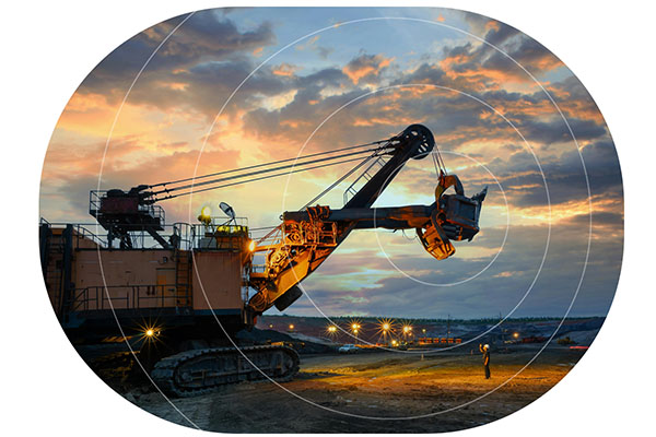
The 2021 McKinsey & Company ‘The Internet of Things’ Report highlighted that in the construction sector, employing IoT applications can improve uptime by 30 to 50 percent and increase throughput by 1 to 5 percent.
An additional benefit of monitoring machinery usage is to provide a better return on the CapEx of the machinery when the equipment is sold at the end of the project.
2. Remote Monitoring
Remote monitoring of site personnel and equipment can enable the operational efficiency of worksites, as well as ensure the safety of all workers on-site. With satellite-connected asset trackers on equipment and team members, remote operations centres can use geo-fencing capabilities to keep personnel and heavy machinery apart using safety zone alerts. Should a team member stray into the path of an oncoming vehicle, both the individual and the driver can be alerted to the potential risk.
Satellite IoT enabled sensors can detect worksite ambient conditions to ensure staff and machinery are not exposed to extreme working temperatures, strong winds, excessive rainfall or poor air quality. By encouraging and demonstrating a commitment to site safety, labor recruitment can be improved.
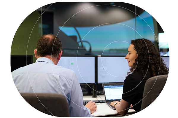
Site operations can be further optimized through monitoring of raw material tanks and silos (e.g. concrete and chemical reagents), machinery fuel consumption, generator fuel levels and final product storage and collection (e.g. metal ores, timber, grain). By integrating satellite IoT sensors across the work site, logistics managers can ensure fuel and raw material deliveries and product collections are planned according to site requirements, reducing bottlenecks and improving operational efficiency.
According to McKinsey and Company, operators which have more than 50% of their vehicle fleet connected to the internet have 23% better financial performance than peers with less than 50% connected. Companies with more than 75% of their fleet connected have 51% better financial performance.
3. Telematics
Monitoring heavy equipment on-site is integral to operational performance, and can also ensure the worksite is remaining committed to its safety, sustainability and environmental goals.
Aside from monitoring onboard sensors for predictive and reactive maintenance, telematics can also improve driver behavior, which in turn can reduce fuel consumption and carbon emissions. Heavy industry equipment by its nature burns fossil fuels and emits greenhouse gases during operation, but there are opportunities to limit these effects.
In the construction industry alone, machinery idle time averages 36% which increases fuel consumption by up to 5%. The biggest operational opportunity for reducing the potential for idling is ensuring vehicles are dispatched to their collection or drop-off locations according to requirements rather than on a continuous cycle, thereby preventing fleet waiting times.
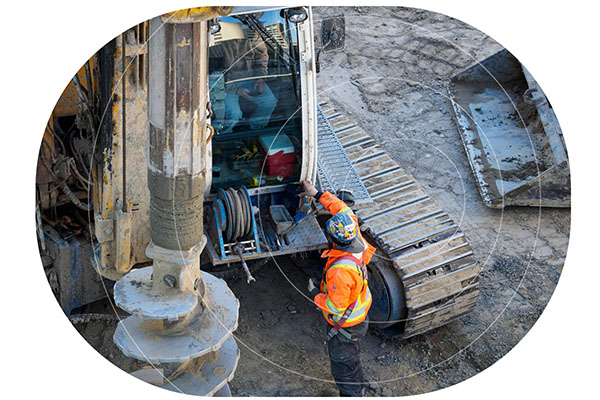
There is also driver behavior to consider, with some operators leaving machinery idling during their break periods. Using real-time telematics, Site Managers can address the machinery operator actions immediately and encourage them to turn the machine off when not in use.
Through these two simple actions it is possible to reduce fuel costs, decrease carbon emissions, limit noise pollution and improve worksite air quality. When industry profit margins are challenging, evidence has shown that operators who lag behind their peers in reducing downtime are losing future business, wasting time and money, and increasing their ecological impact on the environment.
4. Theft Prevention
Heavy equipment theft costs the USA construction and agricultural industry an estimated $300 million to $1 billion annually, and is especially prevalent during the National Holidays of Labor Day, Memorial Day, Independence Day and Thanksgiving when worksites are closed and machinery is left unattended.
Satellite-connected video surveillance can enable real-time monitoring and recording of remote worksites and storage areas to protect both staff and equipment from unauthorized access.
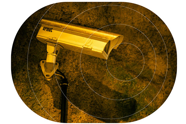
Heavy equipment can be fitted with discreet satellite asset trackers which can alert the operations team when equipment has moved out of a geofenced area or the machinery is being operated outside of normal worksite hours. Satellite assets trackers are especially effective at tracking stolen heavy machinery as they can keep connected across borders, and in the case of the Iridium network anywhere on Earth. Improvement in asset tracking capabilities has led to an increase in machinery recovery rates from 5% to 20% in the last 15 years.
5. Machine Learning and AI
Incorporating AI and machine learning capabilities into the mining, forestry, agriculture and construction industry has the potential to transform how these sectors address the challenges of CapEx and OpEx, as well as their environmental impacts. By leveraging data-driven analysis, businesses can optimize workforce and heavy machinery productivity, identify opportunities for fuel savings and emission reduction, limit raw material wastage and improve final product quality and volumes. Insights from these analyses can be replicated across multiple work site locations and integrated into cost projections for future projects, driving efficiency and sustainability.

Heavy equipment can be fitted with discreet satellite asset trackers which can alert the operations team when equipment has moved out of a geofenced area or the machinery is being operated outside of normal worksite hours. Satellite assets trackers are especially effective at tracking stolen heavy machinery as they can keep connected across borders, and in the case of the Iridium network anywhere on Earth. Improvement in asset tracking capabilities has led to an increase in machinery recovery rates from 5% to 20% in the last 15 years.
6. Autonomous and Remote Control Heavy Machinery
One of the most significant challenges facing the mining, agriculture, construction, and forestry industries is an aging workforce, with many skilled workers nearing retirement and fewer new recruits stepping into these roles. Technological advancements in developing and implementing autonomous and remote operation of heavy equipment are helping to manage labor shortages while enhancing productivity and safety.
Autonomous Haulage Systems (AHS) are already in use across large-scale mining operations, enabling unmanned dump trucks to optimize hauling cycles, improve payload accuracy, and increase operational efficiency. However, not all scenarios are suitable for full automation, which is where remote control solutions come into play.
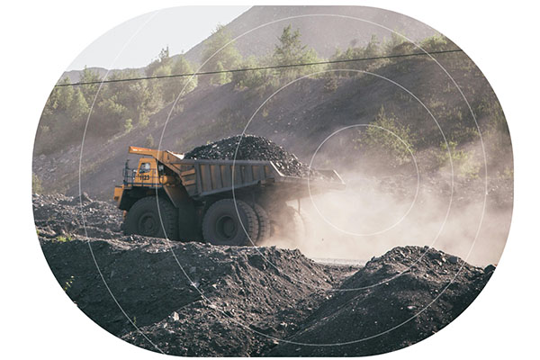
In hazardous environmental conditions or working on difficult or sloping terrain, controlling heavy machinery via remote control allows operators to manage equipment from a safe distance nearby or within a central operations hub. This minimizes risks to personnel while maintaining operational efficiency.
Both autonomous and remote-controlled systems rely on a continuous flow of real-time data, including video feeds and telemetry data, to ensure precise operation and avoid collisions. Satellite connectivity provides reliable and seamless data exchanges in remote locations, enabling the integration of automation and remote operation of heavy machinery in complex environments.
Satellite IoT Solutions for Heavy Machinery Monitoring
Satellite IoT is supporting innovation within the heavy machinery industry, addressing critical challenges such as remote connectivity, safety, and operational efficiency. By leveraging real-time data through predictive maintenance, telematics and remote monitoring, businesses can reduce costs, improve productivity, and meet stringent environmental goals. As automation and AI continue to transform the sector, embracing satellite-enabled solutions is essential for staying competitive in an increasingly connected world.
Get in Touch
Contact us to discover how our satellite IoT solutions can drive efficiency and profitability for your heavy machinery fleet.
With 20 years of experience, we can help you make the best choices based on your requirements.
Please call us on us on +44 (0) 1452 751940 (Europe, Asia, Africa, Oceania) or +1.805.783.4600 (North and South America); email hello@groundcontrol.com, or complete the form.
The Lifesaving Value of Satellite Tracking in Small Aviation
Small aviation operations – flight schools, tourist flights, and private fleets – often venture into areas where communication can be a challenge. Pilots need reliable tools to ensure safety, track their progress, and communicate effectively, even in remote regions. Yet, many still rely on cell phones or satellite phones for these critical tasks, despite their limitations.
Here’s why a dedicated satellite tracking device isn’t just a convenience; it’s a necessity that can save lives.
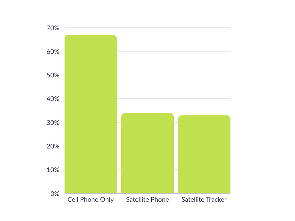
We asked 138 aviators who variously pilot helicopters (30%), gliders (18%), light aircraft (43%), cargo aircraft (25%) or military aircraft (15%) what, if anything, they were using to track their flights.
67% of respondents said they utilized the GPS on their cell phone; 34% had a satellite phone, and 33% had a dedicated satellite tracking device for this purpose (respondents were allowed to pick more than one answer).
While this didn’t come as a huge surprise, there are drawbacks of relying on cell phones. Coverage can be spotty, due to both the altitude and the remote locations visited, and also due to weather conditions. Cell phone service can be negatively affected by storms, wind, rain and even simply cloud cover (source).
Satellite phones are generally less affected by weather, and don’t suffer from coverage issues; they are, however, designed primarily for voice communication, and have none of the specialized features that pilots can benefit from with a dedicated aviation tracking solution.
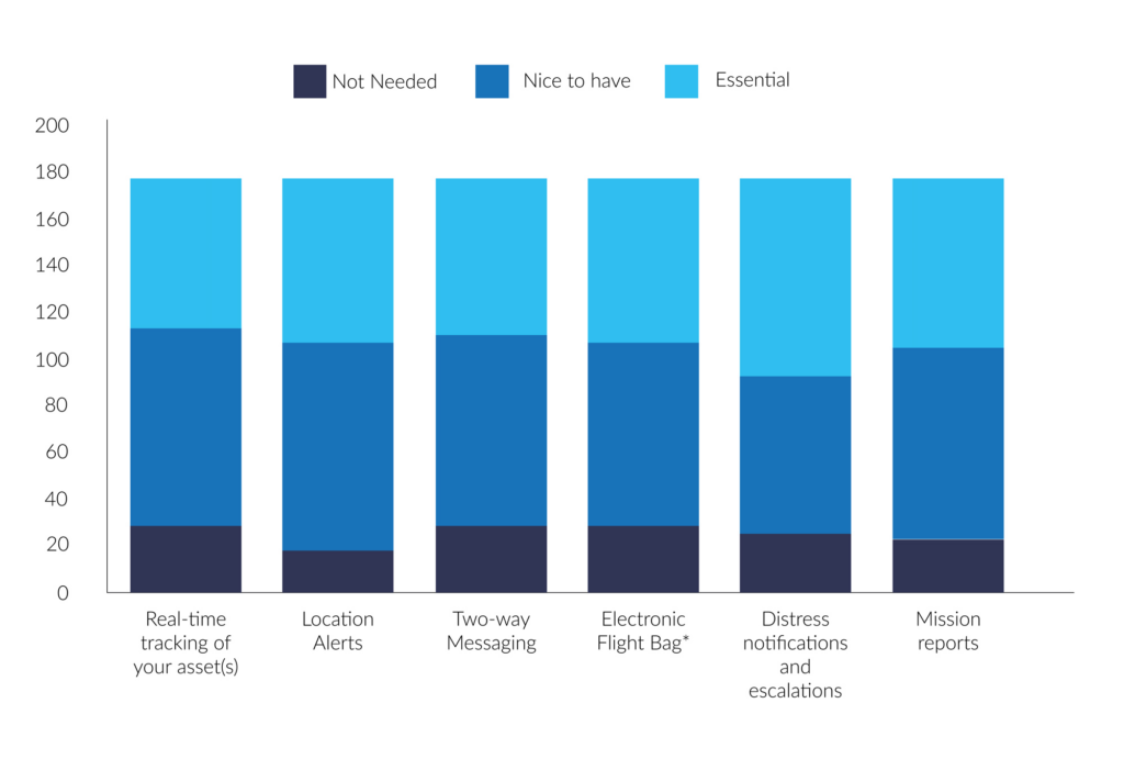
We asked the same group what they valued most in a tracking solution, and, aggregating ‘essential’ and ‘nice to have’, the results were:
- 91% – Location alerts (moving in and out of geofences, stop/start etc.)
- 88% – Mission reports (e.g. mission ID, asset details, route, crew, cargo etc.)
- 87% – Real-time tracking
- 86% – Distress notifications and escalations
- 85% – Two-way messaging
- 83% – Electronic flight bag*
So there is widespread consensus of the value of aviation tracking, but as seen above, only a third of respondents had a dedicated solution for this.
*Advanced messaging including transmission of flight manifest, weight, balance etc.
Why Dedicated Satellite Tracking Devices Excel
Dedicated satellite tracking devices, like the RockAIR, are purpose-built for aviation. Here’s what sets them apart:

Aviation-Specific Features
Altitude Recording: Provides critical data unique to aviation, unlike general-purpose devices
Emergency Response: Distress notifications and escalation processes to ensure swift action when every second counts
Location Alerts: Track movement in and out of geofenced areas or detect when a plane has stopped unexpectedly.

Reliability in Critical Moments
Real Time Tracking: Enables precise monitoring of flight paths, crucial for safety and coordination
Mission Reports: Record mission details such as route, crew, and cargo – helpful for operational efficiency
Two Way Messaging: Communicate instantly, even in areas with no cell coverage.
Designed to Last
Long Battery Life: Far exceeds that of cell phones or satellite phones, ensuring uninterrupted service
Durability: Built to withstand extreme conditions, including potential crashes, ensuring operability when it’s needed most.
A Real Life Lifesaving Story
The value of dedicated tracking devices isn’t theoretical; it’s proven. British pilot Sam Rutherford was flying in the Canadian wilderness when a crash left him stranded in freezing temperatures. Despite the dire situation, he managed to send a location-based message using his RockSTAR device. This timely communication enabled rescuers to locate and save him.
Without a dedicated satellite tracking device, Sam’s story might have ended very differently.
Key Use Cases in Small Aviation
- Flight schools: For flight schools, safety is paramount. Dedicated tracking devices allow instructors to monitor student pilots in real time, providing peace of mind and a critical safety net during training flights.
- Tourist flights: Scenic flights often traverse remote or rugged terrain. Real-time tracking and emergency features not only protect pilots but also reassure passengers of their safety.
- Small private fleets: Fleet operators benefit from improved efficiency and safety with mission reports, real-time tracking, and emergency response capabilities, ensuring that every flight runs smoothly.
Why Not Cell Phones or Satellite Phones?
While cell phones and satellite phones play a role in communication, they fall short in critical ways:
| Cell Phones | Satellite Phones | Satellite Tracking Devices | |
|---|---|---|---|
| Altitude Recording | |||
| Real Time Tracking | |||
| Distress Notifications | |||
| Battery Life | Low | Medium | High |
| Durability | Low | Medium | High |
Dedicated satellite tracking devices stand out as the only option that checks every box for aviation safety and reliability.
Flying with a dedicated satellite tracking device is more than a practical choice; it’s a lifesaving decision. From real time tracking to emergency response, these devices are purpose-built to meet the demands of small aviation.
Can we help?
Don’t leave safety up in the air. Discover the RockSTAR, RockAIR, and other Ground Control solutions to ensure your operations are as safe and efficient as possible.
Contact us by completing the form, or emailing hello@groundcontrol.com; we’ll respond to your inquiry within one working day.
Ground Control Partners with Locate Global to Boost Workforce Safety and Incident Management
We’re excited to announce our strategic partnership with Locate Global, a prominent provider of incident management and workforce safety technology. This collaboration enhances workforce safety and incident response capabilities by integrating Ground Control’s high-speed satellite communication into Locate Global’s platform.
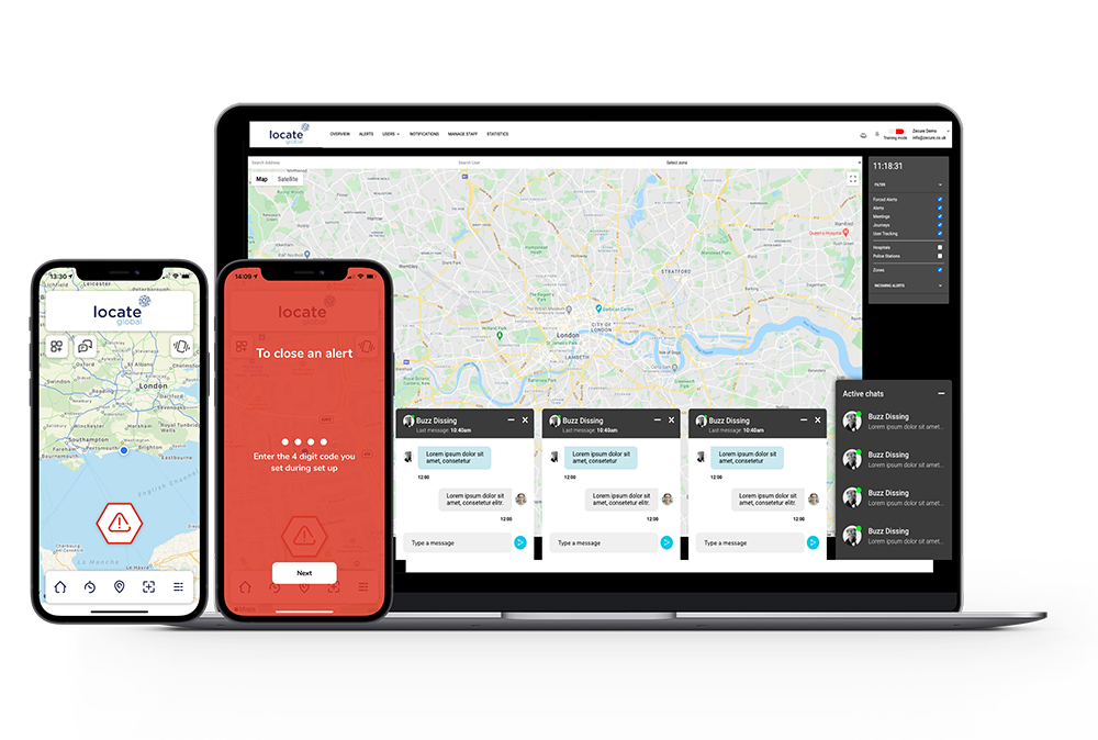
Locate Global’s platform enhances workforce safety and incident management through real-time location tracking, geofencing, and multi-channel communication tools.
It offers shake-triggered alerts, peer reporting, and immediate location data with video and audio to streamline emergency responses.
The system’s centralized dashboard also provides insights via heat maps and supports audit analysis, promoting a proactive safety culture.
The platform is designed for diverse applications, from protecting lone and remote workers to supporting global teams, with flexible integrations for any industry.
By incorporating Ground Control’s reliable satellite connectivity, Locate Global can provide consistent, secure communication even in remote or challenging environments where standard networks fall short.
“We are excited to partner with Ground Control, whose expertise in satellite communications complements our mission of ensuring safety and efficiency in the workplace. This partnership will allow us to provide our users with unparalleled connectivity, enabling them to communicate seamlessly and respond swiftly during emergencies.”
Raphael Polt, Head of Global Partnerships
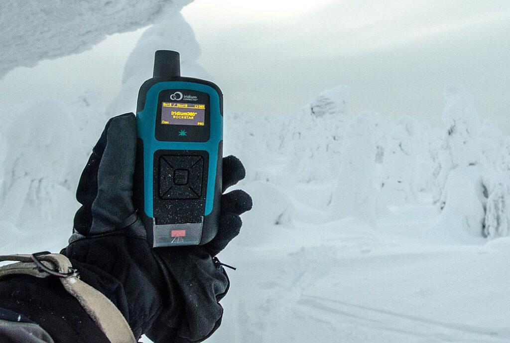
RockSTAR is a handheld satellite device that provides global messaging and tracking in real time, designed for professionals working in remote or extreme locations.
It utilizes the Iridium satellite network, which is global and extremely reliable; as long as your team members have a view of the sky, they will be able to communicate with your base of operations.
RockSTAR features two-way messaging, an emergency alert button, hyper-accurate GPS tracking, and geofencing capabilities. It can be used instead of a cell phone, or linked via Bluetooth to allow usage of the Locate Global app.
The device is ruggedized for durability, waterproof, and has an extremely long battery life, making it viable for extended outdoor use.
Partnering with Locate Global aligns with our commitment to delivering robust communication solutions for industries where connectivity is paramount. Together, we are enhancing the ability for organizations to manage incidents effectively, ensuring that teams can maintain communication and safety in any environment.
Can we help you?
Our partnership with Locate Global empowers teams to communicate and respond effectively, even in the most remote environments.
If you’d like to know more, please complete the form, or email hello@groundcontrol.com.
The Role of 3GPP Standards in Advancing Cross-Border Asset Tracking
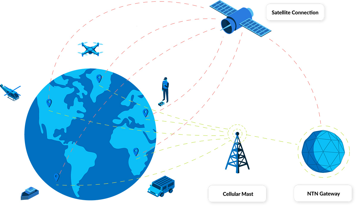
Even in the age of eSIM technology, there remain challenges in tracking road, rail and ocean freight across borders. This post focuses on a key challenge: connectivity. Less than 40 percent of the Earth’s land surface is covered by mobile networks. This figure drops to just 12 percent when oceans are taken into account. So, assets moving out of cellular coverage have had two options: accept gaps in tracking, or utilize satellite connectivity.
The former isn’t an appealing option; freight is vulnerable to theft, adverse weather conditions, damaged infrastructure (roads, bridges etc.), breakdowns etc., all of which can be mitigated, or at least dealt with rapidly, if real-time, global monitoring is available.
The latter – satellite connectivity – has been a mainstay of high value freight for many years, but the relatively high cost of satellite tracking devices, plus airtime, has meant that some organizations with extensive asset inventories or limited budgets haven’t been able to take advantage of the technology.
3GPP standards are poised to lower the cost barrier to satellite connectivity, both directly and indirectly, unlocking truly global asset tracking capabilities to the benefit of logistics, agriculture, manufacturing, healthcare, and many other industries.
3GPP’s Impact on Connectivity
3GPP is an initiative to create global standards for telecommunications, ensuring that a device developed and operated in North America would be able to connect to networks in Asia, Europe, Africa etc. As the name suggests, its original mission was to develop specifications for 3G mobile phones, but it has since created the specifications for 4G and 5G, with 6G in development.
Each revised version of the standards has a release number, and Release 17 was the first to accommodate non-terrestrial networks, or NTN. It was completed quite recently – Q3 2022 – and it will take time before devices utilizing this standard start hitting the market in volume.
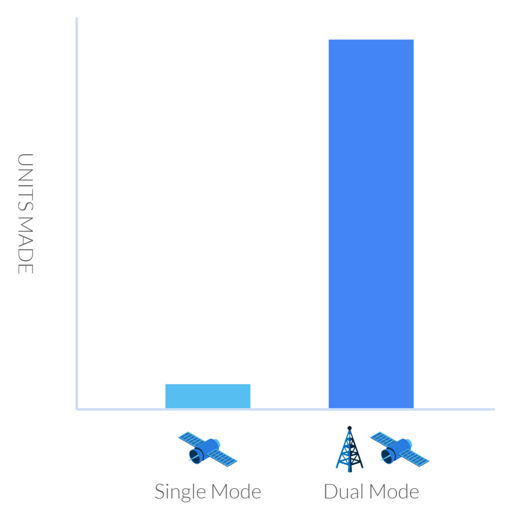
What this means in this context is that a tracking device could use a single SIM to talk to both terrestrial and satellite constellations. There are several benefits from this:
- There are millions more ‘terrestrial’ tracking devices than there are satellite-enabled ones, and because of these economies of scale, they’re generally much lower cost. If these devices are made with the ability to connect to both terrestrial and non-terrestrial networks, these same economies of scale will persist, and the cost of a satellite-enabled tracker will be lower.
- Satellite networks haven’t really, until the advent of 3GPP, had to compete with one another, in the respect that if you want to use satellite connectivity, you need to buy a proprietary modem that communicates with a single satellite network only. Once it’s in place, if you want to change the network, you would physically need to change the modem. But if you have a standards-based SIM, in theory, you can switch your airtime to a different satellite constellation remotely, with the likely impact being that airtime costs will be more competitively priced.
- Data analysis should be simpler; if your tracker is using the same networking language across multiple networks, for example, NB-IoT or LTE Cat-1, the ease with which you can integrate that data with your existing ERP, CRM or inventory management system is greatly enhanced.
Challenges With Implementing 3GPP
There are two ways to enable satellites to ‘speak’ the same language as terrestrial networks. The first is to modify the satellite, and the second is to modify the terrestrial device.
There is a limit to how much modification can be done to satellites that are already in orbit – some as far away as 35,786 kilometers from Earth. So the first option is currently the preserve of companies launching new satellite constellations. The key players here are Starlink, AST SpaceMobile, and Lynk. They are all in the process of launching satellites that are compatible with unmodified LTE-compatible devices. Their largest market is going to be cellphone users, but they’re all anticipating offering an IoT variation; Starlink is likely to be the first to market with this, some time in 2025.
However, they have a key challenge which restricts the global accessibility of these services; they don’t have access to the radio frequencies best suited to IoT and tracking applications. Licensed radio spectrum has been allocated for many years; for satellite network operators it’s called MSS (Mobile Satellite Service) spectrum, and for terrestrial network operators, it’s called MNO spectrum.
In the absence of licensed spectrum, the new satellite network operators have to collaborate with terrestrial network operators to use their spare spectrum. Starlink has agreements with T-Mobile to provide service to the USA, for example, whereas AST SpaceMobile has agreements with AT&T and Verizon. But if your truck or train traveled into Mexico, where Starlink does not, at the time of writing, have an MNO partner, the service would no longer be available.
Given that not all MNOs have spare spectrum – consider Europe and parts of Asia, where networks are already congested – it is unlikely that global service will be available in the next few years.
The second way to implement 3GPP is to update the terrestrial devices that talk to the satellites, and this is the preferred option of the legacy satellite network operators (SNOs). Viasat (previously Inmarsat) and Iridium are the leading SNOs exploring this; they have the advantage of having licensed spectrum, so their services will be globally available from launch.
But, and there’s a big ‘but’ here, they are looking at NB-IoT as their networking language rather than LTE, most probably because it is better suited to existing satellites which weren’t designed for high volumes of high bandwidth traffic. There are far fewer IoT and tracking devices that utilize NB-IoT than there are LTE-enabled devices, so it will take time for the device manufacturers to catch up.
Further, because not all of the satellite network operators have adopted the same networking language, a future in which you can negotiate on price with your SNO because there are several competitors vying for your business is further away.
However, having options to patch the gaps in cellular coverage, particularly as operators are turning off 2G, is a clear positive. If your device has a limited power source – solar or battery – LTE Cat-1 may well not be suitable. So a global in-fill of NTN NB-IoT – which is ideal for low power devices – overcomes the challenge of restricted roaming, and patchy terrestrial LTE-M and NB-IoT.
Where Does Direct-to-Device Come Into Play?
This is sometimes confused / used interchangeably with 3GPP standards-based communication, but it’s not the same thing. D2D refers to the ability for an unmodified terrestrial device to speak to a satellite, but it doesn’t have to be communicating using a standards-based language like LTE or NB-IoT.
The most well-known example of a non-standards-based D2D solution is Globalstar’s collaboration with Apple; Apple updated its handsets to speak to the Globalstar constellation, but they can’t ‘roam’ on to other satellite networks; it’s a proprietary, rather than a standards-based, solution.
Speaking of Proprietary Solutions…
It’s important to stress that proprietary-enabled tracking devices – such as those that use Iridium, Viasat or Globalstar for connectivity – are far from ‘over’. For a start, they already use the most efficient means of communication with satellites, because the devices were designed in conjunction with the satellites. They can send more data, and offer greater flexibility in terms of how that data is transmitted (i.e. IP-based, messages etc.), than standards-based propositions.
Because the narrative around 3GPP standards is chiefly around lower costs, this has already had an impact on satellite connectivity. For the first time, SNOs are enabling their proprietary modems to be incorporated into mass-produced chipsets. This will, through simple economies of scale, lead to a lower price for proprietary modems, making this an increasingly viable option for tracking trucks, trains, ships etc.
As an example, the incredibly small and light, solar-powered and satellite-enabled GSatSolar asset tracking device retails at just $199, with airtime costing <$5 per month (depending on the number of locations you want transmitting).
What Should You Consider for Your Asset Tracking Application?
Firstly, while standards-based devices promise much in the way of cost-savings and ease of implementation, it will be several years before this promise is realized. Mass deployment of devices and adequate supplier competition to influence airtime pricing is unlikely to happen before 2026-27. Further, it’s not clear how the new satellite constellations will overcome their spectrum challenges; although, where there’s a will, there’s usually a way!
In the short to medium-term, the good news is that existing proprietary satellite tracking solutions have, and continue to, come down in price. Our recommendation is to place inquiries and find out what the art of the possible is for your application.
Can we help you with your asset tracking project?
As a company that’s designed and built asset tracking solutions for over 20 years, Ground Control is well placed to help you navigate the dizzying array of options; get in touch – we’re here to help.
Complete the form, or email hello@groundcontrol.com, and we’ll come back to you within one working day.
How Direct-to-Device (D2D) is Shaping the Future of Satellite IoT Connectivity
The Internet of Things (IoT) market is set to grow globally by 18.8% over the next five years, fueled by advancements in 5G and AI technologies, rising demand for automation, and the expanding application of IoT across various industries.
For IoT applications in remote areas beyond the reach of 5G cellular towers, such as environmental monitoring and asset tracking in isolated regions, mountainous terrains, open oceans, and across multiple borders, continuous connectivity remains a challenge. In these scenarios, businesses often turn to satellite IoT, but the perceived high cost and apparent lack of interoperability with terrestrial networking technology may present barriers.
Direct-to-Device (D2D) technology is emerging as a transformative solution to these challenges, poised to revolutionize the IoT marketplace. But before we get to that, let’s clarify what’s meant by the various “direct-to-cell, direct-to-device, direct-to-mobile” terms being bandied about.
What is Direct-to-Cell?
Direct-to-Cell (D2C) is a form of satellite connectivity that enables smartphone users to perform basic functions like texting, calling and basic internet browsing when outside of cellular coverage, with no modifications needed to their cell phone.
This service can be provided in one of two ways: firstly, the satellite network operator (SNO) may partner with a mobile network operator (MNO), and provide the service using the MNO’s licensed terrestrial radio frequencies. In order to do this, both the SNO and the MNO need to use the same waveform technology, e.g. 4G/LTE. This requires the satellites to be designed and deployed with this capability; effectively, it is the satellite that is modified to work with the device, rather than the device being modified to work with the satellite. An example of this is Starlink’s partnership with T-Mobile in the USA.
Secondly, cell phone manufacturers can update their devices to allow them to talk to satellite constellations. This can either be delivered through proprietary solutions – i.e. the handset is updated to allow it to ‘talk’ to a single satellite constellation only (for example, Globalstar’s partnership with Apple) – or via a standards-based solution which can talk to multiple compatible networks, i.e. 5G NTN (NR, NB-IoT, eMTC).
In the case of the latter – where the necessary adjustments are made on the cell phone rather than the satellite – there are a limited number of smartphones that have been made compatible with 5G NTN, including the Google Pixel 9; we’d expect to see this increase in the future.
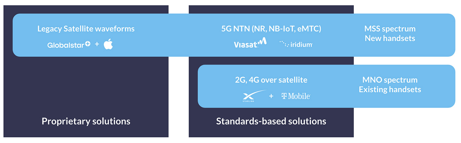
Image credit: Peter Kibutu, Advanced 5G NTN Technology Lead, TTP
What is Direct-to-Device?
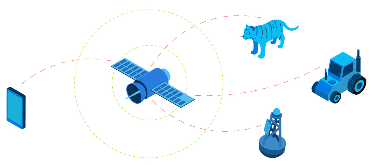
Direct-to-Device (D2D) enables unmodified IoT devices, such as asset tracking beacons and temperature sensors, to transmit data over satellite when cellular is not available. This means that no extra hardware or software is needed to deploy a sensor outside of cellular coverage, or to monitor an asset moving in and out of cellular connectivity.
The difference between Direct-to-Cell and Direct-to-Device is simply the device being connected; in the case of the former it refers to cell phones; in the case of the latter, to IoT devices. They are often used interchangeably – Starlink, for example, refers to both phone and IoT device connectivity as Direct to Cell, whereas analysts Deloitte refer to both as Direct to Device.
For the purposes of this post, we’ll be focusing on IoT applications, and will stick to ‘Direct to Device’.
How Does D2D Work?
Similarly to D2C, there are two ways to deliver D2D. The first is to launch new satellites specifically designed to talk to existing IoT devices, and the second is to add an inexpensive chip to IoT devices so that they can talk to existing satellite networks. This could either be a proprietary chip, which allows the device to speak to a single satellite network, or a standards-based chip, which, in theory, would allow the device to roam on to any network built to the same standards.
There are pros and cons to each approach; in the case of purpose-built satellites, the main plus is that there is a large market of existing devices. However, as we will see, there are performance, spectrum, funding and regulatory challenges to overcome. In the case of new chipsets, whether standards-based or proprietary, it will take time for these to be developed and deployed at scale.
“What technical approach will predominate—one where chipsets in smartphones power satellite communication or where satellites act more as space-based cell towers enabled by network-on-the-edge architecture? In either case, advancement in both satellite and smartphone technology will likely be necessary to enable the full potential of D2D.” – Deloitte Center for Technology, Media & Telecommunications
What Role do Standards-Based Technologies Have to Play in D2D?
There are three cellular-based technologies designed for widespread IoT devices: NB-IoT, LTE-M, and LTE Cat 1. There are lots of blog posts dedicated to the pros and cons of each technology; as a very quick summary, NB-IoT and LTE-M use less power than LTE Cat 1, but LTE Cat 1 has higher data rates and lower latency.
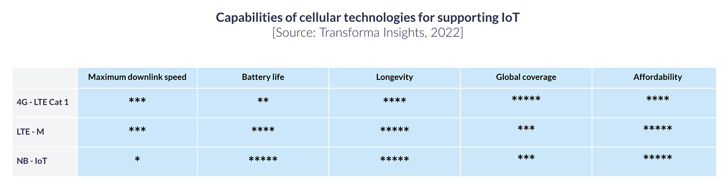
LTE Cat 1 is available wherever there is a 4G LTE network; which covers most of the Earth’s population centers. LTE-M and NB-IoT network technologies are less widely available; 253 mobile network operators have launched NB-IoT or LTE-M networks in 81 countries, of which 173 operators have focused on NB-IoT, and 80 have focused on LTE-M (source).
The satellite network operators working on the delivery of D2D have not all chosen the same cellular technology. Starlink, AST Space Mobile and Lynk have all selected LTE Cat 1, whereas Iridium and Viasat have chosen NB-IoT.
This is probably because the more power-hungry LTE Cat 1 technology would create too great a resource drain on legacy satellite constellations which were not built for high volumes of high speed internet traffic. Equally, where there is no cellular infrastructure, there is often no power source, so an NB-IoT device that can last for years on a single battery is an appealing proposition.
Ultimately, systems integrators will need to make an informed decision about the most suitable technology for their requirements, based on service availability, data volume, latency, and power supply; this will then determine on to which networks their devices can roam.
Who are the Satellite Operators in the Direct-to-Device Market?
LTE Services:
- Starlink: As a major disruptor, Starlink is poised to play a significant role in the D2D market. With the capability to build and launch its own satellites via SpaceX, Starlink has already deployed over 100 D2D satellites and plans to launch over 7,500 more. This will support their goal of providing high-speed, low-latency global connectivity for both mobile and IoT technologies.
- AST SpaceMobile: AST SpaceMobile is making strides with plans to launch its first five commercial satellites in Autumn 2024. AST SpaceMobile has established agreements with over 40 mobile network operators. Backed by strategic investments from giants like Google, AT&T, Vodafone, and Verizon, AST has the potential to be a significant player in the D2D market.
- Lynk: Lynk has already launched satellites and secured relationships with mobile network operators in over 50 countries. Like Starlink and AST SpaceMobile, Lynk uses LTE standards to deliver 5G space-based connectivity directly to existing smartphones.
NTN NB-IoT Services:
- Viasat: Viasat, which now combines Viasat and Inmarsat satellites under the same brand, has satellites in geostationary orbit; 37,785 Km above the Earth. This means that the latency – the time taken for a data packet to be sent, received, and sent back to the ground station – is longer than satellites in Low Earth Orbit.
On the other hand, NTN NB-IoT is well suited to devices that are stationary, and send data several times a day, rather than needing a real-time connection. Viasat’s satellites have good capacity and fewer power limitations than satellites in LEO, so this is a company well placed to deliver on NTN NB-IoT in the near future.
- Iridium: Iridium’s Project Stardust signals their intention to move away from solely proprietary satellite IoT solutions towards standards-based solutions. Iridium aims to enhance its D2D strategy by leveraging its established low Earth orbit (LEO) satellite network for 5G standards-based IoT and NTN services. Iridium aims to collaborate with OEMs and MNOs to integrate satellite capabilities into IoT devices.
Challenges in Rolling out Direct-to-Device
Radio Spectrum Allocation. Long-standing satellite network operators like Viasat and Iridium have licensed L-band spectrum which is ideal for IoT applications; it doesn’t require a large antenna, and is resistant to rain-fade. They can choose to allocate some of this spectrum to enable D2D.
New satellite network operators like Starlink, AST SpaceMobile and Lynk, however, need to forge partnerships with mobile network operators – T-Mobile, Verizon, Telefónica etc. – so that some of their licensed spectrum can be allocated to satellite connectivity.
This means that, for these SNOs, D2D service is only available where partnerships exist. Starlink, for example, has agreements with T-Mobile for the USA, Optus for Australia, Rogers for Canada, and several more; but is very far away from having global coverage.
There also needs to be ‘spare’ MNO spectrum available for use. In larger land masses with dispersed populations like Australia and Canada (respectively, the 6th and 9th least densely populated countries on Earth), this doesn’t present a huge issue. But consider parts of Europe or Asia; the new SNOs will have a much greater challenge gaining partnerships in densely populated countries.
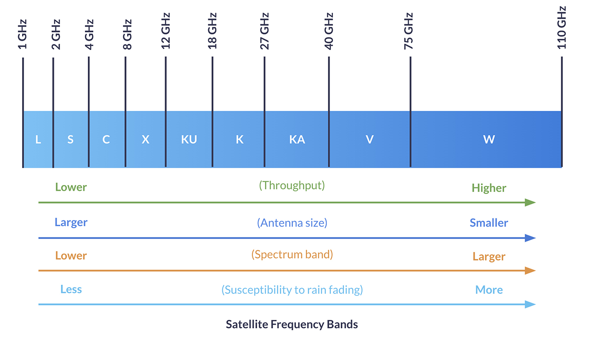
Performance. As briefly mentioned earlier, the “legacy” satellite constellations of Viasat and Iridium weren’t conceived with high volumes of high speed traffic in mind. Hence the choice of NB-IoT as the networking technology, as NB-IoT’s waveform can be transmitted efficiently via satellites, with far less power required than LTE Cat 1bis – both on the device side and on the satellites themselves.
This doesn’t mean that Starlink, AST SpaceMobile etc. have a free-for-all in terms of capacity. Starlink coverage over the USA, for example, is, according to Elon Musk, anticipated to be 7 MB per beam (and the beams are very large). All users – both IoT devices and cell phone users – share that capacity, so congestion and bandwidth limitations are possibilities.
Regulatory. This is a challenge for the new satellite constellations, leveraging MNO spectrum. As Device-to-Device (D2D) communication extends beyond national borders, it poses significant challenges to existing regulatory frameworks and spectrum management practices. Since D2D users can operate in remote regions where traditional mobile networks don’t reach, their activity may span across countries. This makes it essential for neighboring nations to collaborate closely on spectrum management.
Additionally, roaming regulations, licensing, and authorizations may need to adapt, as D2D service providers are no longer confined to one country. This could lead to the development of regional or international licensing systems and potentially even an international regulatory body (source).
Funding. Companies taking the route of launching satellites compatible with terrestrial waveform technologies have a huge CapEx challenge; in order to provide service, they need to launch many satellites, at no small expense, and then bank on subscribers turning up in their tens of thousands in order to recoup their costs.
The business case for D2D purely in the context of IoT is that these new constellations will be able to communicate with unmodified cellular IoT devices – which are far lower cost than current satellite IoT devices – thus unlocking a new, lower price point for hardware. But lower costs means more subscribers need to be found before the SNO is profitable.
Existing satellite IoT applications are often mission-critical and need sureties of data delivery and speeds that D2D may not be able to deliver; thus D2D isn’t likely to dramatically cannibalize the existing satellite IoT market. New use cases need to be found, and use cases with thousands, if not tens of thousands, of endpoints.
This is a bit of a gamble when almost all of the costs have to be incurred before service can be delivered. It is possible that some of the new entrants will run out of steam before their services are commercially available.
When Will Direct-to-Device Services Be Available?
In the context of cellphones, D2D is already available, through Globalstar’s partnership with Apple. In this case, the manufacturer modified the cellphone to talk to Globalstar’s satellite network. However, this proprietary approach has proven unpopular; Iridium and Qualcomm took a similar proposition to market and ultimately shelved the project.
In terms of a standards-based D2D service, there are some early solutions being tested as we write (in September 2024). Notably Skylo, leveraging Viasat and Ligado’s satellite constellations, have partnered with several device manufacturers to develop chipsets that can be added to terrestrial devices to deliver D2D functionality.
Taking the opposite approach – with satellites built for D2D, and needing no changes to devices – Starlink have announced that they intend to offer IoT services at some point in 2025. These will be limited to the areas where Starlink has an MNO partner.
With several technical hurdles still to overcome, it’s our view that we’ll start to see larger deployments of D2D IoT devices no earlier than 2026. In the meantime, however, the buzz around lower hardware pricing is already starting to impact proprietary solutions, with Iridium and Viasat for the first time allowing mass chipset manufacturers to build hybrid devices with their modems. These economies of scale should see proprietary satellite IoT hardware reducing in price, unlocking new applications for satellite IoT long before standards-based D2D becomes a reality.
Additional sources:
Can we help?
It’s an exciting time to be working on a remote IoT or tracking application, but with the greater volume of choice comes more uncertainty about the right service provider and networking technology for you.
We can help. We work with multiple satellite network operators with both standards-based and proprietary technology, and will provide you with unbiased, expert advice.
Complete the form or email hello@groundcontrol.com and we’ll get back to you within one working day.
Five Ways to Tackle Climate Change with Satellite Tracking
As climate change continues to pose significant challenges to our planet, innovative technologies are emerging as critical tools in our efforts to mitigate its effects. Satellite tracking and the Internet of Things (IoT) are at the forefront of this technological revolution, providing invaluable data and insights across various domains.
From monitoring endangered species and tracking glacial retreat to combating illegal fishing and preserving forest health, these technologies are playing a vital role in understanding and addressing climate change. This blog post explores five key ways in which satellite tracking and IoT are transforming the fight against climate change.
1. Tracking Endangered Species
While estimates vary, scientists agree that extinction rates are far higher than the natural rate, due to loss of habitat, climate change and poaching. A 2019 United Nations report puts the figure at 30 to 50 percent of all species going extinct by 2050. This loss of biodiversity threatens ecosystems that support all life – and there are further negative implications for medicine, agriculture and recreation.
Technology has a vital role to play in arresting this decline. Animal tracking through collars and tags helps in several ways: firstly, the data captured can help scientists prioritize habitat conservation, and justify seasonal closures of sensitive areas to the public.
Secondly, it helps us understand the impact of climate change, and both natural and human-driven disasters on wildlife, such as how sperm whales were affected by the Deepwater Horizon oil spill.
Finally, animal tracking can prevent poaching, both by helping to predict endangered species’ movements, and in turn, the hunters trying to evade detection. In this instance, tracking collars are often also combined with intelligent camera traps, giving security forces more information on the threat, so they can respond appropriately.
Satellite connectivity is essential for tracking animals traveling outside of cellular coverage. Modems such as the Iridium 9603N are increasingly small and lightweight, and can be built into the tracking collars for mammals starting at 15 Kg body weight.

2. Monitoring Glacial Retreat
Glaciers are shrinking rapidly, with profound impacts on local hydrology, rising global sea levels, and the acceleration of natural hazards such as the creation of icebergs. However, the processes that go into glacial retreat are not well understood, leaving gaps in models designed to predict future impact.
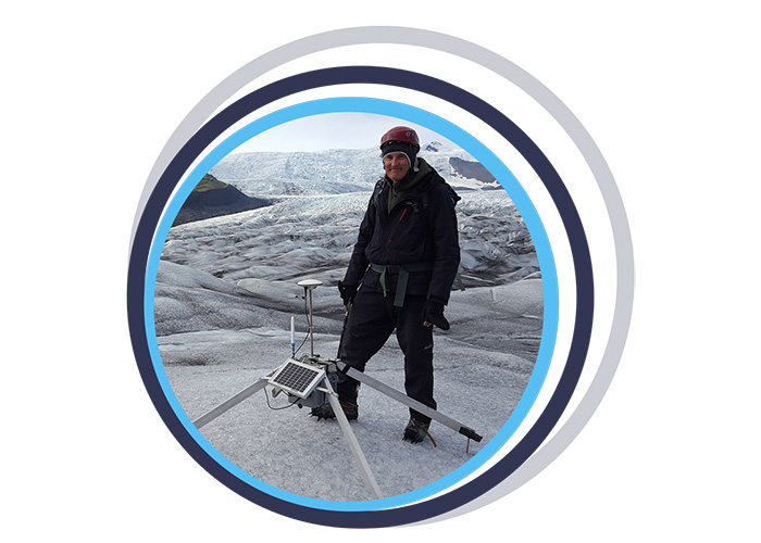
Environmental scientists are working hard to plug these gaps, not least the team at the University of Southampton, who build and deploy Subglacial Probes and Ice Trackers. The Ice Tracker is a web-connected RTK GNSS-solution which measures glacier change and flow. It utilizes the RockBLOCK 9602 to transmit its data reliably and cost-effectively, with no dependency on terrestrial network availability.
After rigorous testing in Iceland, the goal is to roll out this technology around the world to see how different glaciers respond to global warming, and thus create more accurate models for predicting their impact.
Similarly, scientists from the Water and Ice Research Laboratory at Carleton University have developed a low-cost, satellite-enabled device to track icebergs. In the Arctic, as the sea ice retreats, more large icebergs are being calved; at the same time, shipping and fishing vessel traffic in the area has increased by 111% and 41% respectively.
Despite advances in monitoring, ships do still collide with icebergs; in the northern hemisphere, from 1980 to 2005, there were 57 incidents involving icebergs. With the addition of more icebergs and more ships, this risk has exponentially increased.
Tracking – and therefore being able to better predict the behavior of – icebergs mitigates the risks to marine vessels, and also supports scientific research into the effects of iceberg melt on ocean infrastructure and marine life.
The Cryologger is a data recording and telemetry platform that has been ruggedized so it can operate at Arctic temperatures. It utilizes a GNSS receiver, accelerometer, magnetometer and a RockBLOCK 9603 to transmit the data packets.
Data retrieved has already contributed to a database of iceberg tracking beacon tracks, providing insight into drift characteristics and distribution.
3. Combating Overfishing
According to Fishforward.eu, 29% of the world’s fish stocks are overfished; and a further 12-28% of the fishing world-wide is constituted by illegal and unregulated fishing. This is driven by demand, with each individual eating around twice as much fish as was consumed 50 years ago.
Right now, it’s other marine life that suffers the impact of overfishing. 71% of specific shark populations have been wiped out, and more than one-third of sharks, rays and skates are threatened with extinction.
And if nothing changes, in a few years time – some researchers predict as soon as 2048 – the world’s oceans will be virtually empty, leaving billions of people without their key source of protein, and millions of people missing their livelihood.
There are several solutions to this problem, as outlined by the Marine Stewardship Council; among them robust and enforced regulations preventing overfishing. The means of monitoring compliance is a Vessel Monitoring System, or VMS.
The device used to capture the telemetry on a vessel’s present and historical location, fuel used, catch size etc. needs to be tamper-proof and withstand the harsh marine environment. It needs to be reliable, accurate and have no connectivity ‘dead areas’.
VMS specialists Dualog (trading as Fangstr) and Pivotel chose the RockFLEET for their transmissions; it can use cellular when within range of a terrestrial network, and switches to the globally available Iridium satellite constellation when cellular is not available.
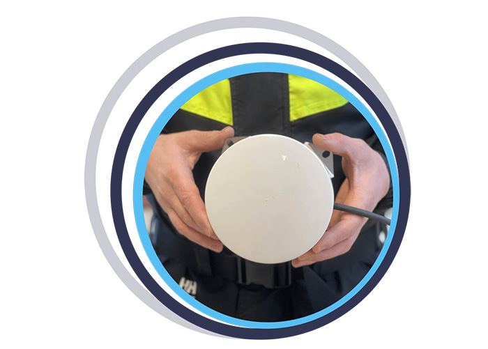
4. Preventing Deforestation
Forests are both affected by climate change, and a key defense against it. Forests capture and store carbon, but when forests are cleared, burned or degraded, they release that carbon back into the atmosphere as carbon dioxide, which contributes to climate change.
Deforestation – the clearing of forests, usually to plant crops in its place – contributes 12 to 20 percent of global greenhouse gas emissions. Degraded forests also contribute; a degraded forest may emit more carbon than it captures, becoming a carbon source rather than a carbon sink. Degradation typically occurs when illegal logging operations take place; loggers bulldoze their way in, extract high value trees, and drag them out, leaving behind roads, clearings and ravaged undergrowth.
The Rainforest Foundation UK is supporting national and local authorities by providing an early warning system for illegal logging activities. They enlist the help of the indigenous people whose way of life is also being threatened by deforestation; when they see signs of illegal logging, mining, or oil spills, they use the free ‘ForestLink’ system to send an alert to the authorities.
When cellular coverage isn’t available, the ForestLink system switches to the global Iridium satellite constellation, allowing the monitors’ smartphones to exchange data anywhere with a clear view of the sky. Rainforest Foundation chose the RockBLOCK Plus for its ruggedized exterior and economical and reliable transmissions.
5. Measuring Ocean Currents to Understand Global Climate Patterns
Our oceans absorb most of the sun’s heat, and then ocean currents distribute that heat around the globe. NOAA describes this as a conveyor belt, moving warm water and rain to the polar regions. There the water cools and sinks, which has the effect of pushing cold water towards the equator, helping to moderate temperatures. Without them, temperatures would be far more extreme – very hot at the equator, very cold at the poles – and much less of Earth’s land would be habitable.
Climate change is believed to be affecting ocean currents; the currents are not only warmer, but also 15 percent faster (measured between 1990 and 2013). This is damaging marine life and speeding up the melting of the sea ice at the poles, leading to global sea level rises. It’s also likely to disrupt the conveyor belt; if the water reaching the poles is too warm, it won’t sink. This could have the effect of slowing down or even stopping ocean currents in some places, notably the Gulf Stream. Western Europe would feel very different without the effect of this warming current.
High sea surface temperature (SST) is an important parameter in predictive weather and climate modeling. To capture this data, fixed and drifting data buoys are deployed all over the world to take measurements of surface and subsurface water temperature, atmospheric pressure, winds, salinity and wave patterns. And for the drifting data buoys, their historical location data allows scientists to profile ocean currents.
Because many of these data buoys are outside of cellular coverage, satellite connectivity is essential to transmit their data. Ground Control works with a number of data buoy companies, who need a satellite modem that’s reliable, robust, and delivers global coverage. RockBLOCK 9603 is a popular choice as it’s cost effective and has very low power consumption, allowing for the data buoys to drift for several years on battery power, or a small solar panel.
Some of Ground Control’s data buoy partners include Sofar Ocean, Maker Buoy, Akrocean, Running Tide and MTE Instruments.
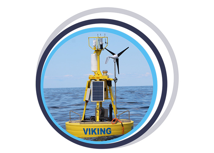
In Summary
The integration of satellite tracking and IoT technologies offers powerful solutions to some of the most pressing environmental challenges we face today. By enabling real-time data collection and analysis, these technologies help scientists, conservationists, and policymakers make informed decisions to protect our planet.
As we continue to innovate and expand the applications of these tools, their role in combating climate change will only become more significant. Embracing and investing in these technologies is essential for creating a sustainable future for generations to come.
Can we Support You?
Based in the UK and USA, Ground Control designs and builds satellite-enabled tracking and IoT solutions. We have over 20 years’ experience, and work with leading satellite network operators to ensure all of our customers get the best combination of coverage, cost, data throughput and latency.
If you have an asset that’s moving in and out of cellular coverage, we ensure that you always stay connected. We work directly with end users like Digital Forest, and often indirectly through our partner network of companies building animal tracking collars and data buoys, for example.
Please email hello@groundcontrol.com or complete the form, and we’ll reply within one working day.
Military Satellite Communications: From IDSCS to Space Force and Beyond
With their reliable, secure and global connectivity, satellites have been instrumental in military communications for over half a century. Applications have covered everything from surveillance to operation support, and monitoring personnel to facilitating mobile command centers. A 2022 report revealed that the government and defense sector accounted for a staggering 42% of the $78.22 billion global satellite communication market. Looking ahead, the global military communication market is projected to reach $54.11 billion by 2029, driven by advancing technologies, including the Military Internet of Things (MIoT).
Throughout history, military personnel have relied on secure and dependable channels to transmit vital information across vast distances. Satellites have played a transformative role in revolutionizing military communications, empowering rapid data transfer, real-time intelligence gathering, and precise targeting. To fully grasp the significance and influence of military satellite communications on the defense industry, it’s essential to delve into its evolutionary journey.
Initial Defense Communications Satellite Program (IDCSP)
Official efforts to create a military communications satellite started in 1960 and since then, the United States has relied largely on four different satellite constellations to deliver timely, reliable communications. The Initial Defense Communications Satellite Program (IDCSP) created the Pentagon’s first near-geosynchronous communications system – the Initial Defense Satellite Communication System (IDSCS). The first satellite of this constellation was launched in 1966, and by July 1967 consisted of 19 satellites in total. These satellites enabled the transfer of high-resolution photographs during the Vietnam War, allowing for near real-time battlefield analysis.
Defense Satellite Communications System II (DSCS II) and DSCS III
Subsequently, constellations Defense Satellite Communications System II (DSCS II) and DSCS III, were launched between 1971 and 2003. The constellations comprised 16 and 14 satellites respectively. The transition from IDCSP to DSCS II and DSCS III marked a significant modernization of military satellite communication systems. Advantages included increased communications privacy and better compatibility with ground-portable units, enabling satellite communications in more dynamic environments.
Wideband Global SATCOM (WGS) Network
Initiated in 2002 by the Department of Defense, the Wideband Global SATCOM (WGS) network holds a significant position within military satellite communications today – welcoming a new era of capabilities and flexibility. First, each WGS satellite offers more SATCOM capacity than the entire DSCS constellation, providing a quantum leap in communications capacity.
Recognizing the system’s potential, in 2012 the WGS network expanded internationally, attracting partner countries including Canada, Denmark, Luxembourg, the Netherlands, and New Zealand. According to Heidi Grant, Deputy Under Secretary of the Air Force for International Affairs, these collaborations aimed to enhance interoperability, bolster trust, and increase capabilities and capacity for all partners.
The WGS system operates through three principal segments: Space (satellites), Control (operators), and Terminal (users). The space segment consists of 10 cost-effective, high-throughput Ka- and X-band satellites; controlled and managed by the USSF Space Delta 8’s 4th Space Operations Squadron and 53rd Space Operations Squadron. The ground segment boasts thousands of tactical SATCOM terminals. Today the system provides worldwide, high-capacity communications for various government agencies, the Department of Defense (DOD), international partners, and NATO.
The WGS network is a critical part of the US military’s communications infrastructure, but it’s important to note that it is not the only network they use. The US military utilizes a variety of other networks, including the Defense Information Systems Network (DISN) and the Joint Tactical Radio System (JTRS).
Satellite Military Communications Today: Introducing United States Space Force
The United States Space Force (USSF) was officially established in December 2019, when President Trump signed the National Defense Authorization Act for Fiscal Year 2020 into law. With a mission to “secure our Nation’s interests in, from, and to space”, the USSF became the sixth branch of the U.S. military.
The establishment of the United States Space Force had been proposed and discussed for several years prior, with many recognizing the growing importance of space within the larger context of military and national security concerns. Its creation consolidated satellite acquisition, budget and workforce, across more than 60 organizations enabling a more efficient, effective service for space operations.
One of the early successes of the Space Force was its role in providing early warnings of missile strikes against U.S. troops. Most recently, in August 2023, the USSF formed a new combative unit the 75th Intelligence, Surveillance and Reconnaissance Squadron (ISRS). The ISRS unit was formed with a clear mission: targeting adversary satellites, ground stations, and counter-space forces that can disrupt satellite systems during conflicts.
Russia and China, possessing ground-based anti-satellite weaponry, both pose significant threats to the WGS. Additionally, they’re developing a “peaceful” spacecraft, designed to reduce orbital debris. However, this “peaceful” spacecraft could, in theory, dismantle U.S. satellites, siphon fuel, and damage components including antennae and solar panels, raising concerns regarding the true intentions and implications for space security.
The Future of Military Satellite Communications
In the ever-evolving landscape of military satellite communications, the demand for robust and widespread connectivity is surging. As Mike Tierney, industry analyst at Velos puts it – “the one thing that is always needed is more comm… We never have enough comm to get after what we need to do. We need more comm to support the fight.” Notably, the government and defense sector’s increasing reliance on satellite communications, driven by the transformation of operational environments and a growing dependence on sensor data and ISR platforms, further propels this growth. This shift is evident in the escalating demand for High Throughput Satellite (HTS) capacity to meet the evolving requirements of government and military applications.
Charting the Course of Military Satellite Communications
- Security: Safeguarding the Final Frontier
- The Future Hub of Space Operations
- Combination of Commercial and Owned Communications
Security: Safeguarding the Final Frontier
As satellite reliance grows, security becomes not only paramount but also twofold. First, the war in Ukraine underscored satellite systems’ vulnerability to cyber warfare. In February 2022, a cyberattack disrupting Viasat’s satellite communications network was attributed to Russia’s military. Using wiper malware, the attack “bricked” KA-SAT modems across Europe, impacting tens of thousands of users, including Ukraine’s military. With cyber attacks becoming integral to military arsenals, the imperative for a robust defense strategy intensifies.
Second, the physical security of satellites demands attention. China’s pursuit of satellites with on-orbit repair capabilities raises concerns, as some could double as weapons. Similarly, Russia is developing laser weapons to target adversary satellites. DARPA’s (Defense Advanced Research Projects Agency) robotic arm, set to launch in 2024, aims to repair satellites in geosynchronous orbit and could serve as “bodyguards” against threats. Safeguarding satellites requires a comprehensive approach, addressing both cyber vulnerabilities and physical defense mechanisms.
The Future Hub of Space Operations
Beyond Space Force, plans for a military space station are underway. The Defense Innovation Unit (DIU) is soliciting proposals for an autonomous orbital outpost, laying the foundation for potential human habitation and docking with manned spacecraft. The DIU envisions the outpost supporting diverse functions, from microgravity experimentation to logistics and training. While its primary goal is currently experimentation, the solicitation hints at broader ambitions, including a military presence in geosynchronous orbit.
Combination of commercial and owned communications
The war in Ukraine also highlighted the agility and responsiveness of commercial satellites, particularly in critical infrastructure support and imaging during conflict. Commercial providers like SpaceX’s Starlink played pivotal roles. Lt. Gen. Michael Guetlein emphasizes a pragmatic approach: “buy what we can and only build what we must.”
However, in allocating nearly $13 billion over the next five years, the Pentagon signals a continued commitment to the importance of government-owned capabilities. As Mike Tierney from Velos notes: “this budget doesn’t reflect a pivot to a greater adoption of commercial capabilities in lieu of government-owned and operated capabilities.” Suggesting that the delicate balance between security, innovation, and pragmatic resource utilization is steering the future trajectory of military satellite communications.
Need a Defense Communications Solution?
At Ground Control our dedication to supporting defense and government organizations reflects our ongoing efforts to evolve with the dynamic landscape of the defense sector. As a trusted partner, we are committed to offering the highest level of service, straightforward procurement processes, and around-the-clock support.
So if you’re looking for reliable and cutting-edge satellite communication solutions tailored to the unique requirements of the defense industry, contact our team today to explore how our solutions can enhance your communication capabilities and contribute to the success of your mission.
Satellite Asset Tracking for Construction Projects
Construction companies operate a diverse range of costly machinery and tools crucial for project success. Delays in locating or maintaining these assets can lead to disruptions, missed deadlines, and tripled costs due to unplanned maintenance.
LoJack’s recent study pinpoints the most stolen equipment as wheeled or tracked loaders, towables, excavators, trailers, and utility vehicles. The National Equipment Register underscores the financial impact, averaging $30,000 per theft incident. In short, asset tracking is integral for risk mitigation in construction.
However, traditional asset tracking methods often prove inadequate for the demands of the construction industry, which, according to McKinsey, has historically lagged in digitization. Relying on manual record-keeping and periodic inspections, firms have limited real-time visibility into assets’ location and their status. Manual tracking, often paper-based or spreadsheet-driven, becomes time-consuming and error-prone in the fast-paced construction environment, where assets frequently relocate. Inaccurate, untimely tracking data then challenges resource optimization, leading to under-utilization, and increased inefficiencies, and leaves construction sites vulnerable to theft and unauthorized usage.
Satellite connectivity emerges as a crucial solution for construction asset tracking, particularly considering the diverse and often remote locations of building projects. Only about 15% of the Earth’s surface is covered by terrestrial networks, and construction sites are notorious for poor cellular service. In remote or challenging terrains, where theft and accidents are exacerbated, satellite connectivity becomes key for effective asset tracking and monitoring.
Benefits of Satellite Asset Tracking
PROMOTING WORKER SAFETY
Satellite asset tracking is crucial for ensuring safety on construction sites, where inherent risks demand proactive measures. By offering real-time location insights, this technology acts as a guardian, facilitating swift responses in emergencies. Improved safety is evident as satellite tracking provides constant information about the location of workers and equipment, preventing accidents and ensuring a secure environment. So much so, that a recent study revealed a remarkable 14% reduction in accident costs for construction companies after implementing asset tracking solutions.
Moreover, specialized alerts on personal tracking devices, such as the RockSTAR, contribute to enhanced worker safety. For instance, the timer alert allows workers to set a specific time interval. If there is no further interaction with the device within that time, the RockSTAR automatically sends a ‘timer alert’ to the server or first responders. This feature adds an extra layer of protection by ensuring timely response in situations where immediate action might be required.


COUNTERING EQUIPMENT THEFT
The construction industry faces a substantial issue — equipment theft, costing an estimated $1 billion annually. A recent survey underscores the severity, with 21% of industry professionals reporting weekly incidents of theft. Beyond financial losses, these thefts lead to project delays, shutdowns, and pilferage of raw materials.
Fleet tracking emerges as a powerful deterrent against the risk of asset theft and unauthorized use. Any unauthorized movement can trigger immediate alerts, facilitating prompt intervention, and enabling teams to alert authorities to the location of stolen assets. This also increases the chances of recovery.
STREAMLINING OPERATIONS
Investments in heavy machinery and fleet vehicles constitute a substantial portion of operational costs. Satellite fleet tracking software serves as a powerful tool, centralising data and offering nearly real-time insights into asset utilization from any location. This efficiency translates to precise payroll and cost projections, providing construction companies with accurate work times and utilization reports.
Moreover, asset tracking facilitates efficient inventory management by supplying accurate data on tool and material availability and usage. Additionally, asset tracking systems aid construction firms in regulatory compliance by maintaining precise records of equipment usage, maintenance, and inspections — a crucial aspect for audits and compliance adherence.
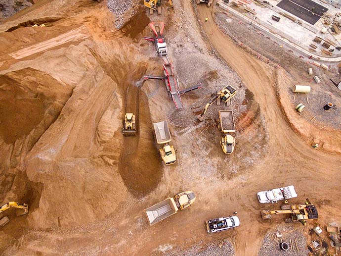
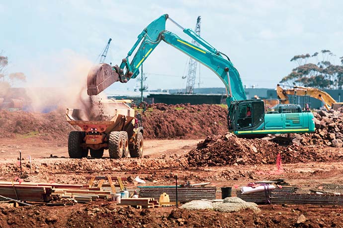
EQUIPMENT UTILIZATION MONITORING
Satellite fleet tracking plays a pivotal role in Equipment Utilization Monitoring (EUM) for the construction sector. With 45% of construction businesses identifying resource management as a challenge, real-time visibility through satellite tracking could prove valuable. Project managers gain instant insights into the location and status of construction assets, facilitating optimal deployment and utilization across various worksites.
This not only enhances worksite productivity but also addresses the challenges of delivering projects on time and within budget, making satellite fleet tracking a key component for effective equipment utilization monitoring in the construction industry.
PROACTIVE MAINTENANCE
Satellite tracking enables firms to conduct proactive maintenance, offering substantial benefits such as cost savings from reduced unplanned equipment breakdowns and minimized repair expenses.
The high adoption rate, with 76% of construction companies utilising fleet tracking and 73% deeming it extremely valuable, underscores its efficacy. The advantages include reduced downtime, improved equipment reliability and availability, lowered long-term maintenance costs, enhanced safety, and increased equipment longevity. This technology facilitates a proactive approach to maintenance, ensuring construction companies achieve optimal performance, mitigate risks, and realize substantial financial savings in the long run.

Satellite Trackers for the Construction Industry
Meet the Iridium Edge Solar
The Iridium Edge Solar is a great choice for those in the construction sector due to its ruggedized, solar-powered, and two-way communications capabilities. Specifically designed for long-term deployment in remote areas, it boasts remote configuration capabilities and military-grade packaging, making it an ideal solution for asset management in challenging construction environments. With real-time GPS tracking and local wireless sensor and communication capabilities via Bluetooth, it provides comprehensive visibility into the location and performance of construction equipment.
Its 10-year deployable lifespan aligns perfectly with the extended timelines often associated with construction projects. By utilising Iridium Edge Solar, construction companies can optimize the efficiency, safety, and productivity of their sites. The device facilitates real-time tracking of equipment locations, proactive monitoring of performance to identify potential issues, and immediate alerts to operators if the equipment is being used in a risky manner. Additionally, it enables data collection for refining safety procedures and training.
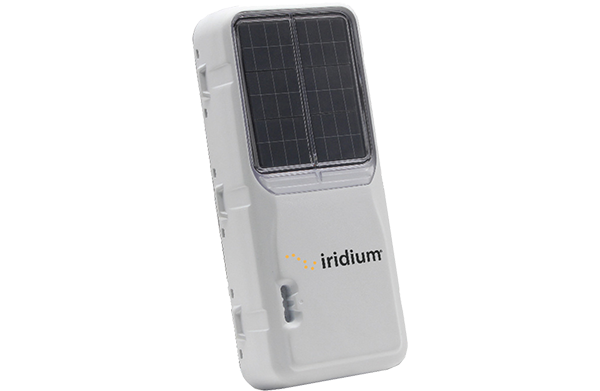
Introducing the RockREMOTE range
For larger data requirements, Ground Control’s RockREMOTE delivers real-time power generation reporting, prevents production stoppage by issuing alerts on machinery failure, and facilitates measurements at potential new sites lacking power.
The waterproof RockREMOTE Rugged, boasting an IP67 rating, enables firms to monitor and manage remote assets like mobile generators, ideal for critical communication in remote scenarios. Customers have flexibility, choosing between Ethernet, Wi-Fi, or Serial RS232/485 for communication interfaces.
Both devices support dual-mode Iridium Certus satellite connectivity combined with LTE, providing the construction industry with robust and globally accessible asset tracking capabilities.
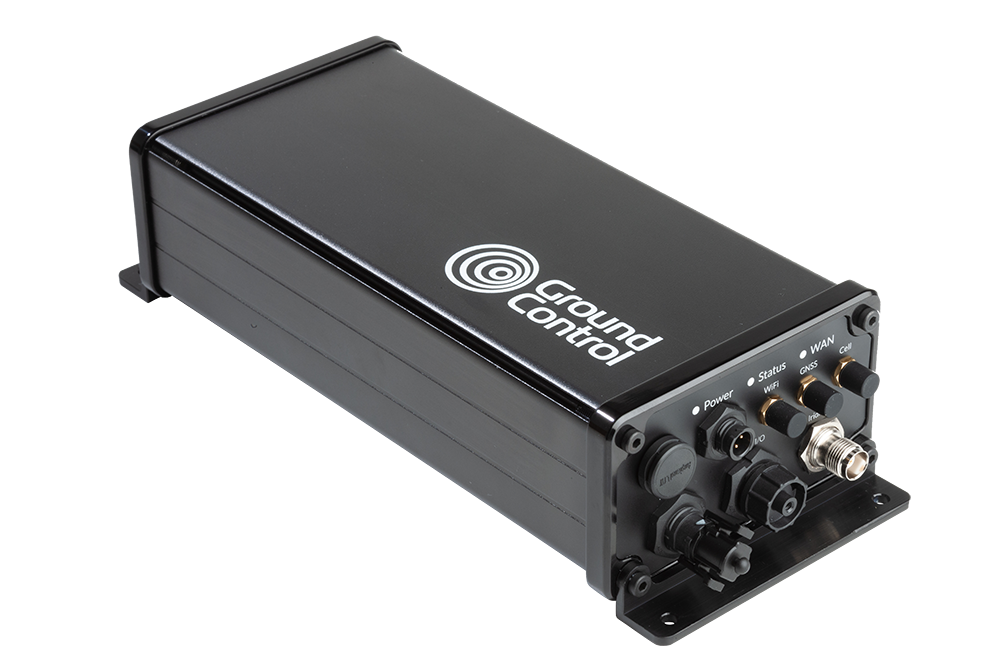
Ready to Build Smarter?
Gain real-time visibility, enhance security, and streamline resource management in any location, even beyond terrestrial networks. Our proven devices empower construction workers with reliable and efficient tracking capabilities.
Ready to transform your construction operations? Explore Ground Control’s satellite asset tracking solutions today.