Topic: Asset Tracking
Will satellites guide Santa’s sleigh tonight?
Not enough thought is given to the practicalities of Santa’s epic sleigh ride, in our view. Living at the North Pole, how does Santa receive all of the emailed letters he’s sent every year? How many carrots does a reindeer actually need to fly around the world? How does Santa avoid flying through the worst of the winter storms in the Northern Hemisphere? And how on earth is he sending “LIVE Christmas Eve updates from the Reindeer and me!” (https://twitter.com/OfficialSanta)?
It’s obvious when you think about it. Only satellite connectivity allows Santa to remain connected wherever he goes on the globe, checking in with his team and Mrs Claus, maintaining the reindeers’ health, and ensuring that every child on the nice list gets a gift. And, in this instance, it’s Iridium satellite connectivity, with its coverage at the polar regions being a must-have!
Without taking any of the magic away from the most wonderful time of the year, our infographic lays bare the communication challenges that Father Christmas solves with portable satellite internet and satellite tracking devices.
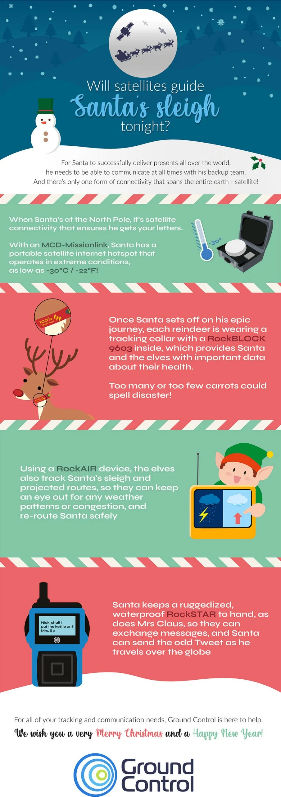
To echo the sentiment of the infographic, we wish all of our customers, staff, and website visitors a safe, happy and healthy Christmas and New Year.
If you’re interested in learning more about Santa’s enviable satellite set up, here are the links: MCD-MissionLINK | RockBLOCK 9603 | RockAIR | RockSTAR
Can we help you with your connectivity challenges?
From data buoys to camel tracking, if you have assets in a remote area, we can help you communicate with them. We design and build all of the satellite IoT and tracking devices Santa uses in this infographic, and we work with the leading satellite network operators to ensure our customers get the best service for their requirements.
If you would like impartial, expert advice on the most cost-effective, reliable, secure and efficient means of transmitting your remote data, get in touch!
Unleashing Precision Forestry: how Satellites Facilitate Decision-Making and Automation
While the Mining industry has been applying advanced analytics and AI to its operational technology for some time, Forestry has lagged behind in terms of digital data capture, automated operations and optimised decision-making made possible through advanced analytics. But the times are changing.
As McKinsey identified in a 2018 article, the increasing technical sophistication of Forestry’s main customers – pulp, paper, transportation, sawmills, timber traders etc. – has driven the adoption of precision farming technologies. Further, early adopters have used their greater yields and reduced costs as a competitive advantage.
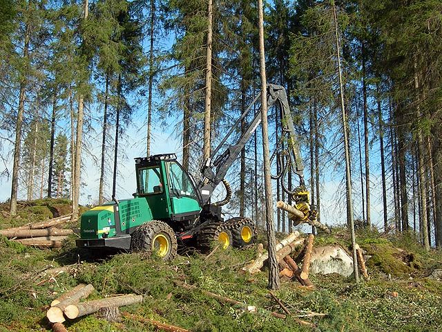
An example of the value of real-time data capture is seen in the mechanised harvesting cut-to-length (CTL) system, evolving in Scandinavia. Traditionally, tree felling and log manufacture are carried out by an operator with a chainsaw; tree trunks are extracted with wheeled skidders or cable systems to the roadside, and then sawn, in situ, into logs. Trunks are connected to cable systems by operators, navigating debris and potential runaway trunks; a manual, dangerous job. Decisions on what log grades to make from each tree trunk are made by the chainsaw operators, guided by a few basic log specifications and prices. There is little automation.
New CTL technology is fully mechanised with a harvester that fells trees and makes logs in one process, paired with a forwarder that moves these logs roadside. The system relies on digital data: cutting instructions are relayed in real-time to the harvesters, where onboard computers optimise the mix of log grades made from each tree, using sensors mounted on the harvester to measure trunk shape and quality. Production data, together with data on machine productivity, and other performance indicators such as fuel efficiency, can be visualised in real-time.
This level of automation and digitalisation increases operational safety while speeding up precision felling and productivity. It gives greater management control, an optimised supply chain, fast value recovery and planning for the next crop. Data on grade outturn from a specific site can inform decisions on what tree species to plant for the next crop, what fertiliser regimen to employ, and at what age to best harvest a crop. Effectively, optimised decision-making via advanced analytics and insight.
Connectivity: why it’s holding Forestry back
The problem with utilising smart industrial equipment is that it’s not that smart without a means of passing data between machines, people, or back-to-base. According to FPInnovations, 60% of forestry operations have no cellular coverage, which “prevents the timely flow of information between the forest and the data centre… we cannot use the productivity tracking technology that’s being used in other sections, such as agriculture.”
Cellular coverage in remote locations, especially covering woodland, mine pits or agricultural fields is often patchy or unavailable and this leaves remote teams and machines disconnected. Recent forestry development has overcome this, to some extent, using geostationary (GEO) satellite technology.
In their 2021 trial project, FPInnovations and partners tested the use of a mobile, private LTE (cellular) network in the forest. An LTE base station was set up at the edge of a cut block, utilising a 30-metre portable cell tower, omnidirectional antenna and tower-mounted amplifier (TMA) to increase signal strength for extended coverage. A satellite terminal was then used to connect the LTE system to the internet.
In this trial, one cell tower covered a 10-kilometre radius. Devices within this radius, including cell phones, tablets and telematics, communicated with the cell tower even while in motion. The GEO satellite service provided the essential backhaul of data. You can read more about the trial here, where the learnings from the project are available.
But this type of solution comes with high initial investment costs, and the use of geostationary satellites can create limitations over more rugged terrain, where a view of the sky is restricted. Devices that connect with geostationary satellites – in orbit 35,786 km above Earth – need to have a clear line of sight to their satellite, which can prove difficult in mountainous and wooded areas. The evolution of the project is to use a satellite transceiver that speaks to satellites in Low Earth Orbit (LEO).
The role of LEO satellites in bridging the gaps
Low Earth Orbit (LEO) satellite networks benefit from lower latency (because of their relative proximity to Earth), and can provide more reliable coverage if there are line-of-sight challenges, or the operation is mobile.
Iridium utilises a mesh of LEO satellites able to communicate with one another, passing data from one satellite to another, until the final destination is reached. Antennas communicating with the mesh network don’t need to be ‘pointed’ towards a single satellite, as data can be picked up by any satellite within the constellation and passed through the network, to the ground station.
This makes this network ideal for mobile IoT applications, and perfect for heavy machinery, or operations that shift in location, such as transitory logger camps. Iridium Certus 100 service can provide ubiquitous connectivity in very remote, forest areas.

Implications for developing precision forestry technologies
Reliable satellite connectivity, be that as the primary form of data connectivity or as a data backhaul for cellular or LoRa networks, creates the foundations for smart precision forestry technology, bringing several exciting digital operational capabilities.
The guaranteed connectivity is essential to the constant stream of data that passes between high-precision heavy machinery and the controller. It may be simple sensory data, such as sudden movements, or hazardous objects detected in the logging zone; a block in the workflow or a major mechanical malfunction. Remote heavy machine monitoring, diagnostics and troubleshooting can also provide advance warning on machine maintenance, saving downtime and redundancy, creating operational efficiency and reducing costs.
Steps towards Forestry digitisation
One obvious consideration for implementing precision forestry technology is the scale of investment relative to the size of the logger operation. For a forestry operation curious to see if the benefits of automation can be realised, satellite IoT devices present a very rapid and low cost means of backhauling data from individual machines, and can be rapidly scaled up or down. They can help logging operations evolve from analogue to digital in incremental ways, depending on the volume of data that needs to be transferred, and the critical nature of what’s being communicated back to base, or between man and machinery.
Automated machinery requires constant data connectivity for safety and autonomous decision-making, whereas maintenance alerts may only be necessary on a report-by-exception basis. For each use case, our technical team is able to advise on the best satellite service to support the operational needs and budget.
The RockREMOTE Rugged provides a fertile opportunity for trialling the benefits of satellite connectivity in a forestry setting. It’s aluminium cased, and built to withstand the roughest of environments. Fixed to a remote asset, like a Forester or Harvester, the device enables satellite data transfer of predictive and preventative maintenance analytics, for example.
Customers with small to moderate-sized Industrial IoT data requirements can utilise Iridium’s IMT message-based service for cost-effective data transfer. For more data-heavy applications and real-time monitoring, the device connects TCP/IP-related data, via the Iridium Certus 100 Airtime service. Certus 100 enables data transfer of up to 200 MB per month with speeds of 22 Kbps up and 88 Kbps down.
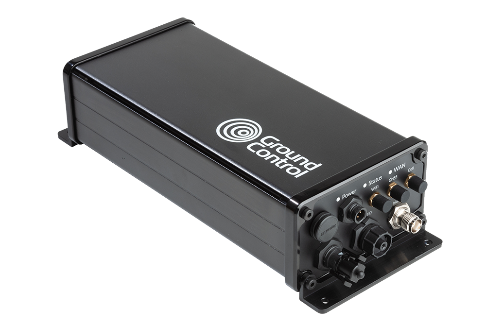
As mentioned earlier, it will maintain a reliable connection on the move, and transmit from anywhere with a clear view of the sky. If your devices and assets are already connected to an LTE Cat 1 or Cat 4 cellular network, the Rock Remote Rugged device also offers automatic WAN to satellite failover.
Digitising Forestry offers more opportunities for data insight and application: from advanced forest mapping, sensor-controlled environments and forest nurseries, to the use of drones/UAVs for fire monitoring and precision forestry inventory. Satellite provides the instant infrastructure needed to test and scale projects like these.
Unlock the potential of your data
If you would like help unlocking the potential of data for your next precision forestry project, get in touch. Our technical team would be happy to assist, no matter how big the project or whatever the question…
Enhancing law enforcement: the role of satellite communications in modern policing
Satellite communications have revolutionized the way police forces operate. Not only has satellite communication technology transformed the reach, reliability and robustness of global connectivity, but it has also provided law enforcement agencies with a powerful tool to enhance their capabilities and improve citizen safety.
In this blog post, we will explore the crucial role and key benefits of satellite-based communication in modern policing and law enforcement practices.
5 benefits of satellite communication for modern policing
1. Seamless connectivity
Satellite communications have the unrivaled ability to establish connectivity even in the world’s most remote and underserved areas. Traditional terrestrial communication networks are often unable to provide reliable coverage in rural regions, national parks, or disaster-stricken areas.
Unlike traditional terrestrial communication systems that often suffer from limitations such as range restrictions, network congestion, and vulnerability to natural disasters or deliberate disruptions, satellite provides a reliable and resilient communication infrastructure that can overcome these challenges. This capability enables law enforcement personnel to remain connected, allowing them to communicate and access critical information, regardless of location.
2. Rapid deployment and flexibility
Satellite communication systems offer rapid deployment capabilities, making them ideal for law enforcement operations that require immediate connectivity. Whether it’s establishing a temporary policing command post, setting up communication networks in disaster-stricken areas, or deploying resources to remote locations, satellite solutions can provide the required flexibility.
A mobile VSAT system could be mounted on the ground, on top of a vehicle, truck, trailer, or even transported in the back of an SUV. Deployment is rapid and suitable for any location – providing a robust, high-speed internet and communications solution. Police forces can subsequently reliably achieve quick, uninterrupted connectivity and operational effectiveness in dynamic and evolving situations.
3. Improved inter-agency collaboration
US law enforcement agencies need to collaborate with multiple agencies during joint policing operations, cross-border investigations, and when combining interagency task forces. Satellite communications enable the facilitation of seamless, secure communication and data sharing between these different agencies, regardless of their geographical location.
In rural areas, satellite-based connectivity can be the only way to achieve this as traditional communication systems like cellular and LMR are typically, much more limited. Satellite enabled messaging devices support rural-based police officers by providing reliable tracking and messaging anywhere in the world, powering collaboration across multiple regions, enhancing policing coordination, and strengthening the overall effectiveness of law enforcement efforts.
4. Real-time surveillance and intelligence gathering
Real-time surveillance monitors high-risk areas, tracks suspects, and shares data with other police forces and agencies for more coordinated operations and successful crime combating. Satellites equipped with high-resolution imaging sensors can provide real-time or near-real-time imagery of vast areas, enabling law enforcement agencies to monitor critical locations, track multiple suspects, or identify potential threats to life. This advanced surveillance capability helps to serve better public safety in the US and the world.
5. Coordinated disaster management and emergency response
During natural disasters, satellite communications play a crucial role in maintaining communication lines when terrestrial infrastructure is damaged, overloaded, or otherwise fails. When this happens, satellite serves as a lifeline for law enforcement agencies to coordinate response efforts, share critical information, and request additional resources. Furthermore, satellite connectivity enables mobile command centers to be established quickly so police can set up communication hubs out in the field during emergency and critical situations. This enables efficient coordination, resource allocation, and decision-making in real time. In the wake of the Boston Marathon bombings, police and the FBI relied on satellites as cellphones were unreliable in the bombing aftermath.
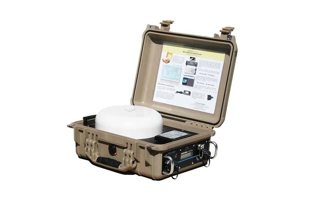
MCD-4800
For seamless connectivity in policing operations, the MCD-4800 provides instant infrastructure independent of terrestrial networks. Within a minute the MCD-4800 becomes a powerful WiFi hotspot accessible by any wireless device within a 300ft range for up to 5 hours on internal battery power alone. This capability enables law enforcement personnel to remain connected, allowing them to communicate and access critical information, regardless of location.
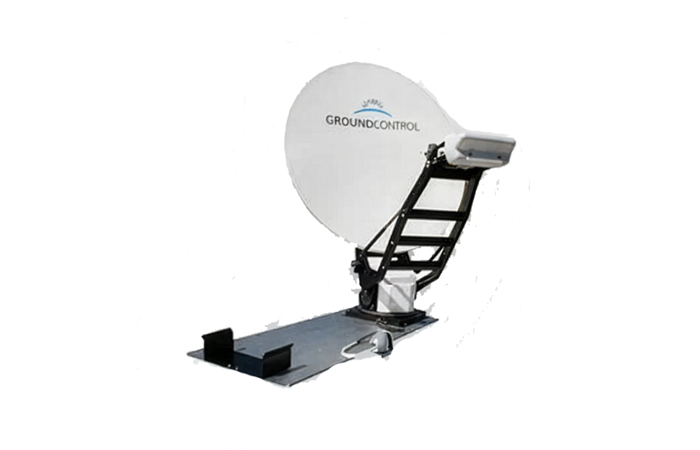
Toughsat Flyaway
The Toughsat Flyaway is designed to mount in all locations where a mobile VSAT system could be mounted, such as on the ground, on top of a vehicle, truck, trailer, or even transported in the back of an SUV. Deployment is rapid and suitable for any location – providing a robust, high-speed internet and communications solution. Police forces benefit from reliable connectivity and operational effectiveness in dynamic and evolving situations.
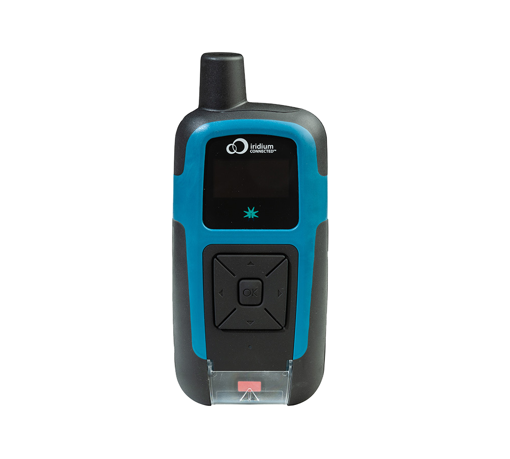
RockSTAR
RockSTAR is a handheld tracking and messaging device which transmits from anywhere in the world. Ruggedized, and with an astonishing 12 month battery life. RockSTAR makes sure that officers’ location is monitored, with alerts if the device is dropped, or moves out of the intended route / location. It can also transmit wearables’ data such as heart rate and blood pressure, making it a valuable health and safety addition for remote policing.
RockREMOTE Rugged
RockREMOTE Rugged is an IoT device utilizing the Iridium Certus network; this means it’s cost-effective to send relatively large amounts of IoT data, including compressed images. Forces around the world use RockREMOTE as part of camera traps, remote security checks and alarm systems. It’s also deployed on unmanned vehicles, including drones, to allow commands to be sent, and data received, from wherever the vehicle travels.
Closing thoughts…
Satellite communication technology offers numerous benefits to law enforcement agencies. From seamless connectivity in remote areas to enhanced surveillance capabilities, satellite technology has become an invaluable tool for improving operational efficiency and public safety. The ability to establish reliable communication during emergencies, support inter-agency collaboration, and provide global reach strengthens the overall effectiveness of law enforcement efforts all over the world.
By harnessing the power of satellite communications, law enforcement and policing agencies can adapt to the ever-evolving landscape of modern crime and ensure safer and more secure communities. As satellite grows in popularity, so too do the service options, and the competitiveness of the pricing. It’s anticipated that in the next few years, satellite and cellular networks will effectively merge, which will open up more possibilities to support policing and law enforcers.
Harness the Power of Satellite Communications
Satellite communication technology transformed what law enforcement agencies and police forces can achieve to enhance crime combating capabilities and improve citizen safety. See what Ground Control can achieve for you, your teams and your agency.
Contact us today. We’ll be able to help and offer impartial advice on the best solutions to improve your operational and connectivity challenges.
How Satellite can Support all Four Phases of Emergency Management
Disasters can affect any area of North America and are most commonly the result of weather-related and geological events. Disasters include everything from wildfires to hurricanes, tornados to floods, earthquakes to dam failures. In 2023, the volume and severity of hurricanes is projected to be ‘normal’ by NOAA, but wildfires are expected to be above average (indeed an area larger than the Netherlands has already burned this year in Canada – that’s more than 5 million hectares).
A single disaster’s impact can significantly vary. From localized to widespread, predictable to unpredictable. That said, FEMA highlights that, as natural hazards are usually more predictable, it’s possible to identify which areas within the US may be most vulnerable to certain types of natural hazards. In addition, as each hazard has both unique characteristics and common elements, the combination of this knowledge enables agencies and organizations to better prepare and respond to natural disasters.
FEMA categorises disasters as recurring events with four phases: 1. Mitigation, 2. Preparedness, 3. Response, and 4. Recovery. The below diagram briefly describes each phase and illustrates the relationship of these four phases within emergency management.
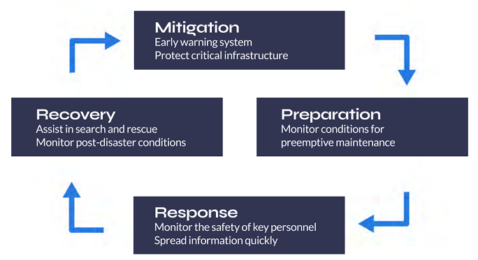
At Ground Control, we have 20 years experience working alongside First Responders and Emergency Personnel. While each situation and/or disaster is unique, there is consistency when it comes to exactly how satellite technology can support and aid teams within each phase.
Mitigation & Preparation – Utilizing IoT
The explosion of the Internet of Things (IoT) continues to revolutionize our world, and the first response sector is no exception to this. In recent years, the number of IoT applications to save human life, no matter how remote the disaster, has exponentially increased. Just a couple of examples include digitally connected gear with built-in sensors that measure air quality, toxins and motion, and protective clothing which continuously monitor vital signs.
Ground Control recently partnered with American Signal Corporation to deliver a Tsunami early warning system, in which the RockBLOCK Plus is utilized as their satellite transceiver. Although this type of technology is more common in larger organizations, we have also had customers successfully create an off-grid fire prevention system utilizing the monitoring capabilities of the RockBLOCK.
Response – Communication Certainty
The vast majority of our First Responder customers acquire our systems for use during emergency response. Generally speaking, our solutions revolve around ensuring teams on the ground have communication and connectivity certainty.
In a crisis, lack of or delayed situational awareness can cost lives, and often, mobility can prove a significant barrier. With SOTM “Satcom-on-the-Move”, teams can stay reliably connected with one another and their Command Center. Utilizing both portable and mobile connectivity solutions, teams can benefit from an almost instant, reliable 300-1000 ft WiFi hotspot. Meaning they can stay connected, even while surveying surroundings and interacting with the community.
In addition, personnel tracking devices such as the RockSTAR can ensure that the location of all personnel is accurately and reliably tracked, in real-time, with zero reliance on terrestrial connectivity. And push-to-talk devices and satellite phones ensure voice communications are achievable, no matter the circumstances. Additionally, features such as talk groups can further support team communications.
Recovery – Supporting Public Safety
First Responders’ main concern will always be public safety in the immediate crisis. However, the recovery phase is crucial. Following the mass destruction of hurricanes Irma and Maria in 2017, 900 VSAT terminals were deployed at sites around the affected region and critical locations including San Juan Airport.
Enabling wi-fi and communications means First Responders on the ground can continue to effectively communicate, and civilians are able to contact loved ones and make appropriate arrangements during the recovery phase.
At Ground Control, we help First Responders and public safety organizations and agencies prepare, providing teams with equipment they need to ensure more successful missions. Reliable communications and connectivity, allow emergency personnel to more safely focus on the task at hand. If you’d like talk to one our experienced team about how you can better support your people ground with satellite technology, simply email sales@groundcontrol.com.
Get in touch
With over 20 years experience facilitating emergency preparedness and response across the globe, we understand that in a crisis, every second counts. We’re constantly evolving and adapting our Public Safety offer and systems to best support teams on the ground. Which is just part of the reason Ground Control has been a trusted name in Emergency Responder satcom since 2002.
Whatever your communication or connectivity needs, we can help.
Satellite Asset Trackers: Choosing the Right Device for Your Requirements
The importance of asset tracking
In today’s connected world, asset trackers have become an essential tool for businesses to enable effective monitoring and management of their assets across the globe. Whether you’re running a logistics company, managing a fleet of vehicles, or overseeing a construction project, having real-time visibility and control over your assets is essential.
Terrestrial asset tracking via BLE, WiFi, LPWAN and cellular has numerous benefits but is not without its drawbacks and limitations. In scenarios where assets operate in remote areas or face signal interruptions, as is often the case in mining, forestry and sea freight, for example, satellite asset tracking becomes essential to ensure uninterrupted monitoring and prevent downtime.
In contrast to terrestrial services, satellite asset tracking provides reliable coverage and continuous visibility from anywhere on the planet with a clear view of the sky; there’s no dependency on proximity to mobile phone masts. This makes it indispensable for applications where reliable asset monitoring is paramount, such as in the case of construction equipment or specialized machinery, where even slight discrepancies in location can have significant consequences. However, with a wide range of solutions available in the market, selecting the optimum satellite device for business and operational needs can be a challenge. Considerations such as coverage, data speed, battery life, accuracy, and cost will ultimately guide buyers’ decisions.
Whether you need real-time tracking or periodic updates, selecting the right device will ensure effective asset management and operational optimization. Using our guide about how to choose the right satellite enabled device will ensure you make the right asset tracker choice. Be sure to consider the key five criteria outlined here.
Choosing the right satellite device for asset tracking
1. Assess your needs
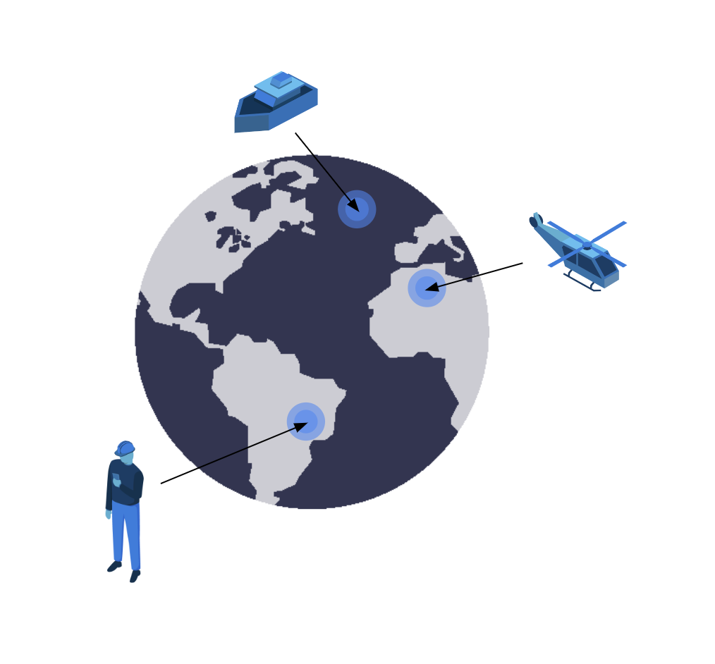
Before determining the asset tracking device required, it’s crucial to understand what needs to be achieved by the tracking solution. Considering the types of assets that need to be tracked – such as vessels at sea, a remote workforce, or aircraft – the geographical areas the assets will be located in, and the level of tracking accuracy required are just three considerations to make.
Another crucial factor to consider is the level of tracking accuracy required. Some applications demand real-time and precise location updates, such as high-value shipments or sensitive equipment. In such cases, a device that offers high accuracy and frequent data transmission will be essential. On the other hand, if periodic location updates are sufficient, a device with longer battery life and less frequent data transmission would be more suitable.
2. Evaluate coverage options
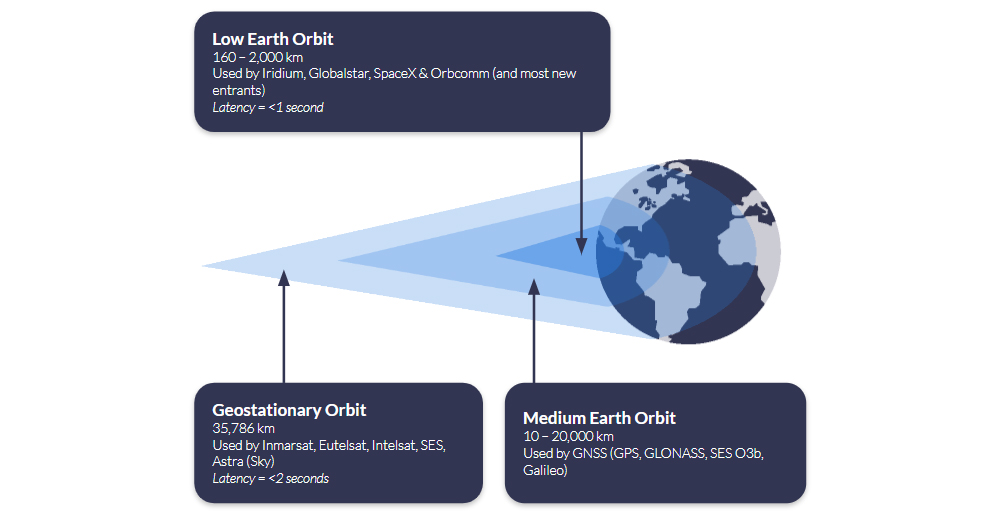
Armed with a clear view of your essential requirements, your next consideration when choosing a satellite asset tracking device is coverage. A satellite network operator’s coverage depends on the number of satellites they have in orbit, and the height of those satellites relative to the Earth.
It’s certainly not the case that all satellite operators offer 100% global coverage, and you should check carefully to ensure that the tracking device you’re looking at has good, stable coverage in every region your asset operates in.
Iridium offers complete global coverage; Viasat covers most of the globe, but service degrades towards the polar regions. Globalstar works well in the Americas, Western Europe and much of the Asia-Pacific region.
Use our coverage maps to view the different satellite networks and select a network that ensures seamless connectivity for your assets, regardless of their location.
3. Battery life and power management
Many tracking devices use your vehicle’s electrical system as their principle power source, connected via 9-30v input or USB; cars, trucks, boats, aircraft etc. If this applies to you, you’ll have a wide choice of devices and don’t need to be particularly concerned with the power draw, even if you’re transmitting a location signal very regularly.
However, for assets that have limited access to power sources, extended battery life is essential. Satellite asset trackers consume power to transmit location data, and their battery life can vary significantly depending on the device and usage frequency. If real-time tracking and monitoring are required, buyers should opt for devices with longer battery lives, solar power options or power-saving features. Alternatively, if reporting only on exception or low-frequency updates is sufficient, there are tracking devices available with extended battery life lasting weeks or even months.

4. Data accuracy, speed and management
It goes without saying that frequent and fast data transmission enables more precise asset tracking. Knowing the location and status of your assets in close to real time helps you make informed decisions, optimize logistics, and provide reliable information to customers or stakeholders. That said, data points always require context to be meaningful.
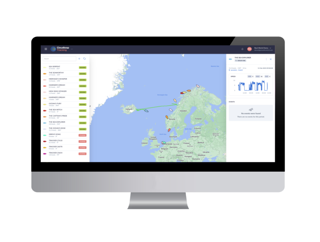
So, a robust satellite asset tracking solution should not only provide accurate, real-time location information but also deliver data management capabilities. Cloudloop is Ground Control’s cloud-based platform for subscription and device management, and, new for 2023, device tracking. There are a number of key tracking features of the platform, including:
- Real-time visibility of your assets, with multiple mapping options
- View the location, speed and heading of your assets, wherever they are on the planet
- Instant notifications of driver-issued alerts
- Historical position reporting and device events.
5. Cost and scalability
As well as the upfront costs, when selecting a tracker, it’s important to consider ongoing airtime and/or service charges. There are various pricing models available, from pay-as-you-go where you top up your device’s airtime as needed; monthly fixed payments based on your estimated usage; or post-pay invoicing based on actual usage (note: while this sounds appealing, they’re often more expensive than having a monthly fixed payment).
You can also pay per asset, or in some cases, use ‘pooled’ data so that all assets are drawing from the same data allowance (this gives you flexibility if assets’ tracking requirements change week on week, or month on month, while still having a fixed monthly payment).
Ground Control offers very flexible pricing models, and is competitive on airtime too. Our most popular tracking airtime services include Iridium Short Burst Data (SBD) and Viasat IoT Pro.
Ready to select your asset tracking device?
Having partnered with satellite network providers such as Iridium and Inmarsat for well over a decade, we have access to competitively priced tariffs, and can also be very flexible in terms of bundled data – saving you money.
So if you are working on upgrading your existing solution, or tracking your assets for the first time and would like some no pressure, objective advice, simply fill in the form and one of our expert team will get back to you.
Satellite IoT use cases: truly global connectivity for real world applications
Satellite IoT is growing in popularity, providing reliable connectivity to remote locations that would otherwise be challenging or even impossible to reach with terrestrial networks. As the world becomes more connected, the demand for real-time data from even the most remote locations has increased. Satellite IoT provides the solution to this need by offering truly global connectivity for real-world applications.
Satellite IoT is being used in a variety of industries, including healthcare, agriculture, workforce safety, and more. Let’s dive into just some of the most prominent use cases for satellite IoT…
1: Healthcare
IoT has revolutionised the healthcare industry by providing innovative solutions to improve patient care, reduce costs, and increase efficiency. IoT in healthcare refers to the use of connected devices, sensors, and data analytics to collect and analyse patient health data in real-time. This could include remote patient monitoring, smart medical devices and wearable technology like fitness trackers and smart watches.
Satellite IoT can also facilitate medical and healthcare accessibility to patients in remote areas who are unable to travel. For example, utilising the RockBLOCK 9603 technology, satellite IoT has enabled the transportation and delivery of emergency and essential medical supplies to vulnerable people who are at high risk if they travel.
Read Healthcare By Drone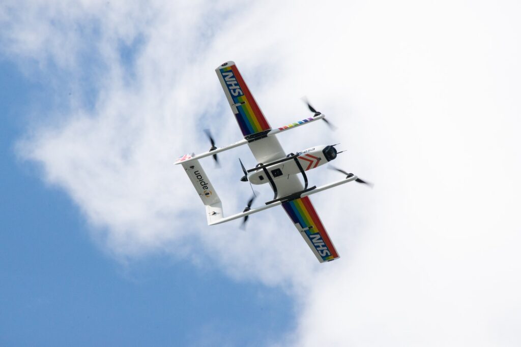
2: Agriculture
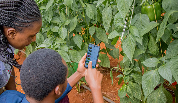
The agriculture industry is utilising satellite IoT to enhance productivity and lower expenses. By monitoring soil moisture, temperature, and other environmental factors, farmers can optimise their crop yield and reduce waste. This is sometimes referred to as Smart Farming. Satellite IoT can also be used to track livestock and monitor their health – improving overall animal welfare and reducing losses.
COSMOS-UK has installed Viasat IoT Pro terminals at remote soil moisture monitoring locations, to help combat climate change. The soil moisture data intelligence delivered by the Hughes 9502 specifically, to agricultural and environmental scientists, has the potential to transform the way we understand and model the natural environment.
Furthermore, satellite IoT has supported Synnefa in Kenya, to operate outside of terrestrial infrastructure by transmitting sensor data to enable smarter predictions for optimum harvesting times. The introduction of precision farming has been so successful, Synnefa has been able to help farmers:
- Save water by over 50%
- Reduce fertiliser application rates by 41%
- Increase production by 30% when compared to yields prior to the use of their devices.
3: Asset Tracking and Monitoring
Tracking and managing assets in real-time, providing valuable data on asset location at any given time is made possible with IoT technology. With satellite-enabled tracking devices, businesses can keep track of their assets no matter where they are in the world, even in the most remote locations. But here, it’s not just vessels, wind turbines and remote workers who can be tracked – animals can be too!
Illegal poaching is a big problem in Gabon, Africa. RockREMOTE with IMT enablement has equipped the rangers in Gabon with the latest in AI-powered camera trap technology to effectively monitor and prevent illegal poaching in the forest. With this advanced technology, endangered African species and iconic African wildlife have greater protection from poachers for this generation and the next.
Read More About Poaching in Gabon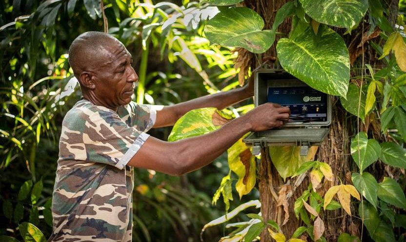
4: Workforce and Personnel Safety
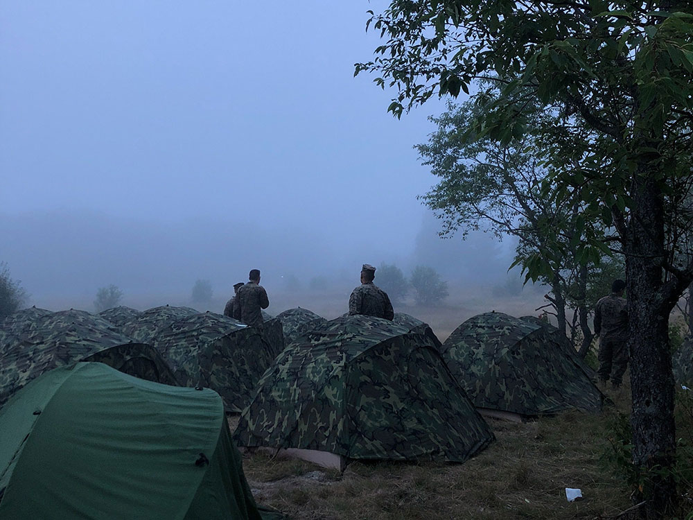
Satellite IoT can be harnessed to monitor the safety of lone or remote workers in hazardous environments. By providing real-time alerts in the event of an incident or emergency, companies can respond quickly and potentially save lives. For example, workers in mining or oil and gas operations can wear wearable devices that monitor their location and vital signs, alerting supervisors in the event of an accident or injury. In addition, monitoring remote military personnel and natural disaster response teams is critical to their safety and well-being.
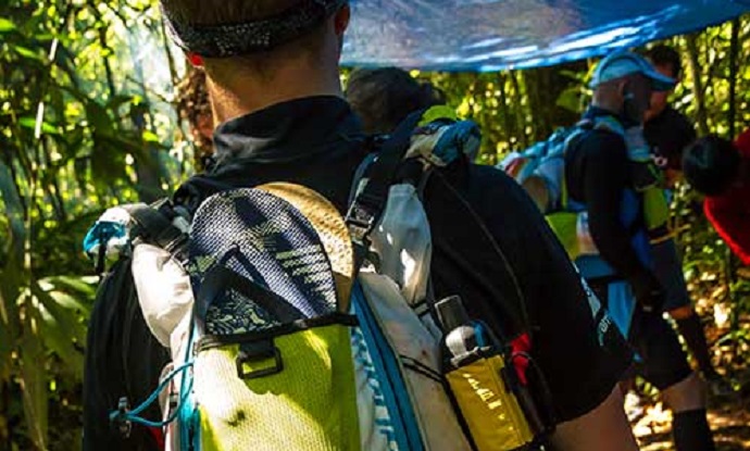
For example, the RockSTAR device has been used by the Ministry of Defence in their training. The RockSTAR was paired with bluetooth heart rate monitors, meaning biometrics could be monitored throughout with the added benefit of worldwide tracking and two-way communications. As well as critical monitoring, satellite IoT can also be leveraged for more leisure-based tracking and monitoring applications – including ultra-marathon runners via the RockSTAR tracking and two-way communications device.
See Tracking in Action5: Energy and Renewables
The energy sector is also seeing the benefits of satellite IoT. The technology enables remote monitoring of renewable energy infrastructure in real-time, allowing for early identification of any faults or issues, thus preventing downtime and maximising energy output. The performance of renewable energy assets is also optimised by collecting and analysing data on weather patterns, energy production, and equipment performance. This data can be used to improve efficiency, reduce costs, and even enhance the lifespan of renewable energy assets.
With five hydroelectric power stations in Snowdonia, North Wales, RWE maximises its renewable energy output from the reservoirs with a remote IoT solution – the Hughes 9502.
Read About Facilitating Renewable Energy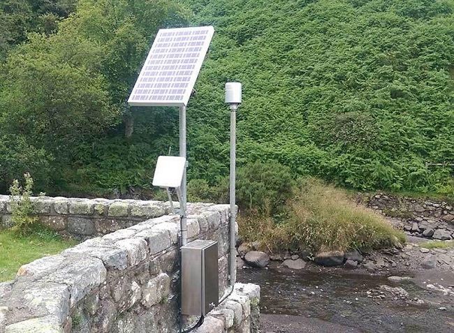
Satellite IoT vs. Traditional Cellular Networks
While traditional cellular networks are sufficient for many use cases, they have limitations when it comes to remote locations.
One of the biggest advantages of satellite IoT is that it provides truly global connectivity, even in the most remote and inaccessible locations. Unlike traditional cellular or Wi-Fi networks, satellite signals can reach anywhere on the planet, making it ideal for industries where assets are remote or located in harsh environments.
With satellite IoT, data can be transmitted from quite literally anywhere in the world, making it ideal for applications where cellular coverage is limited or even non-existent. Satellite IoT is also more reliable than cellular networks in many cases, as it is resilient to interference or disruption from extreme weather events.
However, it’s not necessary to choose either terrestrial or satellite connectivity. Satellite networks can be deployed quickly and easily, using the same messaging protocols as terrestrial networks, allowing businesses to scale their operations up or down as needed without having to worry about the limitations of traditional networks. What’s more, for businesses and industries that require global connectivity, the cost of deploying and maintaining satellite IoT devices can often be less expensive than building and maintaining traditional terrestrial networks from scratch. It can also be cheaper than deploying remote field engineers to remote sites.
In Summary…
Satellite IoT provides reliable connectivity to remote locations; bridging the connectivity gap that would otherwise be difficult or impossible to achieve with traditional cellular networks alone.
From reliable communication to real-time data collection and analysis, satellite IoT is changing the game for businesses and entire industries that need to stay connected no matter where their assets are located. Furthermore, as satellite technology continues to evolve and become more affordable, we can expect to see even more innovative use cases emerge in the coming years.
Unlock the Full Potential of Your IoT Project
Incorporating satellite IoT into your existing business operations can revolutionise what you can achieve. With satellite IoT, you can access data and insights that were previously unavailable or difficult to obtain with traditional networks and connectivity options.
Contact us to discover the added value of satellite IoT to your business today. We’re here to help and provide solutions to your connectivity challenges.
How RockSTARs Are Being Used to Keep Remote Personnel Safe
Most of us are familiar with the limitations of terrestrial networks. However, for those working as a field engineer or as part of an expedition team; who have been a competitor in a yacht race or taken part in military training; you’ll also know how important it is to overcome this limitation. Cellular connectivity only covers 15% of the globe and there are many reasons why someone may take the roads less travelled. For the purpose of this blog, the term remote personnel refers to anyone travelling outside cellular coverage regularly, or for an extended period of time – be that for work or leisure.
For both safety and well-being, it’s essential that remote personnel have access to two-way communication that functions both in and out of cellular range. Determining a tracking and communication plan will reduce the chance of accidents and ensure swift response times in the case of an emergency; and by encouraging the use of two-way notifications and alerts, deliver peace of mind. This is where Ground Control’s RockSTAR device can help.
Introducing the RockSTAR
The RockSTAR is a lightweight, rugged, handheld device that can be used to send and receive short messages (like SMS and short emails) and track GPS location, through the Iridium satellite network and back to Earth. Simply, if the unit has a clear view of the sky, it’ll deliver two-way communications and virtually real-time tracking, anywhere and everywhere.
How do RockSTAR devices work?
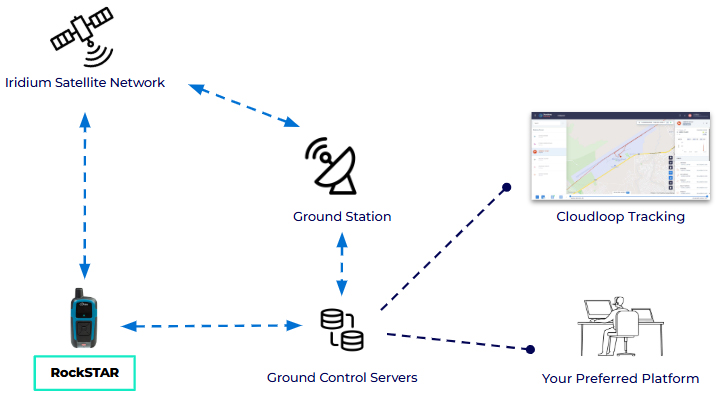
Each RockSTAR unit houses an Iridium 9602 modem. This modem allows the device to leverage the Iridium Satellite network – using the ‘short burst data’ (SBD) service, to support location and messaging data transmission.
The RockSTAR can be set to ‘wake up’ and transmit your location anywhere between 15 seconds and once a day. It’ll obtain a position using the GPS satellite network, and then transmit that position back to Ground Control HQ using the Iridium satellite network. In 1-2 seconds, the position can then be visualised on our easy-to-use web-based system or automatically set up to relay this information direct to your application.
For example, if you’re a field technician working in a remote area, location data can be sent direct to whichever security tracking application your employer is using. What’s more, RockSTAR units have a great battery life. Even transmitting location data every 15 minutes, a device will last 3 weeks between charges.
In addition to SBD being relatively low cost, there are no annual contracts, delivering flexibility for those who only require a satellite device like the RockSTAR for a specific trip or project. In short, if you or your team don’t need to use a device for a month or more, there won’t be any monthly fee, simply pay ‘per month, per device’.
Additional RockSTAR features
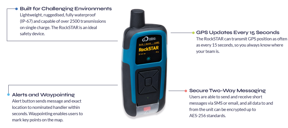
Designed and built in the UK, the RockSTAR satellite device has also evolved throughout the years to better meet customer needs. The form factor has noticeably contracted, with the current device standing at just 144mm; other developments have helped create a feature-packed handheld unit.
RockSTAR units can be used to send and receive short messages, including SMS and short emails to nominated groups. Groups are created and amended in the device’s settings and can include mobile phone numbers, email addresses and servers. Using the device itself, you can send pre-set messages or free text; the RockSTAR can also be paired with a mobile or tablet via bluetooth, enabling truly global two-way communications.
The RockSTAR unit is configured with a number of alert options; for full details please see our article on RockSTAR alerts. All six device buttons can be activated by a user in gloves and the main SOS function is initiated via the button at the bottom of the device. When pressed, the unit immediately transmits your location and pre-set emergency message to those nominated within the device’s first-responder group.
The RockSTAR unit can also be used for waypointing, so key points of interest or concern (in the case of wildland firefighting) can be marked while you’re out in the field, and then viewed on our web-based system.
Common RockSTAR applications
Because the RockSTAR device is ruggedized and waterproof, with a great battery life, the applications are vast. Our RockSTAR customers aren’t just worldwide, they’re travelling by land, air and sea. Operating in some of the most remote and harsh environments on Earth. To demonstrate this range, we’ve collated some of the most common remote personnel use cases supported by our RockSTAR devices today.
MILITARY EXERCISE MONITORING
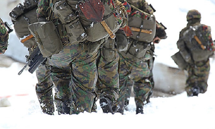
Military training exercises are often held in remote locations, under challenging conditions. This can place significant strain on soldiers, thus tracking services are often employed for peace of mind and if needed, timely, mission-critical response. Ground Control worked in partnership with JCSys to tailor the RockSTAR hardware and firmware to meet the very specific and stringent requirements of the UK’s Ministry of Defence. The result? A compact and durable device able to track soldiers in all weather and military attire, and pair with BLE heart rate monitors. Additionally, developer-friendly APIs meant JCSys were able to securely receive telemetry data and add the required context to support a safe training environment.
TRACKING ANTARCTIC EXPLORERS & RESEARCHERS
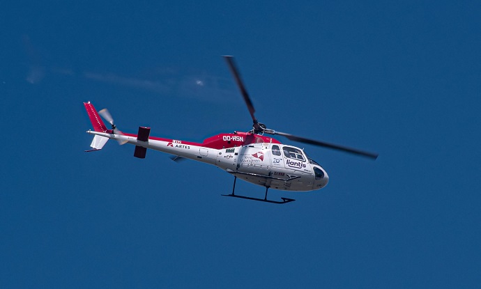
RockSTAR devices are ideal for use in extreme environments where wifi or cellular coverage isn’t widely available. As well as being waterproof, units can operate in temperatures between -30 to 60 degrees Celsius and be operated by users in gloves. What’s more, currently Iridium is the only network able to offer truly global coverage – including both poles. We’re proud to have supported both researchers and explorers on multiple Antarctic trips, and our RockSTAR devices have even been used to monitor icebergs across Northern Canada.
SUPPORTING RURAL-BASED POLICE OFFICERS
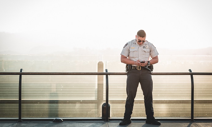
It is the duty of all law enforcement to “protect life and property through the enforcement of laws and regulations”. This includes serving those in rural-based communities, where cellular coverage may not be available, or intermittent. As all data to and from RockSTAR units can be encrypted up to AES-256 standards, the RockSTAR can be a great, relatively inexpensive solution for two-way communications. We’ve worked with various police units and law enforcement rangers, ensuring personnel maintain connected and tracked at all times.
SAFEGUARDING REMOTE MEDICAL WORKERS
It’s essential that when medical personnel are caring for patients in remote areas, they can be reliably tracked and monitored. To ensure their safety, devices which are lightweight and discreet, with a long battery life are essential. Many security firms have specific applications for remote and lone worker safety, that can be utilised alongside devices such as the RockSTAR to provide a complete, secure solution. We have worked with many companies, creating/enabling specific alert criteria via our RockSTAR devices, even simplifying our menu to ensure it’s as easy as possible for users to access key functions.
What sets the RockSTAR apart from other satellite devices?

Flexible, Secure APIs
We understand many customers will have their own remote worker and/or security applications – so we make getting that data easy. All data to and from the unit can be encrypted up to AES-256 standards, but we’re still able to give customers access to some of the lowest lines of code. This ensures all data transmissions are available in the required format, without compromising security.
Truly Ruggedized
The RockSTAR has been built to withstand the most challenging environments. Tried and tested everyday, everywhere from the Antarctic to the Australian desert, the Pacific Ocean to Rocky Mountains in North America. The device has a number of certifications including FCC and CE MIL-810 F/G for ruggedness, and is waterproof to IP-67.

Customization Opportunities
As manufacturers we have the flexibility to customise the device on larger orders. These ensure the RockSTAR is the best fit for our client’s project. They also enrich the device’s functionality for future users. For example, when working with JCSys, to better safeguard soldiers in the UK, RockSTARs were adapted to disable switch off without a PIN code.
GPS Tracking for Teams
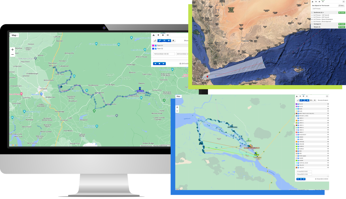
Whether you and your team have one RockSTAR or 1,000, Ground Control’s easy-to-use web platform simplifies device management. From the platform, you can track all of your field workers’ positions simultaneously, both in real-time and across set periods of time.
Users can divide devices into relevant groups and set up multiple platform users with differing permissions. For example, some team members may only need to ‘view’ RockSTAR positions, while others could be allowed to send commands and configure devices in the field.
Within the platform users are also able to:
- Add line rental and credits
- Monitor alerts from all devices
- Set up relevant geofences, ensuring teams receive early warning if a device enters/exits specified areas.
If you’re interested in learning more about the RockSTAR device and how units are supporting remote personnel with ubiquitous connectivity, take a look at our related content: RockSTAR Alerts | Case study – RockSTAR Provides Vital Tracking Telemetry for Soldiers and Ultra Runners | RockSTAR Used in Iridium Certus Demo.
Likewise, if you have any queries you’d like to discuss with our team, simply fill in the contact form below.
Got questions?
Ground Control’s RockSTAR device helps deliver peace of mind to anyone working or travelling within remote locations – unit’s have literally saved lives. From security personnel to armed forces, humanitarian aid workers to aviators, the RockSTAR might be just what you need.
For more information on how we can help solve your remote communication challenges and better safeguard you and your team, fill in the form and we’ll match your enquiry with one of our experts.
Six Ways Asset Tracking Can Help Reduce Costs and Wastage in the Supply Chain
According to the BSI and TT Club’s Cargo Theft Report 2021, the top countries for cargo theft are Brazil, India, Mexico, Germany, Russia and the United Kingdom. By far the most common form of theft is to hijack trucks or otherwise force entry into containers while in transit; at 71%, this eclipses thefts from facilities (25%).
Road freight crime cost the UK economy £250 million in 2020 – a 113% increase on 2018 data – and the UK also holds the dubious honour of hosting the largest theft in EMEA supply chains: £7.5m worth of computing equipment was stolen from a truck in Nuneaton in the West Midlands in March 2020.
In addition to theft, there is a growing problem of individuals stowing away in cargo shipments, which increases insurance costs, and can result in loss of goods. To round off our trifecta of supply chain issues, we have perishable goods failing to make it to their destination in a usable state – astonishingly, a third of all food produced globally is lost or wasted, largely due to temperature sensitivity (accounting for half of all food waste).
Six ways asset tracking can help reduce costs and wastage in the supply chain
- Cargo theft is being effectively prevented by having IoT-enabled locks that send alerts if they’re tampered with by unauthorised people. Couple this with ubiquitous coverage provided by hybrid cellular / satellite services, and you can act in real-time to reduce theft.
- The same technology can prevent unwanted passengers, whose presence not only compromises the shipment integrity, but also increases your insurance premiums (not to mention rarely being a safe means of transport for the stowaway).
- By giving your drivers a means of contact with the outside world, even when out of mobile phone range, you can improve their personal safety and morale. And tracking their location gives reassurance that the goods will be delivered when intended, which means that the recipient can plan around the estimated delivery time with confidence.
- By measuring the condition of your assets (such as perishables), and being able to act on, for example, an unexpected temperature change in a refrigerated unit, you can reduce the chances of spoiled goods on arrival, saving costs and improving sustainability.
- Either by aggregating route data over time, or by layering real-time traffic and weather data over your truck, train or ship’s trajectory, you can perform route optimisation, lowering fuel costs and improving driver safety.
- Sensor data can easily measure wear and tear; by alerting fleet managers to any issues before they become crises, you can lower costs and improve driver safety, as well as avoiding costly and reputation damaging delays.
What technologies should you consider for your asset tracking requirements?
There are two considerations: firstly, how will you gather your sensor data from multiple different units (e.g. containers) in a cost-effective, low maintenance, secure and reliable way? Secondly, once you have that data, how will you transmit it to your base of operations so it can be acted upon?
In terms of gathering sensor data, this is where LPWAN (low-power wide area network) technology comes into its own. Created for IoT networks, LPWANs combine great power efficiency, low operating costs, and the ability to manage a large number of connected devices over a wide area. Most have a star topology – each sensor or node is connected to a central gateway. Here’s an excellent explanation of LPWAN technology and the major players in this space.
The gateway, or hub, typically has some edge processing capabilities, so it can recognise when data points have fallen out of pre-set parameters, and can then report on exception, rather than sending a continuous stream of data. This is useful for smart locks or temperature sensors, where you don’t necessarily need to provide an update if nothing has changed.
Then it’s a question of getting that data back to you. If your asset is within range of a mobile phone mast, a cellular transmitter will be your first choice of data retrieval. It’s low cost, relatively low power, reliable and well understood. Plus, the challenges of moving between mobile network operators (MNOs) as your asset moves from country to country have been largely overcome.
One solution is eSIMs: this technology allows you to host multiple “profiles” (i.e. MNOs) on a single SIM card. Another solution is working with a provider such as Telit, who have global IoT data plans, and manage this complexity for you.
If your asset is going to travel outside of cellular coverage, you have two choices: firstly, you can wait until your tracker reconnects to the next available mobile phone mast, which is probably OK if the black spot is just a few minutes. Secondly, you can failover to satellite connectivity.
Considerations for satellite asset tracking
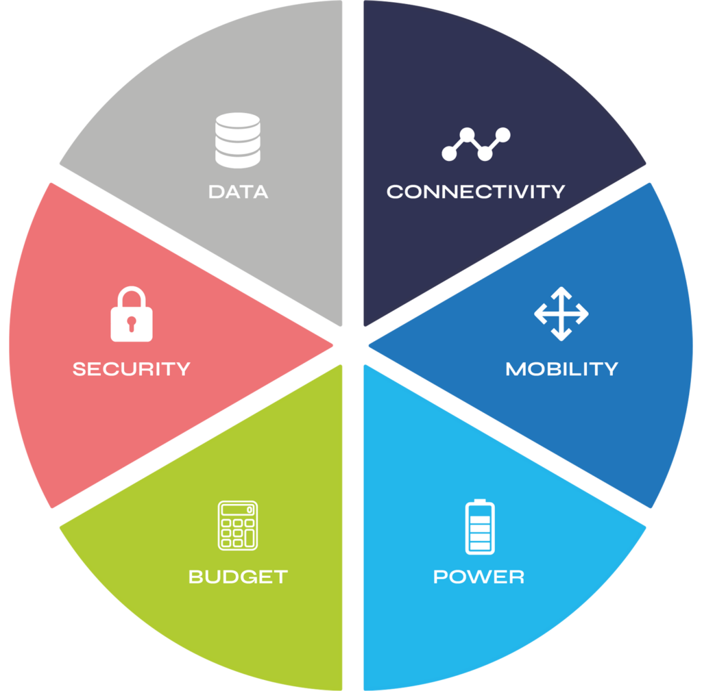
Data: satellite is more expensive than cellular, so it makes sense to optimise your data transmissions – this will also extend the battery life of your device, if it is battery-powered. Reporting on exception, or using a messaging protocol like MQTT, are increasingly common best practices.
Security: when it comes to sending data to the satellite, and from the satellite to the ground station, this is very secure and hard to intercept. Next, you must get your data from the ground station to your application server. Most companies use the internet for data backhaul and protect their asset by VPN, or a dedicated circuit. Our blog post on ‘How to Improve Satellite IoT Network Security‘ is worth a read for more information on this topic.
The security of the physical asset – the transceiver – is also important, and so look for a ruggedised, small form factor device that can be easily concealed, and will stand up to all manner of weather conditions.
Budget: as your asset will likely be moving in and out of cellular coverage, choose a device that seamlessly switches between cellular and satellite, such as the RockFLEET, choosing the lowest cost routing. This, along with data optimisation and the appropriate choice of airtime, will keep your costs down.
Power: asset tracking devices are by design not power hungry. There are battery and solar powered options if there is no mains power available; as an example, a company we work with on endangered species preservation builds a satellite transceiver into animal tracking collars, which then typically last around 3 years on a single charge.
Mobility: in this use case you are expecting the asset to move; that means you either need a device that auto-points itself at a satellite in geostationary orbit, or use a device that connects with satellite constellations in low earth orbit (LEO). The latter is often a better choice for land freight as it is easier for LEO devices to find a signal when passing through wooded or hilly territory.
Connectivity: Make sure you’re using the appropriate airtime for your needs. Satellite connectivity has diversified a great deal, so don’t pay for broadband when you only need event driven messaging like Iridium’s Short Burst Data, or Viasat’s IsatData Pro.
Get in touch
If you’d like expert guidance on your asset tracking needs, please get in touch by completing this form or emailing hello@groundcontrol.com.
With over 20 years’ experience, we are well placed to advise you on the best hardware and airtime to meet your specifications.
Lone worker safety: a snapshot of operations in North America
In its most basic term, lone workers are defined as employees who perform an activity in isolation from other workers, without close or direct supervision. Working in numerous industries, there are an estimated 53 million lone workers across the globe, with almost half (25 million) operating within North America.
In addition to safety concerns faced by lone workers simply as a result of being alone, many also work in remote areas. Communication plans and tracking can reduce the chance of accidents when lone working and ensure swift response times in the case of an emergency. While there are regulatory and contractual standards in place for lone workers, procedures surrounding lone worker safety are very much evolving.
With rapidly changing needs and increasingly challenging environments, it’s imperative organisations continually evaluate their strategies, hardware and software to ensure they are able to maintain worker safety and operational efficiency.
To better understand how lone workers in North America currently remain safe and connected when out of cellular range, Ground Control in partnership with TracPlus, surveyed almost 250 lone workers and individuals responsible for the safety and supervision of lone workers.
Lone worker operations in North America today
How often do lone workers travel out of mobile phone range?
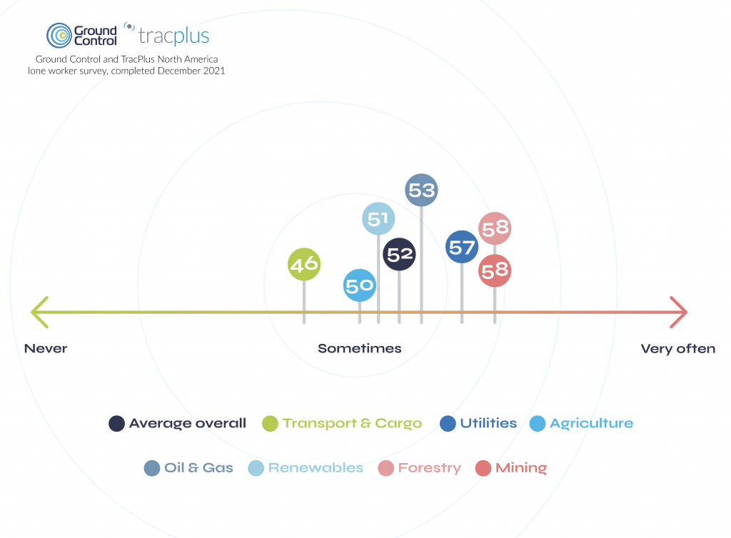
Lone workers and lone worker supervisors were asked to indicate on a scale from 0 – 100, whether they ever travelled out of mobile phone range. As can be seen in the above graph, on average, lone workers sometimes travel out of mobile phone range. It’s also worth noting that lone workers actually responded with a lower than average figure than those responsible for them (52 vs 58).
Our data also indicates that 10% of respondents are quite often out of mobile phone range, as these reported a figure of 75 or above.
When analysing the data grouped by industry, recipients from the Mining, Forestry and Utilities sectors provided the highest average scores, and those within Transport & Cargo, the lowest. This indicates that those working within Mining, Forestry and Utilities, are more likely to travel out of mobile phone range than those in the Transport & Cargo sector.
How many lone workers have experienced the following situations?
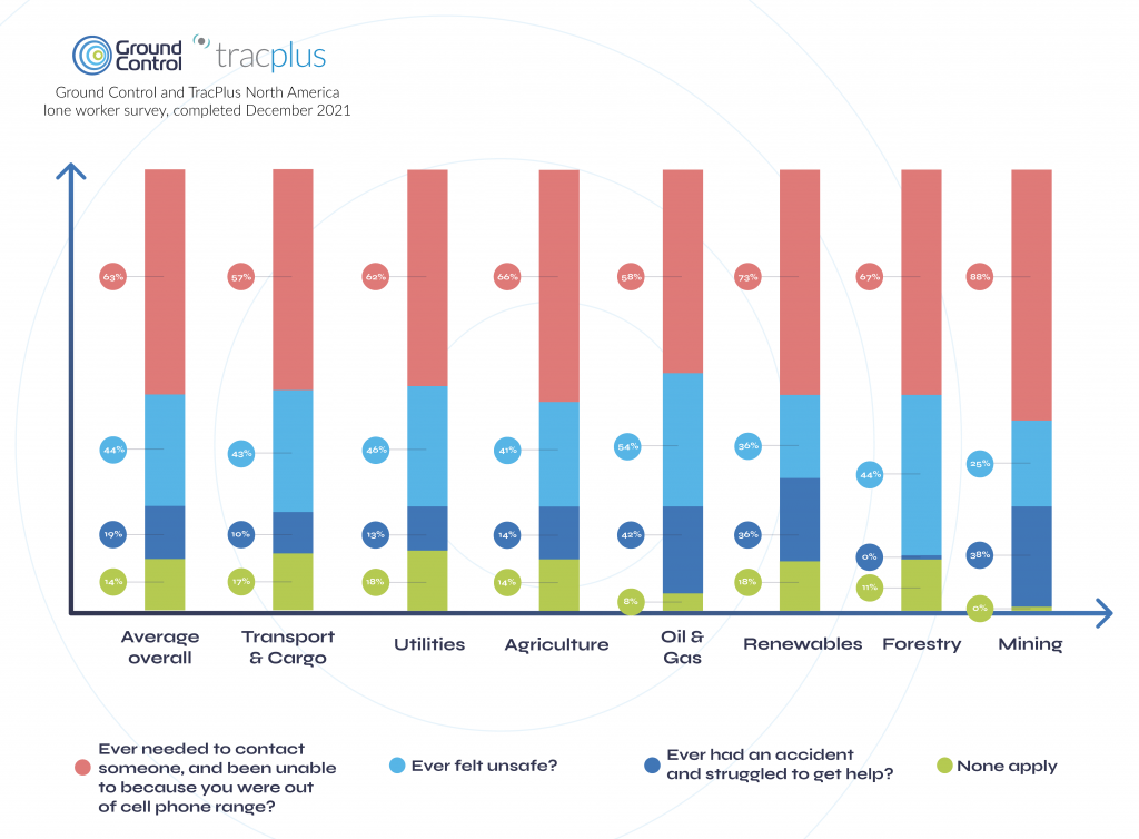
Results show over 60% of lone workers surveyed have been in a situation where they have needed to contact someone and were unable to, due to lack of mobile phone reception. Comparatively, for those within the Mining and Renewables industries, this figure rose to 88% and 73% respectively.
Further, almost one fifth (19%) of those surveyed reported having an accident, and struggling to get help. Encouragingly, none of the lone workers from the Forestry sector indicated having an accident when lone working, but this increased to over 40% within the Oil and Gas industry. Subsequently, workers within Oil and Gas were also most likely to report having felt unsafe (54%); 10% above the overall average.
How frequently do those responsible for lone workers check in with them?
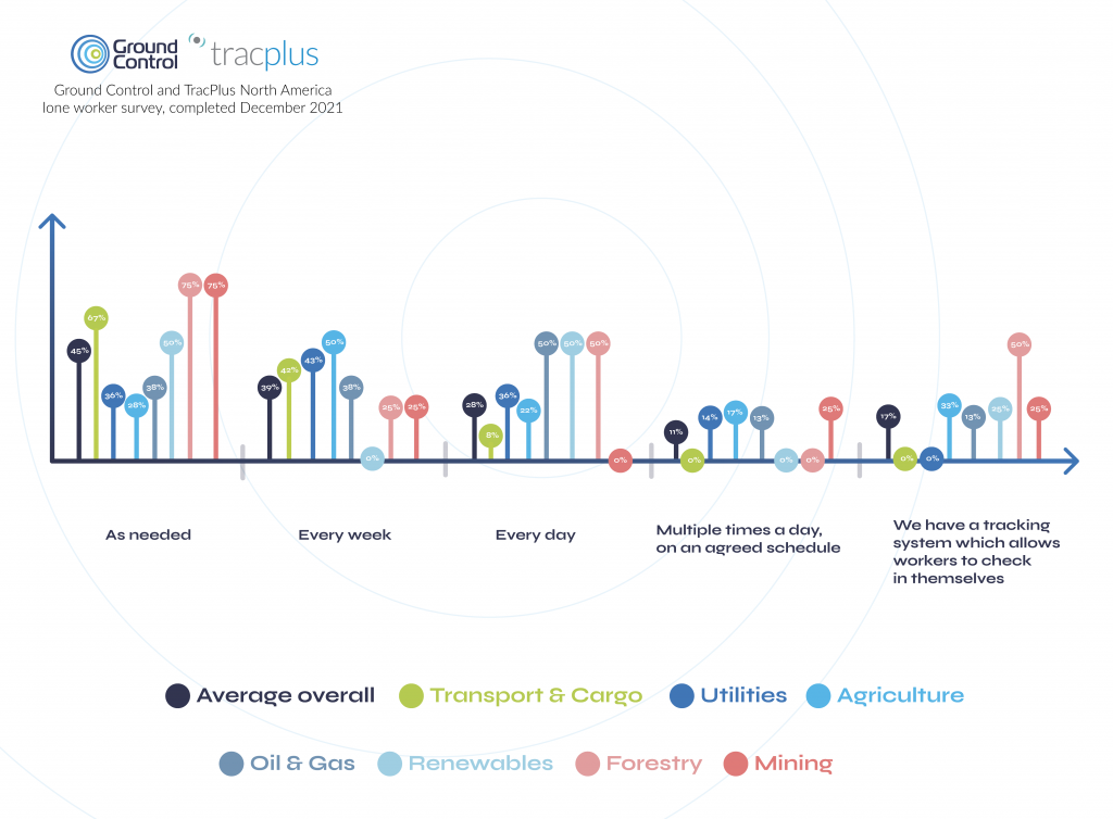
Overall 28% of respondents reported daily check-ins with their lone workers, 39% weekly and 45% as needed on a demand basis. Just 17% confirmed having a tracking system which allows lone workers to check in themselves, and over 10% disclosed checking in multiple times per day.
Interestingly, those within the Forestry sector were most likely to report more frequent check-ins – 75% indicating as needed and 50% every day. Additionally, 50% of those within Forestry also confirmed having a tracking system whereby their workers could check themselves in. This is particularly significant, considering the overall average reported was just 17%. In contrast, none of the respondents within the Transport & Cargo nor Utilities industries, indicated having a tracking system lone workers could use. Given the operational efficiency benefits these types of systems can deliver, this is quite surprising.
How robust are current lone worker communication strategies?
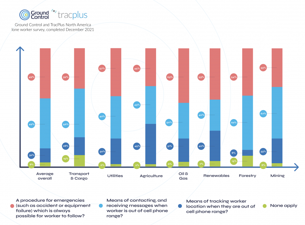
As illustrated above, only 49% of respondents reported having the ability to both send and receive messages while lone workers were out of mobile phone range. This figure remained the same when recipients were asked whether they had a procedure which could always be followed (even if there had been an accident or equipment failure), that enabled messages to be sent and received without mobile phone reception. Interestingly for those within the Mining industry, despite 67% reporting the ability to send and receive messages while out of mobile range, just 33% confirmed the ability to do this under all circumstances, for example in the event of an accident or equipment failure.
Additionally, less than one third (32%) of respondents overall confirmed they were able to track the location of a lone worker out of mobile phone range. This fell to just 8% in the Forestry industry.
Finally, 8% of respondents overall and 15% of those within the Transport & Cargo and Forestry sectors, indicated that they were unable to support any of these communication scenarios.
In summary, although our research represents just a snapshot of lone worker operations in North America, it does highlight that organisations still have some way to go in terms of safeguarding lone workers; a sentiment which holds true across all surveyed industries.
The future of lone worker safety: The RockSTAR
Communication plans and tracking are imperative to lone worker safety and increasing operational efficiency. With this in mind, it would be remiss of us to not talk about the RockSTAR device by Rock Seven (now trading as Ground Control). This powerful, handheld device allows the user to send and receive short messages from anywhere on Earth with a clear view of the sky. The unit is waterproof, ruggedized, and built to withstand the most challenging environments. And perhaps most importantly, the RockSTAR is able to transmit every minute with 15-second updates, ensuring teams know the whereabouts and safety of their lone workers at all times.
What is TracPlus?
TracPlus is a trusted real-time tracking and communication platform of first responders, government agencies, militaries, and other critical operators around the world. It has been developed to deliver situational awareness to first responders, irrespective of who owns the asset, what the asset is, who provides the tracking, or what the platform or signal type is – be it radio, cellular or satellite.
Get in touch
Ground Control and TracPlus have worked in partnership for over eight years, developing essential, cost-effective solutions for organisations and their remote field workers all over the world.
If you’d like to get in touch with our expert team, simply complete our online form, or you can email sales@groundcontrol.com or phone us on +1.805.783.4600 (USA) or +44 (0) 1452 751940 (UK).
Far-Sighted Satellite Solutions for Constant Connectivity
We can now establish optimal communications to and from even the most inaccessible areas on land, on sea and in the skies, while contributing directly to the reduction of international carbon emissions.
Spearheading this momentous and necessary step change is Iridium, proudly designating itself as ‘the only truly global communications network’. Iridium’s Global Line of Sight programme is currently emphasising the versatility, efficiency and practicality of its satellite services with regard to unmanned aircraft systems, drones and other autonomous or remotely-piloted vehicles; and this initiative is, in turn, enthusiastically supported by Rock Seven (now trading as Ground Control), with integral products such as its RockBLOCK plug-and-play satellite communication solution.
RockBLOCK units are indispensable Internet of Things (IoT) devices, enabling all manner of autonomous assets to transmit Short Burst Data (SBD) messages between the equipment and centralised host computer systems. The range encompasses the RockBLOCK 9602 and the more compact RockBLOCK 9603, chiefly intended for use in contexts such as system integration or product development where space within an enclosure might be limited. Hosting an Iridium SBD modem, RockBLOCK effortlessly overcomes the limitations of Wi-Fi and GSM networks, and is capable of sending and receiving short messages from literally anywhere on Earth with a view of the sky.
RockBLOCK’s value to sectors such as Search & Rescue, ISR (Intelligence, Surveillance, Reconnaissance), Environmental Monitoring and Disaster Assessment, where rapid and reliable messaging is of the essence, is demonstrable. Here are some examples of the RockBLOCK in action.
Iridium Edge Solar
In addition to the RockBLOCK, Ground Control’s plug-and-play product range features a variety of other tracking and communications solutions, using the Iridium network, to enable data transfer to and from hitherto inaccessible areas. These include the RockSTAR two-way messenger, the RockFLEET global tracking device to drive efficiencies in fleet management, and the RockAIR tracking and messaging device, designed for easy mounting on the dashboard of light aircraft and vehicles.
In a meaningful new development, it was announced at the tail end of 2019 that Rock Seven (now trading as Ground Control) has been nominated as the beta partner for the new, solar-powered and competitively-priced Iridium Edge Solar tracking device, which is scheduled for launch in 2020. Offering easy wireless installation and an autonomous tracking facility, the set-and-forget Iridium Edge Solar is perfect for users requiring a simple, economical but completely reliable SBD tracking device supplying pole-to-pole connectivity.
Wingcopter
Wingcopter’s lightweight but robust VTOL drones are transforming processes and practices for customers in a broad variety of contexts – anything from the transportation of medical or aid supplies and the inspection of large-scale infrastructure, to forestry mapping and the creation of logistics chains to and from remote locations.
Wingcopter has been equipping its drones with RockBLOCK units. With their unprecedented range and speed, the VTOL drones are capable of flying into environments and territories with limited or zero GSM coverage, and the RockBLOCK’s ability to send and receive data from such locations means that users can reliably track a drone’s flight status with ease from their tablet or computer, regardless of the VTOL’s whereabouts.
RockBLOCK at High Altitudes
RockBLOCK units have also been fundamental components in esoteric, questing enterprises such as the LOHAN (Low-Orbit Helium-Assisted Navigator) spaceplane project, enacted by the Special Projects Bureau from the science and technology website The Register, aided by a team of volunteers. The project’s aim was to deploy a single meteorological balloon to raise the 3D-printed spaceplane to altitude – the rim of space – then release the craft and glide it back to a designated landing site using a combination of GPS and autopilot control.
The RockBLOCK proved indispensable as a means of transmitting GPS data and receiving ground commands when the LOHAN unit rose out of GRPS coverage range. Furthermore, a stipulation of the project was that an emergency mission abort protocol needed to be implemented in the event of the unit veering off course. Had this occurred, a message would have been communicated to the RockBLOCK via Rock Seven’s API, which enables remote systems to interact with the firm’s products, and this would have triggered the spaceplane’s self-destruct mechanism.
A similarly lofty demonstration of the RockBLOCK’s capabilities took place when a team comprising Andrew Ashe, Jerry Sandys and Peter Gibbs sent a balloon to near space, using code developed by the eminent computer scientist and senior software engineer Mikal Hart. In this instance, the RockBLOCK was used to successfully allow the team to track the balloon throughout its flight, as well as enabling them to recover its payload when the high-altitude craft returned to Earth.
The Microtransat Challenge
Proving that RockBLOCK products are just as much at home afloat as in the sky, the Microtransat Challenge is a transatlantic race for autonomous boats; but the competitive element is, in a sense, an adjunct to its real objective, which is to encourage the development, construction and refinement of such vessels. Two teams involved in the challenge, representing Epsom College and Southampton University, are finding the RockBLOCK to be an ideal IoT solution.
Teams from Epsom College have participated in the 2016, 2018 and 2019 challenges with the boats That’ll Do, That’ll Do Two and EC-Crossing, and in each case, a RockBLOCK unit has been put to work transmitting detailed telemetry data from each vessel as they have attempted to cross the Atlantic. Once an hour, the RockBLOCK has relayed each boat’s latitude and longitude position as well as providing updates on battery voltages and temperature readings inside the electronics bays. The RockBLOCK is also capable of sending a Mayday alert should any water be detected in the hull. The RockBLOCK has enabled teams to forward vessel updates to a PHP script which places a position marker on a rolling map on the college’s website as well as updating Twitter and allowing data to be stored in a Structured Query Language (SQL) database.
Ship Science students from Southampton University, meanwhile, have applied themselves to the design and construction of an autonomous, solar-powered vessel named Peruagus. A radical departure from most craft that have undertaken the Microtransat Challenge in previous years, the sturdy, self-righting Peruagus exclusively draws upon sustainable solar energy for propulsion and rudder control, and its modular composition has been devised specifically to allow all manner of different weather monitoring apparatus, power systems and superstructure configurations to be installed. As with the Epsom College vessels, a RockBLOCK unit is a prerequisite for transmitting exhaustive telemetry data from the Peruagus while also enabling the autonomous boat to receive waypoint instructions.
SEASCAMS2
RockBLOCK units are also providing sterling service at the heart of the SEACAMS2 project, a £17m, three-year undertaking jointly conceived by the universities of Bangor and Swansea to assist research and applications for low-carbon, marine-renewable energy opportunities in the convergence regions of Wales. Environmental monitoring specialists OSIL (Ocean Scientific International Ltd) are closely involved with the project and have supplied a network of three data buoys, each of which has a RockBLOCK unit installed.
The function of the buoys is to support the sustainability aims of the project by collating water quality, meteorological and oceanographic data from the waters around the North Wales coast. To this end, each buoy is equipped with a dual telemetry system; and the RockBLOCK units are a prerequisite for conveying the crucial information collected by the buoys in dependable, unbroken SBD transmissions from remote sea areas beyond the range of GSM networks.
Read more about our work with OSIL and the SEACAMS2 project.
As commerce, society and the ecology come to rely more and more upon the exchange of real-time data we can trust, Rock Seven (now trading as Ground Control) is blazing a trail for 24-carat connectivity from all corners of the globe.
Get in touch
We’ve implemented satellite IoT infrastructure for decades, and there’s very rarely been an obstruction issue we couldn’t overcome with a bit of knowledge and ingenuity.
We’d be happy to talk to you about your project and offer impartial advice on the best antenna and satellite service for your particular requirements. Call or email us, or complete the form.
Pivotel Meets Tracking Regulations with RockFLEET
The proven RockFLEET global tracking and messaging system has been selected by Queensland Fisheries as an approved device within mandated schemes to install Vessel Monitoring System (VMS) on all commercial fishing boats in Queensland, Australia. Pivotel has also released the RockFLEET into New Zealand, fulfilling similar VMS regulations implemented by New Zealand’s Ministry of Primary Industry for a range of different fisheries.
Under the terms of the scheme in Queensland, all commercial fishing and charter boats will require a vessel tracking device to be fitted and operational by the end of 2020. Meanwhile, trawl, net, crab, and line boats already require VMS tracking to comply with regulation that came into effect on 1st January 2019.
New Zealand’s VMS regulation has undergone a staged implementation with initial vessels requiring compliance as of the 1st May 2019 with the final group of operators needing to be compliant by the 1st December 2019. Pivotel has found the versatility and configurability of the RockFLEET to be key in meeting the different tracking regulations of both markets.
The RockFLEET’s proven reliability ensures skippers can always meet tracking requirements under the scheme. The comparatively low initial hardware outlay and ongoing airtime costs makes the RockFLEET a competitively priced VMS solution. Its compact and lightweight design makes it easy to mount, and installation is made simple through its ability to wire the terminal directly to a battery. The global two-way communication ability, low cost of ownership and the reliability of the Iridium network gives clear advantages over alternative VMS options.
Ground Control has been working successfully in partnership with leading remote communication provider Pivotel to support the RockFLEET devices deployed with Queensland and New Zealand fishers. To date, over 700 RockFLEET units have been installed on Queensland and New Zealand fishing boats. With additional fisheries coming under regulation in 2020, Pivotel will continue to support regulatory compliance for fishers and expects the number of deployed RockFLEET’s to exceed 1,000 units by the end of 2020.
Leveraging Pivotel’s online tracking portal, Tracertrak, the RockFLEET device provides real-time and historical location information to the licence holder. Currently, there is a focus on ensuring the device maintains effective tracking for all Queensland and New Zealand vessels. In 2020, Pivotel plans to expand the capabilities of its Ground Control devices to support SOS alarms, scheduled check-ins, remote messaging, and other device alarms.
Pivotel CEO, Peter Bolger, said: “The partnership between Rock Seven [now trading as Ground Control] and Pivotel has ensured fishers receive informative and timely support for all product queries. The RockFLEET device is a high-quality product that has proven easy to install and operate, but still offers the sophisticated data and coverage that the Queensland fishing industry requires.”
Rock Seven (now trading as Ground Control) CEO, Nick Farrell, said: “RockFLEET provides both Queensland Fisheries and New Zealand’s Ministry of Primary Industries with important information to ensure fishing practices remain sustainable for years to come. Pivotel is providing the highest quality customer service, supporting fishers during this ongoing transitionary period. As a company, Pivotel reflects Rock Seven’s values of quality, reliability and innovation.”
RockSTAR Used in Iridium Certus Demo
British search and rescue charity SARAID hosted an immersive, natural disaster search and rescue live demonstration day in association with Ground Control and Iridium. Using RockSTAR devices to track team members, contributors were able to showcase how the Iridium Certus platform can work in the field.
The demonstration day was held at the Rig 5 incident ground at The Fire Service College. The unique 300-acre venue can be found at Moreton-in-Marsh in the United Kingdom. It has an impressive collapsed structure, vast rubble pile, and destabilized floors and walls. The enormous grounds and specialist facilities are the perfect environment for identifying where tracking systems would be needed most.
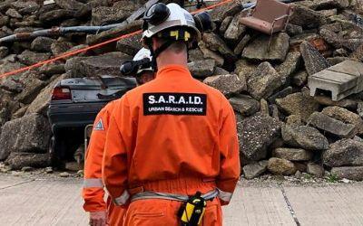
The main purpose of the demonstration was to show how the Iridium Certus platform can benefit a number of sectors, from military to search and rescue and utility companies. The advanced multi-service platform delivers a reliable connection for voice and data services, including telephony, satellite internet, land mobile radio, and location-based applications. All of which can now all be made possible by the upgraded Iridium constellation.
Rock Seven (now trading as Ground Control)’s RockSTAR device was given to each search and rescue (SAR) team member. Certus allowed the people on the ground to get a secure, strong internet connection, allowing them to tap into the RockSTAR tracking applications online. Each RockSTAR transmitted every minute with 15-second updates, giving the team leader a view on where their SAR team members were in the field at all times.
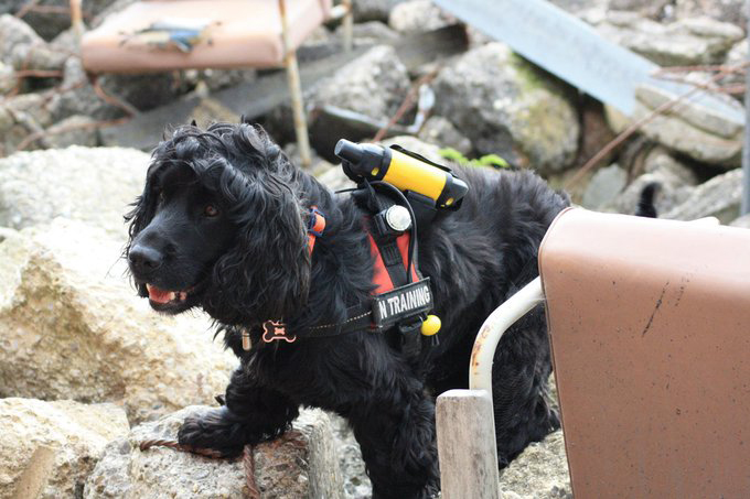
Even their rescue dog in training had RockSTAR strapped to its body to track its position during the exercise. This shows the versatility of our devices and how almost anything that moves can be tracked if it’s big enough to carry the product.
Rock Seven (now trading as Ground Control) CEO, Nick Farrell, bore witness to the demonstration. He said: “Seeing SARAID in action was so impressive. We rarely think about the brave men and women, all volunteers, who deploy into disaster zones to help those in need. They work for weeks at a time, helping to find and rescue people trapped in destroyed buildings, risking their own lives in the process – incredibly hard work, with relentless determination and total selflessness.
Anything we can do as a business to help provide better connectivity and situational awareness for SARAID and other similar organizations will hopefully translate into more lives saved.”