Topic: Drones
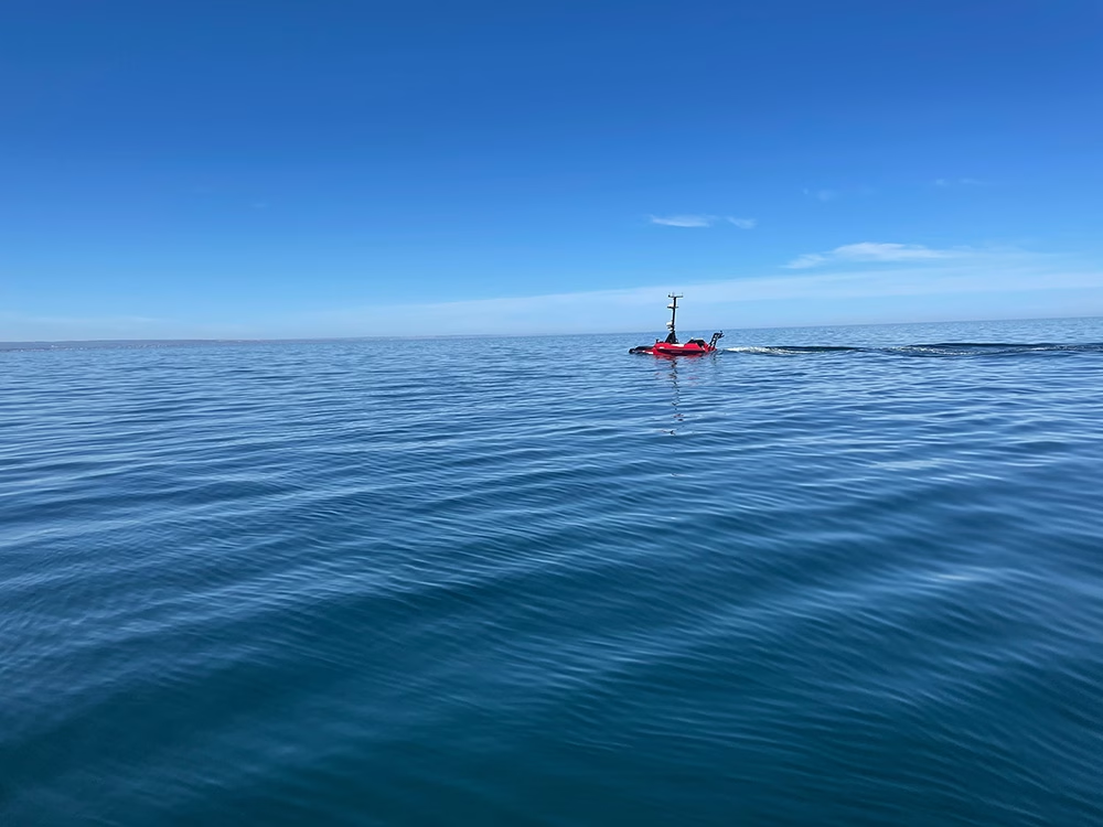
Why Resilient Connectivity Matters in Offshore USV Operations
The USV market is growing quickly. Allied Market Research says it’s projected to reach $2.7 billion by 2032, growing at an 11.5% CAGR. MarketsandMarkets points in the same direction, forecasting growth from $0.82 billion in 2025 to $1.59 billion by 2030 at a 14.1% CAGR. Behind those forecasts is a simple idea: operators want to do more offshore, for longer, with less risk to crew and a better cost profile.
As missions become longer and more complex, connectivity becomes a bigger part of the operating model. Operators need to know they can maintain oversight of the mission, receive alerts when conditions change, and keep essential data flowing even when the primary link is under pressure.
That matters because offshore environments are rarely forgiving. Sea state affects antenna performance, weather can affect signal quality, and coverage isn’t always consistent across an entire mission. Communications systems need to be designed around those realities, rather than around best case assumptions.
Why connectivity has such a direct impact on the business case
Connectivity affects both operational performance and commercial performance. If a vessel loses its main link but can continue operating safely while still sending health data, position reports, and exception based alerts, the mission may continue with only limited disruption. If the vessel goes dark in a way that removes visibility and confidence, the cost picture changes much more quickly.
Published data on the cost of recovering a USV is limited, but offshore operating cost studies show the broader dynamic clearly. Once a crewed vessel, personnel, mobilisation, and weather related delays are back in the loop, costs rise fast. In one NREL offshore operations model, a relatively modest crew transfer vessel scenario was estimated at around $4,100 per day. That’s not a dedicated USV recovery figure, but it does illustrate why operators want to avoid reintroducing crewed intervention unless they absolutely have to.
That’s why resilient connectivity matters commercially as well as operationally. It helps preserve confidence in the vessel’s status, the payload’s output, and the economics that justified using a USV in the first place.
What operators are actually evaluating
One of the clearest signals in this market comes from the kinds of conversations already happening around offshore connectivity. In our role as a remote connectivity specialist, we receive inquiries from USV operators and manufacturers who are actively evaluating how to keep vessels safe, visible, and manageable when the primary link is under pressure.
Those discussions are often less about maximum throughput in the abstract and more about what needs to keep working when conditions aren’t ideal. The priorities tend to be safety override, basic telemetry, vessel tracking, low rate command traffic, and a backup path that can take over if the main link drops.
We also see strong interest in backup satellite communications and last resort systems that can preserve continuity when a richer link is unavailable. That suggests the market is moving beyond a simple question of whether a USV can connect offshore. The more practical question is which functions need to be protected, and which link is best suited to carrying them.
Why primary and backup links should be treated differently
A useful way to think about offshore USV connectivity is to separate the role of the primary link from the role of the backup. The primary link supports the fuller operating picture. Depending on the mission, that may mean higher rate telemetry, software updates, larger payload files, imagery, video, or more responsive command and control. High bandwidth satellite services have expanded what is possible here and have made remote offshore operations much more practical than they once were.
The backup link has a narrower role, but it’s no less important. It exists to preserve essential functions when the primary link is constrained or unavailable. In practice, that often means vessel health, alarms, mission status, low rate command traffic, and, in some cases, compressed imagery or short bursts of additional data. It doesn’t need to recreate the entire primary link experience; it needs to provide enough continuity for the vessel to remain safe, visible, and manageable until the richer link is available again.
That distinction is reflected in the way these requirements are typically framed. The fallback path is often defined in terms such as safety override, telemetry, tracking, or a “Hail Mary” communications layer.
That tends to lead to better architecture decisions because it matches the way communications are actually used at sea. Not every function needs the richest link, but some do need to keep working almost regardless of conditions. Onboard autonomy has a role here, but operators still need enough visibility and control to stay confident in what’s happening offshore.
Why a single broadband satellite link leaves gaps offshore
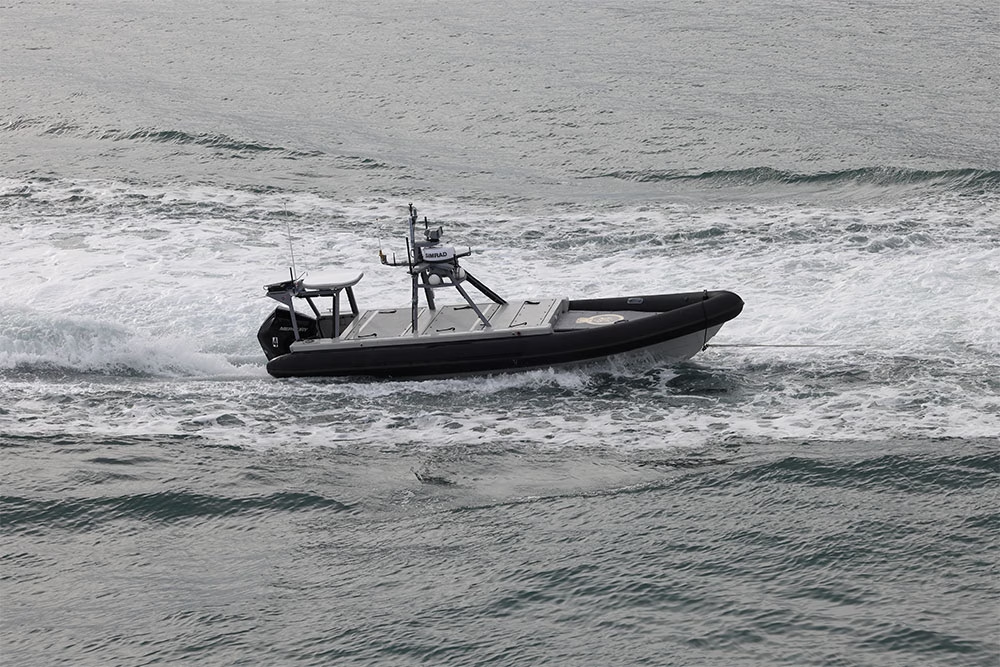
Broadband satellite has changed offshore connectivity for the better; it supports a much richer operating model, and it can make remote operations far more practical for larger USVs. But relying on one broadband service on its own still creates a dependency on a single communications path.
That means one antenna setup, one service profile, one network architecture, and one main route back to shore. If that route is affected by weather, vessel motion, local obstructions, hardware issues, or service constraints, the mission can lose the level of connectivity on which it was relying. Starlink itself notes that significant weather can degrade service, that moderate to heavy rain, snow, and hail can cause momentary dropouts, and that storms near a local ground station can also affect performance. Its maritime service information also says that once Priority Data is exhausted, users fall back to rates of up to 1 Mbps down and 0.5 Mbps up.
That risk is one reason many operators are actively evaluating layered satcoms rather than a single broadband path. In our conversations with USV manufacturers and operators, a recurring theme is the need for backup communications that can preserve control, visibility, and essential status data if the primary service drops, even briefly. A strong primary link is valuable, but resilience usually depends on having a second path for the functions that matter most.
Why layered satcoms make sense for offshore USVs
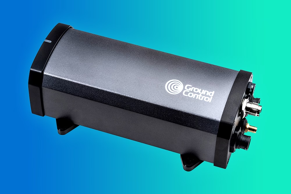
This is where layered satellite communications start to make sense. A primary link supports the richer operating picture when conditions allow. A secondary link helps preserve the essentials if the main path is constrained. For many offshore USV applications, Iridium Certus 100 is a good example of what that secondary communications layer can look like. It’s well suited to telemetry, alerts, command traffic, and other continuity functions that don’t need broadband throughput.
It also aligns with the way missions behave in practice. Data needs aren’t constant across a deployment. There will be times when high throughput is useful and times when the priority is to maintain visibility of vessel health, mission progress, and any exceptions that require attention. A backup link is well suited to those moments, particularly when the vessel can keep operating in a controlled way while communications are degraded.
That matches what we see in the market, where operators are increasingly focused on which functions need to be protected if the main path is interrupted, rather than on preserving full bandwidth at all times.
What operators should be asking as the market grows
As the USV market expands, connectivity deserves to be discussed with the same realism that is now routinely applied to autonomy, payload design, and endurance. What happens when the primary link is degraded? Which functions are preserved? What information still gets through? Can the vessel continue operating safely? Can the operator remain confident in the mission without immediately considering recovery?
Those questions matter because offshore operations are shaped by constraints, not just capabilities. A communications setup that works well in a demo or a short mission close to shore may not be enough for a longer deployment in more variable conditions. By contrast, a layered approach that combines a richer primary link with a lower bandwidth backup can give operators a more dependable path through the realities of offshore operations.
That’s why resilient connectivity has become such an important consideration in USV design and deployment. It supports visibility, continuity, and operational confidence, and it helps ensure that a temporary link issue doesn’t become a much more expensive problem.
Need help with offshore USV connectivity?
If you’re looking at offshore USV connectivity and weighing up primary and backup options, it’s worth having that conversation early. The right architecture depends on the mission, the data you need to move, and the functions that have to keep working if the main link is interrupted.
At Ground Control, we work with operators and manufacturers on exactly these kinds of remote connectivity challenges. If you’d like to talk through a specific use case, get in touch with us either by completing the form, or emailing hello@groundcontrol.com. We’ll reply within one working day.
ArduPilot Testing: MAVLink Telemetry Over Iridium Certus 100
Operating beyond cellular coverage is a reality for many ArduPilot-powered vehicles, and satellite is often the only practical backhaul. Recently, the ArduPilot Development Team (with support from Ground Control) documented MAVLink telemetry performance over Iridium Certus 100 using the RockREMOTE UAV OEM modem. The goal: understand what usable telemetry looks like over a real satellite link, and share configuration guidance the community can replicate.
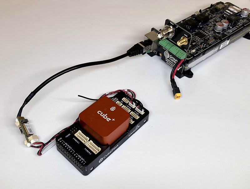
RockREMOTE UAV OEM is a low SWaP Certus modem designed for OEM integration on unmanned aircraft. It provides an IP data path for BVLOS command and control (C2), MAVLink telemetry, and payload/edge networking when terrestrial backhaul isn’t available.
What the ArduPilot testing looked at
The work, conducted and written up by Stephen Dade, a member of ArduPilot’s Development Team, evaluated MAVLink telemetry reliability and latency over Iridium Certus 100 across multiple connection configurations. In the reported results, MAVLink telemetry was usable and consistent when configured appropriately, with typical round trip latency reported in the sub-2 second range.
Key takeaways from the write-up
- Reliable MAVLink telemetry over Certus 100 (with the right config): The test summary reported measured latencies roughly in the ~600-1600 ms range, with broader observed ranges depending on protocol and conditions.
- Stream rates matter under uplink constraints: The write-up notes Certus 100 uplink limits and recommends configuring ArduPilot stream rates around 2 Hz to stay within available throughput.
- Secure connectivity works best when designed for satellite: High latency/low bandwidth links benefit from VPN patterns optimized for satellite. Ground Control supports architectures that terminate secure tunneling at the gateway, and offers WireGuard where on-link VPN is required.
- Installation can make or break performance: Antenna placement and local obstructions (trees/buildings) had a major impact. Roof height mounting improved results versus a low height suburban placement.
Why this matters for integrators
The documented setup used a representative unmanned systems stack (ArduPilot flight controller, Ethernet bridging, and ground endpoint infrastructure), and the notes are practical for anyone building satellite-enabled autonomy: you can design for predictable behavior, but you have to design around constraints like latency, throughput, and installation quality.
“These results help validate a satellite telemetry approach that can extend operations into truly remote areas, and provide the community with clear configuration guidance.” – Stephen Dade, ArduPilot Development Team
“What’s exciting here is giving builders real architectural choice: lean messaging for efficient telemetry, and IP connectivity when an uninterrupted C2 link matters.” – Alastair MacLeod, Ground Control CEO
Read the full technical write-up
The full methodology, recommended configurations, and measured performance data are here: https://discuss.ardupilot.org/t/ardupilot-and-the-iridium-certus-satellite-service.
Need help integrating Certus100 with ArduPilot?
If you’re looking at satellite-enabled ArduPilot telemetry using Iridium Certus 100, including hardware availability and integration guidance, we’re here to help.
Complete the form, or email hello@groundcontrol.com, and we’ll connect you with our drone specialists within one working day.
Why A-PNT is the Future of Trusted Positioning for BVLOS Drone Operations
Global Navigation Satellite Systems (GNSS) such as GPS, Galileo, GLONASS, and BeiDou have driven navigation for Unmanned Aerial Vehicles (UAVs) for decades. These satellite signals provide critical positioning, navigation, and timing (PNT) data that inform core functions like waypoint navigation, path planning, dynamic obstacle avoidance, geofencing for airspace compliance, and failsafe behaviors such as Return to Home or auto landing. However, GNSS/GPS signals are inherently weak – designed to be received at the Earth’s surface from satellites tens of thousands of kilometers away – and as such, are vulnerable to interference, jamming, or deliberate PNT denial.
Particularly over conflict zones, but increasingly widespread, GNSS signals are being degraded, spoofed, or blocked, causing multipath errors and signal loss and leaving autonomous drones without reliable positioning or timing information. Reliance on GNSS alone subsequently becomes a single point of failure for safe, reliable and trusted and UAV operations.
This is why navigation resilience has become one of the most important technical and operational requirements for modern BVLOS UAV deployments, and why selecting the right navigation solution is no longer simply about accuracy, but about operational continuity, trust, and reliability when navigational conditions degrade.
In this blog, we’ll explore the satellite service that addresses GNSS/GPS overreliance, the onboard technology that delivers resilient UAV navigation in contested environments, and the key factors integrators should consider when choosing a navigation stack for BVLOS operations.
Continuity Challenges in Contested and Complex Environments
Studies on GNSS-denied navigation show that jamming can overwhelm genuine satellite frequencies, driving receivers into error or total loss of signal. Spoofing goes a step further by feeding convincing but false signals, tricking receivers into calculating an incorrect location and potentially sending autonomous systems off course. This isn’t theoretical – the mechanisms and impact of GNSS spoofing and jamming are well documented, with spoofing described as a more complex and deceptive threat than simple interference, because it actively misleads the navigator rather than just depriving it of data.
GNSS denial isn’t confined to military battlefields either. Complex civil environments present similar challenges. Urban canyons made of steel and glass can reflect, attenuate, and distort satellite signals. Industrial zones rife with electromagnetic activity can drown out weak satellite broadcasts. Remote farmlands, border regions, and mountainous terrain all produce signal shadows and multipath effects, and these are not edge cases; many operators encounter these conditions regularly.
Without trusted PNT, a drone’s ability to follow a flight plan, maintain orientation, and sense its environment becomes compromised. In military operations, this can mean the difference between mission success and failure when conducting reconnaissance, supply delivery, or coordinated swarm operations. In maritime environments far from land, relying solely on GNSS undermines situational awareness and safety. In these contested or degraded environments, drones that depend exclusively on GPS risk mission degradation, erratic navigation, or complete loss of control.
It’s worth noting, however, that when a UAV loses trusted PNT, it doesn’t necessarily lose the ability to fly. Rather, it loses confidence in where it is, and that uncertainty is enough to abort missions, degrade data quality, violate airspace restrictions, or erode operator trust. Without PNT, UAV missions fail not because the vehicle lacks propulsion or control, but because it cannot navigate with confidence. For BVLOS operations, this loss of confidence is especially critical. Unlike VLOS flights, BVLOS operations depend on automation, remote supervision, and regulatory compliance. A drone that cannot prove where it is – reliably and continuously – cannot safely remain in controlled airspace or operate near people, infrastructure, or other aircraft.
The Solution Beyond GPS
To address the vulnerabilities in GNSS/GPS, engineers and operators are turning to Assured Positioning, Navigation and Timing (A-PNT).
A-PNT represents a layered approach in which GNSS is complemented, and in some cases temporarily replaced, by alternative sources that can provide trusted PNT data in environments where GPS is unavailable or untrusted. One alternative A-PNT source is derived from Iridium, and broadcast from a constellation of Low Earth Orbit (LEO) satellites. Because these satellites orbit significantly closer to Earth than traditional GNSS satellites, the downlink signals are up to 1,000 times stronger and more resistant to jamming or obstruction.
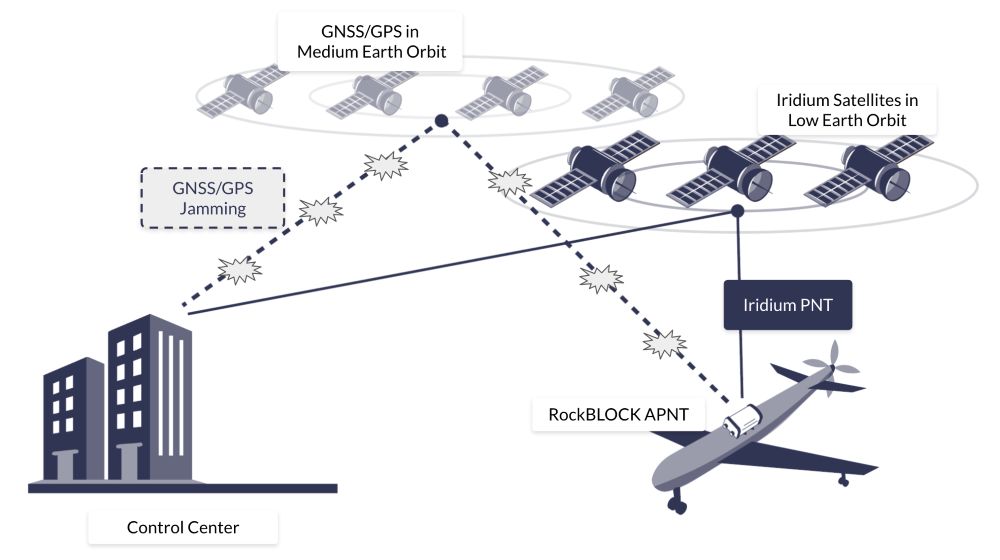
What makes Iridium’s PNT particularly effective is also its hybrid operation. When GNSS signals are present and reliable, an A-PNT system can blend that positioning data with Iridium PNT to maximise accuracy. When GNSS fails or is compromised, the system can continue operating on the stronger, authenticated Iridium PNT signals alone, preserving continuity of service and trusted navigation. This redundancy is key for autonomous systems that cannot afford to lose their bearings due to interference or contested signals.
In addition, the Iridium PNT signal incorporates cryptographic authentication that enables receivers to verify the integrity of their navigation signals and reject spoofed or tampered data. Whether operating at sea, in urban canyons, or in warfare environments, A-PNT provides a resilient and secure source of position and timing that can help autonomous drones sustain operations when GNSS cannot be trusted.
Why Antenna Positioning Still Matters in GNSS-Denied Scenarios
Even before GNSS is intentionally denied, the physical realities of a UAV or drone’s design can degrade satellite reception. The placement and orientation of antennas determine how effectively a platform can see the sky and receive navigation signals.
Placement near high current electronics, motors, or carbon fiber structures can block signals and create multipath interference, both of which erode signal quality. In contested environments, where robust reception is already tenuous, such degradation only exacerbates the problem. Careful antenna placement – including optimal sky visibility, proper ground planes, and physical isolation from noisy subsystems – remains foundational to any navigation strategy that seeks resilience when GNSS signals are challenged or absent. Further, incorporating A-PNT sources into those antenna systems becomes essential to maintaining navigation and timing.
RockBLOCK APNT for Autonomous and UAV Platforms
One of the standout implementations of this A-PNT approach is RockBLOCK APNT – a rugged, self-contained satellite device designed to deliver Iridium PNT-based positioning data even in GNSS-denied environments. RockBLOCK APNT integrates both Iridium PNT and multi-constellation GNSS reception into a compact device suitable for integration with drones and other unmanned systems. By leveraging Iridium’s globally available, authenticated PNT signals, RockBLOCK APNT delivers a level of navigational assurance that GPS alone cannot provide.
For UAV manufacturers and integrators, A-PNT needs to be both practical and reliable. Built with an IP66-rated rugged enclosure, RockBLOCK APNT withstands harsh operational conditions across land and aerial deployments, making it suitable for military, industrial, and maritime applications where environmental stresses and contested RF conditions are common.
The design is also considerate of OEM deployment, featuring a compact form factor with low size, weight, and power (SWaP) requirements, and standard interfaces that simplify integration into existing navigation stacks. It is designed to be both resilient and flexible, supporting serial, USB-C, and Bluetooth connectivity, and easily configurable with common development tools.
Notably, the device also operates with twin antennas to optimize sky visibility and signal resilience according to the drone’s design. In addition to delivering trusted PNT data, RockBLOCK APNT also provides two way satellite messaging up to 100 KB, offering a valuable fallback communications channel when other links fail.
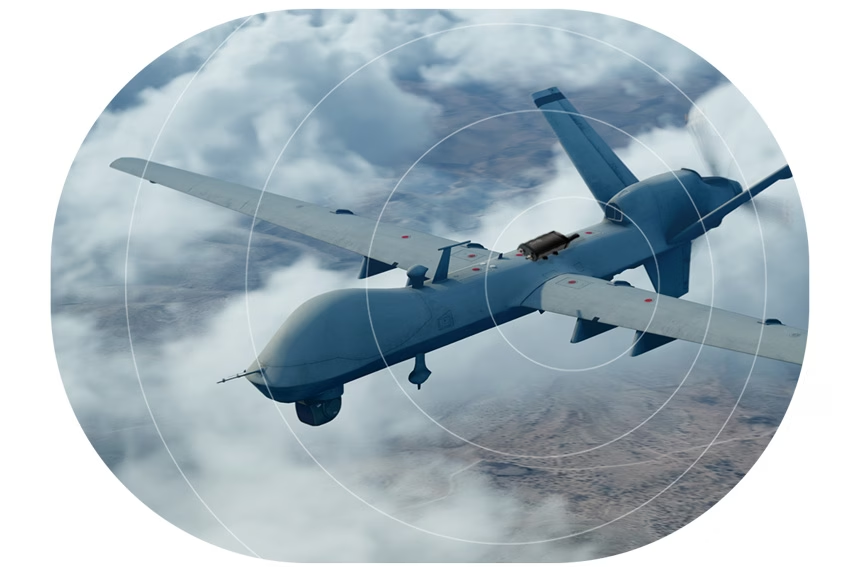
For UAVs and drones operating BVLOS, the ability to compare GNSS and Iridium PNT data streams is a powerful tool for detecting anomalies indicative of interference or spoofing. By validating position and timing against independent sources and reducing dependence on a single satellite navigation source, RockBLOCK APNT enhances navigational integrity and situational awareness. Operating on stronger Iridium PNT signals also expands the envelope of reliable navigation to areas where traditional GNSS geometry is poor or disrupted, such as high latitudes or deep urban corridors.
Future-Proofing UAV Operations With A-PNT
GPS and GNSS have served the world of autonomous navigation well, but they were never designed with modern contested environments in mind. As threats evolve and operations push into regions of intentional interference or obstructed signal conditions, autonomous systems must adapt.
If GNSS is your only source of PNT, your unmanned platform has a single point of failure. In environments where GNSS signals can be jammed, manipulated, or unavailable, this reliance represents a significant operational liability.
A-PNT, powered by strong alternative signals such as Iridium PNT and delivered through devices like RockBLOCK APNT, offers a practical, resilient path forward. By blending multiple navigation sources and validating integrity through authenticated signals, autonomous drones can maintain reliable PNT and continue operating effectively, even when GPS fails.
RockBLOCK APNT delivers UAVs a trusted, independent, and resilient source of positioning, navigation and timing. This enables UAVs to maintain autonomy under interference, preserve mission continuity, protect critical timing and coordination functions, and operate globally with confidence.
Trusted A-PNT For Resilient UAV and Drone Operations
Ground Control brings more than 20 years of experience delivering resilient satellite solutions for remote connectivity and secure communications. We provide expert guidance on deploying the right mix of A-PNT capabilities and reliable satellite connectivity options to ensure trusted positioning, navigation, and for autonomous drones, aircraft and UAVs.
Complete the form, or email hello@groundcontrol.com and we’ll reply within one working day.
UAV Satcom Architecture: When Messaging Fits Better Than Always-On IP
When OEM teams discuss satellite connectivity for UAVs, the conversation often defaults to IP. It feels familiar, maps neatly to ‘internet-like’ thinking, and enables genuinely interactive workflows. And if your primary link is cellular, you’re usually already living in an IP world, so using an IP-based satellite service can look like the cleanest way to add failover comms without changing the application stack.
There’s also a second, equally valid pattern that many UAV architectures underuse: message-based transport. Used intentionally, it gives you a delivery oriented path for critical data, well suited to situations where connectivity can be variable and you want the system to behave calmly through brief fades. Further, if you’re tight on payload and battery, messaging can be the better fit in practice because the terminals are typically smaller, lighter, and lower power.
In real operations, links do get imperfect; often briefly, sometimes repeatedly. The question isn’t whether IP or messaging is better. The question is: what should your system do when connectivity becomes intermittent?
Intermittency is Normal in UAV Satcom
Irrespective of your choice of satellite network, satellite connectivity is shaped by installation choices and the operational environment. You may see brief fades or dropouts caused by antenna placement and orientation (vehicle attitude, manoeuvring, installation constraints), airframe shadowing (the drone itself blocking sky view), and terrain or obstructions (especially at lower altitudes). These aren’t exotic edge cases; they’re part of the everyday reality of airborne links.
Designing for that reality is less about chasing a perfect connection, and more about choosing link behaviors that match the data you need to move.
| IP (interactive session) | Messaging (queued delivery) | |
|---|---|---|
| Best for | Operator driven workflows and interactive payload control | Delivery oriented updates and 'must get through' messages |
| Typical pattern | Continuous back and forth | Discrete messages sent in packets |
| When the link fades briefly | Sessions may need reconnection / state re-establishment before resuming | Messages can be queued and retried according to your policy / service behavior |
| How to think about it | “Stay connected” | “Deliver this information” |
IP is Ideal for Interactive Sessions
An IP connection excels when you genuinely need an interactive session: operator driven workflows, higher touch payload control, and applications that depend on continuous back and forth.
Many IP applications also maintain session state and use keep-alives. When connectivity becomes intermittent, those session oriented behaviors may require reconnection and state re-establishment before the application resumes normal operation. That’s not a problem with IP; it’s simply how many interactive applications are designed.
In UAV satcom, where brief fades can be normal, it can be helpful to complement interactive IP workflows with a delivery oriented path for data that should still make progress even when the link isn’t perfectly continuous.
Messaging is Designed for Queued Delivery
Message-based transport starts from a different premise: you’re not trying to stay in an ongoing conversation. You’re trying to deliver discrete information, and you want the system to behave sensibly if conditions aren’t perfect at the moment you try to send.
In a well designed message-based workflow, you can queue data for delivery and apply an explicit retry policy, so brief fades don’t necessarily translate into a broken live session experience. Messaging doesn’t need to hold a session together to succeed; it just needs a window good enough to move the message, with delivery behavior determined by the service and by how you design your application logic.
Messaging is often a good fit for data types where you care about delivery and can tolerate brief delays, such as safety and control intents, periodic telemetry snapshots, mission state updates and compliance events, and ‘must get through’ alerts.
A useful practical point for OEMs: messaging aligns with how many UAV systems already work internally. Most aircraft already buffer, queue, and batch. Messaging extends that same logic across the link.
Treat Connectivity as Multiple Lanes, Not One Pipe
A helpful mental model is to stop choosing “IP vs messaging” as a single binary decision for the whole aircraft. Instead, choose by data type, and build lanes that match how that data behaves and what it’s worth.
Hardware reality (SWaP): These lanes often map to different terminal classes. Messaging modules can be palm sized and tens of grams, while IP terminals are commonly larger, heavier and higher peak power because they’re built to sustain a live session.
Lane 1: Tiny, decisive commands (SBD / RockBLOCK 9603)
Some messages are small because they should be small. When the message is ‘deliver the intent’, payload is not the point.
This is where Iridium Short Burst Data (SBD), delivered via RockBLOCK 9603, fits well: very small messages that can carry command and control intents such as stop, start, return to base, or critical state flags.
It’s an architecture move as much as a connectivity move: you’re creating a path for decisive actions that don’t require an ongoing live session to be valuable.
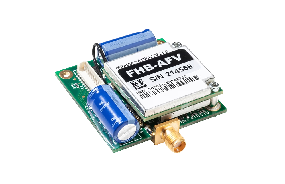
SWaP snapshot: RockBLOCK 9603 is 45 × 45 × 15 mm, 39 g (incl. antenna), max 450 mA; a good fit when you want deliver the intent with minimal payload and battery impact.
Lane 2: Larger discrete packets (IMT / RockBLOCK 9704)
Messaging becomes even more interesting when it isn’t constrained to tiny pings. With Iridium Messaging Transport (IMT), delivered via RockBLOCK 9704, you can work with larger messages (up to 100 KB). That’s enough to move more than bare minimum telemetry.
For many OEM designs, it opens the door to a straightforward pattern: collect richer data onboard (as you already do), then transmit it as structured packets – telemetry snapshots, compressed logs, payload summaries, detection events – according to a schedule and policy that fits the mission. Instead of ‘keep the pipe open’, the goal becomes ‘move the next packet when conditions allow’, with clear application logic around queueing, acknowledgement, and retry.
This approach can be a good match for how operators actually use data: many decisions don’t require millisecond streaming; they require timely, trustworthy updates that arrive consistently.
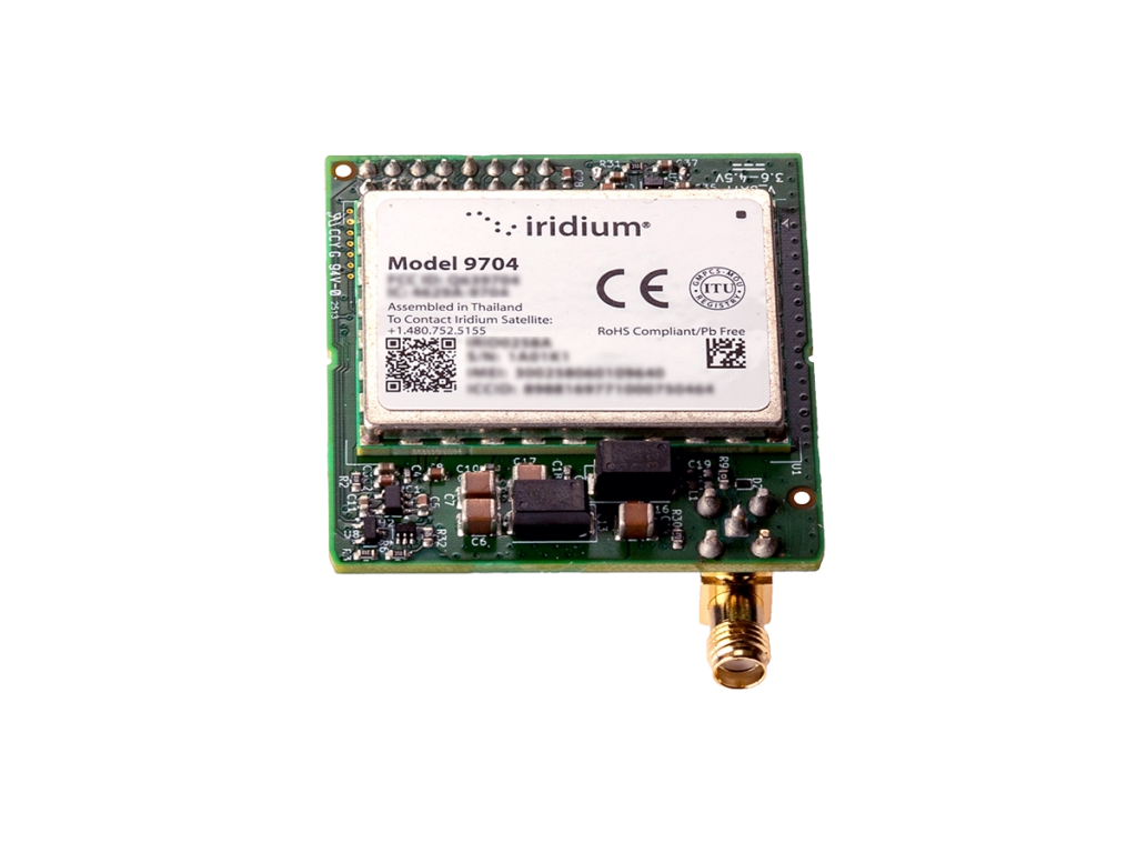
SWaP snapshot: RockBLOCK 9704 (SMA) is 48 × 52 × 16 mm, <35 g (excl. antenna), max 1.4 W; still firmly in the small and light messaging class.
Lane 3: Interactive workflows (Certus 100 / RockREMOTE UAV OEM)
When you truly need a live interactive link, IP is absolutely the right tool.
That’s where Iridium Certus 100, delivered via RockREMOTE UAV OEM, comes in. For OEMs, the appeal is flexibility at the system level: you can support an IP-based connection for interactive workflows, while also designing message-based IMT workflows for data types that benefit from queued, delivery oriented transport, without forcing every workload through a single paradigm.
The result is a more intentional architecture: interactive applications use IP when they need to, and delivery oriented data uses messaging patterns when that better matches the operational reality.

Trade-off (SWaP): RockREMOTE UAV OEM is 175 × 60 × 37 mm, 287 g, peak <1.66 A @ 12 V or <833 mA @ 24 V (≈ 20 W peak); worth it when you truly need an interactive link, but a meaningful step up in size / weight / power versus messaging modules.
The OEM Decision: What Happens During a 30 Second Fade?
Here’s a simple test that clarifies architecture decisions fast. Picture a brief period where conditions degrade: antenna orientation changes during a manoeuvre, the airframe masks sky view, or the aircraft drops behind terrain. It’s not a total outage, but the link becomes unreliable.
Now ask: what should your system do? If the data is interactive, it’s reasonable for the experience to be interrupted. The operator understands that continuous live control isn’t guaranteed in all conditions.
If the data is delivery-oriented, especially safety, health, compliance, or mission state, then the system should behave calmly: queue, send when it can, and retry according to your service behaviour and your application’s retry policy.
That’s the core difference in mindset: designing for interactivity versus designing for delivery.

Messaging
Use messaging first when the requirement is: ‘this must get through, even if it arrives later than a live dashboard would prefer’.

IP
Use IP first when the requirement is: ‘a human or application must interact continuously’.

Combined
Use both when you want the best operational outcome: IP for interactivity, messaging for delivery oriented updates and structured packets.
The strongest OEM architectures rarely treat connectivity as one monolithic pipe. They treat it as a set of behaviors, each aligned to what the data is for.
Bottom Line: Choose by Data Type, and Design for Real Operations
IP is excellent when you need live interactivity. Messaging is well suited to delivery oriented updates when conditions are variable and you want a queued approach with an explicit retry policy. Hybrid designs let you use each where it fits best: IP for interactive moments, messaging patterns for critical updates and structured packets.
If you’re designing for real operations, and not just ideal lab conditions, message-based transport deserves consideration early in the architecture, alongside IP, rather than as an afterthought.
Disclaimer: real world performance depends on system design, antenna integration, operational environment, and service configuration; the right approach is mission- and data-dependent.
Talk through your satcom architecture with us
Email us at hello@groundcontrol.com, or complete the form, with your details and a couple of lines about your platform (airframe class, typical mission profile, and what data you need to move).
We’ll follow up with practical guidance on where SBD (RockBLOCK 9603), IMT (RockBLOCK 9704), and Certus 100 (RockREMOTE UAV OEM) fit in your architecture, and how to combine them for an operator-friendly design.
No Signal, No Problem: Enabling BVLOS Drone Operations Anywhere on Earth
Drones are no longer futuristic novelties. They’re already saving lives, cutting emissions, and driving efficiency across industries as diverse as healthcare, energy, and infrastructure.
The ability to fly Beyond Visual Line of Sight (BVLOS) is critical to unlocking these benefits at scale. Without BVLOS, most missions are limited to the operator’s direct line of sight, constraining both range and impact. With BVLOS, drones can cross oceans, inspect thousands of miles of pipeline, and deliver life saving supplies to remote communities.
But for BVLOS to be safe and effective, drones must maintain reliable, unbroken connectivity. And that’s where the challenge begins.
The Comms Reality Check
However, relying solely on terrestrial networks for drone connectivity can be a risky proposition, especially for BVLOS missions.
1. Vulnerability to inference and jamming
In contested or hostile environments, terrestrial links are vulnerable to deliberate interference or jamming. For example, during the conflict in Ukraine, both commercial LTE and unlicensed radio links have been targeted and disrupted, grounding entire fleets of drones and illustrating how fragile these systems can be when faced with intentional electronic warfare. Even in peacetime, terrestrial systems are not immune to accidental interference; for instance, at large sporting events or urban centers where multiple devices compete for spectrum, drones can lose connection at critical moments.
2. Coverage gaps in rural and offshore areas
Coverage is another major challenge. LTE and 5G networks work well in cities, but in rural or offshore areas, coverage gaps are common. This creates real problems for industries like pipeline inspection or offshore wind maintenance, where drones must operate hundreds of kilometers from the nearest tower.
3. Network failures during disasters
Even where coverage exists, networks can fail under stress: in natural disasters such as hurricanes or wildfires, cellular towers are often damaged or overloaded. For instance, during Hurricane Ian (2022), parts of Florida experienced complete cellular blackouts, leaving first responders unable to rely on mobile networks.
4. Technical limitations
Long missions also introduce technical issues like handover failures when a drone crosses between towers – a known problem for high speed UAVs flying over mixed terrain. Finally, legacy aviation bands like VHF are limited to strict Line of Sight, making them unsuitable for missions that span mountains, forests, or the open ocean.
The bottom line is that the only truly global, always-on network is in space. For many BVLOS missions, satellite connectivity is the primary link for safe command and control (C2). In other cases, it’s a failover that ensures uninterrupted operations if the primary terrestrial link drops or fails.
Choosing the Right Connectivity
The table below outlines the strengths and weaknesses of the most common BVLOS connectivity options.
| Direct RF (LoS) | Cellular (4G/5G) | LEO Satellite (e.g., Iridium) | Mesh / Relay Networks | Hybrid (e.g., LTE + Satcom) | |
|---|---|---|---|---|---|
| Range | Low-Mid (20–30 km) | High – wherever towers exist | Global (with constellation coverage) | Variable – range extends hop by hop | Global with redundancy |
| Coverage | Limited – range depends on altitude and obstructions | Urban/suburban areas, gaps in rural/remote regions | Requires clear view of the sky – partial blockage from terrain, buildings, or canopy can cause dropouts | Customizable – requires supporting nodes or relay drones | Global – seamless failover between links |
| Cost | Low | Moderate | High | Medium-High | High |
| Ideal Use Case | Close range inspections, small scale BVLOS in open terrain | Urban delivery, public safety, mapping | Remote BVLOS missions needing high bandwidth: offshore energy, maritime inspections, remote mining | Disaster response, temporary missions in areas with no infrastructure | Safety-critical commercial BVLOS, mixed terrain missions |
LEO vs GEO: Understanding the Differences
Satellites are positioned in either Low Earth Orbit (LEO), Medium Earth Orbit (MEO), or Geostationary orbit (GEO). Our blog post on Satellite Orbit Heights provides a more detailed explanation, but to summarise, the closer the satellite network is to Earth, the lower the latency – the time it takes for data to travel from the drone, to the orbiting satellite, and down to the ground station (from where it’s routed to the drone operator’s system). Latency is a key attribute for UAV operators looking for as close to real-time command and control as possible, so it’s worth reviewing LEO satellite networks such as Iridium, Starlink or OneWeb.
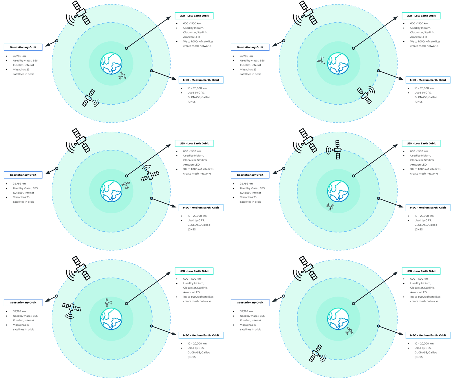
Another consideration is where your drone will be operating. If you are connecting to a satellite in Geostationary orbit, such as Viasat, the satellite remains in the same location overhead, and you need “line of sight” to that satellite. This works very well in wide open spaces, but if the signal could be blocked by infrastructure or mountains, for example, it’s not the best choice. Satellites in Low Earth Orbit need a “clear view of the sky”, but because the satellites are in motion overhead, rather than in a fixed point, it’s less rigid than GEO services. Read more about what’s meant by a clear view of the sky.
Also, consider the practicalities of hardware and power consumption when choosing between LEO and GEO networks. Terminals designed for LEO services are often smaller and lighter, making them well suited to drones where every gram matters and battery life is at a premium. Because these satellites are closer to Earth, they can typically operate at lower power levels, which helps maximize flight endurance. GEO terminals, while still compact, may draw more power and require slightly larger antennas to maintain a continuous connection with a single, fixed satellite.
Ultimately, the decision isn’t just about latency or coverage. It’s about balancing responsiveness, operating environment, and hardware constraints to select the right orbit for the mission. Whether it’s low-latency LEO for real-time control or the stable, wide-area coverage of GEO for long-range operations, matching the satellite architecture to the needs of the drone is key to safe and reliable BVLOS flight anywhere on Earth.
Hybrid Strategies: Best of Both Worlds
Whether you choose LEO for responsiveness or GEO for stability, no single connectivity method can cover every scenario perfectly. The most resilient BVLOS operations don’t rely on a single link at all; instead, they use a hybrid strategy, combining multiple communications paths to ensure that control of the aircraft is never lost, no matter what happens in the sky or on the ground.
A hybrid approach integrates multiple communication technologies, each serving a different role. This isn’t simply about adding a backup link; it’s about creating a system where the aircraft actively prioritizes and switches between links in real time, based on performance and availability.
At present, most commercial operators treat satellite as a failover link. Cellular and RF systems are used as the primary connection because they are cost effective and can handle large data streams such as live HD video or high-resolution sensor data. Satellite is kept in reserve as the safety net – the “final line of defense,” as Skylift UAV describes their use of the RockBLOCK 9603.
In their words, the satellite module provides the confidence to continue operating safely in the unlikely event of a complete communications blackout. This model works well for urban and suburban missions where cellular coverage is strong, or for flights where Line of Sight RF can be maintained most of the time.
However, as BVLOS missions grow in range and complexity, this dynamic is beginning to shift. In rural or offshore environments, cellular coverage is unreliable or entirely absent, and Line of Sight radios quickly become impractical. In these contexts, satellite is increasingly moving from failover to primary link, especially for critical command and control traffic. For example, during recent flight tests, pilots reported that LTE video streams were prone to frequent dropouts at altitude, but satellite remained reliably stable throughout.

A hybrid approach requires intelligent link management. The drone must be able to segment traffic by type and seamlessly prioritize the best available link without pilot intervention. For example, during an offshore mission, a drone may begin by streaming video over LTE while using satellite for command and control in the background. As it moves further out to sea and loses cellular coverage, the satellite connection continues uninterrupted, ensuring no loss of control. Later, if the drone comes back into range, LTE automatically resumes for payload data, but satellite remains quietly handling the critical link in the background. From the operator’s perspective, these transitions should be invisible, with the system maintaining continuous awareness and control throughout.
Many regulatory frameworks now encourage or require operators to demonstrate redundancy, often by using two independent communications paths so that a single failure cannot compromise control of the aircraft. This level of resilience is essential for operations such as pipeline patrols, offshore deliveries, or disaster response, where losing connectivity could have serious safety, regulatory, or financial consequences.
With a hybrid strategy in place, the next step is to match the satellite service to the mission profile.
Matching Satellite Services to Missions
Before you pick a hardware or service, think about your data rates, power and weight constraints, and how critical your command and position links are. The table below shows two tiers of mission profiles, one for simple commands such as go to the nearest rally point, go home, or terminate the flight, and another for full BVLOS operations, with the attributes you should aim for in each.
Simple Commands (Light Missions)
- Lightweight telemetry and commands only
- Ultra low power draw, so maximal flight time
- Small hardware footprint, minimal antenna gain
- Reliable even in remote environments, rough terrain, trees, or sparse coverage
Full BVLOS Operations
- Continuous, reliable command and control link
- Command response delays kept under ~700 ms
- Position updates as frequent as 1 second
- Enables safe separation from other aircraft and scalable BVLOS flights across mixed terrain and range
Ground Control’s RockBLOCK devices are optimized for simple commands, where size, power, and reliability under constrained conditions are the top priorities. Meanwhile, our Iridium Certus 100-based offerings (e.g. RockREMOTE UAV OEM) are built for BVLOS missions that need higher throughput, frequent updates, and strong command responsiveness. Adjusting your satellite choice to the mission kind avoids over-engineering, keeps costs manageable, and ensures safety without carrying unnecessary weight or power burden.
The following devices all leverage the Iridium satellite network, chosen because it is in Low Earth Orbit, so has very low latency, and truly global coverage. It has been tried and tested over years of operation, and is extremely reliable and resilient.
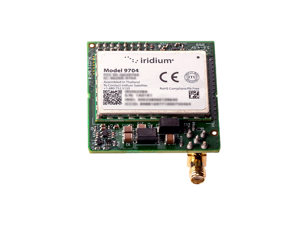
RockBLOCK 9704
RockBLOCK 9704 supports larger message payloads, giving operators more flexibility for richer telemetry and mission data.

RockBLOCK 9603
RockBLOCK 9603 provides lightweight, low power satellite messaging for essential UAV tracking, telemetry and alerts.
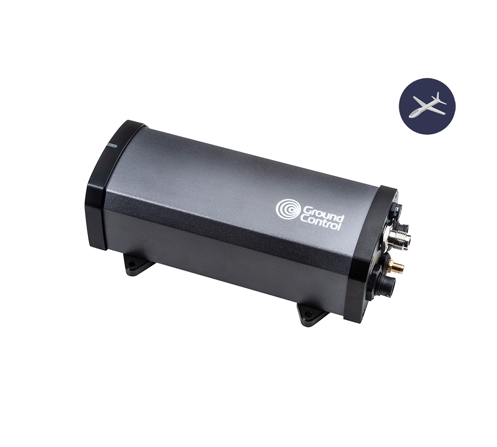
RockREMOTE UAV
RockREMOTE UAV delivers low power IP connectivity for UAV applications that need an always available satellite data link.
RockREMOTE UAV OEM
RockREMOTE UAV OEM brings the same IP connectivity into a compact embedded form for integration within the aircraft or payload system.
BVLOS drones are already proving their value across industries. In the UK, drones are delivering chemotherapy drugs to the Isle of Wight eight times faster than traditional transport, while in the offshore energy sector, companies like Skyports are replacing helicopter supply runs with drones, cutting emissions and reducing downtime. In the USA, long range drone patrols are helping to monitor thousands of miles of remote pipelines, and in the North Sea, offshore wind farms are being inspected in real time without costly, carbon intensive vessel missions.
Key Takeaways
When planning BVLOS operations, the priority should always be maintaining a reliable command and control link. Satellite connectivity is uniquely suited to this role because it offers consistent, global coverage that isn’t dependent on local infrastructure. Terrestrial networks such as LTE or RF can still play an important role, but they are best used for non-critical data like video streaming or payload telemetry rather than the core C2 function.
A hybrid approach delivers the best of both worlds. By combining satellite and terrestrial links intelligently, operators can use satellite for stable, predictable command and control while taking advantage of LTE or other networks for higher bandwidth data when coverage is available. This balance provides flexibility while keeping safety at the forefront.
Operational resilience comes from planning for failure. BVLOS systems should be designed with multiple communications paths and the ability to switch between them instantly, ensuring that connectivity is never lost if one link goes down. Continuous monitoring and rapid failover processes are essential to meeting safety and regulatory expectations as drone fleets grow in scale.
Finally, data management must not be overlooked. Tracking airtime, managing costs, and ensuring telemetry data is actionable are all key to running efficient, scalable operations. By keeping a close eye on data use and system performance, operators can make informed decisions that improve reliability and maximize return on investment.
Take Your BVLOS Operations Further
BVLOS connectivity doesn’t have to be a limiting factor. With the right mix of satellite and terrestrial links, your drones can stay connected and operational anywhere on Earth; from dense urban environments to the most remote locations.
Whether you need lightweight hardware for simple commands or a fully scalable solution for complex BVLOS missions, our team can help you design a system that’s safe, reliable, and ready to grow with your operations.
Email hello@groundcontrol.com or complete the form, and we’ll be in touch within one working day.
Power, Payload, Performance: What Drone Manufacturers Ask Us About Satellite Connectivity
Unmanned aerial vehicles are no longer confined to the pilot’s line of sight. Today’s drone programs, from infrastructure inspection across deserts to search and rescue in the Arctic, depend on rock solid, global data links. Satellite connectivity has gone from “nice to have” to mission critical, but integrating it brings a fresh set of challenges: regulatory approvals for BVLOS, SWaP trade-offs inside a tiny airframe, keeping latency low for real time piloting, and building in fail-safe handovers when the sky gets crowded.
In this guide, we tackle the questions drone manufacturers ask most often. We’ll show you how to:
- Prove your link reliability for Beyond Visual Line Of Sight flights
- Choose and integrate a compact, power efficient satellite modem without busting your weight budget
- Optimize latency and throughput so your command links stay sharp
- Understand cost structures and usage patterns to build a viable business case.
Click on the above links to jump straight to your top concern, or read straight through for an end-to-end blueprint. Let’s get you connected.
Q: What Makes BVLOS so Challenging, and How Can Satellite Connectivity Help?
A: Flying Beyond Visual Line of Sight (BVLOS) introduces several core challenges which satellite connectivity can help mitigate using commercially available, aviation-tested technologies. The insights below draw on findings from Iridium’s excellent white paper, Monitored BVLOS Operations & Safe Separation, which we highly recommend reading in full.
1. Detect and Avoid (DAA)
Challenge: Drones must detect and steer clear of nearby aircraft, especially in non-segregated airspace.
Satellite role: By integrating Commercial Off-the-Shelf (COTS) avionics such as ADS-B In, and using satellite communications to deliver traffic data to the RPIC, operators can enhance situational awareness and support onboard or ground-based DAA strategies, even in regions with no ground infrastructure.
2. Reliable Command & Control (C2)
Challenge: Maintaining a robust, real-time command link is critical, but VHF is unavailable in remote areas and LTE coverage is patchy.
Satellite role: Iridium L-band communication links deliver consistent, uninterrupted C2 performance, even in remote and hostile environments where terrestrial networks fail. In test flights, satellite C2 links proved more reliable and continuous than LTE. Aircraft with dual independent L-band satcom systems also gain redundancy, ensuring control is maintained even if one link fails.
3. Communication with Air Traffic Control (ATC) and Other Aircraft
Challenge: Drones operating in controlled airspace still need to maintain communication with ATC and be aware of other traffic, even without VHF.
Satellite role: COTS satcom solutions can be used to maintain communication between RPICs and ATC where ground-based VHF isn’t an option. Integrating technologies such as ADS-B In and Out over satellite provides RPICs with the same traffic visibility expected of crewed IFR flights.
4. Regulatory and Certification Barriers
Challenge: Aircraft type certification processes were built for decades-long product cycles, not fast-evolving drone platforms. A 36 month certification timeline often means that core systems (e.g. batteries, avionics) are outdated by the time certification is complete.
Satellite role: While waiting for certification frameworks to catch up, drone operators can pursue BVLOS waivers for specific missions. Embedding a standardized Minimum Equipment List (MEL) of proven, COTS avionics and satcom hardware strengthens the case for safe, monitored BVLOS operations and supports a more scalable path toward regulatory approval.
Q: How Can I Integrate Satellite Connectivity Into My Drone Without Compromising on Size, Weight, or Power?
A: Thanks to ongoing improvements in satellite IoT hardware, it’s now possible to integrate satellite connectivity into a drone without breaking your SWaP budget, but there are trade-offs. Smaller, lighter, message-based modules like RockBLOCK 9603 and 9704 are ideal for sending telemetry or basic commands with minimal power draw. However, if your application demands real-time command and control, you’ll need a larger, IP-capable device like the RockREMOTE UAV OEM, which delivers more functionality, but at a higher cost in power and space.
1. Managing the SWaP Budget for Satellite Modules
Fortunately for UAV manufacturers, satellite IoT modules have been on a smaller, lighter, lower-power draw trajectory for several years, so it’s not usually difficult to find a module that will fit into your enclosure. Our most popular device is the RockBLOCK 9603, weighing just 36 g (1.27 oz) and measuring 45 x 45 x 15 mm. This incorporates a patch antenna, but because it usually sits within a metal enclosure, an external antenna is often deployed.
However, there are trade-offs between module size and capability. RockBLOCK 9603 utilizes Iridium’s Short Burst Data service (SBD), which is suitable for some drone applications, but not all.
It works well as a failover means of communication in the event that the primary means of communication (usually radio) drops; to transmit the drone’s position, altitude and speed, and to issue basic commands (go to the nearest rally point; go home; terminate flight etc.).
If you simply need to send more data – for example, compressed images or multiple sensor readings – RockBLOCK 9704, which utilizes Iridium Messaging Transport (IMT), delivers much larger data packets, and is similarly small and light (35 g / 48 x 52 x 16 mm for the SMA – external antenna – option).
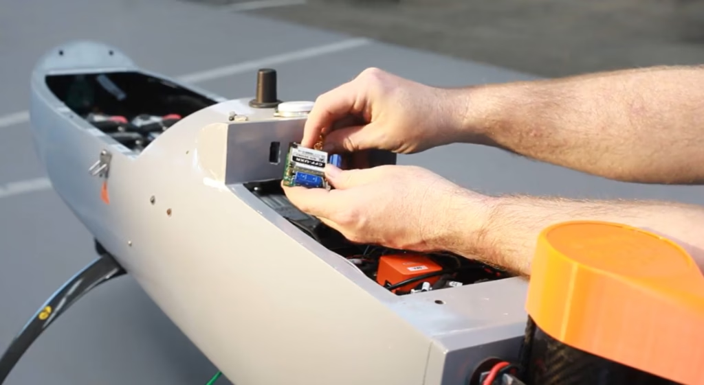
Both of these solutions are message-based, however, which makes them less suited to real-time command and control of your UAV. For this purpose you need an IP-based transmission, and that means both a larger device, which draws more power.
2. Trade-Offs Between Module Size, Transmit Power, and Battery Life
An IP-based connection enables near real-time communication, making it ideal for applications like command and control, or remote diagnostics. However, this comes at a cost: IP-based modules require more processing power, memory, and a more complex operating system, which increases both size and power consumption. They also transmit higher volumes of data, which typically requires more energy per transmission.
Our recommended hardware for an IP-based connection is RockREMOTE UAV OEM, as this utilizes both the Iridium Certus 100 airtime service, running at 22/88 Kbps, and Iridium Messaging Transport, giving you the option to save power and potentially costs by transmitting some data in a packet format, and reserving the IP connection for real-time applications. It’s also one of, if not *the*, smallest and lightest options for UAV IP communication.
Q: How do I Manage Latency When Designing Satellite Connectivity for Drones?
A: LEO satellites offer low latency – typically 0.5 – 1.5 seconds for IP-based services – making them ideal for real time drone control, while message-based protocols (around 10 seconds latency) are better suited to delay-tolerant data like location or telemetry. GEO satellites add more delay due to distance, but can still be effective for non-urgent communications.
Latency – the time it takes for your data to do the trip from your drone to your application – is chiefly governed by the satellite orbit height. Simply, the further away from Earth the orbit, the longer the latency. Satellite networks in Low Earth Orbit (LEO), including Iridium and Starlink, are between 160 and 2,000 km above Earth, and the typical round-trip latency for an IP-based service like Iridium Certus 100 is between 500 – 1,500 milliseconds (0.5 – 1.5 seconds). This makes LEO services ideal for time-sensitive operations like piloting or real time alerts.
It’s worth noting that LEO round-trip latency is longer for a message-based service – around 10 seconds – because the message is queued, then forwarded to a ground station, vs. an always-on transmission model. So, for drone applications, message-based protocols are better suited to delay-tolerant applications (location, altitude, speed; basic commands; failover comms), reserving IP-based connectivity for real time command and control, or live diagnostics.
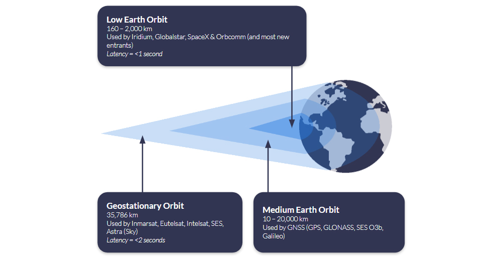
Satellites in Geostationary Orbit (GEO) are 35,786 km above Earth; because they’re so much further away, they can ‘see’ much more of the Earth’s surface, so fewer satellites are needed to provide wide coverage. The latency is longer – c. 2 seconds for an IP-based connection such as Viasat IoT Pro, and longer for a message-based solution such as Viasat IoT Nano – because the data has to travel further. However, if you can bake in some latency tolerance into your application, or simply reserve this means of communication for less time-sensitive telemetry, this offers an economical and often very stable means of communication.
Q: Is Satellite Connectivity Financially Viable for Drone Operations?
A: Satellite airtime can be tailored to match drone usage patterns and fleet scale, using flexible subscription models with clear pricing. For many drone operators, particularly those flying BVLOS or in low connectivity areas, satellite becomes cost effective with just 10 – 20 flight hours per month, especially when uptime is mission critical.
Flexible Subscription Models
Recognising that unmanned applications like drones are a key growth market, satellite network operators like Iridium offer increasingly diversified options for airtime. Ground Control, as a long-term Iridium partner, can offer UAV manufacturers and users monthly subscriptions, pay‑as‑you‑go, or annual commitments – all with transparent pricing and volume discounts for larger operations. Operators using existing Certus 100-compatible hardware can activate airtime instantly through Ground Control, simplifying deployment.
When Does Satcom Pay Off?
Although detailed cost breakdowns vary by mission profile, satellite connectivity often becomes cost effective at a relatively modest flight tempo. If your missions involve command/control, telemetry, or operations beyond cellular coverage, satellite ensures reliability that terrestrial networks can’t guarantee. With real time capabilities over Iridium Certus 100 and competitive airtime pricing, operational risk reduction often justifies the cost within 10 – 20 flight hours per month.
Connecting Drones Beyond Terrestrial Coverage
Satellite connectivity makes it possible to operate UAVs far beyond the reach of terrestrial networks, but integrating it requires thoughtful design. From managing size, weight and power to understanding latency, throughput and cost, this post outlines the key considerations for adding satcom to your drone system.
If you’re developing a satcom-enabled drone, our team can help you find the right hardware and airtime for your mission. Email hello@groundcontrol.com or complete the form, and we’ll be in touch within one working day.
Affordable BVLOS Drone Connectivity: Introducing Iridium Certus 100 Airtime Plans for Drone Operators
Flying drones Beyond Visual Line of Sight (BVLOS) is the new frontier for commercial and industrial operations. Whether you’re surveying expansive agricultural lands, monitoring critical infrastructure, or conducting environmental research in remote regions, reliable connectivity is the linchpin for mission success. Recognizing this need, we’re excited to unveil Iridium Certus 100 aeronautical airtime plans tailored specifically for drone applications.
Why Satellite Connectivity Matters for BVLOS
Traditional RF and cellular networks may falter once a drone ventures beyond visual range, leading to dropped links, latency spikes, and potential safety hazards. To mitigate these risks, many aviation authorities now mandate a secondary communication channel to serve as a failsafe if the primary link fails. For example, the EASA requires redundant communication systems for BVLOS flights to ensure operational resilience, while the UK Civil Aviation Authority’s guidance similarly calls for dual-link architectures as part of any BVLOS operational authorization. In the United States, the FAA’s UAS BVLOS Aviation Rulemaking Committee report recommends demonstrating multiple active command-and-control links – or an automated failover scheme combining cellular, radio, and satellite – to secure BVLOS waivers.
Why Iridium Works Best
Satellite networks offer coverage with no dependency on terrestrial infrastructure, but that doesn’t mean all satellite networks are the same. In this context, low latency – the time it takes for you to send a command to the drone, and for it to receive it and respond – is critical, and therefore, satellite networks in Low Earth Orbit (LEO) are preferable. This is simply because they are closer to Earth than networks in Geostationary orbit, and therefore the round trip of data takes less time.
Iridium’s satellite network is in Low Earth Orbit, and further, it utilizes the L-Band radio frequency. L-Band signals are extremely reliable, and penetrate poor weather conditions with ease; ideal for mission-critical applications where you can’t afford to lose contact with your asset.
With Iridium Certus 100, operators enjoy 22/88 Kbps of bi-directional data, low latency, and complete pole-to-pole coverage, so your drone’s telemetry, sensor data, and command/control signals remain rock solid. It can be used as a primary or failover means of communication.

Our new airtime plans capitalize on our decades-long partnership with Iridium to provide flexible data bundles that scale from single drone deployments to entire fleets. Whether customers prefer monthly subscriptions, pay-as-you-go usage, or annual commitments, each plan features transparent rates, with volume discounts available for larger scale operations.
Customers who already own an Iridium Certus 100-compatible device can simply activate their chosen plan through Ground Control, eliminating the need for additional purchases or complex installation processes.
Recommended Hardware for IP Over Satellite
For those seeking an out-of-the-box solution, RockREMOTE UAV OEM provides direct board-level integration of the Iridium Certus 9770 module in a compact, 288 g form factor. Optimized for low power consumption, all non‑RF connections (Ethernet, serial, GPIO) are routed through a single 30‑way header, and installation is as simple as four screw mounts – no external gimbals or moving parts required.
Configuration and firmware updates are managed over Bluetooth LE via a companion app or API, and operators only need to attach the specified MMCX and U.FL antennas for Iridium and GNSS. Rated for operation from –40C to 70C and 95% humidity, RockREMOTE UAV OEM ensures mission-critical stability and performance across extreme environmental conditions.
Real-world use cases for these new airtime offerings span multiple industries. In agriculture, farmers can obtain real-time soil and crop health data from remote fields, optimizing inputs and maximizing yields. Renewable energy and utilities companies can conduct continuous inspections of pipelines, power lines, and wind turbines, preventing costly downtime and enhancing safety.
During emergency response missions, drones equipped with Iridium Certus 100 connectivity can relay critical situational data from disaster zones or search and rescue sites, accelerating decision-making when every second counts. Researchers performing environmental monitoring can gather long-range data on wildlife habitats, forestry conditions, and ocean patterns, undeterred by geographic isolation. And for jurisdictions that require communication redundancy, our plans serve as a reliable secondary link, providing an essential failsafe that keeps aircraft controllable even if the primary link is disrupted.
With affordable, reliable satellite connectivity and built-in redundancy now within reach, your BVLOS aspirations can become reality. Ground Control’s UAV-specific Iridium Certus 100 airtime plans can help extend your operational envelope, enhance safety, and unlock new business opportunities.
Would You Like to Know More?
If you’d like to get a quote for your UAV airtime, please complete the form, or email hello@groundcontrol.com, and we will respond within one working day.
It’s helpful if you can tell us more about your application, i.e. what sort of function do you need to perform (command and control in real-time, or the transmission of telemetry on demand, for example); any SWaP constraints; where you’ll be operating the drones etc.
Drones in Modern Warfare: Enhancing UAV Capabilities with Satellite Connectivity
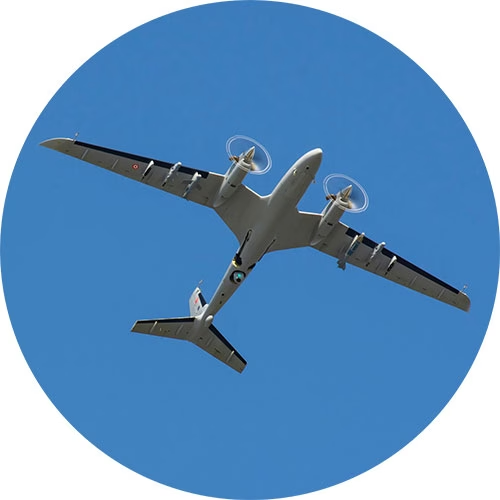
Drones, or Unmanned Aerial Vehicles (UAVs), have become an integral part of modern military operations. Initially developed for reconnaissance and surveillance, drones have evolved into versatile platforms capable of executing various missions, from intelligence gathering to precision strikes. However, the full potential of UAVs is realized when enhanced with satellite connectivity, removing the limitations of traditional line of sight or terrestrial based communication, and enabling real time communication and coordination across vast distances and hostile environments.
While satellite connectivity has enhanced UAV capabilities, the utilization of UAVs in warfare is nothing especially new, and has instead, evolved significantly over the past century. Early concepts of UAVs emerged during World War I, with the development of rudimentary unmanned aircraft such as the “Kettering Bug”, – a drone prototype designed purely for bombing missions. However, these early models were not widely operational.
It wasn’t until World War II that UAV technology saw further development, particularly with the creation of the German V-1 flying bomb – essentially an early form of a cruise missile. The Cold War era spurred advancements in UAVs, primarily for reconnaissance purposes and the U.S. developed drones like the Ryan Firebee, which were used for surveillance during the Vietnam War.
The 1990s marked a turning point in UAV usage, particularly during the Gulf War, when drones like the RQ-2 Pioneer provided critical intelligence. Then in the early 2000s, UAVs like the MQ-1 Predator and MQ-9 Reaper – American remotely piloted aircrafts – gained worldwide attention for their role in counterterrorism operations. Powered by global satellite connectivity, these drones could carry out targeted strikes with high precision, far out of the reach of cellular and telecommunication networks. Step forward into 2024, and the role of UAVs in modern warfare has only continued to advance.
As the roles of UAVs broaden from strike and EW to logistics and ISR, the conversation is increasingly about how they’re used to protect people and infrastructure. Alongside the well known offensive missions, we’re seeing rapid growth in defensive and humanitarian applications enabled by resilient satellite links. Let’s explore some of these key roles in more detail.
Surveillance and Reconnaissance
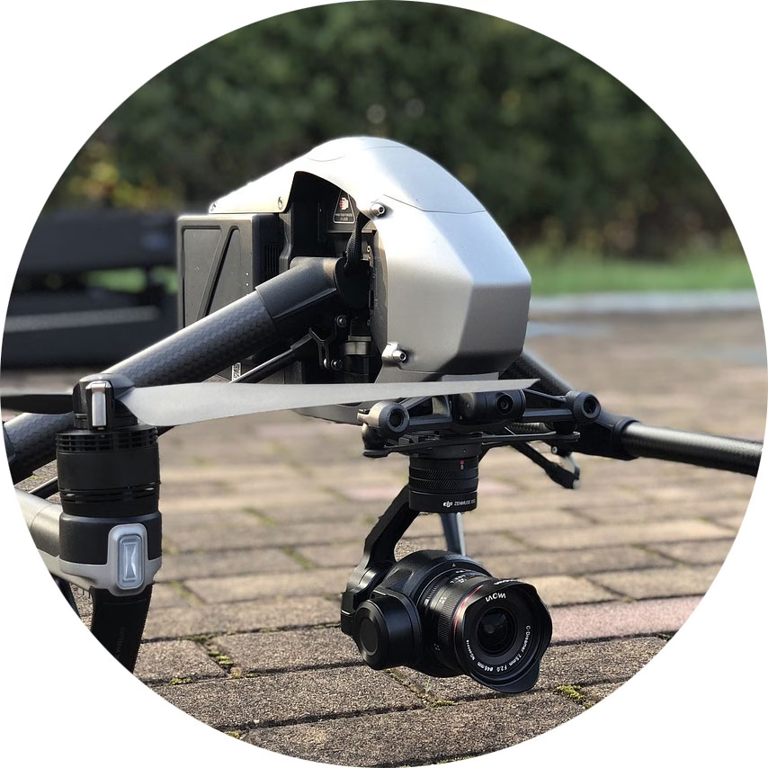
Drones are extensively used for Intelligence, Surveillance, and Reconnaissance (ISR) missions. UAVs have the ability to capture real time video and image data, which is transmitted back to command centers for analysis, without the need for soldiers to be physically present in hostile or rugged environments. The drones often operate at high altitudes, across multiple geographies.
Search and Rescue
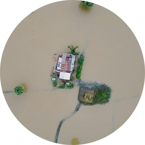
In post-conflict or disaster scenarios, UAVs can locate survivors and assess damage in areas too dangerous or inaccessible for physical teams. This can prevent further human loss and lead to the identification, location and administration of aid to ground-based defense teams. Drones have also been know to guide troops to safe areas, and away from enemy fire.
Aid and Supplies
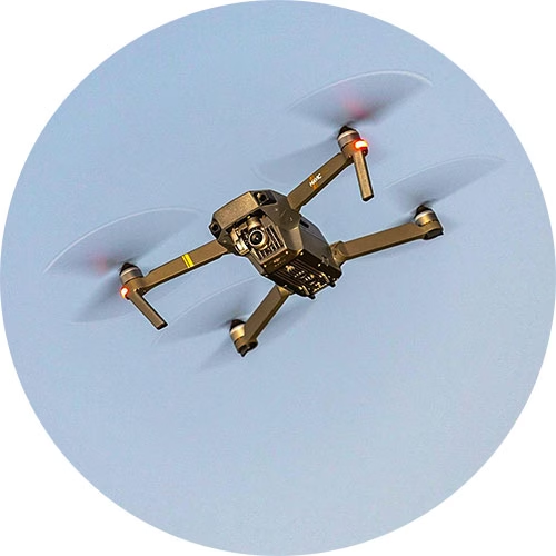
UAVs can be adapted for resupply missions in hard to reach areas and have been deployed to help soldiers on the battlefield to receive essential supplies like food, water, and medical equipment. This capability becomes especially crucial in situations where ground convoys may face delays due to hostile terrain, enemy activity, or other logistical challenges.
Precision Strikes
UAVs equipped with precision-guided munitions allow military forces to carry out highly targeted strikes with minimal collateral damage. Their precision has made them instrumental in counter-terrorism operations and eliminating high-value targets while protecting civilian lives. Further, the remote strike action removes the need for ground forces.

Electronic Warfare
UAVs fitted with highly sophisticated sensor systems are designed to gather signals intelligence (SIGINT) by detecting and analyzing enemy radio transmissions, as well as electronic intelligence (ELINT) by monitoring radar emissions. This data can provide comprehensive insights into the structure, capabilities, and operations of enemy networks.
Satellite Devices Best Suited for Military Drone Applications
Satellite connectivity is a reliable, secure means of communicating with UAVs far beyond the reach of terrestrial networks. These devices are our top picks for command and control, piloting BVLOS, and transmitting real time video footage from UAVs, for civil and defensive applications only.
Simple Command and Control with RockBLOCK 9603
Command and control of UAVs requires stable, low latency communication channels.
RockBLOCK 9603 enables basic two way communication over the Iridium satellite network, allowing operators to send flight commands or adjust mission parameters approximately once every 10-15 seconds, regardless of their geographical location.
For example, RockBLOCK 9603 could send positional data, informing operators of any need to make altitude adjustments or course corrections during a mission. This level of sophisticated satellite-enabled C2 is essential for UAVs operating in areas where ground communication networks are compromised or unavailable.
RockBLOCK 9603 is especially suited to applications where space is at a premium. It’s designed to make adding Iridium Short Burst Data (SBD) satellite connectivity super easy.
Piloting BVLOS with RockREMOTE Mini OEM
One of the most significant challenges in drone warfare is piloting UAVs beyond visual line of sight (BVLOS) – a necessity for long range missions or operations in hostile areas.
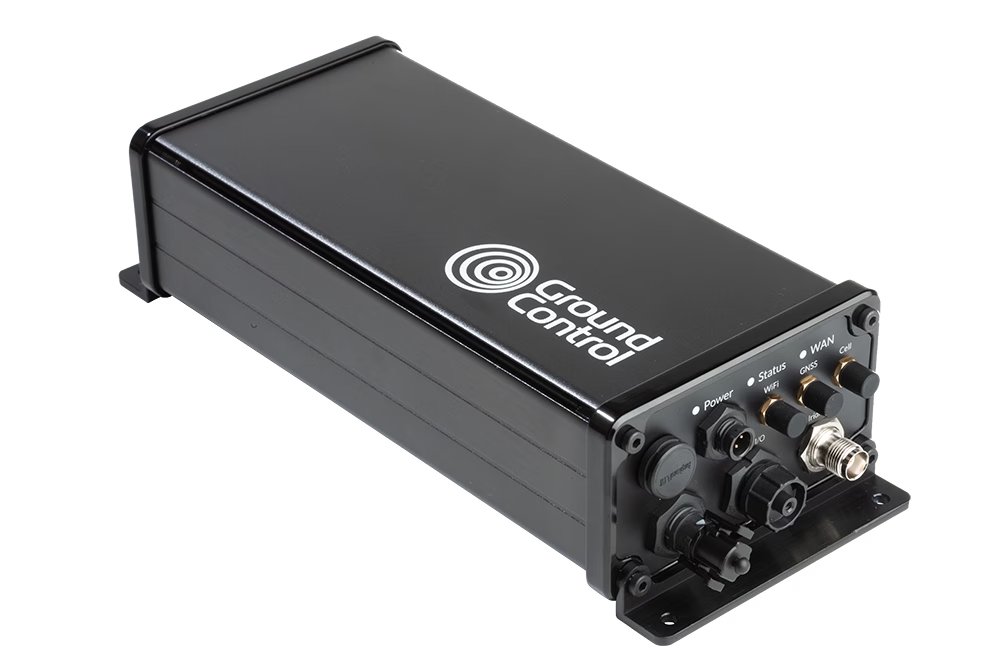
Solutions like the RockREMOTE Mini OEM provide satellite-based connectivity designed for such operations involving on the move assets.
RockREMOTE Mini OEM is lightweight, designed to draw as little power as possible, and harnesses the Iridium Certus 100 satellite network service, delivering virtually real time IP connectivity.
This technology allows for piloting and navigation adjustments, crucial for UAVs conducting missions deep into enemy territory. Furthermore, satellite-based communication ensures the operator maintains constant control over the UAV’s flight path, even when thousands of kilometers away.
Capturing Real Time Video Footage with RockREMOTE Rugged
Arguably, one of the most critical functions of UAVs in modern warfare is real time video reconnaissance.
RockREMOTE Rugged coupled with Videosoft video compression technology facilitates the transmission of high definition video feeds from drones to ground stations, enabling military forces to monitor enemy activities and gather intelligence without delay. This helps military operators to respond to threats or gather information promptly, enhancing battlefield awareness and operational decision making.
RockREMOTE Rugged does not require antenna pointing, and even with a poor or changing view of the sky, RockREMOTE Rugged can reliably and securely transfer data in close to real time via the Iridium satellite network.
Selecting the Right Satellite-Enabled Solution
|
RockBLOCK 9603
|
RockREMOTE UAV OEM
|
RockREMOTE Rugged
|
|
|---|---|---|---|
| Size | 45 x 45 x 15 mm | 175 x 60 x 37 mm | 250 x 97 x 61 mm |
| Weight | 36 g | 287 g | 1.2 kg |
| Power | Max 450mA | <30mW (sleep), <0.25W (idle), <7.5W (average transmit) | 0W (sleep), 5W (idle), 9W (average transmit) |
| Satellite Service | Iridium Short Burst Data (340 bytes ↑ 270 bytes ↓ per message) | Iridium Certus 100 (22/88 Kbps) + IMT (100 kB per message) | Iridium Certus 100 (22/88 Kbps) + IMT (100 kB per message) |
| Interfaces | Molex PicoBlade 1.25mm pitch | Ethernet (available on pin out), Serial RS232, RS485, GPIO (2xI, 2xO) | Ethernet, Wi-Fi, Serial RS232, RS485 |
| Antenna | Built in 1621 Mhz tuned patch antenna (or use optional SMA connector for external antenna) | External – various approved options | External – various approved options |
| Hosted Applications | |||
| Ideal For | Simple Commands / Failover Comms | Piloting BVLOS; Sending Compressed Images | Transmitting Real Time Video Footage |
| View Product | View Product | View Product |
Edge AI, BVLOS, and the Next Wave of UAV ISR
UAV use is expanding across military missions, including kinetic applications; however, the fastest day to day gains we see are in defensive ISR and mission support; secure C2 beyond line of sight, wide area monitoring, and comms relay. Expect more drones running AI at the edge to spot “needles in the haystack” (changes on a perimeter, vessels of interest, wildfire flare-ups) before sending only the useful bits over constrained links, cutting bandwidth while speeding decisions. That’s already a theme in ISR tooling and video workflows.
Connectivity will remain the backbone. Iridium-powered BVLOS links, facilitated by devices like the RockREMOTE Mini OEM, are being adopted to extend C2 and push telemetry/video from places cellular can’t reach, central to safe separation concepts and multi-aircraft operations.
Swarm and multi-UAV teaming are also trending for search & rescue, disaster assessment, and wide area reconnaissance, using multiple small platforms to map faster, hand off targets, and maintain comms. Agencies are likewise exploring comms-relay roles so one asset can keep others connected in difficult terrain.
Looking ahead, one area we’re excited about is humanitarian demining. Drones can scan from above, use onboard AI to flag likely contamination, and then alert clearance teams over satcom. As those edge models improve, triage gets quicker and tasking more precise.
In short, whether it’s low rate C2, BVLOS piloting, or near-real time ISR video, pairing UAVs with reliable satellite links is unlocking new defensive capabilities, and doing it in ways that help reduce risk to people on the ground.
Can we help?
Working on UAV command and control, BVLOS piloting, or real time ISR video?
We can help you choose and integrate the right Iridium-powered solution, from RockBLOCK for simple C2 to RockREMOTE for IP video, so you get reliable, global connectivity faster. We support civil and defensive applications; tell us about your mission profile and we’ll recommend a build that fits.
Complete the form or email hello@groundcontrol.com and we’ll get back to you within one working day.
Attitudes Towards Commercial & Military Drone Applications
The drone market is expected to surpass $101.1 Billion by 2032, and while military applications continue to dominate, commercial applications – parcel deliveries, remote safety inspections, environmental monitoring etc. – will make up a substantial part of that revenue.
In light of this anticipated growth in drone usage, we wanted to discover if people felt more or less comfortable about commercial vs. military applications, and whether the benefits outweighed their reservations. In March 2024, we surveyed 500+ American adults, and compiled the results in this eBook.
Download eBook For Free
What surprised us about the data
Two surveys from 2021 which engaged European audiences suggested that we could anticipate a broadly positive response. These surveys indicate that 68% of British citizens believe that drones will positively impact their lives, and 83% of EU-based respondents are positive about the use of drones in cities.
Our survey was more nuanced. Overall, 55% of respondents supported commercial drone applications, and 57% supported military drone applications. This is a more conversative response than previous studies, but what was particularly interesting was how much variation there was in the results. People in different household income, age, and industry groups held, in some cases, quite dramatically different views.
Which demographics are most likely to support military applications?
We offered two options for military applications: “passive”, which we defined as surveying and monitoring, and “active”, defined as identifying and destroying targets. The average result was 59% in favor of passive military drone applications, and 54% in favor of active applications.
This materially differed when the data was refined by demographic. Those in with household incomes over $100,000 p/a were more likely to approve of both passive (72% approval) and active (69% approval) military applications. Men were also more likely than women to support these use cases, with 63% approval for both from men, vs. 55% and 48% from women.
The larger deviations from the norm came from people working in Education & Research and Healthcare, and the under 30s, all of whom were less likely to support military drone applications – particularly active.
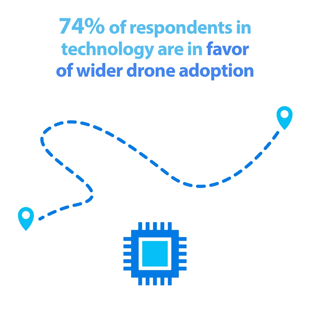
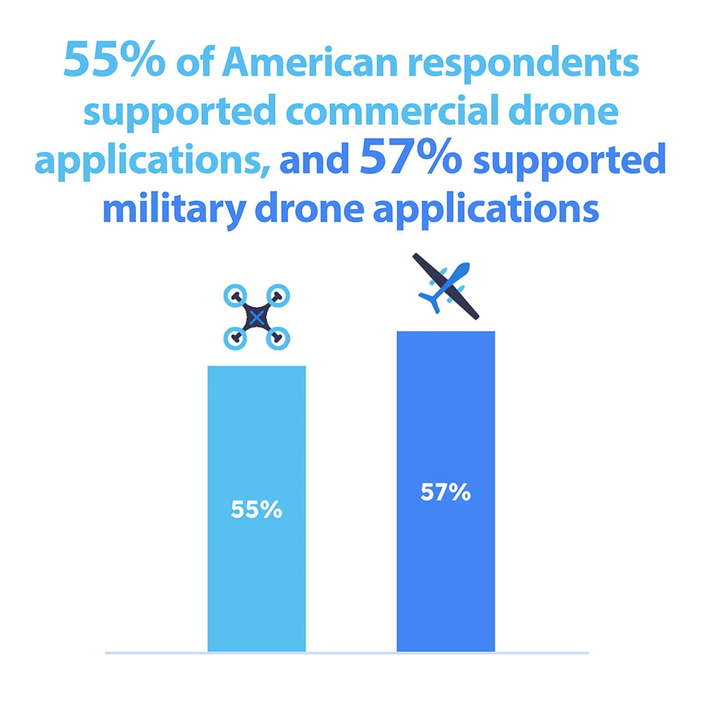
Who is most likely to support commercial applications?
We divided commercial drone applications into five: Parcel Deliveries, Prescription Medicine Deliveries, Remote Safety Inspections, Environmental Monitoring, and Emergencies.
Opinions ranged from just 37% in favor (medicine deliveries) to 72% in favor (emergencies). Departing substantially from the average results were people working in Technology, who were more comfortable with drones being used across all commercial applications listed, but particularly positive about remote safety inspections – 72% in favor vs. 58% average.
People working in Healthcare were the most opposed to drones being used for prescription medicine deliveries, at just 18% in favor, and 58% opposed.
What concerns do Americans have about drone usage?
The biggest concern our respondents had was security – the possibility that drones can be hacked or intercepted. This view was most strongly supported by people working in Technology, of whom 76% cited this as a concern.
54% of respondents cited privacy – concerns about the information drones can capture and store – as a concern, and this rose to 62% for people working in Education & Research.
Fewer respondents were concerned about the potential for job losses – just 27% – but this rose to 38% for people working in Healthcare, possibly correlated with their discomfort around prescription medicine deliveries.
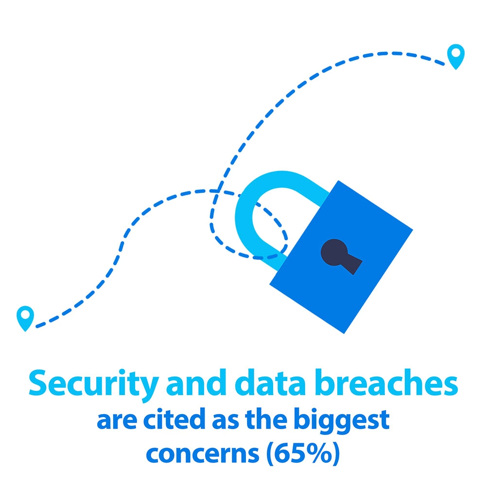
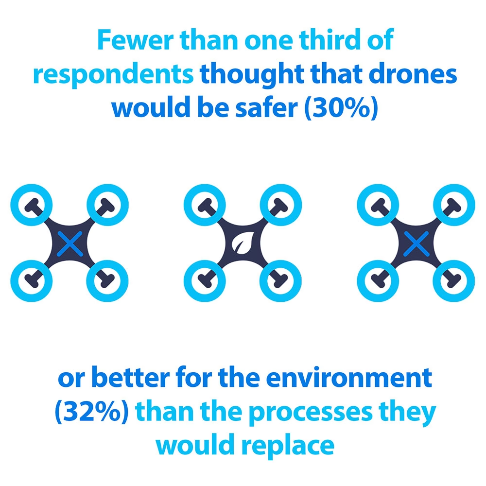
What benefits do Americans perceive can be derived from drone usage?
People were pretty reserved in their responses to this question, with no single option getting selected by more than half of respondents. The most popular response was ‘Faster Deliveries’, at 49%, followed by ‘Lower Cost’ at 38%.
The over 60s departed from the average here; slightly more saw the cost-saving benefit (42%) but only 38% thought deliveries would be faster, and only 22% thought that using drones would be safer than the processes they replaced (vs. 30% average).
Fewer than a third of respondents thought that drone usage was better for the environment, which was a surprise; analysts have reported that drone-based applications could reduce global greenhouse gas emissions by as much as 2.4 gigatons by 2030.
Leading us neatly on to…
What can the drone industry learn from these results?
While regulation remains a significant barrier for wider adoption of commercial drone applications, it will be overcome: market forces demand it. Solutions for the challenges of communication and collision avoidance already exist, and the industry received $4.8 billion in investment in 2022 alone. And at least from the operators’ perspective, the benefits, both projected and empirically demonstrated, outweigh the drawbacks.
But our respondents were, for the most part, cautious in their responses, particularly the over 60s, people in lower income households, and people working in Healthcare and Education and Research. Put simply, companies planning to deploy drones should consider how they communicate the benefits and address the concerns of citizens – particularly in applications that could directly affect their day to day lives.
How Can We Help?
Ground Control delivers satellite IoT modems that allow drone operators to remotely command and control UAVs, USVs and UGVs. We use the global Iridium satellite constellation, which is well suited to mobile, low latency, high-reliability use cases.
If you’re a drone manufacturer and would like to know more about our connectivity options, please complete the form, or email hello@groundcontrol.com; we’d love to talk.
The Vital Role of LEO Satellites in Safe and Secure UAV Drone Operations
Unmanned Aerial Vehicle (UAV) drones are transforming logistics. The diverse applications range from delivering medicines to people in remote locations, to monitoring offshore wind platforms to identify and communicate possible hazards.
The cost-saving advantages are clear; a drone is less expensive to operate than a manned vehicle, and it’s also safer. Historically, drones have been used in areas that are harder to reach by people. They’re harder to reach because they’re remote: out at sea, on an island, in the mountains or in the desert. This often comes with a side order of weather, radiation and elevation hazards. While a UAV might be negatively affected by these conditions, it’s obviously preferable to put a machine at risk rather than a human!
But drone operation is not without its challenges, chief among them piloting beyond visual line of sight (BVLOS). Without this capability, drones have to remain within sight of the operator, which limits the viability of most commercial applications. To operate safely BVLOS in non-segregated airspace (i.e. airspace shared by manned aircraft), drones must be able to detect and avoid other airspace users, reliably communicate with all stakeholders (the remote pilot, plus other aircraft and ground control), comply with relevant air traffic control regulations, and adapt to changing situations.
Certification is currently managed on a case-by-case basis, and can take years. Satellite network operator Iridium recently published a white paper calling for a Minimum Equipment List (MEL) that, if adhered to, would allow drone operators to fast-track certification and operate safely in designated airspace. In the meantime, the UK’s Civil Aviation Authority (CAA) is working on a regulatory framework that will enable specific category BVLOS operations in non-segregated airspace by 2026.
Until these initiatives bear fruit, scaled drone operations will continue to take place within well-defined and controlled operating areas, reducing the risk of conflict with other aircraft. For example, the newly implemented European Standard Scenario (STS) allows drone operators to skip the EASA’s risk assessment and authorization process by restricting altitude, flight paths and operational hours. Both pilots and the drones must meet certain standards, which include failsafes for communication: you must be able to reestablish a data link in the event that it fails, or else be able to remotely terminate the flight (source).
Communication with drones operating BVLOS
Where available, drone operators will use airborne VHF / UHF / L-Band radio, or some form of cellular connectivity to communicate with their drones. But these radio frequencies may suffer from congestion, security challenges and regulatory limits. As many drones are used in unpopulated areas, cellular may simply not be an option. So connection redundancy is an increasingly important element of BVLOS operations.
This is where LEO – Low Earth Orbit – satellite communication comes into play. Satellites launched into Low Earth Orbit are closer to the Earth than their geostationary counterparts. This has important implications for drone operators, because the latency – the time it takes a message to be sent to the drone from the operator, and received (or vice versa) – is reduced from c. two seconds to less than one second.
As this diagram shows, very few satellites are needed to cover huge swathes of Earth if the satellite is far enough away from it, but satellites in Low Earth Orbit cover only a small portion of the Earth’s surface. Multiple LEO satellites are needed for global coverage, and the first – and to date only – globally accessible satellite IoT network is Iridium. This is why Iridium is so often the choice for UAV manufacturers looking to add failover communication to their drones.
Iridium offers multiple airtime options for connecting to their satellites, from Certus 700 (700 Kbps, fast enough to support live video broadcasts) through to Short Burst Data (packet-based data which sends 270 / 340 bytes per message). Short Burst Data (SBD) is ideal as a failover connection; with SBD, operators can get position, altitude and speed, and can return basic commands such as ‘go to the nearest rally point’, ‘go home’ or ‘terminate flight’.
SBD is lightweight, low power consuming, and meets most SWaP requirements for UAVs. It offers a secure and reliable connection to the drone to make it less vulnerable to hacking, and safe to pilot within controlled operating areas.

Our team visiting Zipline in late 2023
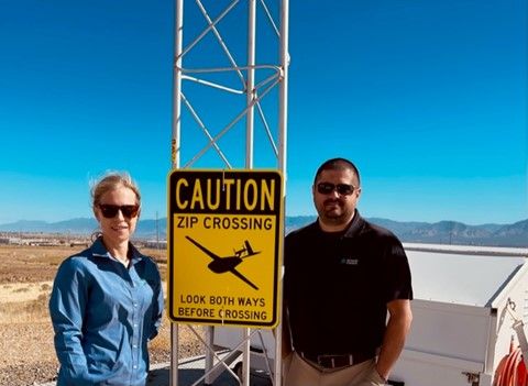
Supported by satellite IoT connectivity, important work is already taking place. Our customer Zipline is using SBD as the failover communication method for its Zips: autonomous aircraft that are being used to deliver prescriptions, groceries, vaccines, livestock supplies and more.
Very recently, Zipline was cited in the peer-reviewed journal Vaccine, noting that its method of delivering vaccines aerially to more isolated parts of Ghana has improved clinical outcomes and prevented disease among children.
In fact, it’s estimated that Zipline delivery has saved an estimated 727 lives in the Western-North Region by enabling 15,000 children to access vaccines who would not previously have been able to.
Popular Youtuber Mark Rober filmed his experience at Zipline, and it’s well worth a watch to learn more about this incredible operation.
To deliver vital chemotherapy drugs to patients on the Isle of Wight, UK-based Skylift UAV built an autonomous eVTOL (electric, vertical take-off and landing) aircraft which can fly for 1.5 hours on a single charge, with a maximum speed of 100 Mph. In BVLOS configuration, it can travel up to 100 Km, depending on the payload.
The drones are autonomous, but monitored by Skylift’s safety pilots who can take control of the drone at any time. As the drone travels BVLOS, and across a body of water (the Solent), it’s essential that the pilots have two reliable means of communication with the drone at all times. The Skylift UAV team chose the RockBLOCK 9603 to deliver SBD connectivity in addition to aviation-grade L-Band radio to ensure that irrespective of the drone’s location, connectivity is guaranteed.
RockBLOCK allows them to send and receive data from the aircraft, and is part of the robust communications package with which all Skylift drones are equipped. It’s also the final line of defence for mission success.
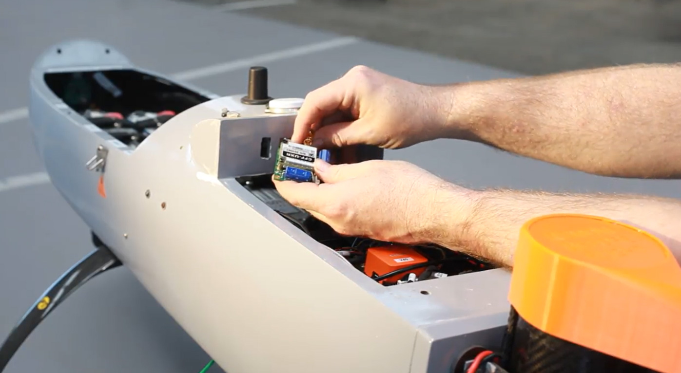
Would you like to know more?
If you’re building a drone and you’re looking for a failover communication method, we can certainly help. If your requirements are more data-hungry than simple commands – perhaps you need to be able to transmit imagery, for example – speak to our team to find out what options are available to you.
We have over 20 years’ experience in satellite connectivity, and specialise in IoT and tracking applications. We’re standing by to ensure you get the service you need.
Satellite IoT use cases: truly global connectivity for real world applications
Satellite IoT is growing in popularity, providing reliable connectivity to remote locations that would otherwise be challenging or even impossible to reach with terrestrial networks. As the world becomes more connected, the demand for real-time data from even the most remote locations has increased. Satellite IoT provides the solution to this need by offering truly global connectivity for real-world applications.
Satellite IoT is being used in a variety of industries, including healthcare, agriculture, workforce safety, and more. Let’s dive into just some of the most prominent use cases for satellite IoT…
1: Healthcare
IoT has revolutionised the healthcare industry by providing innovative solutions to improve patient care, reduce costs, and increase efficiency. IoT in healthcare refers to the use of connected devices, sensors, and data analytics to collect and analyse patient health data in real-time. This could include remote patient monitoring, smart medical devices and wearable technology like fitness trackers and smart watches.
Satellite IoT can also facilitate medical and healthcare accessibility to patients in remote areas who are unable to travel. For example, utilising the RockBLOCK 9603 technology, satellite IoT has enabled the transportation and delivery of emergency and essential medical supplies to vulnerable people who are at high risk if they travel.
Read Healthcare By Drone
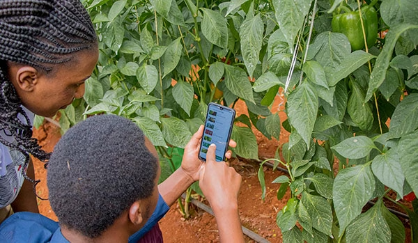
2: Agriculture
The agriculture industry is utilising satellite IoT to enhance productivity and lower expenses. By monitoring soil moisture, temperature, and other environmental factors, farmers can optimise their crop yield and reduce waste. This is sometimes referred to as Smart Farming. Satellite IoT can also be used to track livestock and monitor their health – improving overall animal welfare and reducing losses.
COSMOS-UK has installed Viasat IoT Pro terminals at remote soil moisture monitoring locations, to help combat climate change. The soil moisture data intelligence delivered by the Hughes 9502 specifically, to agricultural and environmental scientists, has the potential to transform the way we understand and model the natural environment.
Furthermore, satellite IoT has supported Synnefa in Kenya, to operate outside of terrestrial infrastructure by transmitting sensor data to enable smarter predictions for optimum harvesting times. The introduction of precision farming has been so successful, Synnefa has been able to help farmers:
- Save water by over 50%
- Reduce fertiliser application rates by 41%
- Increase production by 30% when compared to yields prior to the use of their devices.
3: Asset Tracking and Monitoring
Tracking and managing assets in real-time, providing valuable data on asset location at any given time is made possible with IoT technology. With satellite-enabled tracking devices, businesses can keep track of their assets no matter where they are in the world, even in the most remote locations. But here, it’s not just vessels, wind turbines and remote workers who can be tracked – animals can be too!
Illegal poaching is a big problem in Gabon, Africa. RockREMOTE with IMT enablement has equipped the rangers in Gabon with the latest in AI-powered camera trap technology to effectively monitor and prevent illegal poaching in the forest. With this advanced technology, endangered African species and iconic African wildlife have greater protection from poachers for this generation and the next.
Read More About Poaching in Gabon
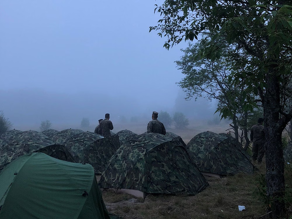
4: Workforce and Personnel Safety
Satellite IoT can be harnessed to monitor the safety of lone or remote workers in hazardous environments. By providing real-time alerts in the event of an incident or emergency, companies can respond quickly and potentially save lives. For example, workers in mining or oil and gas operations can wear wearable devices that monitor their location and vital signs, alerting supervisors in the event of an accident or injury. In addition, monitoring remote military personnel and natural disaster response teams is critical to their safety and well-being.
For example, the RockSTAR device has been used by the Ministry of Defence in their training. The RockSTAR was paired with bluetooth heart rate monitors, meaning biometrics could be monitored throughout with the added benefit of worldwide tracking and two-way communications. As well as critical monitoring, satellite IoT can also be leveraged for more leisure-based tracking and monitoring applications – including ultra-marathon runners via the RockSTAR tracking and two-way communications device.
See Tracking in Action5: Energy and Renewables
The energy sector is also seeing the benefits of satellite IoT. The technology enables remote monitoring of renewable energy infrastructure in real-time, allowing for early identification of any faults or issues, thus preventing downtime and maximising energy output. The performance of renewable energy assets is also optimized by collecting and analysing data on weather patterns, energy production, and equipment performance. This data can be used to improve efficiency, reduce costs, and even enhance the lifespan of renewable energy assets.
With five hydroelectric power stations in Snowdonia, North Wales, RWE maximises its renewable energy output from the reservoirs with a remote IoT solution – the Hughes 9502.
Read About Facilitating Renewable Energy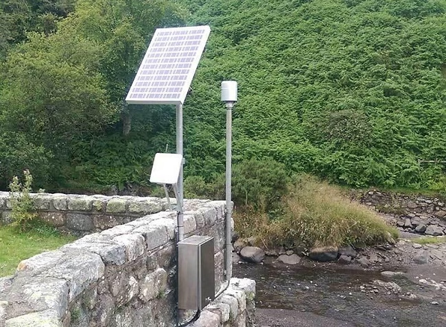
Satellite IoT vs. Traditional Cellular Networks
While traditional cellular networks are sufficient for many use cases, they have limitations when it comes to remote locations.
One of the biggest advantages of satellite IoT is that it provides truly global connectivity, even in the most remote and inaccessible locations. Unlike traditional cellular or Wi-Fi networks, satellite signals can reach anywhere on the planet, making it ideal for industries where assets are remote or located in harsh environments.
With satellite IoT, data can be transmitted from quite literally anywhere in the world, making it ideal for applications where cellular coverage is limited or even non-existent. Satellite IoT is also more reliable than cellular networks in many cases, as it is resilient to interference or disruption from extreme weather events.
However, it’s not necessary to choose either terrestrial or satellite connectivity. Satellite networks can be deployed quickly and easily, using the same messaging protocols as terrestrial networks, allowing businesses to scale their operations up or down as needed without having to worry about the limitations of traditional networks. What’s more, for businesses and industries that require global connectivity, the cost of deploying and maintaining satellite IoT devices can often be less expensive than building and maintaining traditional terrestrial networks from scratch. It can also be cheaper than deploying remote field engineers to remote sites.
In Summary…
Satellite IoT provides reliable connectivity to remote locations; bridging the connectivity gap that would otherwise be difficult or impossible to achieve with traditional cellular networks alone.
From reliable communication to real-time data collection and analysis, satellite IoT is changing the game for businesses and entire industries that need to stay connected no matter where their assets are located. Furthermore, as satellite technology continues to evolve and become more affordable, we can expect to see even more innovative use cases emerge in the coming years.
Unlock the Full Potential of Your IoT Project
Incorporating satellite IoT into your existing business operations can revolutionise what you can achieve. With satellite IoT, you can access data and insights that were previously unavailable or difficult to obtain with traditional networks and connectivity options.
Contact us to discover the added value of satellite IoT to your business today. We’re here to help and provide solutions to your connectivity challenges.
Far-Sighted Satellite Solutions for Constant Connectivity
We can now establish optimal communications to and from even the most inaccessible areas on land, on sea and in the skies, while contributing directly to the reduction of international carbon emissions.
Spearheading this momentous and necessary step change is Iridium, proudly designating itself as ‘the only truly global communications network’. Iridium’s Global Line of Sight programme is currently emphasising the versatility, efficiency and practicality of its satellite services with regard to unmanned aircraft systems, drones and other autonomous or remotely-piloted vehicles; and this initiative is, in turn, enthusiastically supported by Rock Seven (now trading as Ground Control), with integral products such as its RockBLOCK plug-and-play satellite communication solution.
RockBLOCK units are indispensable Internet of Things (IoT) devices, enabling all manner of autonomous assets to transmit Short Burst Data (SBD) messages between the equipment and centralised host computer systems. The range encompasses the RockBLOCK 9602 and the more compact RockBLOCK 9603, chiefly intended for use in contexts such as system integration or product development where space within an enclosure might be limited. Hosting an Iridium SBD modem, RockBLOCK effortlessly overcomes the limitations of Wi-Fi and GSM networks, and is capable of sending and receiving short messages from literally anywhere on Earth with a view of the sky.
RockBLOCK’s value to sectors such as Search & Rescue, ISR (Intelligence, Surveillance, Reconnaissance), Environmental Monitoring and Disaster Assessment, where rapid and reliable messaging is of the essence, is demonstrable. Here are some examples of the RockBLOCK in action.
Iridium Edge Solar
In addition to the RockBLOCK, Ground Control’s plug-and-play product range features a variety of other tracking and communications solutions, using the Iridium network, to enable data transfer to and from hitherto inaccessible areas. These include the RockSTAR two-way messenger, the RockFLEET global tracking device to drive efficiencies in fleet management, and the RockAIR tracking and messaging device, designed for easy mounting on the dashboard of light aircraft and vehicles.
In a meaningful new development, it was announced at the tail end of 2019 that Rock Seven (now trading as Ground Control) has been nominated as the beta partner for the new, solar-powered and competitively-priced Iridium Edge Solar tracking device, which is scheduled for launch in 2020. Offering easy wireless installation and an autonomous tracking facility, the set-and-forget Iridium Edge Solar is perfect for users requiring a simple, economical but completely reliable SBD tracking device supplying pole-to-pole connectivity.
Wingcopter
Wingcopter’s lightweight but robust VTOL drones are transforming processes and practices for customers in a broad variety of contexts – anything from the transportation of medical or aid supplies and the inspection of large-scale infrastructure, to forestry mapping and the creation of logistics chains to and from remote locations.
Wingcopter has been equipping its drones with RockBLOCK units. With their unprecedented range and speed, the VTOL drones are capable of flying into environments and territories with limited or zero GSM coverage, and the RockBLOCK’s ability to send and receive data from such locations means that users can reliably track a drone’s flight status with ease from their tablet or computer, regardless of the VTOL’s whereabouts.
RockBLOCK at High Altitudes
RockBLOCK units have also been fundamental components in esoteric, questing enterprises such as the LOHAN (Low-Orbit Helium-Assisted Navigator) spaceplane project, enacted by the Special Projects Bureau from the science and technology website The Register, aided by a team of volunteers. The project’s aim was to deploy a single meteorological balloon to raise the 3D-printed spaceplane to altitude – the rim of space – then release the craft and glide it back to a designated landing site using a combination of GPS and autopilot control.
The RockBLOCK proved indispensable as a means of transmitting GPS data and receiving ground commands when the LOHAN unit rose out of GRPS coverage range. Furthermore, a stipulation of the project was that an emergency mission abort protocol needed to be implemented in the event of the unit veering off course. Had this occurred, a message would have been communicated to the RockBLOCK via Rock Seven’s API, which enables remote systems to interact with the firm’s products, and this would have triggered the spaceplane’s self-destruct mechanism.
A similarly lofty demonstration of the RockBLOCK’s capabilities took place when a team comprising Andrew Ashe, Jerry Sandys and Peter Gibbs sent a balloon to near space, using code developed by the eminent computer scientist and senior software engineer Mikal Hart. In this instance, the RockBLOCK was used to successfully allow the team to track the balloon throughout its flight, as well as enabling them to recover its payload when the high-altitude craft returned to Earth.
The Microtransat Challenge
Proving that RockBLOCK products are just as much at home afloat as in the sky, the Microtransat Challenge is a transatlantic race for autonomous boats; but the competitive element is, in a sense, an adjunct to its real objective, which is to encourage the development, construction and refinement of such vessels. Two teams involved in the challenge, representing Epsom College and Southampton University, are finding the RockBLOCK to be an ideal IoT solution.
Teams from Epsom College have participated in the 2016, 2018 and 2019 challenges with the boats That’ll Do, That’ll Do Two and EC-Crossing, and in each case, a RockBLOCK unit has been put to work transmitting detailed telemetry data from each vessel as they have attempted to cross the Atlantic. Once an hour, the RockBLOCK has relayed each boat’s latitude and longitude position as well as providing updates on battery voltages and temperature readings inside the electronics bays. The RockBLOCK is also capable of sending a Mayday alert should any water be detected in the hull. The RockBLOCK has enabled teams to forward vessel updates to a PHP script which places a position marker on a rolling map on the college’s website as well as updating Twitter and allowing data to be stored in a Structured Query Language (SQL) database.
Ship Science students from Southampton University, meanwhile, have applied themselves to the design and construction of an autonomous, solar-powered vessel named Peruagus. A radical departure from most craft that have undertaken the Microtransat Challenge in previous years, the sturdy, self-righting Peruagus exclusively draws upon sustainable solar energy for propulsion and rudder control, and its modular composition has been devised specifically to allow all manner of different weather monitoring apparatus, power systems and superstructure configurations to be installed. As with the Epsom College vessels, a RockBLOCK unit is a prerequisite for transmitting exhaustive telemetry data from the Peruagus while also enabling the autonomous boat to receive waypoint instructions.
SEASCAMS2
RockBLOCK units are also providing sterling service at the heart of the SEACAMS2 project, a £17m, three-year undertaking jointly conceived by the universities of Bangor and Swansea to assist research and applications for low-carbon, marine-renewable energy opportunities in the convergence regions of Wales. Environmental monitoring specialists OSIL (Ocean Scientific International Ltd) are closely involved with the project and have supplied a network of three data buoys, each of which has a RockBLOCK unit installed.
The function of the buoys is to support the sustainability aims of the project by collating water quality, meteorological and oceanographic data from the waters around the North Wales coast. To this end, each buoy is equipped with a dual telemetry system; and the RockBLOCK units are a prerequisite for conveying the crucial information collected by the buoys in dependable, unbroken SBD transmissions from remote sea areas beyond the range of GSM networks.
Read more about our work with OSIL and the SEACAMS2 project.
As commerce, society and the ecology come to rely more and more upon the exchange of real-time data we can trust, Rock Seven (now trading as Ground Control) is blazing a trail for 24-carat connectivity from all corners of the globe.
Get in touch
We’ve implemented satellite IoT infrastructure for decades, and there’s very rarely been an obstruction issue we couldn’t overcome with a bit of knowledge and ingenuity.
We’d be happy to talk to you about your project and offer impartial advice on the best antenna and satellite service for your particular requirements. Call or email us, or complete the form.