Okala’s conservation scientists and software engineers use a combination of methodologies, including camera traps, bioacoustics, and remote sensing, to assess biodiversity and monitor environmental impact. They effectively leverage AI and machine learning for data analysis, offering expert-verified insights and a dashboard for visualizing and understanding nature data.
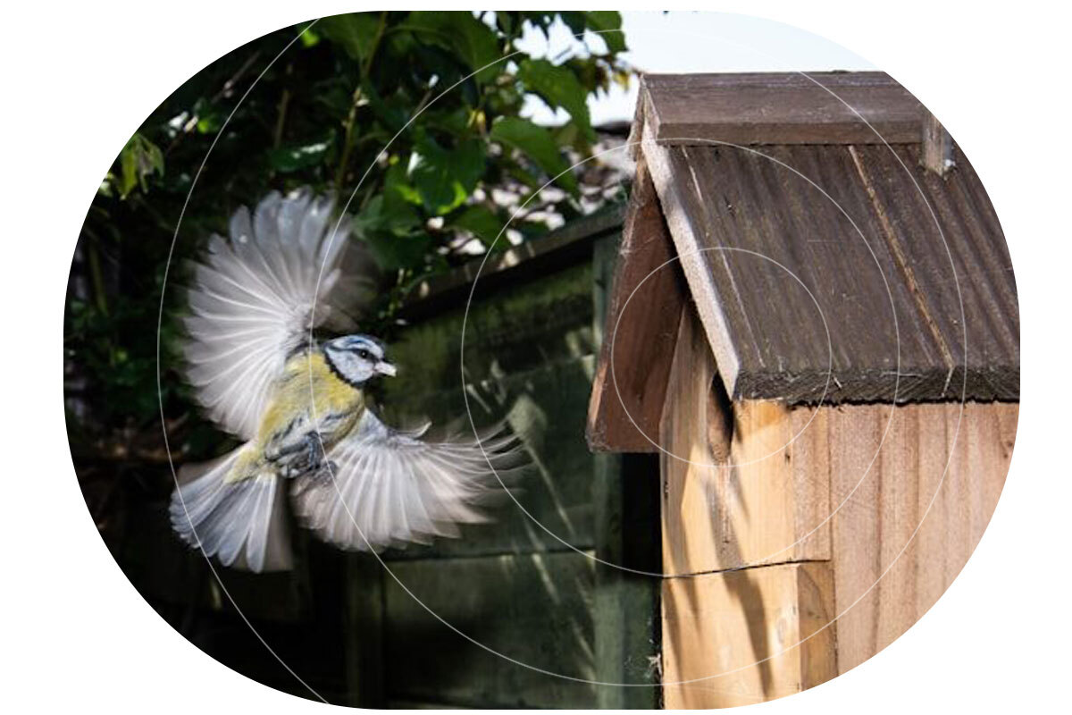
Known for delivering scalable, science-driven nature monitoring and compliance solutions, Okala partnered with Ground Control to create a new kind of remote sensing device – a smart birdbox equipped with a camera, digital scales and satellite connectivity that can be deployed in any environment, to track and monitor birdlife.
This marked the beginning of Project Pyedwagtail. The mission? Build a rugged, low-power system capable of collecting and transmitting wildlife data from anywhere in the world, even the most remote and inaccessible regions.
The challenge set by Robin, CEO of Okala, was deceptively simple: “We need a smart bird box with a camera that we can deploy anywhere.”
However, delivering on that vision required a blend of hardware innovation, software efficiency, and robust, reliable connectivity. The system needed to detect when a bird was present, or absent, inside the birdbox; capture images automatically, record temperature readings both inside and outside the box, and transmit all of the data to Okala’s conservation management platform. It had to be low-power, compact and resilient, function entirely off-grid, and communicate via satellite from any location on Earth.
The Challenge Takes Flight
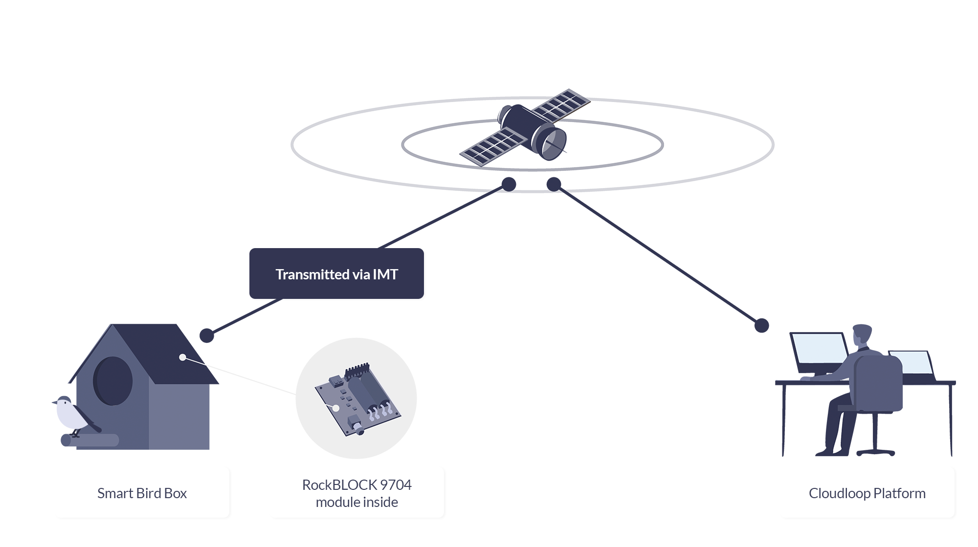
The Okala smart birdbox solution is built around four key stages: sensing, imaging, satellite transmission, and cloud integration. At the core of the sensing solution is a simple but effective digital scale mounted inside the birdbox, which communicates with a Raspberry Pi via the I²C interface. This setup enables the system to detect when a bird enters the box, monitors changes in weight over time, identifies how many birds are present, tracks egg-laying events, and even determines when chicks fledge. These weight changes also trigger automatic photo captures. While the Ground Control team could have implemented a more complex machine learning model, we opted for a simple, reliable mechanism for minimum power consumption and complexity.
To capture images, we utilized a Raspberry Pi Camera Module 3 and the libcamera library. Each triggers a photograph, saved as a JPEG file. However, since the size of JPEG files can vary dramatically based on image complexity, such as a blue sky versus the intricate details of a bird’s feathers, Ground Control developed a smart resize function. This function compresses images intelligently, optimizing file size for efficient satellite transmission without compromising essential visual detail. The next challenge is transmitting the data back to Okala.
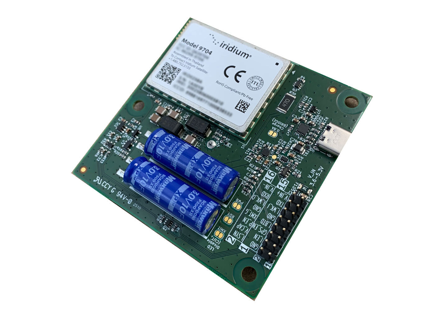
RockBLOCK 9704
For this project, reliable, global satellite connectivity is achieved via the RockBLOCK 9704 – a compact satellite modem that utilizes the Iridium global satellite network – and Iridium’s IMT (Iridium Messaging Transport) service. IMT enables the system to send and receive messages of up to 100Kb, with very low latency, from anywhere in the world.
RockBLOCK 9704 operates with very low power requirements, consuming less than 5 mW in sleep mode and peaking at 1.4 W during transmission. RockBLOCK’s Python and C libraries made integration incredibly simple, with only a few lines of code required to send data.
Of course, the satellite module is only one piece of the puzzle. Once the data is returned from the satellite, it needs to be routed securely and reliably to Okala’s system. This is where Ground Control’s Cloudloop Data platform plays a critical role.
Cloudloop Data
Rather than requiring custom code to decode device messages, Cloudloop Data takes care of the translation and seamlessly delivers the data to Okala, whether via MQTT, HTTPS, AWS, Azure, or other services. It’s built to ensure data reaches its destination in the correct format, no matter the protocol – SBD or IMT. By handling the complexity of proprietary device communication, Cloudloop accelerates integration and significantly reduces development time. Even if Okala’s servers are temporarily offline, Cloudloop securely stores all incoming data to guarantee nothing is lost. The platform also supports devices from other manufacturers, making it highly adaptable for diverse IoT applications.
And the cost of the project? The total system was surprisingly cost-effective. The RockBLOCK 9704 module costs $279 and operates on either prepaid plans starting from $0.29 per KB, or post-pay contract plans which are even lower cost. Given the power of the technology and the low cost of deployment, it represents an accessible, scalable solution for conservation projects of any size.
Beyond The Birdbox
By combining Okala’s expertise in AI-powered conservation platforms with Ground Control’s proven track record in global satellite IoT, Project Pyedwagtail has demonstrated what’s possible in smart, remote wildlife monitoring. The result is a simple but robust system that can send photographs, environmental data, and near-real time alerts from any location on Earth, with nothing more than a Raspberry Pi, a few sensors, a RockBLOCK 9704 module, and some participating wildlife.
While the project started with the concept of a smart birdbox, the implications are further-reaching. The combination of camera traps, intelligent sensing, and global satellite connectivity has applications across wildlife monitoring, ecological research, remote surveillance, and even anti-poaching operations. This ability to gather visual and environmental data in near real time from remote locations opens new possibilities for field researchers, conservationists, and environmental organizations worldwide.

We're Here to Help
If you need to transmit sensor data from remote environments, whether it’s wildlife activity, environmental metrics, or atmospheric readings, we’re here to help. At Ground Control, we specialize in connecting devices and assets in the most inaccessible locations, far beyond the reach of traditional cellular networks.
By leveraging multiple satellite networks and communication protocols, we deliver cost-effective, reliable solutions tailored to your needs. Get in touch with us at hello@groundcontrol.com or fill out the form. We’ll get back to you within one working day.