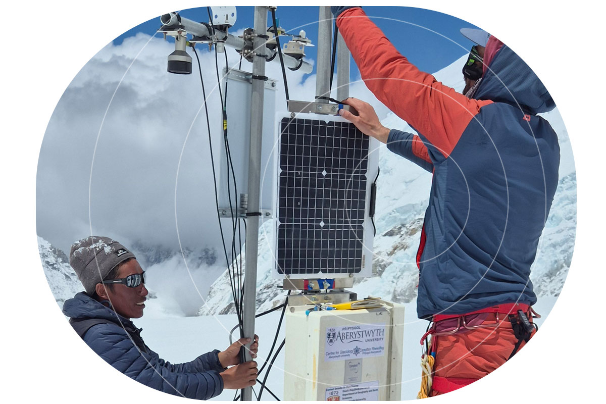
At over 6,500 meters above sea level, in the Western Cwm of Mount Everest, a team of glaciologists is gathering climate-critical data from one of the most extreme environments on Earth. Their aim is to better understand the controls of ice temperatures at high elevation, where observations are few and far between. Working on the Khumbu Glacier, their findings promise to improve forecasts of ice recession and water availability for millions of people living across the Himalayas.
Working in partnership with scientists from the University of Leeds and Aberystwyth University, Ground Control provided a satellite communications system capable of transmitting data daily from Everest’s icy slopes, without requiring a single visit back to the deployment site.

The Challenge
The Khumbu Glacier has long been a focus of glaciological research, not least because of its accessibility from Everest Base Camp. But this latest project, funded by the UK’s Natural Environment Research Council, sought to go deeper. By drilling into the glacier at over 6,500 meters elevation, the research team aimed to directly measure:
- Ice temperature at different depths
- Snow depth, accumulation, and compaction
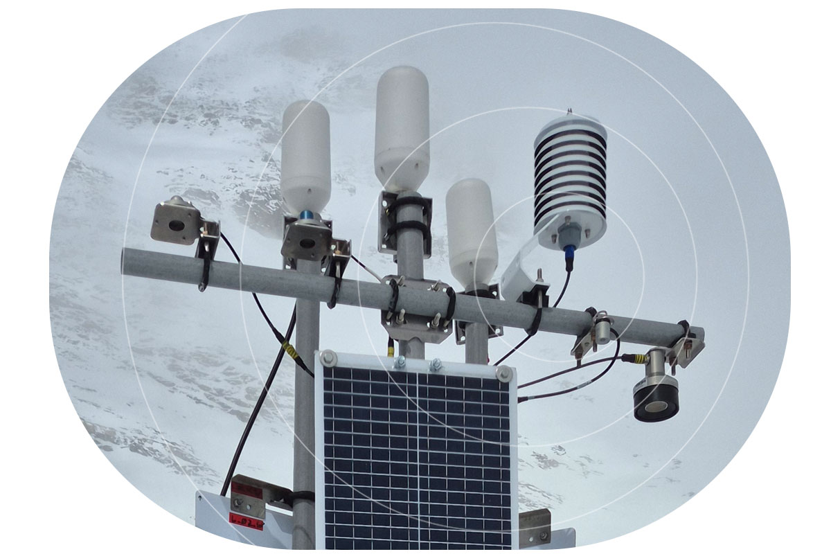
- Meteorological conditions, including temperature, humidity, and solar radiation.
Collecting this data was only half the challenge. Getting it off the glacier and into the hands of researchers in close to real time, without physically retrieving the equipment, was critical for both data continuity and team safety.
Connecting the Glacier
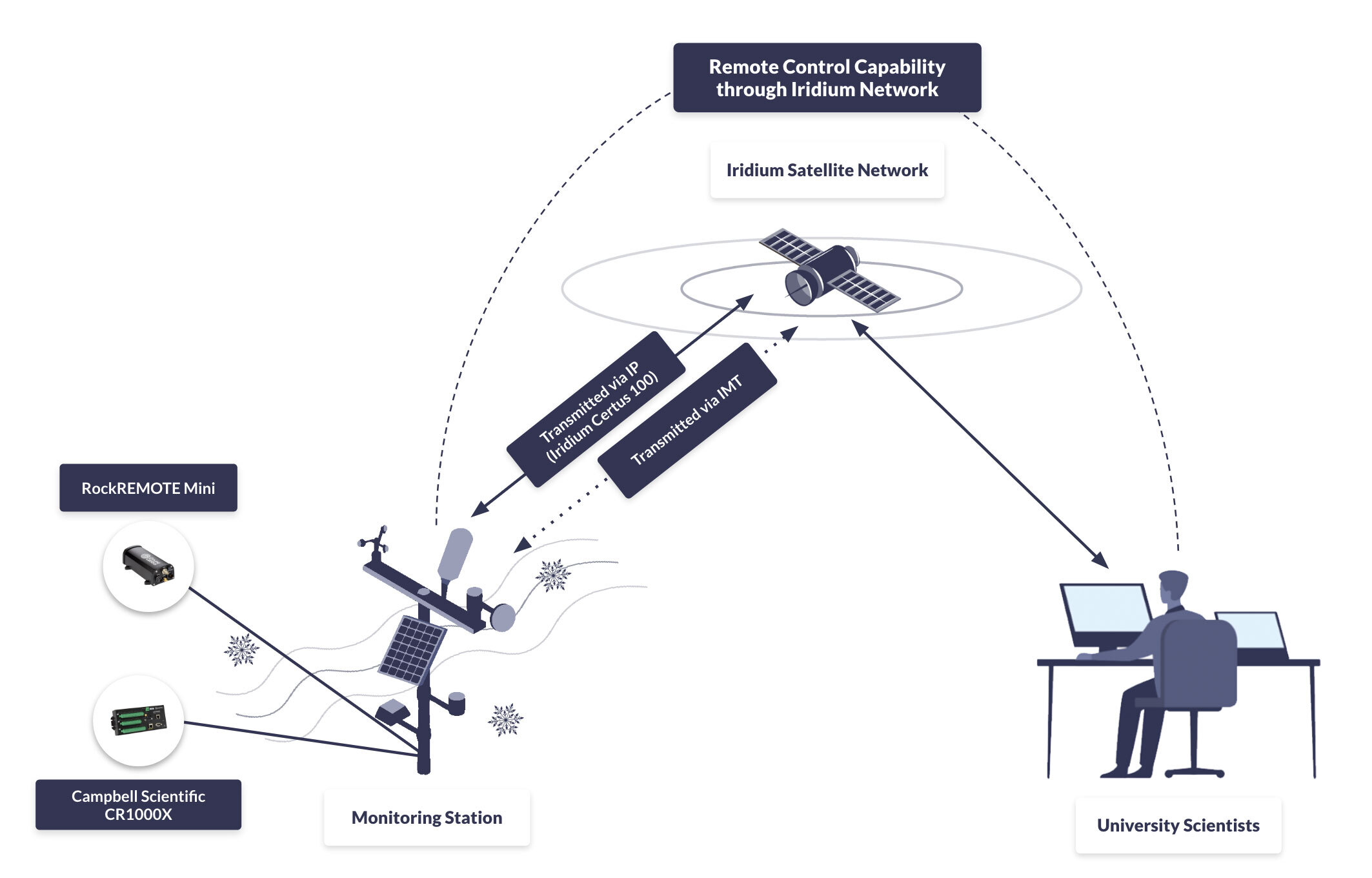
To enable this, Ground Control supported the integration of the RockREMOTE Mini satellite transceiver with Campbell Scientific CR1000X dataloggers at two drill sites and a weather station.
RockREMOTE Mini supports both IP and message-based communication over the Iridium Certus 100 network, for efficient, flexible, low power transmissions.
In addition to sending regular data packets, the system also allows researchers to remotely log in to the data logger via Satellite IP, offering full access for reconfiguration or troubleshooting without a site visit.
Early stage troubleshooting was also supported by Ground Control to ensure robust communications before the kit was taken into the field.

“We planned, tested, and validated the integration between the CR1000X and the RockREMOTE Mini. We created a sample CRBasic program that demonstrated how to control the RockREMOTE Mini from the logger, send data, and allow remote access, all of which the team could adapt for their own setup.”
Michael Mitrev, Solutions Architect, Ground Control
Outcome: Real Time Data from Everest
During operation, the satellite-enabled system transmitted data reliably from the Khumbu Glacier’s drill sites and weather station. Despite sub-zero temperatures and remote conditions, the RockREMOTE Mini operated autonomously, sending back environmental data that has helped scientists monitor how the glacier responds to changes both in short term weather and long term climate, improving forecasts of ice recession for the wider region.
The data are expected to contribute to a growing understanding of:
- The characteristics of high altitude ice masses
- Seasonal and long-term glacier melt patterns
- Future threats to communities relying on Himalayan glacial water.
“The ability to be able to observe the glacier in near real-time, without having to visit the field site, has revolutionised the way we conduct our research. For the first time we can analyse and interpret the data as soon as we have installed the equipment, rather than waiting 12 months or more until a team can recover the loggers.”
Duncan Quincey, Professor of Glaciology, University of Leeds
Why Satellite IoT?
Traditional communication systems are unworkable on the snowfields and glaciers of the Everest region. There is no cellular coverage, and even high frequency radio is unreliable in mountainous terrain. Satellite IoT provides a uniquely resilient option for projects like this, offering:
- Global coverage, even in the highest and most remote parts of the world
- Low power operation, ideal for battery or solar-powered deployments
- Two way communication, enabling both data transmission and remote access
- Scalability, from a single sensor node to multi-site sensor networks.
For glaciologists, and for environmental science more broadly, satellite IoT is opening up new possibilities for data collection in places where previously, researchers had to choose between scientific insight and personal risk.

Bring Your Data Home From Anywhere
Want to monitor assets or environments in places where cellular and radio can’t reach?
Ground Control helps teams deploy low power satellite IoT that sends data reliably, and supports remote configuration without repeat site visits.
Tell us about your project and we’ll recommend the right connectivity and integration approach. Either complete the form, or email hello@groundcontrol.com, and we’ll be in touch within one working day.