Remote environmental monitoring systems rarely fail because sensors stop working. They fail because connectivity becomes inconsistent over time. Terrain, vegetation, infrastructure, and network changes all influence performance. What begins as intermittent coverage can gradually become unreliable.
The result is silent data gaps, repeated site visits, and reduced confidence in the dataset. Instruments may be functioning correctly, but the monitoring program no longer feels stable.
This guide to remote satellite IoT outlines practical connectivity models for long life deployments. It explains how satellite and hybrid architectures complement cellular networks, how different data behaviors influence device selection, and how to design for predictable performance over years, not months.
Why Connectivity Design Determines Monitoring Reliability
In remote environmental monitoring, connectivity decisions are architectural decisions. They influence power design, enclosure layout, antenna placement, maintenance cycles, and long term operating cost.
Two practical questions shape the right approach:
- What does your data look like?
Is it small and periodic, structured and diagnostic, or does it require IP access for remote servicing? - What does the site look like?
Open sky behaves differently from mountainous terrain, dense canopy, or built infrastructure. Satellite networks tolerate obstruction differently, and GEO systems require clearer line of sight than LEO systems.
The guide explains how these variables interact and how to select an approach that matches the real conditions of your deployment.
What Connectivity Models Do We Cover?
Giving four practical connectivity models commonly used in environmental monitoring, we explain how to align them with real deployment needs.
These include message based telemetry for small periodic readings, alarms, and heartbeats where power efficiency and long battery life are priorities; rich messaging for larger structured payloads, logs, and diagnostic snapshots while maintaining a message based workflow; IP connectivity for remote access, interactive diagnostics, firmware updates, or site networking; and standards based satellite NB-IoT (NTN) for small scheduled packets delivered using a cellular style model via satellite in latency tolerant applications.
Each model is described with clear guidance on power impact, operational complexity, and suitable use cases so you can select an approach that fits your data behavior without over specifying the system.
What Devices and Architectures are Included?
We cover:
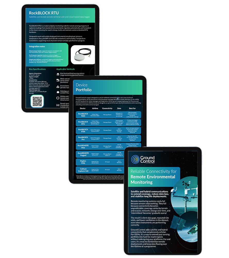
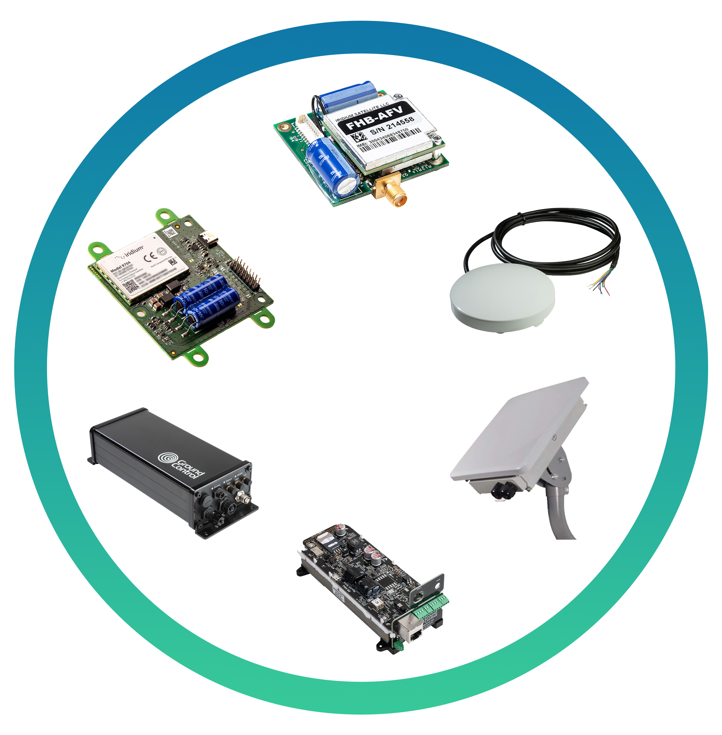
- Ultra-low power SBD modules for simple telemetry
- Integrated remote terminal units for turnkey sensing
- Messaging Transport devices for structured multi-sensor reporting
- Compact Certus 100 IP gateways for controlled remote access
- Rugged hybrid gateways combining satellite and LTE
- GEO IP terminals for stable open-sky fixed installations.
With integration notes, message size and throughput expectations, typical applications, SWaP considerations and coverage behavior for each device. Trade-offs are stated directly, helping engineering teams to compare options with realistic expectations.
How Does Our IoT Platform Support Deployment at Scale?
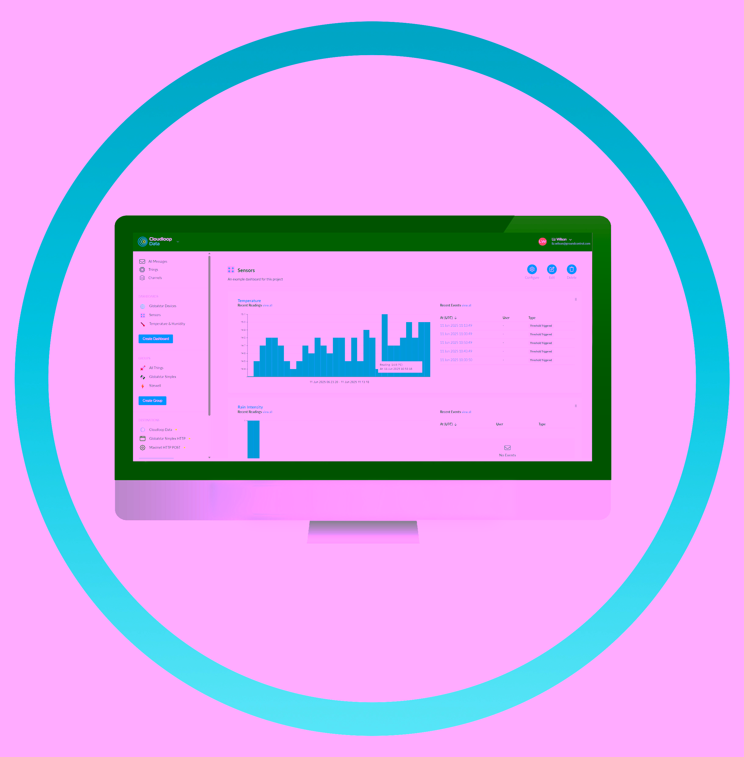
Connectivity alone doesn’t guarantee operational stability; monitoring programs also depend on predictable device management and reliable data handling. Our guide explains how the Cloudloop IoT platform delivers the functionality (and APIs) needed to manage subscriptions and services as deployments scale, securely provision and support devices with remote troubleshooting, and maintain message visibility and retrieval for audits and diagnostics.
It also covers API-based data delivery into existing monitoring platforms, with optional visualization and threshold monitoring to speed up validation. The emphasis throughout is on control and observability: you retain architectural ownership while reducing manual processes and eliminating one off tooling.
Why Download This Environmental Monitoring Guide?
If you’re planning to extend environmental monitoring into areas with unreliable cellular coverage, experiencing data gaps or increasing truck rolls in remote deployments, or evaluating satellite for the first time and need a clear technical comparison.
Our guide, Reliable Connectivity for Remote Environmental Monitoring, provides structured comparisons, integration guidance, and realistic performance expectations all designed to help support architectural decisions or broaden your deployment options.
Quick Reference Page Guide
The decision depends on data behavior:
- SBD supports small periodic readings and alarms with very low power demand
- IMT supports larger structured payloads and structured diagnostics while remaining message-based
- IP connectivity is used when remote access, firmware updates, or LAN integration are required.
Higher capability increases power demand and system complexity, so alignment with workflow requirements is important.
See Guide: Connectivity Behaviors Overview (Page 2) and Device Portfolio (Page 3)
Message-based systems can operate at low average power when transmissions are short and periodic. IP sessions require more deliberate power budgeting because they establish active links.
Off-grid deployments should evaluate transmission frequency, payload size, and idle consumption during the architecture phase.
See Guide: SBD and IMT Device Tiers (Pages 4–7) and GEO Terminal notes (Page 10)
It depends on the network. GEO systems require clear line of sight to a fixed point in the sky, so siting discipline is important. LEO systems such as Iridium do not require antenna pointing but still require a clear sky view. Terrain and obstruction should be assessed early in deployment planning.
See Guide: GEO vs LEO positioning notes (Page 3)
Yes. Message-based devices can often be added alongside existing controllers without redesigning the sensing platform. Data can be delivered into SCADA systems, databases, dashboards, or analytics tools using API-driven integration methods. Integration effort depends on payload format and system architecture.
See Guide: Device integration notes (Pages 4–9) and Cloudloop Data delivery (Page 13)
Yes. Satellite supports fleet-scale deployments when payload formats, device configuration, and subscription management are standardized. Consistent architecture supports replication across regions with mixed coverage conditions.
See Guide: Device Portfolio structure (Page 3), Cloudloop platform (Page 12), and OEM/System Integrator model (Page 14)

Looking for more?
Reliable environmental monitoring starts with predictable connectivity. If our guide has prompted interest in our satellite device portfolio, or you want more integration support for your deployment or end users, please get in touch!
Complete the form or email hello@groundcontrol.com. We will reply within one working day.