Drones are no longer futuristic novelties. They’re already saving lives, cutting emissions, and driving efficiency across industries as diverse as healthcare, energy, and infrastructure.
The ability to fly Beyond Visual Line of Sight (BVLOS) is critical to unlocking these benefits at scale. Without BVLOS, most missions are limited to the operator’s direct line of sight, constraining both range and impact. With BVLOS, drones can cross oceans, inspect thousands of miles of pipeline, and deliver life saving supplies to remote communities.
But for BVLOS to be safe and effective, drones must maintain reliable, unbroken connectivity. And that’s where the challenge begins.
The Comms Reality Check
However, relying solely on terrestrial networks for drone connectivity can be a risky proposition, especially for BVLOS missions.
1. Vulnerability to inference and jamming
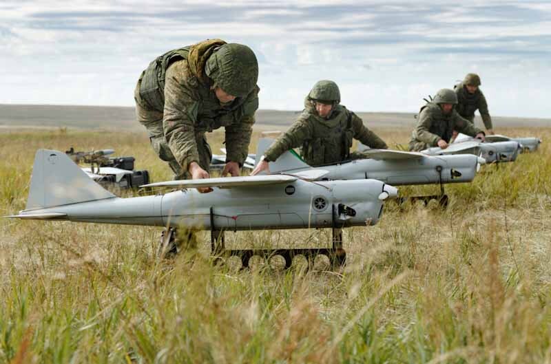
In contested or hostile environments, terrestrial links are vulnerable to deliberate interference or jamming. For example, during the conflict in Ukraine, both commercial LTE and unlicensed radio links have been targeted and disrupted, grounding entire fleets of drones and illustrating how fragile these systems can be when faced with intentional electronic warfare. Even in peacetime, terrestrial systems are not immune to accidental interference; for instance, at large sporting events or urban centers where multiple devices compete for spectrum, drones can lose connection at critical moments.
2. Coverage gaps in rural and offshore areas
Coverage is another major challenge. LTE and 5G networks work well in cities, but in rural or offshore areas, coverage gaps are common. This creates real problems for industries like pipeline inspection or offshore wind maintenance, where drones must operate hundreds of kilometers from the nearest tower.
3. Network failures during disasters
Even where coverage exists, networks can fail under stress: in natural disasters such as hurricanes or wildfires, cellular towers are often damaged or overloaded. For instance, during Hurricane Ian (2022), parts of Florida experienced complete cellular blackouts, leaving first responders unable to rely on mobile networks.
4. Technical limitations
Long missions also introduce technical issues like handover failures when a drone crosses between towers – a known problem for high speed UAVs flying over mixed terrain. Finally, legacy aviation bands like VHF are limited to strict Line of Sight, making them unsuitable for missions that span mountains, forests, or the open ocean.
The bottom line is that the only truly global, always-on network is in space. For many BVLOS missions, satellite connectivity is the primary link for safe command and control (C2). In other cases, it’s a failover that ensures uninterrupted operations if the primary terrestrial link drops or fails.
Choosing the Right Connectivity
The table below outlines the strengths and weaknesses of the most common BVLOS connectivity options.
|
Direct RF (LoS) |
Cellular (4G/5G) |
LEO Satellite (e.g., Iridium) |
GEO Satellite (e.g., Viasat) |
Mesh / Relay Networks |
Hybrid (e.g., LTE + Satcom) |
|
|
Range |
Low-Mid (20–30 km) |
High - wherever towers exist |
Global (with constellation coverage) |
Global, exc. poles |
Variable - range extends hop by hop |
Global with redundancy |
|
Latency |
Very Low (ms) |
Low - Moderate (20-100 ms) |
Moderate (270-400 ms) |
High (~500–600 ms)* |
Moderate (depends on hops) |
Low - Moderate |
|
Coverage |
Limited - range depends on altitude and obstructions |
Urban/suburban areas, gaps in rural/remote regions |
Requires clear view of the sky - partial blockage from terrain, buildings, or canopy can cause dropouts |
Requires continuous line of sight to the geostationary satellite - signal can be blocked by mountains, cliffs, or large offshore structures |
Customizable - requires supporting nodes or relay drones |
Global - seamless failover between links |
|
Cost |
Low |
Moderate |
High |
High |
Medium - High |
High |
|
Ideal Use Case |
Close range inspections, small scale BVLOS in open terrain |
Urban delivery, public safety, mapping |
Remote BVLOS missions needing high bandwidth: offshore energy, maritime inspections, remote mining |
Long endurance flights where latency is less critical: pipeline patrol, wilderness operations |
Disaster response, temporary missions in areas with no infrastructure |
Safety-critical commercial BVLOS, mixed terrain missions |
*Viasat doesn’t publicly publish a detailed latency spec comparable to Iridium Certus 100’s 270-400 ms. From flight demos, we know it supports reliable command & control when terrestrial links fail, but the reported latency for video stream fallback and link reversion suggests it is likely in the hundreds of milliseconds range rather than tens of milliseconds. Until more data is published, this is a reasonable working assumption.
LEO vs GEO: Understanding the Differences
Satellites are positioned in either Low Earth Orbit (LEO), Medium Earth Orbit (MEO), or Geostationary orbit (GEO). Our blog post on Satellite Orbit Heights provides a more detailed explanation, but to summarise, the closer the satellite network is to Earth, the lower the latency – the time it takes for data to travel from the drone, to the orbiting satellite, and down to the ground station (from where it’s routed to the drone operator’s system). Latency is a key attribute for UAV operators looking for as close to real-time command and control as possible, so it’s worth reviewing LEO satellite networks such as Iridium, Starlink or OneWeb.
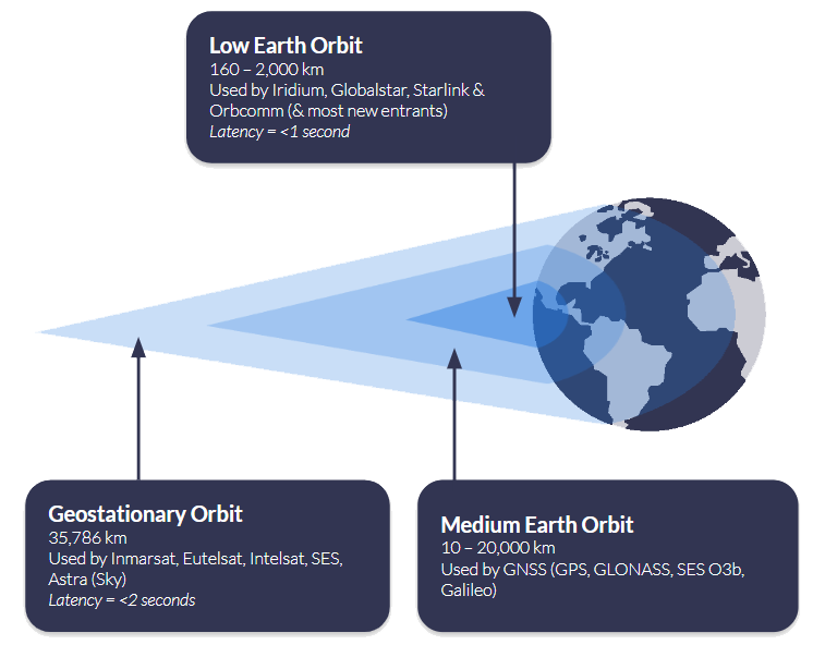
Another consideration is where your drone will be operating. If you are connecting to a satellite in Geostationary orbit, such as Viasat, the satellite remains in the same location overhead, and you need “line of sight” to that satellite. This works very well in wide open spaces, but if the signal could be blocked by infrastructure or mountains, for example, it’s not the best choice. Satellites in Low Earth Orbit need a “clear view of the sky”, but because the satellites are in motion overhead, rather than in a fixed point, it’s less rigid than GEO services. Read more about what’s meant by a clear view of the sky.
Also, consider the practicalities of hardware and power consumption when choosing between LEO and GEO networks. Terminals designed for LEO services are often smaller and lighter, making them well suited to drones where every gram matters and battery life is at a premium. Because these satellites are closer to Earth, they can typically operate at lower power levels, which helps maximize flight endurance. GEO terminals, while still compact, may draw more power and require slightly larger antennas to maintain a continuous connection with a single, fixed satellite.
Ultimately, the decision isn’t just about latency or coverage. It’s about balancing responsiveness, operating environment, and hardware constraints to select the right orbit for the mission. Whether it’s low-latency LEO for real-time control or the stable, wide-area coverage of GEO for long-range operations, matching the satellite architecture to the needs of the drone is key to safe and reliable BVLOS flight anywhere on Earth.
Hybrid Strategies: Best of Both Worlds
Whether you choose LEO for responsiveness or GEO for stability, no single connectivity method can cover every scenario perfectly. The most resilient BVLOS operations don’t rely on a single link at all; instead, they use a hybrid strategy, combining multiple communications paths to ensure that control of the aircraft is never lost, no matter what happens in the sky or on the ground.
A hybrid approach integrates multiple communication technologies, each serving a different role. This isn’t simply about adding a backup link; it’s about creating a system where the aircraft actively prioritizes and switches between links in real time, based on performance and availability.
At present, most commercial operators treat satellite as a failover link. Cellular and RF systems are used as the primary connection because they are cost effective and can handle large data streams such as live HD video or high-resolution sensor data. Satellite is kept in reserve as the safety net – the “final line of defense,” as Skylift UAV describes their use of the RockBLOCK 9603.
In their words, the satellite module provides the confidence to continue operating safely in the unlikely event of a complete communications blackout. This model works well for urban and suburban missions where cellular coverage is strong, or for flights where Line of Sight RF can be maintained most of the time.
However, as BVLOS missions grow in range and complexity, this dynamic is beginning to shift. In rural or offshore environments, cellular coverage is unreliable or entirely absent, and Line of Sight radios quickly become impractical. In these contexts, satellite is increasingly moving from failover to primary link, especially for critical command and control traffic. For example, during recent flight tests, pilots reported that LTE video streams were prone to frequent dropouts at altitude, but satellite remained reliably stable throughout.
A hybrid approach requires intelligent link management. The drone must be able to segment traffic by type and seamlessly prioritize the best available link without pilot intervention. For example, during an offshore mission, a drone may begin by streaming video over LTE while using satellite for command and control in the background. As it moves further out to sea and loses cellular coverage, the satellite connection continues uninterrupted, ensuring no loss of control. Later, if the drone comes back into range, LTE automatically resumes for payload data, but satellite remains quietly handling the critical link in the background. From the operator’s perspective, these transitions should be invisible, with the system maintaining continuous awareness and control throughout.
Many regulatory frameworks now encourage or require operators to demonstrate redundancy, often by using two independent communications paths so that a single failure cannot compromise control of the aircraft. This level of resilience is essential for operations such as pipeline patrols, offshore deliveries, or disaster response, where losing connectivity could have serious safety, regulatory, or financial consequences.
With a hybrid strategy in place, the next step is to match the satellite service to the mission profile.
Matching Satellite Services to Missions
Before you pick a hardware or service, think about your data rates, power and weight constraints, and how critical your command and position links are. The table below shows two tiers of mission profiles, one for simple commands such as go to the nearest rally point, go home, or terminate the flight, and another for full BVLOS operations, with the attributes you should aim for in each.
Simple Commands (Light Missions)
- Lightweight telemetry and commands only
- Ultra low power draw, so maximal flight time
- Small hardware footprint, minimal antenna gain
- Reliable even in remote environments, rough terrain, trees, or sparse coverage
Full BVLOS Operations
- Continuous, reliable command and control link
- Command response delays kept under ~700 ms
- Position updates as frequent as 1 second
- Enables safe separation from other aircraft and scalable BVLOS flights across mixed terrain and range
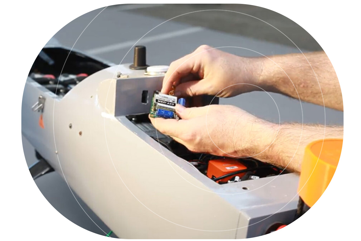
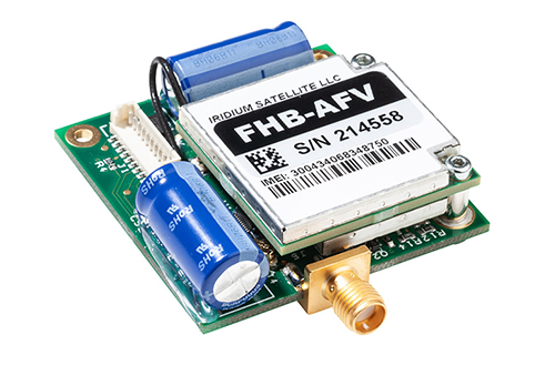
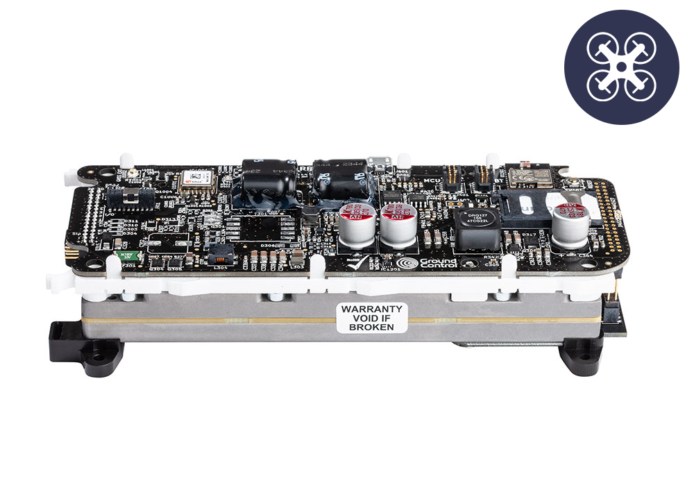
Ground Control’s RockBLOCK devices are optimized for simple commands, where size, power, and reliability under constrained conditions are the top priorities. Meanwhile, our Iridium Certus 100-based offerings (e.g. RockREMOTE UAV OEM) are built for BVLOS missions that need higher throughput, frequent updates, and strong command responsiveness. Adjusting your satellite choice to the mission kind avoids over-engineering, keeps costs manageable, and ensures safety without carrying unnecessary weight or power burden.
The following devices all leverage the Iridium satellite network, chosen because it is in Low Earth Orbit, so has very low latency, and truly global coverage. It has been tried and tested over years of operation, and is extremely reliable and resilient.
Recommended Hardware

RockBLOCK 9704
RockBLOCK 9603
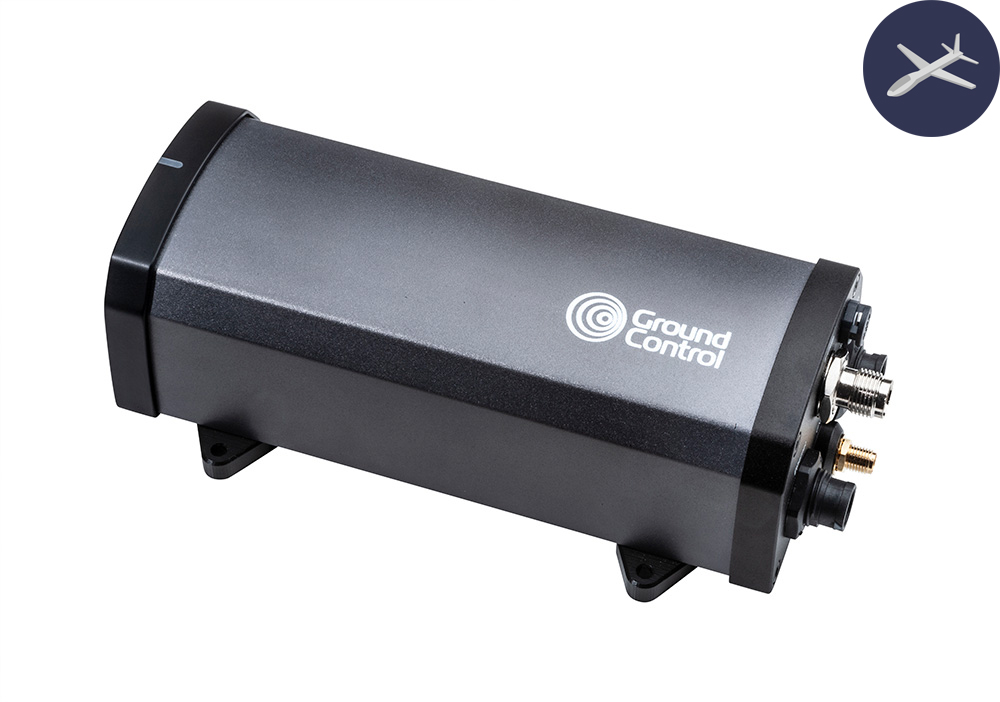
RockREMOTE UAV
RockREMOTE UAV OEM
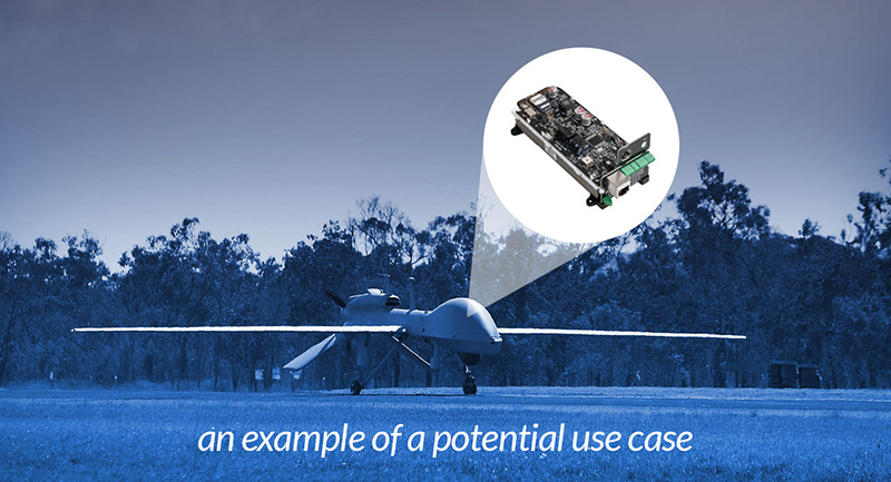
BVLOS drones are already proving their value across industries. In the UK, drones are delivering chemotherapy drugs to the Isle of Wight eight times faster than traditional transport, while in the offshore energy sector, companies like Skyports are replacing helicopter supply runs with drones, cutting emissions and reducing downtime. In the USA, long range drone patrols are helping to monitor thousands of miles of remote pipelines, and in the North Sea, offshore wind farms are being inspected in real time without costly, carbon intensive vessel missions.
Key Takeaways
When planning BVLOS operations, the priority should always be maintaining a reliable command and control link. Satellite connectivity is uniquely suited to this role because it offers consistent, global coverage that isn’t dependent on local infrastructure. Terrestrial networks such as LTE or RF can still play an important role, but they are best used for non-critical data like video streaming or payload telemetry rather than the core C2 function.
A hybrid approach delivers the best of both worlds. By combining satellite and terrestrial links intelligently, operators can use satellite for stable, predictable command and control while taking advantage of LTE or other networks for higher bandwidth data when coverage is available. This balance provides flexibility while keeping safety at the forefront.
Operational resilience comes from planning for failure. BVLOS systems should be designed with multiple communications paths and the ability to switch between them instantly, ensuring that connectivity is never lost if one link goes down. Continuous monitoring and rapid failover processes are essential to meeting safety and regulatory expectations as drone fleets grow in scale.
Finally, data management must not be overlooked. Tracking airtime, managing costs, and ensuring telemetry data is actionable are all key to running efficient, scalable operations. By keeping a close eye on data use and system performance, operators can make informed decisions that improve reliability and maximize return on investment.
Related Blog Posts
-
Affordable BVLOS Drone Connectivity: Introducing Iridium Certus 100 Airtime Plans for Drone Operators
Cost-effective Iridium Certus 100 drone airtime for BVLOS control of your UAV, with built-in satellite redundancy & flexible data plans.
Read more -
Attitudes Towards Commercial & Military Drone Applications
55% of respondents supported commercial drone applications, and 57% supported military applications: a more conversative response than expected. Download our free eBook to read more.
Read more -
Power, Payload, Performance: What Drone Manufacturers Ask Us About Satellite Connectivity
This guide breaks down the key considerations for choosing and integrating a satellite modem that fits your drone’s requirements, without compromising performance or budget.
Read more -

ETH Zurich’s Autonomous UAVs Utilizing the RockBLOCK
The Autonomous Systems Lab (ASL) of ETH Zurich has developed two solar-powered, low-altitude long-endurance (LALE) unmanned aerial vehicles (UAVs) that are gathering valuable data on climate change and agriculture.
Read more -

The Vital Role of LEO Satellites in Safe and Secure UAV Drone Operations
UAV operators seeking to pilot drones BVLOS need to have complete trust in their communication channels. Increasingly, LEO satellites are used as a failover. Our blog post explores why, how and where.
Read more -
Drones in Modern Warfare: Enhancing UAV Capabilities with Satellite Connectivity
How satellite connected Drones, or Unmanned Aerial Vehicles (UAVs), have become an integral part of modern military and defense operations.
Read more

Take Your BVLOS Operations Further
BVLOS connectivity doesn’t have to be a limiting factor. With the right mix of satellite and terrestrial links, your drones can stay connected and operational anywhere on Earth; from dense urban environments to the most remote locations.
Whether you need lightweight hardware for simple commands or a fully scalable solution for complex BVLOS missions, our team can help you design a system that’s safe, reliable, and ready to grow with your operations.
Email hello@groundcontrol.com or complete the form, and we’ll be in touch within one working day.