GPS/GNSS spoofing & jamming protection for merchant vessels
Where GNSS is unreliable, spoofed, or jammed, RockFLEET Assured supports trusted position reporting via Iridium PNT and assured positioning (A-PNT) workflows.
For crews and operators, an optional chart view presents the assured position alongside GNSS position / track with clear integrity status and event logging, helping teams identify anomalies quickly and maintain situational awareness.
Integrity events and alerts can also be logged and shared with shore teams, supporting operational oversight and post incident review when it matters most.
Deploy, monitor, & integrate easily
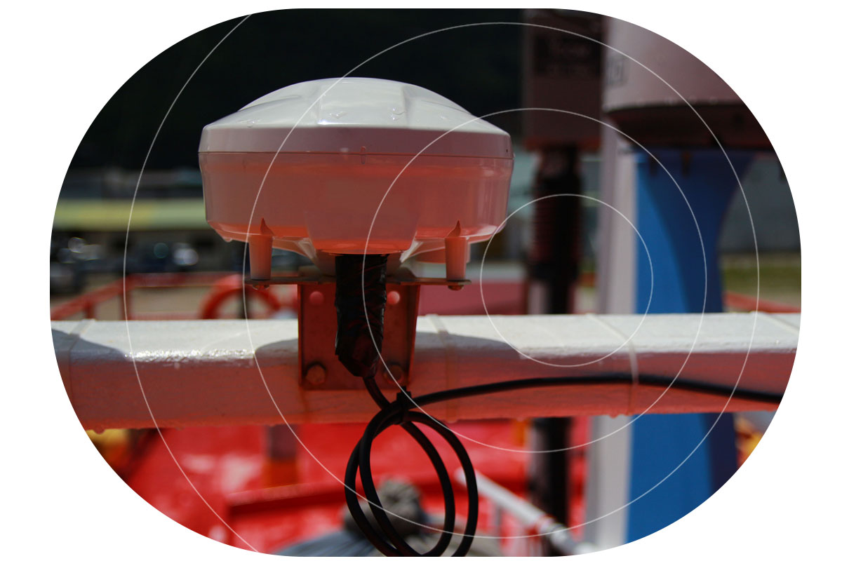
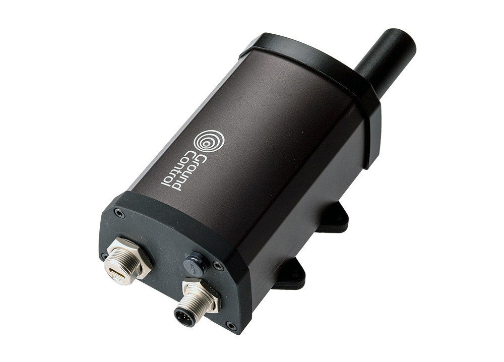
RockFLEET Assured is designed around a simple above-deck terminal for faster vessel deployment, with setup and status provided through a Bluetooth LE mobile app. For installations that need cleaner bridge integration, the optional Power Hub provides below-deck power management, lightning protection, and standard NMEA connectivity.
RockFLEET Assured supports configurable position reporting, OTA configuration, and geofence-based alerting for operational and security workflows.
For fleet operators and merchant shipping technical teams, RockFLEET Assured connects into Cloudloop Tracking for browser-based fleet views. Cloudloop is also API-first, so you can consume location, integrity status, and events in your own platform via push delivery, including webhooks, MQTT, and cloud destinations, or pull via REST API using a consistent structured JSON format.
Independent A-PNT for Trusted Positioning When GNSS Cannot be Trusted
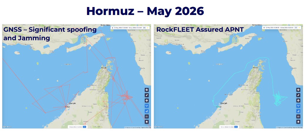
Many operators already have measures in place to protect against GNSS disruption, but most solutions still depend on the very signals they’re trying to protect.
By providing an independent A-PNT capability, vessels can maintain operational awareness, support safer navigation and operational continuity in GNSS-denied environments.
For fleet managers and vessel operators, the benefits are clear: a trusted position when GNSS can’t be trusted, immediate awareness of interference, spoofing, or integrity issues and verifiable positioning data to support operational reporting, investigations, compliance, and insurance requirements.
Proven Satellite Expertise for Maritime and Offshore Operations
Ground Control has been delivering satellite connectivity solutions for over 20 years, supporting maritime, offshore and remote operations worldwide.
As an Iridium Gold Partner since 2005, we are recognised for our expertise in reliable communications beyond terrestrial networks. Our proven heritage in vessel tracking, remote monitoring and critical communications enables partners to deploy trusted satellite solutions with confidence, anywhere on the globe.
Specification subject to change
- Assured positioning (A-PNT) via Iridium PNT: Authenticated position source for trusted vessel position reporting
- Chart view (optional): Assured position alongside GNSS position / track, with integrity status indicators
- Flexible NMEA integration: supports NMEA 2000 or NMEA 0183 / RS422 configurations, depending on the selected build
- Optional Power Hub: below-deck junction box for power management, lightning protection, and NMEA 2000 or NMEA 0183 / RS422 integration
- Integrity alerts & event logs: Integrity events surfaced locally and optionally forwarded to shore
- Two way satellite messaging via IMT
- Configurable reporting: 1/min to 1/hour, with scheduled / event driven / exception reporting
- Over the air management (OTA): Reporting profiles and device configuration managed remotely
- Geofencing & alerting
- Power cut resilience (optional backup battery)
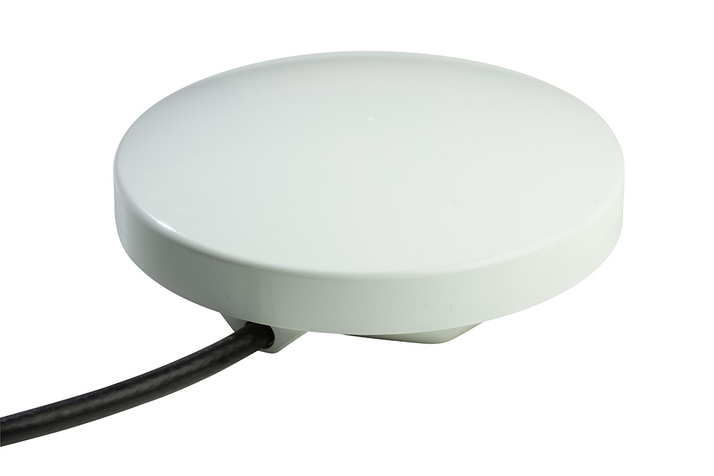
- Simple above-deck terminal, with optional below-deck accessories for bridge display, power management, lightning protection, and NMEA integration
- Flexible routing: Marine-grade cable up to 100 m
Physical & Environmental
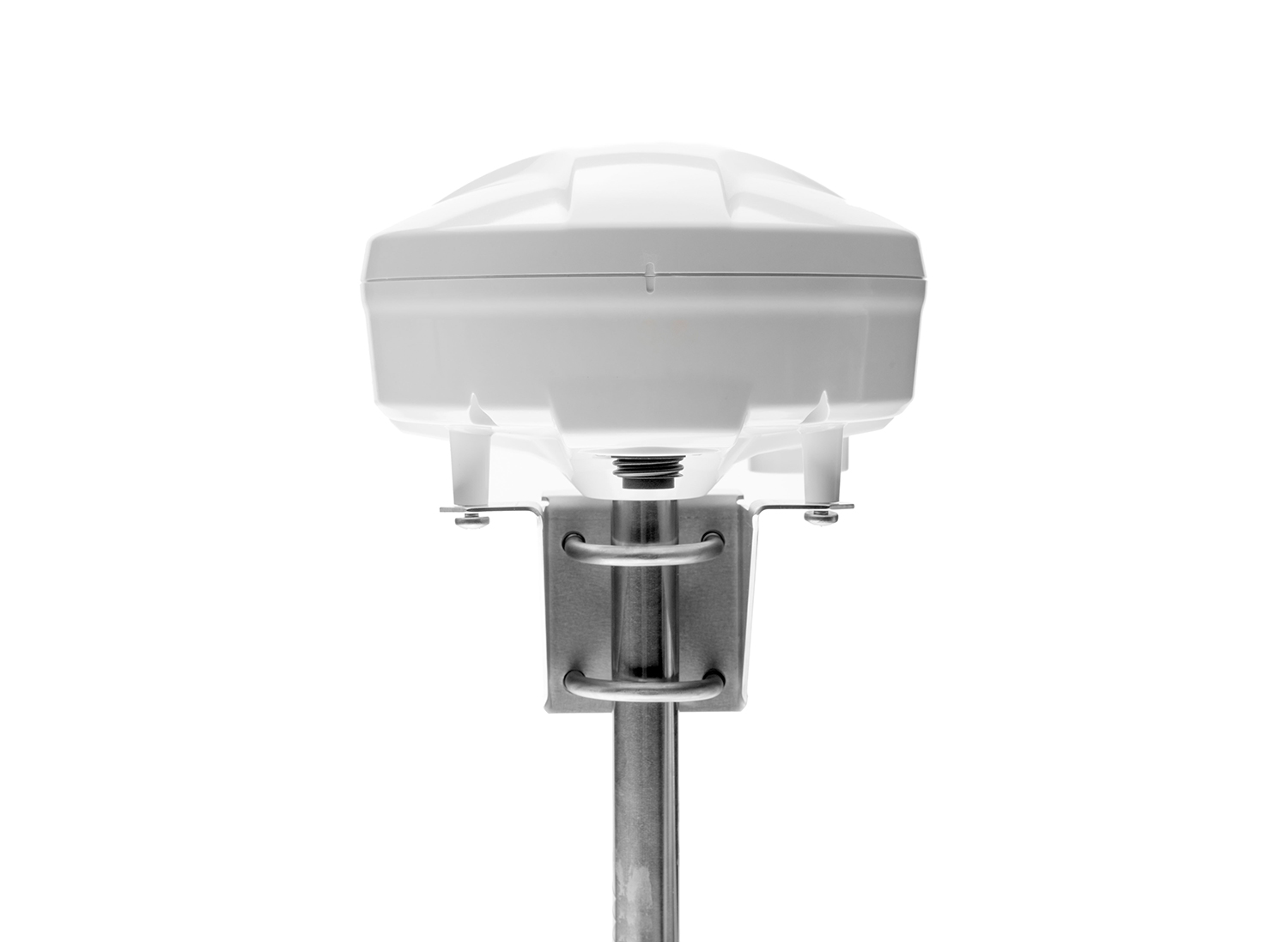
- Mounting: low profile antenna (deck or pole mounted)
- Cable: marine-grade, up to 100 m
- Dimensions: 201 mm diameter, 125 mm height
- Weight: 1,460 g (antenna + mounting bracket)
- Environmental: IP67; operating -40°C to +70°C
User Interface & Device Management
- Bluetooth LE mobile app: configuration, commissioning, status reporting (including position and message/connection state)
- Local alerts: status/fault reporting via the app (optional remote notifications to shore systems)
Communications
- Satellite transport: Iridium Messaging Transport (IMT)
- IMT packet size: 25 to 100,000 bytes
- Assured positioning: integrated Iridium PNT module
Electrical Power
- DC input: 10 V to 30 V DC (Cable 0-20 m) | 20 V to 30 V DC (Cable 21-100 m)
- AC input (optional): 220 V AC via external power supply
- Backup battery (optional): internal battery option (autonomy depends on reporting profile)
Where does RockFLEET Assured Fit?
The solution provides a resilience layer for the bridge or onshore remote fleet monitoring. It is not a SOLAS navigation instrument by design.
- Use for independent comparison alerting on position integrity against GNSS positioning
- Back up reference and situational monitoring
- Trusted reporting and compliance
Designed to support bridge confidence, shore side oversight and incident review.


RockFLEET Assured FAQs
The system uses GNSS whenever the signal is valid and continuously cross-checks the data with Iridium PNT. It detects anomalies such as spoofing or jamming, flags events, and alerts users when issues occur. Even during disruptions, the system continues reporting trusted position data via A-PNT.
RockFLEET Assured can be configured for integration with existing onboard systems using either NMEA 2000 or NMEA 0183 over RS422, depending on the selected build.
For simpler serial integrations, it can feed NMEA 0183 data into a multiplexer alongside other navigational components. For installations requiring cleaner below-deck wiring, longer cable runs, power management, or lightning protection, the optional Power Hub provides a dedicated junction point for connected bridge equipment.
Yes. RockFLEET Assured can be configured as an input to an ECDIS or other onboard system, with interface type chosen before shipping. Units supplied with the optional Raymarine Axiom 9 chartplotter use NMEA 2000, while units intended for integration into a customer’s own system use NMEA 0183 over RS422.
RockFLEET Assured is not an IMO-approved primary navigation source, so it is intended for use as a backup, comparison, alerting, or other non-primary input.
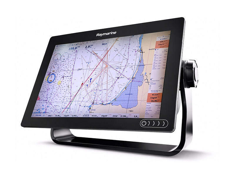
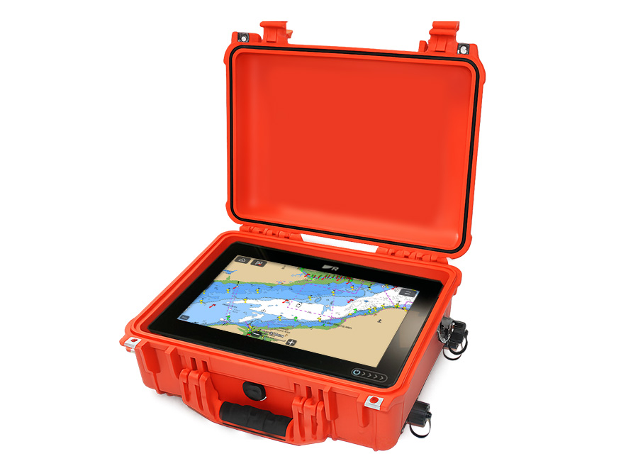
RockFLEET Assured offers an optional Raymarine Axiom 9 chartplotter in two formats: a rugged case version for a complete out-of-the-box setup, or a lower cost version without the case using a wiring harness.
If no chartplotter is purchased, the system can still integrate with existing onboard equipment. Depending on the selected build, RockFLEET Assured can output A-PNT and GNSS position data via NMEA 2000 or NMEA 0183 over RS422. Configuration is handled through the Bluetooth app, which also provides a visual map of both GNSS and A-PNT positions.
For more complete bridge integrations, the optional Power Hub provides a below-deck junction point for power, protection, and NMEA connectivity.
Not for every deployment. RockFLEET Assured is designed around a simple above-deck terminal, but the Power Hub is recommended where the vessel needs below-deck power management, lightning protection, longer cable runs, or standard NMEA 2000 / RS422 integration with bridge equipment.
The Power Hub is configured at the factory to match the chosen RockFLEET Assured build option: NMEA 2000 or NMEA 0183 / RS422.
When GNSS/GPS signals are unavailable, vessels can effectively become “blind” from a positioning perspective, with little or no reliable location accuracy available. In these scenarios, A-PNT provides a highly valuable independent positioning capability, typically delivering 25–100 meter accuracy.
While this may not match the precision of GNSS, it represents a dramatic improvement over having no positioning information at all, enabling continued navigation, operational awareness, and resilience in GNSS-denied environments. Performance is generally even better at higher latitudes due to the geometry of the Iridium satellite constellation.
RockFLEET Assured includes configurable geofencing, integrity monitoring, anomaly detection, and real-time alerting. Operators can define reporting schedules, receive notifications when vessel position integrity is compromised, and monitor events from shore.
Yes. RockFLEET Assured creates a verifiable record of vessel positions, integrity events, and system alerts that can support post-incident investigations and operational reporting. For shipowners operating in regions where GNSS interference is a known risk, having an independent source of position data can strengthen evidence trails and demonstrate proactive risk management practices to stakeholders, insurers, and charterers.
Traditional GPS receivers are highly effective under normal conditions but remain vulnerable to jamming and spoofing. RockFLEET Assured adds a trusted, independent layer of position assurance that helps operators verify the integrity of navigation data and identify potential interference events. For shipowners, this means greater confidence in vessel tracking, improved operational resilience, and enhanced protection against emerging maritime security threats that could otherwise disrupt navigation and fleet operations.

Talk to us
Whether you need assured positioning for operations in GNSS-challenged regions, a bridge ready chart view for crews, or a simple way to stream trusted location and events into your own platform, RockFLEET Assured is designed to fit.
Get in touch to arrange a demo and share your requirements either by completing the form, or emailing hello@groundcontrol.com. We’ll respond to your inquiry within one working day.