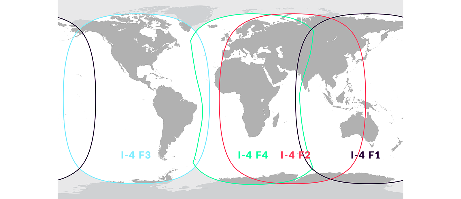
FleetBroadband offers global coverage and enables terminals to function in any ocean or waterway within the coverage area. The service automatically connects to any of the four I-4 satellites without requiring user intervention or changes to the service plan. The FleetBroadband coverage map is identical to that of BGAN since both services utilise the same network provided by Inmarsat.
It is important to note that FleetBroadband should not be mistaken for Inmarsat’s “Fleet 33-55-77” coverage areas, which are significantly different. While the map above provides a reasonably close approximation of the service coverage, there may be some signal degradation on the map’s edges due to various atmospheric conditions.

Would you like to know more?
If you're planning a satellite-enabled project and you're not sure which satellite constellation will best meet your needs, get in touch! We have 20 years of experience in this field, and we work with leading satellite operators to make sure our customers have the greatest choice.
Either call or email us, or complete the form, and we'll be happy to help.
Either call or email us, or complete the form, and we'll be happy to help.