
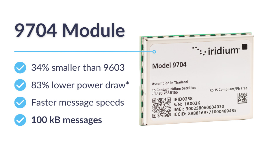
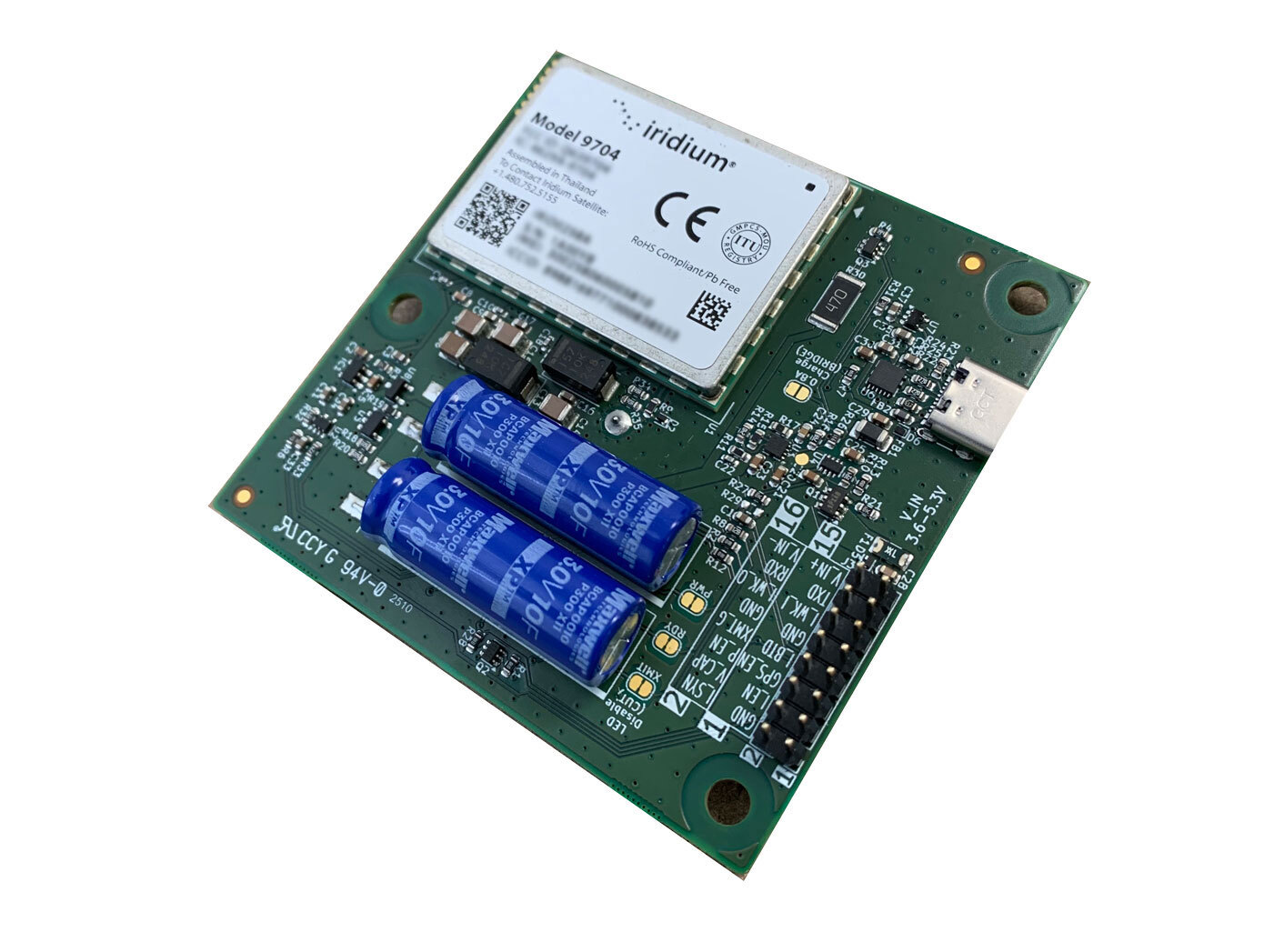
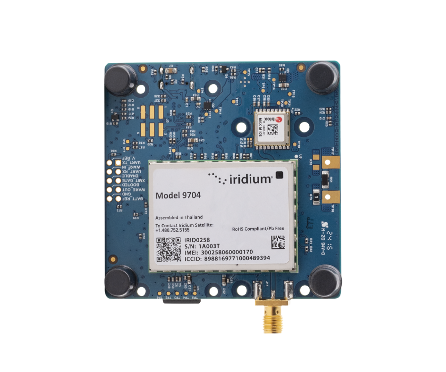
RockBLOCK Pro incorporates the new Iridium 9704 module, a small, lightweight unit that connects to the globally available Iridium Messaging Transport (IMT). This enables messages of up to 100 kB, which is large enough to accommodate aggregated sensors’ data, images and audio clips.
IMT is a natural successor to the Iridium SBD service, and RockBLOCK Pro supports the original AT command set implemented by the 9602 and 9603 transceivers. This means you can switch out your SBD module with RockBLOCK to enjoy the benefits of IMT: larger message sizes, faster throughput, and in most cases, lower data costs.
*83% reduction in idle power consumption compared to 9603
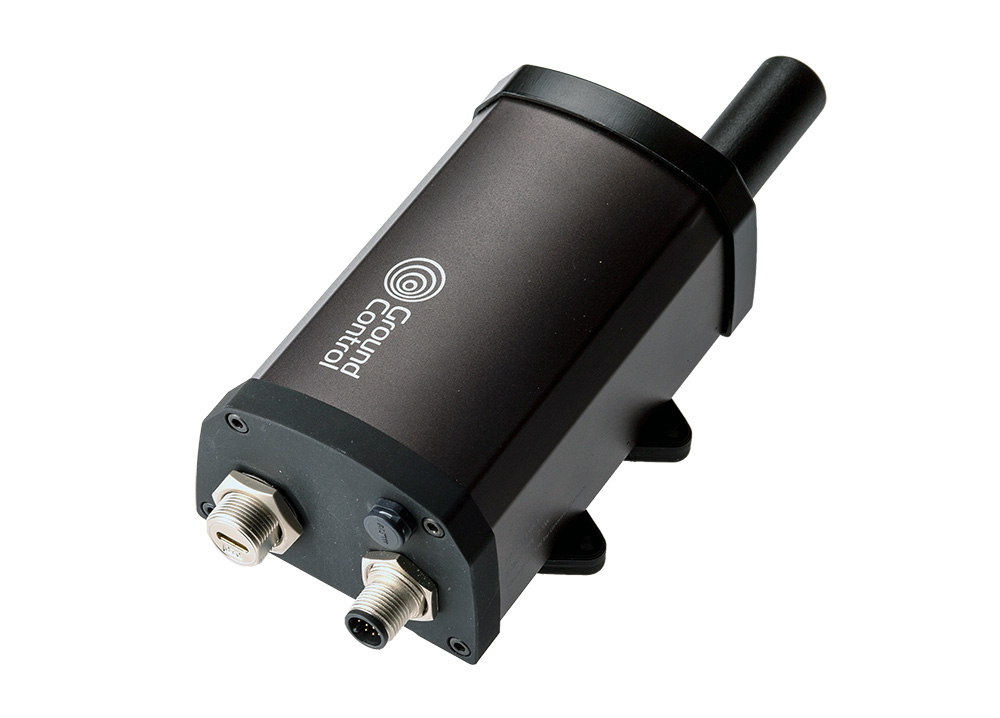
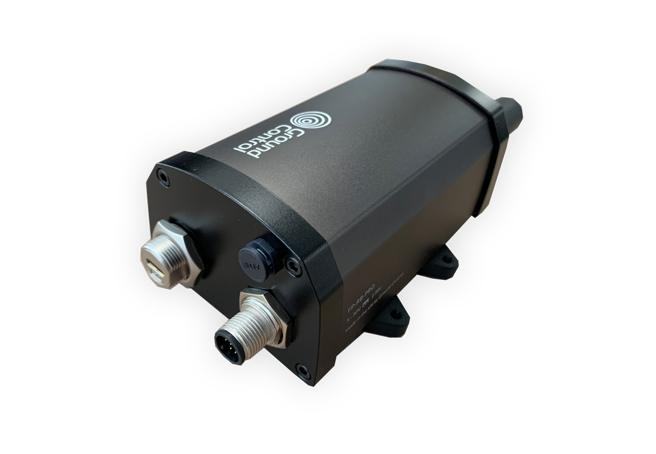
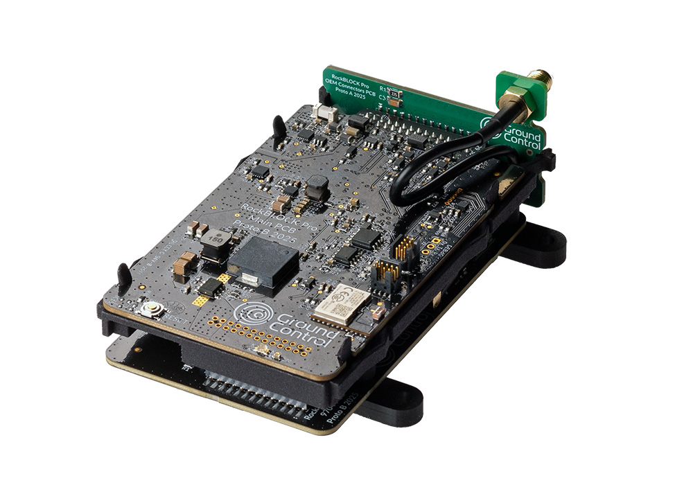
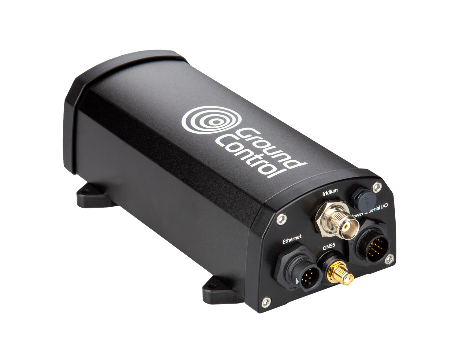
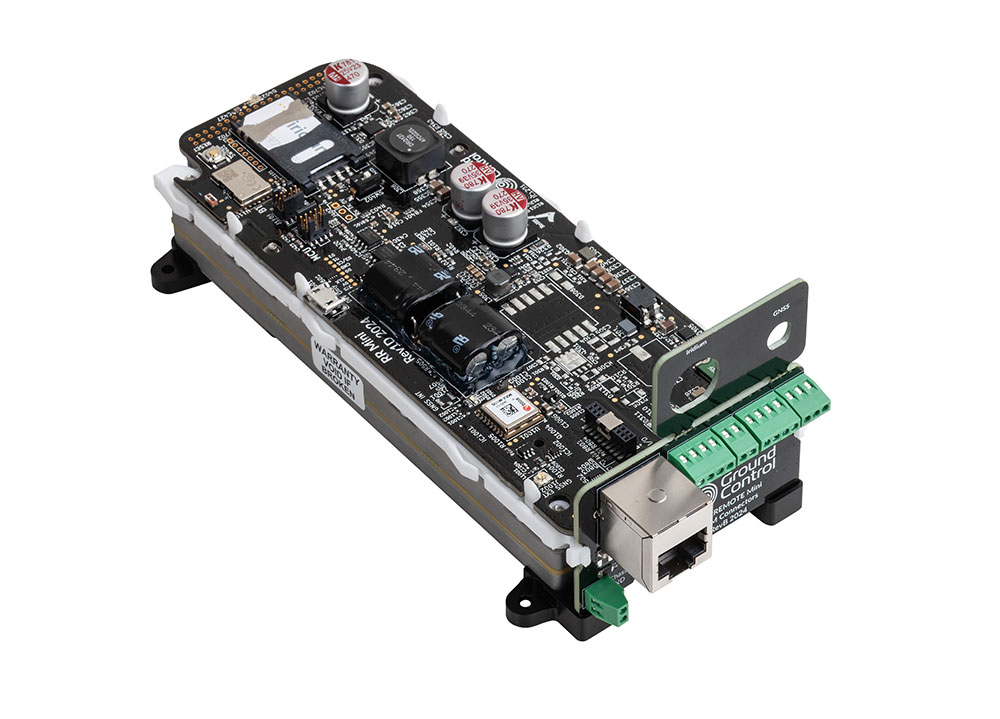
RockBLOCK Pro is a rugged, IP66 rated terminal with either a built-in antenna, or provision for an external antenna. It’s also available as an OEM version, for integration into your enclosure.
It is designed to operate on extremely low power; when idle, the RockBLOCK Pro consumes less than 200mW, and its maximum power consumption is 2.5W. This makes it ideal for remote, unmanned applications powered with batteries or solar.
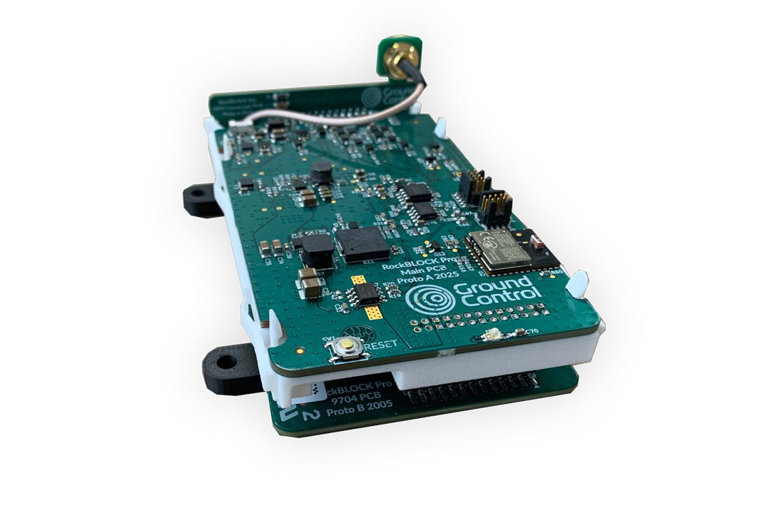
RockBLOCK Pro is designed to remove development complexity; it has an on-board processor which handles queuing, retries and network management, so you can get up and running faster.
For message handling, Cloudloop Data delivers messages to and from your application, supporting AWS, Azure, Google Cloud, and standard protocols like HTTP webhooks, MQTT, and email.
- Utilizes the Iridium 9704 module
- Sends messages of up to 100 kB via Iridium Messaging Transport (IMT)
- Designed for low power consumption
- Multiple interfaces for easy integration
- Available as a rugged (IP66) terminal with a built-in antenna, or with provision for an external antenna
- Also available as an OEM version for integration into your enclosure
- Built-in GNSS – suitable for tracking applications
- Configurable I/O options
- Manages message queuing, retries and any network issues, reducing development complexity
- Tightly integrated with Cloudloop for data storage, processing and delivery of your IoT messages
IMPORTANT: This is intended to provide early access information to interested parties during the development process. While we strive to maintain accuracy, any part of the specification or design of these products may change without notice.
Physical
- Size: 121 x 75 x 53 mm (188 x 91 x 57 mm inc. antenna / connectors / foot)
- Weight: 400 g (including antenna) / 388 g (SMA version)
- Case: Aluminum enclosure
Environmental
- Ingress Rating: IP66
- Operating Temperature: -40C to +70C, <95% RH
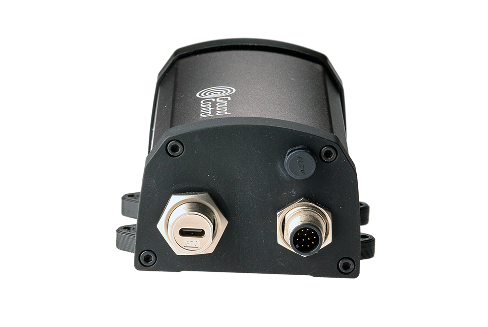
Cable Connections
- Power: 2m 12-core cable or USB-C
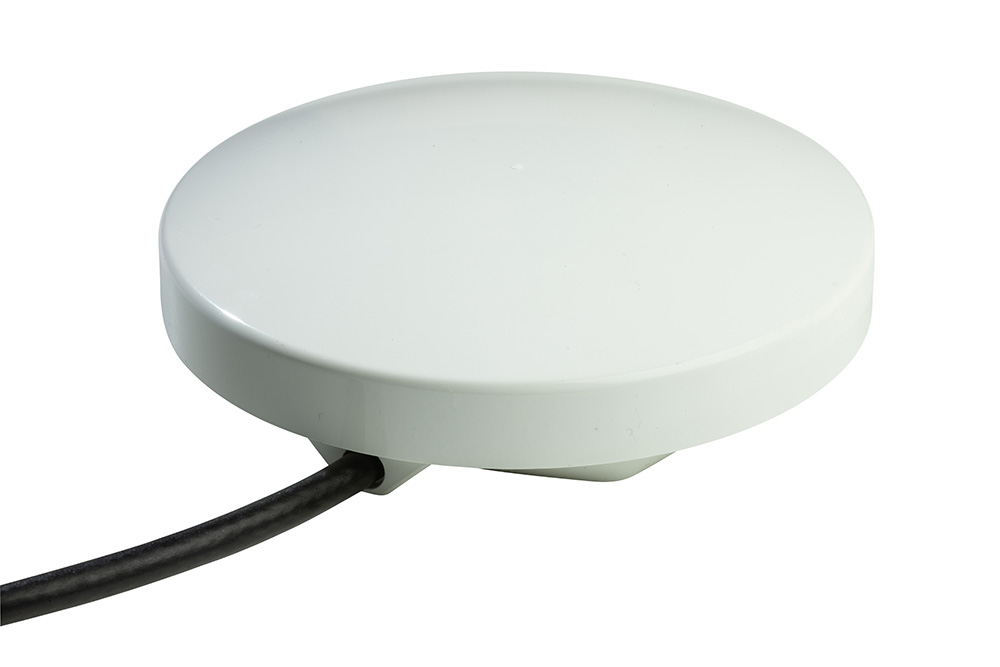
- Antenna: SMA connector. Cable options from 0.2m to 4m. Approved antenna (combined Iridium & GNSS) required
Electrical & Power
- Voltage: 5-30V DC, 5V USB-C
- Power Consumption (Maximum): 2.5W
- Power Consumption (Minimum): <75mW (sleep mode)
- Power Consumption (Idle): <200mW (registered with network, listening, ready to transmit/receive)
Communication Interfaces
- Iridium Messaging Transport: 4.8kbps bi-directional messages from 10 to 100,000 bytes. Latency typically < 10s between remote and cloud applications
- GNSS: Concurrent reception of 4 GNSS – BeiDou, Galileo, GLONASS, GPS / QZSS
- Bluetooth: BLE 5.0. App for configuration/status. Future sensor connectivity planned
- Serial: RS485 or RS232. Proprietary serial API & support for legacy 9603 AT commands
- USB-C: Serial port. MSD file system
- Digital GPIO: All 4 channels independently configurable as either 0-10V analogue input, open drain digital output or digital input suitable for dry contacts. Connection via 12 way cable assembly
These prices are representative, and we can offer tailored pricing based on your specific usage. Please get in touch for a quote.
Iridium Certus 9704 Device Comparison
RockBLOCK Pro |
RockBLOCK Pro OEM |
RockBLOCK 9704 Patch |
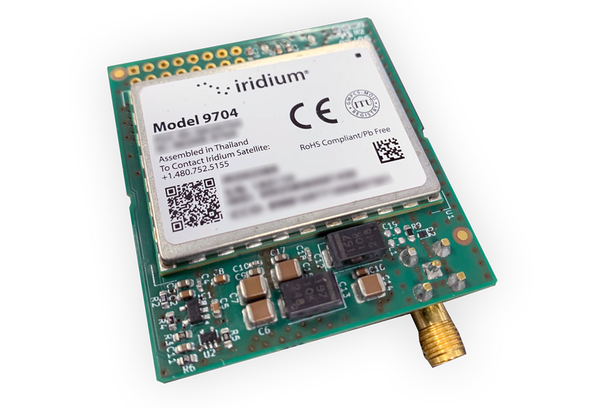
RockBLOCK 9704 SMA |
|
|
Form Factor |
Aluminium enclosure |
PCB assembly with mounting frame |
PCB assembly with 4 mm mounting holes |
PCB assembly with notched edge for slot-mounting |
|
Dimensions |
121 x 75 x 57 mm |
104 x 65 x 29 mm |
72 x 72 x 16.5 mm |
48 x 52 x 16 mm |
|
Weight |
400 g (inc. antenna) |
108 g (exc. antenna) |
< 50 g (inc. patch antenna) |
< 35 g (exc. antenna) |
|
Environmental |
IP66 |
No Rating |
No Rating |
No Rating |
|
Power |
5–30 V DC, 5 V USB-C |
5–30 V DC, 5 V USB-C |
4.0–5.3 V DC; 3.6–4.5 V battery; 5 V USB-C |
4.0–5.3 V DC; 3.6–4.5 V battery; 5 V USB-C |
|
Antennae |
Optional built-in antenna; or use SMA connector |
SMA connector; approved combined Iridium + GNSS antenna required |
Integrated patch antenna |
SMA connector for Iridium/GNSS + U.FL for GNSS passthrough |
|
Protocol |
IMT + 9603 AT commands |
IMT + 9603 AT commands |
IMT only |
IMT only |
|
Message Handling |
|
|
|
|
|
GNSS |
Concurrent reception of 4 GNSS |
Concurrent reception of 4 GNSS |
External GNSS via U.FL passthrough |
External GNSS via U.FL passthrough |
|
I/O Options |
4 x configurable channels (0–10 V analog input / open-drain digital output / dry-contact input) |
2 x inputs & 2 x outputs via 30-way header |
5 x inputs & 3 x outputs via 16-way cable assembly |
5 x inputs & 3 x outputs via 16-way cable assembly |


Would you like to know more?
RockBLOCK Pro units are available for testing now.
If you’d like to know more about the standard RockBLOCK Pro, or the STL variant for GPS-denied environments, please contact us at hello@groundcontrol.com, or complete the form. We’ll come back to you within one working day.