One of the most disruptive threats to commercial and military maritime operators is the manipulation of Global Navigation Satellite Systems (GNSS), primarily by low-cost GPS jammers, state-sponsored GPS spoofing campaigns, and cyber-physical interference. From oil tankers seized via spoofed coordinates to cargo ships disappearing from satellite tracking due to jamming, the vulnerabilities of GNSS reliant systems are no longer theoretical, they’re operational hazards. These disruptions compromise navigation, safety, and compliance monitoring, particularly in high-risk regions such as the Baltic Sea, Eastern Mediterranean, and other areas with geopolitical tensions.
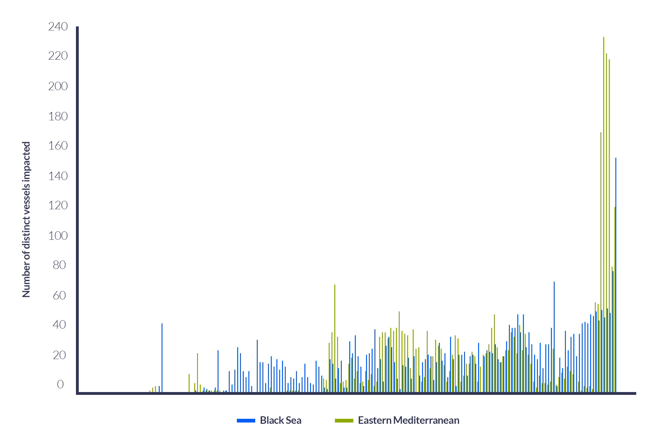
GPS Jamming Issue Grows in Eastern Mediterranean and Black Seas
Daily, October 1, 2023 – April 4, 2024
GNSS/GPS manipulation has far-reaching implications, from compromised navigation to operational disruptions. While there are various satellite-based techniques for detecting spoofing and jamming, RockBLOCK Pro STL offers a truly resilient, unjammable alternative. In this blog, we explore how it works and why it matters.
Key Differences Between Jamming and Spoofing
|
Jamming |
Spoofing |
|
|
Definition |
Overwhelms GNSS signals with noise to block reception |
Sends fake GNSS signals to mislead the calculation of a false position/time |
|
Mechanism |
High-power RF signals on GNSS frequencies disrupt signal acquisition |
Fake signals mimic legitimate ones, often stronger, to deceive the vessel |
|
Goal |
Denial of service (DoS) – prevents GNSS-based operation |
Deceives the receiving vessel into believing a false position or time |
|
Effect on receiving vessel |
Loss of satellite lock; receiving vessel cannot determine position/time |
The receiving vessel continues to operate, but with incorrect data |
|
Detection Difficulty |
Often easy to detect due to complete signal loss |
Harder to detect, may go unnoticed as the vessel operates normally |
|
Signal power |
High (to overpower weak satellite signals, typically > -100 dBm) |
High (to overpower weak satellite signals, typically > -100 dBm) |
|
Legality |
Illegal in most countries |
Also illegal, often more complex to execute and trace |
|
Hardware Requirements |
Relatively simple - can be handheld or vehicle-mounted |
More complex, requires GNSS signal generation and precise timing |
|
Use Cases (Malicious) |
Disrupt vessel navigation, leave crew and cargo vulnerable to attack |
Mislead ships, expose ships to hijacking, steer vessels into dangerous waters |
Implications for the Shipping Industry
The interception and denial of GNSS/GPS connectivity pose significant risks to the commercial shipping industry. GPS spoofing, for example, misleads shipping vessels into believing they are on a safe course when, in reality, they may be heading into dangerous waters or restricted areas. Reports indicate that vessels in the Eastern Mediterranean have been falsely located at airports, and other instances have shown ships being misled into high-risk territories. Many vessels, especially those without backup navigation systems, are vulnerable to these attacks.
In July 2019, the UK-flagged oil tanker Stena Impero, operated by Stena Bulk, was seized by Iranian forces while transiting the Strait of Hormuz. Investigations suggest that the vessel’s navigation systems were subjected to GPS spoofing, causing it to deviate into Iranian territorial waters. Analysis of AIS data indicated anomalies consistent with spoofing attacks, where counterfeit signals misled the ship’s navigation systems. This incident highlighted the vulnerabilities in maritime navigation and the potential for state actors to exploit them.
Later in 2019, vessels operating near Chinese ports, particularly around Shanghai, reported widespread GPS anomalies. Ships experienced sudden changes in reported positions, with some appearing to move erratically or vanish from tracking systems. Investigations revealed that these anomalies were due to GPS spoofing attacks, affecting hundreds of vessels and disrupting port operations. The incidents raised concerns about the potential for such attacks to be used for strategic or economic purposes, with the United Nations urging the protection of satellite navigation from interference.
Spoofing and Jamming Detection via Satellite
Satellite systems can detect GNSS/GPS spoofing and jamming by identifying inconsistencies via a number of indicators and parameters.
Positional behavior can indicate spoofing or jamming. Satellite systems can identify positional and movement abnormalities and send alerts when ships “jump” positions, show physically impossible maneuvers, such as a 90° turn at high speed, or appear in two locations simultaneously, known as ghost ships. Further, comparison with terrestrial radar and sensors is a method of spoofing detection. Satellites compare reported Automatic Identification System (AIS) data with ground radar or visual surveillance, and mismatches may indicate spoofing.
To avoid and prevent spoofing and jamming attacks, commercial shipping companies can support risk-based routing. Here, shipping companies use historical spoofing “heat maps” to reroute vessels around known interference zones, such Baltic Sea, Eastern Mediterranean, and any other region or zone with geopolitical tensions.
These detection techniques are effective, but the vulnerabilities of GNSS/GPS signals remain. A secure and unjammable solution is required for complete visibility and confidence of vessel positioning at sea.
STL For GNSS/GPS Independence at Sea
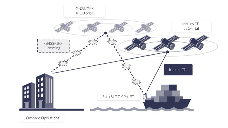
While satellite-enabled detections exist to combat traditional GNSS/GPS spoofing and jamming, STL (Satellite Time and Location) via the Iridium network offers an uncontested solution – a secure, unjammable, encrypted alternative for acquiring positional, navigation and timing (PNT) information anywhere in the world.
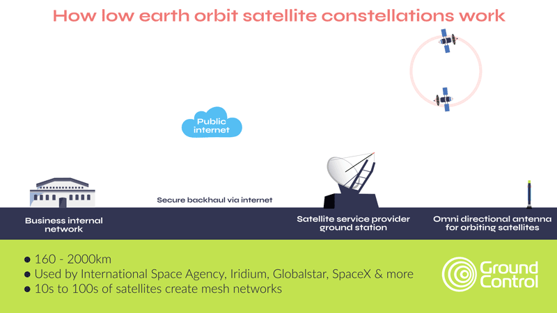
STL is a one way, encrypted signal broadcast via the Iridium satellite constellation,1,000 times stronger than GPS, making it far more resilient to jamming. Leveraging Iridium’s LEO satellite constellation and thus, a signal 25 times closer to the Earth than GNSS, STL delivers accurate time and position data without needing traditional GNSS visibility, giving commercial ships and maritime systems trusted positioning even when GPS is denied.
Although STL provides an independent signal, it is notable that it is not designed to replace GNSS, rather, it’s designed to complement it. STL can be accessed from the same receivers as GNSS and GPS, making it easy to incorporate as part of a layered approach to reliable, secure and unjammable tracking and positioning.
How RockBLOCK Pro Utilizes STL for Unjammable Maritime Tracking
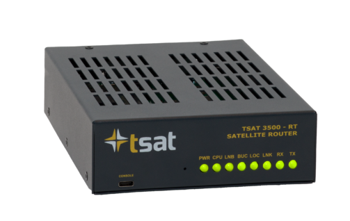
RockBLOCK Pro STL is a ruggedized, compact satellite-based tracking solution that harnesses the power of STL to deliver a secure signal independent of terrestrial or GNSS infrastructure. This PNT service offers an alternative when GPS or GNSS Global signals are absent, denied, or disrupted.
Traditional GPS signals are vulnerable and easy to overpower or imitate with spoofing equipment. STL, by contrast, resists these threats through encryption so spoofers cannot easily mimic the signals. Complementing traditional GPS / GNSS and delivering a reliable backup, RockBLOCK Pro STL enables transmission of vessel location updates even when GPS / GNSS is being denied, spoofed, or jammed.
This is vital for commercial ships as well as vessels transiting piracy or cyber-prone regions, unmanned surface vehicles (USVs) operating in contested waters and NATO and allied vessels conducting patrols in high-risk areas.
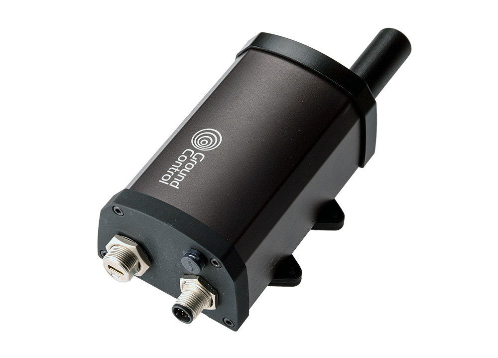
The technology encapsulated within RockBLOCK Pro STL is designed for ease of integration with existing maritime equipment. The solution delivers RS232 / RS485 and USB-C serial interfaces for easy integration with existing hardware, IP66 waterproofing – ideal for harsh marine conditions – and a compact, low-power design for permanent and portable deployments. It’s a secure and rugged solution for shipping companies to tackle the ongoing threat of GPS spoofers and jammers.
Operational Scenarios with RockBLOCK Pro STL
There are several operational scenarios where RockBLOCK STL provides an uncontested, reliable solution to GPS-denied environments, spoofing, and jamming:
Anti-Spoofing for Cargo Ships: A container vessel approaching a spoofing hotspot in the Eastern Mediterranean receives conflicting GPS signals. RockBLOCK Pro STL continues to deliver trusted positioning, allowing the bridge crew and HQ to detect the spoof and maintain safe routing.
Naval Operations in Denied Environments: A patrol vessel operating under electronic warfare conditions near contested maritime borders loses GPS functionality. Utilizing RockBLOCK Pro STL, onboard systems retain accurate time and position data, crucial for navigation, targeting, and tactical coordination.
Unmanned Maritime Drones: An autonomous surface vessel in the Arctic Circle cannot acquire GPS due to interference. RockBLOCK Pro STL ensures connectivity, continuity and remote GPS monitoring via Iridium.
Secure Positioning When GPS Goes Dark
From bulk carriers drifting off-course in the Black Sea to naval vessels being targeted in the Red Sea, GNSS/GPS interference has shifted from a rare anomaly to a strategic weapon. The rise of low-cost jammers, state-sponsored spoofing campaigns, and cyber-physical interference has exposed a serious blind spot in global shipping: overdependence on vulnerable, unprotected GNSS/GPS satellite signals. RockBLOCK Pro STL provides an essential layer of protection, ensuring a secure, unjammable and critical connection to vessels at sea.
With RockBLOCK Pro STL, Ground Control offers a compact, secure, and rugged satellite-based solution that ensures maritime assets stay online, stay located, and stay safe, even when GPS goes dark.

Can we help?
Partner with us to implement satellite technology that safeguards your maritime operations and enhances secure, real-time data transmission wherever your journey takes you.
Complete the form or email us at hello@groundcontrol.com and we’ll get back to you within one working day.
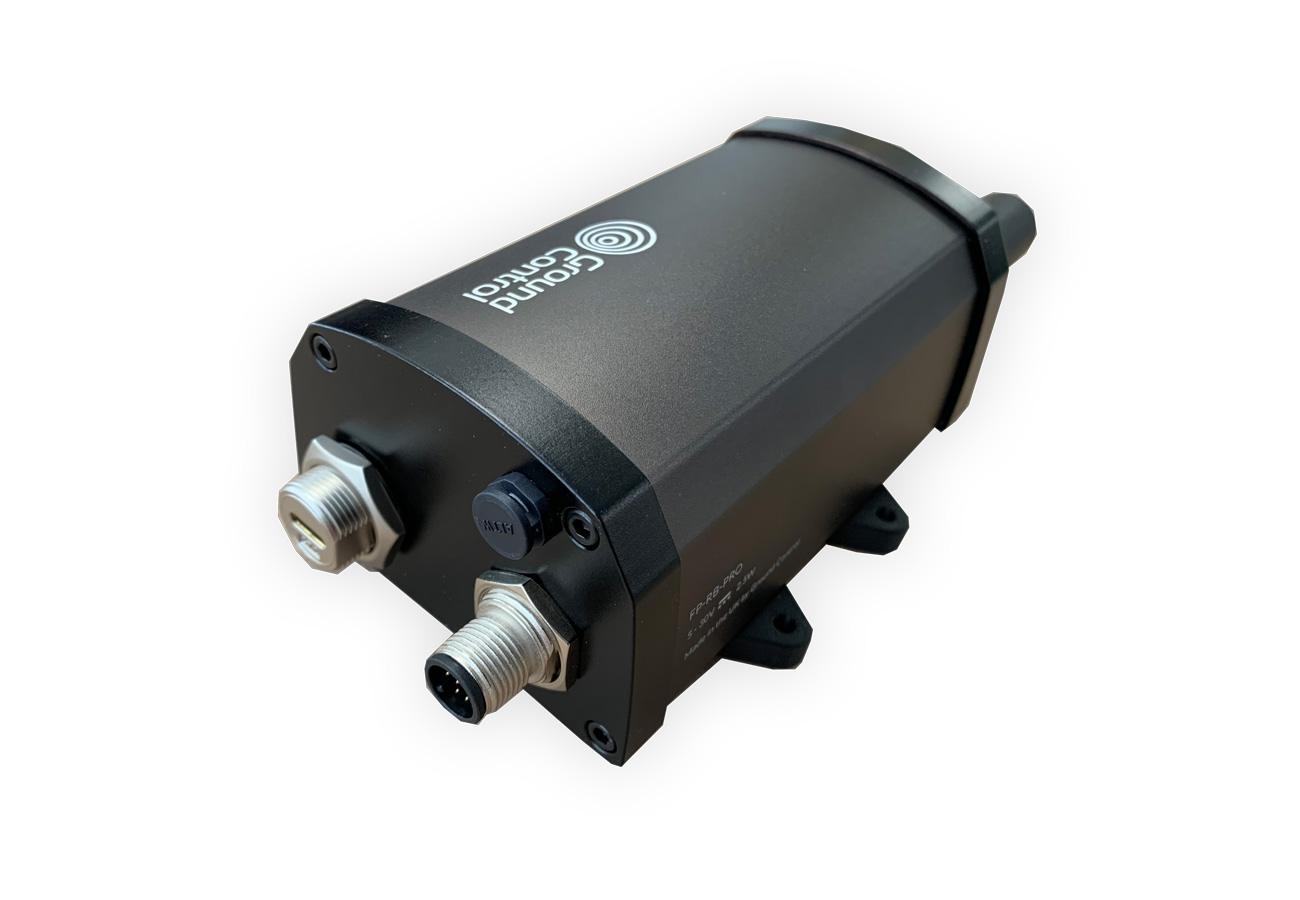


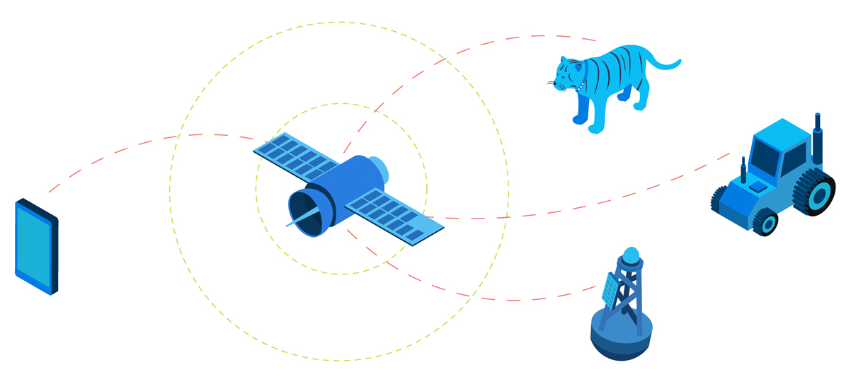
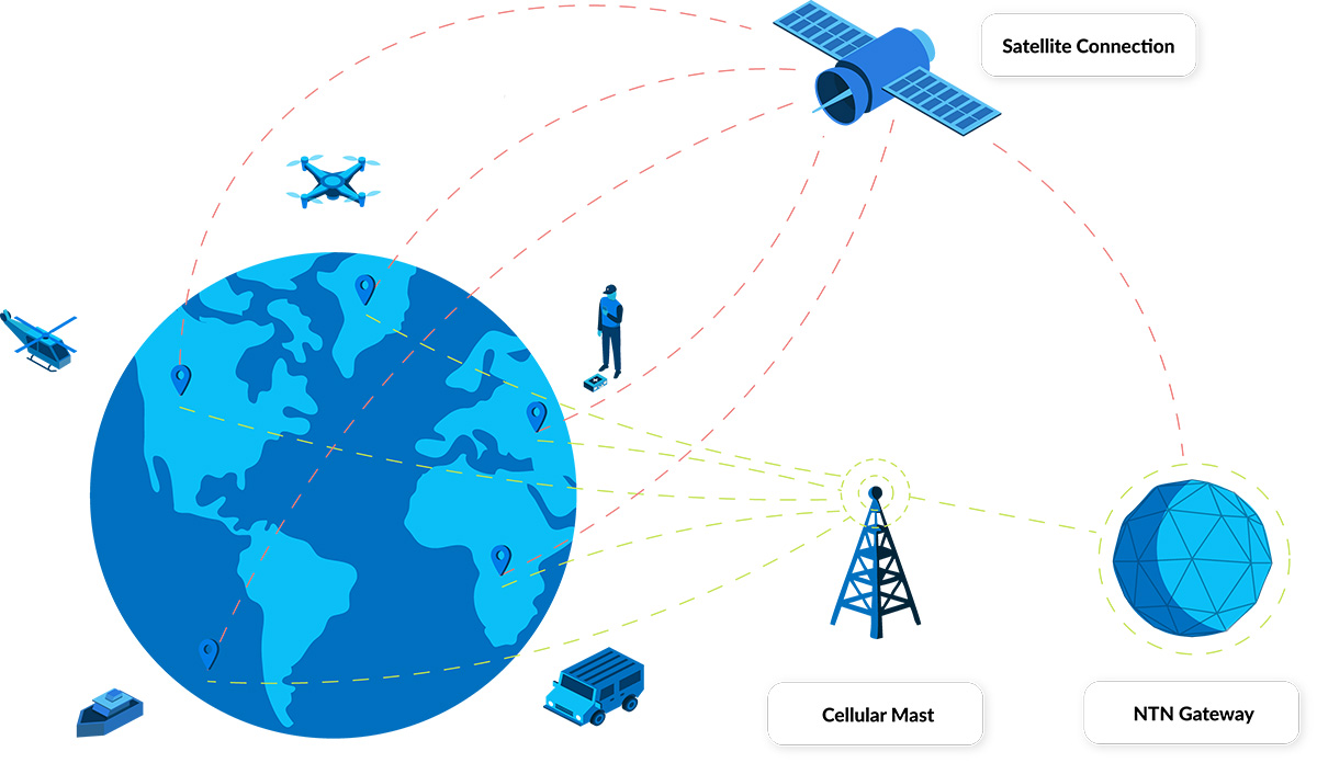

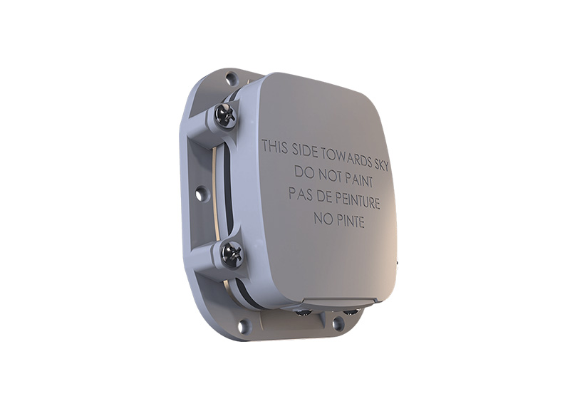


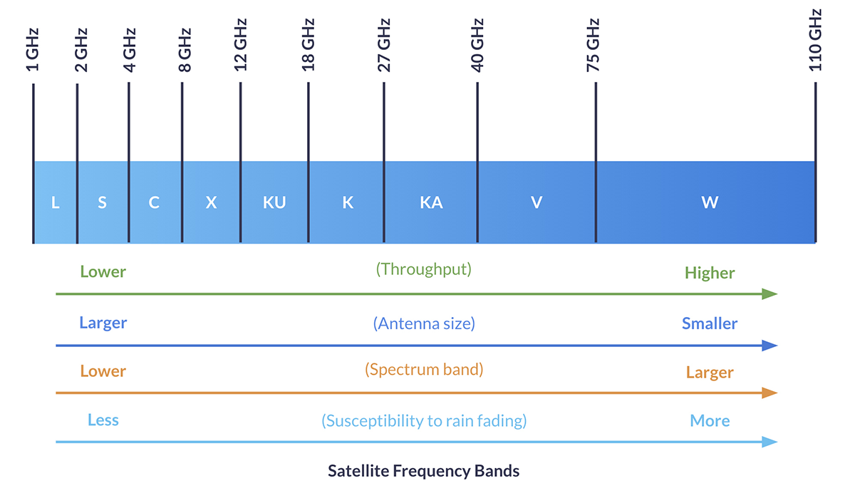

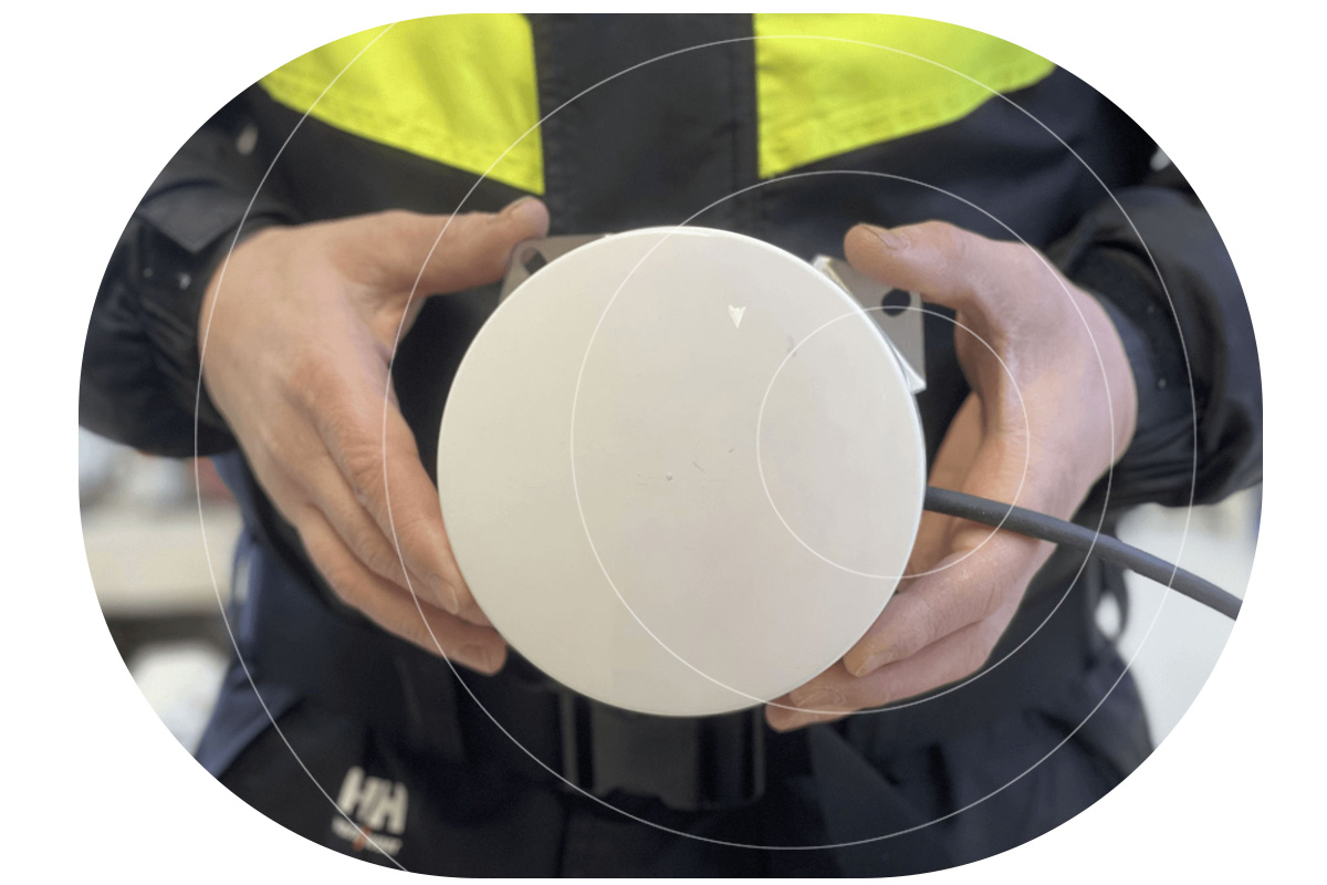

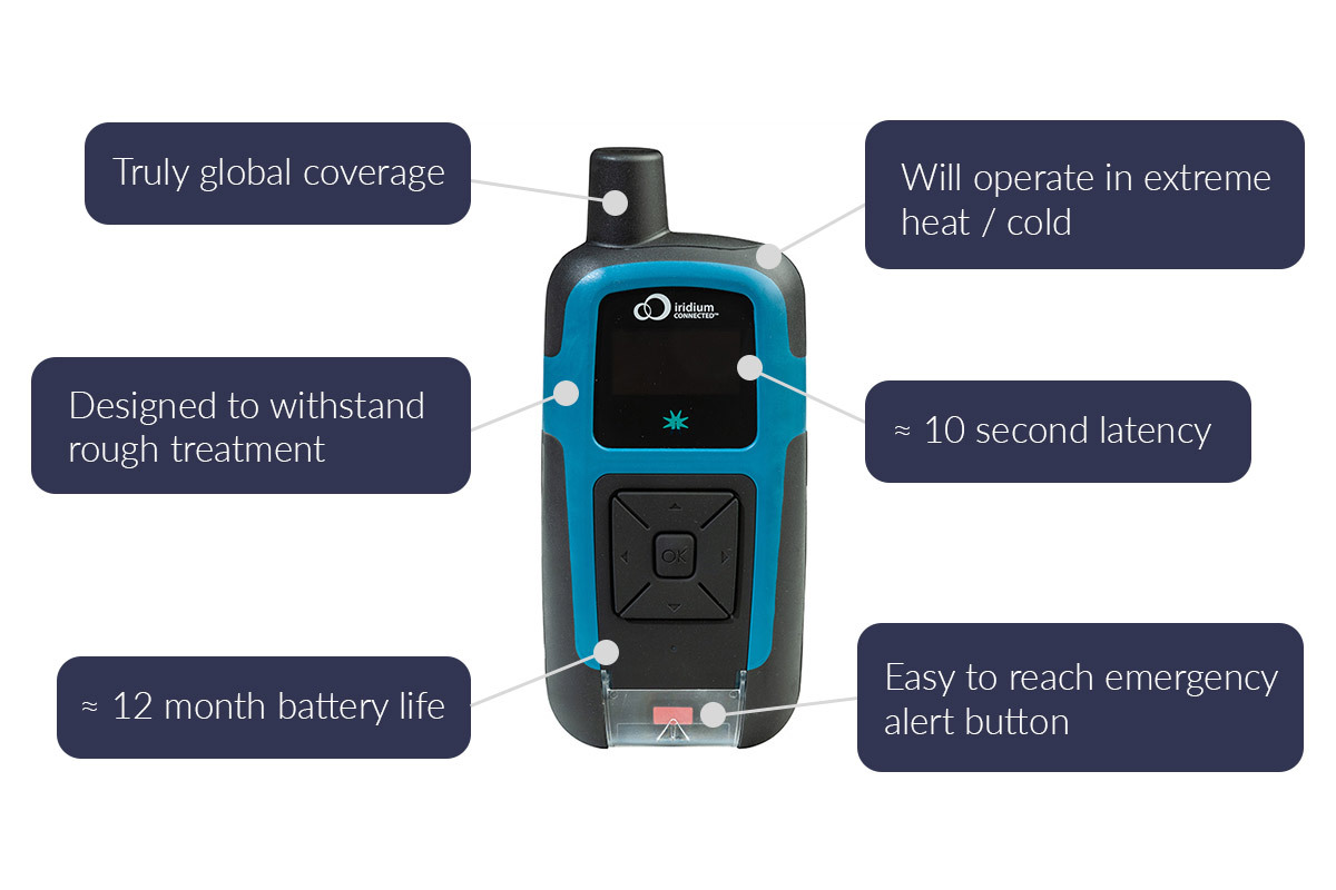
 Illustration showing the number of reported ransomware attacks by continent